Zh-hans:Map Features
OpenStreetMap 在资料元素 (点 ![]() , 路径
, 路径 ![]() 或是 关系
或是 关系 ![]() )。的标签(tags)使用上并无任何限制,你可以选用任何你想使用的标签。可是,如各OpenStreetMap用户在建议使用的设施标签(features)及相关标签作出共识,会对编辑地图起帮助。此条目列出了建议使用设施及相关标签。
)。的标签(tags)使用上并无任何限制,你可以选用任何你想使用的标签。可是,如各OpenStreetMap用户在建议使用的设施标签(features)及相关标签作出共识,会对编辑地图起帮助。此条目列出了建议使用设施及相关标签。
如果你未能在此条目找到适当的标签,你可以前往Proposed features(拟议设施标签)。你可以在那里作出增加设施标签的建议。要将一群路径和点构成更高等及的组合,可疑查看关系页面。
特别提醒:
- 使用这里所描述的标签代表你的编辑将会出现在有可能会出现在绘制出的地图上。但是这并不保证这里的所有标签都会被所有的绘图工具绘制在地图上。请参考Symbol Rendering 查看有哪些标签会被Mapnik 和Osmarender 绘制出来。
- 有许多会被绘制在地图上的标签并没有列在这里。这个列表并没有同步列出所有绘图工具所支持的标签。
- '图上显示' 栏的图只是示意图,并不代表绘图工具一定会将这个标签的资料会制成这样子。
这些表按主题分组,按常用程度排序。
每个部分都是一个模板,可用于语言翻译。
自然
公路
highway是用于表示道路的主要标签。此标签在不同的国家或地区有相应的公约和使用方法,参见公路标签用法和公路。
| 键(key) | 值(value) | 可应用的元素 | 说明 | 地图渲染 | 场景照片 | |
|---|---|---|---|---|---|---|
道路 | ||||||
|
以下是道路的主要标签,按等级和重要性由高到低排序(在绘制时请首先考虑道路等级)。 | ||||||
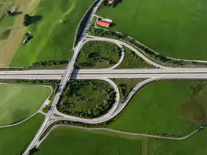
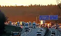
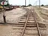
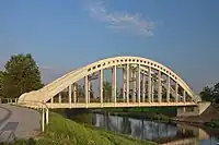
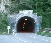
| highway | motorway | 国家级/省级高速公路。专供机动车分方向、分车道通行的,全封闭或半封闭,出入口受控制的公路,通常是双向4车道及以上的收费公路。 |  |
|||
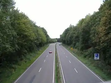
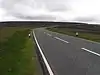
| highway | trunk | 国道/城市快速路。国家公路系统中重要性仅次于高速公路的公路,以及城市道路系统中的快速路。 |  |
| ||
| highway | primary | 省道/主干道。连接主要区域或城镇的道路,以及城市内较为重要的市政道路。 |  |
| ||
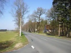
| highway | secondary | 县道/次干道。连接主要区域或村镇的道路,但不及省道。城市道路系统中的次干道也用此值表示。 |  |
| ||
| highway | tertiary | 乡道/支路。一般为连接村与村的道路,或市政道路中比较狭窄的双向、单向2车道道路。 |  |
| ||
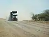
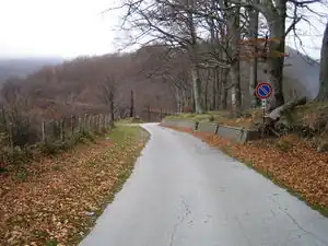
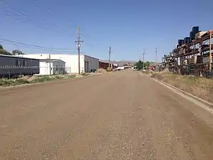
| highway | unclassified | 小型道路。最普通的道路,通常很窄,如中国大陆的村道。 |  |
| ||
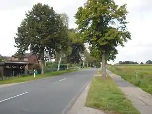
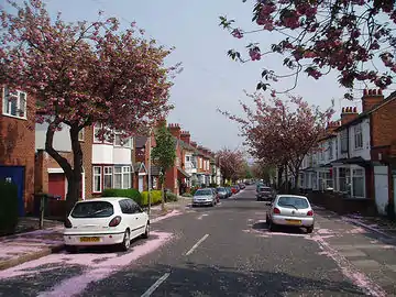
| highway | residential | 居住区道路。通常为小区内部道路,村中的道路或单向狭窄单车道的市政道路,路旁一般伴有住房。 |  |
| ||
道路连接线 | ||||||
| highway | motorway_link | 其他公路通往高速公路的连接道路,高速公路之间的连接匝道。 |  |
 A5 exit link to A672, Darmstadt, Germany | ||
| highway | trunk_link | 连接国道/快速路与其他国道/快速路或更低级道路的连接路。 |  |
 A7 / OAL23 interchange, Nesselwang, Germany | ||
| highway | primary_link | 连接省道/主干道与其他省道/主干道或更低级道路的连接路。 |  |
_-_geo-en.hlipp.de_-_11914.jpg.webp) B20 exit and entrance to Brunn, Fridolfing, Germany | ||
| highway | secondary_link | 连接县道/次干道与其他县道/次干道或更低级道路的连接路。 |  |
 | ||
| highway | tertiary_link | 连接乡道/支路与其他乡道/支路或更低级道路的连接路。 |  |
|||
特殊道路 | ||||||
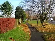
| highway | living_street | 生活性街道。行人优先,儿童可以在街上玩,最高限速较低的街道,常为5km/h。 |  |
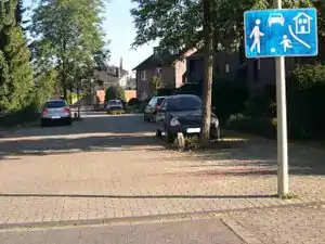 beginning of a living street with a paving stones surface and some trees and cars parking at the sides | ||
| highway | service | 服务性道路。通常为通往建筑物、海滩、营地、工厂、商业园等的道路,不常被称为胡同。可与service=*配合使用以标明使用类型,与access=*配合使用以标明使用对象和使用范围。 |  |
 | ||
| highway | pedestrian | 步行街。这些道路可能仅允许在一天中非常有限的时间内使用机动车或不准机动车或单车通行。若用于广场,则须沿广场边缘创建封闭路径,另加上area=yes。 |  |
 | ||
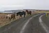
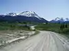
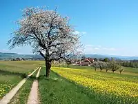
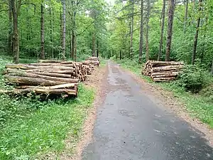
| highway | track | 小径。指通常未铺设路面,主要用于农业、林业、建筑、生产而非居民步行出行的道路,如农用机耕道、林区采伐道、电力工程临时道路等。此标签主要描述道路的用途,如需描述道路铺砌质量须与tracktype=*标签配合使用,如标记普通用途的小型道路,请选用highway=unclassified或highway=residential等代替。 |  |
|||
| highway | bus_guideway | 有轨公交专用道,其他交通工具不可驶入。注意普通的公交专用道不应使用此标签,而应添加 access=no、psv=yes标签。 |  |
 | ||
| highway | escape | 避险车道。包括上坡避险车道,水平避险车道或砂堆型避险车道。通常设置于公路的长陡下坡路段行车道外侧,供刹车失灵的车辆驶出公路正线并安全减速。 | 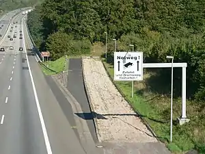 | |||
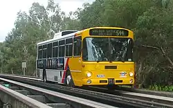
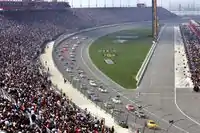
| highway | raceway | 赛道。汽车比赛专用道。 |  |
 | ||
| highway | road | 未知分类的道路。此标签为临时标签,当找到道路的分类后须以其他值取代。 |  |
 | ||
| highway | busway | A dedicated roadway for bus rapid transit systems | 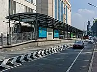 grade-seperated section of busway outside of station | |||
小路 | ||||||
| highway | footway | 步行道路。行人为主或行人专用的道路。包括人行道和碎石小路。如果允许自行车通行,须加上 bicycle=yes 标签,商业步行街、住宅区步行道须改用 highway=pedestrian标签,允许农业机械车辆通行的道路改用 highway=track标签。 |  |
 | ||
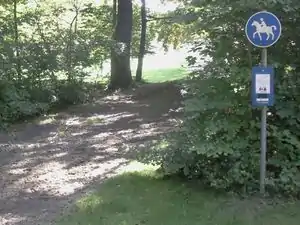
| highway | bridleway | 马道。供马匹奔走的道路。等效于 highway=path+horse=designated组合标签。 |  |
 | ||
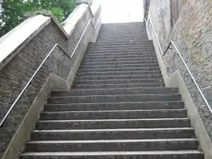
| highway | steps | 阶梯。在人行道的楼梯(阶梯)。用 step_count=* 来表示阶梯数目。 |  |
 | ||
| highway | corridor | For a hallway inside of a building. |  | |||
| highway | path | 小道。一个非特定的或共享使用的路径。 |  |
 | ||
| highway | via_ferrata | A via ferrata is a route equipped with fixed cables, stemples, ladders, and bridges in order to increase ease and security for climbers. These via ferrata require equipment : climbing harness, shock absorber and two short lengths of rope, but do not require a long rope as for climbing. | not rendered in OSM-Carto |  | ||
When sidewalk/crosswalk is tagged as a separate way | ||||||
| footway | sidewalk | Sidewalk that runs typically along residential road. Use in combination with highway=footway or highway=path | |
 | ||
| footway | crossing | 人行过街通道,一般称作斑马线、人行横道。 | |
 | ||
在主路中附注人行道 | ||||||
| sidewalk | both | left | right | no | Specifies that the highways has sidewalks on both sides, on one side or no sidewalk at all | 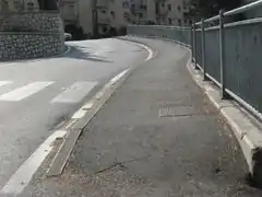 | |||
单独描绘非机动车道(参见 Bicycle) | ||||||
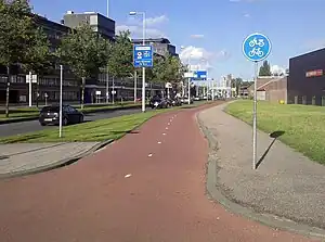
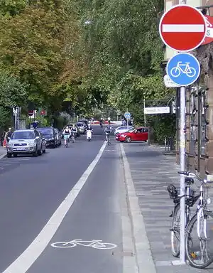
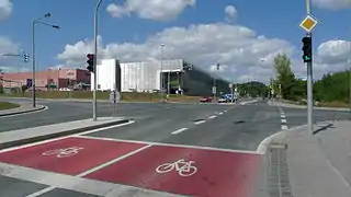
| highway | cycleway | 非机动车道,自行车为主或自行车专用道路。仅当 默认行驶方式限制 不适用时,添加 foot=*标签。 |  |
 Separated cycleway with traffic sign | ||
在主路中附注非机动车道(参见 Bicycle) | ||||||
| cycleway | lane | 用于机动车与非机动车同向行驶的路段,机非车道间无物理隔离设施,通常仅标记机非分界虚实线。机非混行路段通常无需标注cycleway=*,默认允许非机动车靠边通行。 | 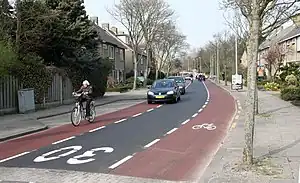 | |||
| cycleway | opposite | 用于机动车单向行驶(带有oneway=yes标签)且非机动车双向行驶的路段,机非车道间无物理隔离设施。须与oneway:bicycle=no标签配合使用。 |  | |||
| cycleway | opposite_lane | 用于机动车单向行驶(带有oneway=yes标签)且非机动车单向对向行驶的路段,机非车道间无物理隔离设施。须与oneway:bicycle=no标签配合使用。 | 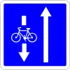 | |||
| cycleway | track | 用于机动车与自行车同向行驶的路段,机非车道间有物理隔离设施。物理隔离设施可以是绿化带、隔离桩、隔离栏、停车位等。此标注可以替代单独描绘且标记highway=cycleway的、位于汽车道外侧的同向路线。 | 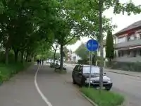 | |||
| cycleway | opposite_track | 用于机动车单向行驶(带有oneway=yes标签)且非机动车单向对向行驶的路段,机非车道间有物理隔离设施。须与oneway:bicycle=no标签配合使用。 |  | |||
| cycleway | share_busway | 用于设有公交车非机动车混行专用道的路段。 | 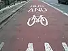 | |||
| cycleway | opposite_share_busway | 用于机动车单向行驶(带有oneway=yes标签)且公交车非机动车混行专用道单向对向行驶的路段,须与oneway:bicycle=no标签配合使用。 | 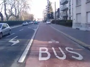 | |||
| cycleway | shared_lane | 交通标志或标线规定非机动车与其他车种混用(兼作机动车停车位、分时段供机动车通行等)的路段。 | 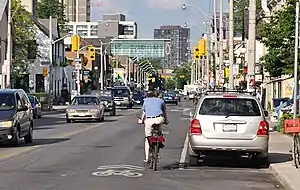 | |||
| busway | lane | 用于两侧都设有公交车专用道的路段。 | | |||
Street parking tagged on the main roadway (see Street parking) | ||||||
| parking :left / :right / :both (hereafter: parking:side) |
lane | street_side | on_kerb | half_on_kerb | shoulder | no | separate | yes | 用于机动车与非机动车同向行驶的路段,机非车道间无物理隔离设施,通常仅标记机非分界虚实线。机非混行路段通常无需标注cycleway=*,默认允许非机动车靠边通行。 |  | |||
| parking:sideorientation=* | parallel | diagonal | perpendicular | 用于机动车与非机动车同向行驶的路段,机非车道间无物理隔离设施,通常仅标记机非分界虚实线。机非混行路段通常无需标注cycleway=*,默认允许非机动车靠边通行。 | ||||
未建成的道路 (see also lifecycle prefixes) | ||||||
| highway | proposed | 规划道路。与proposed=*标签(取highway主要值,如proposed=motorway 规划中的高速公路,请不要标注远长期规划的道路,建议标注已经批准还未动工的道路)配合使用。 | ||||
| highway | construction | 在建道路。与construction=*标签(取highway主要值,如 construction=motorway建设中的高速公路)配合使用。 |  |
 | ||
属性 | ||||||
| abutters | commercial | industrial | mixed | residential | retail etc. | 沿线土地用途。详情参见 Key:abutters 。 | 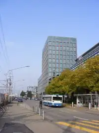 | |||
| bicycle_road | yes | 指定用于自行车行驶的道路。通常在住宅区道路上以特定标志规定自行车优先,但也允许当地居民的机动车低速行驶。 | 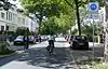 | |||
| bus_bay | both | left | right | A bus bay outside the main carriageway for boarding/alighting | 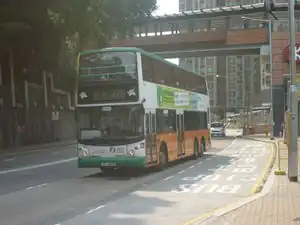 | |||
| change | yes | no | not_right | not_left | only_right | only_left | Specify the allowed/forbidden lane changes | .jpg.webp) | |||
| destination | <place name of destination> | Destination when following a linear feature | .svg.png.webp) | |||
| embankment | yes | dyke | A dyke or a raised bank to carry a road, railway, or canal across a low-lying or wet area. | 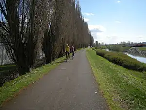 | |||
| embedded_rails | yes | <type of railway> | 标示单独描绘的嵌于机动车路面的铁轨。 | _heading_NW.jpg.webp) | |||
| ford | yes | 过水路面或漫水桥。道路横穿水流,车辆须淌水通过。 |  | |||
| ice_road | yes | 修建在冰面或季节性冻土上的道路,夏季道路融化无法通行。 | 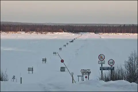 | |||
| incline | Number % | ° | up | down | 道路的纵向坡度。以百分比或角度表示,正值为上坡,负值为下坡。 | 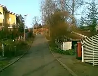 | |||
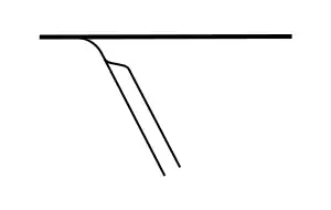
| junction | roundabout | 环岛交叉路口。默认为单向道路,适用于已标记highway=*标签的道路。仅在路面绘设环形标线的环形交叉路口建议改用highway=mini_roundabout标签。 | 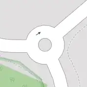 |
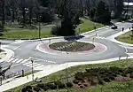 | ||
| lanes | <number> | 车道数。通常包括普通机动车道、公交车或其他机动车种专用的车道。不包括导流车道、停车道、应急停车带、非机动车道、人行道。无车道线的较宽道路也可标记为多车道。 | 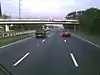 | |||
| lit | yes | no | 标记道路是否有夜间照明设施。 |  | |||
| maxspeed | <number> | Specifies the maximum legal speed limit on a road, railway or waterway. | 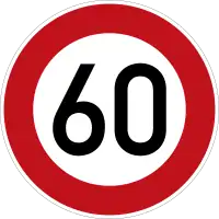 | |||
| motorroad | yes | no | 用于描述通行限制类似高速公路但不属于高速公路的公路。 | 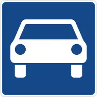 | |||
| mountain_pass | yes | 道路通过山口/山脊的最高点。 |  | |||
| mtb:scale | 0-6 | 山地自行车骑行难度指数,适用于标记highway=path 或 highway=track的道路,具体分级参见 Key:mtb:scale 。 |  | |||
| mtb:scale :uphill | 0-5 | 山地自行车上坡骑行难度指数,适用于标记highway=path 或 highway=track的道路,具体分级参见 Key:mtb:scale 。 | | |||
| mtb:scale :imba | 0-4 | 自行车公园里的人工障碍山道的山地自行车骑行难度指数,适用于标记highway=path 或 highway=track的道路,详情参见 Key:mtb:scale:imba 。 | ||||
| mtb:description | Text | 针对山地自行车骑行的备注,适用于标记highway=path 或 highway=track的道路。 | ||||
| oneway | yes | no | reversible | Oneway streets are streets where you are only allowed to drive in one direction. |  | |||
| oneway:bicycle | yes | no | | Used on ways with oneway=yes where it is legally permitted to cycle in both directions. | | |||
| overtaking | yes | no | caution | both | forward | backward | 超车限制路段。允许/禁止/谨慎/双向允许/本向允许/对向允许,或按行驶方向不同用 overtaking:forward=yes/no/caution 或 overtaking:backward=yes/no/caution 标签。 |  | |||
| parallel | diagonal | perpendicular | marked | no_parking | no_stopping | fire_lane. | 路边停车规定:平行/斜列/垂直/按车位标记/禁止长时停车/禁止停车/消防通道。详情参见 parking:lane=* 。 | |||||
| free | ticket | disc | residents | customers | private | 路边停车限制:免费/凭票/限时长/住户专属/顾客专属/私人专属。详情参见 parking:condition=* 。 |  | ||||
| passing_places | yes | 一条有多处错车空间的狭窄道路。 |  | |||
| priority | forward | backward | Traffic priority for narrow parts of roads, e.g. narrow bridges. | 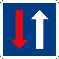 | |||
| priority_road | designated | yes_unposted | end | Specifying roads signposted as priority roads. |  | |||
| sac_scale | hiking | mountain_hiking | demanding_mountain_hiking | alpine_hiking | demanding_alpine_hiking | difficult_alpine_hiking | 步道的步行难度分级,从平坦步道到攀岩通道。适用于标记highway=path 或 highway=footway的道路。 |  | |||
| service | alley | driveway | parking_aisle etc. | 服务型道路,巷道/入户道/停车场通道。详情参见Key:service。 |  | |||
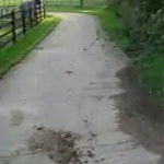
| smoothness | excellent | good | intermediate | bad | very_bad | horrible | very_horrible | impassable | 路面平整程度,优秀/良好/一般/较差/很差/恶劣/非常恶劣/极度恶劣。详情参见Key:smoothness 。 |  | |||
| surface | paved | unpaved | asphalt | concrete | paving_stones | sett | cobblestone | metal | wood | compacted | fine_gravel | gravel | pebblestone | plastic | grass_paver | grass | dirt | earth | mud | sand | ground | 路面状态,已铺/未铺/沥青/水泥混凝土/砖石砌块/大缝砖石砌块/卵石/金属/木材/压实(沙碎石/水碎石)/细碎石/碎石/碎卵石/塑胶/草皮砖/草皮/泥石/泥土/湿泥/沙/天然。详情参见Key:surface。 | ||||
| tactile_paving | yes | no | 盲道,辅助盲人利用导盲杖行走的道路设施。 | Not to be rendered on standard maps. | 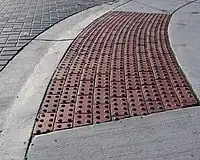 | ||
| tracktype | grade1 | grade2 | grade3 | grade4 | grade5 | 小径类型,具体取值参见Key:tracktype。 |  |
 | ||
| traffic_calming | bump | hump | table | island | cushion | yes | etc. | 减速带。有/减速丘/减速台(大型减速丘)/减速垫/人行横道减速台。详情参见Key:traffic calming。 | 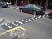 | |||
| trail_visibility | excellent | good | intermediate | bad | horrible | no | 路径的可辨性分级,轻易/较易/尚可/较难/很难/不可辨认。适用于标记 highway=path、highway=footway、highway=cycleway 和 highway=bridleway。 |  | |||
| trailblazed | yes | no | poles | cairns | symbols | Applies to highway=*. Describing trail blazing and marking. See Key:trailblazed for more information. | 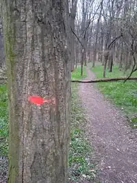 | |||
| trailblazed:visibility | excellent | good | intermediate | bad | horrible | no | Applies to trailblazed=*. A classification for visibility of trailblazing. See Key:trailblazed:visibility for more information. | ||||
| turn | left | slight_left | through | right | slight_right | merge_to_left | merge_to_right | reverse | 用于指定道路或车道的行进方向。左转/左弯/直行/右转/右弯/向左并道/向右并道/掉头。 | 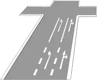 | |||
| width | <number> | The width of a feature. |  | |||
| winter_road | yes | 用于冬季行驶的道路,一般在夏季无法行驶。水域上的季节性冰面道路须改用 ice_road=yes。 |  | |||
其他道路特征 | ||||||
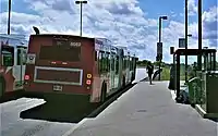
| highway | bus_stop | 一个小公共汽车站。较大的车站则用 amenity=bus_station 代替。 | 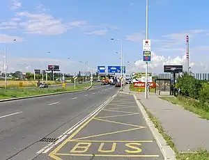 | |||
| highway | crossing | A.k.a. crosswalk. Pedestrians can cross a street here; e.g., zebra crossing | | |||
| highway | elevator | 电梯,在建筑的不同楼层的通道之间给客货提供往来的垂直通道。 | 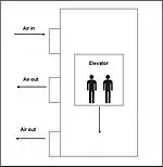 | |||
| highway | emergency_bay | An area beside a highway where you can safely stop your car in case of breakdown or emergency. | 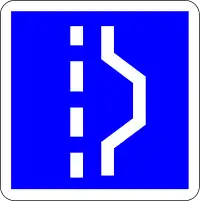 | |||
| highway | emergency_access_point | 紧急位置号,紧急情况下可用于求援报告自己所处位置的数字编号标识,常出现于人迹罕至处如森林、草原等。与 ref=标志显示的编号标签配合使用。 | 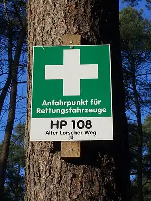 | |||
| highway | give_way | 减速让行标志。 |  | |||
| emergency | phone | 紧急电话,紧急情况下可用于请求援助的单键式固定通讯设备,多出现于户外,如高速公路上。 |  | |||
| highway | milestone | 公路里程标志,如里程碑,里程牌。配合distance=*标记里程数字。 | 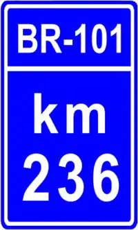 | |||
| highway | mini_roundabout | 环形交叉路口。类似于环岛路口,但在路口中心仅划设圆形中心圈标线,或设置了车辆可以驶越的低矮环岛。如果是车辆无法驶越的环岛则改用junction=roundabout 。默认为逆时针行进 direction=anticlockwise,如须改为顺时针行进则添加 direction=clockwise标签。 |  |
|||
| highway | motorway_junction | 指定高速公路出口,一般标记在出口匝道与主线的分流处。配合ref=*标记出口编号、name=*标记出口的名称、destination=*标记出口的指示地点(目的地)。 |  |
| ||
| highway | passing_place | 错车道(或称避车道、会车道)。在双向错车困难的狭窄道路上用于双向车辆交错通过的一段加宽车道。 |  | |||
| highway | platform | 停靠站。位于公路外侧,供乘客上下汽车的站台,一般用于公交车、校车等。与public_transport=platform不同,它不一定是公交配套设施,但一定是高出路面的实体平台。 |  |
 | ||
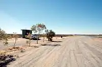
| highway | rest_area | 停车区(或称观景台、休息区)。通常位于高速公路上,不同于设施完善的服务区,驾驶员可以离开道路休息,但没有加油、购物、用餐的地方。 |  |
 | ||
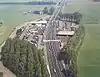
| highway | services | 服务区。通常位于高速公路或快速公路上,为司机和乘员提供补充车辆能源、休息、用餐、购物、如厕等服务的场所。 |  |
 | ||
| highway | speed_camera | 测速点,固定在路边或门架上的测速摄像机。 | 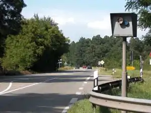 | |||
| highway | stop | 停车让行标志。 |  | |||
| highway | street_lamp | 路灯,位于道路边缘或隔离带高处的夜间照明设施。 | 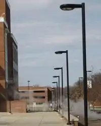 | |||
| highway | toll_gantry | ETC门架。位于道路上(通常是高速公路)用于电子收费的门架,通常位于高速公路出口或立交前,是电子收费系统的一部分。有关任何带阻拦设施需停车缴费的收费站亭请参见后:barrier=toll_booth。 | .jpg.webp) | |||
| highway | traffic_mirror | 道路反光镜。用于视野不足的弯道、路口,帮助司机识别交通事故隐患的反光镜装置。 | 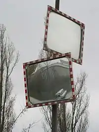 | |||
| highway | traffic_signals | 交通信号灯。 | 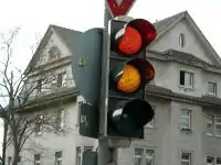 | |||
| highway | trailhead | 标记一条路径起始的地方。 | 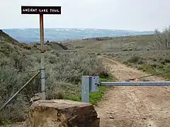 | |||
| highway | turning_circle | 回车环场。便于车辆转弯或掉头的环形加宽区域,通常设在道路末端。 |  |
 | ||
| highway | turning_loop | 回车环岛。便于车辆转弯或掉头的环岛区域,车辆无法驶越环岛。通常设在道路末端。 | 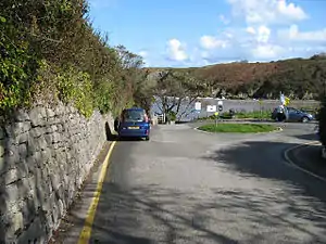 | |||
| highway | User Defined | 全部常用值 参照 Taginfo。 | ||||

.jpg.webp)
Barrier
These are used to describe barriers and obstacles that are usually involved by traveling. See the page Barriers for an introduction on its usage.
Linear barriers
This table is a wiki template with a default description in English. Editable here.
Access control on highways
This table is a wiki template with a default description in English. Editable here.
Barrier障碍物
These are used to describe barriers and obstacles that are usually involved by traveling. See the page Barriers for an introduction on its usage.
Linear barriers
This table is a wiki template with a default description in English. Editable here.
Access control on highways
This table is a wiki template with a default description in English. Editable here.
Cycleway
To describe infrastructure designed mainly for cyclists. See also: Cycle routes.
| Key | Value | Element | Comment | Rendering | Photo |
|---|---|---|---|---|---|
| cycleway | lane | Two cycle lanes, one on each side of the road. | Cyclist map |
| |
| cycleway:right cycleway:left |
lane | A cycle lane only on one side of the road. Left or right depend on the direction in which the way is drawn in OpenStreetMap. | Cyclist map |
||
| cycleway | opposite | Used on ways with oneway=yes where it is permitted to cycle in both directions.
Note - such streets are common in Belgium, the Netherlands and Denmark, for example, but are rare in the UK (although they do exist): often, instead, actually the street is two-way as normal for its whole length except for the very short section past the no-entry sign at the end, where cycles are excepted from the no-entry by means of a short lane separated by an island. This is called a "cycle plug". In some places this has been represented as very short oneway Way at the end with an adjacent cycleway, forming a little triangle with the road they join to, or sometimes with a short oneway Way with cycleway=opposite_lane or opposite_track. |
Cyclist map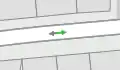 |
| |
| cycleway | opposite_lane | Used on ways with oneway=yes that have a cycling lane going the opposite direction of normal traffic flow (a "contraflow" lane). | Cyclist map |
 | |
| cycleway | track | A track is a route that is separate from the road.+oneway=yes if needed. | Cyclist map |
| |
| cycleway:right cycleway:left |
track | A track only on one side of the road. You can drive in both directions. Left and right depend on the direction in which the way is drawn in OpenStreetMap. | Cyclist map |
||
| cycleway | opposite_track | Used on ways with oneway=yes that have a cycling track going the opposite direction of normal traffic flow. | Cyclist map |
| |
| cycleway | shared | Cyclists share space with other traffic on this highway. | |||
| cycleway | share_busway | There is a bus lane that cyclists are permitted to use. | | ||
| cycleway:right cycleway:left |
share_busway | A bus lane permitted to use only on one side of the road. Left and right depend on the direction in which the way is drawn in OpenStreetMap. | |||
| cycleway | shared_lane | Cyclists share a lane with motor vehicles, but there are markings indicating that they should share the lane with motorists. The road markings are usually there to highlight a cycle route or to remind drivers that you can cycle there. Also used for the on-road shared-lane marking called a "sharrow". | | ||
| cycleway:right cycleway:left |
shared_lane | A shared lane only on one side of the road. Left and right depend on the direction in which the way is drawn in OpenStreetMap. | |||
| cycleway | asl | A cycleway advanced stop line (ASL), also known as a bike box or an advanced stop box, is a marked area for cyclists in front of the stop line for motor traffic. | CyclOSM |
 | |
| cycleway | user defined | All commonly used values according to Taginfo. |
This table is a wiki template with a default description in English. Editable here.
路径类型
Mapnik 和 Osmarender 需要将此标签与 highway=track 一起使用来呈现。
| 类别(key) | 值(value) | 元素 | 说明 | 图上显示 | 照片 |
|---|---|---|---|---|---|
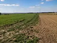
| tracktype | grade1 | 铺好的路径或已压实。 | |
.jpg.webp) | |
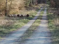
| tracktype | grade2 | 未铺设的路径:密密麻麻的碎石或泥土/沙面。 |  |
 | |
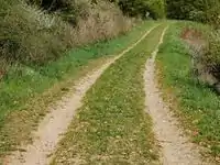
| tracktype | grade3 | 未铺设的路径:硬质和软质材料的混合物。 | 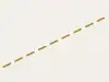 |
 | |
| tracktype | grade4 | 未铺设的路径:污垢/沙/草较突出,但有一些硬质材料,或密实的混合材料 |  |
 | |
| tracktype | grade5 | 未铺设的路径:未压实,只有草,沙和/或土壤。 |  |
 | |
| tracktype | <no value> | If no tracktype tag is present, the track is rendered with a dot-dash line style (as shown right). |  |
This table is a wiki template with a default description in English. Editable here.
Waterway
This is used to described different types of waterways. When mapping the way of a river, stream, drain, canal, etc. these need to be aligned in the direction of the water flow. See the page titled Waterways for an introduction on its usage.
Natural watercourses
This table is a wiki template with a default description in English. Editable here.
Man-made waterways
This table is a wiki template with a default description in English. Editable here.
Facilities
This table is a wiki template with a default description in English. Editable here.
Barriers on waterways
This table is a wiki template with a default description in English. Editable here.
Other features on waterways
This table is a wiki template with a default description in English. Editable here.
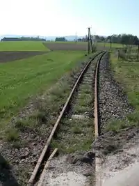
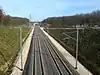
铁路
- 主条目:Railways
This tag includes all kinds of railways ranging from heavily used mainline railways to an abandoned rail line.
| 类别(key) | 值(value) | 元素 | 说明 | 图上显示 | 照片 | |
|---|---|---|---|---|---|---|
轨道 | ||||||
| railway | abandoned | 铁路遗迹,路线设备、铁轨已经被拆除。 | Not rendered by osm-carto |  | ||
| railway | construction | 在建铁路。 请参照 construction=* 以及 construction=yes 提议中的 Proposed_features/Construction |  |
 | ||
| railway | disused | 废弃铁路,路基、铁轨还没有被拆除。参见 disused=yes。 |  |
 | ||
| railway | funicular | 缆索铁路(参见 Wikipedia 上的缆索铁路)。 |  |
 | ||
| railway | light_rail | 较高标准的电车系统,通常靠右行驶(轻轨)。 | |
 | ||
| railway | miniature | Miniature railways are narrower than narrow gauge and carry passengers, frequently at an exact scale of "standard-sized" rail (for example "1/4 scale"). They can often be found in parks. |  |
 | ||
| railway | monorail | 单轨铁路,注意不应与单线铁路混淆。 |  |
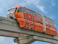 Monorail in Kuala Lumpur | ||
| railway | narrow_gauge | 窄轨客运或货运列车。 | |
 | ||
| 保留的铁路,通常是一个旅游景点。 |  |
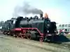 | ||||
| railway | rail | 在该国标准轨距上的全尺寸旅客或货物列车 |  |
 | ||
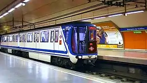
| railway | subway | 地铁(参见 维基百科上的叙述) |  |
 | ||
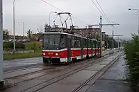
| railway | tram | 路面电车。(其他语言)。 |  |
 | ||
其它特征 | ||||||
| bridge | yes | 桥梁 |  |
 | ||
| cutting | yes | 路堑,明显低于地面的铁路。 |  | |||
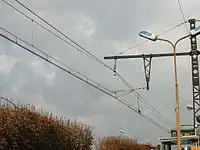
| electrified | contact_line rail yes no |
contact_line:架空电力线(图) rail:第三轨供电 yes:电气化,但是供电方式不详 no:非电气化铁路 |
 | |||
| embankment | yes | 路堤,明显高于地面的铁路。 |  | |||
| embedded_rails | yes/<type of railway> | Specifies that a highway on which non-railway traffic is also allowed has railway tracks embedded in it but the rails are mapped as separate ways. | | |||
| frequency | number [Hz] | 接触网供电频率。0表示使用直流电。参见电压标记。 |  | |||
| railway:track_ref | number | Track number |  | |||
| service | crossover | Relatively short lengths of track which switch traffic from one parallel line to another | ||||
| service | siding | 侧线,长度较短的轨道,并行(及连接)于主线。 |  |
|||
| service | spur | 专用线,长度较短,连接企业、厂矿。 | |
 | ||
| service | yard | 站线,车场内的线路。 | |
 | ||
| tunnel | yes | 隧道。应始终于地铁上使用(但也不一定)。 | 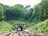 | |||
| tracks | number | Number of parallel tracks in close proximity when mapped as one single way representing all tracks. If not given means unknown and defaults to 1. In many parts of the world the tracks are being drawn out separately so that there is more detail, in which case this tag isn't used. | 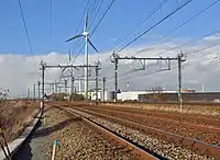 | |||
| usage | main branch industrial military tourism scientific test |
铁路主要用途(主线/支线/工业/军事/旅游) | ||||
| voltage | number | 接触网供电电压。参见频率标记。 |  | |||
车站 | ||||||
| railway | halt | 小站、乘降所,可能没有站台,火车只在遥招时停。 | 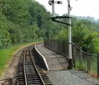 | |||
| public_transport | stop_position | The position on the railway track where the train (its centre) stops at a platform. This is useful for routing on long platforms where also short trains stop and on long platforms where multiple trains stop behind each other. See also public_transport=stop_area. | | |||
| public_transport | platform | 月台。 可以用人行道来连接月台,这样可以帮助路径规划。 | .jpg.webp) | |||
| railway | platform | This is parallel to the rail line for showing where the actual platforms are. It is also to know where you can change platform and enter the station, so use footpaths to connect them. This is really useful for routing too. Use in addition to public_transport=platform. | | |||
| public_transport | station | Railway passenger-only station. | 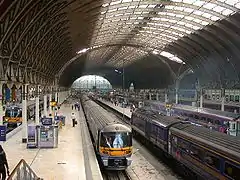 | |||
| railway | station | 火车站 (其他语言)。 | | |||
| railway | subway_entrance | 地铁站出入口 | 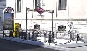 | |||
| railway | tram_stop | 电车站 | 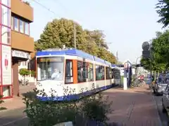 | |||
铁路有关设施 | ||||||
| railway | buffer_stop | 止冲器。在线路终点停住火车,参见止冲档。 | Not rendered by osm-carto | .jpg.webp) | ||
| railway | derail | A device used to prevent fouling of a rail track by unauthorized movements of trains or unattended rolling stock. See Derail (railroad). | Not rendered by osm-carto | 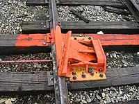 | ||
| railway | crossing | 仅供仅供行人通过的道口。 | 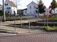 | |||
| railway | level_crossing | 平交道口 |  | |||
| railway | tram_level_crossing | A point where trams and roads cross. | 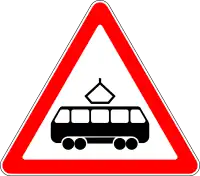 | |||
| railway | signal | Any kind of railway signal. | Not rendered by osm-carto |  | ||
| railway | switch | Full connections between railways (aka 'points'). | Not rendered by osm-carto |  | ||
| railway | railway_crossing | Crossing rails with no interconnection. | Not rendered by osm-carto |  | ||
| landuse | railway | 铁路用地。 |  Except no border, as landuse=industrial Except no border, as landuse=industrial |
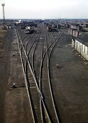 | ||
| railway | turntable | 机车转盘,主要供蒸汽机车改变行驶方向使用。 |
|
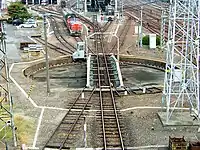 | ||
| railway | roundhouse | 扇形机车库 | Not rendered by osm-carto | 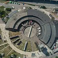 | ||
| railway | traverser | These are used for changing trains between railways. Also known as transfer table. | 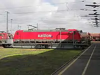 | |||
| railway | wash | A railroad carriage/car wash | Not rendered by osm-carto | 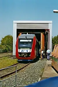 | ||
| railway | water_crane | A structure to deliver water to steam locomotives | Not rendered by osm-carto |  | ||
| railway | ventilation_shaft | A structure that allows ventilation in underground tunnels | Not rendered by osm-carto | .jpg.webp) | ||
| railway | user defined | – – – | – – – | |||

This table is a wiki template with a default description in English. Editable here.
![]()
如果您会map features,您可以帮助我们完成中文(简体) 翻译。帮助我们翻译此页。
似乎没有人在进行翻译工作,欢迎您进行翻译。
![]()
机场道路
| 类别(key) | 值(value) | 元素 | 说明 | 图上显示 | 照片 |
|---|---|---|---|---|---|
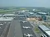
| aeroway | aerodrome | 机场,参见 military=airfield。 | 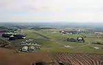 | ||
| aeroway | airstrip | A field or area where light aircraft can land and take off from. | 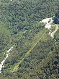 | ||
| aeroway | apron | 停机坪。 |  |
 | |
| aeroway | control_center |  | |||
| aeroway | fuel | Fuelling station for aircraft. | .jpg.webp) | ||
| aeroway | gate | 用来标记机场登机口的数字。 |  |
 | |
| aeroway | hangar | 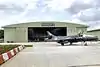 | |||
| aeroway | helipad | 直升机停机坪。 |  | ||
| aeroway | heliport |  | |||
| aeroway | holding_position | A point behind which aircraft are considered clear of a crossing way |  | ||
| aeroway | jet_bridge | Passenger boarding bridge | 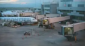 | ||
| aeroway | navigationaid | A facility that supports visual navigation for aircraft |  | ||
| airmark | beacon | 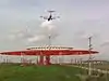 | |||
| aeroway | parking_position | A location where an aeroplane can park | 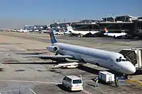 | ||
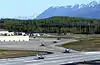
| aeroway | runway | 跑道,一条保持畅通的区域,为飞机起降而留出。(其他语言) |  |
.jpg.webp) | |
| aeroway | taxilane | Taxilane is a path in an airport that is part of the aircraft parking area or apron (Proposed feature with low usage as of 2015-10; use with an eye towards the question correct usage). | |||
| aeroway | taxiway | 滑行道,飞机在跑道和停机坪之间的制动区域。 |  |
 | |
| aeroway | terminal | 航站楼,供上下乘客和货物。 |  |
 | |
| aeroway | tower | See also aeroway=control_tower or combination of man_made=tower + service=aircraft_control for similar schemes. |
 | ||
| aeroway | windsock | 风向袋。 |  | ||
| aeroway | highway_strip | 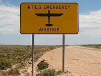 | |||
| aeroway | User defined | 其他常用的值请参见 Taginfo。 |
This table is a wiki template with a default description in English. Editable here.
Aerialway
This is used to tag different forms of transportation for people or goods by using aerial wires. For example these may include cable-cars, chair-lifts and drag-lifts. See the page Aerialway for more information on the usage of these tags.
This table is a wiki template with a default description in English. Editable here.
Power
These are used to map electrical power generation and distributions systems. See Power for an introduction on its usage.
This table is a wiki template with a default description in English. Editable here.
Man made
A tag for identifying man made (artificial) structures that are added to the landscape. See man_made=* for an introduction on its usage.
This table is a wiki template with a default description in English. Editable here.
Leisure
This is used to tag leisure and sports facilities. See the page titled Leisure for an introduction on its usage.
This table is a wiki template with a default description in English. Editable here.
设施(Amenity)
标识供居民或游客使用的设施,如:厕所、电话、银行、药房、咖啡厅、停车场、学校。主条目:设施。
| 关键字 | 值 | 元素 | 描述 | 渲染 | 照片 | |
|---|---|---|---|---|---|---|
餐饮设施 | ||||||
| amenity | bar | 酒吧(bar)。贩卖酒精饮料的商业场所。特点是嘈杂、气氛活跃,通常不贩售食品。请见amenity=bar和amenity=pub区分二者的不同。 | 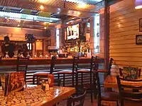 | |||
| amenity | biergarten | 啤酒花园,提供酒精饮料及食物的露天设施。另见amenity=pub;bar;restaurant。通常属于酒馆、酒吧、饭店的一部分,这种情况下可以在amenity=pub;bar;restaurant的基础上使用biergarten=yes标签。 | 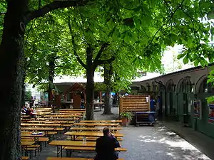 | |||
| amenity | cafe | 咖啡店,一般是非正式的场所,提供简单的餐食和饮料,通常以咖啡或茶为主。提供正式餐食的咖啡厅还可标注cuisine=*和diet:*=*。另见:amenity=restaurant;bar;fast_food。 | 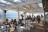 | |||
| amenity | fast_food | 快餐店(另见amenity=restaurant)。提供正式餐食的餐厅还可标注cuisine=*和diet:*=*。 | 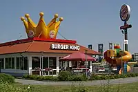 | |||
| amenity | food_court | 美食广场,通常在商场、机场等建筑内。由多家餐馆、食品柜台、公共进餐区组成。 | 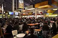 | |||
| amenity | ice_cream | 冷饮店,在柜台售卖冰淇淋、冻酸奶等的设施。 | .jpg.webp) | |||
| amenity | pub | 酒吧(pub,静吧)。与bar相比,环境更为闲适,同时提供餐食。 |  | |||
| amenity | restaurant | 餐厅(不是快餐amenity=fast_food)。提供的菜式可使用cuisine=*和diet:*=*标注。 |  | |||
教育设施 | ||||||
| amenity | college | 学院,学院之校园或建物。 |  | |||
| amenity | driving_school | 驾驶学校。 | 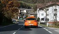 | |||
| amenity | kindergarten | 幼儿园,照顾与教导还未达到正规教育年龄小孩之场所。 |  | |||
| amenity | language_school | 语言学校。 |  | |||
| amenity | library | 图书馆。 |  | |||
| amenity | toy_library | 玩具图书馆,一个提供玩具在现场玩耍的地方,有些提供外借服务。 | 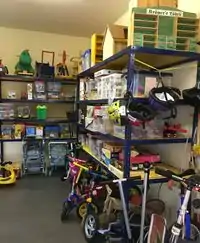 | |||
| amenity | research_institute | 研究机构 | 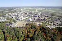 | |||
| amenity | training | Public place where you can get training. | | |||
| amenity | music_school | 音乐学校。 | ._(9196267787).jpg.webp) | |||
| amenity | school | 学校。 |  | |||
| amenity | traffic_park | Juvenile traffic schools |  | |||
| amenity | university | 大学,大学之校园。 |  | |||
交通设施 | ||||||
| amenity | bicycle_parking | 自行车(单车/脚踏车)停车场。 | 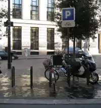 | |||
| amenity | bicycle_repair_station | 自行车自助维修站。 |  | |||
| amenity | bicycle_rental | 自行车(单车/脚踏车)租借处。提供租自行车服务的店家或设施。 | .jpg.webp) | |||
| amenity | boat_rental | 游船租借处。 |  | |||
| amenity | boat_sharing | 游船共享处。 |  | |||
| amenity | bus_station | 巴士总站,也可以标记为 public_transport=station。 |  | |||
| amenity | car_rental | 租车处。提供租车服务的店家。 | ||||
| amenity | car_sharing | 共享汽车,提供汽车共享服務之处。 | 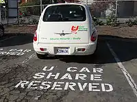 | |||
| amenity | car_wash | 洗车,一提供洗车服务之地方。 | 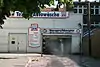 | |||
| amenity | compressed_air | A device to inflate tires/tyres (e.g. motorcar, bicycle) | 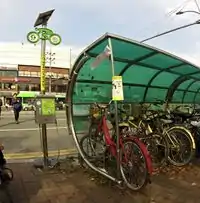 | |||
| amenity | vehicle_inspection | 车辆检测中心。 |  | |||
| amenity | charging_station | 电动车辆充电设施。 |  | |||
| amenity | driver_training | A place for driving training on a closed course |  | |||
| amenity | ferry_terminal | 渡轮站/渡轮码头,渡轮停靠站可供人和车辆上船。 |  | |||
| amenity | fuel | 加油站。汽油、瓦斯、和船舶加油站都属于这个标签;通往加油站的通道常标记为 highway=service | 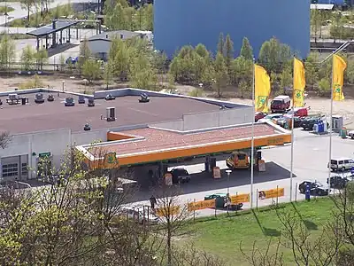 | |||
| amenity | grit_bin | 一用来存放砂,或砂盐混合的容器。 | 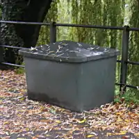 | |||
| amenity | motorcycle_parking | 摩托车停车场。 |  | |||
| amenity | parking | 停车场,以点(node)或区域(area)(没有access标签)显示并标注停车的符号,区域(Area)会有颜色区分,停车场内的道路长被标记为 highway=service 和 service=parking_aisle | 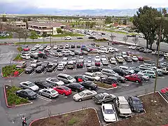 | |||
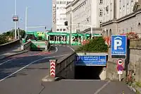
| amenity | parking_entrance | 用于地下或多楼层停车场的车辆出入口,可用标记为 type=site 和 site=parking 的关系(relation)来集合多个出入口,不要和 amenity=parking 搞混。 | Underground |
 | ||
| amenity | parking_space | 停车位,是指单一的停车格,可用标记为 type=site 和 site=parking 的关系(relation)来集合多个停车格,不要和 amenity=parking 搞混。 |  |
.JPG.webp) | ||
| amenity | taxi | 出租车/的士站。 | 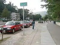 | |||
金融设施 | ||||||
| amenity | atm | 自动柜员机。 | 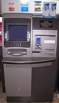 | |||
| amenity | bank | 银行。如果银行中也有自动柜员机(ATM),最好用独立的点(node)来表示每一个自动柜员机。 | 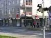 | |||
| amenity | bureau_de_change | 外币兑换处/找换店,提供各种货币交换和旅行支票兑换的地方。(bureau_de_change为英式英文,美式英文为currency exchange) |  | |||
医疗设施 | ||||||
| amenity | baby_hatch | 弃婴保护舱。是一种容器或场所,让因为某些理由而无法继续养育婴儿(通常是新生儿)的家长,能匿名的将婴儿放置于其中,之后会有特定人士前来收取并照顾。 |  | |||
| amenity | clinic | 诊所,小型规模的医疗与健康照顾服务之设施。 |  | |||
| amenity | dentist | 牙科诊所,牙医出诊和进行牙科手术之处。 |  | |||
| amenity | doctors | 医务所,医生出诊和进行手术之处。 |  | |||
| amenity | hospital | 医院,常与 emergency=* 并用来区别是否有急救设施) | 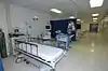 | |||
| amenity | nursing_home | 疗养院/养老院,一个给行动不便或老年人长期照顾的地方。已改用 amenity=social_facility + social_facility=nursing_home |  | |||
| amenity | pharmacy | 药店/药房。 dispensing=yes dispensing=no 或 omitted (意思为是否能在经过医师处方销售处方药) |
 | |||
| amenity | social_facility | 提供社会服务的设施。 | 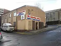 | |||
| amenity | veterinary | 兽医院。 |  | |||
文娱设施 | ||||||
| amenity | arts_centre | 艺术中心。 |  | |||
| amenity | brothel | 妓院。 |  | |||
| amenity | casino | 赌场。备有一种以上的赌桌,如轮盘,21点。也对体育赛事投注,定有固定的赔律。 | 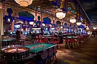 | |||
| amenity | cinema | 电影院。播放电影的地方。(美式英语:movie theater) | 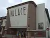 | |||
| amenity | community_centre | 社区中心,被使用来举办本地活动、庆典或集体活动的地方;包括特殊的兴趣和特殊的年龄段。 |  | |||
| amenity | conference_centre | A large building that is used to hold a convention |  | |||
| amenity | events_venue | A building specifically used for organising events |  | |||
| amenity | exhibition_centre | An exhibition centre | ||||
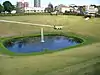
| amenity | fountain | 喷泉,通常是用于文化上,装饰上和娱乐上的目的。 | 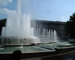 | |||
| amenity | [[ Too many Data Items entities accessed. | gambling ]] | 赌博电玩店,通常提供宾果机,柏青哥机台等此标签不等于:书商 shop=bookmaker、投注站 shop=lottery、赌场 amenity=casino 或成人游戏中心 leisure=adult_gaming_centre。 |  | |||
| amenity | love_hotel | A love hotel is a type of short-stay hotel operated primarily for the purpose of allowing guests privacy for sexual activities. |  | |||
| amenity | music_venue | An indoor place to hear contemporary live music. |  | |||
| amenity | nightclub | 夜店/夜总会。 |  | |||
| amenity | planetarium | 天文馆。 |  | |||
| amenity | public_bookcase | 公共书架,類似台灣的漂書站。是種置於街頭放有書的傢俱,可在此帶走書或留下一本書。 | 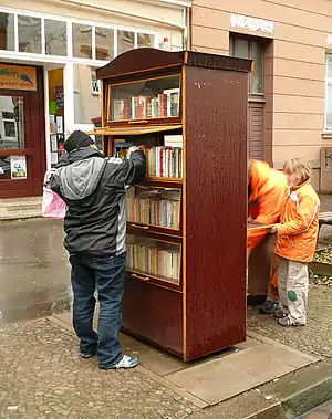 | |||
| amenity | social_centre | 举辨免费或非营利活动的地方。 |  | |||
| amenity | stripclub | 提供脱衣舞表演的地方。(性服务则使用 amenity=brothel) |
 | |||
| amenity | studio | 工作室,电视,广播或录音的工作室。录音室。 |  | |||
| amenity | swingerclub | 一个人们聚在一起举行派对和群体性交的俱乐部。 | 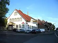 | |||
| amenity | theatre | 剧院。 |  | |||
Public Service | ||||||
| amenity | courthouse | 法院,一个给予公平正义的地方。 |  | |||
| amenity | fire_station | 消防局。 |  | |||
| amenity | police | 警察局、派出所。 |  | |||
| amenity | post_box | 邮箱。 | 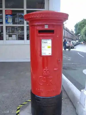 | |||
| amenity | post_depot | Post depot or delivery office, where letters and parcels are collected and sorted prior to delivery. | 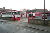 | |||
| amenity | post_office | 邮局。 |  | |||
| amenity | prison | 监狱。 | 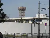 | |||
| amenity | ranger_station | 国家公园游客中心,国家公园管理站。 | 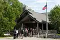 | |||
| amenity | townhall | 市政厅,乡,镇,市等地方政府的办公大楼,或者是社区公所。 | 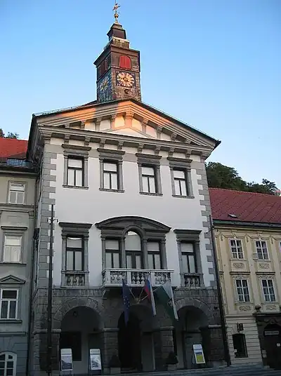 | |||
Facilities | ||||||
| amenity | bbq | 长期的存在的、允许烧烤食物的设施,通常位于室外公共用地,如公园、海滩等。使用fuel=*来标注燃料的类型,如fuel=wood;electric;charcoal。标注附近的桌椅,请使用tourism=picnic_site;标注篝火请使用leisure=firepit。 | 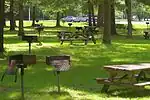 | |||
| amenity | bench | 长椅,用来坐下来休息的椅子。 |  | |||
| amenity | dog_toilet | Area designated for dogs to urinate and excrete. |  | |||
| amenity | dressing_room | Area designated for changing clothes. | 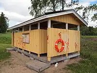 | |||
| amenity | drinking_water | 公共饮水处。 | 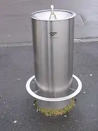 | |||
| amenity | give_box | A small facility where people drop off and pick up various types of items in the sense of free sharing and reuse. | 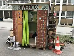 | |||
| amenity | mailroom | A mailroom for receiving packages or letters. |  | |||
| amenity | parcel_locker | Machine for picking up and sending parcels | 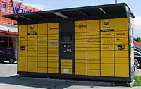 | |||
| amenity | shelter | 对恶劣天气条件的小避难所。要额外描述避难所的用途,请使用shelter_type=*。凉亭。 | 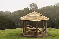 | |||
| amenity | shower | 公共淋浴间或公共澡堂。 | 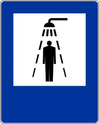 | |||
| amenity | telephone | 公共电话亭。 | 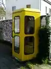 | |||
| amenity | toilets | 厕所。有些可能需要付费。 | 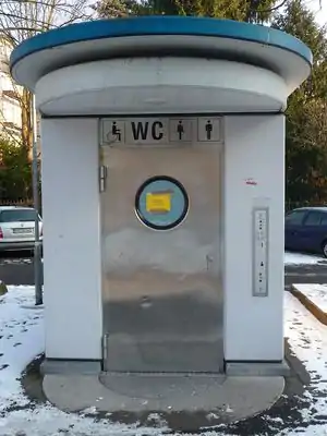 | |||
| amenity | water_point | 你可以得到大量的饮用水的地点。 | 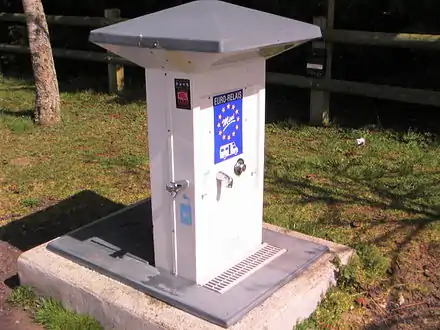 | |||
| amenity | watering_place | 一个可以储存动物可以饮用的水的地方。 | 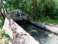 | |||
Waste Management | ||||||
| amenity | sanitary_dump_station | 污水罐排卸站,车载、船载厕所的污水存储罐安全排空的地方。 | | |||
| amenity | recycling | 泛指回收设施。收集回收物资的容器,如资源回收桶、瓶子回收站、旧衣箱等,请加注recycling_type=container;资源回收中心、资源回收场等,请加注recycling_type= centre。 |  | |||
| amenity | waste_basket | 垃圾筒。 | 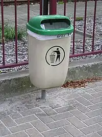 | |||
| amenity | waste_disposal | 垃圾放置点。运河船,拖车等可以处理垃圾的地方。 | 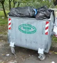 | |||
| amenity | waste_transfer_station | 垃圾转运站。一个接受,整合和转运散装垃圾的地点。 | ||||
其他设施 | ||||||
| amenity | animal_boarding | 一种付钱能短期寄托动物的设施。(比如假期) |  | |||
| amenity | animal_breeding | A facility where animals are bred, usually to sell them |  | |||
| amenity | animal_shelter | 保护处于危险中动物的亭子。 |  | |||
| amenity | animal_training | A facility used for non-competitive animal training | .jpg.webp) | |||
| amenity | baking_oven | 用于烘烤面包和类似物的烤箱,例如在烘焙坊 building=bakehouse 内。 |  | |||
| amenity | childcare | 托儿所,照顾不同年龄的孩子的地方,不是amenity=kindergarten(幼儿园)。 |  | |||
| amenity | clock | 钟,一置放于公共空间的钟。 | .jpg.webp) | |||
| amenity | crematorium | 火葬场。 |  | |||
| amenity | dive_centre | A dive center is the base location where sports divers usually start scuba diving or make dive guided trips at new locations. |  | |||
| amenity | funeral_hall | A place for holding a funeral ceremony, other than a place of worship. |  | |||
| amenity | grave_yard | 墓园/坟场 |  |

| ||
| amenity | hunting_stand | 狩猎用瞭望台。 | 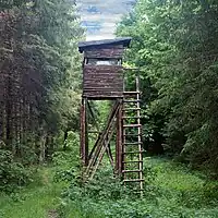 | |||
| amenity | internet_cafe | 网咖,向公众提供互联网服务的地方。 |  | |||
| amenity | kitchen | A public kitchen in a facility to use by everyone or customers |  | |||
| amenity | kneipp_water_cure | 户外泡脚池。通常是配有扶手的冷水池,流行于德语国家。 | 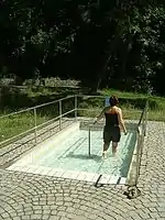 | |||
| amenity | lounger | An object for people to lie down. | .jpg.webp) | |||
| amenity | marketplace | 市场,一个买卖交昜有制度规章的地方。 | 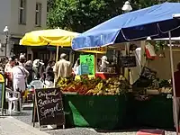 | |||
| amenity | monastery | Monastery is the location of a monastery or a building in which monks and nuns live. | 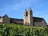 | |||
| amenity | photo_booth | 快速照相站/快像亭。 | 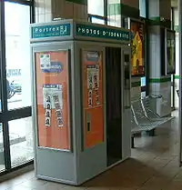 | |||
| amenity | place_of_mourning | A room or building where families and friends can come, before the funeral, and view the body of the person who has died. |  | |||
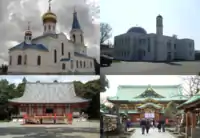
| amenity | place_of_worship | 宗教崇拜场所/祭拜的地方,如教堂,清真寺或寺庙等。最好能同时标注 name=* 和 amenity=place_of_worship,常配合religion=*(所属宗教)和 denomination=*(宗派)使用,。 place_of_worship=*中有详细的解释。 |
 | |||
| amenity | public_bath | 公众可以共同沐浴的地方,如温泉,公共浴池 | .JPG.webp) | |||
| 公共建物,已不使用。改用building=* | ||||||
| amenity | refugee_site | 难民营,安置难民或国内流离失所者的居住区。 | 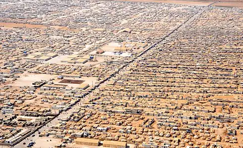 | |||
| amenity | vending_machine | 自动贩卖机。 | 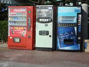 | |||
| amenity | 使用者自訂 | 到Taginfo查询常用标签值 | ||||
This table is a wiki template with a default description in English. Editable here. 此表格由模版自动生成,协助改善中译版本请按此。
Shop
The shop tag is used as a place of business that has stocked goods for sale or sells services. See the page titled Shop for an introduction on its usage.
| Key | Value | Comment | Rendering on default layer (osm-carto) | Photo | ||
|---|---|---|---|---|---|---|
Food, beverages | ||||||
| shop | alcohol | Shop selling alcohol to take away | 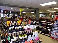 | |||
| shop | bakery | Shop focused on selling bread | 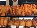 | |||
| shop | beverages | Shop focused on selling alcoholic and non-alcoholic beverages. See also shop=alcohol. | 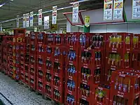 | |||
| shop | brewing_supplies | Shop focused on selling supplies for home brewing of beer, wine and spirits (where permitted). | 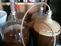 | |||
| shop | butcher | Shop focused on selling meat | 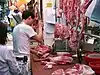 | |||
| shop | cheese | Shop focused on selling cheese. | 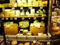 | |||
| shop | chocolate | Shop focused on selling chocolate. |  | |||
| shop | coffee | Shop focused on selling coffee. | 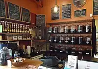 | |||
| shop | confectionery | Shop focused on selling sweets or candy | 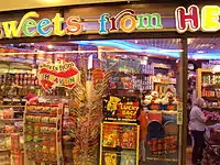 | |||
| shop | convenience | A small local shop carrying a small subset of the items you would find in a supermarket | 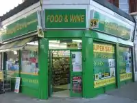 | |||
| shop | deli | Shop focused on selling delicatessen (fine foods, gourmet foods), possibly also fine wine. Not to be confused with the US delis. | 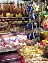 | |||
| shop | dairy | Shop focused on selling dairy products. |  | |||
| shop | farm | Shop or roadside stand focused on selling freshly harvested farm produce | 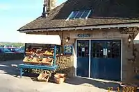 | |||
| shop | frozen_food | Shop focused on selling frozen food. |  | |||
| shop | greengrocer | Shop focused on selling vegetables and fruits. | 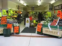 | |||
| shop | health_food | A health food shop; selling wholefoods, vitamins, nutrition supplements and meat and dairy alternatives. |  | |||
| shop | ice_cream | Shop selling ice cream. See also amenity=ice_cream. | 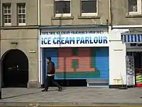 | |||
| shop | pasta | Shop focused on selling (fresh) pasta, ravioli, etc. | 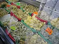 | |||
| shop | pastry | Shop focused on selling baked sweets like cakes, biscuits, strudel and pies. | 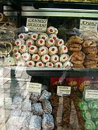 | |||
| shop | seafood | Shop focused on selling fish/seafood. | 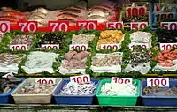 | |||
| shop | spices | Shop focused on selling spices. | .jpg.webp) | |||
| shop | tea | Shop focused on selling tea. | 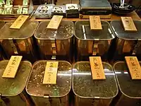 | |||
| shop | wine | Shop selling wine. | 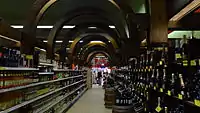 | |||
| shop | water | Shop focused on selling drinking water. | 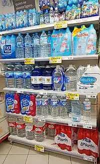 | |||
General store, department store, mall | ||||||
| shop | department_store | A single large store – often multiple storeys high – selling a large variety of goods (see also shop=mall) | ||||
| shop | general | A store that carries a general line of merchandise. (see also shop=convenience if it sells food). | 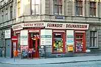 | |||
| shop | kiosk | A small shop on the pavement that sells magazines, tobacco, newspapers, sweets and stamps. |  | |||
| shop | mall | A shopping mall – multiple stores under one roof (also known as a shopping centre) |  | |||
| shop | supermarket | Supermarket – a large store with groceries and other items |  | |||
| shop | wholesale | Wholesale/warehouse club or cash and carry - a store that sells items in bulk to retailers. The branch of industry can be defined with wholesale=*. |  | |||
Clothing, shoes, accessories | ||||||
| shop | baby_goods | Shop focused on selling objects for babies (clothes, prams, cots, toys). |  | |||
| shop | bag | Shop focused on selling bags. | 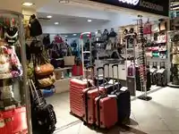 | |||
| shop | boutique | A small shopping outlet, especially one that specializes in elite and fashionable items |  | |||
| shop | clothes | Shop focused on selling clothes and/or underwear (other related value in use is fashion) |  | |||
| shop | fabric | Shop focused on selling fabric and other materials for the purpose of making clothes and other products, eg dress making. |  | |||
| Shop focused on selling fashion. This is deprecated, please use shop=clothes. |  | |||||
| shop | fashion_accessories | Shop focused on selling fashion accessories. |  | |||
| shop | jewelry | Jewellers shops. | 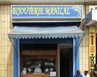 | |||
| shop | leather | Shop focused on selling products made out of leather. | ||||
| shop | sewing | A shop that sells sewing supplies (fabric, thread, yarn, knitting needles, sewing machines, etc.) |  | |||
| shop | shoes | Shop focused on selling shoes. |  | |||
| shop | tailor | A place where clothing is made, repaired, or altered professionally, especially suits and men's clothing |  | |||
| shop | watches | Shop focused on selling watches. | 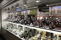 | |||
| shop | wool | Shop selling wool for making of clothes or other products. |  | |||
Discount store, charity | ||||||
| shop | charity | A charity shop is a shop operated by a charity, for the purposes of fundraising. |  | |||
| shop | second_hand | A shop buying and selling used clothes and other things. See also shop=pawnbroker |  | |||
| shop | variety_store | A variety store retailer is a retail store that sells inexpensive items, sometimes with a single price point for all items in the store. |  | |||
Health and beauty | ||||||
| shop | beauty | A non-hairdresser beauty shop, spa, nail salon, etc.. See also shop=hairdresser. |  | |||
| shop | chemist | Shop focused on selling articles of personal hygiene, cosmetics, and household cleaning products (for a shop that potentially dispenses prescription drugs, cf. pharmacy. U.S. drug store, see amenity=pharmacy) |  | |||
| shop | cosmetics | Shop focused on selling cosmetics |  | |||
| shop | erotic | Shop focused on selling erotic toys, -clothes or other erotic stuff. | -01.jpg.webp) | |||
| shop | hairdresser | Here you can get your hair cut, coloured, … See also shop=beauty | %252C_October_2009.JPG.webp) | |||
| shop | hairdresser_supply | A shop, where you can buy hairdressing supplies. |  | |||
| shop | hearing_aids | Shop focused on selling hearing aids devices |  | |||
| shop | herbalist | Shop focused on selling herbs, often for medical purposes. (See also: healthcare:speciality=herbalism and healthcare=alternative). | 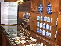 | |||
| shop | massage | A massage shop |  | |||
| shop | medical_supply | Shop focused on selling medical supplies. |  | |||
| shop | nutrition_supplements | Shops that sells one or more nutritional supplements (of vitamins, minerals and/or herbs) |  | |||
| shop | optician | Shop focused on selling eyeglasses, contact lenses (may also check your eyes). |  | |||
| shop | perfumery | Shop focused on selling perfumery |  | |||
| shop | tattoo | A tattoo parlour. |  | |||
Do-it-yourself, household, building materials, gardening | ||||||
| shop | agrarian | Shop focused on selling agrarian products, like seeds, agricultural machinery, animal feed, etc. |  | |||
| shop | appliance | Shop focused on selling large electrical items (aka white goods) washing machines, fridges, cookers, ovens, fans, etc. | 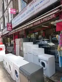 | |||
| shop | bathroom_furnishing | Shop focused on selling bathroom furniture and accessories |  | |||
| shop | doityourself | Shop focused on selling tools and supplies to do-it-yourself householders, gardening, … |  | |||
| shop | electrical | Shop focused on selling electrical supplies and devices | 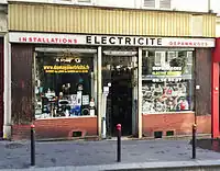 | |||
| shop | energy | Shop focused on selling energy | 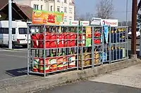 | |||
| shop | fireplace | Shop focused on selling electric fireplaces, stoves or masonry heaters and required fuels |  | |||
| shop | florist | Shop focused on selling bouquets of flowers (see shop=garden_centre for potted flowers). |  | |||
| shop | garden_centre | Shop focused on selling potted flowers, maybe even trees (see also shop=florist for flower bouquets). | 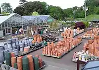 | |||
| shop | garden_furniture | Shop focused on selling garden furniture (sheds, outdoor tables, gates, fences, ...). See shop=garden_centre if also plants are sold. | ||||
| shop | gas | Shop focused on selling technical gas, such as argon, oxygen, acetylene, nitrogen, carbon dioxide, etc. in pressurized containers | 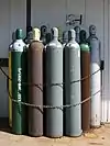 | |||
| shop | glaziery | Shop focused on selling and installing glazing for windows and doors. |  | |||
| shop | groundskeeping | Shop focused on selling outdoor groundskeeping equipment (lawnmowers, chainsaws, small tractors, ... | 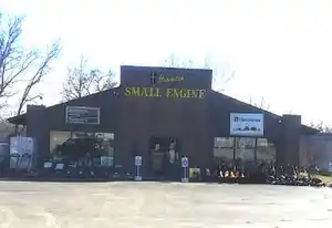 | |||
| shop | hardware | Shop focused on selling building supplies including screws, bolts & paints, … See also shop=doityourself | 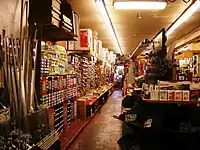 | |||
| shop | houseware | Shop focused on selling crockery, cutlery, kitchenware, small household appliances. |  | |||
| shop | locksmith | Shop focused on selling keys, see also craft=locksmith and craft=key_cutter | 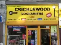 | |||
| shop | paint | Shop focused on selling paints. | 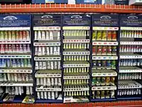 | |||
| shop | pottery | Shop focused on selling earthenware, stoneware and porcelain and other ceramic ware. | _74.jpg.webp) | |||
| shop | security | Shop focused on selling security items like burglar alarms, vaults, locking systems, video surveillance cameras, firefighting equipment, alarm systems, warning systems, etc. | ||||
| shop | trade | Shop focused on selling one or more building supplies such as timber/wood, cement etc. See also shop=doityourself |  | |||
| This tag is deprecated. Please use craft=window_construction instead. | ||||||
Furniture and interior | ||||||
| shop | antiques | Shop focused on selling antiques. |  | |||
| shop | bed | Shop focused on selling beds, mattresses and other bedding products. |  | |||
| shop | candles | Shop focused on selling candles and candle accessories (holders, etc) | .jpg.webp) | |||
| shop | carpet | Shop focused on selling carpets |  | |||
| shop | curtain | Shop focused on selling curtains or drapes (see also shop=fabric) | 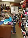 | |||
| shop | doors | Shop focused on selling doors | ||||
| shop | flooring | Shop focused on selling floorings |  | |||
| shop | furniture | Shop focused on selling furniture, might range from small decorational items to a whole flat interior | 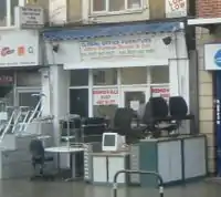 | |||
| shop | household_linen | Shop focused on selling household linen. |  | |||
| shop | interior_decoration | Shop focused on selling interior decorations. |  | |||
| shop | kitchen | A shop where you can plan and buy your kitchen. (Sometimes called "kitchen studio" and the like, but plain kitchen is the most frequently used tag so far.) |  | |||
| shop | lighting | A shop selling lighting fixtures and lamps. | 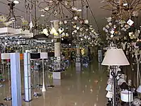 | |||
| shop | tiles | Shop focused on selling tiles. |  | |||
| shop | window_blind | Shop focused on selling window blinds. |  | |||
Electronics | ||||||
| shop | computer | Shop focused on selling computers, peripherals, software, … |  | |||
| shop | electronics | Shop focused on selling consumer electronics (TV, radio, …). Larger ones may also sell computers, fridges, … |  | |||
| shop | hifi | Shop focused on selling High Fidelity or High End environment to listen music or watch films at home |  | |||
| shop | mobile_phone | Shop focused on selling mobile phones and accessories |  | |||
| shop | radiotechnics | Shop focused on selling electronic components, electrical products, radio measuring devices, supplies for radio and electronics. |  | |||
| shop | telecommunication | Shop selling internet, television or similar services, and related hardware. |  | |||
| shop | vacuum_cleaner | Shop focused on selling vacuum cleaners and associated products. |  | |||
Outdoors and sport, vehicles | ||||||
| shop | atv | Shop focused on selling |
 | |||
| shop | bicycle | Shop focused on selling bicycles, bicycle equipment and may rent or repair them | 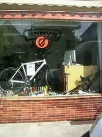 | |||
| shop | boat | Shop focused on selling boats, boat equipment and may rent or repair them |  | |||
| shop | car | Car store – a place to buy cars or to get your car repaired |  | |||
| shop | car_repair | Shop focused on car repair (usually independent of a specific car brand). |  | |||
| shop | car_parts | Shop focused on selling auto parts, auto accessories, motor oil, car chemicals, etc. | 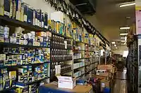 | |||
| shop | caravan | A shop for caravans, motorhomes & similar recreational vehicles. |  | |||
| shop | fuel | Shop selling fuels (motor fuel, wood, coal, gas) that can't be considered a amenity=fuel (fuel station). Use fuel:*=yes/no to indicate which fuels are available. |  | |||
| shop | fishing | Shop focused on selling fishing equipment. | .jpg.webp) | |||
| shop | golf | Shop focused on selling golf equipment. |  | |||
| shop | hunting | Shop focused on selling gun and hunting equipment. |  | |||
| shop | jetski | Shop focused on selling jetskis, jetski equipment and may rent or repair them |  | |||
| shop | military_surplus | Shop selling used military equipment | 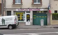 | |||
| shop | motorcycle | Shop focused on selling motorcycles and/or related accessories, clothes, parts, and rental services. |  | |||
| shop | outdoor | Shop focused on selling camping, walking, climbing, and other outdoor sports equipment (GPSes, etc.) |  | |||
| shop | scuba_diving | Shop focused on selling scuba diving equipment. |  | |||
| shop | ski | Shop focused on selling skis, ski equipment and may rent or repair them |  | |||
| shop | snowmobile | Shop focused on selling snowmobiles, snowmobile equipment and may rent or repair them |  | |||
| shop | sports | Shop focused on selling sporting goods. |  | |||
| shop | swimming_pool | A store that sells swimming pool equipment and supplies. |  | |||
| shop | trailer | Shop focused on selling trailers and parts and/or repairing / renting them |  | |||
| shop | tyres | Shop focused on selling tyres. |  | |||
Art, music, hobbies | ||||||
| shop | art | Shop which sells works of art. May be paintings, sculpture, or other types of art |  | |||
| shop | camera | A shop mainly selling cameras and lenses |  | |||
| shop | collector | A shop for different collector's items like stamps, coins, action figures, etc. |  | |||
| shop | craft | An arts and crafts supply store. Commonly sold items are paper, canvas, paint, pencils, crafting wood, crafting tools, etc. - look at craft=* | .jpg.webp) | |||
| shop | frame | Shop focused on selling frames. |  | |||
| shop | games | Shop focused on selling board games, card games and/or role-playing games. |  | |||
| shop | model | Shop specialising in the sale of scale models. |  | |||
| shop | music | Shop focused on selling recorded music (vinyl/CDs/...) |  | |||
| shop | musical_instrument | Shop focused on selling musical instruments, lyrics, scores. If focused on a specific instrument, specify with musical_instrument=* | %252C_September_2009.JPG.webp) | |||
| shop | photo | Shop focused on selling products or services related with photography. |  | |||
| shop | trophy | Store selling trophies, awards, plaques etc. |  | |||
| shop | video | Shop focused on selling or renting out videos/DVDs. |  | |||
| shop | video_games | Shop focused on selling video games. |  GameStop on Powell Street in San Francisco, California. | |||
Stationery, gifts, books, newspapers | ||||||
| shop | anime | Shop focused on selling anime stuff. |  | |||
| shop | books | Shop focused on selling books (for a library that lends books, see amenity=library) |  | |||
| shop | gift | Shop focused on selling gifts, greeting cards, or tourist gifts (souvenirs) |  | |||
| shop | lottery | A shop of which the main or only purpose is the sale of lottery tickets. | %252C_Lotto.jpg.webp) | |||
| shop | newsagent | Shop focused on selling newspapers, cigarettes, other goods | 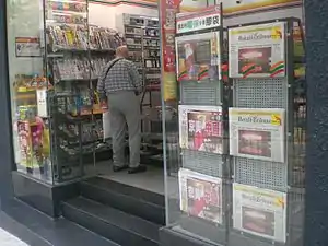 | |||
| shop | stationery | Shop focused on selling office supplies |  | |||
| shop | ticket | Shop focused on selling tickets for concerts, events, public transport, … |  | |||
Others | ||||||
| shop | bookmaker | A shop that takes bets on sporting and other events at agreed upon odds. | .jpg.webp) | |||
| shop | cannabis | a shop primarily and legally selling non-medical cannabis products | 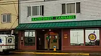 | |||
| shop | copyshop | Shop focused on selling photocopying and printing services. | 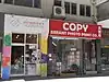 | |||
| shop | dry_cleaning | Shop or kiosk offering a clothes dry cleaning service. The actual cleaning may be done elsewhere. | 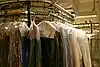 | |||
| shop | e-cigarette | Shop focused on selling electronic cigarettes. |  | |||
| shop | funeral_directors | Providing services related to funeral arrangements, may also be known as a "funeral parlour" or "undertakers". |  | |||
| shop | insurance | A shop selling insurance services from one or more insurance carriers. |  | |||
| shop | laundry | A shop to get your normal clothes washed. Might be self service coin operated, with service staff for drop off, … | 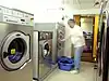 | |||
| shop | money_lender | A money lender offers small personal loans at high rates of interest. |  | |||
| shop | outpost | Shop primarily used to pick-up items ordered online. |  | |||
| shop | party | A shop for party and festival supplies, like costumes, etc. |  | |||
| shop | pawnbroker | A pawnbroker (or pawnshop) is an individual or business that offers secured loans to people. See also shop=second_hand |  | |||
| shop | pest_control | Shop selling pest control goods to exterminate rats, insects etc. |  | |||
| shop | pet | A shop for pets, animals and toys or food for them. |  | |||
| shop | pet_grooming | A shop offering grooming services for pets (most frequently dogs) | 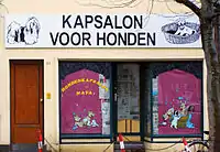 | |||
| shop | pyrotechnics | Store of pyrotechnics: fireworks, firecrackers, sparklers etc. | .JPG.webp) | |||
| shop | religion | Shop focused on selling religious articles, church shop. See also religion=* |  | |||
| shop | storage_rental | self storage | 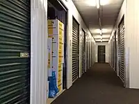 | |||
| shop | tobacco | Shop focused on selling tobacco, cigarettes and their related accessories. | 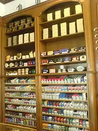 | |||
| shop | toys | Shop focused on selling toys. | 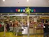 | |||
| shop | travel_agency | Shop focused on selling tickets for travelling. Also known as a tour operator. |  | |||
| shop | weapons | Shop focused on selling weapons like knives, guns etc. | 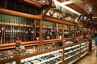 | |||
| shop | vacant | An unused vacant shop. Can be used for an empty or abandoned retail space that seems to be available for lease or purchase where a retail store (or similar businesses) may be opened. No store is being operated in a vacant shop, and neither goods nor services are being offered. This tag can be used after a store was closed or for a newly built shop before any busisness was operated in the shop. |  | |||
| shop | A shop of unspecified type - it is always better to use another value that gives info about shop type, if possible. Used also as indicator that feature such as fuel station has shop. | |||||
| shop | user defined | All commonly used values according to Taginfo | ||||
This table is a wiki template with a default description in English. Editable here.
Tourism
This is used to map places and things of specific interest to tourists. For example these may be places to see, places to stay and things and places providing support. See the page titled Tourism for an introduction on its usage.
This table is a wiki template with a default description in English. Editable here.
Historic
This is used to describe various historic places. For example: archaeological sites, wrecks, ruins, castles and ancient buildings. See the page titled Historic for an introduction on its usage.
This table is a wiki template with a default description in English. Editable here.
土地利用
描述不同区域土地的用地性质。关于此标签的更多信息,参见土地利用页面。
| 关键字(key) | 值(value) | 元素(element) | 说明 | 渲染结果 | 照片 | |
|---|---|---|---|---|---|---|
土地利用常见关键字值-已开发土地 | ||||||
| landuse | commercial | 商业办公用地 |  |
 | ||
| landuse | construction | 建筑工地 |  |
 | ||
| landuse | education | An area predominately used for educational purposes/facilities. |  | |||
| landuse | fairground | A site where the fair takes place |  | |||
| landuse | industrial | 工业用地,包括工厂、车间和仓储用地。 |  |
 | ||
| landuse | residential | 居住区 |  |
 | ||
| landuse | retail | 商业零售用地 |  |
 | ||
| landuse | institutional | Land used for institutional purposes, see
The meaning of this tag is ambiguous and unclear. Consider using another tag that better describes the object. For instance landuse=commercial. See talk page for discussion. |
 | |||
| 关键字(key) | 值(value) | 元素(element) | 说明 | 渲染结果 | 照片 | |
土地利用常见关键字值-乡村与农业用地 | ||||||
| landuse | aquaculture | currently not rendered by osm-carto |  | |||
| landuse | allotments | 市民农场。当地居民的私人菜圃、花圃。 |  |
 | ||
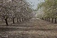
| landuse | farmland | 农田,包括种植粮食、经济作物、蔬菜、水果、花卉以及放牧牲畜的土地。 |  |
 | ||
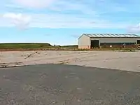
| landuse | farmyard | 农业设施,农业相关设施如农舍,农庄,庄园,棚架,马场,仓库,农机具车库,饲料仓库等,与该设施相邻之树林。 |  |
 | ||
| landuse | flowerbed | An area designated for flowers |  | |||
| landuse | forest | 林业用地。天然林请改用natural=wood。 |  |
 | ||
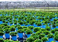
| landuse | greenhouse_horticulture | 温室用地,用于种植蔬菜和花卉的大棚。 | |
 | ||
| landuse | meadow | 牧草地,以栽种草本植物或牧草等作物(如甘蔗,玉米或牧草)为主要用途。 |  |
 | ||
| landuse | [[ Too many Data Items entities accessed. | orchard ]] | 果园 |  |
 | ||
| landuse | plant_nursery | 育种苗圃,人为栽培新品种植物。 |  |
 | ||
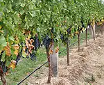
| landuse | vineyard | 葡萄园 |  |
 | ||
| 关键字(key) | 值(value) | 元素(element) | 说明 | 渲染结果 | 照片 | |
Common landuse key values - waterbodyWarning: currently, there is no convention on the exact meaning of this tag. Therefore, it makes sense to treat it like "boundary of aquaculture" (without implication of water body), which means, water body should be tagged by its own, using natural=water etc.}}} | ||||||
| landuse | basin | 人工挖掘的集水区。搭配basin=*标注集水区种类。 |  |
 | ||
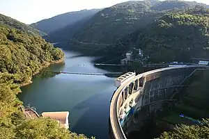
| 水库 |  |
 | ||||
| landuse | salt_pond | 盐田,用于让海水蒸发以取得盐的土地。 |  |
.jpg.webp) | ||
| 关键字(key) | 值(value) | 元素(element) | 说明 | 渲染结果 | 照片 | |
其他土地利用关键字值 | ||||||
| landuse | brownfield | 棕地,废弃的工商业用地,通常旧有建筑已被拆除并将进行更新改造的。 | |
 | ||
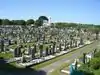
| landuse | cemetery | 墓地。可使用religion=* (可选用的值列在place of worship page)。较小的墓地,如教堂边的也可使用amenity=grave_yard标签代替 | |
 | ||
| Protected areas (deprecated) Alternate tagging of same thing: boundary=protected_area, protected_area=* | ||||||
| landuse | depot | An area used as a depot for e.g. vehicles (trains, buses or trams). Consider using rather standard landuse tags like landuse=railway, landuse=commercial, landuse=industrial, with subtag like industrial=depot. | currently not rendered by osm-carto | .JPG.webp) | ||
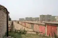
| landuse | garages | 连片的车库。 |  |
 | ||
| landuse | grass | 人工管理的草坪。有些人认为这不是土地利用,请参阅主页landuse=grass以获取信息。 |  |
 | ||
| landuse | greenfield | 待开发的闲置土地。 |  (not rendered) |
| ||
| landuse | landfill | 垃圾堆放/填埋场地 |  |
 | ||
| landuse | military | 军事用地,包括由军队拥有控制的各种用途的土地。 |  |
 | ||
| landuse | port | 处理商业交通的沿海工业区。考虑将landuse=industrial+industrial=port用于此类工业区域。 | currently not rendered by osm-carto |  | ||
| landuse | quarry | 露天采矿/采石场 |  |
 | ||
| landuse | railway | 铁路用地,一般不对公众开放。 | |
 | ||
| landuse | recreation_ground | 游憩用地。常包含球场,绿地等,多为公立,亦可能属于大学或私人公司。 |  |
 | ||
| landuse | religious | 宗教用地 |  |
 | ||
| landuse | village_green | 畸零绿地,常用于分环岛,分隔带等,原意为欧洲社区共有的绿地。 |  |
 | ||
| landuse | winter_sports | An area dedicated to winter sports (e.g. skiing) | .jpg.webp) | |||
| landuse | 用户自定 | 到Taginfo查询常用标签值 | ||||
This table is a wiki template with a default description in English. Editable here.
Military
This is used for facilities and on land used by the military. These may include the Navy, Army, Air Force and Marines. See the page titled Military for an introduction on its usage.
This table is a wiki template with a default description in English. Editable here.
Natural
This is used to describe natural and physical land features. These also include features that have been modified by humans.
Vegetation
This table is a wiki template with a default description in English. Editable here.
Water related
This table is a wiki template with a default description in English. Editable here.
Geology related
This table is a wiki template with a default description in English. Editable here.
Geological
This is used to describe the geological makeup of an area. See the page Geological for an introduction on its usage.
This table is a wiki template with a default description in English. Editable here.
非自然
=== 路线 ===参见 Relation:route 以得到标示路线的另一种方法。
| 类别(key) | 值(value) | 元素 | 说明 | 图上显示 | 照片 |
|---|---|---|---|---|---|
| route | bicycle | Cycle routes 说明了如何标记自行车路线 | 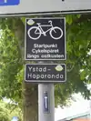 | ||
| route | bus | 公共汽车服务的线路。参见 Buses |  | ||
| route | canoe | Signed route for canoeing through a waterway. |  | ||
| route | detour | 固定的绕行线路。例如德国的 Bedarfsumleitung 和荷兰的 uitwijkroute | %252C_StVO_1970.svg.png.webp) | ||
| route | ferry | 渡轮从两端来回行驶的线路。请至少在缩放级别 12 时为每拼贴添加至少一个节点,最好几公里添加一个,这样离线编辑器就可以在一些下载请求中下载到路线。 |  |
 | |
| route | foot | Walking Route - is used for routes which are walkable without any limitations regarding fitness, equipment or weather conditions. |  | ||
| route | hiking | Hiking 说明了如何标记远足路线 | 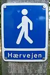 | ||
| route | horse | Riding routes | 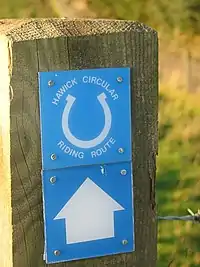 | ||
| route | inline_skates | Inline has more information on the subject. | |||
| route | light_rail | Route of a light rail line. | 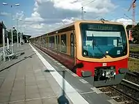 | ||
| route | mtb | Mountainbike 说明了如何标记山地自行车路线 |  | ||
| route | piste | Route of a piste (e.g., snowshoe or XC-Ski trails) in a winter sport area. |  | ||
| route | railway | 为延伸的铁轨命名 (例如英吉利海峡隧道) 参见 Railways |  | ||
| route | road | 可用于标记各种公路路线/长道路 | 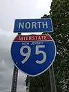 | ||
| route | running | For running (jogging) routes. |  | ||
| route | ski |  | |||
| route | subway | Route of a metro service |  | ||
| route | train | 列车服务 (例如 伦敦-巴黎的欧洲之星) 参见 Railways | |||
| route | tracks | Railroad track as rail infrastructure. | | ||
| route | tram | 参见 Tram 得到更多关于电车服务标签的信息 | 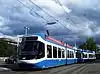 | ||
| route | trolleybus | The route of a trolleybus service. | 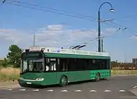 | ||
| route | User defined | 见 [[[Taginfo]] |
This table is a wiki template with a default description in English. Editable here.
Boundary
These are used to describe administrative and other boundaries. See the page Boundaries for an introduction on its usage.
| Key | Value | Element | Comment | Rendering example | Photo | |
|---|---|---|---|---|---|---|
Boundary types | ||||||
| boundary | aboriginal_lands | A boundary representing official reservation boundaries of recognized aboriginal / indigenous / native peoples. |  |
 | ||
| boundary | administrative | An administrative boundary. Subdivisions of areas/territories/jurisdictions recognised by governments or other organisations for administrative purposes. These range from large groups of nation states right down to small administrative districts and suburbs, as indicated by the 'admin_level=*' combo tag. |  |
 | ||
| boundary | border_zone | A border zone is an area near the border where special restrictions on movement apply. Usually a permit is required for visiting. | _-_crop.jpg.webp) | |||
| boundary | forest | A delimited forest is a land which is predominantly wooded and which is, for this reason, given defined boundaries. It may cover different tree stands, non-wooded areas, highways… but all the area within the boundaries are considered and managed as a single forest. | 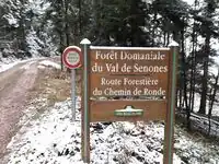 | |||
| boundary | forest_compartment | A forest compartment is a numbered sub-division within a delimited forest, physically materialized with visible, typically cleared, boundaries. |  | |||
| boundary | hazard | A designated hazardous area, with a potential source of damage to health, life, property, or any other interest of value. | 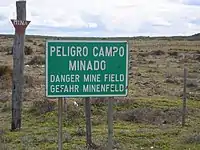 | |||
| boundary | maritime | Maritime boundaries which are not administrative boundaries: the Baseline, Contiguous Zone and EEZ (Exclusive Economic Zone). | 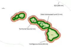 | |||
| boundary | marker | A boundary marker, border marker, boundary stone, or border stone is a robust physical marker that identifies the start of a land boundary or the change in a boundary, especially a change in direction of a boundary. See also historic=boundary_stone |  | |||
| boundary | national_park | Area of outstanding natural beauty, set aside for conservation and for recreation (Other languages). |  |
 | ||
| boundary | place | boundary=place is commonly used to map the boundaries of a place=*, when these boundaries can be defined but these are not administrative boundaries. | ||||
| boundary | political | Electoral boundaries | ||||
| boundary | postal_code | Postal code boundaries | ||||
| boundary | protected_area | Protected areas, such as for national parks, marine protection areas, heritage sites, wilderness, cultural assets and similar. |  | |||
| boundary | special_economic_zone | A government-defined area in which business and trade laws are different. |  | |||
| boundary | disputed | An area of landed claimed by two or more parties (use with caution). See also Disputed territories. | 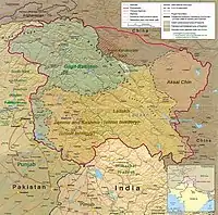 | |||
| boundary | user defined | All commonly used values according to Taginfo | ||||
Attributes | ||||||
| admin_level | (number) | Applies to boundary=administrative and is usually in the range 1 to 10, except for several countries (Bolivia, Germany, Mozambique, Netherlands, Philippines, Poland, Turkmenistan, Venezuela) where it is in the range 1 to 11 – see boundary. |  | |||
| border_type | * | To distinguish between types of boundary where admin_level isn't enough. Used in several different ways e.g in maritime contexts. | ||||
| start_date | (date) | Useful if the boundary is very recent (or if it will become effective in a near future). |  | |||
This table is a wiki template with a default description in English. Editable here.
Sport
This is used to provide information about which sports are placed on a facility such as a pitch or stadium. It is intended to be used in conjunction with tags landuse=* or leisure=*. See the page titled Sport for an introduction on its usage.
This table is a wiki template with a default description in English. Editable here.
Abutters
This key applies to ways only when, for instance, aerial views are not available. See landuse=* for areas.
| Key | Value | Element | Comment | Rendering | Photo |
|---|---|---|---|---|---|
| abutters | commercial | predominantly office buildings, business parks, etc. | | ||
| abutters | industrial | predominantly workshops, factories, warehouses |  | ||
| abutters | mixed | where there is no clear predominance, for example mixed shops and residences in an inner city ring | |||
| abutters | residential | predominantly houses and apartments |  | ||
| abutters | retail | predominantly shops | |||
| abutters | user defined | All commonly used values according to Taginfo |
This table is a wiki template with a default description in English. Editable here.
Properties
This is used to give additional information of a general nature about another element.
| Key | Value | Element | Comment | Rendering | Photo |
|---|---|---|---|---|---|
| area | yes | Means a feature that is normally linear is an area. You should not add this to features that are already defined as an area type. |  | ||
| brand | user defined | Brand of the feature. | |||
| bridge | yes / aqueduct / viaduct / cantilever / movable / covered / … | A bridge, use together with the tag layer=*. Value yes is generic, or you can specialize. |  |
 | |
| capacity | amount | Used for specifying capacity of a facility. | |||
| charge | amount | Used for specifying how much is charged for use/access to a facility. See toll=* or fee=*. | |||
| clothes | see key's page | Tagged on shops and other features to denote if they sell clothes or not and what type of clothes they sell. | | ||
| covered | yes | Used to denote that a node, way or area is covered by another entity (or in some cases the ground), when the use of layers is inappropriate, or additional clarification is needed. | Various, depending on the covered entity |  | |
| crossing | no / traffic_signals / uncontrolled / island / unmarked | Further refinement for nodes already tagged with highway=crossing or railway=crossing | | ||
| crossing:island | yes / no | Specifies whether a pedestrian crossing has a refuge island |  | ||
| cutting | yes / left / right | A cut in the land to carry a road or tram. Mostly in hilly landscape. See Cutting于维基百科 |  | ||
| disused | yes | For features that are useful for navigation, yet are unused. See abandoned=* if infrastructure is removed. | 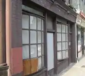 | ||
| drinking_water | yes / no | Describes whether a drinking water is available | |||
| drive_through | yes / no | Used to indicate if a pharmacy, bank, atm, or fast_food, or post_box offers drive_thru service. drive_through=* is different than drive_in=*} |  | ||
| drive_in | yes / no | Used to indicate if a cinema is a drive-in cinema or a restaurant offers drive-in service. drive_in=* is different than drive_through=* |  | ||
| electrified | contact_line / rail | Indicates infrastructure to supply vehicles with electricity on rail tracks | | ||
| ele | Number | Elevation (also known as altitude or height) above mean sea level in metre, based on geoid model EGM 96 which is used by WGS 84 (GPS). (see also Altitude) |  | ||
| embankment | yes | A raised bank to carry a road, railway, or canal across a low-lying or wet area. See Embankment于维基百科 |  |
 | |
| end_date | Date | Date feature was removed | .jpg.webp) | ||
| est_width | Number | A rough guess of the width of way in metres | | ||
| fee | yes / no | Used for specifying whether fee is charged for use/access to a facility. See also toll=*. | |||
| fire_object:type | poo / szo | Potentially dangerous and socially significant objects | |||
| fire_operator | Name | Fire station, which serves the object | |||
| fire_rank | 1bis / 2 to 5 | Rank fire, defined for a particular object | |||
| frequency | Number | Frequency in Hz | | ||
| hazard | see hazard | Indicates of the hazards. | |||
| hot_water | yes / no | Describes whether a hot water is available | |||
| inscription | User Defined | The full text of inscriptions, which can be found on buildings, memorials and other objects. | _(4749426050).jpg.webp) | ||
| internet_access | yes / wired / wlan / terminal / no | This tag is for indication that a map entity such as a building, a shop, restaurant, etc. offers internet access to the public, either as a paid service or even for free. |  | ||
| layer | -5 to 5 | 0: ground (default); -1..-5:under ground layer; 1..5 (not +1):above ground layer This is intended to indicate actual physical separation, shouldn't be used just to influence rendering order. |
 | ||
| leaf_cycle | evergreen / deciduous / semi_evergreen / semi_deciduous / mixed | Describes the phenology of leaves |  | ||
| leaf_type | broadleaved / needleleaved / mixed / leafless | Describes the type of leaves |  | ||
| location | underground / overground / underwater / roof / indoor | Location |  | ||
| narrow | yes | Relative indication that a way (waterway, highway, cycleway) gets narrower. | 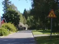 | ||
| nudism | yes / obligatory / designated / no / customary / permissive | Indicates if the described object provides the possibility of nudism | 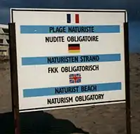 | ||
| opening_hours | 24/7 or mo md hh:mm-hh:mm. (read described syntax) | opening_hours describes when something is open. |  | ||
| opening_hours:drive_through | 24/7 or mo md hh:mm-hh:mm. (read described syntax) | opening_hours describes when something is open for drive-through services. | |||
| operator | User Defined | The operator tag can be used to name a company or corporation who's responsible for a certain object or who operates it. | |||
| power_supply | yes / no | Describes whether a power supply is available | |||
| produce | User Defined | Describes a feature's agricultural output produced though a natural process of growing or breeding. | 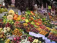 | ||
| rental | see key's page | Tagged on shops and other features to denote if they rent something or not and what they rent. | |||
| sauna | yes / no | Describes whether a sauna is available | 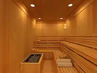 | ||
| service_times | see opening_hours | Times of service of a given feature e.g. church service | _Service_times_2012.jpg.webp) | ||
| shower | yes / no | Describes whether a shower is available | 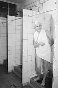 | ||
| start_date | Date | Date feature was created | 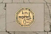 | ||
| tactile_paving | yes /no | Indicate if a specific place can be detected or followed with a blindman's stick. | | ||
| tidal | yes | Area is flooded by the tide |  | ||
| toilets | yes / no | Describes whether a toilets is available | |||
| topless | yes / no | Indicates if the described object provides the possibility of female topless practice | 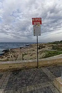 | ||
| tunnel | yes | A tunnel, use together with a tag layer=*. | 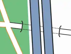 |
 | |
| toilets:wheelchair | yes / no | States if a location has a wheelchair accessible toilet or not. |  | ||
| wheelchair | yes / no / limited | Indicates if a place is accessible using a wheelchair. |  | ||
| width | Number | Width of way in metres | | ||
| Applies to landuse=forest and natural=wood detailing the sort of trees found within each landuse. Makes most sense when applied to areas. Be careful : this tag is now deprecated, please use instead leaf_cycle=* |
 |
Restrictions
This is used to define restrictions that apply to the associated element. See the page titled Restrictions for an introduction on its usage.
| Key | Value | Element | Comment | Rendering | Photo | |
|---|---|---|---|---|---|---|
| Vehicle types | ||||||
| access | agricultural / delivery / designated / destination / forestry / no / official / permissive / private / yes | General access permission.
|
||||
| agricultural | yes / no | Access permission for agricultural vehicles, e.g. tractors. | ||||
| atv | For values see access above | Access restricted to wheeled vehicles 1.27m (50 inches) or less in width, for example |
||||
| bdouble | For values see access above | Access permission for |
||||
| bicycle | For values see access above + dismount | Access permission for bicycles. Usage of bicycle=dismount and bicycle=no will vary in different countries. If according to local traffic rules a bicycle is no longer seen as a bicycle when there's no one driving it, then there's no need for using bicycle=dismount. If the local legislation still sees an undriven bicycle as a bicycle then you may need to use both bicycle=dismount and bicycle=no. | ||||
| boat | For values see access above | Access permission for small boats and pleasure crafts, including yachts | ||||
| electric_bicycle | For values see access above | Access permission for electric bicycles (mostly defined as having a maximum speed of 25 km/h) | ||||
| emergency | yes | Access permission for emergency motor vehicles; e.g., ambulance, fire truck, police car |  | |||
| foot | For values see access above | Access permission for pedestrians. | ||||
| forestry | yes / no | Access permission for forestry vehicles, e.g. tractors. | ||||
| golf_cart | For values see access above | Access permission for golf carts and similar small, low-speed electric vehicles | ||||
| goods | For values see access above | Access permission for |
||||
| hazmat | For values see access above | Access permission for vehicles carrying hazardous materials. |  | |||
| hgv | For values see access above | Access permission for |
||||
| horse | For values see access above | Access permission for horse riders. | ||||
| inline_skates | yes / no | Access permission for |
||||
| lhv | For values see access above | Access permission for |
||||
| mofa | For values see access above | Access permission for |
||||
| moped | For values see access above | Access permission for |
||||
| motorboat | For values see access above | Access permission boats and yachts using motor | ||||
| motorcar | For values see access above | Access permission for (motor) cars | ||||
| motorcycle | For values see access above | Access permission for motorcycles | ||||
| motor_vehicle | For values see access above | Access permission for any motorized vehicle |  | |||
| psv | For values see access above | Access permission for Public Service Vehicles (UK), e.g. buses and coaches | ||||
| roadtrain | For values see access above | Access permission for |
 | |||
| ski | For values see access above | Access permission for |
||||
| speed_pedelec | For values see access above | Access permission for electric bicycles (mostly defined as having a maximum speed of 45 km/h) | ||||
| tank | For values see access above | Access permission for (military) tanks | ||||
| vehicle | For values see access above | Access permission for all vehicles | ||||
| 4wd_only | yes | A road signed as only suitable for 4WD (offroad) vehicles | ||||
| Other | ||||||
| charge | Number | Amount of toll or fee. See toll=* as well | ||||
| female | yes | Female-only or gender segregated (with male=yes) feature | ||||
| male | yes | Male-only or gender segregated (with female=yes) feature | ||||
| max_age | age | The legal maximum age | ||||
| maxaxleload | Weight | The legal maximum axleload – units other than tonnes should be explicit | ||||
| maxheight | Height | Height limit – units other than metres should be explicit | ||||
| maxlength | Length | Length limit – units other than metres should be explicit | ||||
| maxspeed | Speed | Maximum speed – units other than km/h should be explicit | ||||
| maxstay | Number | Maximum stay, in units given (hour/hours/day/days) | ||||
| maxweight | Weight | Weight limit – units other than tonnes should be explicit | ||||
| maxwidth | Width | Width limit – units other than metres should be explicit | ||||
| min_age | age | The legal minimum age | ||||
| minspeed | Speed | Minimum speed – units other than km/h should be explicit | ||||
| noexit | yes | A dead end road/cul de sac with only one access road | ||||
| oneway | yes / no / -1 | oneway=yes for traffic direction same as the sequence of nodes of the way. oneway=no for bidirectional traffic. oneway=-1 for traffic direction opposite to the sequence of nodes of the way (if the way cannot be reversed). Some road types are assumed to be one-way (e.g. highway=motorway), others are assumed to be two-way (most others). |
||||
| Relation:restriction | Used for a set of tags and members to represent a turn restriction. | |||||
| toll | yes | Toll or fee must be paid to access way. See also barrier=toll_booth | ||||
| traffic_sign | city_limit | Start/end sign of city limits, in most countries implies a specific "city maxspeed". | ||||
| unisex | yes | Unisex feature | ||||
This table is a wiki template with a default description in English. Editable here.
命名
Name
The name=* tag is the primary tag used for mapping the name of an element. See the page titled Names for an introduction on its usage.
| Key | Value | Element | Comment |
|---|---|---|---|
| name | User defined | The common default name. Notes:
| |
| name:<lg> | User defined | Name in different language; e.g., name:fr=Londres. Note that all key variants below can use a language suffix. See: Multilingual names. | |
| name:left , name:right | User defined | Used when a way has different names for different sides (e.g., a street that's forming the boundary between two municipalities). | |
| int_name[:<lg>] | User defined | International name. Consider using language specific names instead; e.g., name:en=.... International does not (necessarily) mean English. It is used to give the name transliterated to Latin script in Belarus, Bulgaria, Greece, Kazakhstan and Northern Macedonia | |
| loc_name[:<lg>] | User defined | Local name. | |
| nat_name[:<lg>] | User defined | National name. | |
| official_name[:<lg>] | User defined | Official name. Useful where there is some elaborate official name, while a different one is a common name typically used. Example: official_name=Principat d'Andorra (where "name" is name=Andorra). | |
| old_name[:<lg>] | User defined | Historical/old name, still in some use. | |
| reg_name[:<lg>] | User defined | Regional name. | |
| short_name[:<lg>] | User defined | Should be a recognizable commonly-used short version of the name, not a nickname (use alt_name for that), useful for searching (recognized by Nominatim). | |
| sorting_name[:<lg>] | User defined | Name, used for correct sorting of names — This is only needed when sorting names cannot be based only on their orthography (using the Unicode Collation Algorithm with collation tables tailored by language and script, or when sorted lists of names are including names written in multiple languages and/or scripts) but requires ignoring some parts such as:
all of them being ignored at the primary sort level and not easily inferable by a preprocessing algorithm. | |
| alt_name[:<lg>] | User defined | Alternative name by which the feature is known. If there is a name that does not fit in any of the above keys, alt_name can be used; e.g., name=Field Fare Road and alt_name=Fieldfare Road, or name=University Centre and alt_name=Grad Pad. In rare cases, the key is used for multiple semicolon-separated names; e.g. alt_name=name1;name2;name3, but this usage is not preferred. | |
| Do not use this tag, suffixed name tagging for multiple values is deprecated. |
This table is a wiki template with a default description in English. Editable here.
References
This is used to add reference information for an element.
This table is a wiki template with a default description in English. Editable here.
References
This is used to add reference information for an element.
This table is a wiki template with a default description in English. Editable here.
Place
This is used mainly to give details about settlements. See the page titled Places for an introduction on its usage.
Administratively declared places
This table is a wiki template with a default description in English. Editable here.
Populated settlements, urban
This table is a wiki template with a default description in English. Editable here.
Populated settlements, urban and rural
This table is a wiki template with a default description in English. Editable here.
Other places
This table is a wiki template with a default description in English. Editable here.
Additional attributes
This table is a wiki template with a default description in English. Editable here.
Addresses
This is used to provide postal information for a building or facility. See the pages titled Addresses and addr=* for an introduction on its usage.
| Key | Value | Element | Comment | Rendering | Photo | |
|---|---|---|---|---|---|---|
Tags for individual houses | ||||||
| addr:housenumber | user defined | The house number (may contain letters, dashes or other characters). Addresses describes ways to tag a single building with multiple addresses. Please do not only tag addr:housenumber=*, but also add at least addr:street=* or addr:place=* for places without streets (or map the belonging to a street with a relation using associatedStreet relation or street relation.) |
 |
%252C_October_2009.JPG.webp) | ||
| addr:housename | user defined | The name of a house. This is sometimes used in some countries like England, Spain, Portugal, Latvia instead of (or in addition to) a house number. |
 | |||
| addr:flats | user defined | The unit numbers (a range or a list) of the flats or apartments located behind a single entrance door. |  |
 | ||
| addr:conscriptionnumber | user defined | This special kind of housenumber relates to a settlement instead of a street. Conscription numbers were introduced in the Austrio-Hungarian Empire and are still in use in some parts of Europe, sometimes together with street-related housenumbers which are also called orientation numbers. |  | |||
| addr:street | user defined | The name of the respective street. If the street name is very long or nonexistent, the ref of the respective street. A way with highway=* or a square with place=square and the corresponding name should be found nearby. The belonging to a street can alternatively be represented by a associatedStreet relation or street relation. The keys addr:housenumber=* and addr:street=* in principle are the only necessary ones if there are valid border polygons. If you are not sure if it is so, just add addr:city=*, addr:postcode=* and addr:country=*. |
.jpg.webp) | |||
| addr:place | user defined | This is part of an address which refers to the name of some territorial zone (usually a place=* like island, square or very small village) instead of a street (highway=*). Should not be used together with addr:street=*. | ||||
| addr:postcode | user defined | The postal code of the building/area. Some mappers prefer to rely on boundary=postal_code | ||||
| addr:city | user defined | The name of the city as given in postal addresses of the building/area. (In some places the city in the address corresponds to the post office that serves the area rather than the actual city, if any, in which the building is located.) Some mappers assume it can be derived from a boundary=administrative relation. |  | |||
| addr:country | user defined | The ISO 3166-1 alpha-2 two letter country code in upper case. Example: "DE" for Germany, "CH" for Switzerland, "AT" for Austria, "FR" for France, "IT" for Italy. Caveat: The ISO 3166-1 code for Great Britain is "GB" and not "UK". More or less favoured in different national communities. |
||||
| addr:postbox | user defined | Use this for addressing postal service Post Office Box (PO Box, BP - Boîte Postale, CP - Case Postale, Поштански преградак, Поштански фах, Поштански претинац) as alternative to addressing using street names. Example: "PO Box 34" | ||||
| addr:full | user defined | Use this for a full-text, often multi-line, address if you find the structured address fields unsuitable for denoting the address of this particular location. Examples: "Fifth house on the left after the village oak, Smalltown, Smallcountry", or addresses using special delivery names or codes (possibly via an unrelated city name and post code), or PO Boxes. Beware that these strings can hardly be parsed by software: "1200 West Sunset Boulevard Suite 110A" is still better represented as addr:housenumber=1200 + addr:street=West Sunset Boulevard + addr:unit=110A. |
||||
For countries using hamlet, subdistrict, district, province, state, county | ||||||
| addr:hamlet | user defined | The hamlet of the object. In France, some addresses use hamlets instead of street names. |  | |||
| addr:suburb | user defined | If an address exists several times in a city. You have to add the name of the settlement. See Australian definition of suburb. | ||||
| addr:subdistrict | user defined | The subdistrict of the object. | ||||
| addr:district | user defined | The district of the object. | ||||
| addr:province | user defined | The province of the object. For Canada, uppercase two-letter postal abbreviations (BC, AB, ON, QC, etc.) are used. In Russia a synonym {{{key:addr:region}}} is widely used | ||||
| addr:state | user defined | The state of the object. For the US, uppercase two-letter postal abbreviations (AK, CA, HI, NY, TX, WY, etc.) are used. | ||||
| addr:county | user defined | The county of the object. | ||||
Tags for interpolation ways | ||||||
| addr:interpolation | all/even/odd/ alphabetic | How to interpolate the house numbers belonging to the way along the respective street. See detailed description. |
 | |||
| addr:interpolation | Number n | Every nth house between the end nodes is represented by the interpolation way. | ||||
| addr:inclusion | actual/estimate/potential | Optional tag to indicate the accuracy level of survey used to create the address interpolation way. See detailed description. |
||||
Annotations
Providing further information about tag values for other mappers and in some cases also for users. See the page titled Annotations for an introduction on its usage.
This table is a wiki template with a default description in English. Editable here.