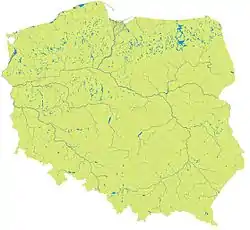
< Poland

Poland/Rzeki
| Polski:
Ta strona grupuje relacje z rzekami w granicach Polski. Rendering granic można zobaczyć tutaj. |

| Tag | Komentarz Notes |
|---|---|
| type=waterway | |
| waterway=river, stream, canal, drain | |
| name=* | Nazwa rzeki. |
| wikipedia=* | Nazwa artykułu w Wikipedii (dodaj prefiks pl:, jeśli strona odnosi się do polskiej Wikipedii) |
| destination=* | Ujście rzeki (nazwa innej rzeki lub morza, jeziora...} |
Dorzecze Wisły
| Nazwa Name |
Długość Langth |
Status | Relacja Relation |
Komentarz Notes |
|---|---|---|---|---|
| Czarna Wisełka | 9 km | 122056611 | ||
| Wisła | 1047 km | 34392 | ||
| Malinka | 8.1 km | 237043757 | ||
| Biebrza | 165 km | 6378830 | ||
| Brda | 238 km | 1289615 | ||
| Bug | 587 km | 1314266 | ||
| Bzura | 166 km | 1491983 | ||
| Drwęca | 207 km | 2712795 | ||
| Dunajec | 247 km | 2822415 | ||
| Narew | 484 km | 2278710 | ||
| Pilica | 319 km | 2698269 | ||
| Poprad | 168,8 km | 5544271 | ||
| Radomka | 98 km | 2753588 | ||
| Rudawa | 35.8 km | 2900774 | ||
| San | 443 km | 1640410 | ||
| Soła | 89 km | 545358 | ||
| Wda | 198 km | 4686023 | ||
| Wieprz | 348,9 km | 2297716 | ||
| Wilga | 26,7 km | 2900813 | ||
| Wisłok | 228 km | 2020696 | ||
| Wkra | 249 km | 2765933 |
Dorzecze Odry
| Nazwa Name |
Długość Langth |
Status | Relacja Relation |
Komentarz Notes |
|---|---|---|---|---|
| Odra | 854 km | 387605 | ||
| Bóbr | 272 km | 1582509 | ||
| Drawa | 185,9 km | 7456890 | ||
| Noteć | 391,3 km | 6124894 | ||
| Nysa Kłodzka | 181,7 km | 3510490 | ||
| Nysa Łużycka | 251,6 km | 406565 | ||
| Prosna | 216,8 km | 7456822 | ||
| Warta | 808 km | 3272339 | ||
| Widawa | 109 km | 1103925 |
Nie jest do końca pewne położenie źródła. Poza tym przebieg rzeki jest już kompletny. | |
| Bystrzyca | 101,5 km | 3205675 |
Nie jest do końca pewne położenie źródła. Poza tym przebieg rzeki jest już kompletny. |
Bezpośrednio uchodzące do Bałtyku
| Nazwa Name |
Długość Langth |
Status | Relacja Relation |
Komentarz Notes |
|---|---|---|---|---|
| Nogat | 62 km | 1645604 |
Zobacz też
Colour and symbol legend
The status of the waterways is indicated by a symbol, which describes the type of feature, and a colour, which indicates the completeness of that feature
Meaning of symbols
 - The Waterway is completly mapped. - Key: ww
 - The Waterbank is completly mapped. - Key: wb
 - All Tributaries are present. - Key: tr
 - The waterway is linked to a Relation. - Key: rl
Meaning of colours
| Background colour | Meaning | Use for navigation | To do | Value |
|---|---|---|---|---|
| The map needs checking, status unknown | Availability unknown | Please check | (none) | |
| The map contains no or little data | Not to be used | Please complete | 0 | |
| The map contains partial data | Limited usability | Please complete | 1 | |
| The map is largely complete (please describe missing data) | Use with restrictions | Please complete (missing data etc.) | 2 | |
| The map is complete (in the opinion of a mapper) | Suitable for use | Please check and correct any errors | 3 | |
| The map is complete (verified by 2 mappers) ; please indicate Date when checked) | Suitable for use | Please update as needed | 4 | |
| This attribute is not existing in the mapped area (e.g. no petrol station existing). | Suitable for use | Please update as needed | X |
This table is a wiki template with a default description in English. Editable here.
| ||||||||||
| ||||||||||
This article is issued from Openstreetmap. The text is licensed under Creative Commons - Attribution - Sharealike. Additional terms may apply for the media files.