< WikiProject Belgium

WikiProject Belgium/Long Distance Walking Routes

     
WikiProject Belgium +/-
Conventions
Subprojects

Conventions

See this page to learn how to tag walking routes in Belgium.

Legend

Status Description
No relation made yet
Relation made, but most of the route is missing
Significant parts of the route are missing
Only a small part of the route is missing, or the main route is done and some alternative routes are missing
Route is completely mapped

GR routes

Cooperation between OpenStreetMap, Grote Routepaden and Les Sentiers de Grande Randonnée (SGR)

GroteroutePaden vzw

We have explicit permission to use the reference GPX files provided by GroteroutePaden.be on their website for all GR routes in Flanders . Of course, this data should not be blindly trusted, and differences between OSM and the official data should always be examined before changing the relation. To make this process easier, a series of Umap's is being set up to make comparison easily and to allow for making on-topic notes that can be discussed with the people at Grote Routepaden.

A recent project together with Grote Routepaden is an effort to get the surface tags completed for all the ways used by the GR routes. More info on the osm.be blog.


Les Sentiers de Grande Randonnée asbl (SGR)

Permission - Authorisation

As of July 2020, we have the permission to use the reference GPX files provided by SGR as well.

See below for the email about this authorisation:

   Hello Joost,
   [If you’re not the best recipient, please forward]
   As you probably know, the GPX tracks of all GR/GRP in Wallonia is available for download on http://grsentiers.org/. A Qgiscloud map of GR in Wallonia is also available on https://qgiscloud.com/grsentiers/Reseau_GR_wallon/.
   Although we (SGR) have said from the beginning that we have no problem with the use of this information by Osm Mappers, this point was never formally defined.
   The CA of SGR Asbl has recently approved that the information will be available under licence : CC-BY 2.0 Belge.
   This means that the information (GPX and dynamic map) can be used by Osm Mappers and that relations defining the GR paths can be legally created. Practically, I’m not sure this will make a difference. I’ve personally created / updated several GR relations of GR in Wallonia in the past. See https://wiki.openstreetmap.org/wiki/WikiProject_Belgium/Long_Distance_Walking_Routes For good practice, the relation tags should specify that the operator in “SGR asbl”.
   If you have any question, do not hesitate, Best mapping regards,
   Michel Dawirs - aka Mercator 1958 SGR asbl - Leader of Cartographic Team
Conditions d'utilisation - Conditions of use

See (in French) Réseau SGR Online et GPX - Conditions d'utilisation

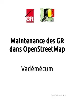
Maintenance des GR dans OpenStreetMap - Maintenance of GR routes in OpenStreetMap

SGR has found that the regular updates that SGR makes to its routes are not always reflected in OSM in a timely and quality manner.

Therefore, in 2021, SGR has approached OSM Belgium with a view to :

  • ensure the complete reporting of all GR routes in OSM
  • ensure the best possible synchronisation of changes to the GR routes

In OSM, the parts of a GR (main route, variants and connections) are included in the form of a relation with a series of attributes for each. This being the case, there is a need to maintain the GR routes in OSM.

A fifteen-page vademecum in PDF format entitled "Maintenance des GR dans OpenStreetMap" was drawn up in consultation with the SGR. It is available in French. It is a procedure to ensure the quality of the data in OSM. It is available here :

Maintenance des GR dans OpenStreetMap - Vadémécum

.

GR - Main routes

Sign Reference Route Relation
GR 5

Noordzee - Middellandse Zee / Mer du Nord - Méditerranée

  • See groteroutepaden.be grsentiers.org
  • See uMap (Vlaanderen)

Note:

  • Member of GR 5 superroute
  • Member of E2 superroute

Alternatives

Sign Route Progress Relation
 ? Variant Genk () Done relation 5951316
Variant Hasselt ()  ? relation 2907324
? Variant Maastricht (Hoge Fronten) ()
Variant Testelt-Zichem (Demervariant) () relation 2923308

Connections

Sign Route Progress Relation
Railway station Heide (1.2 km) Done (note: not included on the Groteroutepaden website and confirmed by an employee of Grote Routepaden VZW to not be an official route. But the local volunteers added waymarking on the ground.) relation 149863
relation 3121667 (Flanders north)

relation 13918842 (Flanders south)

relation 3121668 (Wallonia)

GR 5A

Wandelronde van Vlaanderen

  • GR 5A South checked, in progress. See uMap . Official . Provinces Oost- en West-Vlaanderen
  • GR 5A North, needs first review. See uMap and official page . Provinces Oost- en West-Vlaanderen

Alternatives

Sign Route Progress Relation
Rond Canisvlietsche Kreek Done relation 133437
GR 5A South: Variant E2 / Verbinding GR5A-GR12 (Official Some checks remain relation 13638
GR 5A South: Variant Dode Ijzer (Official ) Needs mapping relation 6481535
GR 5A South: Connection to GR 123 (Official ) Done relation 5556328
GR 5A Noord: Variant in Brugge (Official ) Needs relation Relation not defined yet
GR 5A Noord: Aanlooproute Maldegem (Official ) Needs relation Relation not defined yet
GR 5A Noord: Variant Oostende Haven (Official ) Done relation 3194117
GR 5A Noord relation 13658

GR 5A Zuid relation 2629186

GR 12

Amsterdam - Brussels - Paris

  • Mapped from border to border
  • Flemish part checked with Groteroutepaden GPX, some issues remain. Notes and comparison available on this uMap . Official . Provinces Vlaams Brabant and Antwerpen.


Main

Sign Route Progress Relation
Main trajectory Wallonia Done relation 13632
Main trajectory Flanders Done relation 14893806

Alternatives

Sign Route Progress Relation
Via De Uitlegger (Kapellen, Brasschaat) (6.5 km) Done > verify current status relation 66652
GR 12 Variant West (Official Done relation 6296002

Connections

Sign Route Progress Relation
Railway station Heide (1.6 km) Done relation 150957
Connection GR 12 - GR 512 Official . relation 112820
relation 13629424
GR 14

Monschau - Bouillon - Sedan

Alternatives

Sign Route Progress Relation
Variante de crue de la Semois (7.1 km) Completed relation 10285544

Connections

Sign Route Progress Relation
Liaison AJ Champlon Nord (4 km) Completed relation 10291197
Liaison AJ Champlon Est (3.3 km) Completed relation 10291210
    relation 2929186
    GR 15

    Sentiers de l’Ardenne « De la Lorraine belge à l’Eifel »

    Alternatives

    Sign Route Progress Relation
    Variante Mardasson (6.7 km) Completed by User:Mercator 1958 - Last update 2022-07-10 relation 4163012
    Variante Charmille (2.2 km) Completed by User:Mercator 1958 - Last update 2022-07-10 relation 9156234
    Variante Fagne de Nathsief (2.2 km) Completed by User:Mercator 1958 - Last update 2022-07-10 relation 8636396

    Connections

    Sign Route Progress Relation
    Connection to Arlon railway station (1.0 km) Completed relation 9157328
    relation 8613893
    GR 16

    Sentier de la Semois

    Alternatives

    Sign Route Progress Relation
    Variante d'Arlon (1.8 km) Completed relation 7854005
    Variante de la Roche Lenel (0.9 km) Completed relation 7854108
    Variante de Mortehan (1.1 km) Completed relation 7857070
    Variante de Les Hayons (3,7 km) Completed relation 7862661
    Variante des Échelles de Rochehaut (2.3 km) Completed relation 4161833
    Variante de Frahan (1.7 km) Completed relation 7860298
    Variante de Laforêt (7.7 km) Completed relation 7860671

    Connections

    Sign Route Progress Relation
    Liaison GR 15 (barrage de la Vierre - GR 151 (Suxy) (5.3 km) Completed relation 7854056
      relation 197843
      GR 17 La Lesse et la Lomme par les GR
      • ISBN 9782931078082
      • Edition 1 - Mars 2021

      Sections of main route

      Sign Route Distance Progress Relation
      Lesse - Parcours Principal 105 km Completed by User:Mercator 1958 - Last update 2022-07-10 relation 14339565
      Lomme - Parcours Principal 61 km Completed by User:Mercator 1958 - Last update 2022-07-29 relation 14399260

      Connections

      Sign Route Distance Progress Relation
      GR 56 GR 56 Sentiers de l’Est de la Belgique
      • Edition 8 - September 2022
      • Troisfrontières - Kelmis - Raeren - Eupen - Monschau - Rocherath - Manderfeld - Burg-Reuland - Ouren (Monument "Five stones for Europe"

      Alternatives

      Sign Route Distance Progress Relation
      Parcours principal : Sentier des Frontières (Grenzpfad) 157 km Completed by User:LeFagnard - Last update 2022-07-30 relation 13818271
      none Variante crue Lontzen 0,8 Km Completed by User:LeFagnard - Last update 2022-07-30 relation 14405675
      Variante Drapeau Rouge Nahtsief 1,5 km Completed by User:LeFagnard - Last update 2022-07-30 relation 14405754
      Variante principale : Sentier des Fagnes (Vennpfad) 87 km Completed by User:LeFagnard - Last update 2022-07-30 relation 14388249
      Variante crue Herzogenhügel 4 km Completed by User:LeFagnard - Last update 2022-07-30 relation 14407281
      Variante Amblève (Amel) 37 km Completed by User:LeFagnard - Last update 2022-07-30 relation 13807655
      Variante Warche 36 km Completed by User:LeFagnard - Last update 2022-07-30 relation 8516113

      Connections

      Sign Route Distance Progress Relation
      Liaison Bayehon 12 km Completed by User:LeFagnard - Last update 2022-07-30 relation 8608381
      Variante Crue Reinhardstein 0,5 km Completed by User:LeFagnard - Last update 2022-07-30 relation 14407153
      Liaison Gare d'Aix-La-Chapelle

      Verbindung Bahnhof Aachen (Follow GR 128)

      8 km Completed by User:LeFagnard - Last update 2022-07-30 relation 14405426
      Liaison Gare Eupen

      Verbindung Bahnhof Eupen

      1,7 km Completed by User:LeFagnard - Last update 2022-10-13 relation 14690800
      none Liaison Gare Hergenrath 1,4 km Completed by User:LeFagnard - Last update 2022-10-13 relation 14690800
      relation 14407495

      Route-Master

      GR 57

      Sentiers de l'Ourthe

      Sections of main route

      Sign Route Distance Progress Relation
      Sentier de l'Ourthe 135 km Completed by User:Mercator 1958 - Last update 2022-06-26 relation 9294292
      Sentier de l'Ourthe orientale 58 km

      Completed by User:Mercator 1958 - Last update 2022-06-26

      relation 157527
      Sentier de l'Ourthe occidentale 67 km Completed by User:Mercator 1958 - Last update 2022-06-26 relation 9308683

      Connections

      Sign Route Distance Progress Relation
      Liaison Barchon vers GR 5 14 km Completed by User:Mercator 1958 - Last update 2022-06-26 relation 9135812
      GR 121

      Wavre - Boulogne-sur-Mer

      • Mapped near Nivelles train station
      • Mapped start at Wavre
      relation 1320213
      GR 122

      Zeeland - Champagne/Ardenne

      • See uMap:
      • Grote Routepaden . Province Oost-Vlaanderen

      Sections of main route

      Sign Route Distance Progress Relation
      GR 122 - Scheldeland 161 km Updated based on GroteRoutepaden GXP, as this section received a big update in 2021. Lots of parts were redesigned. relation 166227
      GR 122 - Wallonie 108 km Completed by User:Mercator 1958 (Carto Team @SGR Asbl)

      Common with west part of GRP 123

      relation 2454038
      GR 122 - France relation 2454598
      relation 2454566

      GR 123

      Tour du Hainaut Occidental (obsolete)

      • Edition 1 - April 2004
      • Warning : No longer exist - Replaced by GRP 123 - Tour de la Wallonie Picarde - See below
      • Warning : Relation has been deleted
      relation 2454064
      GR 125

      Tour de l'Entre-Sambre-et-Meuse See GRP 125

      relation 2927577
      GR 126

      Brussegem - Bruxelles - Namur - Dinant - Membre-sur-Semois

      • Main Route (224 km): Completed

      Connections

      Sign Route Progress Relation
      Connection to Namur Center (5.9 km) Completed relation 1437761
      Connection to the Youth Hostel La Plante (2.8 km) Completed relation 4205279
      Connection to GR579 Completed
      relation 33768
      GR 128

      Vlaanderenroute Noordzee-Rivièra

      • See uMap
      • See groteroutepaden.be

      Alternatives

      Sign Route Progress Relation
      Aanlooproute Schoonaarde (official ) relation 11558558
      Duits deeltraject: Teuven-Aken (official ) relation 11659292
      Frans deeltraject: Bailleul-Kemmel (official ) relation 11659239
      Variant Gent-Destelbergen (official ) relation 11558750
      Variant Leuven

      (official )

      relation 11581538
      Variant Sint-Truiden

      Missing from station to the eastern connection (official )

      relation 5182874
      Variant Tongeren (official ) relation 11558514
      Hoofdtraject relation 2067765
      relation 12034919
      GR 129

      Dwars door België / La Belgique en diagonale

      Sections of main route

      • GR 129 Dwars door België | Vlaanderen. Brugge - Ronse - Ellezelles - relation 204077 (completely checked on 2020-03-11, together with Grote Routepaden VZW)
      • GR 129 La Belgique en diagonale ! Tronçon Ellezelles – Dinant. Edition 3 - December 2007. Ellezelles - Ath - Mons - Lobbes - Gerpinnes - Maredsous - Dinant (198 km) - relation 2521808
      • GR 129 Sud La Belgique en diagonale ! Tronçon Dinant - Arlon. Edition 1 - May 2012. Dinant - Houyet - Wellin - Herbeumont - Florenville - Orval - Torgny - Virton - Arlon (254.3 km) - relation 2459527

      See also

      • uMap
      • Info from Grote Routepaden . Provinces Oost-Vlaanderen, West-Vlaanderen
      • Info from GRsentiers ASBL
      GR 130

      IJzer

      • Note: large part in France, how about copyright? => Written approval (by email) to also edit the part in France
      • Official . Province West-Vlaanderen.
      • uMap (completely checked on 2019-07-11, together with Grote Routepaden VZW)

      Sections of main route

      Sign Route Progress Relation Official Link
      Wintervariant Oost Cappel Done relation 4210125 .
      Wintervariant Roesbrugge Done relation 9769052 .
      Wintervariant Schoorbakkehoeve Done relation 9832204 .
      relation 2583905
      GR 131

      Brugse Ommeland - Ieperboog

      • Official . Province West-Vlaanderen.
      • uMap (completely checked on 2019-07-17, together with Grote Routepaden VZW)
      • Note: old ref was GR130, new ref is GR131, as indicated on GR-boom at junction with GR 129 --Johandkwiki 19:40, 10 October 2012 (BST)
      • Completed survey and tagging of complete trajectory --Johandkwiki 18:37, 19 November 2012 (UTC)
      Sign Route Progress Relation Official Link
      Hoofdtraject Done relation 2459560 .
      Aanlooproute station Ieper Done relation 12533013 .
      relation 12533015
      GR 412 Sentier des Terrils
      • Edition 2 - July 2021. Work in progress.
      Sign Route Progress Relation
      Liaison gare de Namur Done relation 12420102
      Liaison GR 573 et gare d'Angleur Done relation 13481799
      Boucle Noire relation 9644845
      Boucle des Coteaux relation 9994009
      Boucle Hasard Bas-Bois relation 9994110
      relation 157373
      GR 512

      Vlaams-Brabantroute

      • Mapped completely
      • Some checks left to do based on comparison with Groteroutepaden GPX. See this uMap . Province Vlaams-Brabant.
      Sign Route Progress Relation
      Verbinding GR 12 - GR 512 Official . relation 112820
      Verbinding GR 512 - Groene Gordel Official . To do
      Variant Bivakzone Meerdaalwoud Official . relation 6315832
      relation 1860840
      GR 561

      Kempen-Maaspad

      • Mapped from start in Diest to where it leaves the Brabants Vennepad near Valkenswaard
      • Official . Province Limburg. Note: links to first 3 variants are broken.
      • uMap

      Connections

      Sign Route Progress Relation
      Aanlooproute Balen Official relation 3351080
      Aanlooproute Bree Official To do
      Aanlooproute Geel Done (6.7 km) relation 3231956
      Aanlooproute Neerpelt Official . relation 9822961
      Variant Stamprooierbroek Official relation 8011922
      Variant Militaire dijk Official . Note that the main OSM route is mapped on the variant relation 7993146
      Verbinding GR 561 - Vennekespad This is mentioned on the official website, but internal link is dead.

      How to tag? No GPX available. Probably doesn't exist anymore, we should ask..

      To do
      Verbinding Herentals-Geel Official . How to tag? No GPX available. To do
      relation 144503
      GR 564 De Loonse route
      • Official, Flanders part . Province Limburg.
      • uMap
      • Some trunks around Fumal
      • Mapped at crossing with GR 128O
      • Note: this GR is mapped as a relation with subrelations. OSM.org does not render these. They are relations

      relation 5163762, relation 4761620, relation 5177021 and relation 5177020 (subrelations for common parts with GR Haspengauw). You can see the entire route with this overpass query

      Sign Route Progress Relation
      Aanlooproute Bokrijk Official (dead link, not in GPX) To do?
      relation 2099432 (main part)
      GR 565

      Sniederspad

      Sign Route Progress Relation
      E2 | Verbinding GR 5A - GR 565 | Kruibeke - Deurne To do relation 13638
      Aanlooproute station Antwerpen To do relation 9823786
      Variant Arendonk To do
      Variant Watermolen To do
      relation 2361924
      GR 570
      GR 575

      Tour du Condroz Namurois

      relation 4642627 (together with GR 756)
      GR 576

      Tour du Condroz Liégeois

      relation 4642627 (together with GR 755)
      relation 8617677
      GR 578

      The former GR 578 / GRLI, Vallée de la Lienne, was merged with GR 571.

      GR 579

      Sentiers Bruxelles - Liège

      • Edition 2 - December 2004
      • Main route from Bruxelles to Liège (162 km): Completed by User:Mercator 1958 - Last update 2022-07-10

      Connections

      Alternatives

      Sign Route Progress Relation
      Huldenberg - Wavre - Pécrot (22 km) Connection to GR 121 at Wavre Done relation 1646736
      relation 53358
      GR 654
      GRT SAT Sentier des Abbayes Trappistes de Wallonie
      • Main Route (272km): Completed

      Connections

      relation 13950957
      GRT SMA Sentier des Monts des Ardennes
      • Main Route (225 km): Completed
      relation 10329247

      GR de Pays (GRP)

      Sign Reference Progress Relation
      GRP 123

      Tour de la Wallonie Picarde

      • Edition 2
      • Official path: https://qgiscloud.com/grsentiers/GRP123

      Alternatives

      • Variante Silly (6.2 km) relation 10514878

      Connections

      • Liaison Gare de Tournai (1 km) relation 10493121
      relation 10494349
      GRP 127 Tour du Brabant Wallon
      • Edition 1 - January 2018

      Alternative

      • Variante Pluie Quenast relation 10965514
      relation 34122
      GRP 151 Tour du Luxembourg belge
      • Edition 2 - December 2021
      • Main route: Neufchâteau - Libramont - Marche-en-Famenne - Martelange - Neufchâteau (234.1 km)

      Alternatives

      • Variante n° 1 - Chenogne - Marbehan relation 14006104
      • Variante n° 2 - Bodange - Neufchâteau relation 14006040
      relation 6447988
      GRP 161 Tour du Pays de Bouillon
      • Edition 1 - May 2022
      • Main route: Bouillon - Herbeumont - Maissin - Our - Gedinne - Membre sur Semois - Bouillon (186 km)
      relation 14285420
      GRP 563 Tour du Pays de Herve
      • Edition 3 - March 2017
      • Main route: Herve – Dison – Limbourg – Eupen - Raeren – La Calamine – Plombières – Aubel - Dalhem – Blegny – Soumagne – Olne – Herve (161 km)

        Alternatives

        Sign Route Distance Progress Relation
        Variante Hoëgne (Belleheid - Pepinster) 27.7 km Completed by User:LeFagnard - Last update 2022-01-27 relation 14639673
        none Variante crue Lontzen 0.8 km

        Completed by User:LeFagnard - Last update 2022-09-30

        relation 14639905

        Connections

        Sign Route Distance Progress Relation
        Liaison GRP 573 via Verviers 7.5 km Completed by User:LeFagnard - Last update 2022-09-30 relation 14421938
        Liaison Aachen

        (Suivre le GR 128)

        7.7 km Completed by User:LeFagnard - Last update 2022-09-30 relation 14421875
        Liaison gare Eupen 0.9 km Completed by User:LeFagnard - Last update 2022-09-30 relation 14421902
        none Liaison Roerberg 1.9 km Completed by User:LeFagnard - Last update 2022-10-12 relation 14421875
        relation 1696127
        GRP 571

        Vallée des Légendes - Amblève - Salm - Lienne

        • Main route: Comblain - Aywaille - Coo - Vielsalm - Lierneux - Remouchamps (165 km)

        Alternatives

        • Variante crue
        relation 3672059
        GRP 573 Tour de la vallée de la Vesdre et des Hautes Fagnes
        • Edition 7 - February 2022
        • Main route: Chaudfontaine - Nessonvaux - Pepinster - Eupen - Signal de Botrange - Spa - Theux - Sprimont - Chaudfontaine (140.3 km)

        Alternatives

        Sign Route Distance Progress Relation
        Variante Soiron - Grand Rechain 27.7 km Completed by User:LeFagnard - Last update 2023-01-27 relation 15352212
        Variante crue Herzogenhügel 4 km Completed by User:LeFagnard - Last update 2023-01-27 relation 15351740

        Connections

        Sign Route Distance Progress Relation
        Liaison gare d’Angleur 7.8 km Completed by User:LeFagnard - Last update 2023-01-27 relation 15337483
        Liaison gare de Trooz 2.8 km Completed by User:LeFagnard - Last update 2023-01-27 relation 15341264
        Liaison gare de Fraipont

        (Follow GR 5)

        0.2 km Completed by User:LeFagnard - Last update 2023-01-28 relation 15341294
        Liaison gare de Pepinster 6.2 km Completed by User:LeFagnard - Last update 2023-01-27 relation 15351801
        Liaison gare de Dolhain-Gileppe 1.9 km Completed by User:LeFagnard - Last update 2023-01-27 relation 15341186
        Liaison gare d’Eupen

        Verbindung Bahnhof Eupen

        1.7 km Completed by User:LeFagnard - Last update 2023-01-27 relation 15340923
        Liaison GRP 573 - GRP 563 (Verviers) 7.5 km Completed by User:LeFagnard - Last update 2023-01-27 relation 14640130
        Liaison GR ®P 573 - GR ® 5 et GR ®P 575 (Hautregard) 6.8 km Completed by User:LeFagnard - Last update 2023-01-27 relation 15341567
        Liaison GR ®P 573 - GR ®P 575 (Sprimont) 5.3 km Completed by User:LeFagnard - Last update 2023-01-27 relation 15341329
        relation 166219
        GRP 577

        Tour de la Famenne

        • Edition 4 - June 2021
        • Marche-en-Famenne - Rochefort – Han-sur-Lesse – Wellin – Beauraing – Houyet – Sinsin – Durbuy – Hotton – Marche-en-Famenne (197 km)

        Alternatives

        Sign Route Progress Relation
        Liaison Sinsin - Humain (9.1 km) relation 4164272
        Variante Revogne (6.6 km) relation 4164373
        Variante Chevetogne (10.0 km) relation 2301559
        Variante Géopark
        Variante Les Pairées

        Connections

        Sign Route Progress Relation
        Liaison Monastère de Chevetogne
        Liaison GR 17

        Liaison gare de Marche-en-Famenne
        Liaison gare de Beauraing
        Liaison gare de Barvaux
        Liaison gare de Jemelle relation 2301540

        Streek-GR's

        Sign Name Progress Relation
        Dijleland
        • Mapped between Leuven and Elewijt (55 km)

        Alternate routes:

        Sign Route Progress Relation
        Verkorting Leefdaal - Neerijse Done relation 1781593

        Verkorting Hever - Elewijt Not mapped
        Verbinding met Streek-GR Hageland Not mapped
        Verbinding met Streek-GR Hageland variant Leuven Not mapped
        Variant Bivakzone Meerdaalwoud Not mapped
        relation 71268
        Hageland
        • Mapped from Bierbeek - Zoutleeuw (concurrency with GR128O) --Johandkwiki 13:08, 30 October 2012 (UTC)
        Sign Route Progress Relation
        Variant Linden To Do
        Verbinding met Streek-GR Dijleland Not mapped Zelfde als hierboven bij Dijleland
        Verbinding met Streek-GR Dijleland variant Leuven Not mapped Zelfde als hierboven bij Dijleland
        Verbinding Horst - Steensel (GR 512) Moet dit in aparte relation? Want dit is

        eigenlijk gewoon stuk van GR 512

        Verbinding Neervelp - Horst (GR 512) Moet dit in aparte relation? Want dit is

        eigenlijk gewoon stuk van GR 512

        Verbinding GR 5 / GR 512 (Kloosterberg - Diest) Moet dit in aparte relation? Want dit is

        eigenlijk gewoon stuk van GR 512


        relation 2067796
        Hapsengouw Seems to be mapped, but as a lot of seperate relations. Needs some work. relation 5150605
        Groene Gordel relation 8204223
        Heuvelland relation 5543597
        Kempen
        • (old route is in relation 2362517 and relation 163024 )
        • Mapped from Zoerselbos (intersection GR12) to Zoersel


         ? Connection Herentals-Geel Note: not included in the Groteroutepaden GPX or website relation 3958805
        relation 9514645


        Molom
        • Done (90 km) VERNIEUWD 2019, shortcuts 45km, 59km mapped.
        relation 7791375
        Waas- en Reynaertland
        • Done (101.6 km)
        relation 16904
        Uilenspiegel
        • surveyed & mapped from Eeklo to Sijsele
        • surveyed & mapped from Eeklo to Oostburg (NL)
        • still some gaps, eg in centre of Bassevelde, and in natural reserve (grassland) near IJzendijke (NL)
        • currently 75% done (90 km) --Johandkwiki 13:08, 30 October 2012 (UTC)
        • Variant Drongengoedhoeve relation 10975567
        relation 2524951
        Vlaamse Ardennen
        • Done (154 km)
        relation 1286694
        Stads-GR Antwerpen Niet echt een streekGR, maar niet nodig om een nieuwe tabel te maken hier op de wiki

        Connections between routes

        Sign Connects Progress Relation
        GR 5A - GR 12

        Done

        (Referred to as GRE2 since it's part of European route E2)

        relation 13638
        GR 12 - GR 126

        Done (Laarbeek - Atomium, 4.9 km)

        relation 107242
        GR 12 - GR 512

        Done (Dworp - Linkebeek, 5.33 km)

        relation 112820
        GR 126 - GR 579

        Mapped (GR579 at Herrmann-Debroux to Drève du Buis/Buksboomstraat)

        relation 112647
        GR 128 - GR 579

        Only begin from GR128 mapped

        relation 227182

        Routes from other countries in Belgium

        Some routes from other countries enter Belgium and keep their number. The routes connect to the GR network.

        Reference Country Progress (in Belgium) Relation
        LAW7 NL

        Pelgrimspad: connects to GR5 in Visé

        relation 39008
        LAW11 NL

        Grenslandpad: enters Belgium several times along the Dutch border

        relation 103502

        Camino de Santiago

        Main:

        Description Relation Status Sign
        *Camino de Santiago relation 153968

        Going through Belgium:

        Description Relation Status Sign
        * Via Mosana relation 151765
        * Via Gallia Belgica

        European long distance paths

        Currently not tagged as such. Make use of the GR routes

        Reference Progress
        E2

        To do

        • Common: GR 5 from Zoersel to Luxemburg
        • Western route: from Oostende to Antwerp on GR 5A, then follows GR 565 to GR 5 in Zoersel
        • Eastern route: Follows GR 5 between the Netherlands and Zoersel
        E3
        E8
        E9
        This article is issued from Openstreetmap. The text is licensed under Creative Commons - Attribution - Sharealike. Additional terms may apply for the media files.