Washington
| V・T・E |
| latitude: 47.5, longitude: -121 |
| Browse map of Washington 47°30′00.00″ N, 121°00′00.00″ W |
| Edit map |
 |
|
External links:
|
| Use this template for your city |
Washington is a state in United States, North America at latitude 47°30′00.00″ North, longitude 121°00′00.00″ West.
Cities
Transportation
Highway Route Relations
Interstates and U.S. Routes
See Interstate Highways Relations and United States Numbered Highway Relations.
Washington State Routes
See Wikipedia:List of state highways in Washington and Washington State Routes relation page and RCW 47.17.
| Number | Relation | Status and notes |
|---|---|---|
| 11 | 2865989 | complete |
| 24 | 1175895 | complete |
| 99 | 2855420 | complete, contains separate relations for northern section and southern section |
| 100 | 131560 | complete |
| 100 SPUR | 131561 | complete |
| 103 | 131164 | complete |
| 107 | 128096 | complete |
| 117 | 124142 | complete |
| 125 | 1167027 | complete |
| 213 | 2858852 | complete, WA 213 is Washington's shortest state route |
| 240 | 1123583 | |
| 240 | 1123597 | SR 240 Business |
| 240 | 1123605 | SR 240 Bypass |
| 339 | 2855411 | complete, is a ferry route only |
| 432 | 168020 | complete |
| 509 | 2855471 | complete |
| 512 | 536183 | complete, east and west in separate relations |
| 513 | 2859018 | complete |
| 519 | 2855372 | complete |
| 520 | 2859048 | complete |
| 522 | 1070623 | complete |
| 523 | 2858862 | complete |
Pre-1964 State Highways
Prior to 1964, Washington used a completely different state highway numbering system divided between Primary and Secondary State Highways. After 1964, this system was succeeded by the current Washington State Route system.
Primary State Highways (PSH)
Complete list of Primary State Highways
| Number | Relation | Present Day Replacement | Notes |
|---|---|---|---|
| 1 | 2859142 | 99;5 | complete, was conccurent with US 99 throughout the entire state |
| 1-CD | 2860483 | 11 | complete, Chuckanut Drive Branch of PSH 1, entire length was concurrent with US 99 Alternate |
| 1-EP | 2859097 | 520 | complete, Evergreen Point Branch of PSH 1 |
| 8 | 2860530 | 14;97;22 | incomplete, concurrent US 830 from US 99/PSH 1 to US 97 and concurrent with US 97 from US 830 to present day WA 22 |
| 9 | 2859180 | 8;12;101 | incomplete, US 101 ran concurrent with PSH 9 from Olympia to Aberdeen and was concurrent with US 410 from Aberdeen to Mud Bay |
Secondary State Highways (SSH)
| Number | Relation | Present Day Replacement | Notes |
|---|---|---|---|
| 1J | 2859111 | 513 | complete |
| 3M | 6520911 | None (deleted 1953) | complete |
Railroads
See separate wiki: Washington_State/Railroads.
Power Network
- Power lines in Washington
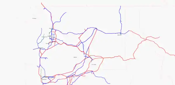 Lines with voltage on Mar 9th, 2011
Rivers
Columbia River
The Columbia River comprises a large section of the southern border with Oregon and also extends north into Canada. This section covers the section of river from the Pacific Ocean, along the Washingto-Oregon border, and north until it reaches the border with Canada. It is composed of the following relations:
| Relation | Ways | Status |
|---|---|---|
| 104856 | 3 | Starts at "natural=coastline" near Kelso, Washington |
| 104551 | 2 | Unknown |
| 104546 | 4 | Unknown |
| 104543 | 3 | Unknown |
| 104541 | 8 | Unknown |
| 104531 | 2 | Unknown |
| 721782 | 6 | Unknown |
| 1067449 | 2 | Unknown |
| 1029247 | 3 | Unknown |
| 593669 | 36 | The Dalles Dam east to McNary Dam |
| 184572 | 37 | OR border north to Tri-Cities and Handford Reach |
| 912594 | 26 | Unknown |
| 898949 | 3 | Unknown |
| 108626 | 9 | Unknown |
| 161561 | 8 | Unknown |
| 161551 | 6 | Unknown |
| 898973 | 1 | Unknown |
| 898972 | 1 | landuse=reservoir |
| 236689 | 3 | Unknown |
| 236687 | 5 | Unknown |
| 236675 | 14 | Unknown |
| Relation | Ways | Status |
|---|---|---|
| 898978 | 2 | Unknown |
| 898977 | 2 | landuse=reservoir |
| 234025 | 2 | Unknown |
| 233705 | 3 | Unknown |
| 233539 | 2 | Unknown |
| 898985 | 2 | Unknown |
| 898984 | 2 | landuse=reservoir |
| 233422 | 4 | Unknown |
| 233336 | 5 | Unknown |
| 233243 | 2 | Unknown |
| 233157 | 5 | Unknown |
| 233156 | 2 | Unknown |
| 233024 | 3 | Unknown |
| 232918 | 4 | Unknown |
| 232916 | 4 | Unknown |
| 232868 | 5 | Unknown |
| 231975 | 2 | Unknown |
| 230107 | 6 | Unknown |
| 230106 | 4 | Unknown |
| 230105 | 2 | Ends at Canadian border |
| 1111653 | 0 | No longer used |
Administrative Boundary Relations
- More Information
State Boundary Relation
- More Information
- Washington State Constitution, Article XXIV Section 1 State Boundaries
- United States State Boundary Relations
| State | Relation | Status |
|---|---|---|
| Washington | 165479 |
See main wiki page United States State Boundary Relations for status |
County Boundary Relations
| Name | FIPS Code | Relation | Status | Notes | TIGER correction | Notes |
|---|---|---|---|---|---|---|
| Adams | 53001 | 1153148 | no | * Relation created 29 August 2010 | ||
| Asotin | 53003 | 1150372 | no | * Relation created 27 August 2010 | ||
| Benton | 53005 | 1152564 | no | * Relation created 29 August 2010 | ||
| Chelan | 53007 | 1153517 | no | * Relation created 29 August 2010 | ||
| Clallam | 53009 | 1153923 | no | * Relation created 29 August 2010 | ||
| Clark | 53011 | 1153325 | no | * Relation created 29 August 2010 | ||
| Columbia | 53013 | 1150530 | no | * Relation created 27 August 2010 | ||
| Cowlitz | 53015 | 1153326 | no | * Relation created 29 August 2010 | ||
| Douglas | 53017 | 1153555 | no | * Relation created 29 August 2010 | ||
| Ferry | 53019 | 1153067 | no | * Relation created 29 August 2010 | ||
| Franklin | 53021 | 1150531 | no | * Relation created 27 August 2010 | ||
| Garfield | 53023 | 1150429 | no | * Relation created 27 August 2010 | ||
| Grant | 53025 | 1153147 | no | * Relation created 29 August 2010 | ||
| Grays Harbor | 53027 | 1153401 | no | * Relation created 29 August 2010 | ||
| Island | 53029 | 1165268 | no | * Relation Created 5 September 2010 | ||
| Jefferson | 53031 | 1153701 | no | * Relation created 29 August 2010 | ||
| King | 53033 | 1153346 | no | * Relation created 29 August 2010 | ||
| Kitsap | 53035 | 1153661 | no | * Relation created 29 August 2010 | ||
| Kittitas | 53037 | 1153345 | no | * Relation created 29 August 2010 | ||
| Klickitat | 53039 | 1152565 | no | * Relation created 29 August 2010 | ||
| Lewis | 53041 | 1153327 | no | * Relation created 29 August 2010 | ||
| Lincoln | 53043 | 1153068 | no | * Relation created 29 August 2010 | ||
| Mason | 53045 | 1153637 | no | * Relation created 29 August 2010 | ||
| Okanogan | 53047 | 1153069 | no | * Relation created 29 August 2010 | ||
| Pacific | 53049 | 1153390 | no | * Relation created 29 August 2010 | ||
| Pend_Oreille | 53051 | 1150582 | no | * Relation created 27 August 2010 | ||
| Pierce | 53053 | 1153347 | no | * Relation created 29 August 2010 | ||
| San Juan | 53055 | 1162038 | no | * Relation Created 3 September 2010 | ||
| Skagit | 53057 | 1153763 | no | * Relation created 29 August 2010 | ||
| Skamania | 53059 | 1153324 | no | * Relation created 29 August 2010 | ||
| Snohomish | 53061 | 1153766 | no | * Relation created 29 August 2010 | ||
| Spokane | 53063 | 1150576 | no | * Relation created 27 August 2010 | ||
| Stevens | 53065 | 1150602 | no | * Relation created 27 August 2010 | ||
| Thurston | 53067 | 1153508 | no | * Relation created 29 August 2010 | ||
| Wahkiakum | 53069 | 1153389 | no | * Relation created 29 August 2010 | ||
| Walla Walla | 53071 | 1150532 | no | * Relation created 27 August 2010 | ||
| Whatcom | 53073 | 1153762 | no | * Relation created 29 August 2010 | ||
| Whitman | 53075 | 1150529 | no | * Relation created 27 August 2010 | ||
| Yakima | 53077 | 1153323 | no | * Relation created 29 August 2010 |
External Links
- State Art Collection (with locations, data is public domain)