Tr:Map Features
Dikkat: Bu sayfa Map Features'ın Türkçe bir özetidir; ve İngilizce sayfanın birebir kopyasıdır. Böylece çeviri kolaylaşmıştır.
OpenStreetMap Düğüm, Yol veya Alanlara atanacak etiketler için hiç bir içerik kısıtlamasına sahip değildir. İstediğiniz herhangi bir etiketi kullanabilirsiniz. Fakat, ortak bir altlık harita yaratmak, yorumlamak ve görüntülemek için öznitelik ve bunlara karşılık gelen etiketlerden oluşan bir tavsiye edilecek bir küme üzerinde anlaşmanın bir çok yararı vardır. Bu sayfa tavsiye edilen bir öznitelik ve ilgili etiket kümesini içermektedir.
Eğer haritalamak istediğiniz öznitelik için uygun etiket bulamıyorsanız Proposed features sayfasına bakın. Orada hangi olası eklenecek özniteliklerin neler görebilir (daha önce eklenmelerini sağlayabilir) veya kendiniz bir şey önerebilirsiniz.
- Eğer Düğüm/Yol/Alan terimlerini anlamak için yardıma ihtiyacınız olursa, Elements'e bakınız.
- Bazı haritalama özniteliklerinin ayrıntılı açıklaması için Feature Index bakınız.
- Yeni bir simge önermek için Proposed Icons sayfasını kullanınız.
- Daha önce geçerli olan ancak artık kullanılmayan özniteliklerin listesi için Deprecated features'e bakınız.
- Editing Standards and Conventions'a da bakınız.
Görsel giydirme (rendering) hakkında notlar:
- Burada bulunan etiketleri kullanmanız yaptığınız düzenlemelerin çeşitli yazılımlarca büyük olasılıkla gösterilmesini sağlayacaktır. Ancak, bu durum kullanılan bir etiketin belirli bir yazılım veya OSM ana harita sayfasında kullanılan yazılımlar ile gösterilebileceğini garanti etmez.
- Burada listelenmemiş ancak OSM ana harita sayfasında giydirilerek gösterilebilen birçok etiketler bulunabilir. Bu liste yazılımlar tarafından uygulanmış tüm etiketler ile güncellenmemiştir.
Tablolar en çok kullanılan başta olmak üzere temalarına göre gruplandırılmıştır.
Fiziksel
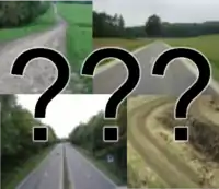
=== Araçyolu ===
Bu etiket öncelikle her türlü yolu belirlemekte kullanılır.
| Key | Value | Element | Comment | Rendering carto | Examples | |
|---|---|---|---|---|---|---|
Roads | ||||||
|
These are the principal tags for the road network. They range from the most to least important. | ||||||
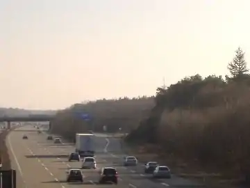
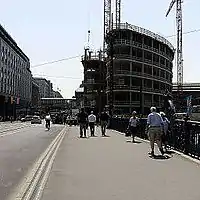
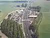
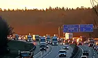
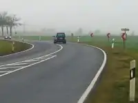
| highway | motorway | A restricted access major divided highway, normally with 2 or more running lanes plus emergency hard shoulder. Equivalent to the Freeway, Autobahn, etc.. |  |
|||
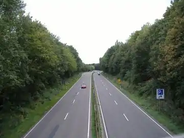
| highway | trunk | The most important roads in a country's system that aren't motorways. (Need not necessarily be a divided highway.) |  |
| ||
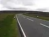
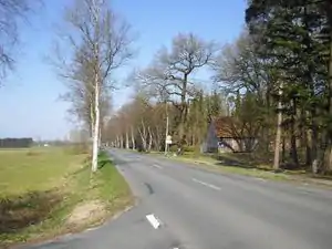
| highway | primary | The next most important roads in a country's system. (Often link larger towns.) |  |
| ||
| highway | secondary | The next most important roads in a country's system. (Often link towns.) |  |
| ||
| highway | tertiary | The next most important roads in a country's system. (Often link smaller towns and villages) |  |
| ||
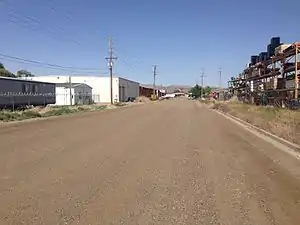
| highway | unclassified | The least important through roads in a country's system – i.e. minor roads of a lower classification than tertiary, but which serve a purpose other than access to properties. (Often link villages and hamlets.)
The word 'unclassified' is a historical artefact of the UK road system and does not mean that the classification is unknown; you can use highway=road for that. |
 |
| ||
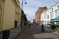
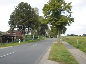
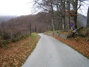
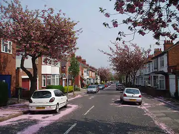
| highway | residential | Roads which serve as an access to housing, without function of connecting settlements. Often lined with housing. |  |
| ||
Link roads | ||||||
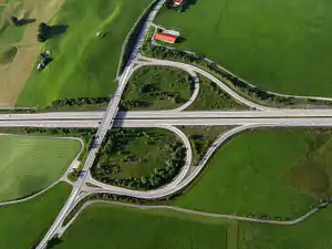
| highway | motorway_link | The link roads (sliproads/ramps) leading to/from a motorway from/to a motorway or lower class highway. Normally with the same motorway restrictions. |  |
 A5 exit link to A672, Darmstadt, Germany | ||
| highway | trunk_link | The link roads (sliproads/ramps) leading to/from a trunk road from/to a trunk road or lower class highway. |  |
 A7 / OAL23 interchange, Nesselwang, Germany | ||
| highway | primary_link | The link roads (sliproads/ramps) leading to/from a primary road from/to a primary road or lower class highway. |  |
_-_geo-en.hlipp.de_-_11914.jpg.webp) B20 exit and entrance to Brunn, Fridolfing, Germany | ||
| highway | secondary_link | The link roads (sliproads/ramps) leading to/from a secondary road from/to a secondary road or lower class highway. |  |
 | ||
| highway | tertiary_link | The link roads (sliproads/ramps) leading to/from a tertiary road from/to a tertiary road or lower class highway. |  |
|||
Special road types | ||||||
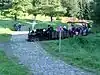
| highway | living_street | For living streets, which are residential streets where pedestrians have legal priority over cars, speeds are kept very low and where children are allowed to play on the street. |  |
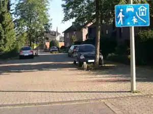 beginning of a living street with a paving stones surface and some trees and cars parking at the sides | ||
| highway | service | For access roads to, or within an industrial estate, camp site, business park, car park, alleys, etc. Can be used in conjunction with service=* to indicate the type of usage and with access=* to indicate who can use it and in what circumstances. |  |
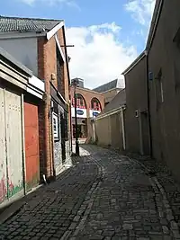 | ||
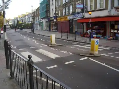
| highway | pedestrian | For roads used mainly/exclusively for pedestrians in shopping and some residential areas which may allow access by motorised vehicles only for very limited periods of the day. To create a 'square' or 'plaza' create a closed way and tag as pedestrian and also with area=yes. |  |
 | ||
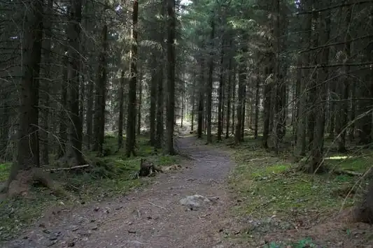
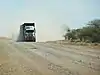
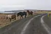
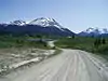
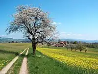
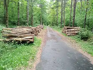
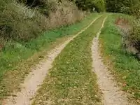
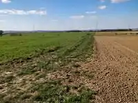
| highway | track | Roads for mostly agricultural or forestry uses. To describe the quality of a track, see tracktype=*. Note: Although tracks are often rough with unpaved surfaces, this tag is not describing the quality of a road but its use. Consequently, if you want to tag a general use road, use one of the general highway values instead of track. |  |
|||
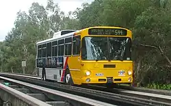
| highway | bus_guideway | A busway where the vehicle guided by the way (though not a railway) and is not suitable for other traffic. Please note: this is not a normal bus lane, use access=no, psv=yes instead! |  |
 | ||
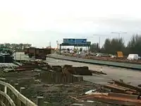
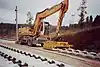
| highway | escape | For runaway truck ramps, runaway truck lanes, emergency escape ramps, or truck arrester beds. It enables vehicles with braking failure to safely stop. | 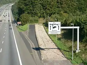 | |||
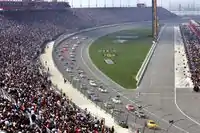
| highway | raceway | A course or track for (motor) racing |  |
 | ||
| highway | road | A road/way/street/motorway/etc. of unknown type. It can stand for anything ranging from a footpath to a motorway. This tag should only be used temporarily until the road/way/etc. has been properly surveyed. If you do know the road type, do not use this value, instead use one of the more specific highway=* values. |  |
 | ||
| highway | busway | A dedicated roadway for bus rapid transit systems | 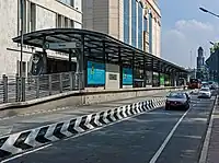 grade-seperated section of busway outside of station | |||
Paths | ||||||
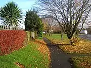
| highway | footway | For designated footpaths; i.e., mainly/exclusively for pedestrians. This includes walking tracks and gravel paths. If bicycles are allowed as well, you can indicate this by adding a bicycle=yes tag. Should not be used for paths where the primary or intended usage is unknown. Use highway=pedestrian for pedestrianised roads in shopping or residential areas and highway=track if it is usable by agricultural or similar vehicles. For ramps (sloped paths without steps), combine this tag with incline=*. |  |
 | ||
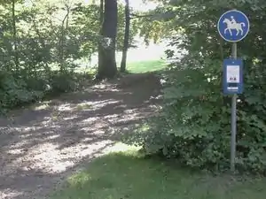
| highway | bridleway | For horse riders. Pedestrians are usually also permitted, cyclists may be permitted depending on local rules/laws. Motor vehicles are forbidden. |  |
 | ||
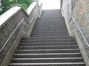
| highway | steps | For flights of steps (stairs) on footways. Use with step_count=* to indicate the number of steps |  |
 | ||
| highway | corridor | For a hallway inside of a building. |  | |||
| highway | path | A non-specific path. Use highway=footway for paths mainly for walkers, highway=cycleway for one also usable by cyclists, highway=bridleway for ones available to horse riders as well as walkers and highway=track for ones which is passable by agriculture or similar vehicles. |  |
 | ||
| highway | via_ferrata | A via ferrata is a route equipped with fixed cables, stemples, ladders, and bridges in order to increase ease and security for climbers. These via ferrata require equipment : climbing harness, shock absorber and two short lengths of rope, but do not require a long rope as for climbing. | not rendered in OSM-Carto | 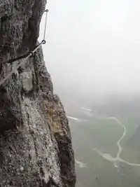 | ||
When sidewalk/crosswalk is tagged as a separate way | ||||||
| footway | sidewalk | Sidewalk that runs typically along residential road. Use in combination with highway=footway or highway=path | |
 | ||
| footway | crossing | Crosswalk that connects two sidewalks on the opposite side of the road. Often recognized by painted markings on the road, road sign or traffic lights. Use in combination with highway=footway or highway=path. Useful information is presence of tactile_paving=*, wheelchair=* suitability and kerb=* represented as a node on the crosswalk way. | |
 | ||
When sidewalk (or pavement) is tagged on the main roadway (see Sidewalks) | ||||||
| sidewalk | both | left | right | no | Specifies that the highways has sidewalks on both sides, on one side or no sidewalk at all |  | |||
When cycleway is drawn as its own way (see Bicycle) | ||||||
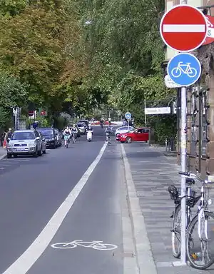
| highway | cycleway | For designated cycleways. Add foot=*, though it may be avoided if default-access-restrictions do apply. | 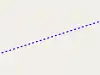 |
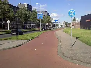 Separated cycleway with traffic sign | ||
Cycleway tagged on the main roadway or lane (see Bicycle) | ||||||
| cycleway | lane | A lane is a route that lies within the roadway | 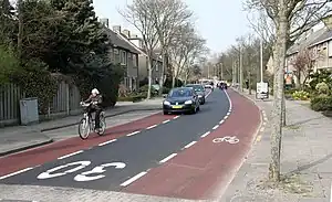 | |||
| cycleway | opposite | Used on ways with oneway=yes where it is legally permitted to cycle in both directions. Used together with oneway:bicycle=no. | 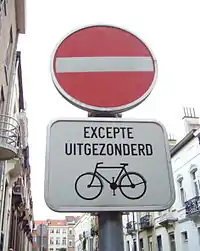 | |||
| cycleway | opposite_lane | Used on ways with oneway=yes that have a cycling lane going the opposite direction of normal traffic flow (a "contraflow" lane). Used together with oneway:bicycle=no. | 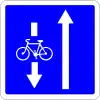 | |||
| cycleway | track | A track provides a route that is separated from traffic. In the United States, this term is often used to refer to bike lanes that are separated from lanes for cars by pavement buffers, bollards, parking lanes, and curbs. Note that a cycle track may alternatively be drawn as a separate way next to the road which is tagged as highway=cycleway. | 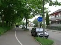 | |||
| cycleway | opposite_track | Used on ways with oneway=yes that have a cycling track going the opposite direction of normal traffic flow. Used together with oneway:bicycle=no. | 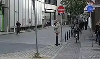 | |||
| cycleway | share_busway | There is a bus lane that cyclists are permitted to use. | 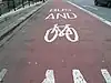 | |||
| cycleway | opposite_share_busway | Used on ways with oneway=yes that have a bus lane that cyclists are also permitted to use, and which go in the opposite direction to normal traffic flow (a "contraflow" bus lane). Used together with oneway:bicycle=no. | 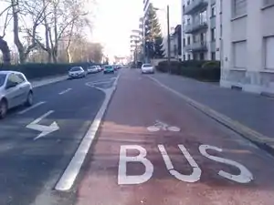 | |||
| cycleway | shared_lane | Cyclists share a lane with motor vehicles, but there are markings indicating that they should share the lane with motorists. In some places these markings are known as "sharrows" ('sharing arrows') and this is the tag to use for those. | 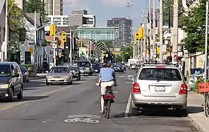 | |||
| busway | lane | Bus lane on both sides of the road. (See also: Parallel scheme for bus/psv lane tagging lanes:bus=* / lanes:psv=*) | | |||
Street parking tagged on the main roadway (see Street parking) | ||||||
| parking :left / :right / :both (hereafter: parking:side) |
lane | street_side | on_kerb | half_on_kerb | shoulder | no | separate | yes | Primary key to record parking along the street. Desribes the parking position of parked vehicles in the street. | 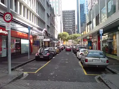 | |||
| parking:sideorientation=* | parallel | diagonal | perpendicular | To specify the orientation of parked vehicles if there is street parking. | ||||
Lifecycle (see also lifecycle prefixes) | ||||||
| highway | proposed | For planned roads, use with proposed=* and a value of the proposed highway value. | ||||
| highway | construction | For roads under construction. Use construction=* to hold the value for the completed road. |  |
 | ||
Attributes | ||||||
| abutters | commercial | industrial | mixed | residential | retail etc. | See Key:abutters for more details. | 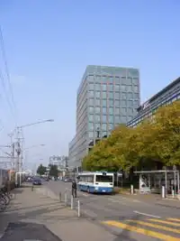 | |||
| bicycle_road | yes | A bicycle road is a road designated for bicycles. If residential streets get the status of bicycle roads, normally, by special signs, motor traffic is admitted with limited speed, often only for residents. | 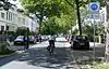 | |||
| bus_bay | both | left | right | A bus bay outside the main carriageway for boarding/alighting |  | |||
| change | yes | no | not_right | not_left | only_right | only_left | Specify the allowed/forbidden lane changes | .jpg.webp) | |||
| destination | <place name of destination> | Destination when following a linear feature | .svg.png.webp) | |||
| embankment | yes | dyke | A dyke or a raised bank to carry a road, railway, or canal across a low-lying or wet area. | 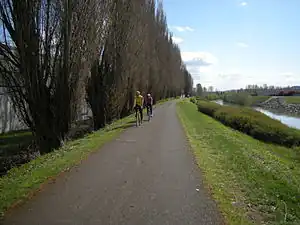 | |||
| embedded_rails | yes | <type of railway> | A highway on which non-railway traffic is also allowed has railway tracks embedded in it but the rails are mapped as separate ways. | _heading_NW.jpg.webp) | |||
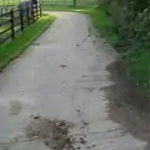
| ford | yes | The road crosses through stream or river, vehicles must enter any water. | 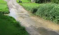 | |||
| ice_road | yes | A highway is laid upon frozen water basin, definitely doesn't exist in summer. | 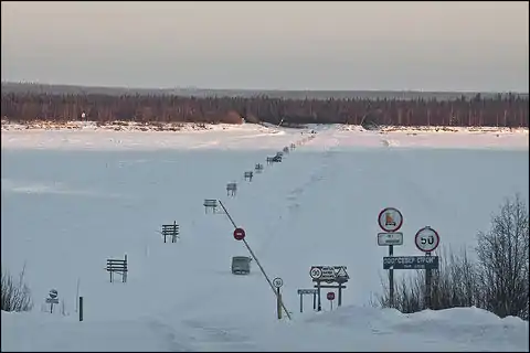 | |||
| incline | Number % | ° | up | down | Incline steepness as percents ("5%") or degrees ("20°"). Positive/negative values indicate movement upward/downwards in the direction of the way. | 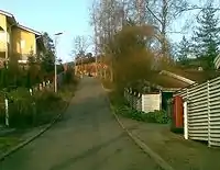 | |||
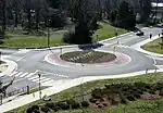
| junction | roundabout | This automatically implies oneway=yes, the oneway direction is defined by the sequential ordering of nodes within the Way. This applies on a way, tagged with highway=* already. | 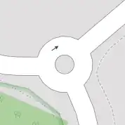 |
 | ||
| lanes | <number> | The number of traffic lanes for general purpose traffic, also for buses and other specific classes of vehicle. | 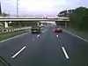 | |||
| lit | yes | no | Street lighting |  | |||
| maxspeed | <number> | Specifies the maximum legal speed limit on a road, railway or waterway. | 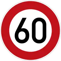 | |||
| motorroad | yes | no | The motorroad tag is used to describe highways that have motorway-like access restrictions but that are not a motorway. | 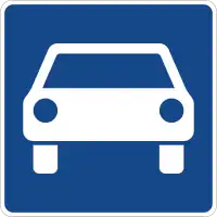 | |||
| mountain_pass | yes | The highest point of a mountain pass. |  | |||
| mtb:scale | 0-6 | Applies to highway=path and highway=track. A classification scheme for mtb trails (few inclination and downhill). |  | |||
| mtb:scale :uphill | 0-5 | A classification scheme for mtb trails for going uphill if there is significant inclination. | | |||
| mtb:scale :imba | 0-4 | The IMBA Trail Difficulty Rating System shall be used for bikeparks. It is adapted to mtb trails with artificial obstacles. | ||||
| mtb:description | Text | Applies to highway=path and highway=track. A key to input variable infos related to mtbiking on a way with human words | ||||
| oneway | yes | no | reversible | Oneway streets are streets where you are only allowed to drive in one direction. | 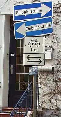 | |||
| oneway:bicycle | yes | no | | Used on ways with oneway=yes where it is legally permitted to cycle in both directions. | | |||
| overtaking | yes | no | caution | both | forward | backward | Specifying sections of roads where overtaking is legally forbidden. Use overtaking:forward=yes/no/caution and overtaking:backward=yes/no/caution when it depends on driving direction. |  | |||
| parallel | diagonal | perpendicular | marked | no_parking | no_stopping | fire_lane. | Deprecated variant to map parking along streets. See section on street parking above or the street parking page for more details. | |||||
| free | ticket | disc | residents | customers | private | Deprecated variant to map parking conditions along streets. See section on street parking above or the street parking page for more details. |  | ||||
| passing_places | yes | A way which has frequent passing places (See also: highway=passing_place) | 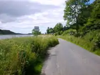 | |||
| priority | forward | backward | Traffic priority for narrow parts of roads, e.g. narrow bridges. | 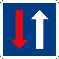 | |||
| priority_road | designated | yes_unposted | end | Specifying roads signposted as priority roads. | 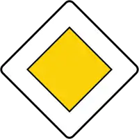 | |||
| sac_scale | hiking | mountain_hiking | demanding_mountain_hiking | alpine_hiking | demanding_alpine_hiking | difficult_alpine_hiking | Applies to highway=path and highway=footway. A classification scheme for hiking trails. | 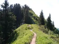 | |||
| service | alley | driveway | parking_aisle etc. | See Key:service for more details. | 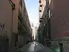 | |||
| smoothness | excellent | good | intermediate | bad | very_bad | horrible | very_horrible | impassable | See Key:smoothness for more details. | 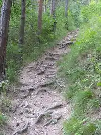 | |||
| surface | paved | unpaved | asphalt | concrete | paving_stones | sett | cobblestone | metal | wood | compacted | fine_gravel | gravel | pebblestone | plastic | grass_paver | grass | dirt | earth | mud | sand | ground | See Key:surface for more details. | ||||
| tactile_paving | yes | no | A paving in the ground to be followed with a blindman's stick. | Not to be rendered on standard maps. | 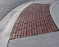 | ||
| tracktype | grade1 | grade2 | grade3 | grade4 | grade5 | To describe the quality of the surface. See Key:tracktype for more information. |  |
 | ||
| traffic_calming | bump | hump | table | island | cushion | yes | etc. | See Key:traffic calming for more details. | 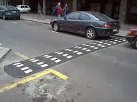 | |||
| trail_visibility | excellent | good | intermediate | bad | horrible | no | Applies to highway=path, highway=footway, highway=cycleway and highway=bridleway. A classification for hiking trails visibility | 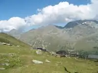 | |||
| trailblazed | yes | no | poles | cairns | symbols | Applies to highway=*. Describing trail blazing and marking. See Key:trailblazed for more information. | 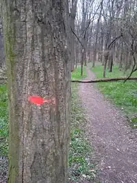 | |||
| trailblazed:visibility | excellent | good | intermediate | bad | horrible | no | Applies to trailblazed=*. A classification for visibility of trailblazing. See Key:trailblazed:visibility for more information. | ||||
| turn | left | slight_left | through | right | slight_right | merge_to_left | merge_to_right | reverse | The key turn can be used to specify the direction in which a way or a lane will lead. | 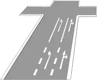 | |||
| width | <number> | The width of a feature. |  | |||
| winter_road | yes | A highway functions during winter, probably can't be driven in summer. | 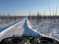 | |||
Other highway features | ||||||
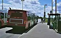
| highway | bus_stop | A small bus stop. Optionally one may also use public_transport=stop_position for the position where the vehicle stops and public_transport=platform for the place where passengers wait. | 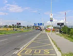 | |||
| highway | crossing | A.k.a. crosswalk. Pedestrians can cross a street here; e.g., zebra crossing | | |||
| highway | elevator | An elevator or lift, used to travel vertically, providing passenger and freight access between pathways at different floor levels. | 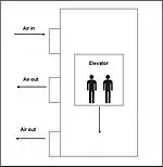 | |||
| highway | emergency_bay | An area beside a highway where you can safely stop your car in case of breakdown or emergency. | 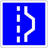 | |||
| highway | emergency_access_point | Sign number which can be used to define your current position in case of an emergency. Use with ref=NUMBER_ON_THE_SIGN. See also emergency=access_point | 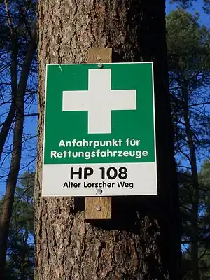 | |||
| highway | give_way | A "give way," or "Yield" sign | 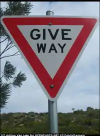 | |||
| emergency | phone | A calling device can be used to tell on your current position in case of an emergency. Use with ref=NUMBER_ON_THE_SIGN | 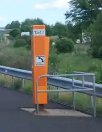 | |||
| highway | milestone | Highway location marker | 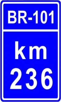 | |||
| highway | mini_roundabout | Similar to roundabouts, but at the center there is either a painted circle or a fully traversable island. In case of an untraversable center island, junction=roundabout should be used.
Rendered as anti-clockwise by default direction=anticlockwise. To render clockwise add the tag direction=clockwise. |
 |
|||
| highway | motorway_junction | Indicates a junction (UK) or exit (US). ref=* should be set to the exit number or junction identifier. (Some roads – e.g., the A14 – also carry junction numbers, so the tag may be encountered elsewhere despite its name) |  |
| ||
| highway | passing_place | The location of a passing space | 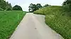 | |||
| highway | platform | A platform at a bus stop or station. |  |
 | ||
| highway | rest_area | Place where drivers can leave the road to rest, but not refuel. |  |
 | ||
| highway | services | A service station to get food and eat something, often found at motorways |  |
 | ||
| highway | speed_camera | A fixed road-side or overhead speed camera. | 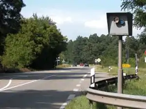 | |||
| highway | stop | A stop sign | 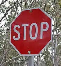 | |||
| highway | street_lamp | A street light, lamppost, street lamp, light standard, or lamp standard is a raised source of light on the edge of a road, which is turned on or lit at a certain time every night | 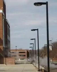 | |||
| highway | toll_gantry | A toll gantry is a gantry suspended over a way, usually a motorway, as part of a system of electronic toll collection. For a toll booth with any kind of barrier or booth see: barrier=toll_booth | .jpg.webp) | |||
| highway | traffic_mirror | Mirror that reflects the traffic on one road when direct view is blocked. | 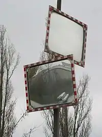 | |||
| highway | traffic_signals | Lights that control the traffic | 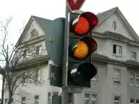 | |||
| highway | trailhead | Designated place to start on a trail or route | 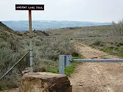 | |||
| highway | turning_circle | A turning circle is a rounded, widened area usually, but not necessarily, at the end of a road to facilitate easier turning of a vehicle. Also known as a cul de sac. |  |
 | ||
| highway | turning_loop | A widened area of a highway with a non-traversable island for turning around, often circular and at the end of a road. | 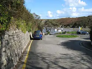 | |||
| highway | User Defined | All commonly used values according to Taginfo | ||||
.jpg.webp)
Bisiklet yolu
Bu etiket öncelikle bisiklet yollarını belirlemekte kullanılır.
| Key | Value | Element | Comment | Rendering | Photo |
|---|---|---|---|---|---|
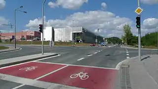
| cycleway | lane | Two cycle lanes, one on each side of the road. | Cyclist map |
| |
| cycleway:right cycleway:left |
lane | A cycle lane only on one side of the road. Left or right depend on the direction in which the way is drawn in OpenStreetMap. | Cyclist map |
||
| cycleway | opposite | Used on ways with oneway=yes where it is permitted to cycle in both directions.
Note - such streets are common in Belgium, the Netherlands and Denmark, for example, but are rare in the UK (although they do exist): often, instead, actually the street is two-way as normal for its whole length except for the very short section past the no-entry sign at the end, where cycles are excepted from the no-entry by means of a short lane separated by an island. This is called a "cycle plug". In some places this has been represented as very short oneway Way at the end with an adjacent cycleway, forming a little triangle with the road they join to, or sometimes with a short oneway Way with cycleway=opposite_lane or opposite_track. |
Cyclist map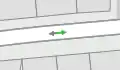 |
| |
| cycleway | opposite_lane | Used on ways with oneway=yes that have a cycling lane going the opposite direction of normal traffic flow (a "contraflow" lane). | Cyclist map |
 | |
| cycleway | track | A track is a route that is separate from the road.+oneway=yes if needed. | Cyclist map |
| |
| cycleway:right cycleway:left |
track | A track only on one side of the road. You can drive in both directions. Left and right depend on the direction in which the way is drawn in OpenStreetMap. | Cyclist map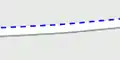 |
||
| cycleway | opposite_track | Used on ways with oneway=yes that have a cycling track going the opposite direction of normal traffic flow. | Cyclist map |
| |
| cycleway | shared | Cyclists share space with other traffic on this highway. | |||
| cycleway | share_busway | There is a bus lane that cyclists are permitted to use. | | ||
| cycleway:right cycleway:left |
share_busway | A bus lane permitted to use only on one side of the road. Left and right depend on the direction in which the way is drawn in OpenStreetMap. | |||
| cycleway | shared_lane | Cyclists share a lane with motor vehicles, but there are markings indicating that they should share the lane with motorists. The road markings are usually there to highlight a cycle route or to remind drivers that you can cycle there. Also used for the on-road shared-lane marking called a "sharrow". | | ||
| cycleway:right cycleway:left |
shared_lane | A shared lane only on one side of the road. Left and right depend on the direction in which the way is drawn in OpenStreetMap. | |||
| cycleway | asl | A cycleway advanced stop line (ASL), also known as a bike box or an advanced stop box, is a marked area for cyclists in front of the stop line for motor traffic. | CyclOSM |
 | |
| cycleway | user defined | All commonly used values according to Taginfo. |
This table is a wiki template with a default description in English. Editable here.
Patika
| Key | Value | Element | Comment | Rendering | Photo |
|---|---|---|---|---|---|
| tracktype | grade1 | Solid[1]. Usually a paved surface (called also |
|
.jpg.webp) | |
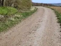
| tracktype | grade2 | Mostly solid. Usually an unpaved track with surface of gravel mixed with a varying amount of sand, silt, and clay. See Gravel road Vikipedi’de. May be applicable to heavily degraded and crumbled roads which was paved in past. |
 |
 | |
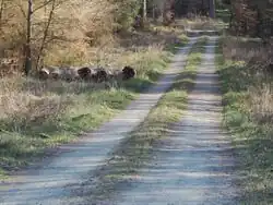
| tracktype | grade3 | Even mixture of hard and soft materials. An unpaved track. |
 |
 | |
| tracktype | grade4 | Mostly soft. An unpaved track prominently with soil/sand/grass, but with some hard or compacted materials mixed in. |
 |
 | |
| tracktype | grade5 | Soft. An unimproved track lacking hard materials, uncompacted, with surface of soil/sand/grass. |
 |
 | |
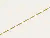
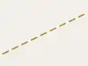
| tracktype | <no value> | If no tracktype tag is present, the track is rendered with a dot-dash line style (as shown right). | 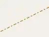 |
This table is a wiki template with a default description in English. Editable here.
Suyolu
Natural watercourses
This table is a wiki template with a default description in English. Editable here.
Man-made waterways
This table is a wiki template with a default description in English. Editable here.
Facilities
This table is a wiki template with a default description in English. Editable here.
Barriers on waterways
This table is a wiki template with a default description in English. Editable here.
Other features on waterways
This table is a wiki template with a default description in English. Editable here.
Demiryolu
| Key | Value | Element | Comment | Rendering carto | Photo | |
|---|---|---|---|---|---|---|
Tracks | ||||||
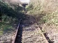
| railway | abandoned | The course of a former railway which has been abandoned and the track removed. The course is still recognized through embankments, cuttings, tree rows, bridges, tunnels, remaining track ties, building shapes and rolling or straight ways. For demolished rails that are no longer identifiable, e.g. that have been built over, some use the highly questionable railway=razed. | Not rendered by osm-carto | 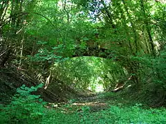 | ||
| railway | construction | Railway under construction. |  |
 | ||
| railway | disused | A section of railway which is no longer used but where the track and infrastructure remains in place. The track is likely overgrown with endemic vegetation, but could be brought back into useful service with only minor effort. |  |
 | ||
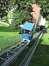
| railway | funicular | Cable driven inclined railways on a steep slope, with a pair of cars connected by one cable |  |
 | ||
| railway | light_rail | A higher-standard tram system, normally in its own right-of-way. Often it connects towns and thus reaches a considerable length (tens of kilometres). | |
 | ||
| railway | miniature | Miniature railways are narrower than narrow gauge and carry passengers, frequently at an exact scale of "standard-sized" rail (for example "1/4 scale"). They can often be found in parks. |  |
 | ||
| railway | monorail | A railway with only a single rail. A monorail can run above the rail like in Las Vegas and Disneyland or can suspend below the rail like the Wuppertal Schwebebahn (Germany). |  |
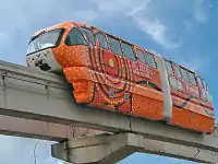 Monorail in Kuala Lumpur | ||
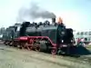
| railway | narrow_gauge | Narrow-gauge passenger or freight trains. Narrow gauge railways can have mainline railway service like the Rhaetian Railway in Switzerland or can be a small light industrial railway. Use gauge=* to specify the actual width of rails in mm. | |
 | ||
| This is the old tag for historic trains. Use railway:preserved=yes for historical railway instead. |  |
 | ||||
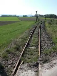
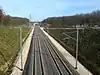
| railway | rail | Full sized passenger or freight trains in the standard gauge for the country or state. |  |
 | ||
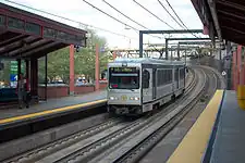
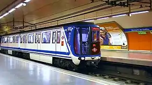
| railway | subway | A city passenger rail service running mostly grade separated (see Wikipedia:rapid transit). Often a significant portion of the line or its system/network is underground. |  |
 | ||
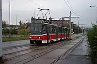
| railway | tram | One or two carriage rail vehicles, usually sharing motor road, sometimes called "street running" (Other languages). |  |
 | ||
Additional track features or attributes | ||||||
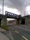
| bridge | yes | If the railway goes over a street, waterway or other railway on an elevated structure. | 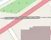 |
 | ||
| cutting | yes | A section where the railway is significantly lower than ground level, but not underground. | 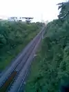 | |||
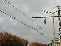
| electrified | contact_line rail yes no |
contact_line: a power line over the train head rail: a third rail near the track supplying the train with power yes: electrified track, but no details available no: track with no power supply. |
 | |||
| embankment | yes | A section where the railway is raised significantly higher than ground level. |  | |||
| embedded_rails | yes/<type of railway> | Specifies that a highway on which non-railway traffic is also allowed has railway tracks embedded in it but the rails are mapped as separate ways. | | |||
| frequency | number [Hz] | The frequency with which a line is electrified. Use 0 for DC. Also see the voltage tag. | 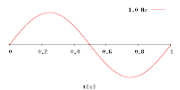 | |||
| railway:track_ref | number | Track number | 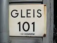 | |||
| service | crossover | Relatively short lengths of track which switch traffic from one parallel line to another | ||||
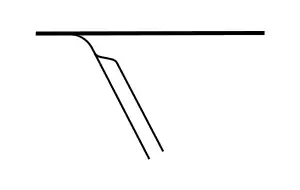
| service | siding | Relatively short lengths of track, running parallel to (and connected to) a main route |  |
|||
| service | spur | Relatively short lengths of track, built to give one company or entity access to a main or branch line. | |
 | ||
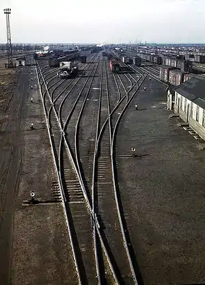
| service | yard | Tracks within railway company operated marshalling or maintenance yards. | |
 | ||
| tunnel | yes | If the railway goes below ground. Most subways have this tag. | 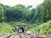 | |||
| tracks | number | Number of parallel tracks in close proximity when mapped as one single way representing all tracks. If not given means unknown and defaults to 1. In many parts of the world the tracks are being drawn out separately so that there is more detail, in which case this tag isn't used. | 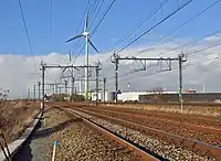 | |||
| usage | main branch industrial military tourism scientific test |
main line: heavy traffic branch line: connecting places with a mainline industrial: servicing large plants (iron, chemical etc.), surface mining, … military: servicing military area tourism: most mountain rails (rack-rails, funicular) and preserved railways scientific: rail transport at spaceports, large array telescopes, etc. test: track for testing new wheels, rails, tracks and rail technologies. |
||||
| voltage | number | The voltage with which a line is electrified. Also see the frequency tag. |  | |||
Stations and stops | ||||||
| railway | halt | A small station without switches | 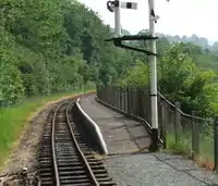 | |||
| public_transport | stop_position | The position on the railway track where the train (its centre) stops at a platform. This is useful for routing on long platforms where also short trains stop and on long platforms where multiple trains stop behind each other. See also public_transport=stop_area. | | |||
| public_transport | platform | This is parallel to the rail line for showing where the actual platforms are. It is also to know where you can change platform and enter the station, so use footpaths to connect them. This is really useful for routing too. Use only if the platform is served by public transport. | .jpg.webp) | |||
| railway | platform | This is parallel to the rail line for showing where the actual platforms are. It is also to know where you can change platform and enter the station, so use footpaths to connect them. This is really useful for routing too. Use in addition to public_transport=platform. | | |||
| public_transport | station | Railway passenger-only station. | 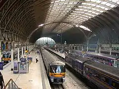 | |||
| railway | station | Railway passenger and/or cargo station. Use in addition to public_transport=station. | | |||
| railway | subway_entrance | The entrance to a subway station, usually going from surface to underground. | 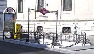 | |||
| railway | tram_stop | A tram stop is a place where a passenger can embark / disembark a tram. | 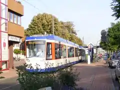 | |||
Other railways | ||||||
| railway | buffer_stop | Stops the train at the end of a track. See buffer stop. | Not rendered by osm-carto | .jpg.webp) | ||
| railway | derail | A device used to prevent fouling of a rail track by unauthorized movements of trains or unattended rolling stock. See Derail (railroad). | Not rendered by osm-carto | 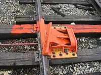 | ||
| railway | crossing | A point where pedestrians may cross. | 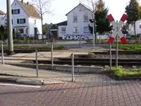 | |||
| railway | level_crossing | A point where rails and roads cross. | 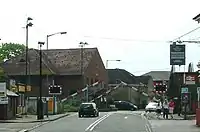 | |||
| railway | tram_level_crossing | A point where trams and roads cross. | 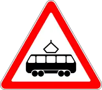 | |||
| railway | signal | Any kind of railway signal. | Not rendered by osm-carto | 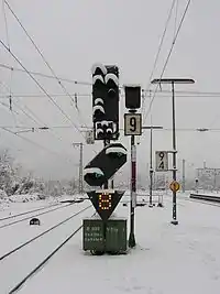 | ||
| railway | switch | Full connections between railways (aka 'points'). | Not rendered by osm-carto | 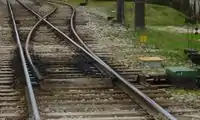 | ||
| railway | railway_crossing | Crossing rails with no interconnection. | Not rendered by osm-carto | 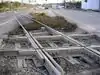 | ||
| landuse | railway | Ground used around railways and railway-stations. |  Except no border, as landuse=industrial Except no border, as landuse=industrial |
 | ||
| railway | turntable | These are used for changing the direction that part of a train is pointing in. |
|
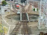 | ||
| railway | roundhouse | A semicircular building with many stalls for servicing engines. | Not rendered by osm-carto | 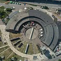 | ||
| railway | traverser | These are used for changing trains between railways. Also known as transfer table. | 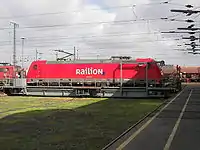 | |||
| railway | wash | A railroad carriage/car wash | Not rendered by osm-carto | 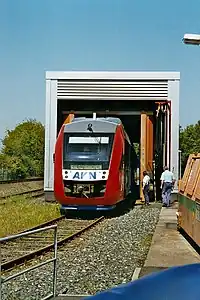 | ||
| railway | water_crane | A structure to deliver water to steam locomotives | Not rendered by osm-carto | 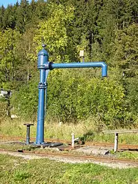 | ||
| railway | ventilation_shaft | A structure that allows ventilation in underground tunnels | Not rendered by osm-carto | .jpg.webp) | ||
| railway | user defined | All commonly used values according to Taginfo | – – – | – – – | ||

This table is a wiki template with a default description in English. Editable here.
Havacılık
This table is a wiki template with a default description in English. Editable here.
Havai hat
This table is a wiki template with a default description in English. Editable here.
Güç - Enerji
This table is a wiki template with a default description in English. Editable here.
İnsan Yapısı
This table is a wiki template with a default description in English. Editable here.
Dinlence
![]() - Düğüm,
- Düğüm, ![]() - Yol,
- Yol, ![]() - Alan
- Alan
| Anahtar | Değer | Öğe | Açıklama | Örnek |
|---|---|---|---|---|
| leisure | sports_centre | Spor Merkezi | ||
| leisure | golf_course | Golf sahası | ||
| leisure | stadium | Stadyum | ||
| leisure | marina | Liman / marina | ||
| leisure | track | koşu, bisiklet v.b. parkur | ||
| leisure | water_park | Su parkı | ||
| leisure | slipway | Kayıkhane | ||
| leisure | fishing | Balık avı | ||
| leisure | nature_reserve | Korunmuş doğa alanı | ||
| leisure | park | Park | ||
| leisure | playground | Oyun alanı | ||
| leisure | garden | Bahçe | ||
| leisure | common | Kamuya açık genel alan | ||
| leisure | User Defined |
Olanaklar
![]() - Düğüm,
- Düğüm, ![]() - Yol,
- Yol, ![]() - Alan
- Alan
| Anahtar | Değer | Öğe | Açıklama | Örnek |
|---|---|---|---|---|
| amenity | notary | Noter | ||
| amenity | pub | Alkollü içki sunulan mekanlar: bar, pub, şarap evi, v.b. | ||
| amenity | biergarten | Birahane http://en.wikipedia.org/wiki/Biergarten | ||
| amenity | cafe | Kahvehane, kahve evi |  | |
| amenity | restaurant | Hızlı tüketime yönelik olmayan lokanta | ||
| amenity | fast_food | Hızlı tüketilen gıda (hamburger, sandöviç v.b.) | ||
| amenity | parking | Otopark. Tek düğüm noktası park simgesi olacak, alan imlemeleri ise renkli olarak kodlanacaktır. | 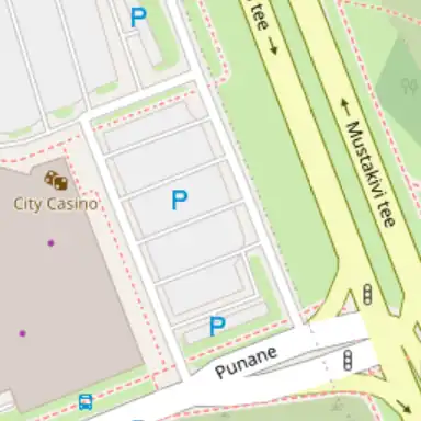 | |
| amenity | bicycle_parking | Bisiklet park yeri | ||
| amenity | fuel | Akaryakıt / LPG istasyonu ... | 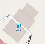 | |
| amenity | telephone | Umumi telefon | ||
| amenity | toilets | Umumi tuvalet. (Ücretli olabilir) | ||
| amenity | recycling | Geri dönüşüm noktaları (şişe, kağıt, naylon,...) | ||
| amenity | public_building | Kamuya açık bina | ||
| amenity | place_of_worship | Camii, kilise ya da farklı tapınaklar. Unutmayınız ki religion=<din>, denomination=<mezhep> de belirleyici olarak kullanılması iyi olur. Ayrıca bkz. the article | ||
| amenity | grave_yard | Küçük mezarlık. Büyük mezarlıklar için landuse=cemetery kullanılabilir. | ||
| amenity | post_office | Postane | ||
| amenity | post_box | Posta kutusu | 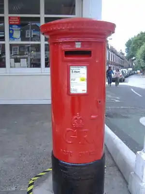 | |
| amenity | school | Okul ve okul bölgesi | ||
| amenity | university | Üniversite yerleşkesi ya da binaları | ||
| amenity | college | Kolej kampüsü ya da binaları | ||
| amenity | pharmacy | Eczane | ||
| amenity | hospital | Hastane, Poliklinik |  | |
| amenity | library | Kütüphane |  | |
| amenity | police | Polis merkezi | ||
| amenity | fire_station | İtfaiye | ||
| amenity | taxi | Taksi durağı ya da zili | ||
| amenity | car_service | Oto Servis | ||
| amenity | bus_station | Otobüs terminali ya da duraklar gurubu (otobüs durağı için highway=bus_stop kullanınız) | ||
| amenity | theatre | Tiyatro ya da opera sahnesi | ||
| amenity | cinema | Sinema salonu | ||
| amenity | arts_centre | Sanat Merkezi | ||
| amenity | courthouse | Adliye / Mahkeme | ||
| amenity | prison | Hapishane / Islahevi | ||
| amenity | bank | Banka şubesi (eğer ATM varsa atm=yes etiketini ekleyiniz) | ||
| amenity | atm | ATM / Otomatik Bankacılık Makinesi | ||
| amenity | townhall | Belediye binası | ||
| amenity | User Defined |
Dükkan
![]() - Düğüm,
- Düğüm, ![]() - Yol,
- Yol, ![]() - Alan
- Alan
| Anahtar | Değer | Öğe | Açıklama | Örnek |
|---|---|---|---|---|
| shop | bakery | Ekmek ve unlu mamüller | ||
| shop | butcher | Kasap / Şarküteri | ||
| shop | chandler | Mum ve sabun | ||
| shop | supermarket | Supermarket |  | |
| shop | User Defined | Önerilmiş olan etiketleri görmek ya da eklemek için. |
Turizm
![]() - Düğüm,
- Düğüm, ![]() - Yol,
- Yol, ![]() - Alan
- Alan
| Anahtar | Değer | Öğe | Açıklama | Örnek |
|---|---|---|---|---|
| tourism | information | |||
| tourism | camp_site | |||
| tourism | caravan_site | |||
| tourism | picnic_site | |||
| tourism | viewpoint | |||
| tourism | theme_park | |||
| tourism | hotel | Wikipedia:Hotel |  | |
| tourism | motel | Wikipedia:Motel | ||
| tourism | guest_house | Wikipedia:Guest House | ||
| tourism | hostel | Wikipedia:Hostel | ||
| tourism | attraction | |||
| tourism | zoo | |||
| tourism | User Defined |
Tarihi
![]() - Düğüm,
- Düğüm, ![]() - Yol,
- Yol, ![]() - Alan
- Alan
| Anahtar | Değer | Öğe | Açıklama | Örnek |
|---|---|---|---|---|
| historic | castle | Kale, şato | ||
| historic | monument | Anıt, Heykel | ||
| historic | memorial | Heykelsiz küçük anıt | ||
| historic | museum | Müze | ||
| historic | archaeological_site | Arkeolojik kazı bölgesi | ||
| historic | icon | İkon, ikona | ||
| historic | house_of_person | Önemli bir kişinin yaşamış olduğu ev | ||
| historic | ruins | Tarihi kalıntı | ||
| historic | User Defined |
See also railway=preserved for historic trains.
Arazi Kullanımı
![]() - Düğüm,
- Düğüm, ![]() - Yol,
- Yol, ![]() - Alan
- Alan
| Anahtar | Değer | Öğe | Açıklama | Örnek |
|---|---|---|---|---|
| landuse | farm | Animals, vegetables, flowers, fruit growing (Other languages) | ||
| landuse | quarry | Surface mineral extraction (Other languages) | ||
| landuse | landfill | Place where waste is dumped upon. Other languages | ||
| landuse | basin | Other languages | ||
| landuse | reservoir | Stores water, may covered or uncovered ((3196) Other languages) | ||
| landuse | forest | Managed forest or woodland plantation (Other languages) | ||
| landuse | allotments | A piece of land given over to local residents for growing vegetables and flowers (UK) | ||
| landuse | residential | Predominantly houses or apartment buildings | ||
| landuse | retail | Predominantly shops | ||
| landuse | commercial | Predominantly offices | ||
| landuse | industrial | Predominantly workshops, factories or warehouses | ||
| landuse | brownfield | Describes land scheduled for new development where old buildings have been demolished and cleared | ||
| landuse | greenfield | Describes land scheduled for new development where there have been no buildings before | ||
| landuse | cemetery | Place for burials. Smaller places (e.g. with a church nearby) may use amenity=grave_yard instead. | 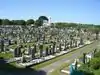 | |
| landuse | village_green | An area of common land, usually grass, in the centre of a village (quintessentially English - defined separately from 'common land' under the Commons Registration ACt 1965 and the Commons Act 2006) | ||
| landuse | recreation_ground | An open green space for general recreation, which may include pitches, nets and so on, usually municipal but possibly also private to colleges or companies | ||
| landuse | User Defined |
Askeri
![]() - Düğüm,
- Düğüm, ![]() - Yol,
- Yol, ![]() - Alan
- Alan
| Anahtar | Değer | Öğe | Açıklama | Örnek |
|---|---|---|---|---|
| military | airfield | |||
| military | bunker | Buildings, often build from concrete, to stand even heavier fire. | ||
| military | barracks | Buildings where soldiers live and work. | ||
| military | danger_area | Usually a large marked area around something like a firing range, bombing range, etc which is an exclusion zone. | ||
| military | range | Where soldiers have practice with their weapons (firing, bombing, artillery, ...). | ||
| military | User Defined |
Doğal
![]() - Düğüm,
- Düğüm, ![]() - Yol,
- Yol, ![]() - Alan
- Alan
| Key | Value | Element | Comment | Example |
|---|---|---|---|---|
| natural | spring | A place where ground water flows naturally from the ground ((hydrology, land) (3596) Other languages) | ||
| natural | peak | top of a hill or mountain | ||
| natural | cliff | Rock face | ||
| natural | scree | Loose rock | ||
| natural | scrub | Uncultivated land covered with bushes or stunted trees | ||
| natural | fell | Bare upper lying uncultivated land principally covered with grass and often grazed. | ||
| natural | heath | Bare lower lying uncultivated land with bushes but little or no tree cover. | ||
| natural | wood | Natural woodland (trees) | ||
| natural | marsh | waterlogged area | ||
| natural | water | Lakes, etc. Always keep water on the right side of the segment and land on the left side, in relation to segment direction. | ||
| natural | coastline | The coastline should run anti-clockwise, i.e. land on the left side and water on the right side of the segment, for it to show correctly. | ||
| natural | mud | (Other languages) | ||
| natural | beach | Beach: sand, gravel or pebble (Other languages) | ||
| natural | bay | Bay (Other languages) | ||
| natural | land | Land that exists within another area, such as a lake. (i.e an island). Keep water on the right and land on the left side in relation to segment direction. Layering may also be required | ||
| natural | User Defined |
Fiziksel Olmayan
Rota
![]() - Düğüm,
- Düğüm, ![]() - Yol,
- Yol, ![]() - Alan
- Alan
| Anahtar | Değer | Öğe | Açıklama | Örnek |
|---|---|---|---|---|
| route | bus | |||
| route | ferry | |||
| route | flight | |||
| route | ncn | ncn = National Cycle Network (in the UK) | ||
| route | subsea | |||
| route | ski | |||
| route | tour | |||
| route | pub_crawl | |||
| route | User Defined |
Sınır
![]() - Düğüm,
- Düğüm, ![]() - Yol,
- Yol, ![]() - Alan
- Alan
| Anahtar | Değer | Öğe | Açıklama | Örnek |
|---|---|---|---|---|
| boundary | administrative | e.g. State, county, local council (unclear how these are specified. Clarify!). Use therefore bordertype= | ||
| boundary | civil | |||
| boundary | political | Electoral boundaries | ||
| boundary | national_park | Area of outstanding natural beauty, set aside for conservation and for recreation (Other languages) |
Spor
![]() - Düğüm,
- Düğüm, ![]() - Yol,
- Yol, ![]() - Alan
- Alan
| Anahtar | Değer | Öğe | Açıklama | Örnek |
|---|---|---|---|---|
| sport | 10pin | Bovling | ||
| sport | athletics | Atletizm | ||
| sport | basketball | Basketbol | ||
| sport | climbing | Kaya tırmanma (ve kaya duvarı) | ||
| sport | cycling | Bisiklet | ||
| sport | golf | Golf | ||
| sport | gymnastics | Jimnastik | ||
| sport | hockey | Buz hokeyi | ||
| sport | horse_racing | Hipodrom | ||
| sport | motor | Motorlu araç yarışı | ||
| sport | multi | Çoklu | ||
| sport | racquet | Squash | ||
| sport | skating | Buz pateni | ||
| sport | skateboard | Kay-kay | ||
| sport | soccer | Futbol | ||
| sport | swimming | Yüzme | ||
| sport | skiing | Kayak | ||
| sport | table_tennis | Masa Tenisi / Pin-pon | ||
| sport | tennis | Tenis kortu |
Abutters
![]() - Düğüm,
- Düğüm, ![]() - Yol,
- Yol, ![]() - Alan
- Alan
| Anahtar | Değer | Öğe | Açıklama | Örnek |
|---|---|---|---|---|
| abutters | residential | predominantly houses and apartments | ||
| abutters | retail | predominantly shops | ||
| abutters | industrial | predominantly workshops, factories, warehouses |  | |
| abutters | commercial | office buildings, business parks, etc. | ||
| abutters | mixed |
Accessories
![]() - Düğüm,
- Düğüm, ![]() - Yol,
- Yol, ![]() - Alan
- Alan
| Anahtar | Değer | Öğe | Açıklama | Örnek |
|---|---|---|---|---|
| fenced | yes/no | |||
| lit | yes/no | Street lighting |
Özellikler
![]() - Düğüm,
- Düğüm, ![]() - Yol,
- Yol, ![]() - Alan
- Alan
| Anahtar | Değer | Öğe | Açıklama | Örnek |
|---|---|---|---|---|
| area | yes | Making a closed way render solid | ||
| bridge | yes | |||
| tunnel | yes | |||
| cutting | yes | |||
| embankment | yes | |||
| lanes | Num | Number of travel lanes in each (or only permitted) direction | ||
| layer | -5 to 5 | This numerical tag used to be `elevation', however it got renamed due to confusion with the ele and altitude tags used by tracklog imports. | layer:-1 layer:1 (not +1) | |
| surface | paved/unpaved | |||
| ele | Num | Altitude (meter over sea level) | ||
| width | Num | Width of way in metres | ||
| est_width | Num | A rough guess of the width of way/segment in metres | ||
| depth | Num | Depth in metres | ||
| est_depth | Num | A rough guess of the Depth in metres | ||
| start_date | Date | Date feature was created | ||
| end_date | Date | Date feature was removed |
Kısıtlamalar
![]() - Düğüm,
- Düğüm, ![]() - Yol,
- Yol, ![]() - Alan
- Alan
| Anahtar | Değer | Öğe | Açıklama | Örnek |
|---|---|---|---|---|
| access | yes/private/ permissive/ unknown/no | General access permission. 'permissive' means there is no legally-enshrined right of access, but the landowner has allowed it at his/her discretion. 'private' means access is restricted to the landowner. | ||
| bicycle | yes/private/ permissive/ unknown/no | Access permission for bicycles. For values see above | ||
| foot | yes/private/ permissive/ unknown/no | Access permission for pedestrians. For values see above | ||
| goods | yes/private/ permissive/ unknown/no | Vans and trucks?? See above | ||
| hgv | yes/private/ permissive/ unknown/no | Access permission for Heavy Goods Vehicles (UK), e.g. trucks. See above | ||
| horse | yes/private/ permissive/ unknown/no | Access permission for horse riders. For values see above | ||
| motorcycle | yes/private/ permissive/ unknown/no | Access permission for motorcycles. For values see above | ||
| motorcar | yes/private/ permissive/ unknown/no | Access permission for (motor) cars. For values see above | ||
| psv | yes/private/ permissive/ unknown/no | Access permission for Public Service Vehicles (UK), e.g. buses and coaches. See above | ||
| motorboat | yes/private/ permissive/ unknown/no | |||
| boat | yes/private/ permissive/ unknown/no | |||
| oneway | yes (or true/1)/ -1/ no (or false) | The permitted direction for a segment, is indicated by segment direction (enable arrows!). -1 for oneway direction opposed to segment direction. | ||
| noexit | yes | A dead end road/cul de sac with only one access road | ||
| date_on | Date | Date restriction starts | ||
| date_off | Date | Date restriction stops | ||
| day_on | Day of Week | Day restriction starts | ||
| day_off | Day of Week | Day restriction stops | ||
| hour_on | Time | Time restriction starts | ||
| hour_off | Time | Time restriction stops | ||
| maxweight | Num | Weight limit in tonnes | ||
| maxheight | Num | height limit in metres | ||
| maxwidth | Num | width limit in metres | ||
| maxlength | Num | length limit in metres | ||
| maxspeed | Num | Maximum speed in km/hr | ||
| minspeed | Num | Minimum speed in km/hr | ||
| toll | yes | Toll or fee must be paid to access way, see also highway=toll_booth |
Adlandırma
Ad
![]() - Düğüm,
- Düğüm, ![]() - Yol,
- Yol, ![]() - Alan
- Alan
| Anahtar | Değer | Öğe | Açıklama | Örnek |
|---|---|---|---|---|
| name | User Defined | Ortak varsayılan ad | ||
| int_name | User Defined | Uluslararası ad | ||
| nat_name | User Defined | Ulusal ad | ||
| reg_name | User Defined | Bölgesel ad | ||
| loc_name | User Defined | Yerel ad | ||
| old_name | User Defined | Tarihi ad | ||
| name:lg | User Defined | Farklı dilde ad. örn. name:en=Ararat. bkz.: Bilingual_street_names |
Göndermeler
![]() - Düğüm,
- Düğüm, ![]() - Yol,
- Yol, ![]() - Alan
- Alan
| Anahtar | Değer | Öğe | Açıklama | Örnek |
|---|---|---|---|---|
| ref | User Defined | The common default reference (eg M25) | ||
| int_ref | User Defined | International reference (eg E30) | ||
| nat_ref | User Defined | National reference | ||
| reg_ref | User Defined | Regional reference | ||
| loc_ref | User Defined | Local reference | ||
| old_ref | User Defined | Historical reference | ||
| ncn_ref | User Defined | The number reference (eg 54) of a National Cycle Network route. In the UK, national routes have single-or double-digit numbers with a red background on the signs. | 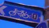 | |
| rcn_ref | User Defined | The number of the regional cycle network. In the UK the regional routes have double-digit numbers with a blue background on the signs. | 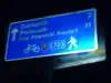 (Sign showing both national and regional spur). (Sign showing both national and regional spur). | |
| lcn_ref | User Defined | The number of the local cycle network | 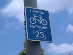 | |
| source ref | User Defined | To record the URI, source reference (eg Landsat) or other link to physical sources. | ||
| icao | User Defined | ICAO International airport codes | ||
| iata | User Defined | IATA International airport codes |
Yer sınıflaması
Administratively declared places
This table is a wiki template with a default description in English. Editable here.
Populated settlements, urban
This table is a wiki template with a default description in English. Editable here.
Populated settlements, urban and rural
This table is a wiki template with a default description in English. Editable here.
Other places
This table is a wiki template with a default description in English. Editable here.
Additional attributes
This table is a wiki template with a default description in English. Editable here.
Notlama / Annotation
some keys are allowed with one of the following values.
![]() - Düğüm,
- Düğüm, ![]() - Yol,
- Yol, ![]() - Alan
- Alan
| Anahtar | Değer | Öğe | Açıklama | Örnek |
|---|---|---|---|---|
| note | serbest içerik | Kendiniz ve diğer haritacılar için not. adresinde notların göründüğü bir harita var. | ||
| description | serbest içerik | Bir tarama sistemi ya da pop-up destekleyen haritalarda görüntülenebilir bilgi.. | ||
| image | URI | Bir görüntü dosyasına atıf (Eğer görüntü bir kaynağı belirtiyorsa aşağıdaki "source_ref" anahtarını kullanınız.) | ||
| source | extrapolation | Extension of information from a known source | ||
| source | knowledge | Local or common knowledge | ||
| source | historical | from out-of-copyright mapping or other historical document | ||
| source | image | photograph or video | ||
| source | survey | gpx track or other physical survey | ||
| source | voice | Voice recordings, eg dictaphone | ||
| source | User Defined | |||
| source_ref | User Defined | To record the URI, source reference (eg Landsat) or other link to physical sources. | ||
| created_by | User Defined | Defined by the editor used (JOSM, applet, osmeditor, etc), mainly to deal with Utf8 errors. Should not be changed manually. |