Tag:highway=construction
 |
| Description |
|---|
| A highway (road, track or path) currently under construction. |
| Rendering in OSM Carto |
 |
| Group: Highways |
| Used on these elements |
| Useful combination |
| See also |
| Status: de facto |
| Tools for this tag |
|
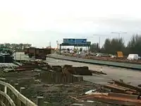
This tag is used together with construction=* for any type of highway, including roads, tracks and paths, currently under construction and impassable by the traffic it is intended for.
Major construction projects typically several years to complete. Use this key to denote active construction roadworks. For projects being planned, where there is little or no evidence for them on the ground, avoid tagging them or use proposed=* instead.
Already existing features may be closed for a short time for a temporary construction (e.g. old, damaged roads getting rebuilt). Don't use construction=* to tag such short-term closures (e.g. a road closed over a weekend to replace a sewer pipe); consider using conditional restrictions instead. As OSM data is often used offline (and therefore may be several months old), only tag construction sites if they are planned to be closed for at least six to nine months.
For minor road-works (where the road in question remains open), see construction=minor
How to map
To map a highway under construction you can just draw a line (way) and tag with highway=construction and construction=*
The value of the construction=* key should be one of those defined below and indicates the type of road, track or path being built .
For example: highway=construction + construction=primary describes a highway which is under construction and its type after the construction has finished will be a highway=primary.
If you know the date at which a construction site is expected to be completed, you can tag it with opening_date=*. Additionally, you can use check_date=* to denote when you last checked/updated the values. This can be useful as large construction projects are often delayed and for some construction projects planned opening date may be unknown or complicated to obtain.
Also add:
- bridge=yes - If the highway goes over a street or waterway.
- tunnel=yes - If the highway goes below a street or waterway.
How to map the start of a road repair or reconstruction
Suppose there is a road highway=tertiary that has been closed for a longer period of time due to repair or reconstruction. It is then necessary to:
- replace highway=tertiary tag with highway=construction
- add construction=tertiary
- optionally: add foot=yes or bicycle=yes, if pedestrian or bicycle traffic is possible
- in some cases mapping a separate footway/path is a good fit
- optionally: add opening_date=*, if we know when the road construction will be finished
- optionally: add note=* with construction details
How to map the completion of road construction
If a road tagged highway=construction has already opened and is passable, don't forget:
- to replace highway=construction with highway=tertiary or similar depending on the road category
- remove tags construction=*, or possibly note=* and update access tags (some add access=no to highway=construction, sometimes roads allow bicycles/pedestrians during construction but not once road is completed)
- add surface=* tag with the road surface and optionally other road parameters
- In some cases removing outdated detail without adding it would be beneficial
Values
highway=construction with any of the following values for construction=* will render on the Standard layer at zoom level 12 and above:
| Value | Element | Comment | Rendering carto |
|---|---|---|---|
| motorway | Motorway under construction |  | |
| motorway_link | Motorway sliproad under construction | | |
| trunk | Important non-motorway road under construction |  | |
| trunk_link | Sliproad to an important non-motorway road under construction | | |
| primary | Primary road under construction |  | |
| primary_link | Sliproad to a primary road under construction | | |
| secondary | Secondary road under construction |  | |
| secondary_link | Secondary road link under construction | | |
| tertiary | Tertiary road under construction | | |
| tertiary_link | Tertiary road link under construction | | |
| unclassified | Unclassified road under construction (alternatively tag construction=minor) | | |
| road | Road with unknown classification under construction |  | |
| raceway | Raceway road under construction | | |
| residential | Residential road under construction | | |
| living_street | Living street under construction |  | |
| pedestrian | Pedestrianised road under construction |  | |
| service | Service road under construction |  | |
| track | Track under construction |  | |
| bridleway | Bridleway under construction | | |
| cycleway | Cycleway under construction | | |
| footway | Foot path under construction (alternative tag <construction=footpath>) | | |
| path | Path under construction | | |
| steps | Steps under construction | |
Possible tagging mistakes
See also
- hazard=roadworks - A section of road with workers on the roadway
- railway=construction - A railway feature under construction
- building=construction - A building under construction
- landuse=construction - An area of land being built on
- proposed=* - The proposed tag may be used for any road, railway or route that is in planning phase
| ||||||||||||||||||||||||||||||