Tag:canal=qanat
 |
| Description |
|---|
| A gently sloping underground waterway that transports water downhill from an aquifer or well |
| Group: Waterways |
| Used on these elements |
| Requires |
| Useful combination |
| See also |
| Status: de facto |
| Tools for this tag |
|
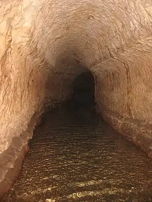
canal=qanat is used with waterway=canal and tunnel=yes to specify a qanat, also known as a faraj, khettara, kariz or kanez - a gently sloping underground channel used to transport water downhill from an aquifer or water well to the surface, commonly found in the Middle East and surrounding arid areas near hills or mountains.
A qanat is usually built with vertical ventilation shafts along it's course, which can be used to verify the route of the underground waterway. These have been mapped as nodes with the tag excavation=qanat_shaft
For more details on this tagging scheme, see Proposed features/Qanat.
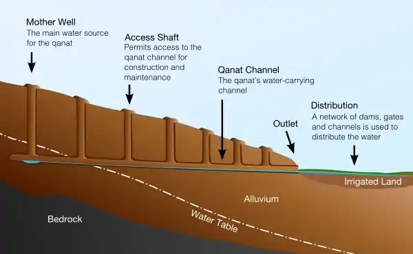
Quanat diagram
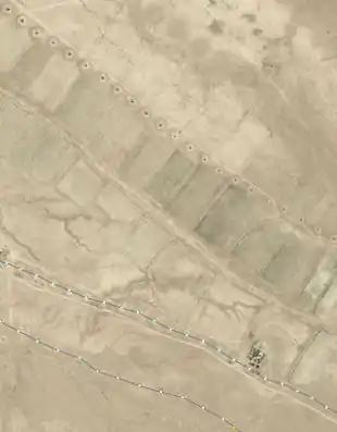
Quanats - both mapped and unmapped ones
This article is issued from Openstreetmap. The text is licensed under Creative Commons - Attribution - Sharealike. Additional terms may apply for the media files.