Tag:basin=infiltration
 |
| Description |
|---|
| A special basin used for infiltration of rainwater into the groundwater. |
| Rendering in OSM Carto |
| Group: Water |
| Used on these elements |
| Requires |
|
or |
| Status: approved |
| Tools for this tag |
|
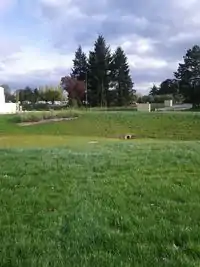
A special basin used for infiltration of rainwater into the groundwater. The basin is normally not filled with water.
Infiltration basin on Wikipedia: "It is essentially a shallow artificial pond that is designed to infiltrate stormwater though permeable soils into the groundwater aquifer. Infiltration basins do not discharge to a surface water body under most storm conditions, but are designed with overflow structures (pipes, weirs, etc.) that operate during flood conditions."
How to map
Draw as an area ![]() along the outline of the basin and add
along the outline of the basin and add
or
See also
This article is issued from Openstreetmap. The text is licensed under Creative Commons - Attribution - Sharealike. Additional terms may apply for the media files.