Renewable energy in the United Kingdom
According to Wikipedia "The total of all renewable electricity sources provided for 14.9% of the electricity generated in the United Kingdom in 2013, reaching 53.7 TWh of electricity generated. In the second quarter of 2015, renewable electricity generation exceeded 25% and coal generation for the first time"
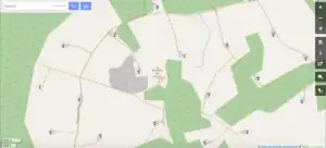
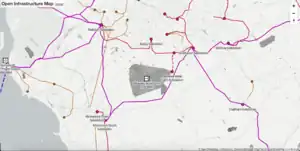
There is a nice render at Open Infrastructure Map
UK Renewable Energy Planning Database (REPD)
The Department for Business, Energy and Industrial Strategy (BEIS....that used to be DEFRA) Renewable Energy Planning Database (REPD) defines larger scale renewable energy sites in the UK. The database shows planning requests and their status. We are probably most interested in those that are operational or under construction.
The important data file for this is the REPD Extract produced every quarter.
"Larger scale" is defined as generating 1MW+.
The database provides a UK National Grid Reference for each location, but this is frequently inaccurate (+/-1km) as it may have been created early on in the planning process before the actual site location was decided. On occasion the given location may be on the nearest conurbation. Operational or under construction sites are often visible in aerial photography, in particular wind turbines which cast a clear shadow.
user:Jnicho02 is running a project to map wind farms, ground mounted solar farms, and renewable energy sites in the REPD and invites you to join in.
Energy sites are mapped as a relation which links wind turbines, transformer unit they connect to, and access tracks. See http://overpass-turbo.eu/s/rJW for a couple of examples.
As of September 2017 the REPD identifies larger renewable energy sites ('farms') in the UK. These are split into:
 select "technology type", "mounting type for solar", "development status (short)", count(*) as counter
 from ukgov_energy_planning
 where "development status (short)" = 'Operational'
 group by "technology type", "mounting type for solar", "development status (short)"
 order by counter desc
| technology type | operational |
|---|---|
| Solar Photovoltaics (roof mounted) | 740 |
| Wind Onshore | 667 |
| Solar Photovoltaics (ground mounted) | 320 |
| Landfill Gas | 268 |
| Anaerobic Digestion | 113 |
| Small Hydro | 55 |
| Biomass dedicated | 52 |
| EfW Incineration | 46 |
| Wind Offshore | 31 |
| Large Hydro | 18 |
| Sewage Sludge Digestion | 8 |
| Advanced Conversion Technologies | 7 |
| Tidal Barrage and Tidal Stream | 5 |
| Biomass co-firing | 3 |
| Solar Photovoltaics (floating) | 2 |
| Shoreline Wave | 2 |
Suggested process and tags (onshore wind power)
There is a global definition at Wind_farms, partly based on this page.
Wind turbines are easy-ish to spot in aerial photos as they cast a shadow. The Newcorp progress map shows REPD sites and has a link to the location on OSM.
Different aerial photos: If a wind farm was constructed in the last couple of years then some aerial images might not show it. Try different layers in the ID editor.
The REPD record includes the Planning Application authority and number, so you can view the original plans.
The contractor's web site may help you locate the site.
In the ID Editor, after submitting the edit to OSM it can be good to click on 'View on OSM' to view the changeset, then click on the link to the relation, e.g. Mynydd y Betws relation/7587679 to check that you added all of the turbines.
energy 'farm'
A wind farm is not a polygon, it is a relation. Other activities can and do happen on the grass between the turbines (e.g. sheep grazing), so the 'farm' is actually a collection of turbines, access tracks, and substation.
A wind farm is most definitely not landuse=industrial as there is still farmland between the turbines. I'm also strongly against mapping the turbine 'pad' areas as landuse=industrial.
| tag | comments |
|---|---|
| type=site | |
| site=wind_farm | |
| name=* | the name of the wind farm (excluding the words 'Wind Farm', 'resubmission', 'repowering', but do include 'extension') |
| power=plant | |
| plant:source=wind | |
| plant:output:electricity=number MW | if known (use a '.' dot as decimal separator, the indicated unit is usually 'MW' for megawatts or 'kW' for kilowatts) REPD has this as a field |
| repd:id=number | the UK Gov Renewable Energy Planning Database id |
A 'resubmission' is when a planning application is resubmitted. A 'repowering' is when a site has had old turbines replaced with new, more modern, ones. An 'extension' is where extra turbines are added on to an existing scheme.
Please merge phases/extensions into single sites where it is obvious that it is owned and run as the same operation, e.g. "Xyz" and "Xyz Extension". Sites being adjacent does *not* mean they get merged automatically because there are often groups of separate wind farm operations at a location.
   [out:json][timeout:25];
   (
       relation["site"="wind_farm"]({ { bbox } });
   );
   out body;
   >;
   out skel qt;
wind turbine
The ID editor does most of these by default.
| tag | note |
|---|---|
| power=generator | |
| generator:source=wind | |
| generator:method=wind_turbine | |
| generator:type=horizontal_axis | most likely, unless its a corkscrew shape |
| generator:output:electricity=2.0 MW | optional |
| name=turbine 1 | optional/unlikely. This is *not* the name of the wind farm. Often available on planning docs. |
Add a turbine to the wind farm relation role=generator
Note: when adding things to a relation using the ID Editor the wind farm will only appear in the dropdown if another object already in the relation is visible in the edit screen. Sometimes, turbines are quite far apart. It can help to include the access tracks as you go.
access tracks
Wind farms must have access tracks to get to the turbines. Often they are clearly for this purpose only, other times they may be existing paths.
Q: does it hurt for an existing footpath to be included in wind farm relation? The path may need to have a section broken so as to not include lots of other sections that aren't relevant.
Optionally add the tracks to the wind farm relation as role='access'
To now, I have only connected obvious access tracks
pads
Very occasionally mappers have plotted the concrete 'pad' that the turbine sits on, sometimes as landuse=industrial. I recommend against this - Jnicho02 (talk) 12:16, 15 December 2018 (UTC)
substation
Every wind farm has a substation where the turbines are connected to the main power cable. This will be a small building close to the first turbine, but not always identifiable.
Add it to the wind farm relation role='substation'
meteorologic mast
A wind farm often has meteorological masts instrumented with anemometers and wind vanes installed, for both pre-construction assessement of wind resource (temporary structures of 1-3 yrs) and performance monitoring during wind farm operation (fixed structures usually for the operational wind farm lifetime). Typically modern wind turbines will have pairs of individual anemometers and wind vanes mounted on the nacelle used for control, therefore these met masts are not essential for wind farm operation. Typically masts aren't installed unless the wind farm is considering a power curve performance test to validate the turbines are performing to manufacturer specification.
I have mapped these as a 'tower' but I could be wrong.
Scottish Open Data
You could compare to data from https://www.spatialhub.scot/ in iD by adding a custom background of https://geo-apps.spatialhub.scot/geoserver/national_datasets_one_attribute/ows?authkey=05da4c39-517d-4e04-a6f3-90a6ab5d1c82&FORMAT=image/png&TRANSPARENT=TRUE&VERSION=1.3.0&SERVICE=WMS&REQUEST=GetMap&LAYERS=pub_respol,pub_respnt&STYLES=&CRS={proj}&WIDTH={width}&HEIGHT={height}&BBOX={bbox} or in JOSM. The points only display between a range of zoom levels.
List of under construction and operational UK Onshore Wind Farms
| repd:id | OSM | name | comments | country |
|---|---|---|---|---|
| 2555 | 8399879 | South Beach | England | |
| 2556 | 8400257 | Swaffham 1 | England | |
| 2559 | 7891423 | Mynydd Gorddu | Wales | |
| 2563 | 2924301 | Cefn Croes | Wales | |
| 3556 | Bryn Du | 39 turbines - is this repd:id=2563 Cefn Croes? | Wales | |
| 2565 | 7871919 | Carno | includes repd:id=2564 and repd:id=3277 | Wales |
| 2567 | 2924696 | Trysglwyn | Wales | |
| 2568 | 8391205 | Hafoty Ucha 2 and 3 Wind Turbine | Wales | |
| 2574 | 8411093 | Royal Seaforth Dock | England | |
| 2576 | 2924315 | Cemmaes | includes repd:id=2566 | Wales |
| 2582 | 2924679 | Llanbabo | Wales | |
| 2586 | 9417336 | Tow Law | England | |
| 2587 | 8408282 | Kirkheaton | England | |
| 4177 | 2928689 | Furness/High Winds (Harlock Repowering) | replaced repd:id=2617 Harlock Hill | England |
| 2618 | 8408072 | Wharrels Hill | England | |
| 2624 | 5513996 | Siddick | England | |
| 2625 | 8407244 | Oldside | England | |
| 2630 | 8397380 | Blaen Bowi | Wales | |
| 2636 | 7544440 | Parc-Cynog | Wales | |
| 2653 | 8391233 | Moel Maelogen A | Wales | |
| 3172 | 2924729 | Moel Maelogen A Phase 2 | merge into repd:id=2653 ? | Wales |
| 2659 | 8402958 | Out Newton | England | |
| 2672 | 9303664 | Brockholes | Scotland | |
| 2673 | 6949355 | Kilbraur Farlary | check me | Scotland |
| 2674 | 2933102 | Maesgwyn | Wales | |
| 4485 | 2924279 | Maesgwyn Extension | check detail | Wales |
| 2680 | 8410968 | Spicer Hill | England | |
| 2683 | 7547916 | Ford Motor Company Ltd Extension | England | |
| 2694 | 8397721 | Blue Gates Farm | England | |
| 2695 | 8394511 | Celcon Blocks Ltd | England | |
| 2697 | 2396664 | Hammers Hill | Scotland | |
| 2704 | 4547330751 | F M C Land, Pitreavie Business Park | replaced repd:id=2687 | Scotland |
| 2711 | 6972691 | Hare Hill (East Ayrshire) | includes repd:id=4157 | Scotland |
| 2713 | 2928690 | Kirkby Moor | England | |
| 2724 | 8844322 | Cairnmore Farm | Scotland | |
| 2741 | 9362905 | St Fergus Moss | Scotland | |
| 2742 | 3822252066 | West Hill, Flotta | Scotland | |
| 2747 | 2928683 | Chelker Reservoir | England | |
| 2758 | 9585411 | Hill of c Extension | Scotland | |
| 2776 | 7544102 | Taff Ely | Wales | |
| 2780 | 9403608 | Mossmorran | Scotland | |
| 2782 | 6342866382 | Courtstone | Scotland | |
| 2796 | 6949397 | Lairg | Scotland | |
| 2804 | 7544068 | G24 Innovations | Wales | |
| 2839 | 9316590 | Clochnahill | Scotland | |
| 2867 | 9132441 | St John Hill | Scotland | |
| 4031 | St. Johns Hill | 9 @ Chapel of Barras, nr Kinneff, South of Stonehaven https://www.openstreetmap.org/#map=12/56.88857/-2.27242 | Scotland | |
| 2873 | 9953919 | Bryn Blaen | Wales | |
| 2875 | 8400495 | March Sewage Treatment Works | England | |
| 2902 | 8835814 | Burnfoot Hill | includes repd:id=4450 but not repd:id=6324 yet. Should it? Site is east of Rhodders repd:id=4223 | Scotland |
| 6324 | Burnfoot Hill Extension | 3 @ Site West Of Burnfoot Hill, High Street, Tillicoultry, Central https://www.openstreetmap.org/#map=12/56.20911/-3.75996 cannot see it, check planning | Scotland | |
| 4223 | 9316967 | Rhodders | West of Burnfoot Hill repd:id=2902 | Scotland |
| 2922 | 9285504 | Strath of Brydock | includes repd:id=2708 | Scotland |
| 4892 | 11565184 | Gawnsmoss | 3 @ Cairnhill Banff https://www.openstreetmap.org/#map=12/57.62232/-2.61301 can't see, check planning. Near to repd:id=2922 | Scotland |
| 2923 | 9296893 | House O'Hill | Scotland | |
| 3980 | 9365080 | Mains of Hatton | Scotland | |
| 3666 | 9365043 | Gordonstown Hill | Scotland | |
| 2928 | 2928674 | Bagmoor | England | |
| 2932 | Croda Chemicals Europe | 1 @ Croda International Plc, Cowick Hall, Snaith, Goole, East Yorkshire, DN14 9AA https://www.openstreetmap.org/#map=12/53.68233/-1.00720 01/10/2008 Cannot see it | England | |
| 2935 | 8407218 | Eastman Chemicals | England | |
| 2938 | 8400570 | Lindhurst | England | |
| 2940 | 9319220 | Craigengelt | Scotland | |
| 2942 | 8402880 | Saltend | England | |
| 2943 | 2928684 | Loftsome Bridge | England | |
| 2944 | 8408273 | Nissan Motors Plant + Extension repd 3964 | England | |
| 2950 | 7544453 | Parc Cynog Extension | Wales | |
| 2952 | 8400414 | Ranson Moor Phase 1 | England | |
| 2953 | 8400415 | Ranson Moor Phase 2 | merge into repd:id=2952 ? | England |
| 2955 | 6950045 | West Durham | England | |
| 2956 | 7544395 | Dyffryn Brodyn | Wales | |
| 2965 | 9403645 | North Red Bog | Scotland | |
| 2968 | 2924282 | Milton Keynes | England | |
| 2983 | 6950083 | Broom Hill | England | |
| 2986 | 8406388 | Winscales Moor | England | |
| 2988 | 8399213 | Africa Alive | England | |
| 2999 | 9304020 | St John's Well | Scotland | |
| 3002 | 8406183 | Hellrigg | England | |
| 3015 | 7876316 | Bryn Titli | Wales | |
| 3019 | 2918820 | Delabole | England | |
| 3021 | 8400328 | Whittlesey | England | |
| 3028 | 8402731 | Advanced Manufacturing Research Centre | England | |
| 3034 | 7544065 | Solutia UK Ltd | Wales | |
| 3050 | 8406114 | High Haswell | England | |
| 3057 | 7021245 | Llandinam | Wales | |
| 3061 | 2885559 | Goonhilly | England | |
| 3068 | 9403659 | MSD Cramlington | England | |
| 3075 | 9415371 | Skelmonae | Scotland | |
| 3077 | Carn Vean | 5 @ Carn Vean, Tretheague Mill, Stithians, Truro, Cornwall https://www.openstreetmap.org/#map=16/50.1793/-5.1904 30/10/2008 cannot locate | England | |
| 3078 | 8405327 | Dewlay Cheese | England | |
| 3079 | 8392929 | Coal Clough | 24 @ Burnley 390207 428154 01/02/1993 can see 16. Includes 8 * repowering 4321 https://www.openstreetmap.org/#map=12/53.74966/-2.14998 | England |
| 3090 | 9403690 | Myres Hill | Scotland | |
| 3093 | National Wind Turbine Test Site | Messy. Judging by the name, they've put up and taken down a number of turbines plus is mixed up with Myres Hill Wind Farm. 2 turbines on Myres Hill, Eaglesham 256500 646500 15/02/2001 see repd:id=3090 | Scotland | |
| 3092 | 8408193 | High Sharpley | England | |
| 3096 | 2919043 | Little Cheyne Court | England | |
| 3101 | 8400494 | Long Hill Road | England | |
| 3105 | 8399875 | Ness Point | England | |
| 3108 | 8087095 | Causeymire | Scotland | |
| 4646 | 9954065 | Bad a Cheo | Scotland | |
| 3109 | 6949332 | Hadyard Hill | Scotland | |
| 3114 | 7872001 | Crystal Rig | 25 turbines + 60 Phase 2a repd:id=3440. merge in repd:id=3536 and repd:id=4215? | Scotland |
| 3536 | Crystal Rig Extension II | 9 @ Lammermuir Hills on the East Lothian Council/Scottish Borders Council border approximately 11km from Dunbar and 16.5km from Duns. 366000 669000 25/10/2010 | Scotland | |
| 4215 | Crystal Rig Phase III | 6 @ Crystal Rigg Wind Farm, Cranshaws Duns, Scottish Borders https://www.openstreetmap.org/#map=12/55.92641/-2.53447 | Scotland | |
| 3116 | 2321400 | Black Law | 54 turbines currently mapped in OSM + merge in extensions repd:id=4253 29 turbines and repd:id=4580 5 turbines? | Scotland |
| 4253 | Black Law Extension - 1a | 29 turbines. 22 Aug 2019 I just plotted a load of new turbines, are these they? | Scotland | |
| 4580 | Black Law Extension - 1b | 5 @ Black Law, Climpy https://www.openstreetmap.org/#map=15/55.76218/-3.76256 | Scotland | |
| 3117 | 8835808 | Ardrossan | Scotland | |
| 3119 | 7872124 | Braes O'Doune | Scotland | |
| 3120 | 1293289546 | Thorfinn - NM1500 | Scotland | |
| 3126 | 8835819 | Boulfruich | Scotland | |
| 3128 | 2924640 | Bicker Fen | England | |
| 3479 | 8051754 | Coldham | England | |
| 3607 | 8400493 | Coldham | see also repd:id=3479 and repd:id=3480 | England |
| 3480 | 8400497 | Whitemill | 7 turbines | England |
| 3129 | Stags Holt | 9 @ March, Cambridgeshire https://www.openstreetmap.org/#map=12/52.56977/0.12329 close to Coldham and Whitemill | England | |
| 3741 | 8400496 | Stags Holt Extension | merge into repd:id=3129 ? | England |
| 3132 | 8399551 | Glass Moor | England | |
| 3765 | 8399552 | Glass Moor Extension | Merge into repd:id=3132 ? | England |
| 3133 | 8397773 | Gedney Marsh | England | |
| 3135 | 8041181 | Ben Aketil | includes repd:id=3668 | Scotland |
| 3147 | 8393112 | Knabs Ridge | England | |
| 3149 | 9301644 | Kelburn | Scotland | |
| 3155 | 9585468 | Ramsey | includes repd:id=4414 | England |
| 3157 | 2924741 | Bambers Farm | does this also include 2 turbines on the adjacent sewage works?2992772 | England |
| 2715 | 2992771 | Bambers II | merge with repd:id=3157 ? | England |
| 3158 | 7547874 | Ford Dagenham | England | |
| 3159 | 8400270 | Swaffham Plashes II | England | |
| 3161 | 917146643 | Shooters Bottom | England | |
| 3171 | 8405360 | Caton Moor | England | |
| 3177 | 7872135 | Scout Moor | England | |
| 3179 | The Haven | ignore? private house approx 52.09717/-2.28229 http://www.worcesternews.co.uk/news/7659431.Dream_of__a_house_powered_purely_by_the_wind_and_sun/ | England | |
| 3186 | 8404275 | The Hollies | England | |
| 3190 | 8849887 | Tullo Farm | Scotland | |
| 3818 | Tullo North Extension (Shiels) | 3 @ Laurencekirk see 8849887 | Scotland | |
| 4422 | Tullo South Extension | 4 @ Tullo Farm, Laurencekirk, AB30 1HS see 8849887 | Scotland | |
| 4365 | 9576299 | Tullo Extension (Easter Tulloch) | 10 @ Land to North of Tullo Farm, Laurencekirk | Scotland |
| 3194 | 2924252 | Avonmouth Port | England | |
| 3200 | 8835817 | Dummuie | Scotland | |
| 3201 | 9299464 | Earlsburn | Scotland | |
| 3202 | 6949355 | Kilbraur | check me | Scotland |
| 3205 | 6949399 | Achany | Scotland | |
| 3207 | 9415424 | Bilbster | Scotland | |
| 3210 | 8391342 | Green Park | England | |
| 3214 | 8837652 | Carcant | Scotland | |
| 3218 | 8406084 | Butterwick Moor | England | |
| 3229 | 2924289 | Llangwyryfon | Wales | |
| 3232 | 8039179 | Pates Hill | Scotland | |
| 3233 | 2918750 | WWF Roskrow Barton | England | |
| 3236 | 8849155 | Greendykeside | Scotland | |
| 3247 | 2924743 | Loscar Farm | England | |
| 3248 | 8408200 | Langley Moor | England | |
| 3258 | 7872032 | Arecleoch | Scotland | |
| 3260 | 7998314 | Mark Hill | Scotland | |
| 3264 | 2919020 | Westmill | England | |
| 3272 | 7544434 | Lodge Farm 1 | Wales | |
| 3285 | 9297765 | Achairn | Scotland | |
| 3290 | 6950044 | High Hedley Hope Extension | 4 @ High Hedley Farm, Tow Law, Bishop Auckland, County Durham includes originally 3 in High Hedley Hope | England |
| 3292 | 6949470 | Beinn an Tuirc | 46 + 26 repd:id=4525 | Scotland |
| 3294 | Cnoc Donn Arnicle | 26 @ Situated next to Beinn an Tuirc, Kintyre https://www.openstreetmap.org/#map=12/55.58003/-5.56814 | Scotland | |
| 4184 | 9584762 | Auchadaduie | 3 turbines West of Beinn an Tuirc | Scotland |
| 3295 | 8835807 | Beinn Ghlas | Scotland | |
| 3296 | Bendealt, Highland | 18 @ Novar Estate https://www.openstreetmap.org/#map=12/57.7055/-4.42666 mixed in with 3297 Meall an Tuirc 6949418 | Scotland | |
| 3297 | 6949418 | Meall an Tuirc | 34 @ Novar Estate mixed in with repd:id=3296 Bendealt | Scotland |
| 4013 | Novar Extension | 16 @ Novar Estate, Evanton, Ross-shire https://www.openstreetmap.org/#map=12/57.70999/-4.42696 | Scotland | |
| 3298 | 6949563 | An Suidhe | Scotland | |
| 3300 | 8835795 | Bowbeat | 24 @ Roughside Hill and Emily Bank, Peebles (includes repd:id=3299 as duplicate/previous name) | Scotland |
| 3301 | 8835793 | Hagshaw Hill | 13 @ The site lies 4km west of Douglas (includes 3593=repowering? and 3220=20 turbine extension) | Scotland |
| 3306 | 9418685 | Arnish Moor | Scotland | |
| 3307 | 9285827 | Burgar Hill | Scotland | |
| 3308 | 9285828 | Thorfinn - NM2000 | Scotland | |
| 3310 | 9585630 | Burradale Hill | Scotland | |
| 3309 | 8396695 | Hill of Lybster | 4 original then 4679 another 4. Please check that this is correct and is not actually 4 @ 4679 Forss + 2 @ 4679 Forss Extension | Scotland |
| 6636 | Forss | 2 @ Wind Turbine Ex Navy Base Forss Dounreay Thurso Caithness https://www.openstreetmap.org/#map=12/58.60235/-3.6881 is this mixed up with 3309 8396695 | Scotland | |
| 4679 | Forss Extension | 4 @ Ex Navy Base Forss, Dounreay Thurso Caithness https://www.openstreetmap.org/#map=12/58.60235/-3.68813 is this mixed up with 3309 8396695 | Scotland | |
| 3311 | 8835818 | Glens of Foudland | Scotland | |
| 3313 | 7544402 | Castle Pill | + 2 new turbines? 6905131370 | Wales |
| 3321 | 8396644 | New Holland | Scotland | |
| 3354 | 8399933 | Weston Airfield | England | |
| 3359 | 8406411 | Orton Park Farm | 3 not 2 turbines? | England |
| 3361 | 8411095 | Promised Land Farm | England | |
| 3368 | 11565193 | Nethercott Farm | 3 @ Land At Nethercott Farm Tetcott Holsworthy Devon https://www.openstreetmap.org/#map=15/50.74425/-4.33536 | England |
| 3370 | 9302744 | Bonerbo | Scotland | |
| 3378 | 8397375 | Princes Gate Spring Water | Wales | |
| 3380 | 9597514 | Bettyhill | Scotland | |
| 3382 | 8400581 | Sibelco Brassington | England | |
| 3390 | 2928691 | Lambrigg | England | |
| 3391 | 2928686 | Far Old Park | England | |
| 3392 | 7541899 | Bears Down | England | |
| 3396 | 11522941 | Welton Of Creuchies | Scotland | |
| 3398 | 9403842 | Droop Hill | Scotland | |
| 3403 | 6263493942 | Denhill | Scotland | |
| 3404 | 9303995 | Haddo | 2 @ Methlick, Ellon, Aberdeenshire AB41 7DX 381628 837639 25/05/2011 | Scotland |
| 3548 | Methlick Farmers Wind Energy Project | 6 @ Methlick, Aberdeenshire 01/12/2011 https://www.openstreetmap.org/#map=15/57.42761/-2.24311 | Scotland | |
| 3405 | 6252057405 | Gairnieston Farm | Scotland | |
| 3408 | 6251923785 | Burgar Hill (land Near), Evie Wind Onshore | Scotland | |
| 3415 | 8849157 | Tod Hill Farm | Scotland | |
| 3429 | Moorhouse Farm | 2 @ Land North West Of Shepherds House Moorhouse Coldingham Scottish Borders https://www.openstreetmap.org/#map=12/55.9039/-2.25084 see repd:id=4023 | Scotland | |
| 4023 | 9630982 | Drone Hill | 22 turbines Scottish Borders Council 05/00425/FUL | Scotland |
| 3432 | 8402755 | Royd Moor | England | |
| 3437 | 7547852 | Little Belhus Restoration Site | England | |
| 3448 | 9316516 | Clachan Flats | Scotland | |
| 3449 | 8404351 | Fen Farm | England | |
| 3450 | 8399799 | Darracott Moor | England | |
| 3453 | 9598213 | Lochhead Farm | Scotland | |
| 3457 | 6949310 | Toddleburn | Scotland | |
| 3458 | 2918889 | Crimp | England | |
| 3467 | 6949501 | Tangy | includes repd:id=4024 | Scotland |
| 3487 | 8835815 | Green Knowes | Scotland | |
| 3489 | 2593160 | Whitelee | 214 turbines in relation, 140 + 36 repd:id=3981 + 39 repd:id=2757 = 215 expected | Scotland |
| 3491 | 8408163 | Great Orton | 6 turbines + see repd:id=2613 Great Orton Extension unlocated for another 6...or is it a repowering?? Allerdale Borough Council | England |
| 2613 | Great Orton (Extension) | cannot locate, is it a repowering? Allerdale Council. see 6 turbines @ repd:id=3491 Great Orton | England | |
| 3492 | 8406391 | Winscales | England | |
| 3494 | 8408203 | Holmside Hall | England | |
| 3495 | 8406103 | High Volts | England | |
| 3496 | 8406124 | Hare Hill | England | |
| 3110 | 8406125 | Hare Hill (B) | merge into repd:id=3496? | England |
| 3504 | 8408187 | Great Eppleton | Replaces repd:id=2591 | England |
| 3507 | 8406113 | Haswell Moor | England | |
| 3510 | 8402718 | Worksop B&Q | England | |
| 3511 | 2918864 | Cold Northcott | England | |
| 3524 | 8844317 | Upper Ardgrain | Scotland | |
| 3529 | 10647343 | Rothiesholm | 3 @ Rothiesholm, Stronsay, Orkney https://www.openstreetmap.org/#map=18/59.09725/-2.66008 10/04/2002 Orkney aerial photography is not very recent | Scotland |
| 3532 | 8849892 | Hill of Easterton | includes repd:id=4056 | Scotland |
| 3533 | 8411092 | Port of Liverpool | England | |
| 3534 | 7872180 | Rothes (Cairn Uish) | includes repd:id=3951 | Scotland |
| 3538 | 8835830 | Glenkerie | Scotland | |
| 3539 | 2928685 | Lissett Airfield | England | |
| 3552 | 2924292 | Rheidol | Wales | |
| 3554 | 6949500 | Deucheran Hill | Scotland | |
| 3570 | 6949311 | Dun Law | includes repd:id=3579 | Scotland |
| 3574 | 8844411 | Black Hill | Scotland | |
| 3578 | 2933147 | Four Burrows | England | |
| 3581 | 8835816 | Lochelbank | Scotland | |
| 3585 | 6949564 | Cruach Mhor | Scotland | |
| 3592 | 8391172 | Wern Ddu | Wales | |
| 3594 | 9886726 | Muirake | Scotland | |
| 3602 | 2928678 | Rusholme | England | |
| 3605 | 8411043 | Longpark | Scotland | |
| 3606 | 8406085 | Walkway | England | |
| 3608 | 1447153 | Red Tile | England | |
| 3609 | 8397778 | Deeping St Nicholas | England | |
| 3611 | 8406207 | Lowcra | England | |
| 3613 | 8406379 | Fairfield Farm | England | |
| 3614 | 8405397 | Haverigg | includes repd:id=2626 | England |
| 4015 | 9301579 | Ewe Hill | Scotland | |
| 3633 | Hazelside Farm | 2 @ side Farm, Lanark, Strathclyde https://www.openstreetmap.org/#map=15/55.55755/-3.88418 | Scotland | |
| 3647 | 9590773 | Moy | Scotland | |
| 3651 | 9593916 | Rosehill | Scotland | |
| 3657 | 8394713 | Twin Rivers | England | |
| 3660 | 2933103 | Ferndale | Wales | |
| 3662 | 6949356 | Gordonbush | Scotland | |
| 3664 | 7543995 | Avonmouth Wind Power | England | |
| 3667 | 6470160519 | The Rosti Factory | Scotland | |
| 3670 | Lochcarnan Community Windfarm | 3 @ Lochcarnan, Isle of South Uist 18/02/2013 https://www.openstreetmap.org/#map=12/57.23374/-7.34788 | Scotland | |
| 3671 | 8400323 | The Grange | England | |
| 3672 | 8397723 | Humphrey Group | England | |
| 3673 | 8399162 | Rodbaston | England | |
| 3674 | 9316838 | Boundary Lane | England | |
| 3676 | 8849077 | Nutberry | Scotland | |
| 3677 | 8402719 | Penny Hill Lane | England | |
| 3681 | 9455808 | West Knock | Scotland | |
| 3682 | 7554962 | Low Spinney | England | |
| 3684 | 9378799 | Westfield | Scotland | |
| 3685 | 7554942 | Swinford | England | |
| 3686 | 8400332 | Burnt House Farm | England | |
| 3688 | 9220963 | Calder Water | Scotland | |
| 3690 | 8835791 | Millour Hill | 6 turbines | Scotland |
| 4235 | Millour Hill Community Extension | 2 @ North Of Baidland Hill Dalry Ayrshire https://www.openstreetmap.org/#map=12/55.73582/-4.78090 can't spot them yet | Scotland | |
| 3691 | 9588654 | Netherton of Windyhills | 2 @ Grange Crossroads, Keith, Grampian AB55 6NL 348948 857294 01/11/2014 https://www.openstreetmap.org/#map=15/57.6028/-2.8559 | Scotland |
| 3693 | 11567303 | Gallowhill | 2 @ West Manse, Westray, KW17 2DR 18/02/2013 https://www.openstreetmap.org/#map=15/59.27656/-2.98218 | Scotland |
| 3694 | 7557525 | Frodsham Marsh | England | |
| 3695 | 9589242 | Brechfa Forest West | Wales | |
| 3698 | Greenhill Croft | 2 @ Bonnykelly, New Pitsligo, Fraserburgh, Grampian AB43 6NP 01/03/2012 https://www.openstreetmap.org/#map=15/57.59461/-2.20106 UK Gov location is on a conurbation | Scotland | |
| 3699 | 8400501 | Severn Trent STW | England | |
| 3700 | 8396596 | Spaldington Airfield | 5 turbines, mapping incomplete | England |
| 3701 | 9316589 | Hillhead of Auquhirie | 3 @ Hillhead of Auquhirie, Stonehaven 16/01/2013 https://www.openstreetmap.org/#map=15/56.95519/-3.17720 | Scotland |
| 3702 | 4515485 | Middleton | UK Gov loc is on residential area | Scotland |
| 3703 | 8405346 | Orchard End | England | |
| 3705 | 7906468 | Mynydd Bwllfa | Wales | |
| 3707 | 11567376 | Tirgwynt | 12 @ Mynydd yr Hendre & Mynydd Pistyll Du Near Carno, Powys 15/02/2017 | Wales |
| 3711 | 8399102 | Garreg Lwyd | Wales | |
| 3718 | Castle of Auchry | 3 @ Cuminestown, Turriff, Aberdeenshire AB53 5UR https://www.openstreetmap.org/#map=12/57.28276/-2.44768 01/11/2013 | Scotland | |
| 3722 | 9340942 | Little Byth | Scotland | |
| 3723 | Yonderton Farm | 2 @ Hatton, Peterhead, Aberdeenshire AB42 0QS 01/12/2014 https://www.openstreetmap.org/#map=15/57.430837/-1.9418959 | Scotland | |
| 3726 | 7544287 | Oakdale Business Park | Wales | |
| 3732 | 7554761 | Boddington Reservoir | England | |
| 3733 | 7543976 | HMP Standford Hill | England | |
| 3734 | 6802732100 | Sharpness Docks | 1 @ Dock Lane, Sharpness, Berkley, Gloucestershire 366743 202889 15/01/2017 | England |
| 3735 | 8396608 | Sancton Hill | England | |
| 3738 | 7547670 | Port of Sheerness | England | |
| 3739 | 8400578 | Stonish Hill | England | |
| 3745 | 12866406 | North Yell Garth Community | 5 @ Garth, near Gurcher, Yell, Shetland Islands. ZE2 9DF 03/04/2017 https://www.openstreetmap.org/#map=15/60.6661/-1.00516 | Scotland |
| 3746 | 8039766 | Glenurquhart and Strathglass | Scotland | |
| 3747 | 6013840999 | Damhead Farm | Scotland | |
| 3748 | 8391494 | Hyndburn | England | |
| 3749 | 8402940 | Tedder Hill | England | |
| 3752 | 7582218 | Lynemouth | England | |
| 3754 | 9574798 | Wingates | UK Gov loc is inaccurate | England |
| 3757 | 9418620 | Wathegar | Scotland | |
| 3758 | 6949499 | Allt Dearg | Scotland | |
| 4328 | 11523358 | Srondoire Community | 3 @ Cruach A Phubuill, Adj Allt Dearg Windfarm, Ardrishaig, Lochgilphead, Argyll, PA31 8PE https://www.openstreetmap.org/#map=12/55.93410/-5.48052 | Scotland |
| 3761 | 8392998 | Hameldon Hill extension | England | |
| 3764 | 8400507 | Dalby | England | |
| 3772 | 9319182 | Cour | Scotland | |
| 3776 | 9576293 | Upper Wheedlemont Farm | Scotland | |
| 3784 | 12863802 | Shielburn Farm | 3 @ Newton Of Fortrie, Fortrie, Turriff AB53 4HL https://www.openstreetmap.org/#map=12/57.49978/-2.54196 | Scotland |
| 3787 | 9353227 | Beinneun | includes repd:id=3619 | Scotland |
| 3791 | 8406040 | Seamer 2 | or is this the first of the two? | England |
| 3792 | 8405359 | Fanny House | England | |
| 3793 | 8400562 | Newthorpe | England | |
| 3799 | 9577492 | Torrance Farm | includes repd:id=4085 | Scotland |
| 4747 | Southrigg | 1 @ Southrigg Farm, Bathgate https://www.openstreetmap.org/#map=12/55.87106/-3.72953 near to repd:id=3799 | Scotland | |
| 3802 | 9340911 | Land at Overside and Greenwellheads Farms | Scotland | |
| 3803 | 8405348 | Lancaster University (wind) | England | |
| 3804 | Myreton Crossroads | 2 @ Keith Moray AB55 6NJ https://www.openstreetmap.org/#map=12/57.59898/-2.84254 | Scotland | |
| 3806 | 13570464 | Auchinderran | 3 @ Auchinderran Farm, Aberchirder Aberdeenshire APP/2010/3417 operational 01/12/2014 | Scotland |
| 3807 | 8402886 | The Limes | England | |
| 3809 | 9343386 | Milton of Fisherie | Scotland | |
| 3810 | 9364364 | Blantyre Muir | Scotland | |
| 3828 | 8402704 | North Pickenham Airfield | England | |
| 3814 | 7554955 | Lilbourne | England | |
| 3819 | 9954231 | Easter Melrose Wind Energy Project | Scotland | |
| 3827 | 8404346 | Newton Marsh | England | |
| 3832 | 6246486720 | Wythegill | England | |
| 3835 | 8402939 | Roos | England | |
| 3836 | 14143392 | Yonderton | 2 @ Backhill Of Yonderton, Craigston, Turriff AB53 5PT | Scotland |
| 3837 | 9403864 | Spurness | Scotland | |
| 3840 | 9304021 | St Johns Wells Extension | Scotland | |
| 3841 | GlaxoSmithKline | 3 @ Shewalton Road Riverside Business Park Irvine Ayrshire KA11 5AP https://www.openstreetmap.org/#map=12/55.59791/-4.63388 | Scotland | |
| 3842 | 6505554989 | K L Technologies | England | |
| 4093 | 9594043 | Skeddoway Farm | includes repd:id=3845 | Scotland |
| 3846 | Coire Na Cloiche | 13 @ Land At Sidhean A'Choin Bhain, Strathrusdale, Alness https://www.openstreetmap.org/#map=12/57.76962/-4.37316 | Scotland | |
| 3855 | 9299188 | Ardoch and Over Enoch | Scotland | |
| 3856 | 9576267 | Ystgellog Farm | Wales | |
| 3857 | 8847591 | Neilston | Scotland | |
| 3859 | 8408279 | Greencroft Estate | England | |
| 3862 | 8397699 | Crossness Sewage Works Turbine | England | |
| 4683 | 8835794 | Muirhall | includes repd:id=3873 | Scotland |
| 4281 | Muirhall South | 3 @ Stellashaw Moss, South Lanarkshire https://www.openstreetmap.org/#map=12/55.75839/-3.60554 South Lanarkshire Council CL/14/0113 see repd:id=4683 operational 17/03/2016 | Scotland | |
| 3886 | 9584763 | Freasdail | Scotland | |
| 3887 | 7553910 | Nash Waste Water Treatment Works | Wales | |
| 3890 | 7548012 | Marston Vale Country Park | England | |
| 3893 | Energy Works Hull | operational March 2018 probably Chapman Street | England | |
| 3896 | 7587491 | Mynydd Y Gwrhyd | Wales | |
| 3897 | 8400560 | Severn Trent Water Stoke Bardolph | England | |
| 3902 | Barns of Ayre | 2 @ Deerness, Orkney https://www.openstreetmap.org/#map=12/58.9228/-2.7139 planning appears granted https://planningandwarrant.orkney.gov.uk/online-applications/applicationDetails.do?activeTab=documents&keyVal=LBM9HQMD01600 | Scotland | |
| 3904 | 7554423 | Newton Down | Wales | |
| 3905 | 9632392 | North Steads | 9 @ between Widdrington and Red Row to the west of the A1068 | England |
| 3911 | 8849908 | Hill of Tillymorgan | Scotland | |
| 3915 | 9340896 | Ladehead Farm | Scotland | |
| 3917 | 7541931 | Garlenick Estate | England | |
| 3918 | 8411128 | Goonabarn Farm | England | |
| 3924 | 8399905 | Bloodhills Repowering | England | |
| 3925 | 9299189 | Ardoch and Over Enoch (Ardoch) | Scotland | |
| 3927 | 7543996 | Avonmouth Port II | England | |
| 3928 | 2924749 | Tween Bridge | England | |
| 3931 | 7544088 | Mynydd Portref | Wales | |
| 4194 | 7544074 | Mynydd Portref Extension | merge into 3931 + 6 turbines just appeared https://www.openstreetmap.org/changeset/76032455#map=17/51.55996/-3.44848 are they part of this or another site? | Wales |
| 3932 | 7554266 | Fforch Nest pt2 | Wales | |
| 3935 | 5489620 | Wadlow | England | |
| 3936 | 8397706 | Bradwell | England | |
| 3937 | 8410948 | Hazlehead | England | |
| 3938 | 8406129 | Kiln Pit Hill | England | |
| 3941 | 7541951 | Otterham Down | England | |
| 3942 | 8394744 | Sixpenny Wood | England | |
| 3943 | 8397709 | Earls Hall | England | |
| 3944 | 8411100 | Mawdesley Moss | England | |
| 3946 | 8399286 | Chelveston Renewable Energy Park | England | |
| 3795 | 8399287 | Chelveston Renewable Energy Park 2 | merge into repd:id=3946 ? | England |
| 3947 | 2158122128 | Bewick Drift | England | |
| 3948 | 8396622 | Hall Farm Routh | England | |
| 3956 | 7554299 | Fforch Nest pt1 | Wales | |
| 3957 | 8394638 | Hampole | England | |
| 3958 | 8410950 | Blackstone Edge | England | |
| 3963 | 3726648 | Marr | England | |
| 3968 | 8844308 | Hill of Fiddes | Scotland | |
| 3971 | 8399230 | Cotton Farm | England | |
| 3972 | 8407204 | Flimby Hall Farm | England | |
| 3976 | 7592187 | Carland Cross | England | |
| 3978 | 7554772 | Yelvertoft | England | |
| 3982 | 7547698 | Tilbury Docks | England | |
| 3984 | 8406039 | Seamer | England | |
| 3985 | 8408196 | South Sharpley | England | |
| 3986 | 8405672 | Armistead | England | |
| 3987 | 8396634 | Withernwick | England | |
| 4432 | 9299424 | Withernwick Extension | merge into repd:id=3987 ? | England |
| 3988 | 9342585 | Loch Sminig | Scotland | |
| 3992 | 8402891 | Burton Pidsea (Wadworth Hill) | England | |
| 4006 | 9574760 | Camster | Scotland | |
| 4008 | Bu Farm | 3 @ Rothiesholm, Bu Farm, Stronsay, Orkney https://www.openstreetmap.org/#map=12/59.09725/-2.66008 | Scotland | |
| 4009 | 6949340 | Drumderg | Scotland | |
| 4011 | 6949277 | Clyde | 152 @ Clyde Wind farm, Lowther Hills, between Crawford and Nether Howecleuch, NW of Lockerbie | Scotland |
| 4178 | Clyde Extension | 54 @ Upper Clyde Valley, surrounding Camps Reservoir https://www.openstreetmap.org/#map=12/55.50414/-3.54790 | Scotland | |
| 4014 | Hill of Towie (Drummuir) | 21 @ Hill of Towie, Knockan and McHattie's Cairn, Drummuir, Keith, Banffshire, Moray operational 01/06/2012 Moray Council 02/02099/EIA https://www.openstreetmap.org/#map=12/57.62284/-3.34105 | Scotland | |
| 4019 | 8410137 | Middlemoor | England | |
| 4021 | 8087058 | Baillie | Scotland | |
| 4022 | 2933128 | Braich Ddu | Wildly different to UK Gov loc! Please check. | Wales |
| 4026 | 8408331 | Ray | England | |
| 4027 | 8836290 | Calliachar | Scotland | |
| 4028 | 6949300 | Griffin | Scotland | |
| 4029 | 8408159 | High Pow | England | |
| 4032 | 9599113 | Blackcraig | Scotland | |
| 4033 | 2918923 | Fullabrook Down | England | |
| 4034 | 7719816 | Little Raith Farm | Scotland | |
| 4039 | 7554281 | Pant y wal | includes repd:id=4409 | Wales |
| 4044 | 8406165 | Green Rigg | 5 turbines missing? | England |
| 4051 | 6949398 | Rosehall Hill Forest | Scotland | |
| 4055 | 7592052 | Bankend Rig | Scotland | |
| 4057 | 7542068 | Batsworthy Cross | England | |
| 4059 | 8185279 | Fallago Rig | 48 turbines. 12 more to find? | Scotland |
| 4060 | 2254580072 | Cathkin Braes (Castlemilk) | Scotland | |
| 4061 | 7587679 | Mynydd y Betws | Wales | |
| 4062 | 9299260 | Ark Hill | Scotland | |
| 4063 | 9953842 | Pentland Road | Scotland | |
| 4067 | 8399860 | Turncole | England | |
| 4068 | 8400542 | Derby Sewage Treatment Works | England | |
| 4069 | 8402776 | Grange | England | |
| 4373 | 8394724 | Goole Fields | England | |
| 4070 | 9318318 | Goole Fields II | merge into repd:id=4373 ? | England |
| 4072 | 8850913 | Edintore | Scotland | |
| 4073 | Tralorg | Under construction. 8 @ 2km to the east of Girvan https://www.openstreetmap.org/#map=12/55.24977/-4.80617 | Scotland | |
| 4075 | 6478644496 | Gremista | Scotland | |
| 4076 | 9319133 | Common Barn | England | |
| 4078 | 9316547 | Clentrie (Gevens) | Scotland | |
| 4084 | 7555015 | Kelmarsh | England | |
| 4088 | 4569393393 | Goathill Quarry | Scotland | |
| 4094 | 8844290 | Middle Balbeggie Wind Turbines | Scotland | |
| 4097 | 9287628 | Upper Holton | England | |
| 4104 | 8407661 | Tallentire Hill | England | |
| 4109 | 8849846 | Meikle Carewe | Scotland | |
| 4110 | 8835792 | Andershaw | 11 expecting 14 | Scotland |
| 4113 | 7554982 | East Midlands Airport | England | |
| 4114 | Kildrummy | 8 @ Clashnarae Hill, Kildrummy, Alford https://www.openstreetmap.org/#map=12/57.22529/-2.70293 | Scotland | |
| 4116 | 9298905 | Airfield Farm (Podington) | England | |
| 4118 | 9584535 | Dunmaglass | Scotland | |
| 4119 | 9396198 | Harestanes | Scotland | |
| 4121 | 9575221 | Hill of Stroupster | includes repd:id=3433 | Scotland |
| 4122 | 9584471 | Burn of Whilk | Scotland | |
| 4123 | 8085418 | Lochluichart | 17 turbines | Scotland |
| 4395 | 9342603 | Lochluichart Extension | 6 turbines. Merge into repd:id=4123 ? | Scotland |
| 4120 | 9953388 | Corriemoillie | East of repd:id=4123 Lochluichart | Scotland |
| 4125 | 9574717 | Burnhead | Scotland | |
| 4128 | Sneddon Law Community | 15 @ Sneddon Law Off Hemphill Road Moscow East Ayrshire Near https://www.openstreetmap.org/#map=12/55.64310/-4.39465 | Scotland | |
| 4133 | 14075970 | Easter Tolmauds | 2 @ Easter Tolmauds, Torphins, Banchory, Grampian https://www.openstreetmap.org/#map=12/57.15703/-2.62190 | Scotland |
| 4138 | 7906467 | Maerdy | Wales | |
| 4140 | 8851111 | Woodlands Barton | England | |
| 4141 | 9378775 | Westnewton | England | |
| 4159 | Avonmouth Port Extension | 3 @ St Andrews House, St Andrew's Rd, Avonmouth, Bristol, Avon https://www.openstreetmap.org/#map=12/51.50290/-2.69879 | England | |
| 4163 | 9632257 | Barmoor South | England | |
| 4164 | 7554915 | Winwick | England | |
| 4167 | 8408379 | Sisters | England | |
| 4168 | 8399766 | East Youlstone | England | |
| 4170 | 9351965 | Hill of Skilmafilly Cloffrickford (Denmore) | Scotland | |
| 4174 | 8405357 | Heysham South | England | |
| 4175 | 8399329 | Woolley Hill | England | |
| 4179 | Quixwood Moor | 13 @ Scottish Borders. operational 09/03/2017 Scottish Borders Council 11/01662/FUL https://www.openstreetmap.org/#map=12/55.86739/-2.35265 | Scotland | |
| 4193 | 10030863 |
Mynydd Brombil | 4 @ Brombil, Port Talbot https://www.openstreetmap.org/#map=12/51.58297/-3.74573 Edit: Added to OSM | Wales |
| 4196 | Longlands Lane | 1 @ Longlands Lane, Margam, nr junction 38 of the M4. https://www.openstreetmap.org/#map=12/51.56330/-3.74788 Tata Steel plant - cannot locate | Wales | |
| 4206 | 8400586 | Ryder Point Quarry | England | |
| 4210 | 7556612 | Burton Wold Northern Extension | England | |
| 4211 | 8039178 | Pearie Law | Scotland | |
| 4218 | 9419917 | Drumduff | Scotland | |
| 4225 | 9584818 | Harburnhead | Scotland | |
| 4227 | 8411109 | Dunsland Cross | England | |
| 4233 | 8407555 | Potato Pot | England | |
| 4240 | 9364365 | Blantyre Muir Extension | Scotland | |
| 4244 | 9590825 | Dorenell (Previously Site A and B Scaut Hill) | Scotland | |
| 4247 | Earlsburn North (Kingsburn) | 9 @ Earlsburn, Gargunnock Hills https://www.openstreetmap.org/#map=12/56.08901/-4.12305 | Scotland | |
| 4248 | 8400306 | Wryde Croft | England | |
| 4250 | 8408382 | Wandylaw | England | |
| 4256 | 8404341 | Bishopthorpe | England | |
| 4260 | 8394752 | Keadby | England | |
| 4261 | 8836281 | Berry Burn | Scotland | |
| 4262 | 9298886 | Afton | Scotland | |
| 4263 | Tormywheel | 15 @ Fauldhouse https://www.openstreetmap.org/#map=12/55.80480/-3.67210 | Scotland | |
| 4266 | 7543827 | Den Brook | England | |
| 4269 | Dersalloch | 23 @ Dersalloch Hill https://www.openstreetmap.org/#map=12/55.30425/-4.48821 | Scotland | |
| 4272 | 9594410 | Point Wind / Beinn Ghrideag Farm | Scotland | |
| 4295 | 7548014 | Double Arches Quarry | England | |
| 4299 | 9584472 | Lochend | Scotland | |
| 4303 | Kellas | 8 @ Kellas House Kellas Elgin Moray IV30 8TS https://www.openstreetmap.org/#map=12/57.56772/-3.39599 | Scotland | |
| 4312 | 2924688 | Rhyd-y-Groes | Wales | |
| 4316 | 9594117 | Hallburn Farm | England | |
| 4326 | 7540716 | Shepham Lane | England | |
| 4327 | 8396611 | Sober Hill | England | |
| 4330 | Achlachan | Under construction. 5 @ Achlachan Windfarm Watten https://www.openstreetmap.org/#map=12/58.44892/-3.45459 under construction since Oct 2016 Highland Council 13/01190/FUL Did this morph into 3108 Causeymire? | Scotland | |
| 4331 | 9417449 | A'Chruach Phase 1 | 21 @ Land At A'Cruach, Kilmichael Forest, West Of Minard, Argyll | Scotland |
| 4332 | Aikengall II, Wester Dod Community Wind Farm | 19 @ East Lothian. operational 15/11/2017 https://www.openstreetmap.org/#map=12/55.91720/-2.49006 located SE of Aikengall I, around Wester Dod. Cannot find planning application as Scottish Gov level | Scotland | |
| 4333 | Alaska (Masters Pit) | Under construction. 4 @ Puddletown Road, East Stoke. Purbeck District Council 6/2010/0082 https://www.openstreetmap.org/#map=12/50.68609/-2.17768 under construction (allegedly) 15/09/2016 not operational yet | England | |
| 4335 | 8851151 | Alveston | England | |
| 4337 | 9599155 | Auchrobert | Scotland | |
| 4345 | 8400416 | Boardinghouse | England | |
| 4346 | 6262409561 | Bogenlea Farm | Scotland | |
| 4348 | Brownieleys | 3 @ Nw/O Brownieleys, Fordoun, Alford, Grampian, AB33 1JN operational 28/02/2017 Aberdeenshire APP/2012/1121 https://www.openstreetmap.org/#map=12/56.83990/-2.37914 | Scotland | |
| 4350 | Cairnborrow | 5 @ Land at Cairnborrow Huntly https://www.openstreetmap.org/#map=12/57.46386/-2.89923 | Scotland | |
| 4354 | 8411103 | Crook Hill 1 | England | |
| 4360 | Deuchries | 3 @ Deuchries Farm, Banff, Aberdeenshire https://www.openstreetmap.org/#map=12/57.59065/-2.61570 | Scotland | |
| 4362 | Dungavel Hill | 13 @ Dungavel, Strathaven, Strathclyde https://www.openstreetmap.org/#map=12/55.60858/-4.09774 | Scotland | |
| 4363 | Earlseat | 8 @ Earlseat Farm Standing Stane Road Kirkcaldy Fife KY1 4TH https://www.openstreetmap.org/#map=15/56.17365/-3.08132 | Scotland | |
| 4368 | Galawhistle | 22 @ 7km east of Muirkirk in East Ayrshire and 4km west of Douglas in South Lanarkshire https://www.openstreetmap.org/#map=15/55.53957/-3.97542 | Scotland | |
| 4369 | 8404320 | Gayton Le Marsh | England | |
| 4370 | GlaxoSmithKline | 1 @ Shewalton Road Riverside Business Park Irvine Ayrshire KA11 5AP https://www.openstreetmap.org/#map=15/55.59286/-4.61818 | Scotland | |
| 4374 | 8400336 | Greenvale AP | England | |
| 4381 | Hill of Glaschyle | 12 @ Hill Of Glaschyle Logie Forres Moray https://www.openstreetmap.org/#map=15/57.51052/-3.61558 | Scotland | |
| 4386 | Kilgallioch | 96 @ (Arecloch Phase 2) land five kilometres to the south of Barrhill, five kilometres to the northeast of New Luce and 11km to the northwest of Kirkcowan https://www.openstreetmap.org/#map=12/54.98845/-4.80171 | Scotland | |
| 4390 | 9278697 | Lambs Hill | 4 @ Stillington Industrial Estate, Stockton, village of Stillington, to the north west of Stockton and around three miles east of the A1(M https://www.openstreetmap.org/#map=12/54.54620/-1.32626 this is a bad one! | England |
| 4399 | 7548066 | M1 | England | |
| 4403 | New Rides | 4 @ New Rides Farm, Leysdown Road, Sheerness https://www.openstreetmap.org/#map=12/51.39604/0.86324 | England | |
| 4404 | 4325735915 | Noble Foods | Scotland | |
| 4408 | 2928681 | Ovenden Moor Repowering | England | |
| 4410 | 8402746 | Park Spring | England | |
| 4411 | Brotherton (formerly Paul Matthew Hill wind turbines) | 2 @ Paul Matthew Hill, Johnshaven, Montrose, Grampian, DD10 0HW https://www.openstreetmap.org/#map=12/56.81473/-2.37184 | Scotland | |
| 4412 | 9231483 | Pen Bryn Oer | Wales | |
| 4415 | 8406055 | Red Gap Moor | 2 turbines missing in aerial photos | England |
| 4419 | 8836227 | Todmorden Moor | England | |
| 4420 | Tom Nan Clach | 13 @ Approximately 8km North East Of Tomatin, Drynachan, Nairnshire https://www.openstreetmap.org/#map=12/57.39288/-3.89170 | Scotland | |
| 4424 | 7554792 | Watford Lodge | England | |
| 4425 | 9418645 | Wathegar 2 | 9 @ Wathegar, Bilbster, Wick | Scotland |
| 4427 | 8835950 | West Browncastle | Scotland | |
| 4431 | Brochloch Rig (formerly Windy Standard II) | 30 @ Near New Cummock https://www.openstreetmap.org/#map=12/55.29220/-4.20314 | Scotland | |
| 4434 | 9632222 | Pogbie | 6 @ Humbie, East Lammermuirs, East Lothian.EH36 5PN https://www.openstreetmap.org/#map=12/55.82184/-2.83302 operational March 2019 | Scotland |
| 4435 | 9632151 | Barlockhart Moor | Scotland | |
| 4437 | 9343313 | Minnygap | 10 @ Nr Annandale, Dumfries and Galloway https://www.openstreetmap.org/#map=12/55.24876/-3.51480 | Scotland |
| 4440 | Middle Muir | 15 @ Middle Muir, Hamilton, Strathclyde (north of Crawfordjohn) https://www.openstreetmap.org/#map=12/55.51288/-3.804012 | Scotland | |
| 4441 | Sanquhar Community Windfarm | 9 @ located approximately 7km Southwest of Sanquhar, 5km to the Southwest of Kirkconnel and 4km Southwest of the small steading of Drumbuie https://www.openstreetmap.org/#map=12/55.34417/-4.04657 | Scotland | |
| 4445 | 8848731 | Balmurrie Fell | repd is badly located | Scotland |
| 4462 | 9346423 | Airies Farm | 14 @ Airies Farm, Glenluce https://www.openstreetmap.org/#map=12/54.80205/-4.65773 | Scotland |
| 4465 | Craig Extension | 1 @ Westerkirk https://www.openstreetmap.org/#map=12/54.86847/-5.08712 | Scotland | |
| 4483 | 8397372 | Lawrence Landfill | Wales | |
| 4484 | 8847281 | Plascow | Scotland | |
| 4493 | 7554970 | Halifax Farm | England | |
| 4497 | 7554731 | Norton Fields Farm | England | |
| 4501 | Carscreugh Renewable Energy Park | 18 @ Gelnluce, nr Luce Bay Dumfries and Galloway https://www.openstreetmap.org/#map=12/54.85909/-4.727962 | Scotland | |
| 4502 | Whiteside Hill | 11 @ Whiteside Hill near Sanquhar https://www.openstreetmap.org/#map=12/55.35741/-4.02944 | Scotland | |
| 4508 | North Rhins | 11 @ North Rhins, Stranraer,Dumfries and Galloway https://www.openstreetmap.org/#map=12/54.87707/-5.08809 | Scotland | |
| 4511 | Jacksbank (Glenbervie) | 3 @ Drumlithie, Stonehaven https://www.openstreetmap.org/#map=12/56.939890/-2.38662 | Scotland | |
| 4513 | New Albion | 7 @ Agricultural land at Towns Close Farm, between Pipewell and Rushton and close to the A6003 Road to Corby https://www.openstreetmap.org/#map=12/52.45019/-0.75540 | England | |
| 4514 | Sunnyside | 2 @ Land at Sunnyside, Sanquhar https://www.openstreetmap.org/#map=12/55.37901/-3.94891 just north of spoil heap 2 visible from A76 | Scotland | |
| 4516 | 9632223 | Keith Hill | Scotland | |
| 4517 | 8836112 | Minsca Farm | Scotland | |
| 4518 | 6949327 | Artfield Fell | Scotland | |
| 4519 | 8412473 | Wether Hill | Scotland | |
| 4520 | 8412487 | Dalswinton | Scotland | |
| 4524 | 8410936 | Craig | Scotland | |
| 4526 | 8839300 | Aikengall | Scotland | |
| 4527 | 8836133 | Brochloch Rig 1 (formerly Windy Standard) | Scotland | |
| 4529 | Torrs Hill | 2 @ 10km NW of New Galloway https://www.openstreetmap.org/#map=12/55.17327/-4.31593 | Scotland | |
| 4532 | 9934710 | Hawton | England | |
| 4544 | 9364202 | Beck Burn | England | |
| 4549 | 9365107 | Melton Common | England | |
| 4552 | 9597311 | Clocaenog Forest | Wales | |
| 4575 | Hoprigshiels Community | 3 @ Land North And South Of 1 Whinhouse, Hoprigshiels, Cockburnspath, Scottish Borders https://www.openstreetmap.org/#map=12/55.92068/-2.391496 | Scotland | |
| 4593 | Glen App | 11 @ NE/o Cairnryan, Stranraer, Dumfries and Galloway https://www.openstreetmap.org/#map=15/55.00066/-4.98967 | Scotland | |
| 4595 | 7906469 | Pen Y Cymoedd | Wales | |
| 4597 | Stronelairg | 66 @ located approximately 11 kilometres to the south-east of Fort Augustus https://www.openstreetmap.org/#map=15/57.12692/-4.52637 | Scotland | |
| 4598 | 7554777 | M1 J18 | England | |
| 4599 | Tullymurdoch | 7 @ Alyth, Blairgowrie, Tayside https://www.openstreetmap.org/#map=15/56.65490/-3.31341 | Scotland | |
| 4600 | Penmanshiel | 14 @ Land East Of Penmanshiel Farmhouse Grantshouse Scottish Borders https://www.openstreetmap.org/#map=12/55.89686/-2.32129 | Scotland | |
| 4601 | Kinegar Quarry | 2 @ Land South West Of Neuk Farm Cockburnspath Scottish Borders https://www.openstreetmap.org/#map=12/55.93478/-2.36369 | Scotland | |
| 4604 | 2918800 | St Breock | England | |
| 4609 | Hunterston Test Centre | 2 @ Hunterston Construction Yard Fairlie Largs Ayrshire https://www.openstreetmap.org/#map=12/55.73599/-4.88801 | Scotland | |
| 4619 | 8117328 | Carraig Gheal | Scotland | |
| 4620 | Langhope Rig | 10 @ Langhope Rig, Ettrick Forest, Scottish Borders https://www.openstreetmap.org/#map=12/55.47066/-2.93988 | Scotland | |
| 4623 | Clashindarroch 2 | 18 @ Clashindarroch Forest, Huntly, Aberdeenshire https://www.openstreetmap.org/#map=12/57.36648/-2.86614 | Scotland | |
| 4624 | 8399763 | Galsworthy | England | |
| 4625 | 8087274 | Strathy North | Scotland | |
| 4667 | 8837824 | Mid Hill | includes repd:id=4627 | Scotland |
| 4629 | 9365153 | Monan Hill | Scotland | |
| 4637 | 8400291 | French Farm | England | |
| 4638 | Glenchamber | 11 @ between New Luce, Kirkcowan and Glenluce https://www.openstreetmap.org/#map=12/54.96342/-4.75433 | Scotland | |
| 4640 | 8039767 | Bhlaraidh (previously Balmacaan) | Scotland | |
| 4642 | 9310817 | Moor House | England | |
| 4643 | Kype Muir | 26 @ approximately 5 km south of the town of Strathaven https://www.openstreetmap.org/#map=12/55.63265/-4.036104 | Scotland | |
| 4644 | 9342570 | Llynfi Afan | Wales | |
| 4645 | 9418764 | Assel Valley | Scotland | |
| 4647 | 9574816 | Fraisthorpe | England | |
| 4648 | 9597256 | Mynydd Y Gwair | Wales | |
| 4649 | 8400286 | Jacks Lane | England | |
| 4651 | 8851081 | Denzell Downs | England | |
| 4655 | 8391532 | Reaps Moss | England | |
| 4656 | 9342555 | Llynfi, Land at Mynydd Caerau | Wales | |
| 4657 | 8397751 | Chiplow | England | |
| 4658 | 8394478 | Hook Moor | England | |
| 4659 | 8411104 | Crook Hill 2 | England | |
| 4660 | 8402944 | Far Marsh Farm | England | |
| 4661 | 7544419 | Wear Point | Wales | |
| 4662 | 8397700 | Middlewick | England | |
| 4663 | 1027248317 | Blyth Harbour Repowering | Original 4 turbines were removed | England |
| 4664 | 9584537 | Corriegarth | Scotland | |
| 4665 | 8400580 | Carsington Pasture | England | |
| 4666 | 7548010 | Langford | England | |
| 4668 | 9346469 | Ardrossan Extension | Scotland | |
| 4669 | 6949414 | Beinn Tharsuinn | 17 turbines | Scotland |
| 2991 | 9316717 | Beinn Tharsuinn Extension (Beinn nan Oighrean) | 2 turbines, merge into repd:id=4669 ? | Scotland |
| 4670 | 2933096 | Alltwallis | Wales | |
| 4671 | 8850973 | Boyndie Airfield | includes repd:id=2822 and replaced repd:id=2691 | Scotland |
| 4672 | 7556604 | Burton Wold | England | |
| 4674 | 8041182 | Edinbane | Scotland | |
| 4675 | 8835806 | Fairburn | Scotland | |
| 4676 | 7872100 | Farr | Scotland | |
| 4677 | 2919215 | Ffynnon Oer | Wales | |
| 4678 | Flotta | 1 @ Flotta, Westhill, Orkney https://www.openstreetmap.org/#map=12/58.84124/-3.09725 | Scotland | |
| 4681 | 8844341 | Michelin Tyre Co Ltd | Scotland | |
| 4682 | Millennium | 16 @ Millennium Windfarm on The Achlain and Invergarry amd Aberchalder Estates, Glengarry Invergarry, Inverness-Shire (nr Glen Moriston Fort Augustus) https://www.openstreetmap.org/#map=12/57.15522/-4.88364 | Scotland | |
| 3598 | Millennium Extension | 4 @ Millennium Windfarm on The Achlain and Invergarry amd Aberchalder Estates Glengarry Invergarry, Inverness-Shire 225200 810300 01/12/2008 | Scotland | |
| 2723 | Millennium Extension II | 6 @ Millennium Windfarm, on The Achlain and Invergarry amd Aberchalder Estates, Glengarry Invergarry, Inverness-Shire, (nr Glen Moriston, Fort Augustus) 225679E 810840N 01/04/2011 | Scotland | |
| 4684 | 2933107 | Mynydd Clogau | Wales | |
| 4685 | 8392997 | New Barn Farm | England | |
| 4686 | 2924331 | North Pickenham | England | |
| 4687 | 7872145 | Paul's Hill and Extension | Scotland | |
| 4689 | 7891249 | Tir Mostyn and Foel Goch | Wales | |
| 4690 | 2749417 | Trimdon Grange | check planning for difference between this and repd:id=3223 Southern Law | England |
| 3223 | Southern Law | 4 @ Southern Law Farm, Trimdon Grange https://www.openstreetmap.org/#map=12/54.72218/-1.43485 check planning for difference between this and repd:id=4690 | England | |
| 4691 | 9455838 | Wardlaw Wood | Scotland | |
| 4790 | 7864007476 | Kingspan | 2 @ Kingspan Ltd, 2-4 Bagillt Road, Greenfield, Holywell https://www.openstreetmap.org/#map=12/53.28967/-3.20076 can't see, check planning | Wales |
| 4908 | 8397597 | Quarrendon Fields | England | |
| 4917 | 6735417762 | Newstead and Annesley | England | |
| 4976 | 8397696 | Beckton Sewage Treatment Works | England | |
| 4995 | 8402849 | Melton Waste Park | England | |
| 5277 | 7556597 | Burton Wold Wind Farm South | England | |
| 5555 | 7553889 | ANP Newport | Wales | |
| 5598 | 9296952 | Brenig | Wales | |
| 6033 | 6344762471 | Bodtegir | Wales | |
| 6079 | 6310356719 | West of Rhiwfelin Fach Farm | Wales | |
| 6106 | 6013804567 | Marshill | Scotland | |
| 6173 | 8849099 | Woodlands | Scotland | |
| 6318 | 6310341912 | Craigannet Farm | Scotland | |
| 6388 | 9361731 | Ferneylea Farm | Scotland | |
| 4461055904 | Knostrop Wastewater Treatment Works | Part of the sewage sludge digestion plant (see also note ) | England | |
| 2830 | 6252097920 | Wind Turbine 1 | Northern Ireland | |
| 2866 | Ballymena | 2 turbines, Michelin Tyre PLC Raceview Road Ballymena BT42 4HZ 128574E 562072N 24/01/2013 | Northern Ireland | |
| 3097 | 14075720 | Bessy Bell | 10 @ Bessy Bell Mountain Baronscourt Estate Newtownstewart, County Tyrone https://www.openstreetmap.org/#map=12/54.70395/-7.44045 + repd 3168 6 turbine extension | Northern Ireland |
| 3103 | 12864417 | Corkey | 10 @ Slievenahanaghen Mountain (Accessed via Corkey Road), Cloughmills, County Antrim 126222 580523 01/12/1994 | Northern Ireland |
| 3852 | Corkey Extension | 1 @ 583m north of 42 Reservoir Road, Knockagallen, Corkey. https://www.openstreetmap.org/#map=12/55.0445/-6.27972 | Northern Ireland | |
| 3106 | Elliot's Hill | 10 @ Elliot's Hill, Tildarg, near Ballyclare, County Antrim https://www.openstreetmap.org/#map=12/54.73893/-6.11897 | Northern Ireland | |
| 3112 | Rigged Hill | 10 @ Rigged Hill, 11km east of Limavady, County Londonderry https://www.openstreetmap.org/#map=12/55.02185/-6.81983 | Northern Ireland | |
| 3113 | 9296910 | Bin Mountain | Northern Ireland | |
| 3118 | 14075737 | Owenreagh | 10 @ Land near Craignagapple 10km South East of Strabane, County Tyrone + repd 2927 6 turbine extension https://www.openstreetmap.org/#map=12/54.80968/-7.33902 | Northern Ireland |
| 3122 | Slieve Rushen Phase 1 | 10 @ Slieve Rushen, Derrylin, 20km south of Enniskillen, County Fermanagh https://www.openstreetmap.org/#map=12/54.19028/-7.6284 | Northern Ireland | |
| 4504 | Slieve Rushen Extension | 18 @ Slieve Rushen, Derrylin, Fermanagh https://www.openstreetmap.org/#map=12/54.19028/-7.62840 | Northern Ireland | |
| 3130 | Tappaghan | 13 @ Lack, Tappaghan Mountains, Northern Ireland https://www.openstreetmap.org/#map=12/54.54714/-7.69558 | Northern Ireland | |
| 4688 | Tappaghan Extension | 6 @ Lack, Tappaghan Mountains, Northern Ireland https://www.openstreetmap.org/#map=12/54.54713/-7.69557 | Northern Ireland | |
| 3241 | 9285446 | Gruig | Northern Ireland | |
| 3242 | Wolf Bog | 5 @ Wolf Bog, Tildarg, nr Ballyclare, Co. Antrim https://www.openstreetmap.org/#map=12/54.8043/-6.08061 | Northern Ireland | |
| 3243 | 11198793 | Curryfree | 6 @ Curryfree, South of Newbuildings / Drumahoe and north of Dunamanagh, Co. Londonderry https://www.openstreetmap.org/#map=12/54.9293/-7.3167 | Northern Ireland |
| 3245 | Slieve Divena Phase 1 | 12 @ Slieve Divena, Sixmilecross, Beragh, Ballygawley, County Tyrone https://www.openstreetmap.org/#map=12/54.5086/-7.1064 | Northern Ireland | |
| 4054 | 460076123 | Slieve Divena Phase 2 | 8 @ Slieve Divena Wind Farm Phase II in the townlands of Altcloghfin, Altamuskin and Shantavny Irish, Co Tyrone https://www.openstreetmap.org/#map=12/54.5086/-7.1064 Don't merge with Phase I as this block was sold on | Northern Ireland |
| 3251 | Land approx 75m South of 141 | 8 @ Land approx 75m South of 141 Greencastle Road, Omagh https://www.openstreetmap.org/#map=12/54.68629/-7.08861 | Northern Ireland | |
| 3253 | Hunter's Hill | 8 @ Hunter's Hill, (In the townlands of Tattymoyle Lower, Edergole, Killygordon and Tattanafinnell), Co Tyrone https://www.openstreetmap.org/#map=12/54.439/-7.34151 | Northern Ireland | |
| 3263 | Screggagh | 8 @ Screggagh, Screggagh & Stranisk townlands, Fintona. Co Tyrone https://www.openstreetmap.org/#map=12/54.4624/-7.3329 | Northern Ireland | |
| 3191 | Garves Mountain Farm | 5 @ Garves Mountain Farm, Tullaghans Road (access adjacent to no. 91), Dunloy, Ballymoney https://www.openstreetmap.org/#map=12/55.00176/-6.56487 | Northern Ireland | |
| 3568 | Lendrum's Bridge | 9 @ Lendrum's Bridge, Murley Road, Fivemiletown, County Tyrone 63672 512074 01/02/2000 | Northern Ireland | |
| 3566 | Lendrum's Bridge Extension 2 | 11 @ Lendrum's Bridge, Murley RoadFivemiletown, County Tyrone 65919 512041 20/12/2002 | Northern Ireland | |
| 3678 | Magherafelt | 1 @ 2 Lisnamuck Road, Tobermore, Magherafelt, Co Londonderry. BT45 5QF 101186 551482 12/06/2015 | Northern Ireland | |
| 3680 | The Michelin Tyre Factory - Ballymena | 2 @ Raceview Road, Broughshane, Woodside Road, Ballymena, Co Antrim. BT42 4J 130743 561194 25/02/2013 | Northern Ireland | |
| 3713 | Crockbrack | 1 @ north of Loughmarve Road and west of Gortscraheen Road, with access via Loughmallon Road, Limehill, Pomeroy, County Tyrone 80213 535661 20/03/2017 | Northern Ireland | |
| 3716 | Connaught Road | 2 @ Approx 130m NW of 44 Connaught Road, Randalstown BT41 2NX 123057 549749 11/10/2012 | Northern Ireland | |
| 3717 | Crockagarron Ext | 1 @ Lands to the East of Whitebridge Road and South of Gleneeny Road, on lands at Crockagarron in the Townland of Gleneeny, Co Tyrone 76240 528915 01/06/2012 | Northern Ireland | |
| 3850 | Altaveedan | 6 @ in the townlands of Shelton South, Aldorough, Altaveedan North, Altaveedan South and Turnavedog near Loughguile, Co Antrim https://www.openstreetmap.org/#map=12/55.08466/-6.25775 | Northern Ireland | |
| 3877 | Clondermot Turbines | 2 @ Trench Road, Derry https://www.openstreetmap.org/#map=12/54.96789/-7.31291 | Northern Ireland | |
| 3933 | Gortfinbar | 6 @ Sixmilecross/Carrickmore, Omagh https://www.openstreetmap.org/#map=12/54.544/-7.0197 | Northern Ireland | |
| 3934 | Carn Hill | 6 @ Lands north of Slievetrue Road, Carn Hill/Rea Hill, Newtownabbey, Co Antrim https://www.openstreetmap.org/#map=12/54.7313/-5.9118 | Northern Ireland | |
| 3575 | 9298972 | Altahullion | 20 turbines | Northern Ireland |
| 3244 | 9299070 | Altahullion Phase II | 9 turbines | Northern Ireland |
| 3953 | 9298973 | Glenconway | 8 turbines | Northern Ireland |
| 3955 | 9298997 | Glenconway 2 (formerly Altahullion Phase III) | 12 turbines | Northern Ireland |
| 3961 | Glenbuck | 4 @ Glenbuck, Dunloy https://www.openstreetmap.org/#map=12/55.01009/-6.41242 | Northern Ireland | |
| 3962 | Glenbuck II | 5 @ Glenbuck https://www.openstreetmap.org/#map=12/55.01009/-6.41242 | Northern Ireland | |
| 3969 | Dunmore | 7 @ Town land of Dunmore approximately eight kilometres north east of Limavady, County Londonderry https://www.openstreetmap.org/#map=12/55.06873/-6.88895 | Northern Ireland | |
| 4041 | Crighshane | 14 @ Crighshane, South of Ballymongan Road, Killeter, Castlederg https://www.openstreetmap.org/#map=12/54.63987/-7.75257 | Northern Ireland | |
| 4042 | Townlands of Carrickatane | 9 @ Townlands of Carrickatane, Castlemellan, Cullion, Gortmellan & Taboe Glebe (Co. Tyrone) and Tirkeeveny & Killymallaght (Co. Derry), accessing onto Gortmellon Road, Cullion, BT47 3TA https://www.openstreetmap.org/#map=12/54.89489/-7.1997 | Northern Ireland | |
| 4047 | Church Hill | 8 @ Church Hill, Meenamullan Road, Killeter, Castlederg, and Magherakeel, Killeter, Castlederg, Co Tyrone. https://www.openstreetmap.org/#map=12/54.654/-7.71282 | Northern Ireland | |
| 4048 | Crockagarran | 6 @ Lands to the East of Whitebridge Road and South of Gleneeny Road, on lands at Crockagarron in the Townland of Gleneeny, Co Tyrone. https://www.openstreetmap.org/#map=12/54.55019/-7.01681 | Northern Ireland | |
| 4053 | Thornog | 4 @ Thornog, Meenadoan townland, Drumquin, Co Tyrone https://www.openstreetmap.org/#map=12/54.6064/-7.55961 | Northern Ireland | |
| 4081 | Thornog Extension | 4 @ Thornog, Meenadoan townland, Drumquin, Co Tyrone https://www.openstreetmap.org/#map=12/54.60639/-7.55961 | Northern Ireland | |
| 4058 | Slieve Kirk | 12 @ Lands bounded by Bigwood Road, Kildoag Road & Castlewarren Road, within the townlands of Lisdillon, Kildoag in Co Derry, Knockbrack, Gosheden, Lackagh, Ardground, Legagh in Co Tyrone https://www.openstreetmap.org/#map=12/54.92029/-7.28890 | Northern Ireland | |
| 4065 | Slieveglass | 3 @ Bullock Park, Drumquin, Co. Tyrone https://www.openstreetmap.org/#map=12/54.63549/-7.56923 | Northern Ireland | |
| 4066 | Molly Mountain | 5 @ Land at Molly Mountain near Derrylin https://www.openstreetmap.org/#map=12/54.19792/-7.63650 | Northern Ireland | |
| 4107 | Pollnalaght (Cornavarrow) | 12 @ Pollnalaght, Drumquin, Co Tyrone https://www.openstreetmap.org/#map=12/54.56831/-7.44102 | Northern Ireland | |
| 4108 | Seegronan | 6 @ Killeter, Strabane, Co Tyrone https://www.openstreetmap.org/#map=12/54.63333/-6.30000 | Northern Ireland | |
| 4111 | Eshmore | 3 @ Crockanavark, Eshmore and Altaglushan Townlands , Galbally, Dungannon. Co Tyrone https://www.openstreetmap.org/#map=12/54.55055/-6.94295 | Northern Ireland | |
| 4112 | Castlecraig | 10 @ Castlecraig (Slieve Glass) in Castlecraig, Sloughan, Killoan and Curraghmacall townlands. The proposed site is approximately 5 km south of Killen and 5 km west of Drumquin beside Lough Hill. https://www.openstreetmap.org/#map=12/54.63089/-7.58721 | Northern Ireland | |
| 4124 | Tievenameenta | 15 @ Tievenameenta, Co Tyrone (townlands of Crigshane, Ballymongan, Shanaghy, Tievenameenta, Crighdenis) https://www.openstreetmap.org/#map=12/54.70499/-7.59100 | Northern Ireland | |
| 4139 | Altamuskin | 3 @ Altamooskan (Altamuskin) TD, Sixmilecross, Omagh, Co. Tyrone. https://www.openstreetmap.org/#map=12/54.52219/-7.094612 | Northern Ireland | |
| 4557 | Altamuskin Extension | 3 @ Sixmilecross, Clogher, Co. Tyrone https://www.openstreetmap.org/#map=12/54.51275/-7.11134 | Northern Ireland | |
| 4142 | Windyhill Road (Dunbeg) | 14 @ Picnic Area, Dunbeg Townland, Limavady, Co Londonderry. BT45 https://www.openstreetmap.org/#map=12/55.08042/-6.88861 | Northern Ireland | |
| 4143 | Cloonty | 4 @ 122 Castlecat Road Derry Keighan, Cloonty Townland, Ballymoney, Co Antrim. BT53 8AP https://www.openstreetmap.org/#map=12/55.11849/-6.39582 | Northern Ireland | |
| 4151 | Curraghmulkin (Dooish) | 10 @ Coolavannagh TD, Curraghmulkin TD, Dooish TD, Drumquin https://www.openstreetmap.org/#map=12/54.57782/-7.51413 | Northern Ireland | |
| 4152 | Teiges | 5 @ Eshnanumera and Eshnasillog More townlands (adjacent to Lisnaskea Forest), Brookeborough TD, Co. Fermanagh https://www.openstreetmap.org/#map=12/54.30310/-7.39852 | Northern Ireland | |
| 4155 | Monnaboy | 4 @ on land located east of 62 Monnaboy Road, Greysteel https://www.openstreetmap.org/#map=12/54.97913/-7.13407 | Northern Ireland | |
| 4156 | Crockandun | 6 @ approximately 450m west south-west of junction of Cullion Road and Drumard Road, Draperstown, Magherafelt. https://www.openstreetmap.org/#map=12/54.73948/-6.77187 | Northern Ireland | |
| 4245 | Inishative | 6 @ Inishative Road, Sixmilecross, Omagh (Slievebeg. Land between Ballygawley and Pomeroy, approximately 1.5km north of Altmore Forest, Townland of Inishative) https://www.openstreetmap.org/#map=12/54.56689/-7.00960 | Northern Ireland | |
| 4246 | 9303746 | Corby Knowe | Northern Ireland | |
| 4249 | Brockaghboy | 15 @ Land approximately 750m South East of Dowlin's Bridge, Drumbane Road, Garvagh, Coleraine, BT 51 5DR https://www.openstreetmap.org/#map=12/54.98057/-6.76502 | Northern Ireland | |
| 2888 | Brockaghboy Extension | 4 @ west of Dowlins Bridge in the townlands of Knockoneill and Dunavenny on the Drumbane Road 7.5km south of Garvagh Northern Ireland 87959 566906 01/09/2017 | Northern Ireland | |
| 4255 | 13629062 | Crockbaravally | 3 @ Whitebridge Road, Sixmilecross, Co. Tyrone, BT79 9EH https://www.openstreetmap.org/#map=12/54.55297/-7.04774 | Northern Ireland |
| 4264 | Eglish Mountain | 6 @ Eglish Mountain in the townlands of Ballyartan and Glenlough (Co. Derry) and Ballyneaner (Co. Tyrone), accessing onto Ballyartan Road, Killaloo, Londonderry BT47 3TA https://www.openstreetmap.org/#map=12/54.88379/-7.21361 | Northern Ireland | |
| 4320 | Crockdun | 5 @ 214 Loughmacrory Road, Crockdun, Sixmilecross, Omagh, Co. Tyrone. https://www.openstreetmap.org/#map=12/54.56889/-7.04940 | Northern Ireland | |
| 4325 | Shantavny Scotch | 7 @ Omagh Road, Ballygawley Co. Tyrone https://www.openstreetmap.org/#map=12/54.47661/-7.08996 | Northern Ireland | |
| 4361 | Draperstown (Brackagh) | 3 @ Creagh Concrete Products Ltd, Brackagh Quarry, 29 Disert Road, Draperstown, Magherafelt https://www.openstreetmap.org/#map=12/54.81121/-6.70815 | Northern Ireland | |
| 4558 | Rathsherry | 9 @ lands in the townland of Rathsherry, east of Tullymore Road and south and north of Longmore Road, Broughshane, Ballymena https://www.openstreetmap.org/#map=12/54.95148/-6.175702 | Northern Ireland | |
| 4563 | Elginny Hill | 11 @ Carncoagh Hill, Elginny Hill, Clontrace Hill, Broughshane, Co Antrim https://www.openstreetmap.org/#map=12/54.93261/-6.19286 | Northern Ireland | |
| 4650 | Pigeon Top | 9 @ Dooish, Drumquin, Omagh, Co Tyrone https://www.openstreetmap.org/#map=12/54.58727/-7.449679 | Northern Ireland | |
| 4652 | Long Mountain | 12 @ Dunloy, Co. Antrim https://www.openstreetmap.org/#map=12/54.98409/-6.44200 | Northern Ireland | |
| 4653 | 9285684 | Cregganconroe | Northern Ireland | |
| 4654 | Ora More | 6 @ Ora More Hill, in the Townlands of Killycreen East, Ora Beg and Mullylusty, near Boho and Belcoo, Co Fermanagh https://www.openstreetmap.org/#map=12/54.33849/-7.89590 | Northern Ireland | |
| 4673 | Callagheen | 13 @ Garrison, near borders https://www.openstreetmap.org/#map=12/54.41777/-8.09302 | Northern Ireland | |
| 4680 | 9296897 | Lough Hill | Northern Ireland | |
| 6774 | 6251712550 | NOT EXPECTING THIS YET Islandranny Road | 1 @ Approx 140m, 23 Islandranny Road, Bushmills, Co Antrim https://www.openstreetmap.org/#map=12/53.83335/-3.53246 | Northern Ireland |
Suggested process and tags (solar power)
Solar farms come in two forms: roof-mounted and ground mounted. There are a 740+ roof-mounted panels that produce 1MW+ and I don't propose to map them. I consider the 320 ground-mounted panels to be solar 'farms'. For small domestic and commericial roof-mounted installations see Renewable energy in the United Kingdom/Rooftop Solar PV.
Different aerial photos: Most solar farms was constructed in the last couple of years then some aerial images might not show it. Try different layers in the ID editor.
The REPD has Planning Application details to check the layout.
As a last resort try finding the contractor's web site which may help you locate the site.
Solar farms are mostly in the Midlands and the South
 select region, count(*) as counter
 from ukgov_energy_planning
 where "technology type" = 'Solar Photovoltaics'
   and "development status (short)" = 'Operational'
   and "mounting type for solar" = 'Ground'
 group by region
 order by counter desc
| region | count |
|---|---|
| South West | 72 |
| East Midlands | 51 |
| South East | 43 |
| Wales | 40 |
| Eastern | 30 |
| North West | 25 |
| West Midlands | 20 |
| Yorkshire and Humber | 16 |
| North East | 9 |
| Scotland | 9 |
| Northern Ireland | 5 |
Tagging
- Most (all?) solar farms in the UK have a perimeter deer fence to prevent animal damage. This is our preferred boundary for the power=plant, demarcating the whole plant with a Way.
- For ease of plotting, banks of panels are generally mapped as a single field (as a Way).
- This amazingly detailed solar farm in Germany has each bank of panels individually mapped as generators https://www.openstreetmap.org/?mlat=51.5746&mlon=13.7358#map=15/51.5678/13.7384 It even includes the converters 283521189
 283521189 although not tagged as such. The panels are bounded by perimeter fences to make 4 fields, each tagged as a power=plant: 162241752 162241752, 142507783 142507783, 142507784 142507784, and 192241094 192241094. It does not have anything (like a relation) to link the 4 fields into a single 'farm' entity.
 - The ID editor default for 'Power Station Grounds' adds power=plant + landuse=industrial. Do we really class this as industrial landuse?
- Trevempre Solar Farm has a reference of G04339PVEN tagged. This appears to be a FIT scheme number.
- Where there are a number of fields (e.g. 3) it is unclear whether there is normally a perimeter fence around them all. This might suggest a relation connecting the fields, but this is unpopular/undecided.
![]() power=plant if not using a relation
power=plant if not using a relation
+ plant:source=solar
+ name=* the name of the solar farm (excluding the words 'Solar Farm', 'Solar Park', '(solar)')
+ plant:output:electricity=number MW
+ generator:method=photovoltaic
+ generator:type=solar_photovoltaic_panel
+ location=surface
+ repd:id=number the UK Gov Renewable Energy Planning Database id
- Or where there are a few areas and no perimeter fence, we could group them with a Relation and be consistent with wind farms.
+ site=solar_farm
+ name=* the name of the solar farm (excluding the words 'Solar Farm', 'Solar Park', '(solar)', but do include 'extension')
+ power=plant
+ plant:source=solar
+ plant:output:electricity=number MW if known (use a '.' dot as decimal separator, the indicated unit is usually 'MW' for megawatts or 'kW' for kilowatts) REPD has this as a field
+ repd:id=number the UK Gov Renewable Energy Planning Database id
+ generator:source=solar
+ generator:method=photovoltaic
+ generator:type=solar_photovoltaic_panel
+ location=surface
List of just constructed and operational UK Ground Mounted Solar Farms
| repd:id | OSM | name | comments | country |
|---|---|---|---|---|
| 1018 | 673825036 | Fen Farm | 53.42328/0.06904 | England |
| 1019 | 9361639 | Manor Farm | 50.33713/-4.83632 | England |
| 1020 | 673679846 | Nanterrow Farm | 50.21792/-5.36814 | England |
| 1021 | 550725977 | Howton Farm | 50.44238/-4.28197 | England |
| 1022 | 551286861 | East Langford Farm | 50.87015/-4.4271 | England |
| 1023 | 550725991 | Trevemper | 50.39489/-5.06934 | England |
| 1024 | 673809792 | Chester Energy (East Woolley Farm) | 50.92351/-4.48632 | England |
| 1029 | 474390249 | Carlton Farm | 5453 is immediately south. 52.80476/1.39874 | England |
| 5453 | 798849208 | Bunn's Hill | 5430 is immediately south, 1029 north. 5.0 MW Bunn's Hill, North Walsham Road, Norwich, Norfolk https://www.openstreetmap.org/#map=12/52.79843/1.39792 | England |
| 5430 | 745132287 | Frog's Loke | 5.0 MW Frog's Loke, North Walsham Road, Norwich, Norfolk https://www.openstreetmap.org/#map=12/52.79843/1.39792 | England |
| 1034 | 5488556 | Cantelupe | 52.17214/0.06729 | England |
| 1035 | 299924515 | Benbole Farm | 50.54013/-4.78255 | England |
| 1039 | 7885568 | Langage | 50.38912/-4.00886 | England |
| 1040 | 339183787 | Grange | 53.02821/-0.81454 | England |
| 1041 | 8003186 | Ebbsfleet Farm | 4.9MW + 5MW repd:id=1981 51.3157/1.34583 | England |
| 1042 | 4603573 | Westcott Venture Park Phase 2 & 3 | 51.84541/-0.95572 | England |
| 1046 | 9378074 | Summerway Drove | 51.1227/-2.96566 | England |
| 1047 | 708338031 | Puriton | What is 746023129 | England |
| 2190 | 10694712 | Puriton Landfill | 11.4 MW Land at, Walpole and Puriton Landfill Sites off Puriton Road and, Batch Road, Puriton, Bridgwater https://www.openstreetmap.org/#map=12/51.1788/-2.97842 | England |
| 5440 | 746023128 | Huntspill Level | 5.5 MW Bangor (bounded by Belfast Road https://www.openstreetmap.org/#map=12/51.19434/-2.96196 | England |
| 2015 | 682849360 | Pyde Drove | 7.0 MW Land at, Pyde Drove (2), The Causeway, Woolavington, Bridgwater https://www.openstreetmap.org/#map=12/51.17807/-2.92367 | England |
| 1048 | 676239154 | Toyota | 52.87708/-1.57461 | England |
| 1049 | 377213825 | Long Sutton Butterfly And Wildlife Park | 52.79005/0.13482 | England |
| 1050 | 377213827 | Long Sutton Butterfly And Wildlife Park Extension | 52.79036/0.13587 | England |
| 1053 | 9396362 | Springhill (Northwick) | 52.01879/-1.80246 | England |
| 1731 | 746187956 | Northwick Estate Extension | 2.2 MW Land Adjacent To Northwick 5MW Solar Panel Array, Northwick Estate, Upton Wold, Moreton-in-Marsh, Gloucestershire, GL56 9TR https://www.openstreetmap.org/#map=12/52.01956/-1.80323 | England |
| 1054 | 176912520 | Westmill Farm | 51.61876/-1.644 | England |
| 1055 | 9401501 | Rhosygilwen | 52.03524/-4.62125 | Wales |
| 1056 | 624131361 | Llancayo | 51.72275/-2.91649 | Wales |
| 1058 | 605762189 | Shacks Barn | 52.10209/-1.00485 | England |
| 1059 | 668871466 | Carines Farm | 50.38329/-5.11115 | England |
| 1060 | 538582350 | Trigon | 50.71075/-2.17392 | England |
| 1064 | 725688493 | Tredinnick Fields | 5.8 MW Tredinnick Fields, Luxulyan, Cornwall 50.40666/-4.75821 | England |
| 1065 | 746246320 | Summercourt (Glebe Farm) | 1.1 MW Glebe Farm, Narrow Lane, Penhale, Summercourt https://www.openstreetmap.org/#map=12/50.37342/-4.9579 check 4929 | England |
| 1067 | 215319639 | Higher Trevartha Farm | 50.45169/-4.42811 | England |
| 1070 | 7880260 | Beechgrove Farm | 4.0 MW Hawkchurch, Axminster | England |
| 1076 | 7873194 | Park Wood | 51.1052/-2.67283 | England |
| 1080 | 184046266 | Trefullock | 5.0 MW Trefullock, Trefullock Moor, Summercourt https://www.openstreetmap.org/#map=12/50.3666/-4.95649 | England |
| 1081 | 510205306 | Lower Coombe Farm | 50.88522/-2.83108 | England |
| 1082 | 7681251 | Durrants Farm | 50.70987/-1.36644 unusual mapping | England |
| 1084 | 220383520 | Dunsfold Park | 51.11929/-0.54483 | England |
| 1086 | 344756950 | Tavells Lane | 50.89412/-1.45849 | England |
| 1088 | 9402035 | Little Trevease | 50.14211/-5.19351 | England |
| 1089 | 682850489 | Cobbs Cross | 5.0 MW S/O Durleigh Hill, Bridgwater, Somerset https://www.openstreetmap.org/#map=12/51.11239/-3.03707 | England |
| 1090 | 681812833 | Nottington Lane | 5.0 MW North Farm, Nottington Lane: 50.64334/-2.50625 | England |
| 1091 | 723603978 | Rudge Farm | 51.42038/-1.60671 | England |
| 1094 | 9566527 | Crinacott (Pyworthy) | next to 5582. 50.79044/-4.40144 | England |
| 5582 | 746116907 | Land West of Parsonage Wood | next to 1094. 4.2 MW Land West Of Parsonage Wood, Pyworthy, Holsworthy https://www.openstreetmap.org/#map=12/50.79003/-4.39929 | England |
| 1095 | 675024104 | Chawton Farm | 3.2 MW Chawton Farm, Chawton Lane, Cowes, Isle of Wight https://www.openstreetmap.org/#map=12/50.73502/-1.30196 | England |
| 1096 | 647871633 | Ventnor Road | 4.8 MW S/O Apse New Barn Farm, Ventnor Road, Shanklin, Isle of Wight https://www.openstreetmap.org/#map=12/50.64199/-1.20426 | England |
| 1097 | 725694067 | Rookery Farm | 5.3 MW W/O Rookery Farm, Kimbolton Road, Stow Longa, Huntingdon, Cambridgeshire https://www.openstreetmap.org/#map=12/52.31839/-0.38311 | England |
| 1098 | 798860237 | Little White Alice | 1.3 MW Little White Alice Calvadnack Carnmenellis Redruth Cornwall https://www.openstreetmap.org/#map=12/50.17074/-5.22529 is this really a solar 'farm'? https://littlewhitealice.co.uk/ | England |
| 1103 | 675118590 | Park Wall | 5.0 MW east of M5 motorway, and south of A372, Westonzoyland Road, Bridgwater Without, Bridgwater https://www.openstreetmap.org/#map=12/51.11952/-2.97104 | England |
| 1108 | 684277356 | Hall Farm Park | 15.0 MW Land South Of Hall Farm Bungay Road Tasburgh Norfolk https://www.openstreetmap.org/#map=12/52.49763/1.30918 | England |
| 1128 | 728202722 | Oulton Airfield Phase 1 | 5.0 MW Former Oulton Airfield, The Street, Oulton, Norwich https://www.openstreetmap.org/#map=12/52.79746/1.18385 | England |
| 1157 | 681983894 | Chalcroft | 6.3 MW Chalcroft Farm, Burnetts Lane, West End, Southampton https://www.openstreetmap.org/#map=12/50.94939/-1.30793 | England |
| 1158 | 725694066 | Bradford | 5.3 MW Bradford Manor Farm Pyworthy Devon https://www.openstreetmap.org/#map=12/50.78074/-4.44155 | England |
| 1160 | 738126964 | Lower Coombe Farm (Bean Field) | 1.0 MW Roundham. Crewkerne, Somerset https://www.openstreetmap.org/#map=12/50.88316/-2.83789 | England |
| 1163 | 718206640 | Woodforde Farm | 9.0 MW Weston Green Road, Weston Longville https://www.openstreetmap.org/#map=12/52.69803/1.08996 | England |
| 1165 | 9539161 | Kingston Farm | 5.0 MW Holt Road, Bradford-on-Avon, Wiltshire https://www.openstreetmap.org/#map=12/51.34659/-2.24415 | England |
| 1166 | 688509230 | Spriggs Farm | 12.0 MW Spriggs Farm Little Sampford https://www.openstreetmap.org/#map=12/51.96706/0.36864 | England |
| 1169 | 685749521 | Rotherdale Farm | 5.0 MW Long Lane, Tilesford, Pershore, Worcestershire https://www.openstreetmap.org/#map=12/52.15248/-2.04654 | England |
| 1171 | 717568682 | Turves | 5.0MW + 4.7MW repd:id=2171 Land West Of 15 Burnthouse Sidings, Turves, Whittlesey, Cambridgeshire https://www.openstreetmap.org/#map=12/52.53029/-0.02617 | England |
| 1176 | 347754837 | Hatchlands Farm | 5.2 MW Haberton, Totnes https://www.openstreetmap.org/#map=12/50.42356/-3.78494 | England |
| 1184 | 723603977 | Potash Farm | 7.0 MW Nash Road Beachampton Buckinghamshire https://www.openstreetmap.org/#map=12/52.01667/-0.8641 | England |
| 1198 | 626415801 | Upper Clayhill Farm | 50.91592/0.05535 | England |
| 1203 | 723603981 | Towerbrook Farm (Banwell) | 7.2 MW Land to north of Towerhead Road, Banwell https://www.openstreetmap.org/#map=12/51.33152/-2.85465 | England |
| 1208 | 746246318 | Twin Elm | 1.0 MW Twin Elm Farm off Stock Lane Congresbury https://www.openstreetmap.org/#map=12/51.35798/-2.79587 very close to repd:id=1886 | England |
| 1223 | 685329990 | Hardingham | 14.8 MW 52.6041/1.03513 includes repd:id=2300 5.2 MW extension | England |
| 1226 | 738162878 | Hollamoor Farm | 2.0 MW HOLLAMOOR FARM TAWSTOCK BARNSTAPLE DEVON https://www.openstreetmap.org/#map=12/51.05059/-4.07439 | England |
| 1229 | 673507744 | Langlands | 2.1 MW https://www.openstreetmap.org/#map=12/50.89732/-3.3609 | England |
| 1230 | 9291186 | Langunnett | 6.2 MW Langunnett Farm, St Veep, Lostwithiel https://www.openstreetmap.org/#map=12/50.3913/-4.596 | England |
| 1232 | 7236476 | Manston | 51.35194/1.36744 | England |
| 1359 | 492866467 | Manston extension (Westwood) | 51.35192/1.37447 | England |
| 1233 | 10210475 | Marsh House | 5.5 MW Ne/O Gully Copse, Cheeks Farm Lane, Bentley, Alton, Hampshire https://www.openstreetmap.org/#map=12/51.20564/-0.84865 | England |
| 1240 | 739066987 | Rickfield Farm | 1.0 MW Rickfield Farm North Of River Swere South Newington Road Bloxham https://www.openstreetmap.org/#map=12/52.00349/-1.41356 | England |
| 1243 | 728888404 | Tump | 5.0 MW Tump Farm, Sedbury Lane, Sedbury, Chepstow, Gwent https://www.openstreetmap.org/#map=12/51.64509/-2.65303 | England |
| 1244 | 9291234 | West Farm | 7.7 MW Cosheston, Pembroke Dock https://www.openstreetmap.org/#map=12/51.6987/-4.90119 | Wales |
| 1247 | 551042756 | Owls Lodge Farm | 5.0 MW + 5.0 MW 51.18429/-1.37372 includes repd:id=1538 | England |
| 1252 | 689359681 | Beckley | 1.7 MW Beckley, Hinton, Christchurch, Dorset https://www.openstreetmap.org/#map=12/50.76181/-1.67984 | England |
| 5310 | 746023125 | Parklands | same planning app as repd:id=1269 4.6 MW Parklands, Almondsbury, Oakham Farm Land At, Bristol https://www.openstreetmap.org/#map=12/51.55743/-2.55193 | England |
| 1272 | 738235984 | Limberlost Farm | 1.5 MW Landfill Site Crookham Common Thatcham Berkshire https://www.openstreetmap.org/#map=12/51.38111/-1.23251 | England |
| 1274 | 10221434 | Sandys Moor Road | 2.9 MW south of Sandys Moor Road, Wiveliscombe, Somerset https://www.openstreetmap.org/#map=12/51.03848/-3.3063 | England |
| 1275 | 10750648 | Skylark Meadow park | 5.0 MW Caxton Road, Bourn, Cambridgeshire https://www.openstreetmap.org/#map=12/52.20121/-0.07353 | England |
| 1282 | 9539071 | Bishops Sutton | 12.0 MW Whitehill Lane, Alresford, Hampshire https://www.openstreetmap.org/#map=12/51.08266/-1.15111 | England |
| 1283 | 10221442 | Blackawton | 3.0 MW SX828 522, Blackawton https://www.openstreetmap.org/#map=12/50.36406/-3.6421 | England |
| 1285 | 639101187 | East of Burton Lane | 52.80331/-1.11155 | England |
| 1292 | 713760535 | Land west of Hawkspur Green (Hill Hall) | 4.9 MW Land west of Hill Hall, Hawkspur Green, Little Sampford Road, Little Bardfield https://www.openstreetmap.org/#map=12/51.96341/0.40348 | England |
| 1296 | 725697664 | South of 15 Lough Road | 4.8 MW South of 15 Lough Road, Upper Ballinderry https://www.openstreetmap.org/#map=12/54.5584/-6.19088 | Northern Ireland |
| 1298 | 739076938 | Langley Hall Farm | 2.4 MW Field part of Langley Hall Farm between Chalgrove and Newington https://www.openstreetmap.org/#map=12/51.66326/-1.09777 | England |
| 1299 | 682031324 | Pond Farm | 3.6 MW Pond Farm, Bodham https://www.openstreetmap.org/#map=12/52.90113/1.16824 near to repd:id=1329 Hall Farm | England |
| 1303 | 384508265 | Nether Mill Farm | 3.1 MW Halberton https://www.openstreetmap.org/#map=12/50.8993/-3.3952 | England |
| 1304 | 681352482 | Newnton Dairy Farm | just north of repd:id=1725 7.2 MW NEWTON DAIRY FARM, BROKENBOROUGH, MALMESBURY, WILTSHIRE https://www.openstreetmap.org/#map=12/51.62647/-2.11296 | England |
| 1725 | 9455264 | Marsh Farm | 14.0 MW Long Newnton Airfield, Brokenborough, Malmesbury, Wiltshire https://www.openstreetmap.org/#map=12/51.62641/-2.11081 | England |
| 1306 | 746212390 | Pierces Farm | 1.7 MW Land North Of Goring Lane, Grazeley, Reading, Berkshire https://www.openstreetmap.org/#map=12/51.40061/-1.02217 | England |
| 1308 | 10048636 | Rew Farm | 6.1 MW Rew Farm Sweetshouse Bodmin Cornwall https://www.openstreetmap.org/#map=12/50.41891/-4.68952 | England |
| 1314 | 551042189 | Westbury (Closed) Landfill Site | 3.5 MW LAND SOUTH OF 40 Park Lane Heywood Wiltshire https://www.openstreetmap.org/#map=12/51.27302/-2.1608 | England |
| 1322 | 739072378 | Hyde Farm | 10.8 MW Little Bardfield, Braintree Essex https://www.openstreetmap.org/#map=12/51.95813/0.39067 | England |
| 1324 | 404946569 | St Francis Farm | 50.87493/0.45343 | England |
| 1325 | 10221632 | Bishop's Waltham | 12.0 MW Winchester Road, Bishops Waltham https://www.openstreetmap.org/#map=12/50.94426/-1.20806 + Rectangle mapped adjacent? | England |
| 1328 | 272567888 | Nova Scotia Farm | 13.9 MW Nova Scotia Farm, West Caister, Great Yarmouth, Norfolk https://www.openstreetmap.org/#map=12/52.66175/1.7012 | England |
| 1329 | 10211677 | Hall Farm, East Beckham | 10.2 MW Hall Farm, Hall Farm, East Beckham, Holt, Norfolk, BR11 8GA https://www.openstreetmap.org/#map=12/52.91336/1.18682 | England |
| 1330 | 374098131 | Cefn Betingau | 9.0 MW Cefn Betingau Farm, Morriston, Swansea https://www.openstreetmap.org/#map=12/51.79416/-3.94372 | Wales |
| 2354 | 798893197 | Rhyd-y-Pandy | Same company but different entity to 1330. 6.0 MW Cefn Betingau Farm, Rhydypandy Road, Morriston, Swansea https://www.openstreetmap.org/#map=12/51.6965/-3.93943 | Wales |
| 1331 | 681843749 | Hill Farm (VoWH) | 14.8 MW Land west of Hill Farm Steventon https://www.openstreetmap.org/#map=12/51.61656/-1.34803 | England |
| 1332 | 386370289 | Wix Lodge | 51.91282/1.12405 | England |
| 1333 | 689356307 | Saxley Farm | 5.0 MW Saxley Farm Saxley Farm Lane Red Rice Andover Hampshire SP11 7PG https://www.openstreetmap.org/#map=12/51.16102/-1.53626 | England |
| 1335 | 9432845 | Snarlton Farm (Melksham) | 49.6 MW Snarlton Farm Snarlton Lane Melksham Wilts https://www.openstreetmap.org/#map=12/51.37343/-2.08967 | England |
| 1338 | 682783461 | Lackford Estate | 20.9 MW Bury St Edmunds, Suffolk IP28 https://www.openstreetmap.org/#map=12/52.28876/0.61103 | England |
| 1339 | 443953029 | Colpmans Farm | 5.0 MW Islip, Kettering, Northamptonshire, NN14 3LT https://www.openstreetmap.org/#map=12/52.40561/-0.5611 | England |
| 1341 | 202996492 | Willsland | 3.2 MW Highampton, Beaworthy, Devon https://www.openstreetmap.org/#map=12/50.81657/-4.13 | England |
| 1342 | 616783234 | Frying Down Copse | 5.0 MW north of Bushywarren Lane, Ellisfield, Basingstoke https://www.openstreetmap.org/#map=12/51.21423/-1.06945 | England |
| 1343 | 681493116 | Wilmingham Lane | 7.0 MW Btw Tapnell Furze And Wilmingham Plantation, Wilmingham Lane, Freshwater, Isle of Wight, PO40 9UQ https://www.openstreetmap.org/#map=12/50.68719/-1.48547 | England |
| 1344 | 550716638 | Chilton Cantelo | 5.0 MW The Cypress House Road, Chilton Cantelo, Yeovil, Somerset, BA22 8BQ https://www.openstreetmap.org/#map=12/50.9945/-2.60273 | England |
| 1346 | 9574598 | Beaford Brook | 5.2 MW Upcott Barton Beaford Devon https://www.openstreetmap.org/#map=12/50.92171/-4.03867 | England |
| 1348 | 718494062 | Hayford Farm | 8.9MW + 8.2 MW repd:id=1995 52.68948/-2.94454 | England |
| 1349 | 550883520 | Halse Farm | 8.2 MW Bishop's Lydeard, TA4 3LZ https://www.openstreetmap.org/#map=12/51.05169/-3.21262 | England |
| 1352 | 286467483 | Strete Farm | 4.8 MW Strete Farm, Whimple, Exeter, Devon https://www.openstreetmap.org/#map=12/50.7459/-3.35872 | England |
| 1353 | 550725997 | Tregassow Farm - Modules | 6.0 MW Tregassow Farm, St Erme, Truro, Cornwall https://www.openstreetmap.org/#map=12/50.30689/-5.01522 | England |
| 1356 | 216535638 | Pont Andrew | 1.5 MW FORMER CYNHEIDRE SHAFTS 3 & 4, CYNHEIDRE, LLANELLI https://www.openstreetmap.org/#map=12/51.77528/-4.13763 | Wales |
| 1358 | 724282776 | Cairnhill Farm | 2.4 MW Cairnhill, Turriff, Grampian https://www.openstreetmap.org/#map=12/57.56035/-2.37229 | Scotland |
| 1362 | 499151760 | Newlands Farm - resubmission | 50.83132/-1.19612 | England |
| 1367 | 739092658 | Fen Road | 1.4 MW Land off Fen Road, Boston, Lincolnshire https://www.openstreetmap.org/#map=12/52.96579/-0.07169 | England |
| 1374 | 738170814 | Long Meadow Farm | 4.1 MW Long Meadow Farm, Horton Road, Ivinghoe, Leighton Buzzard, Bedfordshire, LU7 https://www.openstreetmap.org/#map=12/51.84516/-0.64784 | England |
| 1380 | 7873288 | Liverton Farm | 4.8 MW Land North Of Liverton Farm Salterton Road Exmouth https://www.openstreetmap.org/#map=12/50.63392/-3.37109 | England |
| 1382 | 668061824 | Home Farm (Knowlton) | 51.23487/1.26487 | England |
| 1384 | 420134785 | Lake Farm | 5.0 MW 51.4982/-2.09071 | England |
| 1385 | 9580854 | Parkhouse Corner (Orta) | 6.6 MW includes repd:id=1573 51.19553/-1.6752 | England |
| 1386 | 395235113 | Sandhill | 2.0 MW 51.06053/-3.19734 | England |
| 1387 | 683006900 | Mingay Farm | includes repd:id=1502 52.34494/0.16616 | England |
| 1388 | 551258369 | Jordanston | 5.0 MW 51.67538/-4.79588 | Wales |
| 1394 | 723603987 | Rodbourne Rail Farm | 7.6 MW 51.56116/-2.09943 | England |
| 1416 | 10221732 | Knockworthy Farm | 3.5 MW Huntshaw Torrington Devon https://www.openstreetmap.org/#map=12/50.98529/-4.12244 | England |
| 1418 | 9461026 | Raglington Farm | 50.91794/-1.2323 | England |
| 1421 | 561527029 | Stables Farm | 1.5 MW Warlands Lane Shalfleet Newport Isle Of Wight PO30 4NH https://www.openstreetmap.org/#map=12/50.69714/-1.42198 | England |
| 1423 | 746212399 | Luson Farm | 1.9 MW Ermington, Ivybridge https://www.openstreetmap.org/#map=12/50.3617/-3.9413 | England |
| 1428 | 746128239 | Kellygreen Farm | 4.0 MW Kellygreen Farm, St Kew, Bodmin https://www.openstreetmap.org/#map=12/50.56292/-4.74787 | England |
| 1429 | 746146644 | Grove Farm | 3.5 MW Grove Farm, Lydeard, St. Lawrence https://www.openstreetmap.org/#map=12/51.07665/-3.26225 | England |
| 1433 | 681405471 | Marston | 4.9 MW off Toll Bar Road, Marston https://www.openstreetmap.org/#map=12/52.96917/-0.69068 | England |
| 1435 | 746237144 | Tredown | 1.2 MW Land to S/E of Kelly Cross SX398815 (part of Tredown Farm) Meadwell, Kelly, Devon https://www.openstreetmap.org/#map=12/50.61022/-4.27075 | England |
| 1439 | 551042177 | Slaughtergate Farm | 1.8 MW Wavering Lane West, Gillingham, Dorset, SP8 4NR https://www.openstreetmap.org/#map=12/51.0459/-2.31188 | England |
| 1441 | 550883537 | Kia Ora Farm | 1.8 MW Knowle Lane, Cullompton, Devon https://www.openstreetmap.org/#map=12/50.85453/-3.40819 | England |
| 1442 | 689086418 | Ellicombe Farm | 1.4 MW Morchard Road, Crediton, Devon https://www.openstreetmap.org/#map=12/50.83091/-3.78444 | England |
| 1443 | 746237143 | Southcombe Farm | 1.2 MW Shebbear, Devon https://www.openstreetmap.org/#map=12/50.88605/-4.21514 | England |
| 1445 | 550883528 | West Bradley Farm | 1.5 MW Templeton, Tiverton, Devon https://www.openstreetmap.org/#map=12/50.91633/-3.57068 | England |
| 1446 | 746246317 | Whiddon Farm | 1.0 MW Ashwater Beaworthy, Devon https://www.openstreetmap.org/#map=12/50.75238/-4.27734 | England |
| 1449 | 681831375 | Lovedean Farm | 4.5 MW Day Lane, Horndean, Waterlooville, Hampshire, PO8 0SH https://www.openstreetmap.org/#map=12/50.91207/-1.03407 | England |
| 1450 | 631905191 | Higher Knapp Farm | 1.5 MW Higher Knapp Farm, Knapp, Taunton, Somerset, TA3 6AY | England |
| 1453 | 538582328 | Park Farm | 4.0 MW Iwerne Minster, Blandford Forum https://www.openstreetmap.org/#map=12/50.92273/-2.20445 | England |
| 1454 | 746187954 | Dunkeswell Airfield | 2.0 MW Land Adjacent Flightway Business Park Dunkeswell Airfield https://www.openstreetmap.org/#map=12/50.86449/-3.22701 | England |
| 1463 | 682783467 | Langenhoe | 21.3 MW Langenhoe Hall, Langenhoe, Colchester https://www.openstreetmap.org/#map=12/51.81413/0.93683 | England |
| 1464 | 728888403 | Kentishes | 5.0 MW Kentishes Farm, Kentish Farm Road, Stisted, Braintree https://www.openstreetmap.org/#map=12/51.90585/0.60241 | England |
| 1467 | 5182719 | Marley Thatch | 6.3 MW Marley Thatch Farm, South Brent https://www.openstreetmap.org/#map=12/50.42479/-3.80933 | England |
| 1468 | 551275515 | Newlands Farm (East Devon) | 5.0 MW Crewkerne Road Axminster https://www.openstreetmap.org/#map=12/50.77261/-2.95097 | England |
| 1474 | 725688781 | Barley Wood Farm Lane (Gaston Lane) | 5.4 MW Land South of, Gaston Lane, Farringdon, Alton https://www.openstreetmap.org/#map=12/51.11468/-0.97816 | England |
| 1476 | 708338019 | Battens Farm | 11.0 MW Battens Farm, Allington, Chippenham, Wiltshire https://www.openstreetmap.org/#map=12/51.482/-2.16495 | England |
| 1478 | 685748658 | Combermere Abbey | 14.0 MW North East of Combermere Abbey, Combermbere Park Drive, Dodcott Cum Wilkesley, Whitchurch https://www.openstreetmap.org/#map=12/52.99936/-2.59624 | England |
| 1480 | 9542497 | Foxburrow Farm | 8.0 MW Foxburrow Farm Waldringfield Road Brightwell Suffolk https://www.openstreetmap.org/#map=12/52.04674/1.28463 | England |
| 1484 | 714483780 | Great Houndbeare Farm | 10.0 MW Southwest & West Of Great Houndbeare Farm Aylesbeare Exeter https://www.openstreetmap.org/#map=12/50.73264/-3.35123 | England |
| 1485 | 714078457 | Condover (Green Farm) | 10.2 MW Land east of Cound Brook, Gree, Green Farm, Condover, Shrewsbury, Shropshire, SY5 7DA https://www.openstreetmap.org/#map=12/52.65686/-2.72981 | England |
| 1489 | 674306699 | Hurst Farm | 5.0 MW Hurst Farm, Cross Hands, Lydney, Gloucestershire https://www.openstreetmap.org/#map=12/51.72863/-2.50743 | England |
| 1494 | 798896860 | Leverton Ings | 12.0 MW Leverton Ings, Leverton, Boston, Lincolnshire https://www.openstreetmap.org/#map=12/53.01989/0.06325 | England |
| 1497 | 376597488 | Little Morton | 53.3039/-0.99324 | England |
| 1498 | 617892994 | Lodge Farm - Orston | 12.4 MW Lodge Farm Longhedge Lane Orston Nottinghamshire https://www.openstreetmap.org/#map=12/52.96601/-0.83238 | England |
| 1500 | 746212396 | Lowther Farms | 1.8 MW Land Off West Haddon Road, Guilsborough, Northamptonshire https://www.openstreetmap.org/#map=12/52.35989/-1.02427 | England |
| 1501 | 690149750 | Mackies Dairy | 57.37794/-2.38913 | Scotland |
| 1503 | 722020045 | Redcourt Farm | 3.3 MW Redcourt Farm, Llysonnen Road, Carmarthen, Dyfed https://www.openstreetmap.org/#map=12/51.84928/-4.35477 | Wales |
| 1506 | 8296087 | Sowerby Lodge Farm | 5.0 MW Sowerby Lodge Farm, Bank Lane, Barrow-in-Furness https://www.openstreetmap.org/#map=12/54.1389/-3.23995 | England |
| 1507 | 746180283 | Stone Hill | 2.6 MW STONE HILL, CHIDDINGLY ROAD, HORAM https://www.openstreetmap.org/#map=12/50.92005/0.22681 | England |
| 4986 | 615273008 | north and south of Cakers Lane (Wilsom) | includes repd:id=1515. 11.0 MW Cakers Lane, East Worldham, Alton, Hampshire https://www.openstreetmap.org/#map=12/51.14238/-0.9501 | England |
| 1516 | 574812222 | Woodlands Farm | 51.32518/1.12402 | England |
| 1518 | 718495374 | Bowerhouse Farm | 8.3 MW Bowerhouse East of Riverside Banwell https://www.openstreetmap.org/#map=12/51.345/-2.86109 | England |
| 1519 | 693008679 | Brickyard Barn | 4.1 MW Brickyard Barn, Mallory Road, Bishops Tachbrook, Leamington Spa https://www.openstreetmap.org/#map=12/52.25057/-1.55583 | England |
| 1521 | 677272056 | Court Farm | 2.2 MW Court Farm, Treoes, Bridgend, Mid Glamorgan https://www.openstreetmap.org/#map=12/51.49791/-3.51737 | Wales |
| 1522 | 798910691 | Crapnell Farm | 5.4 MW Crapnell, Wells https://www.openstreetmap.org/#map=12/51.20906/-2.57841 confirm merge of 2127 | England |
| 2127 | 725694068 | Pitts Farm | 2.6 MW Chilcote Lane, Chilcote https://www.openstreetmap.org/#map=12/51.21385/-2.58585 | England |
| 1523 | 681692998 | Crookedstone Road | 4.8 MW Land West of no 24 Crookedstone Road Aldergrove https://www.openstreetmap.org/#map=12/54.67069/-6.19853 | Northern Ireland |
| 1527 | 685985153 | Ellough Airfield | 13.2 MW + 10MW repd:id=1753 Ellough Airfield, Benacre Road, Ellough, Beccles, Suffolk https://www.openstreetmap.org/#map=12/52.43404/1.60554 | England |
| 1528 | 9443501 | Ermine Street Farm | 32.5 MW Ermine Street Farm Ermine Street Ancaster Heath Grantham Lincolnshire https://www.openstreetmap.org/#map=12/53.01517/-0.52141 | England |
| 1529 | 303691102 | Eynsham | 13.2 MW Land North of Salutation Farm Barnard Gate https://www.openstreetmap.org/#map=12/51.79404/-1.42637 | England |
| 1531 | 500283444 | Ford Farm (Ashurst) | 50.94284/-0.32228 | England |
| 1536 | 390156313 | Priors Byne Farm | 50.94634/-0.34218 | England |
| 1537 | 6331464 | Scottow Moor - RAF Coltishall | Relation needs simplifying massively! 32MW + 17.9 MW repd:id=5199 Former RAF Coltishall, Coltishall Airfield, Filby Road, Norwich, Norfolk https://www.openstreetmap.org/#map=12/52.75507/1.35692 merge with 5199 | England |
| 1541 | 728888402 | Middle Treworder Farm | 5.0 MW Land East of Wadebridge, Cornwall https://www.openstreetmap.org/#map=12/50.50359/-4.84369 | England |
| 1542 | 625572056 | Black Bush Farm | 2.7 MW Reach Drove, at Black Bush Farm, Whittlesey, Cambridgeshire https://www.openstreetmap.org/#map=12/52.54975/-0.14788 | England |
| 1544 | 9562377 | Higher Tregarne | 5.0 MW Higher Tregarne Mawnan Smith Falmouth Cornwall https://www.openstreetmap.org/#map=12/50.12167/-5.13511 | England |
| 1545 | 9458181 | Causilgey | 50.28629/-5.1209 | England |
| 1546 | 11060086 | Ninnis Farm | 5.0 MW Ninnis Farm Sticker St Austell Cornwall https://www.openstreetmap.org/#map=12/50.31974/-4.83539 719348743 | England |
| 1547 | 799061443 | Trelow Farm | 1.6 MW Land South Of Crealy Adventure Park St Issey Wadebridge Cornwall https://www.openstreetmap.org/#map=12/50.48989/-4.92976 | England |
| 1548 | 550725994 | Hewas | 5.0 MW Hewas Farm Ladock Truro Cornwall https://www.openstreetmap.org/#map=12/50.34141/-4.93032 | England |
| 1549 | 9574534 | Great Knowle Farm | 3.0 MW Great Knowle Farm, Derriton Road, Pyworthy, Holsworthy, Devon https://www.openstreetmap.org/#map=12/50.80423/-4.37693 | England |
| 1550 | 277665663 | Airfield Farm | 5.0 MW Chalk Lane, Norwich, Norfolk https://www.openstreetmap.org/#map=12/52.47456/0.95012 | England |
| 1551 | 7873444 | Lower Bodiniel Farm | 5.0 MW Bodiniel Road Bodmin Cornwall https://www.openstreetmap.org/#map=12/50.48004/-4.73831 | England |
| 1552 | 728888401 | Shelswell Park | 5.0 MW Fringford, Oxfordshire https://www.openstreetmap.org/#map=12/51.97399/-1.11597 | England |
| 1553 | 257772998 | Chittering | 5.0MW + 6.3MW repd_id=1062 Radical Farm, Chittering Drove, Chittering, Cambridgeshire https://www.openstreetmap.org/#map=12/52.31813/0.22109 merge with 1062 | England |
| 1554 | 550725992 | Kernow | 5.0 MW Trebarber, St. Mawgan Nr Newquay https://www.openstreetmap.org/#map=12/50.42977/-5.00543 | England |
| 1555 | 377215316 | Limes Farm | 4.6 MW Limes Farm, Bourne https://www.openstreetmap.org/#map=12/52.7739/-0.3186 | England |
| 1557 | 681500452 | Bratton Fleming | 5.0 MW Land adjacent to four cross way, Bratton Fleming https://www.openstreetmap.org/#map=12/51.12523/-3.92486 | England |
| 1558 | 7961305 | Lee Farm | 5.0 MW NB mapper replaced previous relation with landuse=grass | England |
| 1560 | 746012683 | Woodlands Barton | 4.9 MW Victorie, Roche, St Austell, Cornwall https://www.openstreetmap.org/#map=12/50.42389/-4.80514 | England |
| 1561 | 688375035 | Winsdon Farm | 5.0 MW Winsdon Farm, North Petherwin, Launceston, Cornwall https://www.openstreetmap.org/#map=12/50.69798/-4.44944 | England |
| 1563 | 396236107 | Trenouth Farm | 3.6 MW St Ervan, Wadebridge, Cornwall https://www.openstreetmap.org/#map=12/50.49437/-4.96195 | England |
| 1564 | 550725980 | Callington | 6.4 MW Haye Lane, Callington, Cornwall https://www.openstreetmap.org/#map=12/50.50715/-4.32604 | England |
| 1566 | 550725990 | St Columb Major | 7.0 MW Trekenning Farm, Trekenningm, Newquay, Cornwall https://www.openstreetmap.org/#map=12/50.42291/-4.92779 | England |
| 1567 | 538582344 | Crossways Pit | 5.0 MW Redbridge Road, Crossways, Dorchester, Dorset https://www.openstreetmap.org/#map=12/50.70005/-2.32429 | England |
| 1569 | 688883404 | Ayshford Court Farm | 5.0 MW Westleigh, Tiverton, Devon https://www.openstreetmap.org/#map=12/50.93193/-3.34586 | England |
| 1570 | 544173113 | Andover | 5.0 MW Andover Business Park, Monxton Road, Andover, Hampshire https://www.openstreetmap.org/#map=12/51.21119/-1.53642 | England |
| 1571 | 589023144 | Oving | 5.0 MW Woodhorn Farm, Church Lane, nr.Oving, West Sussex https://www.openstreetmap.org/#map=12/50.83733/-0.70545 | England |
| 1572 | 688375034 | Grange Farm (Cornwall) | 5.0 MW Boyton, Launceston, Cornwall https://www.openstreetmap.org/#map=12/50.71102/-4.42329 | England |
| 1574 | 551275520 | Wyld Meadow | 4.8 MW Wyld Meadow Farm, Pound Lane, Monkton Wyld, Bridport https://www.openstreetmap.org/#map=12/50.77922/-2.93545 | England |
| 1575 | 723603976 | Shooters Bottom | 7.0 MW Townsend Lane, Chewton, Mendip https://www.openstreetmap.org/#map=12/51.2588/-2.58642 | England |
| 1576 | 550716634 | Goldenhaye Field | 2.0 MW Cricket St Thomas, Chard, Somerset https://www.openstreetmap.org/#map=12/50.87389/-2.90582 | England |
| 1577 | 746187953 | Clearwell Farm - solar | 2.0 MW Pentre-poeth Road, Cardiff https://www.openstreetmap.org/#map=12/51.5617/-3.08939 | Wales |
| 1578 | 713763790 | Danes Farm | 3.3MW + 10.5MW repd_id=1525 + 10.2 MW repd:id=4737 Stow Park Road, Stow, Lincoln https://www.openstreetmap.org/#map=12/53.32242/-0.69746 merge with 1525, 4737 | England |
| 1580 | 400809447 | Langstone Court Road | 2.5 MW solar_surface surface @ Langstone Court Road, Langstone, Newport, Gwent https://www.openstreetmap.org/#map=15/51.60086/-2.91207 | Wales |
| 1581 | 283457790 | Five Oaks | 5.0 MW Haven Road Five Oaks West Sussex https://www.openstreetmap.org/#map=12/51.05953/-0.44597 | England |
| 1582 | 746155617 | Culworth House | 3.0 MW East of Banbury Lane, Culworth Grounds Farm, Thorpe Manderville https://www.openstreetmap.org/#map=12/52.10951/-1.20468 | England |
| 1583 | 688724938 | Warleigh Barton | 5.0 MW Station Road, Tamerton Foliot https://www.openstreetmap.org/#map=12/50.43435/-4.1618 | England |
| 1584 | 725688492 | Trenoweth | 2.5 MW Luxulyan Bodmin Cornwall https://www.openstreetmap.org/#map=12/50.39733/-4.74893 | England |
| 1585 | 4487446 | Wymeswold Airfield | 52.80331/-1.11155 | England |
| 1586 | 9462348 | Higher Hatherleigh | 3.5MW + 1.5MW repd:id=1355 Grove Lane, North Cheriton, Templecombe, Somerset, BA9 8AE https://www.openstreetmap.org/#map=12/51.0437/-2.42718 merge with 1355 | England |
| 1587 | 746020116 | Barton | 1.2 MW Burlescombe, Tiverton, Devon https://www.openstreetmap.org/#map=12/50.9461/-3.31411 | England |
| 4792 | 797060382 | Red Hill Farm | 4.8 MW Redhill Farm, Burlescombe, Tiverton https://www.openstreetmap.org/#map=12/50.95494/-3.30283 | England |
| 1588 | 621815776 | Clann | 1.4 MW Clann Farm, Clan Lane, Lanivet, Bodmin, Cornwall https://www.openstreetmap.org/#map=12/50.44077/-4.77759 | England |
| 1589 | 9580918 | Dolmans Hill (Redbridge Farm)s | 5.0 MW Lytchett Matravers, BH16 6HP. https://www.openstreetmap.org/#map=12/50.75044/-2.1031 | England |
| 1590 | 708338018 | North Norfolk Business Centre | 11.0 MW Manor Farm, Crossdale Street, Northrepps, Cromer, NR27 9LD https://www.openstreetmap.org/#map=12/52.90113/1.30703 | England |
| 1591 | 725458007 | Horsacott Farm | 6.4 MW LYDACOTT BARNSTAPLE DEVON https://www.openstreetmap.org/#map=12/51.06416/-4.10879 | England |
| 1592 | 9443503 | Broxted (Stradishall Airfield) | 31.6 MW Lancaster Way, Hundon https://www.openstreetmap.org/#map=12/52.1314/0.51717 | England |
| 1593 | 681746433 | Pentylands Farm | 19.0 MW Pentylands Lane, Highworth, Swindon, Wiltshire https://www.openstreetmap.org/#map=12/51.65296/-1.73047 | England |
| 1594 | 9458182 | Trefinnick Farm | 5.0 MW Trefinnick Road Bray Shop Callington https://www.openstreetmap.org/#map=12/50.54231/-4.34919 | England |
| 1595 | 550725998 | Four Burrows | 7.2 MW + 1.5 MW repd:id=1726 + 6.3 MW repd:id=1655 Little Lambriggan Penhallow Truro Cornwall https://www.openstreetmap.org/#map=12/50.30388/-5.14137 | England |
| 1598 | 7880015 | Rudbaxton | 10.8 MW Withyhedge Landfill Site, RUDBAXTON, Haverfordwest, SA62 4DB https://www.openstreetmap.org/#map=12/51.85013/-4.95239 | Wales |
| 1601 | 9561079 | Hope | 50.21096/-5.36611 | England |
| 1603 | 7873224 | Culmhead | 7.5 MW Former Culmhead Airfield, Culmhead, Churchstanton, Taunton, Somerset https://www.openstreetmap.org/#map=12/50.92611/-3.12799 | England |
| 1604 | 688047345 | Wheal Alfred Road | 3.5 MW Land Off Wheal Alfred Road Hayle Cornwall https://www.openstreetmap.org/#map=12/50.17686/-5.38719 | England |
| 1828 | 723603982 | West Hill Farm | 7.3 MW + 2.4 MW repd:id=4740 ILFRACOMBE DEVON https://www.openstreetmap.org/#map=12/51.14612/-4.13767 | England |
| 1605 | 550883529 | Blatchworthy Farm | 1.5 MW TIVERTON, DEVON | England |
| 1607 | 559089367 | Biossence | 51.32024/0.48158 | England |
| 1609 | 550665894 | Hendra Holiday Park | 1.2 MW Trevilley Farm, Lane, Newquay, Cornwall https://www.openstreetmap.org/#map=12/50.39961/-5.05564 | England |
| 1610 | 688879039 | Eastcombe | 3.6 MW Eastacombe Farm, Clawton, Holsworthy, Devon https://www.openstreetmap.org/#map=12/50.77301/-4.3353 | England |
| 1614 | 746212395 | Creathorne Farm | 1.8 MW Creathorne Farm, Poundstock, Bude https://www.openstreetmap.org/#map=12/50.79562/-4.54505 | England |
| 1617 | 196324983 | Higher Pirzwell | 1.2 MW Higher Pirzwell, Kentisbeare, Cullompton, Devon https://www.openstreetmap.org/#map=12/50.87448/-3.31539 | England |
| 1618 | 746180288 | Broadgate | 1.1 MW Broadgate, Morchard, Bishop, Crediton Devon https://www.openstreetmap.org/#map=12/50.85231/-3.73962 | England |
| 1619 | 9539171 | Craysmarsh | 1.8 MW N/O Craysmarsh Farm, Bowerhill, Melksham, Wiltshire https://www.openstreetmap.org/#map=12/51.36264/-2.09466 | England |
| 1620 | 799112400 | Whitchurch Farm | 6.5 MW Whitchurch Farm, Chilcompton, Bath, Avon https://www.openstreetmap.org/#map=12/51.27994/-2.52557 | England |
| 1622 | 668871147 | The Hollies - Skegness | 8.6 MW The Hollies, High Lane, Croft, Skegness, Lincolnshire, PE24 4SH https://www.openstreetmap.org/#map=12/53.148/0.23483 | England |
| 1626 | 550725978 | Ford Farm | 5.0 MW Ford Farm, St Ive, Liskeard, Cornwall https://www.openstreetmap.org/#map=12/50.47962/-4.3783 | England |
| 1630 | 551286865 | Canworthy Water | 41.0 MW Land west of South Wheatley, Wheatley Road, Nr Canworthy Water, Launceston https://www.openstreetmap.org/#map=12/50.70345/-4.49061 | England |
| 1631 | 10039645 | Foxcombe Farm | 5.0 MW Foxcombe Farm, Hollacombe, Holsworthy, Devon https://www.openstreetmap.org/#map=12/50.80236/-4.29366 | England |
| 1634 | 318933801 | Liddeston Ridge (Milford Haven) | 5.0 MW The S/E/O Court Road, Liddeston, Milford Haven, Dyfed https://www.openstreetmap.org/#map=12/51.71838/-5.04393 | Wales |
| 1639 | 725688489 | Bodwen | 5.5 MW Land South Of A391 Near Bodwen Bugle Cornwall https://www.openstreetmap.org/#map=12/50.41147/-4.77865 | England |
| 1641 | 550725984 | Treswarrow | 6.5 MW Treswarrow, Trelights, Port Isaac, Cornwall https://www.openstreetmap.org/#map=12/50.56794/-4.84981 | England |
| 1642 | 688333765 | Carnemough Farm | 7.0 MW Carnemough Farm Grampound Road Truro Cornwall https://www.openstreetmap.org/#map=12/50.33158/-4.92917 | England |
| 1646 | 728888399 | Aller Court Farm | 5.0 MW Land Os 4716 And Os 4300, Church Path, Aller, Langport, Somerset https://www.openstreetmap.org/#map=12/51.05758/-2.86518 | England |
| 1648 | 724617838 | Derriton Fields | 11.8 MW Derriton Fields Farm Holsworthy Devon https://www.openstreetmap.org/#map=12/50.80259/-4.36781 | England |
| 1649 | 746020115 | Cleave Farm | 4.7 MW Land Adjacent Alverdiscott Substation Near Gammaton Moor Alverdiscott Devon https://www.openstreetmap.org/#map=12/51.00387/-4.14082 | England |
| 1656 | 746246316 | Chelworth Industrial Estate | 1.0 MW Chelworth Industrial Estate, Braydon Lane, Nr Cricklade, Wiltshire https://www.openstreetmap.org/#map=12/51.62758/-1.88762 | England |
| 1658 | 725677002 | Drapers Farm | 6.0 MW E/O Milch Hill Lane, Great Leighs, Chelmsford, Essex, CM3 1QF https://www.openstreetmap.org/#map=12/51.85625/0.49828 | England |
| 1659 | 688883406 | Week Farm | 3.3 MW Week Farm Torrington Devon https://www.openstreetmap.org/#map=12/50.95171/-4.11953 | England |
| 1661 | 746116918 | Langton Farm | 4.4 MW Land west of Langton Farm, Dwrbach, Fishguard, Pembrokeshire https://www.openstreetmap.org/#map=12/51.9647/-4.99311 | Wales |
| 1663 | 6171003 | Says Court Farm | 19.8 MW Says Court Farm Badminton Road Coalpit Heath Bristol South Gloucestershire BS36 2NY https://www.openstreetmap.org/#map=12/51.53361/-2.44944 | England |
| 1667 | 718206639 | Ketton | 9MW + 3MW repd:id=1772 North Field, Off Pit Lane, Ketton, Stamford, Lincolnshire https://www.openstreetmap.org/#map=12/52.6441/-0.5588 | England |
| 1671 | 9463132 | Rowles Farm | 13.0 MW Rowles Farm Bletchingdon Oxfordshire https://www.openstreetmap.org/#map=12/51.84408/-1.22578 | England |
| 1672 | 746020117 | Ryston Estate | 4.8 MW Land Adjacent A10, Ryston, Norfolk https://www.openstreetmap.org/#map=12/52.59442/0.39534 | England |
| 1673 | 725677003 | Reaches Farm | 6.1 MW Reaches Farm Thetford Road Northwold Norfolk https://www.openstreetmap.org/#map=12/52.55939/0.56412 | England |
| 1681 | 714078449 | Watchfield Lawn | 10.2 MW Land at, Watchfield Lawn, Watchfield, Highbridge, TA9 4LD https://www.openstreetmap.org/#map=12/51.22532/-2.94459 | England |
| 1699 | 724266629 | Witches | 5.0 MW Prothither Farm, Hoarwithy, Herefordshire https://www.openstreetmap.org/#map=12/51.97329/-2.67472 | England |
| 1713 | 708338040 | Burntstalk | 11.5 MW Low Road, Narford, Kings Lynn, Norfolk https://www.openstreetmap.org/#map=12/52.67323/0.62712 | England |
| 1714 | 723603988 | Claypit Moor (Lexham) | 7.9 MW Tittleshall, Kings Lynn, Norfolk, PE32 https://www.openstreetmap.org/#map=12/52.74497/0.77579 | England |
| 1715 | 708338011 | Holton Airfield | 11.0 MW Bernard Matthews Ltd, Upper Holton, HALESWORTH, IP19 8NJ https://www.openstreetmap.org/#map=12/52.3606/1.52577 | England |
| 1716 | 681589458 | Goose Willow Farm | 11.5 MW + 7MW repd:id=1908 Hanney Road, Abingdon, Oxfordshire https://www.openstreetmap.org/#map=12/51.63593/-1.3569 | England |
| 1817 | 668067339 | Steventon | 10.0 MW Land to West of Steventon Field, Steventon, Abingdon, Oxon https://www.openstreetmap.org/#map=12/51.63342/-1.36135 | England |
| 1717 | 687677933 | Chediston Hall | 12.3 MW Land Adjacent To Bonners Farm, Mill Road, Wissett, Suffolk https://www.openstreetmap.org/#map=12/52.35225/1.47371 | England |
| 1718 | 550725995 | Burthy Farm | 50.36094/-4.94608 | England |
| 1719 | 295090759 | Caeremlyn | 18.0 MW Land nr Llanlliwe Farm, Hellan Amgoed, Whitland https://www.openstreetmap.org/#map=12/51.82789/-4.63344 | Wales |
| 1720 | 725458006 | Hazard Farm | 6.4 MW Harberton, Totnes https://www.openstreetmap.org/#map=12/50.42024/-3.76104 | England |
| 1721 | 608111170 | Home Farm (Merton) | 18.3 MW Merton Oxfordshire OX25 2ND https://www.openstreetmap.org/#map=12/51.86476/-1.14382 | England |
| 1723 | 9225946 | Rudge Hill Farm | 1.5 MW Rivers Corner, Dorset https://www.openstreetmap.org/#map=12/50.91295/-2.31262 | England |
| 1724 | 9461090 | Sevor Farm | 9.3 MW Nightingale Lane South Marston Swindon https://www.openstreetmap.org/#map=12/51.59225/-1.7161 | England |
| 1727 | 702988021 | Old Rides | 51.39288/0.86952 | England |
| 1728 | 9566738 | Parabel North Beer | 6.8 MW W/O North Beer Farm, North Beer Lane, Boyton, Launceston, Cornwall https://www.openstreetmap.org/#map=12/50.70131/-4.40245 | England |
| 1732 | 724286636 | North Of Field Barn | 1.0 MW Hook Norton Road, Sibford Ferris, Banbury, Oxfordshire, OX15 5QR https://www.openstreetmap.org/#map=12/52.02999/-1.47484 | England |
| 1735 | 455150879 | Wroughton Airfield | 51.51042/-1.81243 | England |
| 1736 | 122832334 | Forest Heath | 5.0 MW Fordham Road, Newmarket, Suffolk https://www.openstreetmap.org/#map=12/52.27938/0.3914 | England |
| 1737 | 681379770 | Abbey Farm | 52.41934/-0.23658 | England |
| 1743 | 728888400 | Soho Farm | 1.5 MW Soho Leigh upon Mendip, Radstock https://www.openstreetmap.org/#map=12/51.23114/-2.43674 | England |
| 1744 | 746212389 | Land South West Of Apollo Business Park | 1.7 MW Drift Lane Wroxton Oxfordshire https://www.openstreetmap.org/#map=12/52.07943/-1.41689 | England |
| 1746 | 799371334 | Manor Farm (Monmouthshire) | 10.5 MW Llanvapley, Monmouthshire https://www.openstreetmap.org/#map=12/51.83464/-2.92532 | Wales |
| 1747 | 9469654 | Mill Farm | 1.0 MW Quab Lane, Wedmore https://www.openstreetmap.org/#map=12/51.22912/-2.82178 | England |
| 1748 | 687532273 | East Farm | 6.8 MW + 6MW repd:id=1915 Codford Dairy, East Farm, Church Lane, Codford https://www.openstreetmap.org/#map=12/51.17827/-2.01959 | England |
| 1750 | 550883521 | New Rendy Farm | 4.8 MW Oake, Taunton, Somerset, TA4 1BB https://www.openstreetmap.org/#map=12/51.00744/-3.20123 | England |
| 1751 | 681360635 | Reydon Farm | 3.9 MW Quay Lane, Reydon, Southwold, Suffolk, IP18 6SF https://www.openstreetmap.org/#map=12/52.34035/1.64673 | England |
| 1752 | 679116880 | Copley Farm | 30.0 MW Doddington Lane, Claypole, Newark, Nottingham https://www.openstreetmap.org/#map=12/53.02219/-0.73528 | England |
| 1754 | 542260558 | Nanteague Farm | 50.30619/-5.09505 | England |
| 1755 | 9455967 | Grange Farm (Burton Pedwardine) | 15.0 MW Asgarby Road, Burton Pedwardine, Lincoln https://www.openstreetmap.org/#map=12/52.97225/-0.35547 | England |
| 1756 | 675229088 | Wheat Leasows | 4.0 MW Land at, Wheat Leasows, Telford https://www.openstreetmap.org/#map=12/52.72074/-2.4863 | England |
| 1757 | 9516279 | Honington | 13.6 MW Euston Estate, Honnington, Suffolk https://www.openstreetmap.org/#map=12/52.33961/0.78861 | England |
| 1758 | 714078448 | Hill Farm | 10.2 MW Hill Farm, Carpenters Road, Brading, Ryde, Isle of Wight, PO33 1YN https://www.openstreetmap.org/#map=12/50.69752/-1.13218 | England |
| 1761 | 7877225 | Homeland | 13.2 MW Homeland Farm, Ringwood Road, Three Legged Cross, Wimborne, Dorset https://www.openstreetmap.org/#map=12/50.84704/-1.86475 | England |
| 1763 | 714505543 | Fairwind Farm | 10.0 MW Fairwind Farm Lower Dunton Road Laindon Essex https://www.openstreetmap.org/#map=12/51.56411/0.38958 | England |
| 1764 | 550715207 | Redlands Farm | 6.2 MW N/O Butleigh Drove,, Butleigh Drove, Pedwell, Bridgwater, Somerset https://www.openstreetmap.org/#map=12/51.11286/-2.81921 | England |
| 1765 | 7879999 | Fenton Home Farm | 31.3 MW Fenton Home Farm, Crundale, Haverfordwest https://www.openstreetmap.org/#map=12/51.81948/-4.9189 | Wales |
| 1766 | 552554263 | Abbots Ripton | 24.7 MW + 3.9 MW repd:id=4997 Land West Of Railway Line And South Of Brooklands Farm, Rectory Lane, Abbots, Ripton https://www.openstreetmap.org/#map=12/52.37871/-0.19816 | England |
| 1767 | 675355861 | South Lees Farm | 51.40166/0.80636 | England |
| 1768 | 4487491 | Southwick Estate | 48.0 MW Belney Lane, Southwick, Hampshire https://www.openstreetmap.org/#map=12/50.88441/-1.08128 | England |
| 1769 | 681357475 | Waterloo | 14.6 MW Land West of Fernbury Farm, Tempsford Road, Everton https://www.openstreetmap.org/#map=12/52.14931/-0.25633 | England |
| 1774 | 746012682 | Oak Cottage | 4.9 MW Land South of Oak Cottage, Wiston, Haverfordwest, Pembrokeshire, SA62 4PR https://www.openstreetmap.org/#map=12/51.82328/-4.86126 | Wales |
| 1775 | 670050929 | Sycamore Farm | 50.99242/0.87625 | England |
| 1776 | 688724937 | North Wayton Farm | 5.0 MW Landulph Saltash Cornwall https://www.openstreetmap.org/#map=12/50.44199/-4.21705 | England |
| 1777 | 681746420 | South Creake | 26.0 MW Leicester Square Farm Leicester Road South Creake Norfolk https://www.openstreetmap.org/#map=12/52.86188/0.77126 | England |
| 1781 | 9456298 | Pen Y Cae | 6.9 MW Pen Y Cae, Saron, Ammanford, Dyfed https://www.openstreetmap.org/#map=12/51.78738/-4.02908 | Wales |
| 1783 | 649698214 | Rose And Crown Farm | 30.0 MW Rose And Crown Farm Walpole Bank Walpole St Andrew Wisbech Norfolk PE14 7JB https://www.openstreetmap.org/#map=12/52.71207/0.19651 | England |
| 1784 | 728893773 | Wickfield Farm | 5.0 MW Wickfield Farm Royal Wootton Bassett Swindon https://www.openstreetmap.org/#map=12/51.54153/-1.87083 | England |
| 1785 | 687462878 | Rookery Farm | 3.8 MW Land between Bilsham and Flansham North of A259 Flansham https://www.openstreetmap.org/#map=12/50.80615/-0.62352 | England |
| 1787 | 555317308 | Seaview Farm | 1.7 MW Seaview Farm, Pyle Road, Porthcawl https://www.openstreetmap.org/#map=12/51.49545/-3.69585 | Wales |
| 1789 | 616338652 | Knockcairn Road | 6.5 MW 20 Knockcairn Road, Crumlin https://www.openstreetmap.org/#map=12/54.60881/-6.16717 | Northern Ireland |
| 1804 | 746246314 | Huddlesford Farm | 1.0 MW Huddlesford House, Huddlesford Lane, Huddlesford, Lichfield https://www.openstreetmap.org/#map=12/52.68394/-1.77552 | England |
| 1806 | 746246315 | Park Lane | 1.0 MW Land South Of The Cottage, Park Lane, Huddlesford, Lichfield, Staffordshire https://www.openstreetmap.org/#map=12/52.684/-1.7649 | England |
| 1811 | 682008033 | Gypsom | 5.0 MW Land North West of Sileby Road, Barrow, Leicestershire https://www.openstreetmap.org/#map=12/52.73974/-1.11615 | England |
| 1813 | 654579269 | Polmaugan Farm | 5.0 MW Polmaugan Farm Trebyan Lostwithiel Cornwall https://www.openstreetmap.org/#map=12/50.42952/-4.66335 | England |
| 1815 | 728893772 | Gilley's Mill Dam | 5.0 MW New Road, Roche, Cornwall https://www.openstreetmap.org/#map=12/50.39424/-4.84552 | England |
| 1816 | 628225156 | East Lenham | 51.22739/0.71193 | England |
| 1818 | 725694063 | Westwood Farm | 5.1 MW Ollerton Road, Tuxford, Newark, Nottinghamshire https://www.openstreetmap.org/#map=12/53.22277/-0.92657 | England |
| 1820 | 725677001 | Meadow Farm | 6.0 MW NW of Main Road Brookville Norfolk https://www.openstreetmap.org/#map=12/52.54327/0.54398 | England |
| 1823 | 723603986 | Sutton Mawr Farm | 7.5 MW Sutton Mawr Farm, Barry, South Glamorgan https://www.openstreetmap.org/#map=12/51.41857/-3.32697 | Wales |
| 1824 | 7873445 | Carloggas Farm | 8.3 MW Carloggas Farm St. Stephen St. Austell https://www.openstreetmap.org/#map=12/50.35131/-4.87591 | England |
| 1826 | 708338032 | Lincoln Farm | 11.4 MW Lincoln Farm, Wainfleet Road, Irby In The Marsh, Skegness https://www.openstreetmap.org/#map=12/53.14269/0.20232 | England |
| 1827 | 799375012 | Llwyn Du | 8.0 MW Llwyn Ddu, Blaenporth, Cardigan https://www.openstreetmap.org/#map=12/52.10839/-4.52358 | Wales |
| 1832 | 687582323 | Elms Farm | 29.0 MW Elms Farm Grove https://www.openstreetmap.org/#map=12/51.60509/-1.40028 | England |
| 1834 | 728893771 | Rock Farm / Goldborough Farm (Rookwood) | 5.0 MW Goldborough Farm Goldborough Broad Town Swindon https://www.openstreetmap.org/#map=12/51.51963/-1.8807 | England |
| 1835 | 7872578 | Great Wilbraham | 38.1 MW Mill Road, Great Wilbraham, Cambridge https://www.openstreetmap.org/#map=12/52.18453/0.26993 | England |
| 1836 | 550715206 | Somerton Door Farm | 8.7 MW Somerton Door Farm, Somerton Door Drove, Somerton, Somerset https://www.openstreetmap.org/#map=12/51.06731/-2.75725 | England |
| 1838 | 799376518 | Barugh Farm | 5.0 MW Barugh Farm, Hutton Conyers, Ripon https://www.openstreetmap.org/#map=12/54.1751/-1.49552 | England |
| 1840 | 799613190 | Lains Farm | 5.0 MW Lains Farm, Lains Paddock, Quarley, Andover, Hampshire https://www.openstreetmap.org/#map=12/51.19872/-1.61162 | England |
| 1842 | 393069288 | Great Seabrook Farm | 5.0 MW Great Seabrook Farm, Seabrook Farm Lane, Cheddington https://www.openstreetmap.org/#map=12/51.85017/-0.64844 | England |
| 1843 | 411095115 | Cotgrave | 52.918/-1.05 | England |
| 1846 | 724803560 | Parkview | 6.5 MW SX765, 687, east of Parkfield Farm, Ashburton https://www.openstreetmap.org/#map=12/50.50467/-3.74974 | England |
| 1848 | 746128238 | Overton | 4.0 MW Land Adjoining Lordsfield Plantation, The Lynch, Overton, Hampshire https://www.openstreetmap.org/#map=12/51.24973/-1.27393 | England |
| 1850 | 714071829 | Lower Basset Down Farm | 10.5 MW Lower Basset Down Farm Hay Lane Bassett Down Swindon https://www.openstreetmap.org/#map=12/51.52446/-1.79137 | England |
| 1862 | 721984228 | Morfa Farm | 51.42163/-3.49772 | Wales |
| 1864 | 725688488 | Barton Close Farm | 5.5 MW Georgeham, Braunton, Devon https://www.openstreetmap.org/#map=12/51.15386/-4.17397 | England |
| 1865 | 724796216 | Wiggin Hill | 6.8 MW + 4.1 MW repd:id=1315 Land North Of Wiggin Hill Old Ramsey Road St Ives https://www.openstreetmap.org/#map=12/52.35568/-0.07741 | England |
| 1872 | 550726464 | Wilton Farm | 9.5 MW Wilton farm, Trerulefoot, Saltash, Cornwall https://www.openstreetmap.org/#map=12/50.40158/-4.3787 | England |
| 1874 | 538582338 | Canada Farm | 8.3 MW Winterborne Stickland, Blandford Forum, Dorset, DT11 9AD https://www.openstreetmap.org/#map=12/50.83775/-2.22821 | England |
| 1875 | 9458205 | Hoback Farm | 13.1 MW 81 Cambridge Road, Wimpole, Royston, Cambridgeshire https://www.openstreetmap.org/#map=12/52.11911/-0.02913 | England |
| 1876 | 293568507 | The Rainbows | 4.0 MW The North Of The Byre, Badsey Lane, Willersey, Gloucestershire https://www.openstreetmap.org/#map=12/52.07016/-1.86097 | England |
| 1878 | 9455366 | Salcey | 5.0 MW Bulls Head Farm, Eakley Lanes, Stoke Goldington, Newport Pagnell, Buckinghamshire https://www.openstreetmap.org/#map=12/52.14663/-0.75652 | England |
| 1884 | 688883411 | Hillsmoor | 1.2 MW Hillsmoor, Holsworthy Road, Hatherleigh, Okehampton, Devon https://www.openstreetmap.org/#map=12/50.81123/-4.08675 | England |
| 1885 | 728893770 | Desford | 5.0 MW Land Adjacent Charnwood Poultry Farm Desford Road Desford Leicester Leicestershire https://www.openstreetmap.org/#map=12/52.63997/-1.25855 | England |
| 1886 | 720373091 | Iwood Lane | 8.0 MW Fields off Stock Lane and Iwood Lane, near Congresbury https://www.openstreetmap.org/#map=12/51.35934/-2.7913 | England |
| 1889 | 687678258 | Playters | 8.6 MW Playters New Farm, Church Road, Ellough, Beccles https://www.openstreetmap.org/#map=12/52.43927/1.58736 | England |
| 1890 | 723689460 | Bypass Nurseries | 3.3 MW Bypass Nursery, The Bungalow, Evesham WR11 8UB https://www.openstreetmap.org/#map=12/52.10244/-1.92005 | England |
| 1895 | 721984225 | Garn | 7.4 MW The Garn Farm, St. Hilary, Cowbridge, South Glamorgan https://www.openstreetmap.org/#map=12/51.45367/-3.3886 | Wales |
| 1896 | 550725987 | Trethosa Farm | 4.8 MW Trethosa Farm Trethosa St Stephen St Austell Cornwall https://www.openstreetmap.org/#map=12/50.35567/-4.89879 | England |
| 1897 | 541086396 | Garvinack Farm | 50.28972/-5.12072 | England |
| 1898 | 724803563 | Caswell Farm | 6.7 MW Caswell Farm, Common Lane, Ryme Intrinseca, Sherborne, Dorset https://www.openstreetmap.org/#map=12/50.88777/-2.59619 | England |
| 1899 | 668067579 | Epwell Grounds Farm | 7.0 MW Epwell Grounds Farm, Shutford Road, Epwell, Banbury https://www.openstreetmap.org/#map=12/52.06653/-1.46582 | England |
| 1900 | 668067579 | Pant-Y-Moch Farm | 5.0 MW Pantymoch Farm Penycae Port Talbot | Wales |
| 1902 | 7868947 | Woolbridge | 5.0 MW Tout Hill, Woolbridge https://www.openstreetmap.org/#map=12/50.68864/-2.22346 | England |
| 1903 | 9462866 | Tengore Lane | 3.6 MW Land North Of, Tengore Lane, Long Sutton, Langport, Somerset https://www.openstreetmap.org/#map=12/51.04276/-2.79203 | England |
| 1904 | 7877227 | Manor Farm (Dorset) | 5.0 MW Manor Farm E377815 N128359, Gillingham, Dorset https://www.openstreetmap.org/#map=12/51.05414/-2.3179 | England |
| 1905 | 687453296 | Hadlow Place | 51.18693/0.34092 | England |
| 1906 | 681358231 | Bassingbourn | 14.4 MW Land adjacent Highfield Farm, Bassingbourn, Cambridge https://www.openstreetmap.org/#map=12/52.07005/-0.04231 | England |
| 1907 | 388655577 | Lower Pennington Farm | 2.7 MW (Field Off Iley Lane) Lower Pennington Farm, Lower Pennington Lane, Pennington, Lymington, Hampshire https://www.openstreetmap.org/#map=12/50.74004/-1.55286 | England |
| 1909 | 642629130 | Avenue Farm | 7.3 MW Land North Of Avenue Farm Back Road Yelverton Norfolk https://www.openstreetmap.org/#map=12/52.57571/1.38898 | England |
| 1910 | 729189530 | Sywell Road | 5.0 MW Land off, Sywell Road, Mears Ashby, Northampton, Northamptonshire https://www.openstreetmap.org/#map=12/52.30332/-0.77751 | England |
| 1912 | 518501186 | Gosfield Airfield | 12.6 MW Gosfield Airfield, Southey Green Sible, Hedingham, Essex https://www.openstreetmap.org/#map=12/51.9558/0.57969 | England |
| 1913 | 617708524 | Exning | 52.25016/0.34857 | England |
| 1914 | 684277345 | Grange Farm (Avon) | discriminate from 1992 21.0 MW Grange Farm, Old Gloucester Road, Winterbourne, Bristol, South Gloucestershire https://www.openstreetmap.org/#map=12/51.53971/-2.52275 | England |
| 1992 | 799389328 | Hammond Court Farm | 15.0 MW Hammond Court Farm Trench Lane Winterbourne Bristol South Gloucestershire BS36 1RY https://www.openstreetmap.org/#map=12/51.53893/-2.53145 | England |
| 1919 | 684269249 | Croydon / Church Farm (Royston) | 16.5 MW Church Farm, Church Lane, Croydon, Royston, Hertfordshire https://www.openstreetmap.org/#map=12/52.12846/-0.07974 | England |
| 1920 | 684266747 | Hadley Farm (Orta Membury) | 17.0 MW West Of Membury Services Westbound Membury Hungerford Berkshire https://www.openstreetmap.org/#map=12/51.48061/-1.564 | England |
| 1923 | 405994012 | Manor Farm (Wiltshire) - resubmission | 6.3 MW Land East of Manor Farm, Wadswick Box, Corsham, Wiltshire https://www.openstreetmap.org/#map=12/51.40954/-2.21889 | England |
| 1924 | 704064112 | Tonge Corner Farm | 51.35506/0.78078 | England |
| 1925 | 670047804 | Oaklands Farm | 51.16818/0.80783 | England |
| 1927 | 725688495 | North East of Ainderby Steeple | 5.9 MW Land North East Of Ainderby Steeple North Yorkshire https://www.openstreetmap.org/#map=12/54.32356/-1.48768 | England |
| 1930 | 641654199 | Errol Estate | 13.0 MW Land 500 Metres South East Of Cottown House Cottown https://www.openstreetmap.org/#map=12/56.36772/-3.27708 | Scotland |
| 1931 | 688022947 | Grange Farm | 6.0 MW Ashlea Farm Solent Grange Nursing Home And Grange Farm, Staplers Road, Wootton Bridge, Ryde https://www.openstreetmap.org/#map=12/50.71306/-1.26004 | England |
| 1938 | 703820777 | Wraysbury Landfill | 4.8 MW Former Wraysbury Landfill, Adj Staines Road, Wraysbury, Staines, Middlesex, TW19 5BS https://www.openstreetmap.org/#map=12/51.44781/-0.54332 | England |
| 1940 | 681358230 | Wisbridge Farm | 9.3 MW High Street, Reed, Royston https://www.openstreetmap.org/#map=12/52.00799/-0.0134 | England |
| 1942 | 10094391 | Caddington | 3.0 MW + 5.0 MW repd:id=4706 Millfield Farm, Caddington, Bedfordshire https://www.openstreetmap.org/#map=12/51.86005/-0.46327 | England |
| 1943 | 681500454 | Capeland Farm | 8.3 MW Capelands Farm, Bratton Fleming, Barnstaple, Devon https://www.openstreetmap.org/#map=12/51.13124/-3.90816 | England |
| 1944 | 668068196 | Castle Combe Circuit | 12.0 MW Castle Combe, Circuit Castle, Combe, Chippenham https://www.openstreetmap.org/#map=12/51.49364/-2.21741 | England |
| 1945 | 668060179 | Castle Eaton Farm | 17.8 MW Mill Lane, Castle Eaton, Swindon https://www.openstreetmap.org/#map=12/51.64906/-1.79073 | England |
| 2085 | 9291197 | Water Eaton Farm / Port Farm | 34.8 MW Water Eaton Farm, Latton https://www.openstreetmap.org/#map=12/51.64332/-1.81779 | England |
| 1946 | 687676053 | Chancery Farm (Ardleigh) | 11.9 MW Chancery Farm, Park Road, Ardleigh, Colchester https://www.openstreetmap.org/#map=12/51.9104/0.99376 | England |
| 1947 | 723603985 | Clapham | 7.5 MW Land North Of And Including The Baulk Clapham https://www.openstreetmap.org/#map=12/52.17675/-0.48436 | England |
| 1949 | 266050619 | Chelveston Airfield | 16.0 MW + 3.5 MW repd:id=1788 + 19.5 MW repd:id=5258, Land South Of Chelveston Base Crescent And East Of Upper Higham Lane Northants https://www.openstreetmap.org/#map=12/52.30271/-0.52533 | England |
| 1950 | 314886516 | Chisbon (Frowick Lane) | 51.82193/1.08728 | England |
| 1951 | 310685599 | Clawdd Ddu | 13.5 MW Potardulas Road, Tycroes, Swansea https://www.openstreetmap.org/#map=12/51.77081/-4.03805 | Wales |
| 1952 | 723603979 | Congresbury | 7.1 MW Carditch Drove, Honeyhall Lane, Congresbury, Bristol, North Somerset, BS49 5JX https://www.openstreetmap.org/#map=12/51.35014/-2.82464 | England |
| 1953 | 9457091 | Abergelli Glas | 7.7 MW Abergelli Farm Felindre Swansea https://www.openstreetmap.org/#map=12/51.70066/-3.94757 | Wales |
| 1954 | 10302697 | Anthony Estate | 4.7 MW Land North Of Freathy Farm Freathy Cornwall https://www.openstreetmap.org/#map=12/50.35021/-4.24983 | England |
| 1955 | 388896101 | Aston House | 20.0 MW Aston House Farm, Aston Lane, Sudbury, Derbyshire https://www.openstreetmap.org/#map=12/52.88168/-1.74302 | England |
| 1957 | 9455550 | Bakers Farm | 50.76443/-0.79308 | England |
| 1958 | 745132295 | Balls Wood | 8.7 MW Balls Wood, Plymouth, Devon https://www.openstreetmap.org/#map=12/50.34974/-4.03699 | England |
| 1959 | 386371700 | Barn Farm | 51.93922/1.13636 | England |
| 1961 | 160045220 | Bay Farm | 8.1 MW Barton Mills, Bury St Edmunds, Suffolk, IP28 6BS. https://www.openstreetmap.org/#map=12/52.31634/0.49894 | England |
| 1963 | 499474059 | Berwick | 50.85601/0.17481 | England |
| 1964 | 729189529 | Bidwell - resubmission | 5.0 MW Solar energy facility at South Downs, Dartington, Totnes https://www.openstreetmap.org/#map=12/50.4391/-3.73134 | England |
| 1966 | 685329977 | Bilsham Farm | 14.5 MW Land Southwest of Drove Lane Farm Yapton https://www.openstreetmap.org/#map=12/50.81384/-0.63568 | England |
| 1968 | 571030552 | Blackwell Grange | 5.0 MW Land To North Of Ilmington Road Blackwell https://www.openstreetmap.org/#map=12/52.08785/-1.66731 | England |
| 1970 | 704114018 | Bobbing | 51.35807/0.68887 | England |
| 1971 | 9566699 | Bodmin 2 | 5.3 MW Middle Bodiniel Farm, Bodiniel Road, Bodmin, Cornwall https://www.openstreetmap.org/#map=12/50.48353/-4.73349 | England |
| 1973 | 538582351 | Bottom Plain | 50.71272/-2.16538 | England |
| 1974 | 718494060 | Braydon Manor Farm | 8.7 MW Braydon Manor Farm, Braydon https://www.openstreetmap.org/#map=12/51.58854/-1.93623 | England |
| 1975 | 11036975 | Brynwhilach | 5.0 MW Brynwhilach Felindre Road Llangyfelach Swansea https://www.openstreetmap.org/#map=12/51.68656/-3.95824 | Wales |
| 1976 | 320001184 | Bulls Head Farm North | 4.7 MW Bulls Head Farm, Eakley Lanes, Stoke Goldington, Newport Pagnell, Buckinghamshire https://www.openstreetmap.org/#map=12/52.15422/-0.81074 | England |
| 1978 | 631071004 | Burrowton Farm | 5.0 MW Broadclyst, Exeter, https://www.openstreetmap.org/#map=12/50.76127/-3.42078 | England |
| 1982 | 555316981 | Court Colman | 15.0 MW COURT COLMAN PENYFAI BRIDGEND https://www.openstreetmap.org/#map=12/51.52266/-3.61874 | Wales |
| 1983 | 405995239 | Cowdown Lane | 40.0 MW Land West Of Cowdown Lane, Goodworth Clatford, Andover https://www.openstreetmap.org/#map=12/51.19607/-1.46013 | England |
| 1984 | 290068926 | Crannaford | 12.5 MW Land North East Of Crannaford House Broadclyst https://www.openstreetmap.org/#map=12/50.75993/-3.4048 | England |
| 1985 | 717789530 | Cwmcaesingrug Farm | 10.0 MW Cwmcaesingrug Farm Mynyddislwyn Mountain Road Mynyddislwyn Blackwood NP12 2BG https://www.openstreetmap.org/#map=12/51.63507/-3.1698 | Wales |
| 1987 | 503582660 | Decoy Farm House Modules | 6.0 MW Decoy Farm House,, Decoy Lane, Oving, Chichester, West Sussex https://www.openstreetmap.org/#map=12/50.82909/-0.69204 | England |
| 1990 | 724803561 | Hadley | 6.6 MW Hadley Farm Wrexham Road Whitchurch Shropshire https://www.openstreetmap.org/#map=12/52.96088/-2.72406 | England |
| 1991 | 729189528 | Hall Farm (Newbold Verdon) | 5.0 MW Hall Farm, Main Street, Newbold Verdon, LEICESTER, LE9 9NL https://www.openstreetmap.org/#map=12/52.63032/-1.34816 | England |
| 1998 | 7877231 | High Penn | 9.6 MW High Penn Farm, Calne, Wiltshire https://www.openstreetmap.org/#map=12/51.45122/-1.98596 | England |
| 2000 | 401085185 | Highfields Farm | 12.2 MW + 2.8 MW repd:id=1999 Highfields Lane, Messing, Colchester https://www.openstreetmap.org/#map=12/51.82476/0.71951 | England |
| 2001 | 746180289 | Hill End Farm | 2.8 MW Hill End Farm, Aldermaston Road, Salters Heath, Tadley, Hampshire, RG26 https://www.openstreetmap.org/#map=12/51.31184/-1.11137 | England |
| 2004 | 7877229 | Holwell Hill | 6.0 MW Toid, Burts Hill To Nunney Catch Roundabout, Trudoxhill, Frome, Somerset https://www.openstreetmap.org/#map=12/51.19834/-2.38395 | England |
| 2005 | 9462347 | Hook Valley | 17.0 MW Lawrence Hill, Wincanton, Somerset, BA9 8AD https://www.openstreetmap.org/#map=12/51.04865/-2.43487 | England |
| 2006 | 703382928 | Partridge Farm | 51.10221/0.97645 | England |
| 2007 | 725697662 | Aspatria | 19.0 MW Pasture Farm, Westnewon Road, Aspatria, Wigton, Cumbria https://www.openstreetmap.org/#map=12/54.77804/-3.32407 | England |
| 2008 | 542266213 | Penare Farm | 50.30369/-5.07549 | England |
| 2009 | 718494059 | Pencoose Farm | 8.5 MW W F Gluyas & Son, Pencoose Farm, Stithians, Truro, Cornwall https://www.openstreetmap.org/#map=12/50.19873/-5.16911 | England |
| 2010 | 729189527 | Pensipple Farm | 5.0 MW St. Keyne Liskeard https://www.openstreetmap.org/#map=12/50.40731/-4.45182 | England |
| 2011 | 475613744 | Pingewood Road South | 15.8 MW Land North Of Pingewood Road, South Burghfield, Reading, Berkshire https://www.openstreetmap.org/#map=12/51.41754/-1.01438 | England |
| 2012 | 746155620 | Pingry Farm | 3.4 MW + 3.4 MW repd:id=5230 Pingry Farm, Pingry Lane, Milkwall, Coleford https://www.openstreetmap.org/#map=12/51.78192/-2.62297 | England |
| 2013 | 10040379 | Pitworthy Farm | 15.6 MW Pitworthy Farm Pancrasweek Holsworthy Devon https://www.openstreetmap.org/#map=12/50.82138/-4.42754 | England |
| 2014 | 746146646 | Primrose Hill Farm | 3.7 MW Primrose Hill Farm, Bardney Road, Wragby, Market Rasen, Lincolnshire, LN8 5JE https://www.openstreetmap.org/#map=12/53.27431/-0.29436 | England |
| 2016 | 689361314 | Race Farm | 6.1 MW Race Farm, Huntick Road, Lytchett Mmatravers, Poole, Dorset https://www.openstreetmap.org/#map=12/50.74819/-2.06139 | England |
| 2017 | 218842171 | Radcliffe | 4.2 MW Land South East Of Holme House Stragglethorpe Road Holme Pierrepont Nottinghamshire https://www.openstreetmap.org/#map=12/52.9356/-1.05911 | England |
| 2019 | 729189526 | Redhall Industrial Estate | 5.0 MW Land South And East Of Redhall Industrial Estate Patrington Road Ottringham East Riding Of Yorkshire HU12 0AD https://www.openstreetmap.org/#map=12/53.69675/-0.06373 | England |
| 2020 | 9455288 | Ring O Bells Farm | 5.0 MW Ring O Bells Farm Pucklechurch Road Hinton Chippenham South Gloucestershire SN14 8HJ https://www.openstreetmap.org/#map=12/51.48898/-2.39605 | England |
| 2021 | 724803559 | Roanhead Farm | 6.5 MW Land north of Roanhead Farm Hawthwaite Lane Barrow-in-Furness LA14 4QL https://www.openstreetmap.org/#map=12/54.17451/-3.2097 | England |
| 2022 | 685749520 | Rotherdale Farm - extension | 9.0 MW Long Lane, Tilesford, Pershore, Worcestershire https://www.openstreetmap.org/#map=12/52.15356/-2.0341 | England |
| 2023 | 685751585 | Roundponds Farm | 13.5 MW Land South East Of Leechpool Farm Norrington Lane Broughton Gifford Wiltshire https://www.openstreetmap.org/#map=12/51.3801/-2.16275 | England |
| 2026 | 9460754 | Field House / Hursley Road | 6.4 MW Field House Farm, Hursley, Winchester https://www.openstreetmap.org/#map=12/51.00868/-1.39148 | England |
| 2027 | 11066504 | Kencot Hill | 37.0 MW Land to north and east of Kencot Hill Farm House, Kencot, Lechlade, Gloucestershire, GL7 3QY https://www.openstreetmap.org/#map=12/51.76011/-1.6396 | England |
| 2028 | 7873446 | DAM Kernick Mica Dam | 12.0 MW Kernick Mica Dam, Trethosa Downs, Trethosa, St Stephen, St Austell, Cornwall https://www.openstreetmap.org/#map=12/50.35336/-4.90435 | England |
| 2030 | 4487210 | Landmead Farm (East Hanney) | 46.0 MW Landmead Farm, East Hanney, Abingdon https://www.openstreetmap.org/#map=12/51.64397/-1.37358 | England |
| 2032 | 696883771 | Lower Newton Farm | 11.5 MW Lower Newton Farm, Draycott Road, Tean, Stoke-On-Trent, Staffordshire https://www.openstreetmap.org/#map=12/52.94733/-2.02033 | England |
| 2033 | 10107607 | Lower Slade Farm | 4.1 MW Kingsbridge https://www.openstreetmap.org/#map=12/50.29326/-3.76712 | England |
| 2034 | 463066063 | Lower Ufford Lane | 1.1 MW Land Adjacent A12 Lower Ufford Lane Pettistree Suffolk https://www.openstreetmap.org/#map=12/52.13659/1.36571 | England |
| 2035 | 687584472 | Lynt Farm | 27.0 MW Lynt Farm, Lynt Farm Lane, Inglesham, Swindon https://www.openstreetmap.org/#map=12/51.66247/-1.70038 | England |
| 2036 | 416578288 | Marchington | 4.3 MW Moisty Lane Marchington Staffordshire https://www.openstreetmap.org/#map=12/52.87802/-1.83204 | England |
| 2039 | 551042185 | Monksham | 10.7 MW 51.18458/-2.33575 | England |
| 2040 | 746116905 | Moorhouse Lane | 1.8 MW Land Adjoining Moorhouse Caravans Moorhouse Lane Hallen Bristol https://www.openstreetmap.org/#map=12/51.51493/-2.65759 | England |
| 2041 | 558727068 | Morton Wood Farm | 4.8 MW 52.18132/-1.9568 | England |
| 2043 | 687457755 | Natewood Farm | 8.9 MW 50.84496/0.23568 | England |
| 2044 | 724798135 | Netley Landfill | 12.0 MW 50.89053/-1.33297 | England |
| 2045 | 676146074 | New Stone House | 12.5 MW Land South Of New Stone House, Main Street, Wendlebury https://www.openstreetmap.org/#map=12/51.86803/-1.18238 | England |
| 2046 | 682783429 | North Creake Airfield | 20.0 MW 52.90569/0.83015 | England |
| 2047 | 689361308 | North of Newton Farm | 3.0 MW 50.74487/-2.09508 | England |
| 2049 | 688503800 | Roves Farm | 12.7 MW 51.5978/-1.69833 | England |
| 2050 | 660825456 | Salhouse | 5.0 MW 52.68868/1.39995 | England |
| 2052 | 538582352 | Oaklands Plantation | 50.70554/-2.14359 | England |
| 2054 | 545115384 | Packington | 13.9 MW 52.70729/-1.4725 | England |
| 2055 | 451500586 | Saundercroft | 7.0 MW 50.765/-3.39853 | England |
| 2056 | 729189525 | Sedbury Park | 5.0 MW 51.63903/-2.6551 | England |
| 2057 | 551695987 | Six Hills | 52.78065/-1.02623 | England |
| 2058 | 689361309 | South Newton Farm | 11.3 MW 50.73554/-2.09755 | England |
| 2060 | 799599026 | Southfield Farm | 11.5 MW Southfield Farm, Smithy Lane, Yeovilton, Yeovil, Somerset | England |
| 2061 | 420134786 | Spittleborough Farm | 12.0 MW 51.54636/-1.88144 | England |
| 2062 | 10088597 | Stanton | 5.0 MW 51.61825/-1.75142 | England |
| 2063 | 693954897 | Stantway | 5.0 MW 51.82124/-2.39979 | England |
| 2064 | 7880258 | Stonebarrow Farm | 8.0 MW 50.78546/-2.92486 | England |
| 2065 | 681379746 | Stowbridge Farm | 24.0MW + 10.0MW repd:id=2360 + 10.0 MW repd:id=2218 Green End, Stretham, Cambridgeshire https://www.openstreetmap.org/#map=12/52.32899/0.21818 | England |
| 2066 | 708338047 | Stratton Hall | 11.6 MW Walk Farm, Croft Lane, Stratton Hall, Ipswich, Suffolk https://www.openstreetmap.org/#map=12/52.00882/1.28686 | England |
| 2067 | 498275162 | Sutton Montis Road / Sutton Bridge | 5.4 MW 51.01333/-2.56473 | England |
| 2068 | 4516780 | Thame | 4.3 MW east of Windmill Road, Towersey https://www.openstreetmap.org/#map=12/51.74776/-0.93483 | England |
| 2071 | 9389517 | The Flit | 10.5 MW 51.80461/-1.29403 | England |
| 2072 | 10088596 | The Old Airfield | 5.0 MW 52.69194/1.10388 | England |
| 2073 | 703386580 | Thorne Farm | 51.33861/1.34764 | England |
| 2074 | 7880014 | Tiers Cross | 24.0 MW 51.74909/-5.04074 | Wales |
| 2076 | 688503793 | Toggam Farm | 12.5 MW Newfen Gravel Drove, Lakenheath, Brandon, Suffolk, IP27 9LN https://www.openstreetmap.org/#map=12/52.43339/0.50092 | England |
| 2077 | 9982795 | Tower Hill Farm | 8.1 MW Cuttsheath Road And New Road, Tytherington, Wotton Under Edge, South Gloucestershire https://www.openstreetmap.org/#map=12/51.59734/-2.47244 | England |
| 2079 | 723603980 | Trench Farm | 7.2 MW Trench Farm, Red Hall Lane, Penley, Wrexham LL13 0NA https://www.openstreetmap.org/#map=12/52.94545/-2.91788 | Wales |
| 2080 | 551042755 | Troughton Farm | 30.0 MW Stoke Road, Stoke Orchard, Cheltenham https://www.openstreetmap.org/#map=12/51.95923/-2.1215 | England |
| 2081 | 653770949 | Turweston | 16.7 MW Turweston Aerodrome, Whitfield Road, Biddlesden, Buckinghamshire https://www.openstreetmap.org/#map=12/52.03282/-1.10531 | England |
| 2082 | 615273007 | Upper Farm | 12.0 MW Upper Farm Bradley Alresford Hampshire SO24 9SA https://www.openstreetmap.org/#map=12/51.1721/-1.09971 | England |
| 2083 | 681369195 | Upper Huntingford Farm | 7.7 MW Upper Huntingford Farm Charfield, Wotton-Under-Edge, Gloucestershire, GL12 8EY https://www.openstreetmap.org/#map=12/51.64356/-2.40646 | England |
| 2084 | 474022952 | Walnut Yard | 1.8 MW + 6.2MW repd:id=5119 West Of Gelscoe House Farm Outbuildings Gelscoe Lane Diseworth https://www.openstreetmap.org/#map=12/52.7997/-1.3642 | England |
| 2086 | 7877226 | Wedgehill Farm | 13.0 MW Wedgehill Farm, Woodlands, Wimborne, Dorset https://www.openstreetmap.org/#map=12/50.86132/-1.90084 | England |
| 2088 | 665592729 | West Raynham | 49.9 MW Former Airfield, West Raynham, Fakenham, Norfolk https://www.openstreetmap.org/#map=12/52.7905/0.74478 | England |
| 2089 | 799615338 | Westerfield Farm | 12.5 MW Westerfield Farm, Carterton https://www.openstreetmap.org/#map=12/51.78543/-1.60817 | England |
| 2090 | 689356308 | Westover Farm | 7.0 MW South Of Longbarrow Westover Farm Barrow Hill Goodworth Clatford Andover Hampshire SP11 7SE https://www.openstreetmap.org/#map=12/51.16215/-1.50625 | England |
| 4874 | 689356309 | Abbots Ann | 7.0 MW Dipden Bottom Lane, Goodworth, Clatford, Hampshire https://www.openstreetmap.org/#map=12/51.16363/-1.51228 very near 2090, joined by mistake? | England |
| 2091 | 550715208 | Whitley Farm 1 | 3.5MW + 3.5MW repd:id=2092 On Land at, Whitley Wood Farm, Whitley Lane, Ashcott, Bridgwater https://www.openstreetmap.org/#map=12/51.1303/-2.79525 | England |
| 2093 | 725677000 | Whitton Mawr | 6.0 MW Land east of Five Mile Lane https://www.openstreetmap.org/#map=12/51.44133/-3.32398 | Wales |
| 2095 | 374133264 | Winham Farm | 5.0 MW NGR 301672 103703 (Land West of Winham Farm) Westcott Devon https://www.openstreetmap.org/#map=12/50.82449/-3.39739 | England |
| 2096 | 10088595 | Woden Park | 5.0 MW Cwrt Yr Ala Road, Michaelston-Le-Pit, Dinas Powys, South Glamorgan, CF5 https://www.openstreetmap.org/#map=12/51.4679/-3.24319 | Wales |
| 2098 | 688724936 | West Kingsmill Farm | 1.6 MW West Kingsmill Farm Kingsmill Park Road From Leigh Lane To Kingsmill Lake And Farm Hatt Saltash Cornwall https://www.openstreetmap.org/#map=12/50.44135/-4.24298 | England |
| 2101 | 10088594 | Bommertown | 5.0 MW Bommertown Farm, Bottreaux Mill, South Molton https://www.openstreetmap.org/#map=12/51.01894/-3.68464 | England |
| 2102 | 729189517 | West Ditchen Farm | 5.0 MW Land South Of Hornacott Chapel Boyton Launceston Cornwall https://www.openstreetmap.org/#map=12/50.72385/-4.40545 | England |
| 2103 | 688883401 | Lower Marsh Farm | 5.0 MW Kingston St Mary, Somerset https://www.openstreetmap.org/#map=12/51.06667/-3.11666 | England |
| 2104 | 722350909 | Bodorgan | 12.6 MW Tai Moelion farm near Aberffraw, Anglesey https://www.openstreetmap.org/#map=12/53.17867/-4.41481 | Wales |
| 2107 | 681366625 | Arkwright | 8.0 MW Land To West Of Duckmanton and North Of Tom Lane Chesterfield Derbyshire https://www.openstreetmap.org/#map=12/53.24792/-1.34645 | England |
| 2108 | 708338050 | Charity Farm (Burlton) | 11.9 MW Land east of B4397, Charity Farm, Burlton, Shropshire https://www.openstreetmap.org/#map=12/52.82444/-2.80958 | England |
| 2109 | 551042171 | Verwood | 20.4 MW Manor Farm St Michaels Road Verwood Dorset https://www.openstreetmap.org/#map=12/50.86524/-1.88297 | England |
| 2110 | 685751628 | Parciau Farm | 13.9 MW Parciau Farm, Griffiths Crossing, Caernarfon, Gwynedd https://www.openstreetmap.org/#map=12/53.16534/-4.24144 | Wales |
| 2111 | 729189516 | Smith Hall Farm | 5.0 MW Smith Hall Farm Smith Hall Lane Hulland Ward Derbyshire DE6 3ES https://www.openstreetmap.org/#map=12/53.01237/-1.60253 | England |
| 2112 | 9225947 | Bystock | 4.1 MW West Of St Johns Road Bystock Farm Exmouth https://www.openstreetmap.org/#map=12/50.64729/-3.38249 | England |
| 2114 | 723603975 | Bedborough Farm | 7.0 MW Bedborough Farm, Uddens Drive Wimborne Dorset https://www.openstreetmap.org/#map=12/50.81732/-1.9243 | England |
| 2117 | 474494452 | Cranham Golf Course | 2.6 MW Cranham Golf Course St. Marys Lane Upminster https://www.openstreetmap.org/#map=12/51.55873/0.28272 | England |
| 2118 | 550716636 | Hurcott Copse | 10.0 MW Hurcott Copse, Boxstone Hill, Hurcott, Ilminster, Somerset https://www.openstreetmap.org/#map=12/50.93734/-2.86596 | England |
| 2120 | 550883524 | Grange Farm | 4.9 MW N/O Grange Farm, Nynehead, Wellington, Somerset https://www.openstreetmap.org/#map=12/51.00593/-3.22193 | England |
| 2121 | 550726465 | Trehawke Barton (Doddycross) | 10.6 MW Trehawke Barton Blunts Liskeard Cornwall https://www.openstreetmap.org/#map=12/50.43588/-4.3788 | England |
| 2125 | 550725979 | Newton Ferrers | 19.5 MW Land In Newton Ferrers Callington Cornwall https://www.openstreetmap.org/#map=12/50.47413/-4.31632 | England |
| 2126 | 9455580 | Nancrossa Farm | 50.1601/-5.1833 | England |
| 2128 | 361488693 | Walmoor Farm | 4.0 MW Land To South West Of Greenfields Grove Road Retford Nottinghamshire https://www.openstreetmap.org/#map=12/53.30265/-0.91945 | England |
| 2129 | 7873452 | Trequite Farm | 9.9 MW Trequite Farm, Menheniot, Liskeard https://www.openstreetmap.org/#map=12/50.42629/-4.36559 | England |
| 2132 | 729189515 | Bentley Estate | 5.0 MW BENTLEY ESTATE, UCKFIELD, EAST SUSSEX, TN22 5QP https://www.openstreetmap.org/#map=12/50.93353/0.11081 | England |
| 2133 | 665057286 | New Row Farm | 3.9 MW New Row Farm, Yelling Mill Lane, Downside, Shepton Mallet https://www.openstreetmap.org/#map=12/51.20419/-2.52807 | England |
| 2135 | 9385050 | Malmaynes Hall Farm | 51.45513/0.6142 | England |
| 2136 | 9539912 | Crucis Park | 12.5 MW Crucis Park, Barnsley Road, Ampney Crucis, Cirencester, Gloucestershire, GL7 5DX https://www.openstreetmap.org/#map=12/51.72409/-1.91316 | England |
| 2137 | 721984227 | Treguff Farm | 4.4 MW Treguff Farm, St. Mary Church, Cowbridge https://www.openstreetmap.org/#map=12/51.43081/-3.40728 | Wales |
| 2138 | 9489337 | Kenardington Place Farm | 51.06116/0.81254 | England |
| 2139 | 746146648 | Henbury Quarry | 3.9 MW Land Adj To Henbury Quarry Henbury Plantation Old Market Road Corfe Mullen Wimborne Dorset BH21 3QZ https://www.openstreetmap.org/#map=12/50.77349/-2.04767 | England |
| 2140 | 541383600 | Grange Farm (Kirkby on Bain) | 9.0 MW and at Grange Farm, Kirkby Lane, Kirkby-on-Bain, Woodhall Spa, Lincolnshire, LN10 6YY https://www.openstreetmap.org/#map=12/53.14396/-0.16054 | England |
| 2143 | 684035481 | Boxted Airfield | 18.8 MW Langham, Colchester https://www.openstreetmap.org/#map=12/51.94307/0.92958 | England |
| 2144 | 662771488 | Rectory Farm/Emberton | 52.13673/-0.69271 | England |
| 2145 | 10303994 | St Francis Court Farm | 4.0 MW Francis Court Farm (west Of The M5 Adjacent To Cutton Alders Wood, South Of Cutton Farm ) Poltimore https://www.openstreetmap.org/#map=12/50.76678/-3.46573 | England |
| 2150 | 689356314 | Berry Court Farm | 4.2 MW Berry Court Farm, New Road, Little London, Tadley https://www.openstreetmap.org/#map=12/51.32798/-1.11219 | England |
| 2151 | 11040637 | Walkers Wood | 27.0 MW Land West Of Green Lane Off Straight Mile Ranby Nottinghamshire https://www.openstreetmap.org/#map=12/53.31244/-0.99975 | England |
| 2152 | 605749358 | Odell Glebe | 16.8 MW The Old Airfield Site Podington Airfield Airfield Road (Odell Glebe Solar Farm) Podington https://www.openstreetmap.org/#map=12/52.23165/-0.5968 | England |
| 2153 | 593062056 | Hunstrete (Wilmington Farm) | 2.3 MW Parcel 0153, Chelwood Road, Marksbury, Bath https://www.openstreetmap.org/#map=12/51.35162/-2.50393 | England |
| 2154 | 713760526 | Lower Severalls Farm | 10.8 MW Land Adjacent Lower Severalls Farm, Lower Severalls Farm Road ,Crewkerne, Somerset https://www.openstreetmap.org/#map=12/50.89887/-2.77723 | England |
| 2157 | 532910167 | Burton Farm | 4.4 MW Burton Farm Bishopton Stratford-upon-Avon https://www.openstreetmap.org/#map=12/52.21345/-1.73718 | England |
| 2158 | 668069381 | Sundorne Grove | 20.0 MW Development Sundorne Battlefield Shrewsbury Shropshire https://www.openstreetmap.org/#map=12/52.73489/-2.70796 | England |
| 2159 | 9493803 | Lower End Farm | 4.9 MW Lower End Farm Long Street Marston Devizes https://www.openstreetmap.org/#map=12/51.30657/-2.03874 | England |
| 2160 | 668754895 | Skegness | 4.9 MW Coronation Fmar, Burgh Road West, Skegness, Lincs | England |
| 2162 | 416411632 | Land north of Temple Normanton | 4.9 MW East Of The A617 And North Of The Sewage Disposal Works Postmans Lane Temple Normanton | England |
| 2164 | 717941405 | Helland Meads | 1.2 MW Pondpool Lane, Helland, North Curry, Taunton | England |
| 2165 | 425431811 | Crow Trees Farm | 4.7 MW Crow Trees Farm, Pinxton Lane, Fulwood, Sutton In Ashfield | England |
| 2169 | 614259981 | Horam | 50.93134/0.23769 | England |
| 2173 | 7873289 | Coombe Farm | 8.0 MW Coombe Farm, Exe View Road, Lympstone, Exmouth, Devon https://www.openstreetmap.org/#map=12/50.65819/-3.39345 | England |
| 2175 | 94241986 | Mount Farm | 22.0 MW Land off Longdon Hill, Wickhamford https://www.openstreetmap.org/#map=12/52.07195/-1.91023 | England |
| 2176 | 796947205 | Hafod-Y-Dafal Farm | 14.0 MW Hafod-Y-Dafal Farm, Aberbeeg, Blaina, Gwent https://www.openstreetmap.org/#map=12/51.72576/-3.15819 | Wales |
| 2178 | 746212394 | Barr Farm | 1.8 MW Barr Farm, Stafford Road, Standeford, South Staffordshire https://www.openstreetmap.org/#map=12/52.66911/-2.1267 | England |
| 2179 | 404294617 | BAE Samlesbury Aerodrome | 2.0 MW BAE Samlesbury Aerodrome Whalley Road Samlesbury Blackburn Lancashire BB2 7LB https://www.openstreetmap.org/#map=12/53.77094/-2.57819 | England |
| 2180 | 551257566 | Shoals Hook Farm | 12.1 MW Land east of Shoals Hook Farm, Shoals Hook Lane, Haverfordwest, SA61 2XN https://www.openstreetmap.org/#map=12/51.81347/-4.94175 | Wales |
| 2181 | 723603984 | Manor Farm | 7.5 MW Land north of Leighton Road, Eggington, Leighton Buzzard https://www.openstreetmap.org/#map=12/51.9248/-0.61184 | England |
| 2182 | 518134065 | Littlewood Farm | 14.0 MW Land Nw of Littlewood Farm Tathall End Hanslope https://www.openstreetmap.org/#map=12/52.12672/-0.80517 | England |
| 2184 | 729189514 | Cherry Tree Farm | 5.0 MW Cherry Tree Farm Chesterfield Road Duckmanton Chesterfield S44 5JG https://www.openstreetmap.org/#map=12/53.23727/-1.34255 | England |
| 2185 | 746187957 | Lodge Farm | 2.4 MW Land South East Of Lodge Farm Bridge Road Broughton https://www.openstreetmap.org/#map=12/52.37028/-0.13145 | England |
| 2186 | 4476342 | Bumpers Farm Phase 1 | 5.0 MW Land North Of Bumpers Farm, Ilmer Lane, Ilmer, Buckinghamshire https://www.openstreetmap.org/#map=12/51.74831/-0.89632 super-relation of Phase 1 and 2 | England |
| 2187 | 730028111 | Birch Airfield | 5.6 MW ch Airfield, Blind Lane, Colchester https://www.openstreetmap.org/#map=12/51.837/0.7886 | England |
| 2188 | 9338387 | Gaultney | 20.5 MW Gaultney Farm, Pipewell Road, Desborough https://www.openstreetmap.org/#map=12/52.44877/-0.79822 | England |
| 2192 | 720373090 | Hunciecroft Farm | 8.0 MW Land North West Of Hunciecroft Farm Holbeck Lane Holbeck Nottinghamshire https://www.openstreetmap.org/#map=12/53.26011/-1.18781 | England |
| 2196 | 551696695 | Rolleston Park Farm | 18.7 MW Rolleston Park Farm, Lodge Hill, Tutbury https://www.openstreetmap.org/#map=12/52.83969/-1.68537 | England |
| 2200 | 7787637 | Prestop Park Farm | 16.0 MW Prestop Park Farm, Burton Road, Ashby De La Zouch https://www.openstreetmap.org/#map=12/52.75681/-1.49901 | England |
| 2201 | 746155616 | Yardwall Manor | 3.0 MW Yardwall Manor Farm Mark Highbridge TA9 4QE https://www.openstreetmap.org/#map=12/51.22167/-2.9116 | England |
| 2202 | 693647905 | Royston Phase 1a | 5.0 MW Land between Railway and Sewage Disposal Works, Royston Road, Melbourn, Cambridgeshire https://www.openstreetmap.org/#map=12/52.06502/-0.02231 | England |
| 2203 | 7877125 | MOD Lyneham | 51.50664/-1.96804 | England |
| 2204 | 738308245 | Deepdale Farm | 8.0 MW Deepdale Farm, Leasingham Moor, Sleaford, Lincolnshire, NG34 8SH https://www.openstreetmap.org/#map=12/53.0276/-0.39912 | England |
| 2205 | 518134066 | Manor Farm (Horton) | 5.0 MW Manor Farm Ravenstone Lane Horton https://www.openstreetmap.org/#map=12/52.17522/-0.78037 | England |
| 2206 | 502748760 | Penrhiwarwydd Farm | 8.5 MW Penrhiwarwydd Farm Mynyddislwyn Mountain Road Mynyddislwyn Newport NP11 7BB https://www.openstreetmap.org/#map=12/51.63273/-3.15822 | Wales |
| 2208 | 9456023 | Nowhere Farm | 8.1 MW Nowhere Farm, Fishmere End Road, Sutterton, Boston, Lincolnshire, PE20 2HX https://www.openstreetmap.org/#map=12/52.92587/-0.10566 | England |
| 2210 | 682102563 | Langar Lane | 10.0 MW OS Fields 6230 And 7657 Langar Lane, Colston, Bassett | England |
| 2211 | 551697149 | Pitchford | 10.2 MW Stockbatch, Pitchford, Shrewsbury, Shropshire https://www.openstreetmap.org/#map=12/52.62229/-2.71306 | England |
| 2212 | 7886592 | Condover Airfield | 12.3 MW Disused Airfield Condover Shrewsbury Shropshire https://www.openstreetmap.org/#map=12/52.63268/-2.73005 | England |
| 2213 | 729189513 | Askern Colliery | 5.0 MW Former Colliery, Campsall Road, Askern, Doncaster https://www.openstreetmap.org/#map=12/53.62082/-1.16022 | England |
| 2215 | 723603983 | Maesgwyn | 7.5 MW Land East of Maesgwyn Wind Farm Glynneath Neath https://www.openstreetmap.org/#map=12/51.76584/-3.6212 | Wales |
| 2216 | 725463867 | Church Farm | 6.2 MW Land To South Of Church Farm Church Road Slapton Buckinghamshire LU7 9BX https://www.openstreetmap.org/#map=12/51.87183/-0.63256 | England |
| 2217 | 713476742 | Folly Farm | 13.1 MW Folly Farm, Potash Lane, Long Marston, Tring, Hertfordshire https://www.openstreetmap.org/#map=12/51.83949/-0.73948 | England |
| 2219 | 694152827 | Black Peak Farm | This location needs confirmation (and tagging in OSM) 31.8 MW Black Peak Farm, Fowlmere Road, Melbourn, Royston, Hertfordshire https://www.openstreetmap.org/#map=12/52.07825/0.04891 | England |
| 2221 | 729189512 | Jubilee Farm, Barnby Moor | 5.0 MW Jubilee Farm, Retford Road, Barnby Moor, Nottinghamshire https://www.openstreetmap.org/#map=12/53.36591/-1.033 | England |
| 2225 | 9458147 | Newnham Estate | 14.0 MW SX559 587, Hemerdon, Plympton https://www.openstreetmap.org/#map=12/50.40845/-4.02953 | England |
| 2226 | 10303995 | Wambrook Farm | 4.1 MW Part Of Wambrook Farm, Weston Road, Wambrook, Chard, Somerset https://www.openstreetmap.org/#map=12/50.87443/-2.98752 | England |
| 2227 | 718206641 | Gawcott Fields Farm | 9.2 MW Gawcott Fields Farm Gawcott Road Buckingham Buckinghamshire MK18 1TN https://www.openstreetmap.org/#map=12/51.98855/-1.00504 | England |
| 2228 | 405358284 | Mount Mill Farm | 12.0 MW Mount Mill Farm, Stratford Road, Wicken https://www.openstreetmap.org/#map=12/52.03939/-0.89435 | England |
| 2231 | 614566443 | Handley Park | 5.0 MW Handley Park Farm, Handley Park, Towcester https://www.openstreetmap.org/#map=12/52.10795/-1.02074 | England |
| 2232 | 512579289 | Tollgate Farm | 4.3 MW Tollgate Farm, Banbury Road, Bishops Tachbrook, Leamington Spa https://www.openstreetmap.org/#map=12/52.2347/-1.54423 | England |
| 2233 | 538582341 | North Farm (Spetisbury) | 11.6 MW E388136 N102088, West Of North Farm, West End, Spetisbury, Dorset https://www.openstreetmap.org/#map=12/50.81821/-2.16978 | England |
| 2236 | 529791425 | Ballinderry Road Phase 1 (Lisburn) | 13.5MW + 7MW repd:id=5331 Lands located 110m WNW of 29 Ballinderry Road, Lisburn https://www.openstreetmap.org/#map=12/54.51814/-6.0994 | Northern Ireland |
| 2237 | 7886587 | Wymeswold | https://www.openstreetmap.org/#map=12/52.80951/-1.08745 | England |
| 2238 | 333916883 | Hillhouse Farm | 28.5 MW Hillhouse Farm Bristol Road, Cambridge, Gloucester, Gloucestershire https://www.openstreetmap.org/#map=12/51.73567/-2.36237 | England |
| 2239 | 685985152 | Gib Lane (Aston Clinton) | 24.2 MW Land To East Of Gib Lane, Bierton, Buckinghamshire https://www.openstreetmap.org/#map=12/51.81059/-0.73385 | England |
| 2240 | 701171456 | Outwood Farm Phase 1 | 5.0 MW Outwood Farm Road Billericay, Essex https://www.openstreetmap.org/#map=12/51.6219/0.44669 | England |
| 2241 | 352173386 | Raventhorpe Farm | 38.0 MW Raventhorpe Farm, Raventhorpe Farm Road, Broughton and Holme, DN16 3RH https://www.openstreetmap.org/#map=12/53.56043/-0.58126 | England |
| 2242 | 746212393 | Manor Farm (Castle Cary) | 1.8 MW Land Adjoining Manor Farm, The ark, Castl Cary, Somerset https://www.openstreetmap.org/#map=12/51.08061/-2.51016 | England |
| 2243 | 797057045 | Maes Bach Farm | 4.9 MW Maes Bach, Willowford Road, Tonte, Pontypridd, Mid Glamorgan https://www.openstreetmap.org/#map=12/51.56386/-3.29155 | Wales |
| 2244 | 729189511 | Sheepbridge Court Farm | 5MW Sheepbridge Court Farm Basingstoke Road Swallowfield Reading https://www.openstreetmap.org/#map=12/51.38954/-0.96104 | England |
| 2247 | 682011099 | Elton | 52.94814/-0.84768 | England |
| 2248 | 9106671 | Cross Roads Plantation | 5MW Cross Roads Plantation Ringwood Road Alderholt Fordingbridge Hants https://www.openstreetmap.org/#map=12/50.9069/-1.84043 | England |
| 2249 | 660059453 | Munceys Farm | 31.6 MW Munceys Farm, London Way, Melbourn, Royston, Cambridgeshire https://www.openstreetmap.org/#map=12/52.06486/0.01101 | England |
| 2252 | 737366199 | Luscott Barton | 13MW Luscott Barton, Ashford, Barnstaple, Devon https://www.openstreetmap.org/#map=12/51.11048/-4.12052 | England |
| 2253 | 436389233 | Kinmel | 5MW + 5MW repd:id=6015 Land immediately north of A547, Rhuddlan Road, Towyn, Conwy https://www.openstreetmap.org/#map=12/53.2868/-3.52521 | Wales |
| 2255 | 401104109 | Owls Hatch Road | 51.35156/1.0986 | England |
| 2258 | 9537556 | Wilbees Farm | 5MW Wilbees Farm, The Street, Polegate, East Sussex, BN26 https://www.openstreetmap.org/#map=12/50.84041/0.19068 | England |
| 2260 | 9493014 | Welbeck/Hazel Gap | 16MW South Of Forge Lodge, Carburton Road, Norton https://www.openstreetmap.org/#map=12/53.24062/-1.10796 | England |
| 2261 | 9455352 | Homestead Farm (Alderton) | 17.6 MW Homestead Farm located east of the A5 and south of Alderton, (Paulerspury & Grafton Regis & Alderton Parish) https://www.openstreetmap.org/#map=12/52.10264/-0.9232 | England |
| 2264 | 386094234 | Knottingley A | 5MW + 2.4MW repd:id=6129 Middle Lane, England Lane, Knottingley, West Yorkshire https://www.openstreetmap.org/#map=12/53.70277/-1.24228 | England |
| 2265 | 717789523 | Clayhill Farm | 10.0 MW North Clayhill Farm, Greenfield Road, Westoning, Bedford, Bedfordshire https://www.openstreetmap.org/#map=12/51.98742/-0.48181 | England |
| 2266 | 687456907 | Paddock Wood | 51.17265/0.41203 | England |
| 2268 | 687674182 | Wick Farm (Burnham on Crouch) | 5.0 MW E/O Burnham Wick Farm, Wick Road, Burnham on Crouch, Essex, CM0 8FA https://www.openstreetmap.org/#map=12/51.62724/0.84302 | England |
| 2271 | 349329544 | Netherfield Lane | 19.7 MW Field Reference Number 7390 Netherfield Lane Perlethorpe Cum Budby Nottinghamshire https://www.openstreetmap.org/#map=12/53.23112/-1.09144 | England |
| 2272 | 713760523 | Upper Meadowley Farm | 10.7 MW Upper Meadowley Farm, Upton Cresset, Bridgnorth, Shropshire https://www.openstreetmap.org/#map=12/52.52949/-2.49094 | England |
| 2274 | 746180285 | Wick Farm | 14.6 MW S/O Wick Farm, Brean Road, Lympsham, Weston Super Mare, North Somerset https://www.openstreetmap.org/#map=12/51.28711/-2.9813 | England |
| 2277 | 597911897 | High Leas | 6.5 MW Land north of High Leas Farm, Willoughby Lane, South Reston, Louth, Lincolnshire https://www.openstreetmap.org/#map=12/53.31994/0.09472 | England |
| 2278 | 336785980 | Atherstone | 14.7 MW Land East Of Grendon House Farm Warton Lane, Grendon https://www.openstreetmap.org/#map=12/52.61306/-1.55899 | England |
| 2279 | 9439063 | The Elms | 10.4 MW The Elms Plough Lane Bishops Itchington Southam https://www.openstreetmap.org/#map=12/52.21418/-1.4455 | England |
| 2280 | 580493598 | Hunters Race | 9.3 MW Lavant Quarry, Hunters Race, Lavant, Chichester, West Sussex https://www.openstreetmap.org/#map=12/50.86214/-0.79273 | England |
| 2281 | 684266757 | Parham Airfield (Great Glenham) | 17.5MW North of Runway Farm, Great Glemham, Suffolk https://www.openstreetmap.org/#map=12/52.19648/1.41011 | England |
| 2282 | 7868829 | Chapel Lane Parley | 20MW + 36MW repd:id=2105 + 4MW repd:id=2234 Parley (Adjacent to Ecos Sustainable Solutions Waste & Recycling Facility) https://www.openstreetmap.org/#map=12/50.7918/-1.86124 | England |
| 2283 | 476763383 | Welbeck Colliery | /53.22392/-1.13768 | England |
| 2284 | 687678970 | Priory Farm | 3.1 MW Mutfordwood Lane, Carlton Colville, Lowestoft, Suffolk, NR33 8HD https://www.openstreetmap.org/#map=12/52.4485/1.67475 | England |
| 2285 | 8156808 | Norrington Common | 10.0 MW Broughton Gifford, Wiltshire https://www.openstreetmap.org/#map=12/51.38332/-2.1701 | England |
| 2286 | 8844218 | Hendre Fawr Farm | 11.6 MW Hendrefawr Farm, Mount Road, Rhigos, Neath, West Glamorgan https://www.openstreetmap.org/#map=12/51.74093/-3.59125 | Wales |
| 2296 | 687462870 | Manor Farm (Shripney) | 5.0 MW Manor Farm Shripney Lane Shripney https://www.openstreetmap.org/#map=12/50.81482/-0.68253 | England |
| 2298 | 593058156 | Chelwood | 5.0 MW Parcel 1326, Church Farm, Main Road, Chelwood, Bristol https://www.openstreetmap.org/#map=12/51.34844/-2.51565 | England |
| 2299 | 684277334 | Manor Farm (Pertenhall) | 15.0 MW Land South Of Manor Farm Green End Pertenhall Bedfordshire https://www.openstreetmap.org/#map=12/52.2679/-0.42343 | England |
| 2307 | 682004205 | Brooks Farm | 8.0 MW Brooks Farm Murcott Road Lower Arncott https://www.openstreetmap.org/#map=12/51.85391/-1.13185 | England |
| 2308 | 684035422 | Christchurch Energy | 18MW + 3.6MW repd:id=5315 East Close Farm Waterditch, Christchurch https://www.openstreetmap.org/#map=12/50.75549/-1.75024 | England |
| 2309 | 720373094 | Yarburgh Grove Farm | 8.1 MW Land rear of Yarburgh Grove Farm, Westfield Road, Yarburgh https://www.openstreetmap.org/#map=12/53.40747/0.01885 | England |
| 2312 | 689356311 | Taplins Farm | 5.9 MW Land East Of Taplins Farm Lane Winchfield Hook Hampshire https://www.openstreetmap.org/#map=12/51.28846/-0.8835 | England |
| 2314 | 9559715 | Homestead Farm | 10.7 MW Homestead Farm, Caulbourne Lane AND Lower Dodpits Farm, Warlands Lane, Ningwood, Newport https://www.openstreetmap.org/#map=12/50.69395/-1.44308 | England |
| 2320 | 410930645 | Eakring | 53.15468/-1.01399 | England |
| 2321 | 685748664 | Egmanton | 14.2 MW Land Between Weston Road, And The A1, Egmanton, Nottinghamshire https://www.openstreetmap.org/#map=12/53.21128/-0.87981 | England |
| 2323 | 322912806 | Branston | 18.9 MW Land Adj Mere Road Branston Lincoln https://www.openstreetmap.org/#map=12/53.18133/-0.47359 | England |
| 2324 | 681697542 | Moira Road | 6.5 MW Adjacent land north and west of no 63 Moira Road Crumlin Co. Antrim https://www.openstreetmap.org/#map=12/54.60771/-6.18995 | Northern Ireland |
| 2325 | 725463866 | Golden Hill | 6.2 MW Land East of Mylett's Hill, Golden Hill, Pembroke, Pembrokeshire https://www.openstreetmap.org/#map=12/51.68491/-4.90785 | Wales |
| 2326 | 374197421 | Chapel Hill | 8.0 MW Land east of Chapel Hill, Orielton, Pembroke, Dyfed https://www.openstreetmap.org/#map=12/51.64231/-4.94841 | Wales |
| 2329 | 799674282 | Vine Farm | 45.0 MW Vine House, Vine Farm, High Street, Shingay Cum Wendy, Royston https://www.openstreetmap.org/#map=12/52.11118/-0.06906 | England |
| 2331 | 315825797 | Coombeshead | 8.0 MW Coombeshead Farm Diptford https://www.openstreetmap.org/#map=12/50.38602/-3.76644 | England |
| 2332 | 729739572 | Decoy Farm | 5.0 MW Decoy Farm, Spalding Road, Crowland, Peterborough https://www.openstreetmap.org/#map=12/52.698/-0.13286 | England |
| 2333 | 11037303 | Easington Farm (Chalgrove) | 21.3 MW Part of Easington Farm near Monument Business Park Chalgrove https://www.openstreetmap.org/#map=12/51.67046/-1.05966 | England |
| 2334 | 486974638 | Gelliwern Isaf Farm | 6.0 MW Land to South of Gelliwern Isaf Felindre Swansea https://www.openstreetmap.org/#map=12/51.69999/-3.99277 | Wales |
| 2335 | 9243705 | Sawmills | 6.5 MW Sawmills, Ashcombe Estate, Ashcombe, Devon https://www.openstreetmap.org/#map=12/50.59212/-3.53371 | England |
| 2336 | 729739571 | Walland Farm | 5.0 MW Land Associated With Walland Farm Bucks Cross Woolsery Devon https://www.openstreetmap.org/#map=12/50.97582/-4.34676 | England |
| 2338 | 723603974 | Weycock Road | 7.0 MW Land off Weycock Cross, Waycock Road, Barry, South Glamorgan https://www.openstreetmap.org/#map=12/51.4178/-3.30753 | Wales |
| 5477 | 799764431 | Cwm Derwyn Farm | Cwm Derwyn Farm, Waycock Road, Barry, South Glamorgan https://www.openstreetmap.org/#map=12/51.4162/-3.31442 | Wales |
| 2342 | 724796215 | Higher Bye Farm | 6.8 MW Higher Bye Farm, Higher Bye Farm https://www.openstreetmap.org/#map=12/51.17257/-3.35968 | England |
| 2343 | 682783416 | Cockhill | 20.0 MW Cockhill Farm Cockhill Trowbridge Wiltshire https://www.openstreetmap.org/#map=12/51.3315/-2.22405 | England |
| 2344 | 9982794 | Bentham Farm | 8.0 MW Bentham Farm, Bentham Lane,Bentham, Purton, Swindon, Wiltshire https://www.openstreetmap.org/#map=12/51.60549/-1.89867 | England |
| 2345 | 687531499 | Boscombe Airfield | 12.3 MW land adjacent to Boscombe Downs Airbase just off Tidworth Road, Idmiston https://www.openstreetmap.org/#map=12/51.15141/-1.73791 | England |
| 2347 | 288829101 | Shotwick | 45.7 MW Weighbridge Road, Sealand, Deeside, Clwyd, CH5 2NN https://www.openstreetmap.org/#map=12/53.24089/-3.02272 | Wales |
| 2348 | 746146645 | Winnards Perch | 3.8 MW Southmoor Farm, Winnards Perch, St Columb, Cornwall https://www.openstreetmap.org/#map=12/50.46243/-4.91985 | England |
| 2351 | 421373975 | Lodge Farm (Poulshot) | 14.5 MW Lodge Farm Poulshot Road Poulshot Devizes Wiltshire https://www.openstreetmap.org/#map=12/51.61761/-2.05315 | England |
| 2352 | 594780571 | Glebe Farm Energy Park | 15.0 MW North East Glebe Farm Forty Foot Lane Souldrop Bedfordshire https://www.openstreetmap.org/#map=12/52.2526/-0.58925 | England |
| 2353 | 9493113 | Bryn yr Odyn | 15.0 MW Bryn yr Odyn https://www.openstreetmap.org/#map=12/53.23334/-4.40466 | Wales |
| 2355 | 311956818 | Saron Road | 6.7 MW E/O Saron Road, N/O Dyffryn Road, Saron, Ammanford, Dyfed https://www.openstreetmap.org/#map=12/51.79528/-4.0184 | Wales |
| 2356 | 714799366 | Tiln Farm | 53.34676/-0.92938 | England |
| 2357 | 401420606 | Langford | 13.0 MW Edworth Road, Biggleswade, Bedfordshire https://www.openstreetmap.org/#map=12/52.04046/-0.25321 | England |
| 2358 | 684269252 | Stokes Marsh Farm | 16.6 MW Stokes Marsh Farm Coulston Westbury Wilts https://www.openstreetmap.org/#map=12/51.30759/-2.08459 | England |
| 2359 | 424852962 | West Hall | 7.0 MW West Hall Farm, Aberthaw, St. Athan https://www.openstreetmap.org/#map=12/51.39492/-3.40494 | Wales |
| 2361 | 729739570 | Bourne Park | 5.0 MW Hanford Plc, Bourne Park, Piddlehinton, Dorchester https://www.openstreetmap.org/#map=12/50.77785/-2.39425 | England |
| 2362 | 10048777 | Hall Farm | 5.1 MW Hall Farm, Radstone, Brackley https://www.openstreetmap.org/#map=12/52.05294/-1.15333 | England |
| 2363 | 374197823 | Brynteg Farm | 16.2 MW Land forming part of Brynteg farm adjacent to the B4309, five roads, Llanelli https://www.openstreetmap.org/#map=12/51.7128/-4.17806 | Wales |
| 2364 | 513730507 | Stonepit Farm | 5.0 MW Stonepit Farm Hanslope Road Hartwell https://www.openstreetmap.org/#map=12/52.1339/-0.84705 | England |
| 2365 | 9589255 | Yerbeston Gate Farm | 6.1 MW Land north, west and south of Yerbeston Gate, Yerbeston, Kilgetty, SA68 0NS https://www.openstreetmap.org/#map=12/51.74726/-4.79451 | Wales |
| 2366 | 335989791 | Grange Farm (Lincolnshire) | 12.7 MW Grange Farm, Fishergate, Sutton St James, Spalding, Lincs https://www.openstreetmap.org/#map=12/52.746/0.05094 | England |
| 2367 | 401106667 | Molehill Farm | 51.35664/1.08544 | England |
| 2368 | 495033112 | Pashley Farm | 50.87316/0.42748 | England |
| 2369 | 606665310 | Fiskerton Airfield Phase 1 | 12.0 MW Reepham Road, Fiskerton, Lincoln https://www.openstreetmap.org/#map=12/53.24386/-0.42866 | England |
| 2370 | 685985167 | Hendai Farm | 13.4 MW Hendai Farm Heol Adam Gelligaer Hengoed CF82 8FU https://www.openstreetmap.org/#map=12/51.67445/-3.27649 | Wales |
| 2372 | 9291287 | Bury Lane Fruit Farm | 24.0 MW Bury Lane Fruit Farm, Melbourn Bypass, Meldreth, Royston, Cambridgeshire https://www.openstreetmap.org/#map=12/52.07957/0.00202 | England |
| 2373 | 680599634 | Marsh Farm Hilperton | 9.1 MW Land North Of Marsh Farm Marsh Road Hilperton Marsh Wiltshire https://www.openstreetmap.org/#map=12/51.34222/-2.1856 | England |
| 2375 | 724796214 | Ashlawn Farm | 6.8 MW Ashlawn Farm, Pill Road, Rooksbridge, Axbridge, Somerset, BS26 2TS https://www.openstreetmap.org/#map=12/51.25569/-2.90406 | England |
| 2376 | 551258375 | Cuckoo Grove Farm | 6.1 MW North of Cuckoo Grove Farm, Cuckoo Lane, Haverfordwest, SA61 2UY https://www.openstreetmap.org/#map=12/51.80994/-5.00745 | Wales |
| 2377 | 334210044 | Gedling | 52.9902/-1.08296 | England |
| 2378 | 686122665 | Bilsthorpe Quarry | 53.14202/-1.02522 | England |
| 2379 | 406375440 | Littlebourne | 51.2738/1.14392 | England |
| 2380 | 662532040 | Wellingborough | 8.5 MW Great Doddington, Wellingborough, Northamptonshire https://www.openstreetmap.org/#map=12/52.28158/-0.6938 | England |
| 2381 | 729739568 | Baglan Bay Phase 1 | 5.0 MW Baglan Energy Park, Port Talbot https://www.openstreetmap.org/#map=12/51.60941/-3.82946 | Wales |
| 2382 | 713660065 | Gover Farm | 8.0 MW Gover Farm Gover Hill Mount Hawke St Agnes Cornwall https://www.openstreetmap.org/#map=12/50.28867/-5.19671 | England |
| 2383 | 718206642 | Kerriers | 9.6 MW Kerriers Withiel Bodmin Cornwall https://www.openstreetmap.org/#map=12/50.44235/-4.81639 | England |
| 2384 | 723603973 | Hullavington | 7.0 MW Hullavington, Wiltshire https://www.openstreetmap.org/#map=12/51.54308/-2.16506 | England |
| 2386 | 7873195 | Higher Hill Farm | 5.0MW + 1.5MW repd:id=2174 Butleigh, Glastonbury, Somerset https://www.openstreetmap.org/#map=12/51.07633/-2.68915 | England |
| 2387 | 490933376 | Manor Farm (Keinton Mandeville) | 1.0 MW Keinton Mandeville, Somerset https://www.openstreetmap.org/#map=12/51.06961/-2.64093 | England |
| 4701 | 746026629 | High Point Farm | 4.5 MW High Point Farm, Neen Sollars https://www.openstreetmap.org/#map=12/52.33537/-2.49432 | England |
| 4703 | 681812819 | Newlands Farm | 5.0 MW Newlands Farm, Chickerell, West Dorset https://www.openstreetmap.org/#map=12/50.62782/-2.49479 | England |
| 4705 | 680558996 | Eckland Lodge Farm | 2.9 MW Eckland Lodge Farm, Desborough Road, Braybrooke https://www.openstreetmap.org/#map=12/52.45836/-0.84298 | England |
| 4712 | 370586332 | Montys Farm | 5.0 MW Montys Farm, Norton Fitzwarren, Taunton https://www.openstreetmap.org/#map=12/51.0319/-3.16655 | England |
| 4713 | 11067266 | Merston | 10.0 MW Pagham Road, Merston, Chichester https://www.openstreetmap.org/#map=12/50.81807/-0.73172 | England |
| 4718 | 729739564 | Fambridge Road/Canewdon Road | 5.0 MW Land North East of Fambridge Road, Ulverston Road, Rochford https://www.openstreetmap.org/#map=12/51.62015/0.69745 | England |
| 4721 | 7541789 | Roskrow Farm | 50.18082/-5.13263 | England |
| 4724 | 621575697 | Ballyboley (Carrowdore) | 6.0 MW Lands 88m West of 2a Ballyblack Road East, Carrowdore, Newtownards https://www.openstreetmap.org/#map=12/54.57157/-5.56916 | Northern Ireland |
| 4727 | 9580879 | Hale Farm | 8.0 MW Hale Farm, Parley Green Lane, Christchurch https://www.openstreetmap.org/#map=12/50.77839/-1.86396 | England |
| 4729 | 7564605 | Pylle Southern (Lower Easton Farm) | 5.0 MW Land Off Easton Lane, Pylle, Somerset https://www.openstreetmap.org/#map=12/51.14628/-2.53955 | England |
| 4734 | 746128240 | Darran Farm | 2.6 MW Darran Farm, Argoed, Blackwood https://www.openstreetmap.org/#map=12/51.68823/-3.1804 | Wales |
| 4736 | 746146643 | Wisbech | 3.5 MW Land North of Begdale Road, Elm, Wisbech https://www.openstreetmap.org/#map=12/52.63785/0.16213 | England |
| 4738 | 746246322 | Rhug Estate | 1.2 MW Rhug Estate, Corwen https://www.openstreetmap.org/#map=12/52.98753/-3.44458 | Wales |
| 4739 | 746180284 | Snettisham | 2.7 MW Land North of Bircham Road, Snettisham, King's Lynn | England |
| 4745 | 729739563 | Cold Harbour Farm | 5.0 MW Cold Harbour Farm, Blind Piece Lane, Dalton https://www.openstreetmap.org/#map=12/54.16979/-1.31563 | England |
| 4748 | 607164517 | Whatton Road | 1.5 MW Site East of Whatton Road, Kegworth, Derby https://www.openstreetmap.org/#map=12/52.82799/-1.28697 | England |
| 4751 | Upper Wick | 5 MW solar_surface surface @ Land Parcel To East of Wick Bridge, Upper Wick, Dursley https://www.openstreetmap.org/#map=15/51.66676/-2.40816 | England | |
| 4752 | 319385727 | Marshwood Farm | 1.8 MW Station Road, Chard Junction, Chard, Somerset https://www.openstreetmap.org/#map=12/50.83938/-2.93705 | England |
| 4753 | 746212387 | House O'Hill | 1.6 MW House O'Hill, Memsie, Fraserburgh https://www.openstreetmap.org/#map=12/57.62141/-2.04284 | Scotland |
| 4757 | 682511692 | Hawkers Farm | 9.5 MW Hawkers Farm, Yeo Moor Drove, Theale, Wedmore https://www.openstreetmap.org/#map=12/51.22436/-2.7639 | England |
| 4761 | 689359392 | Woodtown Farm | 3.8 MW Woodtown Farm, Christchurch Road, West Parley https://www.openstreetmap.org/#map=12/50.77623/-1.87178 | England |
| 4766 | 539246198 | Tangmere Airfield | 5.0 MW Tangmere Airfield Nurseries, The Old Airfield, Tangmere Road, Tangmere, Chichester https://www.openstreetmap.org/#map=12/50.84809/-0.70185 | England |
| 4767 | 618474044 | Coton Park Colliery | 2.5 MW Coton Park Colliery, Coton Park, Linton, Swadlincote https://www.openstreetmap.org/#map=12/52.7585/-1.59768 | England |
| 4769 | 729739562 | Chapel Farm | 5.0 MW Chapel Farm, Lower Widhill Farm Lane, Blunsdon https://www.openstreetmap.org/#map=12/51.61301/-1.81668 | England |
| 4780 | 724277605 | Cairnmore | 3.8 MW + 1.2 MW repd:id=5945 Cairnmore, Rhynie, Huntly https://www.openstreetmap.org/#map=12/57.30861/-2.82716 | Scotland |
| 4783 | 665996712 | Bake Farm | 5.0 MW Bake Farm House, Salisbury Road, Coombe Bissett, Salisbury https://www.openstreetmap.org/#map=12/51.04834/-1.83346 | England |
| 4785 | 729739561 | Thompson House Equestrian Farm | 5.0 MW Thompson House Equestrain Centre, Pepper Lane, Standish https://www.openstreetmap.org/#map=12/53.59759/-2.68399 | England |
| 4794 | 480925228 | Stoneshill Farm | 5.0 MW Stoneshill Farm, Willand Road, Cullompton https://www.openstreetmap.org/#map=12/50.87829/-3.38457 | England |
| 4804 | 729739560 | Carlam Hill Farm | 5MW + 5MW repd:id=5214 Carlam Hill Farm, East of Cumbrian Way, Kingston Upon Hull https://www.openstreetmap.org/#map=12/53.80845/-0.31581 | England |
| 4825 | 729739559 | Caldecote Manor Farm | 5.0 MW Land South West Of Caldecote Manor Farm St Neots Road Abbotsley - resubmission https://www.openstreetmap.org/#map=12/52.21037/-0.20708 | England |
| 4830 | 7879998 | Crundale/Fenton Home Farm Extension | 5.9 MW Fenton Home Farm, Crundale, Haverfordwest https://www.openstreetmap.org/#map=12/51.82362/-4.92836 | Wales |
| 4833 | 478496282 | Fieldscale | 10.6 MW Hale Manor Farm, Hale Common, Newport, Isle of Wight https://www.openstreetmap.org/#map=12/50.6772/-1.24543 | England |
| 4836 | 746212388 | Iwade | 1.7 MW New Kane Farm, Holywell Lane, Sittingbourne https://www.openstreetmap.org/#map=12/51.36711/0.6542 | England |
| 4838 | 729739558 | Kingsland Barton | 5.0 MW Near South Molton, Devon https://www.openstreetmap.org/#map=12/51.0181/-3.86504 | England |
| 4840 | 510414747 | Littleton | 12.1 MW Blandford Forum Bypass, Blandford, St Mary, Dorset https://www.openstreetmap.org/#map=12/50.84486/-2.16709 | England |
| 4841 | 545114572 | Lount | 2.8 MW Site Opposite Ashby Rugby Club, Nottingham Road, Ashby, De La Zouch, Leicestershire https://www.openstreetmap.org/#map=12/52.75615/-1.44048 | England |
| 4844 | 11037445 | New Mains Of Guynd Farm | 10.0 MW Field 325M North Of New Mains Of Guynd Farm Guynd Arbroath https://www.openstreetmap.org/#map=12/56.57404/-2.70914 | Scotland |
| 4846 | 675764906 | Orchard Farm | 51.36977/0.6989 | England |
| 4857 | 305438025 | Thorne Farm | https://www.geograph.org.uk/photo/5286578 Doncaster Metropolitan Borough Council,14/01554/FULM 5.0 MW Former Thorne Colliery, Grange Road, Moorends, Doncaster https://www.openstreetmap.org/#map=12/53.6358/-0.93371 | England |
| 4858 | 551697150 | Tiddiecross | 10.5 MW Land adjacent to Tiddiecross, Charlton, Telford https://www.openstreetmap.org/#map=12/52.70347/-2.57473 | England |
| 4859 | 10048778 | Tooleys Farm | 5.3 MW Site At Tooleys Farm, Brookend Road, Stebbing, Dunmow, Essex https://www.openstreetmap.org/#map=12/51.88499/0.3944 | England |
| 4861 | 715187614 | Twemlows | 10.0 MW Land On Runway At Twemlows Hall, Higher Heath, Whitchurch, Shropshire https://www.openstreetmap.org/#map=12/52.93791/-2.64359 | England |
| 4862 | 724271275 | Tyddyn Cae (Nefyn) | 4.9 MW Tyddyn Cae, Boduan, Pwllheli https://www.openstreetmap.org/#map=12/52.91384/-4.47889 | Wales |
| 4878 | 746155615 | Margate | 3.0 MW Higher Margate, Bodmin, Cornwall https://www.openstreetmap.org/#map=12/50.46714/-4.69757 | England |
| 4880 | 725697665 | Laceby | 27.1 MW Manor Top Farm Manor Top Farm Access Road To Laceby https://www.openstreetmap.org/#map=12/53.52512/-0.14608 | England |
| 4884 | 800715146 | Finvoy Road | next to repd:id=6506. 5.9 MW Lands to the West of 289 Finvoy Road, Rasharkin, Ballymena https://www.openstreetmap.org/#map=12/54.96376/-6.49296 | Northern Ireland |
| 4940 | 888608497 | Llancadle Farm | 5 MW solar_surface surface @ Llancadle Farm, Llancadle, Barry, South Glamorgan https://www.openstreetmap.org/#map=15/51.40656/-3.3862 | Wales |
| 6506 | 485027251 | next to 4884. Near 5955. Bann Road (Rasharkin) | 54.95923/-6.5147 | Northern Ireland |
| 5955 | 718919380 | Bann Road (Tullaghans Road) | 25.0 MW Lands surrounding 25 and 25(a), Tullaghans Road, Mullans 360m Southeast of 190, 430m South of 27 Tullaghans Ro, Ballymena https://www.openstreetmap.org/#map=12/54.99853/-6.44043 | Northern Ireland |
| 4885 | 729739557 | Land East of White Horse Lane | 5.0 MW Land East of White Horse Lane, Norwich https://www.openstreetmap.org/#map=12/52.60512/1.30636 | England |
| 4887 | 729739556 | Westfield Farm | 5.0 MW Westfield Farm, Catterall https://www.openstreetmap.org/#map=12/53.87255/-2.76544 | England |
| 4889 | 7877228 | West Woodlands | 5.0 MW Court Farm, West Woodlands, Frome https://www.openstreetmap.org/#map=12/51.19484/-2.31842 | England |
| 4891 | 688726513 | Mendennick Farm | 2.8 MW Mendennick Hill, Mendennick https://www.openstreetmap.org/#map=12/50.35499/-4.24066 | England |
| 4896 | 800673328 | Cockett Valley | https://www.geograph.org.uk/photo/6091806 4.0 MW Cockett Valley, Waunarlywydd Road, Swansea https://www.openstreetmap.org/#map=12/51.63702/-4.01295 | Wales |
| 4897 | 729739555 | Rampisham North | 5.0 MW Rampisham, Dorchester https://www.openstreetmap.org/#map=12/50.8099/-2.63879 | England |
| 4899 | 746212391 | Severn Road | 1.8 MW Severn Road, Avonmouth https://www.openstreetmap.org/#map=12/51.53246/-2.66895 | England |
| 4903 | 730017662 | Moorhouse Farm | 5.0 MW Moor House Farm, Winscales, Workington https://www.openstreetmap.org/#map=12/54.61396/-3.52998 | England |
| 4916 | 551042178 | Sutor Farm | 5.0 MW Sutor Farm, Wincanton https://www.openstreetmap.org/#map=12/51.03568/-2.39166 | England |
| 4929 | 712269850 | Land North East Of Penrose Far | 1.5 MW Land North East Of Penrose Far, Penhale, Summercourt, Newquay https://www.openstreetmap.org/#map=12/50.37672/-4.95699 | England |
| 4931 | 9455566 | Ferry Farm | 50.75768/-0.78453 | England |
| 4933 | 746155614 | Brookbarn Farm | 3.0 MW Brookbarn Farm, Courtwick Lane, Wick, Littlehampton, West Sussex https://www.openstreetmap.org/#map=12/50.81964/-0.54492 | England |
| 4935 | 400995834 | Field at School Aycliffe Lane | 5.0 MW School Aycliffe Lane, School Aycliffe, Newton Aycliffe, County Durham https://www.openstreetmap.org/#map=12/54.60774/-1.5968 | England |
| 4936 | 687453295 | Capel Grange | 6.6 MW OS Plot 8200, Badsell Road, Five Oak Green, Tonbridge https://www.openstreetmap.org/#map=12/51.17814/0.35965 | England |
| 4938 | 374198124 | Pentre farm | 5.5 MW Pentre Farm, Llannon, Llanelli https://www.openstreetmap.org/#map=12/51.7587/-4.12245 | Wales |
| 4939 | 724796217 | Rymes Farm Phase 1 | 6.9MW + 6.8MW repd:id=4943 Rymes Farm, Malswick, Newent, Gloucestershire https://www.openstreetmap.org/#map=12/51.91838/-2.37152 | England |
| 4948 | 687537568 | Trowle Common | 5.0 MW Trowle Common, Trowbridge, Wiltshire https://www.openstreetmap.org/#map=12/51.32649/-2.23307 | England |
| 4951 | 730017661 | Canopus Farm | 5.0 MW Land Associates With Canopus F, Frith Bank, Boston, Lincolnshire https://www.openstreetmap.org/#map=12/53.0099/-0.05496 | England |
| 4952 | 675766940 | Guston Court Farm | 51.14872/1.32835 | England |
| 4954 | 681706875 | Former Maghaberry Airfield | 25.7 MW Former Maghaberry Airfield, Antrim, Craigavon, Co Armagh https://www.openstreetmap.org/#map=12/54.5058/-6.18628 | Northern Ireland |
| 4969 | 411535844 | Pressock Farm | 5.0 MW Field 225m North East of Pressock Farm, Pressock, Guthrie https://www.openstreetmap.org/#map=12/56.635/-2.70434 | Scotland |
| 4983 | 686128679 | Rufford Lane | 2.6 MW Field Reference Number 3753, Rufford Lane, Wellow, Newark https://www.openstreetmap.org/#map=12/53.18806/-1.00715 | England |
| 4990 | 746026628 | Collacott Farm | 4.5 MW Collacott Farm, Newton Tracey, Barnstaple, Devon https://www.openstreetmap.org/#map=12/51.05345/-4.1253 | England |
| 4994 | 730017660 | Tonedale Farm | 5.0 MW Tonedale Farm, Linden Hill, Wellington, Somerset https://www.openstreetmap.org/#map=12/50.97976/-3.24796 | England |
| 4996 | 730017659 | Lindridge Farm | 5.0 MW Lindridge Farm, Lindridge Lane, Desford, Leicester https://www.openstreetmap.org/#map=12/52.64271/-1.31156 | England |
| 5002 | 717789512 | Triangle Park | 10.0 MW Triangle Farm, Soham, Cambridgeshire https://www.openstreetmap.org/#map=12/52.32847/0.31729 | England |
| 5006 | 797063601 | Lower House Farm | 8.1 MW Lower House Farm, Kemeys Commander, Usk https://www.openstreetmap.org/#map=12/51.73424/-2.94595 | Wales |
| 5014 | 724285098 | Bromfield Sand and Gravel | 0.5 MW Bromfield Sand And Gravel Co L, Bromfield Pit, Bromfield, Ludlow, Shropshire https://www.openstreetmap.org/#map=12/52.3893/-2.76234 Under Construction | England |
| 5015 | 718495375 | Heywood Grange | 8.4 MW Heywood Grange, Tickhill Lane, Dilhorne, Stoke-On-Trent, Staffordshire https://www.openstreetmap.org/#map=12/52.99701/-2.06036 | England |
| 5017 | 10099314 | Ravens Close | 5.0 MW Solar PV Farm Grazing Land, Ravens Close, Lower Bentham, Lancaster, Lancashire https://www.openstreetmap.org/#map=12/54.13081/-2.55203 | England |
| 5018 | 746155613 | Forest Farm | 3.0 MW Forest Farm, Winchester Road, Waltham Chase, Southampton https://www.openstreetmap.org/#map=12/50.94286/-1.20269 | England |
| 5019 | 690058126 | Land West of Roberts Wall Farm | 2.5 MW Land West of, Roberts Wall Far, Trefloyne Lane, Penally, Tenby, Dyfed https://www.openstreetmap.org/#map=12/51.67116/-4.74642 | Wales |
| 5020 | 630322625 | Drayton Manor Farm | 25.0 MW Drayton Manor Farm, Alcester Road, Stratford-On-Avon, Warwickshire https://www.openstreetmap.org/#map=12/52.20026/-1.77508 | England |
| 5022 | 400674335 | Somersal Mill Farm | 2.6 MW Somersal Mill Farm, Somersal Herbert, Ashbourne https://www.openstreetmap.org/#map=12/52.91597/-1.79463 | England |
| 5026 | 730017656 | Land Opposite Tyn Y Pistyll | 5.0 MW Land Opposite Tyn Y Pistyll, West of Delph Road, Penycae, Wrexham, Clwyd https://www.openstreetmap.org/#map=12/52.9874/-3.07044 | Wales |
| 5033 | 582880421 | Land South of Highfield House | 5.0 MW Land South East Of Highfield House, Husthwaite, York, North Yorkshire https://www.openstreetmap.org/#map=12/54.14807/-1.2324 | England |
| 5053 | 725676999 | Rhewl Farm | 6.0 MW Rhewl Farm, Shirenewton https://www.openstreetmap.org/#map=12/51.63398/-2.7312 | Wales |
| 5063 | 796498485 | Dayfields Farm | 4.7 MW Dayfields Farm, Atlow, Ashbourne, Derbyshire https://www.openstreetmap.org/#map=12/53.02687/-1.65725 | England |
| 5080 | 9432844 | Eveley Farm | 49.0 MW Eveley Farm Stevens Drove Houghton Stockbridge https://www.openstreetmap.org/#map=12/51.10762/-1.5302 | England |
| 5084 | 718494058 | Court Farm | 8.5 MW Land Forming Part Of Court Farm, Magor Road https://www.openstreetmap.org/#map=12/51.60115/-2.87865 | Wales |
| 5085 | 9459449 | Millar Farm | 54.74152/-6.2388 | Northern Ireland |
| 5089 | 386370289 | Green Farm | 5.0 MW Green Farm, Oakley Road, Wix https://www.openstreetmap.org/#map=12/51.9119/1.15354 | England |
| 5090 | 724803562 | Home Farm | 6.7 MW Home Farm, Brockhampton Lane, Brockhampton https://www.openstreetmap.org/#map=12/51.93544/-2.08981 | England |
| 5092 | 730017653 | Thornborough Grounds | 5.0 MW Thornborough Grounds, Bletchley Road, Thornborough https://www.openstreetmap.org/#map=12/52.00784/-0.92719 | England |
| 5093 | 641593818 | Port of Barry Site 1 | includes repd:id=5605 (same planning docs) 51.39623/-3.25427 | Wales |
| 5096 | 718206638 | Southern Counties Shooting Ground | + 5MW repd:id=5891 50.82119/-2.55568 | England |
| 5099 | 8244429 | Fanny House Farm | 5.0 MW Fanny House Farm, Heysham https://www.openstreetmap.org/#map=12/54.05206/-2.87827 | England |
| 5102 | 746155611 | Chard | 3.0 MW Land Os 5600, Chaffcombe Road, Chard, Somerset https://www.openstreetmap.org/#map=12/50.88592/-2.94343 | England |
| 5104 | 746155610 | Home Farm | 3.0 MW Home Farm, land West of Drope Road, St. George's-super-Ely, Cardiff, South Glamorgan, Wales https://www.openstreetmap.org/#map=12/51.47451/-3.29278 | Wales |
| 5117 | 8440253 | Marshborough Farm | 51.27739/1.30721 | England |
| 5118 | 606665309 | Fiskerton Airfield Phase 2 | 22.0 MW Reepham Road, Fiskerton, Lincoln https://www.openstreetmap.org/#map=12/53.24386/-0.42866 | England |
| 5125 | 9542484 | Bluegates | 10.5 MW Blue Gates Farm Colchester Main Road Alresford https://www.openstreetmap.org/#map=12/51.86068/1.00504 says it is also 2694 but I cannot find that repd:id here | England |
| 5128 | 421833899 | East Of Back Lane | 5.0 MW East Of Back Lane,, Bole Hill, Calow, Chesterfield, Derbyshire https://www.openstreetmap.org/#map=12/53.22665/-1.37433 | England |
| 5131 | 689365478 | Land East Of Wadbrook Farm | 5.0 MW Land East Of Wadbrook Farm, Wadbrook, Axminster, Devon https://www.openstreetmap.org/#map=12/50.81171/-2.95899 | England |
| 5132 | 743116558 | Fell View Farm Phase 1 | 4.2 MW + 2.9 MW repd:id=5261 Fell View Farm, Preston Road, Grimsargh, Preston, Lancashire (12/53.79182/-2.62034) | England |
| 5136 | 730017652 | South of Henley Hall | 5.0 MW Henley Hall, Ludlow Road, Clee Hill https://www.openstreetmap.org/#map=12/52.38091/-2.67531 | England |
| 5137 | 746012680 | Place Barton Farm | 4.9 MW Solar Array at, Place Barton Farm, Moreleigh, Totnes, Devon https://www.openstreetmap.org/#map=12/50.36008/-3.74726 | England |
| 5139 | 746128235 | Lower Stanley Farm | 4.0 MW Lower Stanley Farm, Gretton Fields, Gretton, Cheltenham, Gloucestershire https://www.openstreetmap.org/#map=12/51.97987/-1.99787 | England |
| 5140 | 656860356 | Land Parcel North of Goddards | 50.97702/-0.16837 | England |
| 5142 | 730017651 | Lawrence End Park & Dane Street | 5.0 MW Lawrence End Park &, Dane Street, To The E Of Birch Spring, Luton, Bedfordshire https://www.openstreetmap.org/#map=12/51.87331/-0.35785 | England |
| 5143 | 199594396 | Gravel Works, Wasing Estate | 5.0 MW Land West Of Gravel Works, Station Road, Woolhampton, Reading, Berkshire https://www.openstreetmap.org/#map=12/51.37966/-1.19322 | England |
| 5145 | 730017648 | Drakelow | 5.0 MW Land At, Walton Road, Drakelow, Burton-On-Trent, Staffordshire https://www.openstreetmap.org/#map=12/52.77425/-1.65348 | England |
| 5146 | 730017647 | Five Oaks Farm | 5.0 MW Five Oaks Farm, Stane Street, Five Oaks, Billingshurst, West Sussex https://www.openstreetmap.org/#map=12/51.04628/-0.43419 | England |
| 5147 | 736552967 | Knolton Farmhouse Cheese | 1.0 MW Knolton Farmhouse Cheese Ltd, Oswestry Road, Overton, Wrexham, Clwyd https://www.openstreetmap.org/#map=12/52.95879/-2.95586 | Wales |
| 5148 | 655210512 | Blakenhall Park | 1.8 MW Blakenhall Park, Bar Lane, Barton Under Needwood, Burton-On-Trent, Staffordshire https://www.openstreetmap.org/#map=12/52.76037/-1.74429 | England |
| 5149 | 681405471 | Grantham | 5.0 MW Land south-east of Pasture Far, Allington Lane, Foston, Grantham https://www.openstreetmap.org/#map=12/52.97125/-0.72246 | England |
| 5150 | 746128234 | Agricultural Trecastle | 4.0 MW Agricultural Trecastel, Four Fields Centered on, Llanharry, Pontyclun, Mid Glamorgan https://www.openstreetmap.org/#map=12/51.52381/-3.42524 | Wales |
| 5152 | 796501581 | Sharland | 2.8 MW (Sharland Farm), Morchard Bishop, Crediton, Devon https://www.openstreetmap.org/#map=12/50.84184/-3.76085 | England |
| 5156 | 545116212 | Short Hazel | 5.0 MW Short Hazel Farm SK322, Manchester Lane, Hartshorne, Swadlincote, Derbyshire https://www.openstreetmap.org/#map=12/52.77553/-1.51112 | England |
| 5157 | 650270301 | Mill Hill Farm | 5.0 MW Mill Hill Farm, Cornborough Road, Sheriff Hutton, York, North Yorkshire https://www.openstreetmap.org/#map=12/54.0956/-1.03226 | England |
| 5158 | 594780080 | Little Irchester, Higham Road | 4.6 MW Land Opposite, 7-11 Higham Road, Irchester, Wellingborough, Northamptonshire https://www.openstreetmap.org/#map=12/52.28936/-0.65475 | England |
| 5162 | 730017650 | Land North of Chiltern Green | 5.0 MW Land North of Chiltern Green F, Lawrence End Park North Herts, Chiltern Green, Luton, Bedfordshire https://www.openstreetmap.org/#map=12/51.8617/-0.352 | England |
| 5163 | 725688494 | Land off Moss Land (resubmission) | 5.0 MW Land Off, Moss Lane, Bilsborrow, Preston, Lancashire https://www.openstreetmap.org/#map=12/53.84573/-2.75956 | England |
| 5164 | 796502818 | Hill Farm | 5.0 MW Hill Farm, Hill Farm Lane, Duns Tew, Bicester, Oxfordshire https://www.openstreetmap.org/#map=12/51.96207/-1.33326 | England |
| 5165 | 385564677 | Padleywood Farm | 5.0 MW Padleywood Farm, Evershill Lane, Morton, Alfreton, Derbyshire https://www.openstreetmap.org/#map=12/53.14807/-1.38703 | England |
| 5167 | 714799366 | Tiln Farm Retford Extension | 53.3482/-0.92813 | England |
| 5168 | 682462335 | Tower Hayes Farm | 5.0 MW Tower Hayes Farm, Ellistown Lane, Stanton Under Bardon, Markfield, Leicestershire https://www.openstreetmap.org/#map=12/52.68522/-1.31746 | England |
| 5169 | 720373095 | Land West of Sheriffhales | 8.2 MW Land west of Sheriffhales, 16 Sandy Lane, Sheriffhales, Shifnal, Shropshire https://www.openstreetmap.org/#map=12/52.7067/-2.36891 | England |
| 5182 | 725688490 | Land Adjacent Claypits Farm | 5.0 MW + 2.3 MW repd:id=5183 Land Adjacent Claypits Farm, Maldon Road, Birch, Colchester, Essex https://www.openstreetmap.org/#map=12/51.84332/0.80498 | England |
| 5190 | 11074088 | Fferm Bryn Bachau | 4.4 MW Fferm Bryn Bachau, Chwilog, Pwllheli https://www.openstreetmap.org/#map=12/52.90745/-4.33397 | Wales |
| 5202 | 719347785 | West Carclaze | 6.5 MW West Carclaze, Carluddon, St Austell https://www.openstreetmap.org/#map=12/50.36294/-4.78625 | England |
| 5204 | 730028110 | Flixborough Industrial Estate | 5.0 MW Land adjacent to Flixborough Industrial Estate, Stather Road, Flixborough https://www.openstreetmap.org/#map=12/53.62011/-0.69468 | England |
| 5207 | 10304120 | Land adjacent to Church Road | 3.5 MW Land adjacent to Church Road and the M49, Severn Beach, Bristol https://www.openstreetmap.org/#map=12/51.56123/-2.65761 | England |
| 5212 | 746155609 | Lady Hole Farm | 3.0 MW Lady Hole Farm, Lady Hole Lane, Yeldersley https://www.openstreetmap.org/#map=12/53.00889/-1.69086 | England |
| 5218 | 521080754 | Christ's Hospital School | 1.1 MW south of Christ's Hospital School, Two Mile Ash, Horsham https://www.openstreetmap.org/#map=12/51.03656/-0.36579 | England |
| 5224 | 10099446 | Creswell | 5.0 MW North And, Frithwo, Elmton, South Of Sewage Treatment Plan, Worksop, Nottinghamshire https://www.openstreetmap.org/#map=12/53.25581/-1.20743 | England |
| 5225 | 730028106 | Pollington | 5.0 MW Land North East Of Quarryside, Heck & Pollington Lane, Great Heck, Goole, Humberside https://www.openstreetmap.org/#map=12/53.68209/-1.08673 | England |
| 5322 | 800746231 | Pollington Airfield | 5.0 MW Pollington Airfield, Gowdall Lane, Pollington, Goole, Humberside https://www.openstreetmap.org/#map=12/53.67354/-1.06656 | England |
| 5226 | 675229082 | Land NW Of Pickhill Bridge Farm | 3.6 MW Land NW Of Pickhill Bridge Far, Holt Road, Cross Lanes, Wrexham, Clwyd https://www.openstreetmap.org/#map=12/53.02416/-2.92546 | Wales |
| 5229 | 730028105 | Moneystone Quarry | 5.0 MW Moneystone Quarry, Cheadle Road, Oakamoor, Stoke-On-Trent, Staffordshire https://www.openstreetmap.org/#map=12/53.0133/-1.9333 | England |
| 5231 | 9455338 | Kenninghall / Hazeldick | 8.0 MW west of Kenninghall https://www.openstreetmap.org/#map=12/52.43293/0.99091 | England |
| 5232 | 668062411 | Little Neath | 5.3 MW Wogaston Farm https://www.openstreetmap.org/#map=12/51.66851/-5.02092 | Wales |
| 5233 | 10048420 | Crugmore Farm | 6.4 MW Crugmore Farm, Penparc, Cardigan https://www.openstreetmap.org/#map=12/52.09182/-4.62061 | Wales |
| 5234 | 724793800 | Rydon Farm | 12.0 MW Rydon Farm, Ogwell, Teignbridge https://www.openstreetmap.org/#map=12/50.50679/-3.63529 | England |
| 5241 | 725458003 | The Willows, Uttoxeter | 6.4 MW Land South East Of The Willows, Dove Walk, Uttoxeter, Staffordshire https://www.openstreetmap.org/#map=12/52.89597/-1.84031 | England |
| 5242 | 563608611 | Highwood Lane | 5.0 MW Highwood Lane, North Baddesley, Romsey, Hampshire https://www.openstreetmap.org/#map=12/50.99/-1.50591 | England |
| 5243 | 730028104 | Yorkley | 5.0 MW Land South Of Yorkley Court, Yorkley Wood Road, Yorkley, Lydney, Gloucestershire https://www.openstreetmap.org/#map=12/51.74587/-2.53561 | England |
| 5244 | 718284355 | Fields Farm Phase 1 | 5.0 MW Fields Farm, Southam https://www.openstreetmap.org/#map=12/52.24493/-1.41022 | England |
| 5253 | 746023127 | Beech Farm | 4.6 MW Beech Farm, Stanton, Fitzwarren, Swindon https://www.openstreetmap.org/#map=12/51.60542/-1.73665 | England |
| 5256 | 746212386 | Aberporth | 1.5 MW B4333 Aberporth, Cardigan https://www.openstreetmap.org/#map=12/52.12339/-4.56322 | Wales |
| 5257 | 681476091 | Hoplass Farm | 10.0 MW Hoplass Farm, Roscrowther https://www.openstreetmap.org/#map=12/51.66977/-5.01271 | Wales |
| 5259 | 470613666 | Grove Phase 1 | 5MW and 11MW repd:id=6163 Grove Solar Park, Land west of A3057 (Romsey Road), Romsey https://www.openstreetmap.org/#map=12/50.96362/-1.47899 | England |
| 5263 | 730028103 | Chiddinglye Farm | 5.0 MW Chiddinglye Farm, Selsfield Road, West Hoathly, East Grinstead https://www.openstreetmap.org/#map=12/50.99852/-0.06705 | England |
| 5264 | 730028102 | Land off Coal Pit Lane | 5.0 MW Land off, Coal Pit Lane, Gisburn, Clitheroe https://www.openstreetmap.org/#map=12/53.92749/-2.25964 | England |
| 5265 | 799620341 | Huntingfield | Some solar for a house...but not 5MW worth?? 4.4 MW Huntingfield Farm, Mill Street, Bradenham, Thetford https://www.openstreetmap.org/#map=12/52.64213/0.84808 | England |
| 5266 | 730028101 | Astley | 5.0 MW Astley Farm, Six Ashes, Alveley, Bridgnorth https://www.openstreetmap.org/#map=12/52.46721/-2.32385 | England |
| 5267 | 746246319 | Majors Hill/Turners Hill | 1.1 MW Land Parcel At 532484 136274 M, Turners Hill Road, Crawley Down, Crawley https://www.openstreetmap.org/#map=12/51.11042/-0.1088 | England |
| 5271 | 722018739 | Land south of Bryn Cyrnau Isaf | 5.9 MW Land South Of, Bryn Cyrnau Isaf, Cwmffrwd, Carmarthen https://www.openstreetmap.org/#map=12/51.83377/-4.28068 | Wales |
| 5273 | 545114568 | Ashby (a) | 5.0 MW East Side B4116, M, Ashby De La Zouch And, North Of Measham Rd,Packington, Ashby-De-La-Zouch https://www.openstreetmap.org/#map=12/52.72268/-1.48532 | England |
| 5282 | 746128233 | Land South of Knock Lane | 4.0 MW South of, Knock Lane, Blisworth, Northampton, Northamptonshire https://www.openstreetmap.org/#map=12/52.16362/-0.92247 | England |
| 5285 | 722496946 | Land south of Brick Kiln Road | 5.0 MW Land South Of, Brick Kiln Road, Mulbarton, Norwich, Norfolk https://www.openstreetmap.org/#map=12/52.55261/1.24961 | England |
| 5287 | 383553613 | Averhill Farm | 5.0 MW Averill Farm, Evershill Lane, Morton, Alfreton https://www.openstreetmap.org/#map=12/53.14807/-1.38703 | England |
| 5288 | 725463865 | Morton House (Marchington) | 6.2 MW Morton House, Moreton Lane, Draycott-in-the-Clay, Ashbourne, Derbyshire https://www.openstreetmap.org/#map=12/52.87381/-1.77645 | England |
| 5289 | 10099445 | Biglis Farm | 5.0 MW Biglis Farm, Argae Lane, Barry, South Glamorgan https://www.openstreetmap.org/#map=12/51.42332/-3.23947 | Wales |
| 5290 | 746116909 | Milborne Port | 4.2 MW Land OS 2269, Old Bowden Way, Milborne Port, Sherborne https://www.openstreetmap.org/#map=12/50.97549/-2.45405 | England |
| 5292 | 730028098 | Cwm Bargoed | 5.0 MW Cwm Bargoed, West of, Fochriw Road, Cwmbargoed, Merthyr Tydfil, Mid Glamorgan https://www.openstreetmap.org/#map=12/51.74613/-3.31717 | Wales |
| 5293 | 746116908 | Land south of Ollerton Road | 4.2 MW Land South Off, Ollerton Road, Edwinstowe, Mansfield https://www.openstreetmap.org/#map=12/53.18743/-1.05534 | England |
| 5295 | 596509078 | Swanland Road | 5.0 MW Land At, Swanland Road, South Mimms, Potters Bar https://www.openstreetmap.org/#map=12/51.69658/-0.22211 | England |
| 5296 | 409723297 | Rookery Business Park | 5.0 MW Land adjacent to Rookery Busin, Silver Street, Besthorpe https://www.openstreetmap.org/#map=12/52.53528/1.0661 | England |
| 5297 | 730032443 | Land north of Sandhutton Lane | 5.0 MW Land North Of, Sandhutton Lane, Carlton Miniott, Thirsk https://www.openstreetmap.org/#map=12/54.23699/-1.39851 | England |
| 5301 | 729755671 | Land west Of Hunger Hill Farm | 5.0 MW Land West Of Hunger Hill Farm,, Middleton St George, Brass Castle, Darlington https://www.openstreetmap.org/#map=12/54.50691/-1.4851 | England |
| 5302 | 746023126 | Land east of Honeysome Road | 4.6 MW Land East Of, Honeysome Road, Honeysome Farm Bungalow, Chatteris https://www.openstreetmap.org/#map=12/52.45689/0.03933 | England |
| 5303 | 746187955 | Salford Road | lat-lon is horribly wrong. Buxton. is it from another record? 2.2 MW Former CMP/GMB Batteries Ltd, Salford Road, Bolton https://www.openstreetmap.org/#map=12/53.21892/-1.91498 | England |
| 5305 | 746146641 | Land NW of Ratcliffe House Farm | 3.5 MW Ld NW Of Ratcliffe House Farm, Ratcliffe House Lane, Ratcliffe Culey, Atherstone https://www.openstreetmap.org/#map=12/52.59456/-1.50789 | England |
| 5309 | 729753575 | Woodhouse Farm | 5.0 MW Woodhouse Farm, Middlesbrough Road, Guisborough https://www.openstreetmap.org/#map=12/54.53499/-1.07577 | England |
| 5316 | 515620604 | Land Off Ingarsby Lane | 2.1 MW Land Off, Ingarsby Lane, Ingarsby, Houghton On The Hill, Leicester https://www.openstreetmap.org/#map=12/52.63375/-0.99848 | England |
| 5320 | 9897310 | Nissan Test Track | 4.8 MW Nissan Test Track, Washington Road, Nissan Motor Manufacturing (UK, Sunderland, Tyne and Wear https://www.openstreetmap.org/#map=12/54.92063/-1.46687 | England |
| 5321 | 730032442 | Cooper House Farm | 5.0 MW Cooper House Farm, Kirkham Road, Freckleton, Preston, Lancashire https://www.openstreetmap.org/#map=12/53.76642/-2.87615 | England |
| 5324 | 10042027 | Poles Hole Farm | 6.8 MW Poles Hole Farm, Southwick, Trowbridge, Wiltshire https://www.openstreetmap.org/#map=12/51.29026/-2.23141 | England |
| 5328 | 746012679 | Staining Wood Farm | 4.9 MW Staining Wood Farm, Preston New Road, Westby, Preston https://www.openstreetmap.org/#map=12/53.78052/-2.95992 | England |
| 5330 | 797306924 | Land between Orton Park Farm | 6.4 MW Land between Orton Park Farm, Newby West, Carlisle https://www.openstreetmap.org/#map=12/54.87528/-2.98755 | England |
| 5332 | 709009443 | Site to north east of Lochcraigs Farm | 5.0 MW Site To North East Of, Lochcraigs Farm, Stevenston, Strathclyde https://www.openstreetmap.org/#map=12/55.65752/-4.74323 | Scotland |
| 5333 | 423236022 | West Mains of Kinblethmont | 5.0 MW West Mains of Kinblethmont, Kinblethmont, Arbroath, Tayside https://www.openstreetmap.org/#map=12/56.61213/-2.60145 | Scotland |
| 5336 | 9539147 | Land West Side of Axe and Cleaver Lane | 5.0 MW Land West Side of, Axe and Cleaver Lane, Southwick, Trowbridge https://www.openstreetmap.org/#map=12/51.2921/-2.21175 | England |
| 5340 | 724274103 | North Of Moor Farm | 3.8 MW North Of Moor Farm, Ruyton Road, Baschurch, Shrewsbury https://www.openstreetmap.org/#map=12/52.80448/-2.86568 | England |
| 5342 | 724803558 | Henley | 6.5 MW Land North Of Henley Common Henley Lane Acton Scott https://www.openstreetmap.org/#map=12/52.48605/-2.80345 | England |
| 5343 | 682511693 | Hawkers Farm | 2.5 MW Hawkers Farm Yeo Moor Drove Theale Wedmore https://www.openstreetmap.org/#map=12/51.22563/-2.76409 | England |
| 5357 | 725676998 | Crown Farm | 6.0 MW Crown Farm, Bagworth Road, Nailstone, Nuneaton, Warwickshire, West Midlands https://www.openstreetmap.org/#map=12/52.66372/-1.36897 | England |
| 5359 | 666271254 | Eaglescliffe | 5.0 MW Durham Lane, Eaglescliffe, Stockton-On-Tees, Cleveland https://www.openstreetmap.org/#map=12/54.54088/-1.35517 | England |
| 5360 | 797308045 | Tyddyn Gwyn (Gelli Gron Farm) | 3.8 MW Tyddyn Gwyn, Llangybi, Pwllheli, Gwynedd, Wales https://www.openstreetmap.org/#map=12/52.93484/-4.354 | Wales |
| 5368 | 682463646 | Thornton Lane | 2.7 MW Land East Of, Thornton Lane, Stanton Under Bardon, Markfield, Leicestershire https://www.openstreetmap.org/#map=12/52.68431/-1.31419 | England |
| 5376 | 730017655 | Penycae | 5.0 MW Land To East And West Of, Benn, The Grange Plas, Penycae, Wrexham, Clwyd https://www.openstreetmap.org/#map=12/52.98879/-3.05957 | Wales |
| 5377 | 545115638 | Ingles Hill Farm | 3.0 MW Ingles Hill Farm, Burton Road, Ashby-De-La-Zouch, Leicestershire https://www.openstreetmap.org/#map=12/52.75648/-1.48988 | England |
| 5379 | 624744813 | Southbrook | 5.0 MW Southbrook Farm, Sudbrook Road, Sudbrook, Portskewett, Caldicot, Gwent https://www.openstreetmap.org/#map=12/51.58729/-2.72274 | Wales |
| 5380 | 10099482 | Green Croft | 5.0 MW Land Between Greencroft Indust, Tower Road/Lanchester Road, Greencroft, Stanley, County Durham https://www.openstreetmap.org/#map=12/54.84758/-1.7367 | England |
| 5381 | 746012678 | Upper Pant-Ysgawen Farm/Crumlin | 4.9 MW Pant-Ysgawen Farm, Pant Ysgawen Farm Lane, Newbridge, Newport, Gwent https://www.openstreetmap.org/#map=12/51.67184/-3.15235 | Wales |
| 5383 | 746155608 | Oxcroft Stocking Ground | 1.2MW + 3MW repd:id=5591 Former Oxcroft Stockin, East Of Woodthorpe Road, Mastin Moor, Chesterfield, Derbyshire https://www.openstreetmap.org/#map=12/53.26387/-1.30445 | England |
| 5384 | 673713702 | West Strathore Limited | 56.16483/-3.151 | Scotland |
| 5385 | 730032441 | Meadow Farm | 5.0 MW Meadow Farm, Main Street, Thorpe Langton, Market Harborough, Leicestershire https://www.openstreetmap.org/#map=12/52.51726/-0.91987 | England |
| 5387 | 689356310 | Hungerford Farm | 5.0 MW Hungerford Farm, Pale Lane, Winchfield, Hook, Hampshire https://www.openstreetmap.org/#map=12/51.27976/-0.88052 | England |
| 5389 | 746180287 | Morfa Camp | 2.8 MW Morfa Camp, Sandilands, Tywyn, Gwynedd https://www.openstreetmap.org/#map=12/52.58997/-4.09669 | Wales |
| 5391 | 718276566 | Land South of Pogmore Spinney | 5.0 MW Land South of Pogmore Spinney, Merevale Lane, Atherstone, Warwickshire https://www.openstreetmap.org/#map=12/52.49854/-1.59888 | England |
| 5394 | 694050268 | Abbey Fields Farm | 51.31871/0.90294 | England |
| 5395 | 494633928 | Ernesettle | 4.1 MW Site to the west of, Ernesettle Crescent, Plymouth, Devon https://www.openstreetmap.org/#map=12/50.4118/-4.18231 | England |
| 5396 | 681175591 | SPF Thirty Acres Farm | 53.20621/-1.19679 | England |
| 5398 | 800754289 | Killan Farm | 1.0 MW Killan Fach Farm, Killan Road, Dunvant, Swansea, West Glamorgan https://www.openstreetmap.org/#map=12/51.62647/-4.04587 | Wales |
| 5400 | 730037364 | Land East of Appleton Farm | 5.0 MW + 5MW repd:id=5403 (may not actually be a merge but planning system is crashing) Ld N Of East Appleton Hall Far, East Appleton, Richmond, North Yorkshire https://www.openstreetmap.org/#map=12/54.3569/-1.63745 | England |
| 5401 | 681177903 | Debdale Lane | 53.16015/-1.21614 | England |
| 5402 | 730037363 | Ash Row Farm | 5.0 MW Ash Row Farm, Bishopdyke Road, Sherburn in Elmet, Leeds, West Yorkshire https://www.openstreetmap.org/#map=12/53.79684/-1.21737 | England |
| 5404 | 730028109 | Bolsover Moor Quarry | 5.0 MW North And East Of, The Works, Whaley Road, Bolsover, Chesterfield, Derbyshire https://www.openstreetmap.org/#map=12/53.23983/-1.25437 | England |
| 5406 | 10304521 | North Of Dairy House Farm | 3.4 MW Ld To The N Of Dairy House Far, Main Road, Worleston, Nantwich, Cheshire https://www.openstreetmap.org/#map=12/53.10419/-2.51177 | England |
| 5407 | 689361325 | Pennington Recycling Centre | 1.2 MW Pennington Recycling Centre, Milford Road, Pennington, Lymington, Hampshire https://www.openstreetmap.org/#map=12/50.73872/-1.56316 | England |
| 5412 | 797318710 | Land west of Welton Road | 4.4 MW Land west of, Welton Road, Dalston, Carlisle, Cumbria https://www.openstreetmap.org/#map=12/54.8089/-3.00221 | England |
| 5415 | 494519262 | Twin Yards | 5.0 MW South East Of, The Hideaway, Pasture Lane, Hilcote, Alfreton, Derbyshire https://www.openstreetmap.org/#map=12/53.1188/-1.3214 | England |
| 5424 | 725463864 | Land of Green Lane | 5.8 MW Land At, Green Lane, Marchington, Uttoxeter https://www.openstreetmap.org/#map=12/52.87554/-1.78097 | England |
| 5425 | 730037362 | Actrees Farm | 5.0 MW Actrees Farm, Heathfield, Alkington, Berkeley https://www.openstreetmap.org/#map=12/51.68153/-2.41943 | England |
| 5428 | 730037361 | Bowden Lane | 5.0 MW Bowden Lane, Henstridge, Templecombe https://www.openstreetmap.org/#map=12/50.98183/-2.42867 | England |
| 5429 | 745132300 | Stalbridge Park | 5.0 MW Stalbridge Park, Landshire Lane, Henstridge, Templecombe, Somerset https://www.openstreetmap.org/#map=12/50.97236/-2.3816 | England |
| 5435 | 681695128 | Lands West of Belfast Road | 10.0 MW Lands Approximately 140m West, 66 Belfast Road, Nutts Corner, Crumlin, Co Antrim https://www.openstreetmap.org/#map=12/54.63561/-6.11479 | Northern Ireland |
| 5437 | 746180282 | Manmoel Road | 4.1 MW Pen-y-Fan Farm, Pen-y-Fan Farm Lane, Manmoel, Blackwood, Gwent https://www.openstreetmap.org/#map=12/51.70371/-3.17928 | Wales |
| 5442 | 691234938 | Box Road | 2.2 MW Land N/O Cam and Coaley Railway, Box Road, Cam, Dursley, Gloucestershire https://www.openstreetmap.org/#map=12/51.71841/-2.36064 | England |
| 5443 | 725697663 | Hillside | 25.2 MW Lds Approximately 180m S Of, 7a Lough Road, Ballinderry Upper, Lisburn, Co Antrim https://www.openstreetmap.org/#map=12/54.56014/-6.18066 | Northern Ireland |
| 5447 | 745132299 | Land south of Wood Lane (Safeguard Bradwell) | 5.0 MW Land south of, Wood Lane, Bradwall, Sandbach, Cheshire https://www.openstreetmap.org/#map=12/53.1589/-2.38244 | England |
| 5450 | 681690951 | South Antrim - Phase 1 | 54.69435/-6.23415 | Northern Ireland |
| 5451 | 718494061 | Newton Downs Farm | 5.0 MW Newton Downs Farm, Newton Ferrers, Plymouth, Devon https://www.openstreetmap.org/#map=12/50.32636/-4.03035 | England |
| 5465 | 745132286 | Rushmoor Lane Farm (Cheshire Coppice) | 5.0 MW Land North Of, Rushmoor Lane, Bratton, Telford https://www.openstreetmap.org/#map=12/52.72719/-2.55276 | England |
| 5472 | 800758925 | Fullerton | 4.2 MW Fullerton Farm, Fullerton Road, Cottonworth, Andover, Hampshire https://www.openstreetmap.org/#map=12/51.15582/-1.45814 | England |
| 5478 | 682002164 | west of Ashfordby Business Park | 52.7785/-0.93798 | England |
| 5482 | 699664629 | York | 34.7 MW solar_surface surface @ Boscar Grange Farm, Thirsk Road, Easingwold, York, North Yorkshire https://www.openstreetmap.org/#map=15/54.14446/-1.2281 | England |
| 5483 | 745132285 | Land off Folly Lane | 5.0 MW Land Off, Folly Lane, Stickney, Boston, Lincolnshire https://www.openstreetmap.org/#map=12/53.10606/-0.01995 | England |
| 5485 | 11043959 | Bake Farm | 5.0 MW Bake Farm, Bake Lane, Trerulefoot, Saltash, Cornwall https://www.openstreetmap.org/#map=12/50.40176/-4.35624 | England |
| 5486 | 746026627 | South Of Todderstaffe | 4.5 MW Ld To The S Of Todderstaffe Ha, Singleton, Weeton With Preese, Poulton-Le-Fylde, Lancashire https://www.openstreetmap.org/#map=12/53.82326/-2.96206 | England |
| 5487 | 610725533 | Strettington | 50.85707/-0.72981 | England |
| 5497 | 745132283 | Cressing Phase 1 | 5.0 MW Land South Of Sheepcote Wood B, Witham Road, Cressing, Braintree, Essex https://www.openstreetmap.org/#map=12/51.84082/0.6011 | England |
| 5498 | 746128232 | Land north of Ashton Road | 4.0 MW Land north of, Ashton Road, Ashton Common, Steeple Ashton, Trowbridge, Wiltshire https://www.openstreetmap.org/#map=12/51.3219/-2.15493 | England |
| 5499 | 797382220 | Parc Cynog | 5.0 MW Parc Cynog, Pendine, Carms https://www.openstreetmap.org/#map=12/51.75918/-4.53375 | Wales |
| 5506 | 797433430 | Albrighton | 15.8 MW North of Harriotts Hayes Lane, Codsall Wood, Wolverhampton https://www.openstreetmap.org/#map=12/52.63946/-2.25072 | England |
| 5508 | 725697661 | Clapton Farm | 5.0 MW Land West Of Tinkers Lane, Southeast Of B3081, Cucklington, Wincanton https://www.openstreetmap.org/#map=12/51.05674/-2.34719 | England |
| 5512 | 797469971 | Galton Manor | 5.0 MW Land to North East of Galton Road, Galton, Dorchester https://www.openstreetmap.org/#map=12/50.66991/-2.30645 | England |
| 5513 | 641679299 | Wormit | 4.0 MW Land North East of Kilmany Road, Wormit, Newport-On-Tay https://www.openstreetmap.org/#map=12/56.41572/-2.96269 | Scotland |
| 5520 | 507788655 | The Breck | 5.0 MW The Breck, Breck Lane, Barrow Hill, Chesterfield https://www.openstreetmap.org/#map=12/53.28127/-1.36185 | England |
| 5523 | 745132276 | North Tenement | same planning application as repd:id=6108? 5.0 MW North Tenement, Dredgeman Hill, Haverfordwest, Dyfed https://www.openstreetmap.org/#map=12/51.77714/-4.98824 | Wales |
| 5524 | 601402640 | Cwrt Henllys Farm | 5.0 MW Church Farm, Cwm Lane, Henllys, Cwmbran, Gwent https://www.openstreetmap.org/#map=12/51.62139/-3.07938 | Wales |
| 5525 | 797484146 | Wreay | 5.0 MW Wreay, Calthwaite, Penrith, Carlisle https://www.openstreetmap.org/#map=12/54.81946/-2.89714 | England |
| 5527 | 714071820 | Common Farm | 4.8 MW Common Farm, Wharf Road, Wroughton, Swindon https://www.openstreetmap.org/#map=12/51.53527/-1.80359 | England |
| 5529 | 9938532 | Fields Farm (Agden) | 5.0 MW Fields Farm, Agden Near Whitchurch https://www.openstreetmap.org/#map=12/52.99574/-2.72484 | England |
| 5530 | 746246321 | Hill Farm | 1.2 MW Hill Farm, Spring Lane, Packington, Ashby-De-La-Zouch https://www.openstreetmap.org/#map=12/52.72496/-1.44572 | England |
| 5531 | 797488390 | Land to north west of Lodge Farm (Park Farm) | 4.0 MW Land To North West Of Lodge Fa, Lodge Hill, Caerleon https://www.openstreetmap.org/#map=12/51.61977/-2.99218 | Wales |
| 5532 | 590451152 | Seaton Road | 4.0 MW Land north of, Seaton Road, Uppingham, Oakham https://www.openstreetmap.org/#map=12/52.58532/-0.709 | England |
| 5536 | 746180286 | Wick Lane Ltd | 2.8 MW Wick Lane, Brent Knoll, Highbridge https://www.openstreetmap.org/#map=12/51.26981/-2.96242 | England |
| 5538 | 723687786 | Otherton Farm | 4.0 MW Otherton Farm, Otherton Lane, Cotheridge, Worcester https://www.openstreetmap.org/#map=12/52.18537/-2.28621 | England |
| 5540 | 745132275 | Nanthenfoel Farms | 5.0 MW Nanthenfoel Farm, Creuddyn Bridge, Lampeter https://www.openstreetmap.org/#map=12/52.15112/-4.13518 | Wales |
| 5545 | 722049249 | Green Farm | 1.0 MW Green Farm, Allensmore, Hereford https://www.openstreetmap.org/#map=12/52.0181/-2.77 | England |
| 5547 | 745132274 | West Venn | 5.0 MW West Venn Farm, Ashwater, Beaworthy https://www.openstreetmap.org/#map=12/50.7544/-4.29943 | England |
| 5548 | 797496006 | Corntown Farm | 3.4 MW Corntown Farm, Corntown, Bridgend, Mid Glamorgan https://www.openstreetmap.org/#map=12/51.47958/-3.53048 | Wales |
| 5551 | 411802369 | Wally Corner Landfill Site | 7.0 MW Land off, Burcot Lane, Dorchester-on-Thames, Berinsfield, Wallingford https://www.openstreetmap.org/#map=12/51.65737/-1.16195 | England |
| 5554 | 443043890 | Land North of the Wood at Averill Farm | 5.0 MW Averill Farm, Evershill Lane, Morton, Alfreton https://www.openstreetmap.org/#map=12/53.14686/-1.39553 | England |
| 5559 | 800761318 | Kellingley | 5.0 MW Sudforth Lane, Beal, Goole, Humberside https://www.openstreetmap.org/#map=12/53.70278/-1.20094 | England |
| 5560 | 745490229 | Berthlwyd Farm | 5.0 MW Berthlwyd Farm, Maendy Road, Penycoedcae, Pontypridd https://www.openstreetmap.org/#map=12/51.58343/-3.33216 | Wales |
| 5568 | 693623955 | Land East of Lawn Lane | 52.64047/-2.14183 | England |
| 5572 | 9537390 | Land off Ford Lane | 4.7 MW Land Between M20 And M26 West, Ford Lane, Wrotham Heath, Sevenoaks https://www.openstreetmap.org/#map=12/51.30581/0.34431 | England |
| 5577 | 745490228 | Woodhouse Fields Farm | 5.0 MW Land To East Of, Nab Lane, Rocester, Uttoxeter https://www.openstreetmap.org/#map=12/52.94906/-1.86978 | England |
| 5578 | 745490227 | Land off Hooklands Lane | 5.0 MW Land off Hooklands Lane, Spear Hill, Ashington, Pulborough https://www.openstreetmap.org/#map=12/50.95237/-0.38546 | England |
| 5581 | 745490226 | High Dyke (Mill Farm) | 5.0 MW Land west of Boothby Great Wood, High Dyke, Woodnook, Grantham https://www.openstreetmap.org/#map=12/52.8826/-0.59939 | England |
| 5588 | 745490225 | Oldstone Farm | 5.0 MW Oldstone Farm, Blackawton, Totnes https://www.openstreetmap.org/#map=12/50.35146/-3.66209 | England |
| 5590 | 745490224 | Shortheath | 5.0 MW Shortheath Farm, Shortheath, Overseal, Swadlincote https://www.openstreetmap.org/#map=12/52.73047/-1.55239 | England |
| 5592 | 745490223 | Holtwood Farm | 5.0 MW Holtwood Farm, Yelt Lane, Doveridge, Ashbourne https://www.openstreetmap.org/#map=12/52.88816/-1.80775 | England |
| 5600 | 551042174 | Land east of Littledown Business Park | 6.2 MW Land east of Littledown Business Park, Shaftesbury https://www.openstreetmap.org/#map=12/51.01954/-2.18821 | England |
| 5632 | 745132281 | Holly Farm | 5.0 MW Holly Farm, Moreton Road, Owermoigne, Dorchester, https://www.openstreetmap.org/#map=12/50.68802/-2.31706 | England |
| 5633 | 683729358 | Worsted Farm | Mid Sussex District Council,DM/15/3056,APP/D3830/W/16/3151730 operatinal 16/04/2019 allegedly. 5 MW solar_surface surface @ Land At Worsted Farm, Worsted Lane, East Grinstead, West Sussex https://www.openstreetmap.org/#map=15/51.12453/0.01552 | England |
| 5650 | 745132282 | East Farm | 5.0 MW Land To East of Moreton Road, Owermoigne, Dorchester https://www.openstreetmap.org/#map=12/50.67451/-2.32271 | England |
| 5643 | 745490222 | Basin Bridge Farm | 5.0 MW Basin Bridge Farm, Basin Bridge Lane, Stoke Golding, Nuneaton https://www.openstreetmap.org/#map=12/52.56144/-1.41843 | England |
| 5654 | 411094996 | Stragglethorpe Road farm | 52.92637/-1.0508 | England |
| 5656 | 745490221 | Bluehouse Farm | 5.0 MW Bluehouse Farm, Stockton Road, Newton Bewley, Billingham https://www.openstreetmap.org/#map=12/54.63264/-1.26838 | England |
| 5660 | 596509079 | Potters Bar | 5.0 MW Land Rear of Cranborne Road, Household Waste Recycling Cent, Potters Bar https://www.openstreetmap.org/#map=12/51.70911/-0.20512 | England |
| 5664 | 701028587 | Stob House Farm | 4.9 MW solar_surface surface @ Land North of Wolviston, Newton Bewley, Billingham https://www.openstreetmap.org/#map=15/54.63328/-1.29581 | England |
| 5670 | 603018713 | Granville Road | 5.0 MW Land West and South West of Granville Road, Muxton Grange Cottages, Donnington, Telford https://www.openstreetmap.org/#map=12/52.70907/-2.4123 | England |
| 5685 | 699504966 | Hyde Farm | 52.17631/-0.70332 | England |
| 5683 | 804604414 | Mamhilad | 5 MW solar_surface surface @ Land South of Little Mill Brickworks, Little Mill, Pontypool, Gwent https://www.openstreetmap.org/#map=15/51.71263/-2.99349 | Wales |
| 5686 | 723687791 | Lower Venn Farm | 5.0 MW Land associated with, Lower Venn Farm, Sutton St. Nicholas, Hereford https://www.openstreetmap.org/#map=12/52.13864/-2.66943 | England |
| 5687 | 681180165 | Littlewood Lane | 53.18121/-1.20381 | England |
| 5694 | 745490219 | Peterlee | 5.0 MW Land North Of Mill Hill, North West Industrial Estate, Peterlee https://www.openstreetmap.org/#map=12/54.77524/-1.36552 | England |
| 5712 | 679991315 | Land On The East Side Of Fosse Way | 10.0 MW Land On The East Side Of Fosse Way, Radford Semele, Leamington Spa https://www.openstreetmap.org/#map=12/52.25374/-1.48088 | England |
| 5720 | 10305176 | Briar | 1.9 MW Briar Chemicals Ltd, Sweet Briar Road, Norwich https://www.openstreetmap.org/#map=12/52.64519/1.25822 | England |
| 5723 | 745490218 | Bent Spur | 5.0 MW Bent Spur Farm, Bent Spur Road, Kearsley, Bolton https://www.openstreetmap.org/#map=12/53.53309/-2.37603 | England |
| 5735 | 662867685 | Blaby | 3.5 MW Land West Of Wigston Sewage Wo, Leicester Road, Countesthorpe, Leicester https://www.openstreetmap.org/#map=12/52.5654/-1.13 | England |
| 5742 | 686128679 | Bilsthorpe (Land off Forest Lane) | 53.1271/-1.04205 | England |
| 5786 | 687462872 | Park Farm | 5.0 MW Land north west of Park Farm, Pagham, Lagness, Chichester https://www.openstreetmap.org/#map=12/50.80588/-0.71699 | England |
| 5793 | 798083446 | Greaves | 5.0 MW Greaves Farm, Popplemire Lane, Old Hutton, Kendal https://www.openstreetmap.org/#map=12/54.28589/-2.68509 | England |
| 5795 | 709009050 | Balhearty | 5.0 MW Balhearty, Coalsnaughton, Tillicoultry https://www.openstreetmap.org/#map=12/56.14302/-3.71199 | Scotland |
| 5797 | 673713701 | Middle Balbeggie | 5.0 MW Ld To N Of Redhouse Grid Subst, Thornton Road, Kirkcaldy https://www.openstreetmap.org/#map=12/56.14794/-3.14669 | Scotland |
| 5824 | 745490217 | Widehurst Farm | 5.0 MW Widehurst Farm, Thorn Road, Marden, Tonbridge https://www.openstreetmap.org/#map=12/51.15927/0.50892 | England |
| 5829 | 745490216 | Biggin Lane | 5.0 MW Ld SE Of Bury Green Farm and, Biggin Lane, South Of, Ramsey, Huntingdon https://www.openstreetmap.org/#map=12/52.44506/-0.13257 | England |
| 5832 | 687462877 | Barnham | 1.0 MW Barnham Court, Barnham, Bognor Regis https://www.openstreetmap.org/#map=12/50.82255/-0.65144 | England |
| 5834 | 10298564 | Ebnal Lodge | 5.0 MW Land At, Rhosygadfa, Gobowen, Oswestry https://www.openstreetmap.org/#map=12/52.90015/-3.01518 | England |
| 5835 | 699477002 | Southill | 4.5 MW Land West Of, Fawler Road, Charlbury, Chipping Norton https://www.openstreetmap.org/#map=12/51.85881/-1.47502 | England |
| 5838 | 746180281 | Carver Hay, moss lane | 2.5 MW Carver Hey Farm, Moss Lane, Little Hoole, Preston https://www.openstreetmap.org/#map=12/53.70655/-2.78136 | England |
| 5848 | 745490213 | St Helen's Lane | 5.0 MW Land Adjacent To, St Helens Lane, Flimby, Maryport https://www.openstreetmap.org/#map=12/54.67413/-3.52628 | England |
| 5852 | 746012677 | Dale Farm | 4.9 MW Approx. 350m south of the Dale, 139 Moneymore Road, Cookstown https://www.openstreetmap.org/#map=12/54.65382/-6.73925 | Northern Ireland |
| 5864 | 746116906 | Avonmouth | 4.2 MW Avonmouth https://www.openstreetmap.org/#map=12/51.50804/-2.6783 | England |
| 5866 | 746012676 | Newport (Began Road) | 4.9 MW Fairwater Farm, Michaelston-y-Fedw https://www.openstreetmap.org/#map=12/51.55077/-3.10028 | Wales |
| 5880 | 724796211 | south of Hill Farm (resubmission) | 6.8 MW south of Hill Farm, Gayton Road, Kislingbury https://www.openstreetmap.org/#map=12/52.20608/-0.97721 | England |
| 5887 | 745490212 | Mill Farm | 5.0 MW Mill Farm, Mentley Lane, Great Munden, Ware, Hertfordshire, East of England https://www.openstreetmap.org/#map=12/51.90739/-0.04662 | England |
| 5914 | 676771889 | Parkhill | 56.60376/-2.58595 Under Construction | Scotland |
| 5926 | 9539129 | Brook Hall Farm (resubmission) | 4.7 MW North Bradley, Trowbridge, Wiltshire https://www.openstreetmap.org/#map=12/51.28022/-2.21402 | England |
| 5928 | 745490211 | Land off Moss Side Lane | 5.0 MW Land north of Moss Side Lane and south of the Railway, Ribby with Wrea, Preston https://www.openstreetmap.org/#map=12/53.77498/-2.92984 | England |
| 5942 | 103721031 | Barvills | 5.0 MW Barvills Farm, Princess Margaret Road, East Tilbury, Thurrock https://www.openstreetmap.org/#map=12/51.47206/0.42344 | England |
| 5946 | 724178537 | London Southend Airport | 2.5 MW London Southend Airport, Southend Airport, Southend-On-Sea https://www.openstreetmap.org/#map=12/51.57549/0.69376 | England |
| 5952 | 9969128 | Laurelhill | 8.5 MW Lands approx. 110m south east, 56 Moygannon Road, 31 Laurelhill Road, Donaghcloney, Craigavon https://www.openstreetmap.org/#map=12/54.40246/-6.26221 | Northern Ireland |
| 5977 | 800762322 | Gibson Farm | 6.4 MW Gibson Farm, Sealstown Road, Newtownabbey https://www.openstreetmap.org/#map=12/54.67544/-6.01604 | Northern Ireland |
| 6007 | 718916340 | Ballygarvey Road | 13.0 MW Lands at the N/o begin appro 3, 65 Ballygarvey Road, S/E 29 Ballygarvey Rd, S/o 42, 120m northeast of the M2 motor, Ballymena https://www.openstreetmap.org/#map=12/54.8839/-6.25362 | Northern Ireland |
| 6019 | 798086600 | Moss Thorn Farm | 5.8 MW Land near Moss Thorn Farm, Pallet Hill, Penrith https://www.openstreetmap.org/#map=12/54.66785/-2.79833 | England |
| 6035 | 746146647 | Caergarw Farm | 3.8 MW Caegarw Farm, Margam, Pyle, Bridgend https://www.openstreetmap.org/#map=12/51.54012/-3.69971 | Wales |
| 6062 | 729739569 | Bourne Farm | 2.4 MW Field B8 at Bourne Farm, adjacent to the Bourne Park Industrial Estates https://www.openstreetmap.org/#map=12/50.77558/-2.39516 | England |
| 6069 | 746180280 | Barnfield | 2.5 MW Former Landfill Site Galton Way Kendrick Industrial Estate Swindon https://www.openstreetmap.org/#map=12/51.57379/-1.81361 | England |
| 6133 | 746012675 | Land East of Horton Road | 4.9 MW Land East of Horton Road Brafield on the Green https://www.openstreetmap.org/#map=12/52.20546/-0.79507 | England |
| 6172 | 675229082 | Williams Farm | 5.0 MW Williams Farm, Maelor Gas Works, Marchwiel, Wrexham https://www.openstreetmap.org/#map=12/53.02898/-2.9213 | Wales |
| 6174 | 746155619 | Kirton | 3.2 MW Land off Meeres Lane and adjacent to Pick's Barn, Kirton, Boston https://www.openstreetmap.org/#map=12/52.93227/-0.0966 | England |
| 6180 | 745490210 | Bury Green Farm | 5.0 MW New Fen Road Lane, Ramsey https://www.openstreetmap.org/#map=12/52.45142/-0.13701 | England |
| 6181 | 10298563 | Misson | 5.0 MW Bawtry Road, Misson https://www.openstreetmap.org/#map=12/53.44545/-0.98103 | England |
| 6189 | 582950242 | Lancaster Wastewater Treatment Works | 1.2 MW Stodday Lane, Stodday, Lancaster, Lancashire https://www.openstreetmap.org/#map=12/54.0207/-2.81722 | England |
| 6205 | 687462886 | Binsted Farm | 5.0 MW Land East of Yapton Lane, Walberton https://www.openstreetmap.org/#map=12/50.83381/-0.60607 | England |
| 6230 | 745490207 | Oakfield Farm | 5.0 MW + 1.7 MW repd:id=6231 Oakfield Farm, Preston https://www.openstreetmap.org/#map=12/53.77185/-2.81025 | England |
| 6244 | 589571431 | Former Westhampnett Landfill | 7.5 MW Former Westhampnett Landfill S, Coach Road, Westhampnett, Chichester https://www.openstreetmap.org/#map=12/50.84742/-0.74325 | England |
| 6321 | 746128231 | High Meadow Farm | 4.0 MW high Meadow Farm, Letch Lane, Carlton, Stockton https://www.openstreetmap.org/#map=12/54.59121/-1.37755 | England |
| 6329 | 740984046 | Testwood Water Supply Works | 1.9 MW Testwood Pumping Station, Nutsey Close, Totton, Southampton, Hampshire https://www.openstreetmap.org/#map=12/50.9325/-1.49792 | England |
| 6369 | 603149383 | Rosedew Farm | 51.3976/-3.47075 | Wales |
| 6402 | 683503416 | Haigh Hall | 53.71189/-1.57145 | England |
| 6458 | 9204101 | Sytchwythy Fields | 52.10079/-1.91459 | England |
| 6493 | 725688491 | Oak Grove Farm | 5.7 MW Oak Grove Farm, A48, Crick to Parkwall Roundabout, Crick https://www.openstreetmap.org/#map=12/51.61066/-2.7209 | Wales |
| 6520 | 738159920 | Stormy Down | 3.8 MW Stormy Down Transfer Station, Stormy Down, Bridgend https://www.openstreetmap.org/#map=12/51.512/-3.67078 | Wales |
| 6603 | 704333982 | Cranfield Airfield | 1.0 MW Cranfield Airfield, College Road, Cranfield https://www.openstreetmap.org/#map=12/52.06719/-0.61202 Under Construction | England |
| 6523 | 804607244 | Clifton Marsh Wastewater Treatment Works | 3.2 MW solar_surface surface @ Clifton Marsh Wastewater Treat, Lytham Road, Clifton, Preston https://www.openstreetmap.org/#map=15/53.74965/-2.83189 | England |
| 6513 | 804612142 | Lathom (Pilkington Technical Centre) | 2.5 MW solar_surface surface @ Land To The E/O Lords Cottage, Hall Lane, Lathom, Ormskirk https://www.openstreetmap.org/#map=15/53.56884/-2.82472 | England |
| 6532 | 804613100 | Huntington Water Treatment Works | 7.2 MW solar_surface surface @ Huntington Water Treatment Wor, Chester Road, Huntington, Chester https://www.openstreetmap.org/#map=15/53.16956/-2.86605 | England |
| 7267 | St Margarets Bay | 0.2 MW solar_surface surface @ Dunfermline W W T W, St Margarets Bay, North Queensferry, Rosyth, Inverkeithing, Fife https://www.openstreetmap.org/#map=15/56.01946/-3.40887 | Scotland | |
| 7281 | Lochaber High School (Resubmission) | 0.3 MW solar_surface surface @ Camaghael, Fort William, Highlands https://www.openstreetmap.org/#map=15/56.83682/-5.07756 | Scotland | |
| 7310 | Invergordon Academy | 0.2 MW solar_surface surface @ Invergordon Sports Centre, Academy Road, Invergordon, Highlands https://www.openstreetmap.org/#map=15/57.6929/-4.16734 | Scotland | |
List of awaiting construction in REPD Ground Mounted Solar Farms
| repd:id | OSM | name | comments | country |
|---|---|---|---|---|
| 1611 | Lodge Farm | Awaiting/under Construction. Not visible in aerial photos. 5.0 MW Lodge Farm, Doulting, Shepton Mallet, Somerset https://www.openstreetmap.org/#map=12/51.20502/-2.50559 | England | |
| 2075 | Tilmanstone Colliery | Awaiting construction. Dover District Council 13/00654 395443108 | England | |
| 5255 | West Holcombe | 5.5 MW NGR 299298 125070 (East Of Bowdens Lane) Shillingford Devon https://www.openstreetmap.org/#map=12/51.01924/-3.44819 Under Construction | England | |
| 5543 | New Road | 5.0 MW Land Adj A47 And North Of, New Road, Bawburgh, Norwich https://www.openstreetmap.org/#map=12/52.63828/1.19754 Under Construction | England | |
| 5593 | Carn Nicholas Farm | 5.0 MW Carn Nicholas Farm, Bonymaen, Swansea https://www.openstreetmap.org/#map=12/51.63189/-3.91087 Under Construction | Wales | |
| 5603 | Long Lane / Nottingham Brick Works | 17.0 MW Land Off, Long Lane, Watnall, Nottingham https://www.openstreetmap.org/#map=12/53.01667/-1.23345 Under Construction | England | |
| 5631 | Carsebank Farm | 5.0 MW Land 950M North East Of Carsebank Farm, Carsebank, Forfar, Tayside https://www.openstreetmap.org/#map=12/56.6785/-2.84712 Under Construction | Scotland | |
| 5796 | Weddington Farm | Can see the location, but no evidence it has been constructed https://apps.stratford.gov.uk/eplanning/AppDetail.aspx?appkey=NRXI89PMK5U00 2.1 MW solar_surface surface @ Weddington Farm, Hambridge Road, Bishops Itchington, Southam https://www.openstreetmap.org/#map=18/52.21553/-1.41285 | England | |
| 6328 | Deep Moor Landfill Site | http://www.dwml.co.uk/our-brands/deep-moor/ says definitely awaiting constuction 2.0 MW Deep Moor Landfill Site, High Bullen, Devon Waste Management Ltd, Torrington https://www.openstreetmap.org/#map=12/50.96813/-4.09506 | England | |
| 6466 | Clifton Marsh Wastewater Treatment Works | http://planningregister.lancashire.gov.uk/PlanAppDisp.aspx?recno=7115 very near repd:id=6523 cannot see evidence of construction. 1.3 MW solar_surface surface @ Clifton Marsh Farm, Preston New Road, Clifton, Preston, Lancashire https://www.openstreetmap.org/#map=15/53.75105/-2.82589 | England | |
Suggested process and tags (biogas)
A biogas power plant is a generator that uses the methane emitted from a filled and covered ex-landfill site. The unit looks similar to a substation, but is recognisable by a chimney. It will have a security fence around the perimeter. The surrounding area is likely to be empty of buildings, it being a disused landfill.
List of under construction and operational Biogas Renewable Energy
| repd:id | OSM | name | comments | country |
|---|---|---|---|---|
| 505 | 687676054 | Bellhouse Pit Landfill Scheme | 2.7 MW landfill_gas @ Bellhouse Pit, , Church Lane, , Stanway, , Colchester https://www.openstreetmap.org/#map=15/51.87535/0.81977 | England |
| 506 | 840060591 | Sandy Lane Landfill Scheme | 2.3 MW landfill_gas @ Sandy Lane, Aveley, Purflee, Essex https://www.openstreetmap.org/#map=15/51.50376/0.2434 | England |
| 507 | 201703142 | Brazier Landfill Scheme | 3.9 MW landfill_gas @ Ware Quarry, Westmill Road, Ware, Hertfordshire https://www.openstreetmap.org/#map=15/51.81575/-0.05598 | England |
| 508 | 840162235 | Lackford Landfill Scheme | 1.2 MW landfill_gas @ Bury Road , Lackford, Suffolk https://www.openstreetmap.org/#map=15/52.29234/0.63794 | England |
| 509 | 840160107 | Attlebridge Landfill Site | 1.3 MW landfill_gas @ Hales Waste Control, Reepham Road, Attlebridge, Norfolk https://www.openstreetmap.org/#map=15/52.69994/1.1776 | England |
| 510 | 687451478 | Aveley Landfill Scheme | 2.1 MW landfill_gas @ Sandy Lane, Aveley, Essex https://www.openstreetmap.org/#map=15/51.50393/0.23476 | England |
| 511 | 840166961 | Elstow Landfill Site | 1.8 MW landfill_gas @ Elstow Landfill Site Wilstead Road Elstow Bedfordshire https://www.openstreetmap.org/#map=15/52.10332/-0.47132 | England |
| 512 | Ongar Landfill Scheme 2 | 1.8 MW landfill_gas @ LECA Works, Mill Lane, High Ongar, Essex https://www.openstreetmap.org/#map=15/51.69771/0.25877 | England | |
| 513 | 840178098 | Sundon Landfill Site | 2.6 MW landfill_gas @ Sundon Landfill Site Common Lane Sundon Bedfordshire https://www.openstreetmap.org/#map=15/51.94353/-0.49131 | England |
| 514 | 687451477 | Aveley | 1.2 MW landfill_gas @ Sandy Lane, Aveley, Essex https://www.openstreetmap.org/#map=15/51.50396/0.23332 | England |
| 515 | Brogborough Phase III | 11 MW landfill_gas @ Woburn Road, Brogborough, Bedfordshire https://www.openstreetmap.org/#map=15/52.05171/-0.58684 | England | |
| 516 | Brogborough Phase IV | 11 MW landfill_gas @ Brogborough Landfill, Woburn Road, Brogborough, Bedfordshire https://www.openstreetmap.org/#map=15/52.0553/-0.58672 | England | |
| 523 | Ockendon 'B' Landfill Scheme | 4.5 MW landfill_gas @ Madebridge Road, Grays, Essex https://www.openstreetmap.org/#map=15/51.51413/0.31165 | England | |
| 518 | Ockendon Area III | 8.5 MW landfill_gas @ Grange Farm, Medebridge Road, Grays, South Ockenden, Essex https://www.openstreetmap.org/#map=15/51.5248/0.31796 | England | |
| 519 | Station Farm Landfill Scheme | 2 MW landfill_gas @ Brampton Road, Buckden, Cambridgeshire https://www.openstreetmap.org/#map=15/52.30849/-0.22663 | England | |
| 522 | 840561587 | Masons Power Plant Landfill Scheme | 5.5 MW landfill_gas @ Masons Landfill, Great Blakenham, Suffolk https://www.openstreetmap.org/#map=15/52.10892/1.08134 | England |
| 524 | 840565677 | L'Field Stewartby Landfill Site | 10.7 MW landfill_gas @ L'Field Stewartby Landfill Site,, Adjacent to Stewartby Village,, Green Lane, Stewartby,, Bedfordshire. https://www.openstreetmap.org/#map=15/52.07877/-0.52031 | England |
| 525 | 840979882 | Dogsthorpe South Landfill Site | 1.9 MW landfill_gas @ Dogsthorpe South Landfill Site, near Peterborough, Cambridgeshire https://www.openstreetmap.org/#map=15/52.60153/-0.2222 | England |
| 526 | Foxhall Landfill Site | 1.2 MW landfill_gas @ Foxhall Road Landfill Site Brightwell Suffolk https://www.openstreetmap.org/#map=15/52.04914/1.26394 | England | |
| 527 | 841621478 | Cotesbach Landfill Gas Project | 2.3 MW landfill_gas @ Cotesbach Landfill Site, Gibbet Lane, Shawell, Lutterworth, Leicestershire, LE17 6AA https://www.openstreetmap.org/#map=15/52.42274/-1.21139 | England |
| 528 | Portley Ford Landfill Site | 1.8 MW landfill_gas @ Portley Ford, Welford, Cold Ashby, Northants https://www.openstreetmap.org/#map=15/52.38707/-1.03313 | England | |
| 529 | Glapwell | 1.2 MW landfill_gas @ Palterton Lane, Glapwell, Derbyshire https://www.openstreetmap.org/#map=15/53.19988/-1.30986 | England | |
| 530 | Colsterworth Landfill Gas Project | 2.6 MW landfill_gas @ Stainby Road, Colsterworth, Lincolnshire https://www.openstreetmap.org/#map=15/52.80867/-0.65885 | England | |
| 531 | 840983068 | Bradgate Quarry Landfill Gas Scheme | 2.5 MW landfill_gas @ Bradgate Quarry, Markfield, Leicestershire https://www.openstreetmap.org/#map=15/52.67269/-1.24277 | England |
| 532 | Burntstump Landfill Scheme | 1.8 MW landfill_gas @ Ollerton Road, Nottinghamshire https://www.openstreetmap.org/#map=15/53.04408/-1.12888 | England | |
| 533 | 841291554 | Judkins Landfill Scheme | 2.7 MW landfill_gas @ Judkins Landfill Site, Tuttle Hill, Nuneaton, Warwickshire https://www.openstreetmap.org/#map=15/52.53194/-1.48253 | England |
| 534 | Warren Quarry Landfill Gas Scheme | 1.9 MW landfill_gas @ Enderby Warren Quarry, Harolds Lane, Tenderby, Leicestershire https://www.openstreetmap.org/#map=15/52.59785/-1.20862 | England | |
| 535 | Kilsby Landfill Scheme | 1 MW landfill_gas @ Grove Farm, Kilsby, Northamptonshire https://www.openstreetmap.org/#map=15/52.32067/-1.16809 | England | |
| 536 | 713301102 | Bletchley Phase II | 2.2 MW landfill_gas @ Newton Longville Landfill, Bletchley Road, Bletchley, Milton Keynes, Buckinghamshire https://www.openstreetmap.org/#map=15/51.97909/-0.7653 | England |
| 537 | Calvert Phase II | 11.2 MW landfill_gas @ Brackley Lane, Calvert, Milton Keynes, Buckinghamshire https://www.openstreetmap.org/#map=15/51.90033/-0.99275 | England | |
| 538 | Weldon Phase 1 and 2 | 4 MW landfill_gas @ Kettering Road, Weldon, Northamptonshire https://www.openstreetmap.org/#map=15/52.48662/-0.64216 | England | |
| 539 | Enderby Warren Phase II | 4.9 MW landfill_gas @ Mill Hill, Enderby Warren, Leicestershire https://www.openstreetmap.org/#map=15/52.59696/-1.21011 | England | |
| 540 | Waverley Wood II | 2.4 MW landfill_gas @ Waverley Wood Farm, Weston Lane, Coventry, West Midlands https://www.openstreetmap.org/#map=15/52.3395/-1.47157 | England | |
| 541 | Glapwell Power | 2 MW landfill_gas @ Glapwell, Bolsover, Chesterfield, Derbyshire https://www.openstreetmap.org/#map=15/53.19628/-1.30991 | England | |
| 542 | Judkins Landfill Site Phase 3 | 1.2 MW landfill_gas @ Judkins Landfill Site, Tuttle Hill, Nuneaton, Warwickshire https://www.openstreetmap.org/#map=15/52.53193/-1.48106 | England | |
| 543 | Pen y Bont | 2.3 MW landfill_gas @ Chirk, Wrexham, Clwyd https://www.openstreetmap.org/#map=15/52.96707/-3.05561 | Wales | |
| 544 | Ruabon | 2.1 MW landfill_gas @ Gardden Lodge Landfill Site, Tatham Road, Ruabon, Wrexham, Clwyd https://www.openstreetmap.org/#map=15/52.99773/-3.04444 | Wales | |
| 545 | Maw Green Landfill Site | 1.6 MW landfill_gas @ Maw Green Landfill Site, Coppenhall, Crewe, Cheshire https://www.openstreetmap.org/#map=15/53.11393/-2.42276 | England | |
| 546 | Gowy Landfill Site | 1.6 MW landfill_gas @ Gowy Landfill Site, Ince Lane, Wimbolds Trafford, near Chester, Cheshire https://www.openstreetmap.org/#map=15/53.23762/-2.83151 | England | |
| 547 | Arpley Landfill Scheme 'A' | 7.9 MW landfill_gas @ Off Liverpool Road, Sankey Bridges, Cheshire https://www.openstreetmap.org/#map=15/53.37182/-2.64324 | England | |
| 548 | Holiday Moss Landfill Gas Scheme | 2.9 MW landfill_gas @ Holiday Moss Landfill Site, Reeds Brow, Rainford, St Helens, Merseyside, WA11 8PG https://www.openstreetmap.org/#map=15/53.51219/-2.77053 | England | |
| 553 | Holiday Moss Gas to Energy II | 1.4 MW landfill_gas @ Holiday Moss Landfill, Reeds Brow, Rainford, Merseyside https://www.openstreetmap.org/#map=15/53.51219/-2.77053 | England | |
| 549 | Arpley Landfill Scheme 'B' | 7.9 MW landfill_gas @ Off Liverpool Road, Sankey Bridges, Cheshire https://www.openstreetmap.org/#map=15/53.37182/-2.64324 | England | |
| 550 | Bromborough Dock Landfill Scheme | 3 MW landfill_gas @ Dock Road South, Bromborough, Merseyside https://www.openstreetmap.org/#map=15/53.35605/-2.97956 | England | |
| 551 | Bidston Moss Landfill Scheme | 2.3 MW landfill_gas @ Bidston, Birkenhead, Merseyside https://www.openstreetmap.org/#map=15/53.41006/-3.07558 | England | |
| 552 | Llandulas Landfill Scheme | 2.9 MW landfill_gas @ Llandulas, Abergele, Clwyd https://www.openstreetmap.org/#map=15/53.29221/-3.63673 | Wales | |
| 554 | Himley Wood Landfill Site | 4.4 MW landfill_gas @ Himley Wood Landfill Site, Himley Road, Himley, Staffordshire https://www.openstreetmap.org/#map=15/52.51589/-2.15026 | England | |
| 555 | Hill and Moor Landfill Scheme | 3.4 MW landfill_gas @ Throckmorton Road, Lower Moor, Pershore, Worcestershire https://www.openstreetmap.org/#map=15/52.133/-2.03063 | England | |
| 556 | Edwin Richards Landfill Scheme | 1.8 MW landfill_gas @ Portway Road Rowley Regis Warley West Midlands https://www.openstreetmap.org/#map=15/52.4899/-2.06034 | England | |
| 557 | Candles/Coalmoor Landfill | 2.9 MW landfill_gas @ Dog Lane, New Works, Telford https://www.openstreetmap.org/#map=15/52.66596/-2.49974 | England | |
| 559 | Packington Generation Plant Phase 3 | 8.5 MW landfill_gas @ Little Packington, Meriden, Coventry, West Midlands https://www.openstreetmap.org/#map=15/52.46973/-1.69082 | England | |
| 560 | 723693710 | Sandy Lane Generation Plant | 2 MW landfill_gas @ Sandy Lane, Wildmoor, Bromsgrove, Worcestershire https://www.openstreetmap.org/#map=15/52.38381/-2.07195 | England |
| 561 | Meece Landfill | 1.3 MW landfill_gas @ Westgate, Swynnerton, Nr Stone, Staffordshire https://www.openstreetmap.org/#map=15/52.90234/-2.2185 | England | |
| 562 | Granville Landfill Site | 1.4 MW landfill_gas @ Granville Landfill Site, , Red Hill, , Telford https://www.openstreetmap.org/#map=15/52.70496/-2.40843 | England | |
| 563 | PG1-Coxhoe Waste Disposal Site | 3.8 MW landfill_gas @ Coxhoe Waste Disposal Site, Coxhoe, County Durham https://www.openstreetmap.org/#map=15/54.72423/-1.49227 | England | |
| 564 | PG2 Bolam Power Generation | 1 MW landfill_gas @ Bolam Quarry, Bolam Village, County Durham https://www.openstreetmap.org/#map=15/54.60272/-1.70585 | England | |
| 565 | Kibblesworth Landfill Site | 2.3 MW landfill_gas @ Greenford Lane, Lamesley, Birtley, Tyne and Wear https://www.openstreetmap.org/#map=15/54.90258/-1.60387 | England | |
| 566 | PG4 St Bedes Power Generation | 2 MW landfill_gas @ Station Lane, Birtley, County Durham, DH2 1AW https://www.openstreetmap.org/#map=15/54.89084/-1.58683 | England | |
| 567 | Seghill Village Waste Disposal Site phase 1 and 2 | 4.1 MW landfill_gas @ Seghill Village Waste Disposal Site, Seghill, Northumberland https://www.openstreetmap.org/#map=15/55.06229/-1.53497 | England | |
| 568 | Distington Landfill | 1.8 MW landfill_gas @ Pitwood Road, Lillyhall Industrial Estate, Workington, Cumbria https://www.openstreetmap.org/#map=15/54.60443/-3.5109 | England | |
| 569 | Shearman Field | 1.9 MW landfill_gas @ Joseph Noble Road, Lillyhall, Workington, Cumbria https://www.openstreetmap.org/#map=15/54.60985/-3.50801 | England | |
| 570 | Danes Moss Landfill Site | 1.6 MW landfill_gas @ Danes Moss Landfill Site, Congleton Road, Gawsworth, Macclesfield, Cheshire https://www.openstreetmap.org/#map=15/53.24044/-2.1453 | England | |
| 571 | Pilsworth Quarry Landfill Scheme | 4.1 MW landfill_gas @ Pilsworth Quarry,Pilsworth Road, Bury, Lancashire https://www.openstreetmap.org/#map=15/53.58361/-2.25826 | England | |
| 572 | Risley '4' Landfill Scheme | 5.9 MW landfill_gas @ Silver Lane, Risley, Warrington, Cheshire https://www.openstreetmap.org/#map=15/53.43721/-2.50574 | England | |
| 573 | Billinge Hill Quarry Landfill Scheme | 1 MW landfill_gas @ Billinge Hill Quarry Landfill, Rainford Road, Billinge, St Helens, Merseyside https://www.openstreetmap.org/#map=15/53.50623/-2.71765 | England | |
| 574 | Whinney Hill II Energy | 1.8 MW landfill_gas @ Enfield Road, Huncoat, Accrington, Lancashire https://www.openstreetmap.org/#map=15/53.77028/-2.3656 | England | |
| 576 | Deerplay Landfill Site | 2 MW landfill_gas @ Bacup Road, Burnley, Lancashire https://www.openstreetmap.org/#map=15/53.75087/-2.21985 | England | |
| 577 | Butchersfield Landfill Site | 3 MW landfill_gas @ Butchersfield Landfill Site, Rixton Old Hall, Manchester Road, Rixton, Warrington,, Cheshire https://www.openstreetmap.org/#map=15/53.39774/-2.48422 | England | |
| 578 | Shelford Landfill Scheme | 1.9 MW landfill_gas @ Shelford Landfill Site, Broad Oak Road Canterbury, Kent https://www.openstreetmap.org/#map=15/51.29806/1.09987 | England | |
| 579 | Beddingham 'B' Landfill Scheme | 7.5 MW landfill_gas @ Beddingham Landfill Site, Old Rodwell Cement Works, Beddingham, East Sussex https://www.openstreetmap.org/#map=15/50.84898/0.0513 | England | |
| 581 | 687452963 | Stangate Landfill Site | 4.5 MW landfill_gas @ Land to the north of Mill Lane within Isles-Quarry West,, Quarry Hill Road, , Borough Green,, Kent https://www.openstreetmap.org/#map=15/51.28329/0.29717 | England |
| 582 | 687452966 | Offham Landfill Site Phase II | 1.2 MW landfill_gas @ Land to Rear of White Ladies, Teston Road, Offham,, West Malling,, Kent https://www.openstreetmap.org/#map=15/51.29194/0.35928 | England |
| 583 | Shelford Generation Plant II | 8 MW landfill_gas @ Broad Oak Road, Canterbury, Kent https://www.openstreetmap.org/#map=15/51.29945/1.09989 | England | |
| 584 | Brookhurst Wood Gas to Energy | 5.1 MW landfill_gas @ Langhurstwood Road, Warnham, West Sussex https://www.openstreetmap.org/#map=15/51.10231/-0.32603 | England | |
| 585 | 840105704 | Horton Landfill Site | 2 MW landfill_gas @ Horton Landfill Site Henfield Road Small Dole Henfield West Sussex https://www.openstreetmap.org/#map=15/50.89852/-0.28784 | England |
| 586 | 689361321 | Whites Landfill Site (Canford) | 6 MW landfill_gas @ Whites Landfill Site, Arrowsmith Road, Wimborne, Dorset https://www.openstreetmap.org/#map=15/50.76808/-1.95883 | England |
| 587 | Ardley Fields Farm Landfill Site | 1.8 MW landfill_gas @ Ardley Fields Farm, Oxford, Oxfordshire https://www.openstreetmap.org/#map=15/51.94334/-1.20855 | England | |
| 588 | Compton Bassett Landfill | 2 MW landfill_gas @ Nr Calne, Wiltshire https://www.openstreetmap.org/#map=15/51.43799/-1.97262 | England | |
| 589 | Sutton Courtenay Landfill Scheme | 5.6 MW landfill_gas @ Appleford Sidings, Abingdon, Oxfordshire https://www.openstreetmap.org/#map=15/51.63173/-1.26744 | England | |
| 590 | Chapel Farm Landfill | 3 MW landfill_gas @ Off A419, Nr Blunsdon, Swindon, Wiltshire https://www.openstreetmap.org/#map=15/51.61587/-1.80931 | England | |
| 592 | Dimmer Landfill Gas Scheme | 2.3 MW landfill_gas @ Dimmer Landfill Site, near Castle Cary Somerse https://www.openstreetmap.org/#map=15/51.07611/-2.55379 | England | |
| 593 | Dimmer Landfill Site | 1.9 MW landfill_gas @ Dimmer, Nr Castle Cary, Somerset https://www.openstreetmap.org/#map=15/51.07521/-2.55378 | England | |
| 594 | Farnham Landfill | 2.4 MW landfill_gas @ Alton Road, Farnham, Surrey https://www.openstreetmap.org/#map=15/51.19565/-0.82786 | England | |
| 595 | Sutton Courtney | 6 MW landfill_gas @ Appleford Sidings, Abingdon, Oxfordshire https://www.openstreetmap.org/#map=15/51.63344/-1.25441 | England | |
| 596 | 687462869 | Lidsey Landfill | 1.4 MW landfill_gas @ Headhome Farm, Near Bognor Regis, West Sussex https://www.openstreetmap.org/#map=15/50.82268/-0.68105 | England |
| 597 | Norlands Lane Landfill Site | 2.7 MW landfill_gas @ Norlands Lane, , Thorpe, , Egham, , Surrey https://www.openstreetmap.org/#map=15/51.41526/-0.52745 | England | |
| 598 | 687533954 | Westbury Landfill Scheme | 1.1 MW landfill_gas @ Trowbridge Road, Westbury, Wiltshire https://www.openstreetmap.org/#map=15/51.27242/-2.17054 | England |
| 599 | Paulsgrove Landfill Site | 2.4 MW landfill_gas @ Paulsgrove Landfill Site, Land east of Port Solent and south of the M27, Portsmouth, Hampshire https://www.openstreetmap.org/#map=15/50.8365/-1.0925 | England | |
| 600 | Wapsey's Wood II Landfill Site | 1 MW landfill_gas @ Wapsey's Wood II, Oxford Road, Gerrards Cross, Buckinghamshire https://www.openstreetmap.org/#map=15/51.59054/-0.59542 | England | |
| 601 | Silent Valley Landfill Scheme | 2.7 MW landfill_gas @ Silent Valley Landfill Site, Waunlwyd Ebbw Vale https://www.openstreetmap.org/#map=15/51.75574/-3.18214 | Wales | |
| 602 | Briton Ferry | 2 MW landfill_gas @ Giants Grave Road, Briton Ferry, Neath, West Glamorgan https://www.openstreetmap.org/#map=15/51.64221/-3.83099 | Wales | |
| 603 | Withyhedge Generation Plant | 2.4 MW landfill_gas @ Bowling Farm, Rudbaxton, Haverfordwest, Pembroke, Dyfed https://www.openstreetmap.org/#map=15/51.85769/-4.9522 | Wales | |
| 604 | Tythegston Landfill Site | 1.2 MW landfill_gas @ Tythegston Landfill Site, Tythegston Mid Glamorgan https://www.openstreetmap.org/#map=15/51.49643/-3.65658 | Wales | |
| 605 | Briton / Neath | 2.2 MW landfill_gas @ Neath Landfill, Giant Grave Road, West Glamorgan https://www.openstreetmap.org/#map=15/51.64308/-3.83247 | Wales | |
| 606 | Lamby Way Landfill Site | 4 MW landfill_gas @ Lamby Way Cardiff https://www.openstreetmap.org/#map=15/51.49826/-3.12216 | Wales | |
| 607 | Nant y Caws Landfill Site | 1.4 MW landfill_gas @ Nant y Caws Landfill Site, , Carmarthenshire https://www.openstreetmap.org/#map=15/51.83695/-4.21919 | Wales | |
| 609 | Deep Moor Gas to Energy | 2 MW landfill_gas @ Deep Moor Landfill, High Bullen, Nr Torrington, Devon https://www.openstreetmap.org/#map=15/50.97223/-4.09936 | England | |
| 610 | Chelson Meadow Gas to Energy Scheme | 1.8 MW landfill_gas @ Laira Bridge Road, Plymouth, Devon https://www.openstreetmap.org/#map=15/50.3709/-4.11615 | England | |
| 611 | United Mines Landfill Scheme | 3 MW landfill_gas @ St Day, Redruth, Cornwall https://www.openstreetmap.org/#map=15/50.239/-5.17777 | England | |
| 612 | Poole Generation Plant | 2.4 MW landfill_gas @ Poole Landfill Site, Wellington, Somerset https://www.openstreetmap.org/#map=15/50.98753/-3.20953 | England | |
| 613 | Walpole Landfill | 1.6 MW landfill_gas @ Pawlett, Bridgwater, Somerset https://www.openstreetmap.org/#map=15/51.1839/-2.98288 | England | |
| 614 | Bootham Lane | 1.2 MW landfill_gas @ Dunscroft, Doncaster, South Yorkshire https://www.openstreetmap.org/#map=15/53.58609/-1.01052 | England | |
| 616 | Parkwood Landfill Scheme | 1.2 MW landfill_gas @ Parkwood Road (North), Neepsend, Sheffield, South Yorkshire https://www.openstreetmap.org/#map=15/53.40389/-1.47954 | England | |
| 618 | Immingham Landfill Scheme | 1 MW landfill_gas @ Queens Road, Immingham, South Humberside https://www.openstreetmap.org/#map=15/53.61329/-0.18602 | England | |
| 620 | Immingham | 2 MW landfill_gas @ Queens Road, Immingham, North Lincs, Doncaster, South Yorkshire https://www.openstreetmap.org/#map=15/53.61329/-0.18602 | England | |
| 621 | Skelbrooke Landfill Gas Project | 2.1 MW landfill_gas @ Skelbrooke L/fill, Straight Lane, Nr Doncaster, South Yorkshire https://www.openstreetmap.org/#map=15/53.5994/-1.23083 | England | |
| 622 | Soothills Landfill | 1 MW landfill_gas @ Quarry Lane, Woodkirk, Dewsbury, Yorkshire https://www.openstreetmap.org/#map=15/53.71804/-1.59992 | England | |
| 623 | Roxby Gas to Energy | 8.5 MW landfill_gas @ Winterton Road, Roxby, Scunthorpe https://www.openstreetmap.org/#map=15/53.64161/-0.62501 | England | |
| 625 | Winterton Landfill Site | 3.8 MW landfill_gas @ Winterton Landfill Site, Coleby Road, West Halton, Humberside https://www.openstreetmap.org/#map=15/53.6694/-0.61805 | England | |
| 626 | Pitsea Tipp | 14 MW landfill_gas @ Pitsea Hall Lane, Basildon, Essex https://www.openstreetmap.org/#map=15/51.53705/0.50893 | England | |
| 627 | Queens Park Energy | 1.9 MW landfill_gas @ Burnley, Lancashire https://www.openstreetmap.org/#map=15/53.79944/-2.21964 | England | |
| 628 | Highfields South Landfill Gas | 1 MW landfill_gas @ Highfields South, Lichfield Road, Walsall, Birmingham WS9 9AH https://www.openstreetmap.org/#map=15/52.62341/-1.93626 | England | |
| 629 | Black Dog | 2.2 MW landfill_gas @ Wester Hatton Landfill Site, Potterton, Aberdeen, AB23 8YY https://www.openstreetmap.org/#map=15/57.22053/-2.06042 | Scotland | |
| 630 | Bootham Lane Phase 2 | 1.4 MW landfill_gas @ Bootham Lane Landfill Site, Bootham Lane, Dunscroft, Doncaster, South Yorkshire, DN7 4JT https://www.openstreetmap.org/#map=15/53.58609/-1.01052 | England | |
| 631 | Westmill Qaurry | 2.6 MW landfill_gas @ Westmill Landfill, Westmill Quarry, Westmill Road, Ware Herts https://www.openstreetmap.org/#map=15/51.82225/-0.05737 | England | |
| 632 | St Day II | 2 MW landfill_gas @ St Day, Redruth, Cornwall https://www.openstreetmap.org/#map=15/50.23753/-5.16063 | England | |
| 633 | Connon Bridge Landfill | 1 MW landfill_gas @ East Taphouse, Liskeard, Cornwall https://www.openstreetmap.org/#map=15/50.43531/-4.54868 | England | |
| 634 | Rowley | 1.9 MW landfill_gas @ Burnley https://www.openstreetmap.org/#map=15/53.79547/-2.22151 | England | |
| 635 | Withnell LFS | 2.3 MW landfill_gas @ Chorley https://www.openstreetmap.org/#map=15/53.71125/-2.54857 | England | |
| 636 | Lune Power | 2 MW landfill_gas @ Lancaster https://www.openstreetmap.org/#map=15/54.05556/-2.83402 | England | |
| 637 | Rossendale Power | 1.6 MW landfill_gas @ Rossendale https://www.openstreetmap.org/#map=15/53.68424/-2.29469 | England | |
| 638 | Dogsthorpe South Landfill Site 2 | 1.4 MW landfill_gas @ Dogsthorpe South Landfill Site, near Peterborough, Cambridgeshire https://www.openstreetmap.org/#map=15/52.60197/-0.22144 | England | |
| 639 | Avondale | 4 MW landfill_gas @ Shanks Landfill Site, Meikle, Drumgray Road, Greengairs, Airdrie, Lanarkshire https://www.openstreetmap.org/#map=15/55.90502/-3.94501 | Scotland | |
| 640 | Springfield Farm | 1.4 MW landfill_gas @ Springfield Farm, Gerrard Cross, Off Junction 12 of the M40 https://www.openstreetmap.org/#map=15/51.58241/-0.55751 | England | |
| 641 | Danes Moss Landfill Site Extension | 2 MW landfill_gas @ Danes Moss Landfill Site, Congleton Road, Gawsworth, Macclesfield, Cheshire https://www.openstreetmap.org/#map=15/53.24044/-2.1453 | England | |
| 642 | Sands Farm Quarry Landfill Site | 3.5 MW landfill_gas @ Calne, Wiltshire https://www.openstreetmap.org/#map=15/51.43889/-1.97837 | England | |
| 644 | 687529808 | Squabb Wood | 1 MW landfill_gas @ Salisbury Road, , Shootash, , Romsey, , Hants https://www.openstreetmap.org/#map=15/50.99193/-1.52405 | England |
| 646 | Wooton | 2 MW landfill_gas @ Northhampton https://www.openstreetmap.org/#map=15/52.1925/-0.88814 | England | |
| 647 | Clifton Hall | 1 MW landfill_gas @ Manchester, M27 8LN https://www.openstreetmap.org/#map=15/53.52074/-2.31455 | England | |
| 648 | Chapman's Well | 1 MW landfill_gas @ Morrison Busty Industrial Estate,, Anfield,, Durham https://www.openstreetmap.org/#map=15/54.8518/-1.73197 | England | |
| 649 | Mark's Quarry | 1 MW landfill_gas @ Leamside, Durham https://www.openstreetmap.org/#map=15/54.81238/-1.51139 | England | |
| 650 | Former Pluckley Landfill Site | 1 MW landfill_gas @ Pluckley, Kent https://www.openstreetmap.org/#map=15/51.17722/0.75534 | England | |
| 651 | Horncliffe Quarry Extension | 1 MW landfill_gas @ Horncliffe Quarry, Bury, Rossendale, Lancashire, BB4 6EZ https://www.openstreetmap.org/#map=15/53.68424/-2.29469 | England | |
| 652 | Skibeden | 2 MW landfill_gas @ Harrogate Road, Skipton, BD23 6AB https://www.openstreetmap.org/#map=15/53.97047/-1.981 | England | |
| 653 | Ugley | 1.1 MW landfill_gas @ Ugley, Near Stanstead, Essex https://www.openstreetmap.org/#map=15/51.93412/0.2168 | England | |
| 654 | Waresley Landfill Site | 1.6 MW landfill_gas @ Waresley Hill, Rear of Unit 100, Hartlebury trading Estate, Worcs, DY10 4JA https://www.openstreetmap.org/#map=15/52.33436/-2.21529 | England | |
| 655 | 687531504 | Whiteparish | 1.1 MW landfill_gas @ White Parish Landfill Site, White Parish, nr. Salisbury, SP5 2QE https://www.openstreetmap.org/#map=15/51.01948/-1.69485 | England |
| 656 | Broockhurst Wood | 2 MW landfill_gas @ Horsham https://www.openstreetmap.org/#map=15/51.08919/-0.3522 | England | |
| 657 | Bromborough Dock | 3.7 MW landfill_gas @ Liverpool https://www.openstreetmap.org/#map=15/53.34798/-2.98059 | England | |
| 658 | Maw Green Landfill Site, Cheshire Extension | 2 MW landfill_gas @ Maw Green Landfill Site, Coppenhall, Crewe, Cheshire https://www.openstreetmap.org/#map=15/53.11393/-2.42276 | England | |
| 659 | Gowy Landfill Site, Cheshire Extension | 6 MW landfill_gas @ Gowy Landfill Site, Ince Lane, Wimbolds Trafford, near Chester, Cheshire, CH2 4JP https://www.openstreetmap.org/#map=15/53.23762/-2.83151 | England | |
| 660 | PG4 St Bedes Power Generation Extension | 2 MW landfill_gas @ Station Lane, Birtley, County Durham, DH2 1AW https://www.openstreetmap.org/#map=15/54.89084/-1.58839 | England | |
| 661 | Sutton Landfill Site | 3 MW landfill_gas @ Sutton Landfill site, Huthwaite road, Sutton in Ashfield https://www.openstreetmap.org/#map=15/53.12595/-1.28188 | England | |
| 663 | PG4 St Bedes Power Generation (Extension 2) | 1 MW landfill_gas @ Station Lane, Birtley, County Durham, DH2 1AW https://www.openstreetmap.org/#map=15/54.89083/-1.58528 | England | |
| 664 | Arlesey Landfill Site | 1.1 MW landfill_gas @ Arlesey Landfill Site, Arlesey, Bedfordshire https://www.openstreetmap.org/#map=15/52.00172/-0.27666 | England | |
| 665 | Brynpica Landfill Site | 2.7 MW landfill_gas @ Brynpica Landfill Site https://www.openstreetmap.org/#map=15/51.65791/-3.48319 | Wales | |
| 667 | Southleigh Landfill | 3.5 MW landfill_gas @ Emsworth Common Road, Havant, Hampshire https://www.openstreetmap.org/#map=15/50.86778/-0.95261 | England | |
| 668 | Heathfield 'A' Landfill | 2 MW landfill_gas @ John Acres Lane, Fosterville, Devon https://www.openstreetmap.org/#map=15/50.69921/-3.55894 | England | |
| 669 | Ongar Landfill Scheme | 1 MW landfill_gas @ LECA Works, Mill Lane, High Ongar, Essex https://www.openstreetmap.org/#map=15/51.69815/0.25951 | England | |
| 670 | PG2 Bolam Power Generator Extension | 1.1 MW landfill_gas @ Bolam Quarry, Bolam Village, County Durham https://www.openstreetmap.org/#map=15/54.60272/-1.70585 | England | |
| 671 | Garlaff Landfill Extension | 3 MW landfill_gas @ Garlaff Landfill Site https://www.openstreetmap.org/#map=15/55.42966/-4.30406 | Scotland | |
| 672 | Milton Landfill Site | 2 MW landfill_gas @ Milton Landfill Site https://www.openstreetmap.org/#map=15/52.24058/0.15605 | England | |
| 673 | Risley Sets 13 & 14 | 2.1 MW landfill_gas @ Silver Lane Risley Warrington Cheshire https://www.openstreetmap.org/#map=15/53.43541/-2.50572 | England | |
| 674 | Path Head | 1 MW landfill_gas @ Blaydon, Tyne and Wear https://www.openstreetmap.org/#map=15/54.9648/-1.72808 | England | |
| 675 | Oatslie Landfill Gas | 2 MW landfill_gas @ Near Roslin https://www.openstreetmap.org/#map=15/55.85557/-3.1645 | Scotland | |
| 678 | Weston Landfill Site | 2 MW landfill_gas @ Weston Landfill,, South of Northampton,, (M1 J16) https://www.openstreetmap.org/#map=15/52.22441/-1.0194 | England | |
| 679 | West Mill | 2.5 MW landfill_gas @ Westmill Landfill Site, Westmill, Ware, Hertfordshire https://www.openstreetmap.org/#map=15/51.88364/0.24169 | England | |
| 680 | Skelton Grange Landfill | 5.2 MW landfill_gas @ Skelton Grange Landfill, , Newham Road, , Newham Green, , Leeds https://www.openstreetmap.org/#map=15/53.77046/-1.44619 | England | |
| 681 | Houghton-le-Spring Landfill Site | 3 MW landfill_gas @ Houghton-le-Spring Landfill Site, , The Quarry, , Quarry Road https://www.openstreetmap.org/#map=15/54.8438/-1.45153 | England | |
| 682 | Barkip Landfill Site | 1.2 MW landfill_gas @ Barkip Landfill Site, Dalry https://www.openstreetmap.org/#map=15/55.71805/-4.71857 | Scotland | |
| 683 | Lochhead | 2 MW landfill_gas @ A823, Dunfermline, Fife https://www.openstreetmap.org/#map=15/56.09849/-3.47245 | Scotland | |
| 684 | Cottonmount Quarry | 3.2 MW landfill_gas @ Cottonmount Quarry, 140 Mallusk Road, Mallusk, Newtownabbey, County Antrim https://www.openstreetmap.org/#map=15/54.68202/-6.01711 | Northern Ireland | |
| 686 | Kaimes Landfill Site | 2.4 MW landfill_gas @ Edinburgh https://www.openstreetmap.org/#map=15/55.88372/-3.39556 | Scotland | |
| 687 | Greengairs Landfill Scheme Phase VI | 2.2 MW landfill_gas @ North Lanarkshire https://www.openstreetmap.org/#map=15/55.90502/-3.94501 | Scotland | |
| 688 | Auchencarroch Landfill | 2.1 MW landfill_gas @ Auchencarroch landfill site, Auchencarroch Road, Jamestown, Alexandria, West Dunbartonshire https://www.openstreetmap.org/#map=15/55.99678/-4.53336 | Scotland | |
| 689 | Greenoakhill | 3.9 MW landfill_gas @ Glasgow https://www.openstreetmap.org/#map=15/55.83902/-4.13177 | Scotland | |
| 690 | Garlaff Landfill | 1.3 MW landfill_gas @ East Ayrshire https://www.openstreetmap.org/#map=15/55.42966/-4.30406 | Scotland | |
| 691 | 841751108 | Tarbothill Landfill Site | 2.2 MW landfill_gas @ Bridge of Don, Aberdeen https://www.openstreetmap.org/#map=15/57.21224/-2.07448 | Scotland |
| 692 | Greengairs Landfill Scheme Phase III | 2 MW landfill_gas @ Airdrie https://www.openstreetmap.org/#map=15/55.90502/-3.94501 | Scotland | |
| 693 | Greengairs Landfill Scheme Phase IV | 2 MW landfill_gas @ Airdrie https://www.openstreetmap.org/#map=15/55.90502/-3.94501 | Scotland | |
| 694 | Greengairs Landfill Scheme Phase I | 1.9 MW landfill_gas @ Greengairs Landfill Site https://www.openstreetmap.org/#map=15/55.81523/-3.94053 | Scotland | |
| 695 | Greengairs Landfill Scheme Phase II | 1.9 MW landfill_gas @ Greengairs Landfill Site https://www.openstreetmap.org/#map=15/55.90502/-3.94501 | Scotland | |
| 696 | West Quarry | 4.5 MW landfill_gas @ West Lancashire https://www.openstreetmap.org/#map=15/53.5817/-2.72346 | England | |
| 697 | Lower Melville Wood | 1 MW landfill_gas @ Lower Melville Wood Landfill Site, Landfill Site Lower Melville Wood, Cupar https://www.openstreetmap.org/#map=15/56.29256/-3.13252 | Scotland | |
| 698 | Bennett Bank Landfill Site (lfg) | 2.2 MW landfill_gas @ Thwaite Flat,, Barrow In Furness, LA14 4QU https://www.openstreetmap.org/#map=15/54.16028/-3.20368 | England | |
| 699 | Efford Landfill (Newmilton) | 2.8 MW landfill_gas @ Efford Landfill Site, Pennington, Lyminton https://www.openstreetmap.org/#map=15/50.75772/-1.6682 | England | |
| 701 | Betton Abbots | 1.3 MW landfill_gas @ Cross Howes, Shrewsbury, Shropshire https://www.openstreetmap.org/#map=15/52.67022/-2.72014 | England | |
| 702 | Burnhills Landfill Scheme (L4) | 1.5 MW landfill_gas @ Greenside Road, Blaydon,, Tyne and Wear https://www.openstreetmap.org/#map=15/54.956/-1.75793 | England | |
| 704 | Brenkley Landfill | 1.9 MW landfill_gas @ Dinnington, Newcastle Upon Tyne, Tyne & Wear https://www.openstreetmap.org/#map=15/55.06903/-1.67426 | England | |
| 705 | Burnhills Landfill (L5) | 3.8 MW landfill_gas @ Longridge Road, Greenside, Tyne & Wear https://www.openstreetmap.org/#map=15/54.956/-1.75793 | England | |
| 706 | Clifton Marsh Energy | 3.3 MW landfill_gas @ Newton With Clifton, Freckleton, Preston, Lancashire https://www.openstreetmap.org/#map=15/53.75197/-2.80373 | England | |
| 707 | Ulnes Walton Energy | 1.3 MW landfill_gas @ Ridley Lane, Croston, Preston, Lancashire https://www.openstreetmap.org/#map=15/53.6767/-2.76747 | England | |
| 708 | Jameson Road | 4.3 MW landfill_gas @ Jameson Road Landfill Site, Jameson Road, Fleetwood, Lancs https://www.openstreetmap.org/#map=15/53.90315/-3.01667 | England | |
| 709 | Scouthead Power Plant | 2.9 MW landfill_gas @ Highmoor Landfill, Whitegate Lane, Scouthead, Oldham, Lancashire https://www.openstreetmap.org/#map=15/53.55512/-2.03921 | England | |
| 710 | Runfold Landfill | 1.2 MW landfill_gas @ Guildford Road, Runfold, Farnham, Surrey https://www.openstreetmap.org/#map=15/51.21836/-0.76285 | England | |
| 711 | Narborough Landfill | 2.7 MW landfill_gas @ Huncote Road, Narborough, Leicester, Leicestershire https://www.openstreetmap.org/#map=15/52.5728/-1.22678 | England | |
| 712 | Lount/Smoile | 1.1 MW landfill_gas @ Nottingham Road, Lount, Ashby De La Zouch, Leicestershire https://www.openstreetmap.org/#map=15/52.76456/-1.43532 | England | |
| 713 | Sidegate Lane | 2.4 MW landfill_gas @ Sidegate Lane, Wellingborough, Northamptonshire https://www.openstreetmap.org/#map=15/52.32315/-0.65597 | England | |
| 714 | Godmanchester | 3 MW landfill_gas @ Godmanchester Landfill, Cow Lane, Huntingdon, Cambridgeshire https://www.openstreetmap.org/#map=15/52.32271/-0.15709 | England | |
| 715 | Binn Landfill | 1.9 MW landfill_gas @ Glenfarg, Perthshire https://www.openstreetmap.org/#map=15/56.31032/-3.33349 | Scotland | |
| 716 | Auchinlea Landfill Site | 2.3 MW landfill_gas @ Bellside https://www.openstreetmap.org/#map=15/55.80956/-3.90035 | Scotland | |
| 717 | Ufton | 1 MW landfill_gas @ Ufton, Nr Southam, Leamington Spa https://www.openstreetmap.org/#map=15/52.24767/-1.44336 | England | |
| 718 | Wilnecote Landfill Site | 1 MW landfill_gas @ Rush Lane, Dosthill, Tamworth, Staffordshire https://www.openstreetmap.org/#map=15/52.60187/-1.68399 | England | |
| 719 | Pebsham | 3 MW landfill_gas @ Freshfields, Bexhill Road, St Leonards On Sea, East Sussex https://www.openstreetmap.org/#map=15/50.85328/0.52036 | England | |
| 720 | Redhill 2 | 3 MW landfill_gas @ Cormongers Lane, Nutfield, Nr Redhill, Surrey https://www.openstreetmap.org/#map=15/51.2354/-0.14644 | England | |
| 721 | Shakespeare Farm Landfill Site | 1 MW landfill_gas @ St Mary Hoo, Rochester, Kent https://www.openstreetmap.org/#map=15/51.46377/0.61146 | England | |
| 722 | Harn Hill Quarry Landfill Site | 2.6 MW landfill_gas @ Harn Hill Quarry Aust Road Olveston Bristol Avon https://www.openstreetmap.org/#map=15/51.58935/-2.59321 | England | |
| 723 | 689361318 | Beacon Hill | 3 MW landfill_gas @ Beacon Hill, Dorset https://www.openstreetmap.org/#map=15/50.75459/-2.02972 | England |
| 724 | Patteson Court Landfill Site | 1.8 MW landfill_gas @ Patteson Court Landfill Site, Cormongers Lane, Surrey https://www.openstreetmap.org/#map=15/51.24353/-0.14898 | England | |
| 725 | 687451476 | Rainham Landfill Scheme, Phase I | 3.9 MW landfill_gas @ Ferry Lane , Rainham, Havering https://www.openstreetmap.org/#map=15/51.49031/0.19376 | England |
| 520 | Rainham Phase II | 17 MW landfill_gas @ Wennington Marshes, Rainham, Essex https://www.openstreetmap.org/#map=15/51.49031/0.19376 | England | |
| 726 | 840181785 | South Cathkin Landfill Site | 7.4 MW landfill_gas @ Cathkin Landfill site. near to Rogerton, South Lanarkshire https://www.openstreetmap.org/#map=15/55.79118/-4.19455 | Scotland |
| 727 | Connon Bridge Landfill Gas Project | 5.2 MW landfill_gas @ East Taphouse, Liskeard, Cornwall https://www.openstreetmap.org/#map=15/50.43438/-4.55004 | England | |
| 728 | Mayton Wood Landfill Site | 1.5 MW landfill_gas @ Mayton Wood Landfill Site, Little Hautbois , Coltishall, Norfolk https://www.openstreetmap.org/#map=15/52.73815/1.32559 | England | |
| 729 | Blackborough End Landfill Site | 1.5 MW landfill_gas @ Blackborough End Landfill Site Mill Drove Blackborough End Kings Lynn Norfolk https://www.openstreetmap.org/#map=15/52.70325/0.47318 | England | |
| 730 | Whinney Hill Waste Disposal Site | 1.2 MW landfill_gas @ Whinney Hill Waste Disposal Site, Hyndburn, Whinney Hill Road, Clayton-le-Moors, Lancashire https://www.openstreetmap.org/#map=15/53.76847/-2.37166 | England | |
| 731 | Queen's Park Road Energy | 1.8 MW landfill_gas @ Rowley Landfill, Queen Park Road, Burnley, Lancashire https://www.openstreetmap.org/#map=15/53.797/-2.22776 | England | |
| 732 | Chelson Meadow 2 | 1.4 MW landfill_gas @ Laira Bridge Road, Plymouth, Devon https://www.openstreetmap.org/#map=15/50.3709/-4.11615 | England | |
| 733 | Costessey Landfill Gas Project 2 | 2 MW landfill_gas @ Longwater Industrial Estate , Dereham Road, Norwich, Norfolk https://www.openstreetmap.org/#map=15/52.65138/1.19404 | England | |
| 734 | Summerston Landfill | 2.8 MW landfill_gas @ Glasgow https://www.openstreetmap.org/#map=15/55.91737/-4.2737 | Scotland | |
| 735 | Barling Hall Farm | 2.4 MW landfill_gas @ Little Wakening Road, Great Wakering, Essex https://www.openstreetmap.org/#map=15/51.5801/0.79279 | England | |
| 736 | 687676055 | Bellhouse South | 3.9 MW landfill_gas @ Warren Lane, Stanway, Colchester, Essex https://www.openstreetmap.org/#map=15/51.86433/0.82925 | England |
| 737 | Mucking Gas 3 Landfill Scheme | 3.9 MW landfill_gas @ Crown Cottage, Mucking Wharf Road, Stanford le Hope, Essex https://www.openstreetmap.org/#map=15/51.49386/0.42444 | England | |
| 738 | Sidegate Lane Landfill Site | 1.3 MW landfill_gas @ Sidegate Lane Landfill Site, , Finedon, , near Wellingborough, , Northants https://www.openstreetmap.org/#map=15/52.32318/-0.6589 | England | |
| 739 | 186033979 | Mucking Gas 2 Landfill Scheme | 3.8 MW landfill_gas @ Mucking Wharf Road, Mucking, Stanford, Essex https://www.openstreetmap.org/#map=15/51.49386/0.42444 | England |
| 740 | Heathfield 'C' Landfill Scheme | 2.2 MW landfill_gas @ John Acres Lane Fosterville Devon https://www.openstreetmap.org/#map=15/50.5744/-3.60989 | England | |
| 741 | Lincoln Landfill Scheme | 2 MW landfill_gas @ Whisby Rd, North Hykeham, Lincoln, Lincolnshire https://www.openstreetmap.org/#map=15/53.19736/-0.60933 | England | |
| 742 | Bretby Power | 1.6 MW landfill_gas @ Newhall, Swadlincote, Derbyshire https://www.openstreetmap.org/#map=15/52.78675/-1.58479 | England | |
| 743 | Bootham Lane Landfill | 2.7 MW landfill_gas @ Bootham Lane Landfill, Doncaster, South Yorkshire https://www.openstreetmap.org/#map=15/53.58967/-1.00893 | England | |
| 744 | Peckfield Quarry Landfill Scheme | 3.9 MW landfill_gas @ Peckfield Quarry, Pit Lane, Micklefield, Leeds https://www.openstreetmap.org/#map=15/53.78252/-1.34131 | England | |
| 745 | Horncliffe Quarry | 1 MW landfill_gas @ Horncliffe Quarry, Bury, Rossendale,, Lancashire, BB4 6EZ https://www.openstreetmap.org/#map=15/53.68424/-2.29469 | England | |
| 746 | Dunlop Landfill Gas Scheme | 2.4 MW landfill_gas @ East Ayrshire https://www.openstreetmap.org/#map=15/55.7319/-4.47634 | Scotland | |
| 747 | Bonnyrigg | 2.2 MW landfill_gas @ Melville Landfill Site,, Lasswade,, Midlothian https://www.openstreetmap.org/#map=15/55.88649/-3.12546 | Scotland | |
| 748 | Salt Ayre | 4 MW landfill_gas @ Salt Ayre Landfill, Ovangle Road, Lancaster, Lancashire https://www.openstreetmap.org/#map=15/54.05556/-2.83402 | England | |
| 749 | Mountsorrel Landfill Site | 1.6 MW landfill_gas @ Mountsorrel Quarry, Loughborough Road, Mountsorrel, Leicestershire https://www.openstreetmap.org/#map=15/52.72964/-1.15589 | England | |
| 750 | 687528290 | Fairoak Landfill | 1.5 MW landfill_gas @ Fairoak Landfill, East Horten Farm, Mortimer Lane, Hampshire https://www.openstreetmap.org/#map=15/50.96323/-1.28234 | England |
| 752 | Boston Landfill Scheme | 1.3 MW landfill_gas @ Slippery Gowt Farm, Boston, Lincolnshire https://www.openstreetmap.org/#map=15/52.95215/0.00502 | England | |
| 753 | Trumps Farm Landfill Scheme | 2.9 MW landfill_gas @ Kitsmead Lane, Longcross, Chertsey, Surrey https://www.openstreetmap.org/#map=15/51.38525/-0.57297 | England | |
| 754 | High Heavens Landfill | 1.9 MW landfill_gas @ Clay Lane, Booker, High Wycombe, Buckinghamshire https://www.openstreetmap.org/#map=15/51.60089/-0.79869 | England | |
| 756 | Docksway Landfill Scheme | 2 MW landfill_gas @ Newport https://www.openstreetmap.org/#map=15/51.56228/-3.004 | Wales | |
| 757 | Cranford | 1.1 MW landfill_gas @ Cranford Landfill Site, Thrapston Lane, Cranford St. John Nr Kettering, Northamptonshire https://www.openstreetmap.org/#map=15/52.37594/-0.6338 | England | |
| 758 | Ling Hall 1 | 3 MW landfill_gas @ Coalpit Lane Lawford Heath Nr Rugby Warwickshire https://www.openstreetmap.org/#map=15/52.35144/-1.34223 | England | |
| 759 | Wapsey's Wood III | 1 MW landfill_gas @ Oxford Road, Gerrards Cross, Buckinghamshire https://www.openstreetmap.org/#map=15/51.58964/-0.59544 | England | |
| 760 | Greengairs Landfill Scheme Phase V | 2.2 MW landfill_gas @ North Lanarkshire https://www.openstreetmap.org/#map=15/55.90502/-3.94501 | Scotland | |
| 761 | Seamer Carr | 1.3 MW landfill_gas @ Dunslow Road, Eastfield, Seamer, Scarborough, North Yorkshire https://www.openstreetmap.org/#map=15/54.22691/-0.41695 | England | |
| 762 | Harewood Whin Landfill Site | 2.4 MW landfill_gas @ Harewood Whin Tinkers Lane Rufforth North Yokshire https://www.openstreetmap.org/#map=15/53.95764/-1.17244 | England | |
| 763 | Lochhead Landfill Scheme | 2 MW landfill_gas @ Restenneth Landfill Site, Montrose Road, Forfar, Angus, DD8, Near Forfar, DD8 2RL https://www.openstreetmap.org/#map=15/56.64705/-2.84084 | Scotland | |
| 765 | Staveley Power | 2.1 MW landfill_gas @ Hall Lane, Staveley, Chesterfield, Derbyshire S43 3TP https://www.openstreetmap.org/#map=15/53.27387/-1.36115 | England | |
| 767 | 687525411 | Albury Landfill | 1.5 MW landfill_gas @ Shere Road, Albury, Guildford, Surrey https://www.openstreetmap.org/#map=15/51.22415/-0.4906 | England |
| 769 | Trecatti | 7 MW landfill_gas @ Fochriw Road, Nr Merthyr Tydfil, Mid Glamorgan https://www.openstreetmap.org/#map=15/51.74312/-3.28138 | Wales | |
| 770 | Gallymoor Landfill | 2.9 MW landfill_gas @ Market Weighton Road, Holme-On-Spalding, Yorkshire https://www.openstreetmap.org/#map=15/53.84587/-0.72625 | England | |
| 772 | 158805973 | Meadow Hall Power | 1.1 MW landfill_gas @ Rotherham, South Yorkshire https://www.openstreetmap.org/#map=15/53.42602/-1.40703 | England |
| 773 | Craigahulliar Landfill Gas | 1 MW landfill_gas @ Craigahulliar Landfill https://www.openstreetmap.org/#map=15/55.19652/-6.61057 | Northern Ireland | |
| 774 | Arlesey Landfill Gas Extension | 2.3 MW landfill_gas @ Mill lane , Arlesey Landfill, Arlesey, Bedfordshire https://www.openstreetmap.org/#map=15/52.00299/-0.27031 | England | |
| 775 | Wapsey's Wood | 7.5 MW landfill_gas @ Wapsys Wood Landfill Site, Oxford Road, Gerrards Cross, Bucks https://www.openstreetmap.org/#map=15/51.59021/-0.59626 | England | |
| 777 | Standen Heath | 1.5 MW landfill_gas @ Isle of Wight https://www.openstreetmap.org/#map=15/50.69155/-1.35952 | England | |
| 778 | Risley | 2 MW landfill_gas @ Warrington https://www.openstreetmap.org/#map=15/53.43763/-2.50243 | England | |
| 779 | Hitchin | 1.5 MW landfill_gas @ Holwell Sandpit, North Herts, SG5 3RT https://www.openstreetmap.org/#map=15/51.97686/-0.29799 | England | |
| 782 | Pebsham Extension | 1 MW landfill_gas @ Freshfields, Bexhill Road, St Leonards On Sea, East Sussex, TN38 8AY https://www.openstreetmap.org/#map=15/50.85328/0.52036 | England | |
| 783 | Arden Quarry Landfill | 3.1 MW landfill_gas @ Arden Quarry Landfill, , Oven Hill Road, , Birch Vale, , Derbyshire https://www.openstreetmap.org/#map=15/53.37176/-1.9681 | England | |
| 784 | Capel Landfill | 1 MW landfill_gas @ Capel Landfill Site, Capel, land adjacent to withdrawn MSW application site https://www.openstreetmap.org/#map=15/51.13855/-0.32496 | England | |
| 785 | Folly Lane | 1 MW landfill_gas @ Beetley Landfill Site, Folly Lane, Beetley, Dereham https://www.openstreetmap.org/#map=15/52.72265/0.92243 | England | |
| 786 | Auchencarroch Landfill Extension | 2 MW landfill_gas @ Auchencarroch Landfill Site, Jamestown, Alexandria, West Dunbartonshire https://www.openstreetmap.org/#map=15/55.99725/-4.53259 | Scotland | |
| 787 | Rigby Landfill | 3 MW landfill_gas @ Rigby Houghton House Quarry, Landfill Site, Adlington , Chorley https://www.openstreetmap.org/#map=15/53.60983/-2.6178 | England | |
| 788 | Stoneyhill Landfill Site | 4.3 MW landfill_gas @ Longhaven,, Peterhead https://www.openstreetmap.org/#map=15/57.45897/-1.87237 | Scotland | |
| 790 | Norlands Lane Landfill Site Extension | 4 MW landfill_gas @ Norlands Lane, , Thorpe, , Egham, , Surrey https://www.openstreetmap.org/#map=15/51.41155/-0.51394 | England | |
| 791 | Roxwell Landfill Scheme | 1.3 MW landfill_gas @ Boyton Hall Roxwell Chelmsford Essex https://www.openstreetmap.org/#map=15/51.76315/0.40551 | England | |
| 792 | Kirkless Power | 2.1 MW landfill_gas @ Kirkless Landfill, Kirkless, Higher Ince, Wigan. https://www.openstreetmap.org/#map=15/53.54738/-2.59006 | England | |
| 793 | Dunbar Power Plant | 14 MW landfill_gas @ Oxwell Mains, Dunbar, East Lothian https://www.openstreetmap.org/#map=15/55.97474/-2.4604 | Scotland | |
| 794 | Dunbar | 2.2 MW landfill_gas @ East Lothian https://www.openstreetmap.org/#map=15/55.97255/-2.45661 | Scotland | |
| 795 | Whitehead Landfill | 5.3 MW landfill_gas @ Off Lower Green Lane, Astley Green, Wigan. https://www.openstreetmap.org/#map=15/53.49181/-2.44911 | England | |
| 797 | Colnbrook Landfill | 1.9 MW landfill_gas @ Sutton Lane, Colnbrook, Berkshire https://www.openstreetmap.org/#map=15/51.489/-0.52796 | England | |
| 798 | 840064939 | Dorket Head | 2.8 MW landfill_gas @ Dorket Head Landfill Site, Woodborough Lane, Arnold, NG5 8PU https://www.openstreetmap.org/#map=15/53.0215/-1.11443 | England |
| 799 | Drummond Moor Landfill | 2 MW landfill_gas @ South of Rosewell, Midlothian https://www.openstreetmap.org/#map=15/55.88225/-3.07738 | Scotland | |
| 800 | Netley Landfill Site, Hampshire Extension | 1.2 MW landfill_gas @ Netley Landfill Site, Grange Road, Netley, Hampshire https://www.openstreetmap.org/#map=15/50.88941/-1.33743 | England | |
| 801 | 687451479 | Pitsea Landfill Scheme | 11.6 MW landfill_gas @ Pitsea Landfill Site, Pitsea Hall Lane, Basildon, Essex https://www.openstreetmap.org/#map=15/51.53702/0.51038 | England |
| 802 | PwllfaWatkin Landfill Gas Site | 3.2 MW landfill_gas @ Pwllfawatkin Landfill Site, Rhy Dy Fro, Pontardawe, Swansea, West Glamorgan, SA8 4RX https://www.openstreetmap.org/#map=15/51.73549/-3.86017 | Wales | |
| 803 | Scorton | 1 MW landfill_gas @ Scorton, Catterick, Yorkshire https://www.openstreetmap.org/#map=15/54.39934/-1.60873 | England | |
Suggested process and tags (misc. power generation)
Some of these will be visible, some not. I've separated them from power storage such as 'batteries'.
List of under construction and operational Misc. UK Renewable Energy
| repd:id | OSM | name | comments | country |
|---|---|---|---|---|
| 4693 | United Downs Project (Geothermal) | Hot Dry Rocks (HDR) @ Redruth, Cornwall https://www.openstreetmap.org/#map=12/50.2313/-5.16409 | England | |
| 4692 | Eden Project Geothermal Energy Facility | Hot Dry Rocks (HDR) @ Bodelva Road, Bodelva Par, Cornwall https://www.openstreetmap.org/#map=12/50.36924/-4.75366 | England | |
Suggested process and tags (power storage)
Not sure how visible these will be.
List of under construction and operational UK Pumped Storage Hydroelectricity Sites
| repd:id | OSM | name | comments | country |
|---|---|---|---|---|
| 6839 | Dinorwig | Pumped Storage Hydroelectricity @ Snowdonia https://www.openstreetmap.org/#map=12/53.11861/-4.11389 | Wales | |
| 6840 | Ffestiniog | Pumped Storage Hydroelectricity @ Ffestiniog, Gwynedd, Snowdonia https://www.openstreetmap.org/#map=12/52.98083/-3.96889 | Wales | |
| 6841 | Cruachan | Pumped Storage Hydroelectricity @ Argyll and Bute https://www.openstreetmap.org/#map=12/56.41115/-5.11345 | Scotland | |
| 6842 | Foyers | Pumped Storage Hydroelectricity @ Highland https://www.openstreetmap.org/#map=12/57.25436/-4.49382 | Scotland | |
| 6868 | Glyn Rhonwy (larger version) | Pumped Storage Hydroelectricity @ Llanberis, Caernarfon, Gwynedd https://www.openstreetmap.org/#map=12/53.12527/-4.13495 | Wales | |
| 6870 | Coire Glas - Phase I | Pumped Storage Hydroelectricity @ Loch a' Choire Ghlais, Balmaccan near, Invermoriston, Spean Bridge https://www.openstreetmap.org/#map=12/57.01349/-4.91862 | Scotland | |
| 6871 | Glenmuckloch | Pumped Storage Hydroelectricity @ Glenmucklock, Kirckconnel https://www.openstreetmap.org/#map=12/55.38747/-4.0016 | Scotland | |
| 6876 | Glyn Rhonwy (smaller version) | Pumped Storage Hydroelectricity @ Llanberis, Caernarfon, Gwynedd https://www.openstreetmap.org/#map=12/53.12814/-4.13916 | Wales | |
| 7046 | Red John Pumped Storage | Pumped Storage Hydroelectricity @ Land 120M NE of South Barn, Dores, Inverness, Highlands https://www.openstreetmap.org/#map=12/57.36907/-4.30496 | Scotland | |
Suggested process and tags (offshore wind power)
Existing locations are often currently marked by polygons.
Offshore wind is harder to map than onshore. If you only have the approximate position from REPD then there are no landmarks to orientate yourself whilst searching aerial photos. Aerial photos of the sea are often at night.
According to REPD there are currently 31 operational offshore wind farms in the UK:
 select '| ' || "ref id" || ' || ' || "site name" || ' || ' || "no. of turbines" || ' || ' || "address" || ' || ' || "operational" || ' || ' || ST_AsGeoJSON(ST_Transform(the_geom,4326),4)
 from ukgov_energy_planning
 where "technology type" = 'Wind Offshore'
   and "development status (short)" = 'Operational'
   order by "no. of turbines" desc
| repd:id | name | turbines | address | operational | OSM |
|---|---|---|---|---|---|
| 2511 | London Array Phase 1 | 175 | 12 miles 20km off the Kent and Essex coasts | 2013-04-06 | 218433470 |
| 2543 | Gwynt y Mor | 160 | Liverpool Bay 13-15km offshore | 2015-06-18 | 5474028 |
| 2510 | Greater Gabbard Wind Farm | 140 | Near the Suffolk Coast 26km out to sea | 2012-09-07 | 113729838 |
| 2519 | West of Duddon Sands | 108 | Off Duddon Sands, Cumbria. East Irish Sea | 2014-10-30 | 2362978617 |
| 2499 | Thanet | 100 | 11km off North Foreland Kent | 2010-09-16 | 113739834 |
| 2512 | Sheringham Shoal | 88 | between 17 and 22 kilometres off the Norfolk coast, north of the seaside town of Sheringham. | 2012-10-29 | 1.1479,53.1353 can't find, Dudgeon? |
| 2513 | Centrica Lincs | 75 | 8 Km of Skegness | 2013-07-24 | 0.4981,53.1842 can't find |
| 2544 | Humber Gateway A | 73 | 8km from Yorkshire Coast | 2015-05-30 | 331863739 |
| 2500 | Walney 1 | 51 | 14km off Walney Island, Irish Sea | 2011-05-30 | -3.5158,54.0394 2362978645 |
| 2506 | Walney 2 | 51 | 14km off Walney Island, Irish Sea | 2012-04-06 | -3.609,54.0807 2363140365 |
| 2545 | Westermost Rough A | 35 | 25 km north of Spurn Head at the River Humber estuary. | 2015-05-26 | 341804043 |
| 2539 | Burbo Bank Extension Burbo Bank 2 | 32 | Burbo Flats, Liverpool Bay, approximately 6.4km 4.0 miles from the Sefton coastline and 7.2km 4.5 miles from North Wirral. | 2017-04-27 | -3.27,53.48 may be mixed with 327949356 |
| 2546 | Barrow | 30 | 7km Walney Island, near Barrow-in-Furness | 2006-04-01 | -3.2983,53.9915 lots round here, not sure |
| 2490 | Gunfleet Sands Offshore Wind Scheme | 30 | Gunfleet Sands 4 miles offshore from Holland-on-Sea Nr Clacton-on-Sea Essex | 2009-07-24 | 113739835 |
| 2492 | Kentish Flats | 30 | Saltend, Thames Estuary, North Sea | 2005-09-10 | 114323074 |
| 2494 | North Hoyle | 30 | 7.5km Prestatyn & Rhyl | 2003-12-01 | 136369186 |
| 2509 | Ormonde Offshore | 30 | 10km off Barrow on Furness, Heysham | 2012-02-22 | -3.4386,54.0889 |
| 2498 | Scroby Sands | 30 | 3km NE Great Yarmouth, Norfolk | 2004-03-01 | 114328399 |
| 2496 | Robin Rigg East | 30 | 9.5km Maryport_8.5km off Rock Cliffe | 2010-04-28 | 291146217 |
| 2497 | Robin Rigg West | 28 | 9.5km Maryport_8.5km off Rock Cliffe | 2009-07-18 | 291146217 |
| 2514 | Teeside Offshore Wind Farm | 27 | Coast of Coatham Sands at Redcar, the nearest within a mile of the beach | 2013-08-31 | -1.0955,54.6453 can't find |
| 2493 | Lynn | 27 | 5.2km Skegness | 2008-03-15 | 114320195 |
| 2491 | Inner Dowsing | 27 | 5.2km Ingoldmells | 2008-04-20 | 114320194 |
| 2495 | Rhyl Flats | 25 | 8km Abergele, five miles off the North Wales coast in Liverpool Bay | 2009-12-28 | 136368935 |
| 2487 | Burbo Bank | 25 | Burbo Flats, Liverpool Bay, approximately 6.4km 4.0 miles from the Sefton coastline and 7.2km 4.5 miles from North Wirral. | 2007-10-18 | 327949356 |
| 2489 | Gunfleet Sands II | 18 | 5 Miles from the Essex coast at Frinton-on-Sea | 2009-07-24 | 218287943 |
| 2504 | Kentish Flats 2 | 15 | Kentish Flats Offshore extension | 2015-09-14 | 1.08,51.45 can't find but should be next to Kentish Flats |
| 2488 | Gunfleet Sands - Demo Extension | 2 | off the Essex coast | 2013-04-19 | 368344994 |
| 2486 | Blyth Offshore | 2 | 1km off Blyth Harbour | 2000-12-01 | 800906572 |
| 2485 | Beatrice Demonstrator | 2 | Beatrice Offshore Platform | 2007-07-17 | -2.8884,58.2528 can't find |
| 2528 | Levenmouth demonstration turbine Fife Energy Park | 1 | Fife Energy Park Test Site off the coast of Methil in Fife | 2014-03-31 | -2.958,56.1607 |
Some that are under construction: Dudgeon http://www.openstreetmap.org/way/415308338 Galloper Array http://www.openstreetmap.org/way/113729835 Rampion http://www.openstreetmap.org/way/448730721