RU:Windows Phone
Этот раздел нацелен на сбор любой полезной информации об использовании устройств Windows Phone для целей OpenStreetMap.
Полный список приложений
Основная информация
| Name | Screenshot | Display map | Navigate | Make track | Monitor | License | Price | Languages | Version | Description |
|---|---|---|---|---|---|---|---|---|---|---|
| GPS Navigator aSpass | 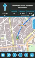 |
да | да | да | нет | nonfreeproprietary | nonfree3.99 € | EN | 2011-10-24 1.5.0.0 |
Navigator |
| maloo outdoor | да | нет | да | да | nonfreeproprietary | nonfree2.99$;2.99€ | EN | 2013-11-16 2.0.0.0 |
Outdoor App designed for hiking and other activities like biking or jogging. | |
| MapStalt Mini | 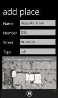 |
нет | нет | ? |
? |
nonfreeproprietary | nonfreefree as in beer | EN | 2011-08-01 1.0.0.0 |
"MapStalt puts to power to complete the map into the hands of the mobile user" (grammar by Microsoft) |
| More Maps |  |
да | да | ? |
нет | nonfreeproprietary | nonfree0.99 € | DE,EN | 2012-06-06 2.1.0.0 |
|
| Multi Map |  |
да | нет | нет | нет | nonfreeproprietary | free | EN | 2011-10-19 1.0 |
Very simple map viewer |
| NaviComputer |  |
да | нет | да | нет | nonfreeproprietary | free | 7 | 2010-11-24 0.95 |
|
| Offline Maps |  |
да | нет | ? |
? |
nonfreeproprietary | nonfree1.49 € | EN | 2011-06-23 1.3.0.0 |
|
| OpenBusMap |  |
да | нет | нет | нет | nonfreeproprietary | free | EN | 2012-04-10 1.1.0.0 |
Public Transport map viewer |
| OSM | .png.webp) |
да | ? |
? |
нет | nonfreeproprietary | free | EN | 2012-01-13 1.1.0.0 |
Map viewer |
| OSMLogger |  |
да | нет | да | нет | nonfreeproprietary | free | EN | 2012-04-07 0.9.0.0 |
Record GPX traces |
| OsmSharp | 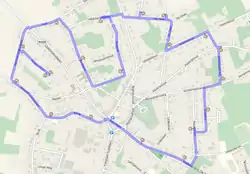 |
? |
? |
? |
? |
GPLv3 | free | EN | 2013-04-06 3.1 |
OSM routing and optimisation library. |
| QuoVadis Mobile |  |
да | да | да | да | nonfreeproprietary | nonfree19.99 € | DE; EN | 2014-02-27 1.0.3.3 |
QuoVadis Mobile ist Ihre "Alles-Inklusive-App", wenn es um Navigation, GPS und Karten geht. On- und Off-Road, zu Fuß, mit dem Fahrrad oder Auto, immer dabei und kinderleicht in der Bedienung. Tracking ermöglicht Live-Übertragung und Darstellung von Positionen. |
| Simple OSM |  |
да | да | да | да | nonfreeproprietary | nonfree1.99€ | EN | ? 2.13.0.0 |
OpenStreetMap for Windows Phone. Displays online maps, record tracks and provides several OSM unrelated features. |
| Vectorial Map | 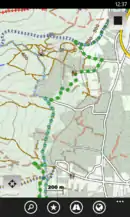 |
да | нет | да | нет | nonfreeproprietary | nonfreedepends on platform | EN | 2014-03-15 1.0 |
Vectorial Map is map viewer and track logger for Mapsforge offline vector maps (*.map) with support for custom XML styles like provided by OpenAndroMaps.org. It is based on a platform independent custom render engine. |
| Wisepilot |  |
да | да | нет | нет | nonfreeproprietary | nonfree€1.79 monthly | EN; DE; ES; FR; SV; and much more | 2014-04-03 5.0.2 |
online turn-by-turn navigation |
| xMaps |  |
да | да | ? |
нет | nonfreeproprietary | free | DE,EN | 2011-01-18 1.2 |
Very simple map viewer |
This table in the past was generated automatically by a bot. Learn more.
Возможности отображения карты
| Name | Shows map as vector | Shows map as bitmap | Stores map-data on-board | Stores map-data off-board (downloads from internet) | Rotate map | 3D view |
|---|---|---|---|---|---|---|
| GPS Navigator aSpass | нет | да | да | да | ? |
нет |
| maloo outdoor | нет | да | да | да | да | нет |
| More Maps | нет | да | да (cache) | да | ? |
? |
| Multi Map | нет | да | да (cache) | да | ? |
нет |
| NaviComputer | нет | да | да (cache) | да | нет | нет |
| Offline Maps | нет | нет | да | да | ? | ? |
| OpenBusMap | нет | да | нет | да | ? |
нет |
| OSM(Nonexistent) | нет | да | нет | да | ? |
нет |
| OSMLogger | нет | да | нет | да | ? |
нет |
| QuoVadis Mobile | нет | да | да | да | да | нет |
| Simple OSM | нет | да | нет (cache) | нет | нет | ? |
| Vectorial Map | да | да | да | да | нет | нет |
| Wisepilot | да | да | нет | да | да | да |
| xMaps | нет | да | да (cache) | да | ? |
да |
This table in the past was generated automatically by a bot. Learn more.
Возможности навигации
| Name | Navigate to point | Find location | Find nearby POIs | Navigate along predefined route | Create route manually | Calculate route | Calculate route without internet | Car routing | Bike routing | Foot routing | Turn restrictions | Navigation with voice | Keep on road | Works without GPS |
|---|---|---|---|---|---|---|---|---|---|---|---|---|---|---|
| GPS Navigator aSpass | да | да | да | ? |
? |
? |
? |
? |
? |
? |
да | да | ? |
нет |
| More Maps | да | ? |
? |
? |
? |
? |
? |
? |
? |
? |
? |
нет | ? |
нет |
| QuoVadis Mobile | да | да | да | да | ? |
да | да | да | да | да | да | да | да | yes;no |
| Simple OSM | да | да | да | ? |
? |
? |
? |
да | нет | да | да | нет | нет | нет |
| Wisepilot | да | да | да | ? |
? |
? |
? |
да | нет | да | да | да | ? |
нет |
| xMaps | да | ? |
? |
? |
? |
? |
? |
? |
? |
? |
? |
нет | ? |
нет |
This table in the past was generated automatically by a bot. Learn more.
Возможности создания треков
| Name | Customizable log interval | GPX format | KML format | NMEA format | All formats | Geo-tagged notes | Geo-tagged photos | Geo-tagged audio | Fast POI buttons |
|---|---|---|---|---|---|---|---|---|---|
| GPS Navigator aSpass | нет | ? |
? |
? |
? |
? |
? |
? |
? |
| maloo outdoor | да | да | нет | нет | gpx | ? |
? |
? |
нет |
| NaviComputer | ? |
да | нет | нет | gpx | ? |
? |
? |
? |
| OSMLogger | нет | ? |
? |
? |
? |
? |
? |
? |
? |
| QuoVadis Mobile | да | да | нет | нет | online-map;qmz;gpx | ? |
? |
? |
да |
| Simple OSM | да | да | нет | нет | gpx | ? |
? |
? |
нет |
| Vectorial Map | да | да | да | нет | jpg;png;gpx;kml;kmz | да | нет | нет | да |
This table in the past was generated automatically by a bot. Learn more.
Возможности мониторинга
| Name | Show current track | Open existing track | Altitude diagram | Show DOP value | Satellite view | Show live NMEA data | Send current position via SMS | Upload current position |
|---|---|---|---|---|---|---|---|---|
| maloo outdoor | да | да | да | да | нет | нет | нет | нет |
| QuoVadis Mobile | да | да | да | да | нет | нет | да | да |
| Simple OSM | да | да | нет | да | нет | нет | нет | да |
This table in the past was generated automatically by a bot. Learn more.
Возможности редактирования OpenStreetMap
| Name | Add POIs | Edit / Delete POIs | Edit arbitrary tags of existing OSM objects | Edit geometries | Support imagery offset DB | Upload to OSM |
|---|---|---|---|---|---|---|
| MapStalt Mini | ? |
? |
? |
? |
? |
? |
| Offline Maps | ? |
? |
? |
? |
? |
? |
This table in the past was generated automatically by a bot. Learn more.
Сбор данных
Ряд программ, доступных для сбора GPS-треков:
Бесплатные приложения/Open Source
Некоммерческие
Бесплатные
Коммерческие
- Simple OSM (simpleosm.net) GPX track logging
Использование данных OSM
Аудио лог
Port splitting
This article is issued from Openstreetmap. The text is licensed under Creative Commons - Attribution - Sharealike. Additional terms may apply for the media files.