Pt:Placas de sinalização no Brasil
Placas de Regulamentação
| Placa | Código | Português | Inglês | Etiquetas relacionadas |
|---|---|---|---|---|
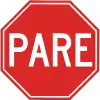 | Parada Obrigatória | Obligatory stop | highway=stop Relation:type=stop | |
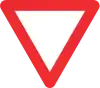 | Dê a Preferência | Yeld | highway=give_way Right of way | |
.svg.png.webp) | Velocidade Máxima Permitida | Maximum permited speed | maxspeed=* | |
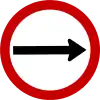 | Sentido Obrigatório | Obligatory direction | oneway=yes/-1 | |
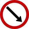 | Passagem Obrigatória | Obligatory passage | N/A | |
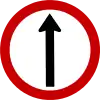 | Siga em Frente | Go straight on | Pt:Relation:restriction | |
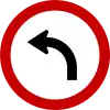 | Vire à Esquerda | Turn left | Pt:Relation:restriction | |
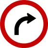 | Vire à Direita | Turn right | Pt:Relation:restriction | |
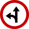 | Siga em Frente ou à Esquerda | Go straight or turn left | Pt:Relation:restriction | |
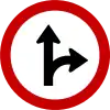 | Siga em Frente ou à Direita | Go straight or turn right | Pt:Relation:restriction | |
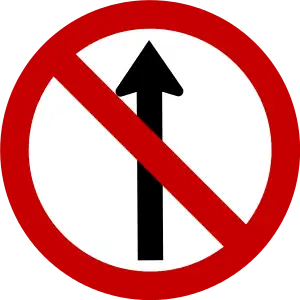 | Sentido Proibido | No straight on | Pt:Relation:restriction | |
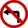 | Proibido virar à Esquerda | Forbidden to turn left | Pt:Relation:restriction | |
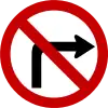 | Proibido virar à Direita | Forbidden to turn right | Pt:Relation:restriction | |
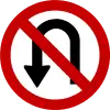 | Proibido Retornar | U-Turn forbidden | Pt:Relation:restriction | |
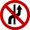 | Proibido mudar de Faixa de Trânsito | Forbidden to change lane | N/A | |
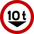 | Carga Máxima Permitida | Maximum permited weight | maxweight=* | |
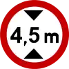 | Altura Máxima Permitida | Maximum permitted height | maxheight=* | |
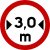 | Largura Máxima Permitida | Maximum permitted width | maxwidth=* | |
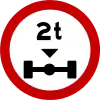 | Peso Máximo Permitido por Eixo | Maximum axle weight | maxaxleload=* | |
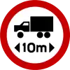 | Comprimento Máximo Permitido | Maximum length | maxlength=* | |
 | Estacionamento Regulamentado | Regulated parking | parking:lane=* amenity=parking | |
 | Alfândega | Custom Clearance/Border Control | barrier=border_control | |
 | Uso Obrigatório de Corrente | Obligatory use of chains | N/A | |
 | Conserve-se à Direita | Keep right | N/A | |
 | Veículos Lentos. Usem Faixa da Direita | Slow vehicles, use right lane | N/A | |
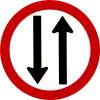 | Mão Dupla | oneway=no (já é implícito em todas as ruas) | ||
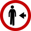 | Pedestre Ande pela Esquerda | Pedestrians to the left | N/A | |
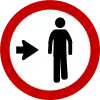 | Pedestre Ande pela Direita | Pedestrians to the right | N/A | |
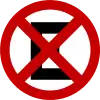
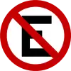 | Proibido Estacionar | No parking | parking:lane=no_parking | |
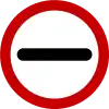
 | Proibido Parar e Estacionar | No Parking and No Stop | parking:lane=no_stopping | |
 | Proibido Ultrapassar | No overtaking | overtaking=no | |
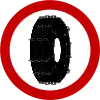
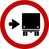
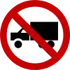 | Proibido Trânsito de Veículos de Carga | No HGV access | access=*
hgv=no | |
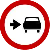
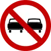
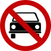 | Proibido Trânsito de Veículos Automotores | No car access | access=*
motorcar=no | |
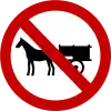 | Proibido Trânsito de Veículos de Tração Animal | No horse and carrige access | access=*
horse=no | |
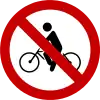 | Proibido Trânsito de Bicicletas | No cycle access | access=*
bicycle=no | |
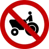 | Proibido Trânsito de Máquinas Agrícolas | No access for agriculture vehicles | access=*
agricultural=no | |
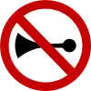 | Proibido Acionar Buzina ou Sinal Sonoro | No use of horn or sound signals | N/A | |
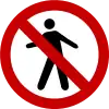 | Proibido Trânsito de Pedestres | No access for pedestrians | access=*
foot=no | |
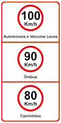 | Velocidade Máxima Permitida | Maximum speed for different vehicle types | maxspeed=100 | |
Placas de Advertência
| Placa | Código | Português | Inglês | Etiquetas relacionadas |
|---|---|---|---|---|
 | A-1a | Curva Acentuada à Esquerda | Sharp courve to left | N/A |
 | A-1b | Curva Acentuada à Direita | Sharp courve to right | N/A |
 | A-2a | Curva à Esquerda | left courve | N/A |
 | A-2b | Curva à Direita | right courve | N/A |
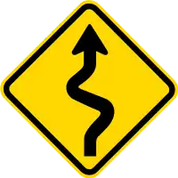
 | A-3a | Pista Sinuosa à Direita | courving road to right | N/A |
 | A-3b | Pista Sinuosa à Esquerda | courving road to left | N/A |
 | A-4a | Curva Acentuda em "S" à Esquerda | sharp "S" courve to left | N/A |
 | A-4b | Curva Acentuda em "S" à Direita | sharp "S" courve to right | N/A |
 | A-5a | Curva em "S" à Direita | "S" courve to right | N/A |
 | A-5b | Curva em "S" à Esquerda | "S" courve to left | N/A |
 | A-6a | Cruzamento de Vias | intersection with crossing road | N/A |
 | A-7a | Via Lateral à Direita | intersection with road to right | N/A |
 | A-7b | Via Lateral à Esquerda | intersection with road to left | N/A |
 | A-8 | Bifurcação em "T" | N/A | |
 | A-9 | Bifurcação em "Y" | N/A | |
 | A-10a | Entroncamento Oblíquo à Esquerda | N/A | |
 | A-10b | Entroncamento Oblíquo à Direita | N/A | |
 | A-11a | Junções Sucessivas Contrárias1ª à Direita | N/A | |
 | A-11b | Junções Sucessivas Contrárias1ª à Esquerda | N/A | |
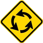 | A-12 | Interseção em Círculo | Roundabout | highway=mini_roundabout |
 | A-13a | Confluência à Direita | N/A | |
 | A-13b | Confluência à Esquerda | N/A | |
 | A-14 | Semáforo a Frente | Light signal ahead | highway=traffic_signals |
 | A-15 | Parada Obrigatória à Frente | Obligatory stop ahead | highway=stop |
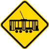 | A-16 | Bonde | Tram | highway=* + railway=tram |
 | A-17 | Pista Irregular | traffic_calming=* | |
 | A-18 | Saliência ou Lombada | Speed bump | traffic_calming=bump o traffic_calming=hump |
 | A-19 | Depressão | Dip | traffic_calming=dip |
 | A-20a | Declive Acentuado | Steep decline | incline=* |
 | A-20b | Aclive Acentuado | Steep incline | incline=* |
 | A-21a | Estreitamento de Pista ao Centro | narrow=* o traffic_calming=choker se o estreitamento é voluntária e destina-se a abrandar o tráfego. | |
 | A-21b | Estreitamento de Pista à Esquerda | narrow=* | |
 | A-21c | Estreitamento de Pista à Direita | narrow=* | |
 | A-22 | Ponte Estreita | highway=* bridge=yes width=* | |
 | A-23 | Ponte Móvel | highway=* bridge=moveable | |
 | A-24 | Obras | Work | (highway=construction/landuse=construction/construction=*) |
 | A-25 | Mão Dupla Adiante | N/A | |
| A-26a | Sentido Único | oneway=yes | ||
| A-26b | Sentido Duplo | N/A | ||
 | A-27 | Área com Desmoronamento | proposal | |
 | A-28 | Pista Escorregadia | proposal | |
 | A-29 | Projeção de Cascalho | proposal | |
 | A-30 | Ciclistas | Bicycles | proposal cycleway=* / highway=cycleway |
 | A-31 | Maquinaria Agrícola | Agricultural machines | proposal |
 | A-32a | Passagem de Pedestres | footway=* / highway=pedestrian / highway=path / highway=steps | |
 | A-33a | Área Escolar | proposal amenity=school / amenity=kindergarten | |
 | A-33b | Passagem Sinalizada de Escolares | proposal | |
 | A-34 | Crianças | Children | highway=living_street? |
 | A-35 | Cuidado Animais | proposal | |
 | A-36 | Animais Selvagens | proposal | |
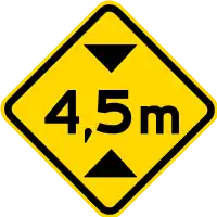 | A-37 | Altura Limitada | Limited height | |
 | A-38 | Largura Limitada | Limited width | width=* |
 | A-39 | Passagem de Nível sem Barreira | Railway Level Crossing without barrier | railway=level_crossing |
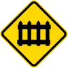 | A-40 | Passagem de Nível com Barreira | Railway Level Crossing with barrier | railway=level_crossing |
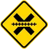
| A-41 | Cruz de Sto. André | N/A | ||
 | A-42a | Início de Pista Dupla | Start of dual carriageway | N/A |
 | A-42b | Fim de Pista Dupla | End of dual carriageway | N/A |
 | A-43 | Aeroporto | Airport | N/A |
 | A-44 | Vento Lateral | Lateral winds | proposal |
 | A-45 | Rua sem Saída | Road without exist | noexit=yes |
Placas de Serviços Auxiliares
| Placa | Português | Inglês | Etiquetas relacionadas |
|---|---|---|---|
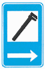 | Serviço Mecânico | Mecanic Workshop | shop=car_repair |
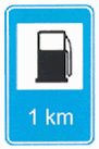 | Abastecimento | Fuel Station | amenity=fuel |
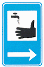 | Serviço Sanitário | Sanitary Services | amenity=toilets |
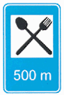 | Restaurante | amenity=restaurant | |
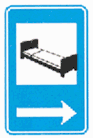 | Hotel | tourism=hotel | |
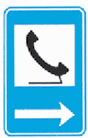 | Serviço Telefônico | Public Telephone | amenity=telephone |
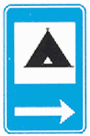 | Área de Campismo | Camp Site | tourism=camp_site |
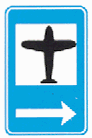 | Aeroporto | Airport | aeroway=aerodrome/aeroway=terminal |
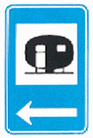 | Estacionamento de Trailer | Camp site for caravans | tourism=camp_site caravans=yes |
 | Área de Estacionamento | Parking | amenity=parking |
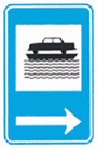 | Transporte sobre Água | Ferry | amenity=ferry_terminal / route=ferry |
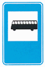 | Ponto de Parada | Bus stop | highway=bus_stop |
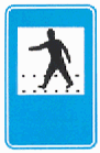 | Passagem protegida para Pedestres | Protected passage for pedestrians | footway=*/highway=pedestrian/highway=crossing |
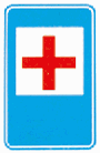 | Pronto Socorro | Emergency Room/Hospital | amenity=hospital |
Outro Placas
| Placa | Português | Inglês | Etiquetas relacionadas |
|---|---|---|---|
|
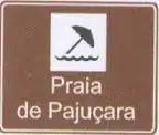
Placas de Identificação de Atrativo Turísti | Signs identifying Tourist Attractions | Por exemplo / For example: |
| Sinal de Indicação de Direção | Signs indicating directions | Relation:destination sign | |
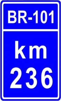 | Marcos Quilométricos | Kilometer Mark | Proposed features/Milestones |
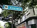 | Agência de correios | Post office | amenity=post_office |
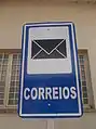 | Agência de correios | Post office | amenity=post_office |
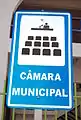 | Câmara Municipal | Town Hall | amenity=townhall |
Veja também
- Placas de sinalização no DNIT
 Sinalização rodoviária na Wikipédia
This article is issued from Openstreetmap. The text is licensed under Creative Commons - Attribution - Sharealike. Additional terms may apply for the media files.