Oklahoma
| V・T・E |
| latitude: 35.50, longitude: -98.5 |
| Browse map of Oklahoma 35°30′00.00″ N, 98°30′00.00″ W |
| Edit map |
 |
|
External links:
|
| Use this template for your city |
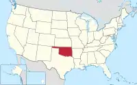
Oklahoma is a state in the United States at latitude 35°30′00.00″ North, longitude 98°30′00.00″ West.
Community
Get in touch with other Oklahoma mappers:
- Invite yourself to OSMUS Slack and join the #local-oklahoma channel.
- Subscribe to the nationwide talk-us mailing list.
Projects
- Reviewing road classification based on 2021 Highway Classification Guidance.
- Discussion ongoing at User:Dulahey/Oklahoma_Highway_Classification_Proposal
- Import Murray County roads - most of which were renamed for E911 purposes.
GIS/Road Data
Routes in Oklahoma
Interstate Highways
| Number | Relation | Status and notes |
|---|---|---|
| 35 Southbound | 2335784 | |
| 35 Northbound | 2335783 |
State Turnpikes
State turnpikes are not numbered, only named and use network=US:OK:Turnpike
| Name | Relation | Status and notes |
|---|---|---|
| Cherokee | 2255331 | Complete |
| Chickasaw | 2261344 | Complete |
State Highways
Currently, Oklahoma has 214 state highways. Routes with super relations have alternate routes or are non-contiguous. State highways in Oklahoma use network=US:OK
| Number | Relation | Status and notes |
|---|---|---|
| 1 | 2253246 | |
| 2 (Antlers - Warner) | 2253836 | |
| 2 (Vinita - Welch) | 2253879 | |
| 3 (Ada - Arkansas state line) | 2254167 | |
| 3 (Colorado state line - Shawnee) | 1671845 | |
| 3E | 2254081 | |
| 3W | 2254050 | |
| 4 (Central Oklahoma) | 2838398 | |
| 4 (Eastern Oklahoma) | 2840762 | |
| 5 (Western) | 2840802 | |
| 5A | 2845256 | |
| 5B | 2845257 | |
| 5C | 2845258 | |
| 6 | 2855448 | |
| 7 | 2860867 | |
| 7B | 2863164 | |
| 7D | 2863165 | |
| 7 Spur | 3234405 | |
| 8 | 2887865 | |
| 8A | 2887867 | |
| 8B | 2887866 | |
| 9 | 2888844 | |
| 9A (Earlsboro-Konawa) | 3234405 | |
| 9A (Canadian-Eufaula) | 3286535 | |
| 9A (Arkoma) | 3647625 | |
| 9 Business (Gotebo) | 2890912 | |
| 9 Business (Hobart) | 2889070 | |
| 10 | 3445472 | |
| 10A | 3647620 | |
| 10C | 3647722 | |
| 11 | 1535171 | |
| 11A | 1535171 | |
| 12 | 3647930 | Future state highway. |
| 14 | 3647991 | |
| 15 (Western) | 3222042 | |
| 15 (Eastern) | 3537459 | |
| 16 | 3149627 | |
| 17 | 3650855 | |
| 17A | 3193556 | |
| 18 | 3305337 | |
| 18A | 3652359 | |
| 18B | 3651350 | |
| 19 | 3221763 | |
| 19C | 3669802 | |
| 19D | 3669969 | |
| 20 | 3013705 | |
| 22 | 3221764 | |
| 23 | 3222044 | |
| 24 | 3670085 | |
| 25 (Eastern) | 3653449 | |
| 25 (Western) | 3653438 | |
| 26 | 3653381 | |
| 27 | 3653334 | |
| 28 | 3445473 | |
| 28A | 3652687 | |
| 29 | 3652386 | |
| 29A | 3652438 | |
| 30 | 3649890 | |
| 31 | 3221765 | |
| 31A | 3221766 | |
| 31B | 3649879 | |
| 32 | 3639051 | |
| 33 | 3193559 | |
| 33 Truck | 3672484 | |
| 34 | 3140334 | |
| 34A | 3632354 | |
| 34B | 3632355 | |
| 34C | 3632353 | |
| 48 | 3006413 | WIP, fixing known continuity problems. |
| 48A | 3006577 |
State Cycleways
Currently, Oklahoma has 1 state cycleway. Relations for state cycleways use network=rcn
| Number | Relation | Status and notes |
|---|---|---|
| 66 | 1421823 | Needs surveying in and around OKC and Tulsa to see how this route bypasses freeways, incomplete west of OKC. Route still subject to change. |
Local Routes
Localities with local routes should be listed here, routes in those localities should be listed on their respective pages.
This article is issued from Openstreetmap. The text is licensed under Creative Commons - Attribution - Sharealike. Additional terms may apply for the media files.