OSMnx
OSMnx is a Python tool for for analysing street networks. "Retrieve, model, analyze, and visualize street networks and other spatial data from OpenStreetMap."
github.com/gboeing/osmnx - Github repo gives the overview description, instructions, and downloads
Created by Geoff Boeing. See his blog post overview and academic publication about OSMnx.
Example renderings from OSMnx
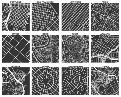
Urban form analysis produced using OSMnx. See more
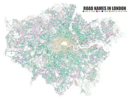
Road/Street/Drive/way names in London. See more
This article is issued from Openstreetmap. The text is licensed under Creative Commons - Attribution - Sharealike. Additional terms may apply for the media files.