National Byway
|
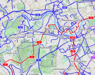
| CyclOSM A free cycle-oriented map with more features than OpenCycleMap. See its wiki page CyclOSM. |
| Waymarked Trails: Cycling by Sarah Hoffman is a layer superimposed over mapnik (Standard Map Layer) which shows marked cycle routes around the world. Updated minutely, it renders actual routes without the state=proposed tag. Therefore no proposed routes (or proposed numbering protocols) are displayed. |
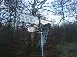
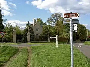
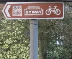
The National Byway (Wikipedia) is a signed, de facto leisure cycling route in the United Kingdom, mostly along quiet lanes and avoiding cities. As of April 2011, no Internet mapping of the National Byway was available, only an (as yet incomplete) set of paper maps. This is therefore a great opportunity for OpenStreetMap to provide such a map.
Tagging
The ways which make up the National Byway should be tagged using relations. Do not tag the ways directly.
There is one or more route relation for each region of the National Byway, and a separate relation for each signed loop. The size of each relation is currently restricted by what can reasonably be worked with - initially the National Byway was created a a single relation for the UK, but that soon became too large to manage.
Each route relation should be tagged as:
| Tag | Comment |
|---|---|
| type=route | |
| route=bicycle | |
| network=rcn | |
| ref=NB | Will display as a route label on the CycleMap. |
| name=National Byway (region) | Include the name of the National Byway region. |
| operator=National Byway |
Relation role
The National Byway is keen on loops and circular rides, and in many instances these are signed in one direction only, generally anti-clockwise to reduce the number of right turns in the loop. It's difficult to follow signs backwards, so it is important for cyclists that the one-way sections of the National Byway are tagged correctly. Where the National Byway is signed in one direction only, the ways in the relation should be assigned a role of forward or backward as described in Relation:route#Members. The direction is rendered on the OpenCycleMap at zoom level 14 and greater.
Other optional tags are listed at Cycle routes#Relations.
Historical note
An earlier proposal was to tag the National Byway as network=national_byway, in conjunction with specific rendering in the OpenCycleMap, which was never implemented. The current tagging as a set of regional cycle routes network=rcn is now preferred: see et seq. for the rationale.
Progress
One can see the 'outline map' at the National Byway website: .
Relation'd sections
Sections that have been mapped already include:
| Description (organised by National Byway region) | Relation | Notes |
|---|---|---|
| Ayrshire, Argyll and Bute | ||
| (none yet) | ||
| East of England | ||
| Cambridgeshire: South of Cambridge | 935883 | marked on the development diagram (on the N.B. site) as 'being signed' |
| Near Ely | 975860 | |
| East Midlands | ||
| Lincolnshire | 1425075 | very incomplete |
| Nottinghamshire | 1818743 | very incomplete |
| the Rutland area | 943883 | large sections have been completed, but certain locales need attending-to |
| North-East England | ||
| County Durham and Northumberland | 1205886 | |
| section around Kielder Forest | ||
| North-West England | ||
| (none yet) | ||
| South-East and South-Central England | ||
| Oxfordshire and Glos—Northleach to Witney Dornford Lane (near Woodstock) to Buckinghamshire border | 1251898 | |
| Buckinghamshire | 1251894 | |
| Bedfordshire | 1251895 | |
| South-West England | ||
Several disconnected sections:
|
1206000 | |
| South-West Scotland | ||
| the Solway Firth area | 943956 | |
| West Midlands | ||
| Shropshire | 943940 | relation'd between Attingham Park and the southern outskirts of Whitchurch |
| Shropshire: Shrewsbury to Leominster, then… — | 943913 | |
| Herefordshire: …towards (and slightly beyond) Ledbury — | 943894 | |
| West Herefordshire: route to Wales | 2553508 | Link route and the Herefordshire section of the Radnor Ring |
| Yorkshire | ||
| from Humber Bridge to the northern end of the Yorkshire region at Barnard Castle | 9327 | |
Loops
To tag National Byway loops, create a new relation with the tags as above, and use the name of the loop, e.g. name=National Byway (Oakham Loop); consult this page on the National Byway site for a list of loops. Remember that loops are usually signed in one direction only.
Loops that have already been fully/partially mapped are as follows:
| Loop (organised by National Byway region) | Relation | Notes |
|---|---|---|
| East Midlands | ||
| Retford Loop | ||
| Newark / Southwell Loop | 1425019 | |
| Grantham Loop | 2070390 | |
| Oakham Loop | 9333 | |
| Oundle Loop | ||
| North-East England | ||
| Hexham Loop | 2052657 | |
| South-East and South-Central England | ||
| Bernwood Forest Loop | 34610 | |
| South-West England | ||
| Charleton Horethorne(?) Loop | 1355711 | |
| Tisbury Loop | 1570469 | Perhaps some signs have been removed or turned round? The route is difficult to follow. |
| Winchester (East) Loop | 2947208 | complete |
| South-West Scotland | ||
| Dumfries Loop | ||
| Ayr Loop | ||
| Girvan Loop | ||
| West Midlands | ||
| Malpas Loop | ||
| Shrewsbury Loop | ||
| Much Wenlock Loop | ||
| Church Stretton Loop | 5522776 | |
| Ledbury Loop | 444340 | complete |
| Winchcombe Loop | ||
| Yorkshire | ||
| Holderness Loop | 47904 | There is a break in the loop where the road has been washed over a cliff but it is passable on foot. |
| Bridlington Loop | 225396 | |
| Driffield Loop | ||
| Malton Loop | 177547 | |
| Easingwold Loop | 158475 | |
| Ripon Loop | 179064 | Ripon is poorly mapped. |
| Bedale Loop | 179065 | |