NL:Key:natural
 |
| Omschrijving |
|---|
| Geeft informatie over de aard van natuurgebieden. |
| Groep: Natural |
| Gebruikt op deze elementen |
| Gedocumenteerde waarden: 88 |
| Status: de facto |
| Gereedschappen voor deze tag |
Met de sleutel natural worden natuurlijke elementen, bijv. landschappen of geologische eigenschappen omschreven. Voor gebieden die door de mens zijn gemaakt of bewerkt worden, zie landuse=*.
Voor algemene informatie over het classificeren/mappen van verschillende stukken land, zie Land use and areas of natural land.
Hier bevindt zich een pagina met expressieve voorbeelden.
Kernwaarden
Natuur
| Key | Waarde | Element | Omschrijving | Tag Usage[1] | Resultaat | Foto |
|---|---|---|---|---|---|---|
Vegetation | ||||||
| natural | fell | Hoog Grasland
Grasland in hooglanden in een bergachtige gebieden. Is alleen geschikt om extensief te laten begrazen. |
No, see #545. | 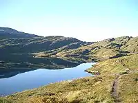 | ||
| natural | grassland | Grassen en kruidachtige planten
Natuurlijke gebieden waar de vegetatie wordt overheerst door grassen en kruidachtige (niet-houtige) planten. |
 |
 | ||
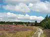
| natural | heath | Heide |  |
 | ||
| natural | moor | Don't use, see wikipage. Upland areas, characterised by low-growing vegetation on acidic soils. | currently not rendered by openstreetmap-carto | 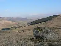 | ||
| natural | scrub | Ruig land | 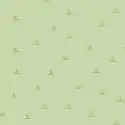 |
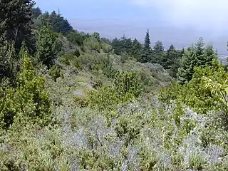 | ||
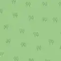
| natural | shrubbery | An area of shrubbery that is actively maintained or pruned by humans. A slightly wilder look is also possible | currently not rendered by openstreetmap-carto | 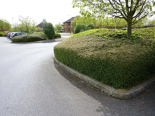 | ||
| natural | tree | Alleenstaande of belangrijke bomen | 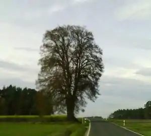 | |||
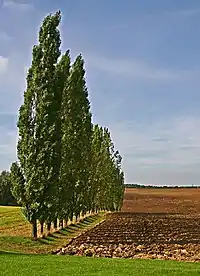
| natural | tree_row | Bomenrij |  |
 | ||
| natural | tree_stump | A tree stump, the remains of a cut down or broken tree. | 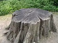 | |||
| natural | tundra | Habitat above tree line in alpine and subpolar regions, principally covered with uncultivated grass, low growing shrubs and mosses and sometimes grazed. | 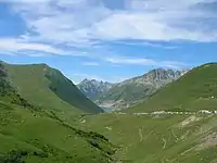 | |||
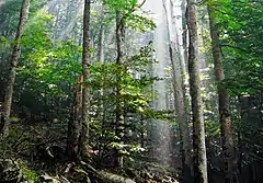
| natural | wood | Oerbos
Voor gewone bossen in bewoonde gebieden gebruik dan landuse=forest. |
 |
| ||
Water related | ||||||
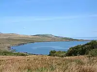
| natural | bay | Baai of golf |  |
 | ||
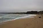
| natural | beach | Strand |  |
 | ||
| natural | blowhole | An opening to a sea cave which has grown landwards resulting in blasts of water from the opening due to the wave action | 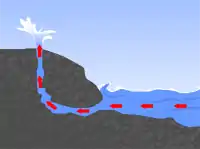 | |||
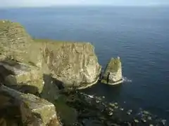
| natural | cape | A piece of elevated land sticking out into the sea or large lake. Includes capes, heads, headlands and (water) promontories. | 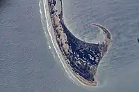 | |||
| natural | coastline | Kustlijn |  |
 | ||
| natural | crevasse | A large crack in a glacier | 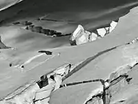 | |||
| natural | geyser | A spring characterized by intermittent discharge of water ejected turbulently and accompanied by steam. | 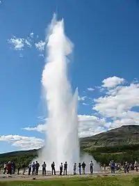 | |||
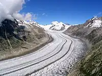
| natural | glacier | IJsgletsjer |  |
 | ||
| natural | hot_spring | A spring of geothermally heated groundwater | 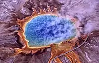 | |||
| natural | isthmus | A narrow strip of land, bordered by water on both sides and connecting two larger land masses. | 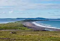 | |||
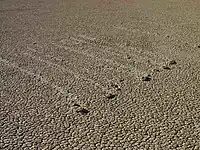
| natural | mud | Slikgronden |  |
 | ||
| natural | peninsula | Schiereiland - Zie ook place=peninsula | ||||
| natural | reef | A feature (rock, sandbar, coral, etc) lying beneath the surface of the water | 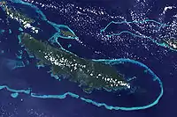 | |||
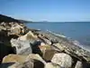
| natural | shingle | An accumulation of rounded rock fragments on a beach or riverbed |  |
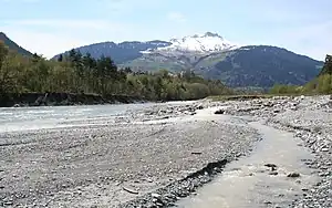 | ||
| natural | shoal | An area of the sea floor near the sea surface (literally, becomes shallow) and exposed at low tide. See natural=sand as well. | |
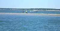 | ||
| natural | spring | Bron van een beek of rivier | 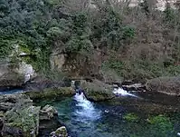 | |||
| natural | strait | A narrow area of water surrounded by land on two sides and by water on two other sides. | 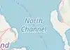 |
.jpg.webp) | ||
| natural | water | Water - Meren, vijvers enz. |  |
 | ||
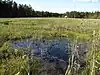
| natural | wetland | Moerassen en waterrijke gebieden
Aanvullen met wetland=*, zoals bijvoorbeeld wetland=bog voor veengebieden. |
 |
 | ||
Geology related | ||||||
| natural | arch | A rock arch naturally formed by erosion, with an opening underneath. | currently not rendered by openstreetmap-carto | 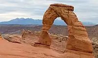 | ||
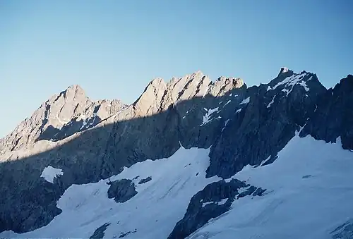
| natural | arete | An arête, a thin, almost knife-like, ridge of rock which is typically formed when two glaciers erode parallel U-shaped valleys. |  |
 | ||
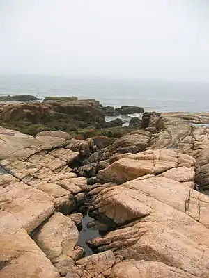
| natural | bare_rock | An area with sparse/no soil or vegetation, so that the bedrock becomes visible. |  |
 | ||
| natural | cave_entrance | Grotingang | 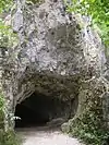 | |||
| natural | cliff | Klif |  |
 | ||
| natural | dune | A hill of sand formed by wind, covered with no or very little vegetation. See also natural=sand and natural=beach | currently not rendered by openstreetmap-carto | 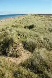 | ||
| natural | earth_bank | Large erosion gully or steep earth bank | _1.jpg.webp) | |||
| natural | fumarole | A fumarole is an opening in a planet's crust, which emits steam and gases | .jpg.webp) | |||
| natural | gully | Small scale cut in relief created by water erosion | 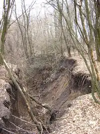 | |||
| natural | hill | Heuvel | currently not rendered by openstreetmap-carto | 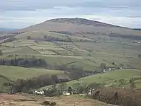 | ||
| natural | peak | Berg- of heuveltop | 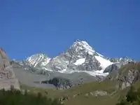 | |||
| natural | ridge | A mountain or hill linear landform with a continuous elevated crest |  |
 | ||
| natural | rock | A notable rock or group of rocks attached to the underlying bedrock. | currently not rendered by openstreetmap-carto | 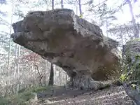 | ||
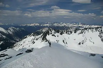
| natural | saddle | The lowest point along a ridge or between two mountain tops | 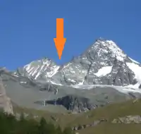 | |||
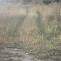
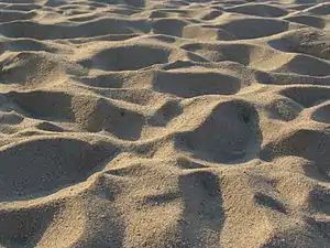
| natural | sand | Zandvlakte
Zandgebieden mogen spaarzaam wat vegetatie bevatten, bv Grassen of Vliegdennen. |
 |
 | ||
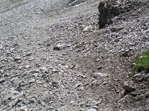
| natural | scree | Steenvlakte
Vlakte van kleinere stenen en rotsblokken. Wordt ook wel een steengletsjer genoemd. |
|
 | ||
| natural | sinkhole | A natural depression or hole in the surface topography. | currently not rendered by openstreetmap-carto | 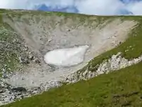 | ||
| natural | stone | Alleenstaande grote steen of rotsblok | currently not rendered by openstreetmap-carto | 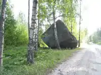 | ||
| natural | valley | Vallei | currently not rendered by openstreetmap-carto | 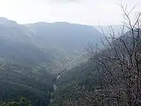 | ||
| natural | volcano | Vulkaan | 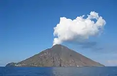 | |||
| natural | user defined | Zie ook Taginfo] voor meer informatie. | ||||
This table is a wiki template with a default description in English. Editable here.
Mogelijke vergissingen
- ↑ Does not include uses in semi-colon value separated lists