Key:golf
 |
| Description |
|---|
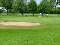
| To map the details on a golf course |
| Group: Sports |
| Used on these elements |
| Documented values: 13 |
| Status: de facto |
| Tools for this tag |
|
With this tag you can map details on a leisure=golf_course.
Possible values
| Type | Value | Description |
|---|---|---|
| golf=tee | Area where play begins on a golf hole: teeing ground | |
| golf=hole | The shortest "line of play" from the tee area to the pin/hole on the green | |
| golf=pin | The pin of a golf course: the hole in the ground on the green | |
| golf=green | The area of short grass on smooth ground surrounding the last yards/meters to the pin/hole, short for the 'putting green' | |
| golf=bunker | A bunker: a depression near the green or fairway that is usually filled with sand. Also called sandtrap or sandpit. | |
| golf=fairway | The fairway: an area between the tee box and the putting green where the grass is cut even and short. | |
| golf=rough | The rough: the area on the left and right of the fairway or green and the out-of-bounds markers, where the grass there is cut higher and is often coarser. | |
| golf=water_hazard | A water hazard, usually marked by yellow stakes or lines. | |
| golf=lateral_water_hazard | A lateral water hazard, usually marked by red stakes or lines. | |
| golf=driving_range | Driving range: an area where golfers can practice their golf swing | |
| golf=clubhouse | The main building where golfers check in and pay, usually including a "Pro shop" and food and drink services. | |
| golf=cartpath | It is likely that standard tags highway=path, highway=service, golf_cart=designated should be used instead. | |
| golf=path | Walking paths common in links style golf. It is likely that standard tags highway=path and highway=footway should be used instead. |
This article is issued from Openstreetmap. The text is licensed under Creative Commons - Attribution - Sharealike. Additional terms may apply for the media files.