JA:Key:natural
 |
| 説明 |
|---|
| 物理的な自然の地形の特徴を記述するために使用します。人間が手を加えたものも含みます。 |
| グループ: 自然 |
| 適用できる要素 |
| 状態:承認 |
| ツール |
使用方法
- 自然も参照
Geological やJA:土地表面の地物の一部を記述するために使用します。
値
| キー | 値 | 要素 | 説明 | Tag Usage[1] | レンダリング | 写真 |
|---|---|---|---|---|---|---|
植生や地面に関するもの | ||||||
| natural | fell | 森林限界を超えた山地や亜寒帯の植生で、主に自生した草、低木、苔などに覆われており、放牧が行われていることもあります。 | No, see #545. | 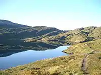 | ||
| natural | grassland | 草地。イネ科やその他の(樹木以外の)草で占められている地帯。観賞用植物(landuse=grassを参照)や、飼料用の干し草(landuse=meadowを参照)などを除く。 |  |
 | ||
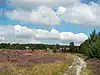
| natural | heath | ヒース。低木の茂った荒野。木がほとんどない茂みか裸の土地で未耕作地。 これは「ヒース」という名前を含む公園のためのタグではありません。 |
 |
 | ||
| natural | moor | 湿原。高原にある地帯で、酸性の土壌に成長の遅い植生が特徴です。 | 現在は Mapnik ではレンダリングされません | 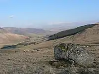 | ||
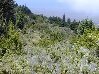
| natural | scrub | 低木林。灌木や低木に覆われた耕作されていない土地です。 |  |
 | ||
| natural | shrubbery | An area of shrubbery that is actively maintained or pruned by humans. A slightly wilder look is also possible | currently not rendered by openstreetmap-carto | 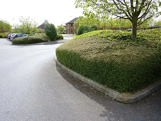 | ||
| natural | tree | 孤立しているか目印になる木。 | 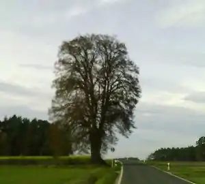 | |||
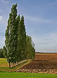
| natural | tree_row | 並木、街路樹。 |  |
 | ||
| natural | tree_stump | A tree stump, the remains of a cut down or broken tree. | 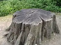 | |||
| natural | tundra | Habitat above tree line in alpine and subpolar regions, principally covered with uncultivated grass, low growing shrubs and mosses and sometimes grazed. | 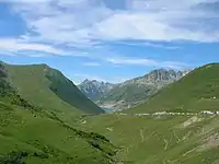 | |||
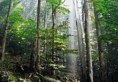
| natural | wood | 林業が積極的に営まれていない森林です。landuse=forestも参照してください。詳細を記述するために、leaf_type=*が使われることもあります。 |  |
| ||
水域に関するもの | ||||||
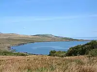
| natural | bay | 湾。広い水域が部分的に陸地に囲まれていますが、広い開口部があります。(他の言語) |  |
 | ||
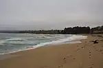
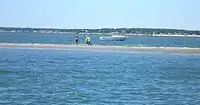
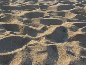
| natural | beach | 砂浜。水に接した砂、砂利、小石などからなる平らな地帯。(他の言語) |  |
 | ||
| natural | blowhole | An opening to a sea cave which has grown landwards resulting in blasts of water from the opening due to the wave action | 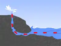 | |||
| natural | cape | A piece of elevated land sticking out into the sea or large lake. Includes capes, heads, headlands and (water) promontories. | 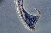 | |||
| natural | coastline | 海岸線。朔望平均満潮位における海と陸地の境界線です(ウェイの右側が水域です)。 | 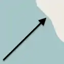 |
 | ||
| natural | crevasse | A large crack in a glacier | 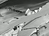 | |||
| natural | geyser | 間欠泉。間隔をおいて激しい水が噴出し、一緒に水蒸気が噴出することが特徴の泉です。 | 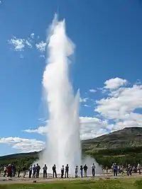 | |||
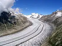
| natural | glacier | 氷河・氷床。年を通して氷でおおわれている地帯(またはそのような頂上)。 |  |
 | ||
| natural | hot_spring | 温泉。地熱で熱せられた地下水が地殻から湧き出すことで作られる泉です。(訳注: 温浴施設としての温泉には amenity=public_bath を使用してください。) | 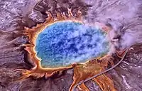 | |||
| natural | isthmus | A narrow strip of land, bordered by water on both sides and connecting two larger land masses. | 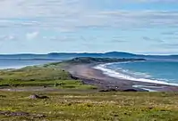 | |||
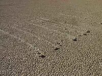
| natural | mud | 泥地。(他の言語)。明文化されていないタグです。natural=wetland + wetland=mudの方が適切かもしれません。 |  |
 | ||
| natural | peninsula | A piece of land projecting into water from a larger land mass, nearly surrounded by water | ||||
| natural | reef | A feature (rock, sandbar, coral, etc) lying beneath the surface of the water | 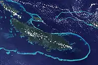 | |||
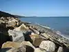
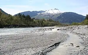
| natural | shingle | 水で削られた石が堆積したところで、ふつうは小石や砂利ですが、もっと大きい場合もあります。 |  |
 | ||
| natural | shoal | An area of the sea floor near the sea surface (literally, becomes shallow) and exposed at low tide. See natural=sand as well. | |
 | ||
| natural | spring | 泉。地面から自然に水が沸いてくる場所です。((hydrology, land) (3596) 他の言語) | 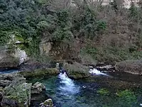 | |||
| natural | strait | A narrow area of water surrounded by land on two sides and by water on two other sides. | 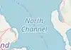 |
.jpg.webp) | ||
| natural | water | 湖などの水域です。 |  |
 | ||
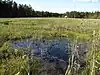
| natural | wetland | 水浸しの地域。潟など( |
 |
 | ||
地形に関するもの | ||||||
| natural | arch | A rock arch naturally formed by erosion, with an opening underneath. | currently not rendered by openstreetmap-carto | 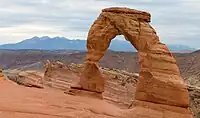 | ||
| natural | arete | アレート、痩せ尾根。2つの氷河が平行するU型の谷を侵食するときに形成される、岩の鋭い(ナイフ状の)尾根。 | 現在は Mapnik ではレンダリングされません | 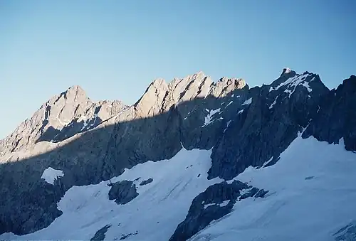 | ||
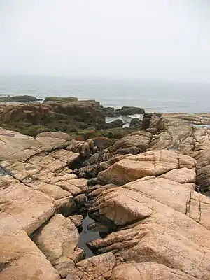
| natural | bare_rock | 岩肌。草木がまばらもしくは無く、岩盤が露出しています。 |  |
 | ||
| natural | cave_entrance | 洞窟の入り口です。 | 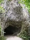 | |||
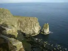
| natural | cliff | 崖。垂直か、垂直に近いもので、岩が露出しています(ウェイの右側が崖下です)。 |  |
 | ||
| natural | dune | A hill of sand formed by wind, covered with no or very little vegetation. See also natural=sand and natural=beach | currently not rendered by openstreetmap-carto | 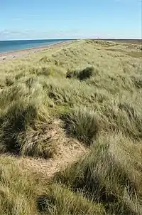 | ||
| natural | earth_bank | Large erosion gully or steep earth bank | _1.jpg.webp) | |||
| natural | fumarole | A fumarole is an opening in a planet's crust, which emits steam and gases | .jpg.webp) | |||
| natural | gully | Small scale cut in relief created by water erosion | 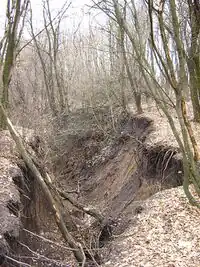 | |||
| natural | hill | A hill. | currently not rendered by openstreetmap-carto | 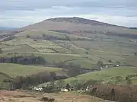 | ||
| natural | peak | 山や丘の頂上。 | 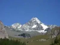 | |||
| natural | ridge | 尾根です。 | 現在は Mapnik ではレンダリングされません | 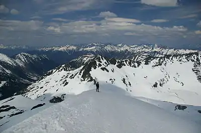 | ||
| natural | rock | 岩場や岩礁。移動の目印になったり、潜在的な危険を知らせたりすることができるように提案されています。 | 現在は Mapnik ではレンダリングされません | 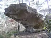 | ||
| natural | saddle | 鞍部。尾根上や2つの山頂間で最も低い地点です。 | 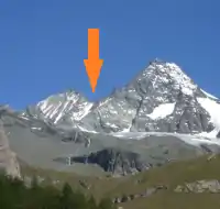 | |||
| natural | sand | ほとんど砂(ケイ石の粒子)に覆われていて、草木がないかほとんどない土地。natural=beachも参照してください。 |  |
 | ||
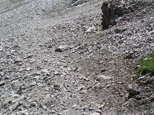
| natural | scree | がれ場。隣接する岩肌から、落石や風化によってはがれた角ばった岩が転がっている場所です。 | |
 | ||
| natural | sinkhole | 窪地。地表にある天然のくぼみや穴。 | 現在は Mapnik ではレンダリングされません | 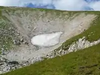 | ||
| natural | stone | (迷子石のような)独立している石。 | 現在は Mapnik ではレンダリングされません | 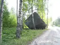 | ||
| natural | valley | 谷です。 | 現在は Mapnik ではレンダリングされません | 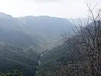 | ||
| natural | volcano | 火山。活火山か休火山に関わらず火山の火口。 | 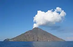 | |||
| natural | user defined | Taginfo でよく使われている値を確認できます。 | ||||
This table is a wiki template with a default description in English. Editable here. 日本語訳の編集はこちら。
- ↑ Does not include uses in semi-colon value separated lists
This article is issued from Openstreetmap. The text is licensed under Creative Commons - Attribution - Sharealike. Additional terms may apply for the media files.