Fi:Kartan ominaisuudet
Tämä sivu on käännetty englanninkielisestä listasta ja sivun käännös on lähes valmis. Suuri osa sivun linkeistä johtaa yhä englanninkielisille sivuille. Voit osallistua suomentamiseen.
OpenStreetMapin kartalle lisättävillä ominaisuustiedoilla (tageilla, englanniksi tag) ei ole mitään sisältörajoituksia. Ominaisuustiedot liittyvät pisteisiin (node), viivoihin (way) tai alueisiin (area). Voit käyttää mitä tahansa sopivalta tuntuvaa ominaisuustietoa. On kuitenkin suotavaa hyödyntää pääasiassa tiettyjä yhteisesti sovittuja merkkaustapoja, jotta kartasta tulee globaalisti yhtenäisen näköinen ja siten helpommin tulkittava. Tämä sivu sisältää olennaisimmat suositellut ominaisuudet ja vastaavat ominaisuustiedot.
Jos et löydä tarvittavan tiedon lisäämiseen soveltuvaa ominaisuustietoa, niin katso ehdotettuja ominaisuuksia tai teiden ja pisteiden ryhmittelyyn korkeamman tason komponenteiksi katso Relations. Edellä mainituilta sivuilta näet mitä ominaisuuksia tulevaisuudessa voidaan lisätä tai voit ehdottaa omaa. Voit myös osallistumalla keskusteluun ja äänestämällä vaikuttaa ehdotettujen ominaisuuksien hyväksymiseen tälle listalle. Jos käytät tämän listan ulkopuolisia tietoja tai arvoja, on suositeltavaa lisätä niitä kuvaava sivu tähän wikiin jotta muut voivat tulkita syöttämiäsi tietoja vaikka merkkausta ei olisi vielä hyväksytty tälle listalle.
- Jos tarvitset apua termien ymmärtämiseen piste/viiva/alue (Node/Way/Area), katso Elements.
- Jotkut kartoitusominaisuudet on selitetty yksityiskohtaisesti, katso Feature Index.
- Voit ehdottaa karttamerkkejä tässä mainituille ominaisuuksille Proposed Icons -sivulla.
- Joitain aiemmin käytettyjä arvoja ei enää suositella käytettäväksi: Deprecated features (toistaiseksi englanniksi).
- Kannattaa lukea myös suositelluista merkkaustavoista, mm. risteysten, siltojen ja alueiden sekä mutkien piirtämisestä sivulta Normit ja käytännöt. Tärkeimpinä ohjeina:
- Piirrä asiat kuten ne maastossa ovat äläkä niin, että kohteet näyttäisivät kartalla haluamaltasi.
- Jos piirtämäsi tiet risteävät, varmista, että risteyksessä niillä on yhteinen piste.
- Jos tie on suora luonnossa, sen tulisi olla suora kartalla.
- Katuosoitteiden numeroiden (talonumerot, katuosoitteet) merkkaamisesta on oma sivunsa.
Merkkausten piirtymisestä kartalle:
- Tällä sivulla mainitut arvot näkyvät muita arvoja todennäköisemmin kartalla. Takeita arvon näkymisestä ei voida minkään karttaa piirtävän ohjelman osalta antaa.
- Myös moni muukin arvo kuin tällä sivulla mainitut voidaan piirtää kartalle. Ohjelmia myös kehitetään jatkuvasti ja piirrettävien arvojen joukko kasvaa ajoittain.
Ominaisuustiedot ja arvot on luokiteltu alla yhteyden mukaan ja järjestetty arvioituun esiintymistiheysjärjestykseen.
Fyysiset
Tiet / highway
Teiden luokittelusta Suomessa, sekä taajamissa että niiden ulkopuolella, on joitain tarkempia ohjeita sivulla Fi:WikiProject_Finland/Piirto-ohjeet
| Avain | Arvo | Elementti | Kommentti | Esitystapa | Valokuva | |
|---|---|---|---|---|---|---|
Tiet ja kadut | ||||||
|
These are the principal tags for the road network. They range from the most to least important. | ||||||
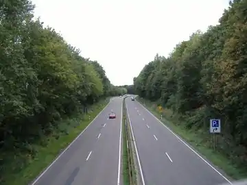
| highway | motorway | Moottoritie. |  |
|||
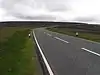
| highway | trunk | Valtatie/moottoriliikennetie. Tienumerot 1-39. Kylttien mukaisille moottoriliikenneteille sopii myös motorroad=yes. |  |
| ||
| highway | primary | Kantatie. Tienumerot 40-99 |  |
| ||
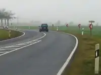
| highway | secondary | Seututie. Tienumerot 100-999 |  |
| ||
| highway | tertiary | Yhdystie (tai entinen paikallistie). Tienumerot 1000-19999 |  |
| ||
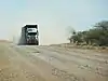
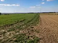
| highway | unclassified | Numeroimaton yleinen tie tai yksityistie. Pienille teille katso kohtaa highway=track. |  |
| ||
| highway | residential | Asuinalueiden tiet. Katso myös WikiProject_Finland#Within_urban_areas teiden luokittelusta taajamissa. |  |
| ||
Liittymät | ||||||
| highway | motorway_link | Moottoritien liittymäramppi. Yksisuuntaisia |  |
 A5 exit link to A672, Darmstadt, Germany | ||
| highway | trunk_link | Valtatien liittymäramppi |  |
 A7 / OAL23 interchange, Nesselwang, Germany | ||
| highway | primary_link | Kantatien liittymäramppi |  |
_-_geo-en.hlipp.de_-_11914.jpg.webp) B20 exit and entrance to Brunn, Fridolfing, Germany | ||
| highway | secondary_link | Seututien liittymäramppi |  |
 | ||
| highway | tertiary_link | Yhdystien liittymäramppi |  |
|||
Special road types | ||||||
| highway | living_street | Pihakatu: läpiajo kielletty, pysäköinti sallittu vain merkatuilla paikoilla, nopeusrajoitus 20 km/h ellei muuta mainita ja autoilla aina väistämisvelvollisuus. Vain saman nimisellä liikennemerkillä merkatuille kaduille. |  |
 beginning of a living street with a paving stones surface and some trees and cars parking at the sides | ||
| highway | service | Erityisesti autoille tarkoitettuja väyliä, esim. yksittäisille asuinrakennuksille vievät tiet, pysäköintialueiden väylät, huoltotiet lastauslaitureille. Katso mahdolliset lisämääreet kohdasta service=* |  |
 | ||
| highway | pedestrian | Kävelykatu |  |
 | ||
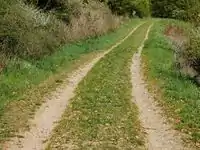
| highway | track | Mökkitie/metsätie - ainakin jollain autolla ajettavissa. |  |
|||
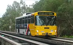
| highway | bus_guideway | Erityinen bussien akseli/raideleveyteen sovitettu väylä, jolla kapeammat henkilöautot eivät pysty ajamaan. Ei käytössä Suomessa. |  |
 | ||
| highway | escape | For runaway truck ramps, runaway truck lanes, emergency escape ramps, or truck arrester beds. It enables vehicles with braking failure to safely stop. | 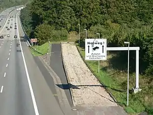 | |||
| highway | raceway | Moottorirata |  |
 | ||
| highway | road | Tuntematon tie. Tarkoitettu merkitsemään väliaikaisesti sellaisia teitä, joiden sijainti on tiedossa mutta luokitus tuntematon. |  |
 | ||
| highway | busway | A dedicated roadway for bus rapid transit systems |  grade-seperated section of busway outside of station | |||
Kevyen liikenteen väylät ja muut kulkuväylät | ||||||
| highway | footway | Jalkakäytävä (vain jalankulkijoille sallittu). Taajamien ulkopuolella myös jalankulkuun erityisesti tarkoitettu väylä. Luontopolku jne. |  |
 | ||
| highway | bridleway | Ratsastustie. Suomessa yleensä muilta tienkäyttäjiltä kielletty (jos alussa pelkkä liikennemerkki ratsastustie ), jolloin lisätään foot=no ja bicycle=no, koska "bridleway" nimenomaisesti sallii jalankulun ja pyöräilyn. |  |
 | ||
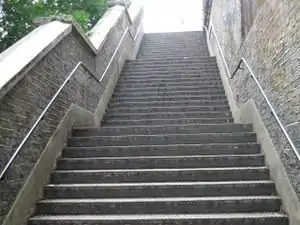
| highway | steps | Portaikko / portaat |  |
 | ||
| highway | corridor | For a hallway inside of a building. | 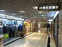 | |||
| highway | path | Polku. Määrittelemättömään tai useamman kulkumuodon käyttöön osoitettu väylä. Ensisijainen tai -sijaiset kulkumuodot merkitään foot=designated (esimerkkinä jalankulku) ja lisäksi niillä kulkumuodoilla, joilla sallittua ja mahdollista tyylillä bicycle=yes (esimerkkinä pyöräily). |  |
 | ||
| highway | via_ferrata | A via ferrata is a route equipped with fixed cables, stemples, ladders, and bridges in order to increase ease and security for climbers. These via ferrata require equipment : climbing harness, shock absorber and two short lengths of rope, but do not require a long rope as for climbing. | not rendered in OSM-Carto |  | ||
When sidewalk/crosswalk is tagged as a separate way | ||||||
| footway | sidewalk | Sidewalk that runs typically along residential road. Use in combination with highway=footway or highway=path | |
 | ||
| footway | crossing | Suojatie | |
 | ||
When sidewalk (or pavement) is tagged on the main roadway (see Sidewalks) | ||||||
| sidewalk | both | left | right | no | Specifies that the highways has sidewalks on both sides, on one side or no sidewalk at all |  | |||
When cycleway is drawn as its own way (see Bicycle) | ||||||
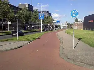
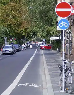
| highway | cycleway | Pyörätie tai yhdistetty pyörätie ja jalkakäytävä, jolloin käytetään lisäksi tagia foot=designated. | 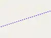 |
 Separated cycleway with traffic sign | ||
Cycleway tagged on the main roadway or lane (see Bicycle) | ||||||
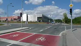
| cycleway | lane | Erillinen pyöräkaista ajoradan vieressä. | 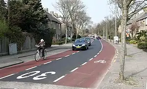 | |||
| cycleway | opposite | Käytetään pyöräkaistojen merkitsemiseen yksisuuntaisilla teillä, joilla pyöräily on sallittu molempiin suuntiin (ainoastaan maissa, joissa se on lainsäädännön osalta mahdollista). | 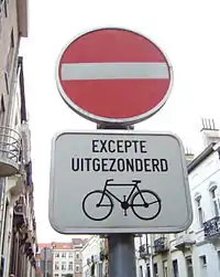 | |||
| cycleway | opposite_lane | Used on ways with oneway=yes that have a cycling lane going the opposite direction of normal traffic flow (a "contraflow" lane). Used together with oneway:bicycle=no. | 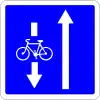 | |||
| cycleway | track | A track provides a route that is separated from traffic. In the United States, this term is often used to refer to bike lanes that are separated from lanes for cars by pavement buffers, bollards, parking lanes, and curbs. Note that a cycle track may alternatively be drawn as a separate way next to the road which is tagged as highway=cycleway. | 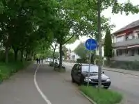 | |||
| cycleway | opposite_track | Used on ways with oneway=yes that have a cycling track going the opposite direction of normal traffic flow. Used together with oneway:bicycle=no. |  | |||
| cycleway | share_busway | There is a bus lane that cyclists are permitted to use. | 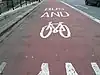 | |||
| cycleway | opposite_share_busway | Used on ways with oneway=yes that have a bus lane that cyclists are also permitted to use, and which go in the opposite direction to normal traffic flow (a "contraflow" bus lane). Used together with oneway:bicycle=no. | 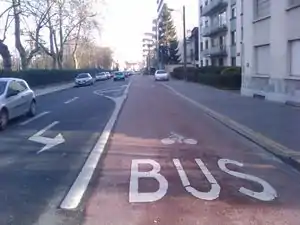 | |||
| cycleway | shared_lane | Cyclists share a lane with motor vehicles, but there are markings indicating that they should share the lane with motorists. In some places these markings are known as "sharrows" ('sharing arrows') and this is the tag to use for those. | 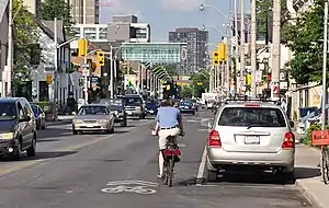 | |||
| busway | lane | Bus lane on both sides of the road. (See also: Parallel scheme for bus/psv lane tagging lanes:bus=* / lanes:psv=*) | | |||
Street parking tagged on the main roadway (see Street parking) | ||||||
| parking :left / :right / :both (hereafter: parking:side) |
lane | street_side | on_kerb | half_on_kerb | shoulder | no | separate | yes | Erillinen pyöräkaista ajoradan vieressä. |  | |||
| parking:sideorientation=* | parallel | diagonal | perpendicular | Erillinen pyöräkaista ajoradan vieressä. | ||||
Lifecycle (see also lifecycle prefixes) | ||||||
| highway | proposed | Teille, jotka ovat suunnitteilla. Käytä yhdessä proposed=*:in kanssa kertomaan tien tyyppi. | ||||
| highway | construction | Teille, jotka ovat rakenteilla. Käytä yhdessä construction=*:in kanssa kertomaan millaista tietä rakennetaan. |  |
 | ||
Attributes | ||||||
| abutters | commercial | industrial | mixed | residential | retail etc. | See Key:abutters for more details. |  | |||
| bicycle_road | yes | A bicycle road is a road designated for bicycles. If residential streets get the status of bicycle roads, normally, by special signs, motor traffic is admitted with limited speed, often only for residents. |  | |||
| bus_bay | both | left | right | A bus bay outside the main carriageway for boarding/alighting |  | |||
| change | yes | no | not_right | not_left | only_right | only_left | Specify the allowed/forbidden lane changes | .jpg.webp) | |||
| destination | <place name of destination> | Destination when following a linear feature | .svg.png.webp) | |||
| embankment | yes | dyke | A dyke or a raised bank to carry a road, railway, or canal across a low-lying or wet area. | 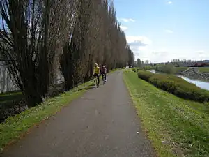 | |||
| embedded_rails | yes | <type of railway> | A highway on which non-railway traffic is also allowed has railway tracks embedded in it but the rails are mapped as separate ways. | _heading_NW.jpg.webp) | |||
| ford | yes | Kahluupaikka, kohta jossa tie ylittää hyvin matalan joen tai muun veden ilman siltaa. |  | |||
| ice_road | yes | Ainoastaan talvisin käytössä oleva jäätie. | 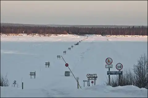 | |||
| incline | Number % | ° | up | down | Jyrkkä mäki, voi hidastaa pyöräilijöiden ja raskaiden ajoneuvojen nopeuksia. Huomaa että tämä koskee solmuja, ehdotus tagin käyttämisestä teille hylättiin. | 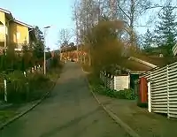 | |||
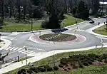
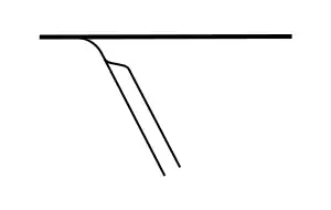
| junction | roundabout | Kiertoliittymä eli/tai liikenneympyrä. Tie pitää piirtää liikenteen kiertosuunnan suuntaisesti, tämä tagi sisältää tiedon oneway=yes. Huomaa että tämä arvo annetaan liikenneympyrän muodostavalle tielle. Tämä tie täytyy merkata myös tagilla highway=*, jossa highway-tagin arvoksi asetataan yleensä sama kuin on ympyrään saapuvista teistä korkeimman luokituksen saaneella tiellä. Tien solmuille ei kiertoliittymän takia tarvita tageja. Pienimmät kiertoliittymät ilman keskikoroketta voi merkata teiden risteyssolmulle annetulla arvolla highway=mini_roundabout, katso siitä ohjeita ylempää. | 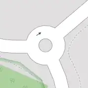 |
 | ||
| lanes | <number> | Ajokaistojen lukumäärä. | 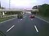 | |||
| lit | yes | no | Tievalaistus. Yksittäiset valaisinpylväät merkitään highway=street_lamp-tagilla. |  | |||
| maxspeed | <number> | Specifies the maximum legal speed limit on a road, railway or waterway. | 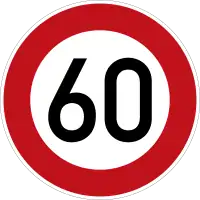 | |||
| motorroad | yes | no | Moottoriliikennetie | 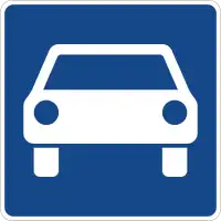 | |||
| mountain_pass | yes | The highest point of a mountain pass. |  | |||
| mtb:scale | 0-6 | Applies to highway=path and highway=track. A classification scheme for mtb trails (few inclination and downhill). |  | |||
| mtb:scale :uphill | 0-5 | A classification scheme for mtb trails for going uphill if there is significant inclination. | | |||
| mtb:scale :imba | 0-4 | The IMBA Trail Difficulty Rating System shall be used for bikeparks. It is adapted to mtb trails with artificial obstacles. | ||||
| mtb:description | Text | Applies to highway=path and highway=track. A key to input variable infos related to mtbiking on a way with human words | ||||
| oneway | yes | no | reversible | Oneway streets are streets where you are only allowed to drive in one direction. |  | |||
| oneway:bicycle | yes | no | | Used on ways with oneway=yes where it is legally permitted to cycle in both directions. | | |||
| overtaking | yes | no | caution | both | forward | backward | Tieosuus, jolla ohittaminen on kielletty. |  | |||
| parallel | diagonal | perpendicular | marked | no_parking | no_stopping | fire_lane. | Deprecated variant to map parking along streets. See section on street parking above or the street parking page for more details. | |||||
| free | ticket | disc | residents | customers | private | Deprecated variant to map parking conditions along streets. See section on street parking above or the street parking page for more details. |  | ||||
| passing_places | yes | A way which has frequent passing places (See also: highway=passing_place) |  | |||
| priority | forward | backward | Traffic priority for narrow parts of roads, e.g. narrow bridges. | 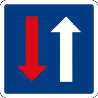 | |||
| priority_road | designated | yes_unposted | end | Specifying roads signposted as priority roads. | 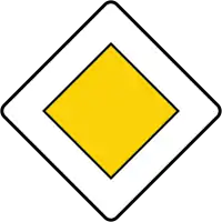 | |||
| sac_scale | hiking | mountain_hiking | demanding_mountain_hiking | alpine_hiking | demanding_alpine_hiking | difficult_alpine_hiking | Applies to highway=path and highway=footway. A classification scheme for hiking trails. |  | |||
| service | alley | driveway | parking_aisle etc. | See Key:service for more details. |  | |||
| smoothness | excellent | good | intermediate | bad | very_bad | horrible | very_horrible | impassable | See Key:smoothness for more details. | 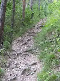 | |||
| surface | paved | unpaved | asphalt | concrete | paving_stones | sett | cobblestone | metal | wood | compacted | fine_gravel | gravel | pebblestone | plastic | grass_paver | grass | dirt | earth | mud | sand | ground | See Key:surface for more details. | ||||
| tactile_paving | yes | no | A paving in the ground to be followed with a blindman's stick. | Not to be rendered on standard maps. | 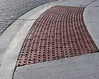 | ||
| tracktype | grade1 | grade2 | grade3 | grade4 | grade5 | To describe the quality of the surface. See Key:tracktype for more information. |  |
 | ||
| traffic_calming | bump | hump | table | island | cushion | yes | etc. | Hidasteita (töyssyjä, shikaaneja, korotettuja suojateitä, kavennuksia). Joko koko tielle tai yksittäiset hidasteet. |  | |||
| trail_visibility | excellent | good | intermediate | bad | horrible | no | Applies to highway=path, highway=footway, highway=cycleway and highway=bridleway. A classification for hiking trails visibility |  | |||
| trailblazed | yes | no | poles | cairns | symbols | Applies to highway=*. Describing trail blazing and marking. See Key:trailblazed for more information. |  | |||
| trailblazed:visibility | excellent | good | intermediate | bad | horrible | no | Applies to trailblazed=*. A classification for visibility of trailblazing. See Key:trailblazed:visibility for more information. | ||||
| turn | left | slight_left | through | right | slight_right | merge_to_left | merge_to_right | reverse | The key turn can be used to specify the direction in which a way or a lane will lead. |  | |||
| width | <number> | The width of a feature. |  | |||
| winter_road | yes | A highway functions during winter, probably can't be driven in summer. | 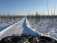 | |||
Muita teihin liittyviä kohteita | ||||||
| highway | bus_stop | Bussipysäkki. Yleisin käytäntö on lisätä tien viereen irrallinen solmu, jolle tämä arvo. Isommat bussiasemat merkataan amenity=bus_station | 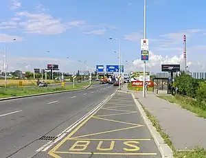 | |||
| highway | crossing | A.k.a. crosswalk. Pedestrians can cross a street here; e.g., zebra crossing | | |||
| highway | elevator | An elevator or lift, used to travel vertically, providing passenger and freight access between pathways at different floor levels. | 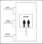 | |||
| highway | emergency_bay | An area beside a highway where you can safely stop your car in case of breakdown or emergency. | 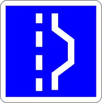 | |||
| highway | emergency_access_point | Ei käytössä Suomessa. | 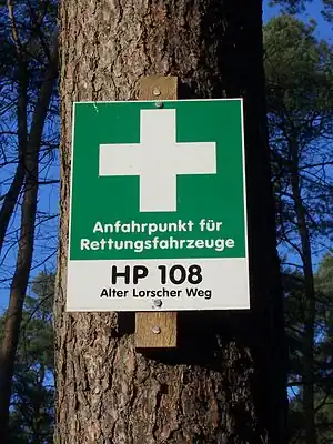 | |||
| highway | give_way | Väistämisvelvollisuus risteyksessä -liikennemerkki | 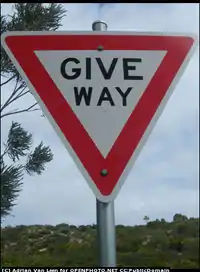 | |||
| emergency | phone | Hätäpuhelin |  | |||
| highway | milestone | Highway location marker |  | |||
| highway | mini_roundabout | Hyvin pieni kiertoliittymä, jonka keskijakajan yli voi tarvittaessa ajaa. Huomaa että tämä arvo asetetaan vain yhdelle eli sille solmulle jossa tiet kohtaavat. Jos piirrät liikenneympyrän ympyrän kiertävänä ympyrän muotoisena tienä, tuo tie merkataan tageilla highway=* ja junction=roundabout ja silloin kiertoliittymän solmuille ei anneta arvoa highway=mini_roundabout - tarkemmin alempana. |  |
|||
| highway | motorway_junction | Käytetään yhdessä tagin name=* tai ref=* kanssa ja kertoo että annettu name tai ref on liittymän nimi tai numero. Lisää tämä siihen solmuun, josta moottoritieltä erkaneva ramppi alkaa. |  |
| ||
| highway | passing_place | Kohtaamispaikka kapealla tiellä. |  | |||
| highway | platform | Linja-autoaseman tai pysäkin laituri |  |
 | ||
| highway | rest_area | Place where drivers can leave the road to rest, but not refuel. |  |
 | ||
| highway | services | A service station to get food and eat something, often found at motorways |  |
 | ||
| highway | speed_camera | Automaattinen nopeudenvalvontakamera | 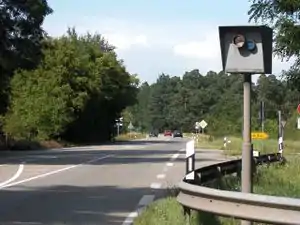 | |||
| highway | stop | Pakollinen pysähtyminen | 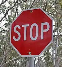 | |||
| highway | street_lamp | Katuvalo. Käytetään vain yksittäisten valaisimien merkitsemiseen. Valaistut tieosuudet merkitään lit=*-tagilla. | 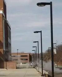 | |||
| highway | toll_gantry | A toll gantry is a gantry suspended over a way, usually a motorway, as part of a system of electronic toll collection. For a toll booth with any kind of barrier or booth see: barrier=toll_booth | .jpg.webp) | |||
| highway | traffic_mirror | Mirror that reflects the traffic on one road when direct view is blocked. | 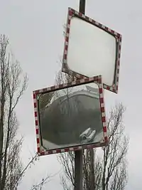 | |||
| highway | traffic_signals | Liikennevalot | 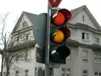 | |||
| highway | trailhead | Designated place to start on a trail or route |  | |||
| highway | turning_circle | Kääntöpaikka. Levennys tiessä tai tien päässä helpottamaan ajoneuvon kääntämistä. Tällaisen kääntöpaikan halkaisija on yleensä 150-200% tien leveydestä. Suuremmat kääntöpaikat voi piirtää itseensä palaavana tienä todellisen ympyrän koon mukaan, mahdollisesti area=yes -tagin kanssa. |  |
 | ||
| highway | turning_loop | A widened area of a highway with a non-traversable island for turning around, often circular and at the end of a road. |  | |||
| highway | User Defined | All commonly used values according to Taginfo | ||||
.jpg.webp)
Esteet / barrier
Barrier -tagia käytetään merkitsemään kulkemista rajoittavia esteitä. Se on selkeämpi vaihtoehto highway=gate jne. merkinnöille sisältäen myös aidat ja muut esteet, jotka eivät ole sidottuja kulkuväylään. Oletuksena access=no, joten merkitse keille kulku on sallitty (esim. foot=yes)
Linear barriers
This table is a wiki template with a default description in English. Editable here.
Access control on highways
This table is a wiki template with a default description in English. Editable here.
Pyörätiet / cycleway
To describe infrastructure designed mainly for cyclists. See also: Cycle routes.
| Key | Value | Element | Comment | Rendering | Photo |
|---|---|---|---|---|---|
| cycleway | lane | Pyörätie ajotien yhteydessä yleensä rotvallikivin erotettuna. | Cyclist map |
| |
| cycleway:right cycleway:left |
lane | A cycle lane only on one side of the road. Left or right depend on the direction in which the way is drawn in OpenStreetMap. | Cyclist map |
||
| cycleway | opposite | Used on ways with oneway=yes where it is permitted to cycle in both directions.
Note - such streets are common in Belgium, the Netherlands and Denmark, for example, but are rare in the UK (although they do exist): often, instead, actually the street is two-way as normal for its whole length except for the very short section past the no-entry sign at the end, where cycles are excepted from the no-entry by means of a short lane separated by an island. This is called a "cycle plug". In some places this has been represented as very short oneway Way at the end with an adjacent cycleway, forming a little triangle with the road they join to, or sometimes with a short oneway Way with cycleway=opposite_lane or opposite_track. |
Cyclist map |
| |
| cycleway | opposite_lane | Used on ways with oneway=yes that have a cycling lane going the opposite direction of normal traffic flow (a "contraflow" lane). | Cyclist map |
 | |
| cycleway | track | Pyörätie kulkee omaa väyläänsä selkeästi ajoteistä erotettuna. | Cyclist map |
| |
| cycleway:right cycleway:left |
track | A track only on one side of the road. You can drive in both directions. Left and right depend on the direction in which the way is drawn in OpenStreetMap. | Cyclist map |
||
| cycleway | opposite_track | Used on ways with oneway=yes that have a cycling track going the opposite direction of normal traffic flow. | Cyclist map |
| |
| cycleway | shared | Cyclists share space with other traffic on this highway. | |||
| cycleway | share_busway | There is a bus lane that cyclists are permitted to use. | | ||
| cycleway:right cycleway:left |
share_busway | A bus lane permitted to use only on one side of the road. Left and right depend on the direction in which the way is drawn in OpenStreetMap. | |||
| cycleway | shared_lane | Cyclists share a lane with motor vehicles, but there are markings indicating that they should share the lane with motorists. The road markings are usually there to highlight a cycle route or to remind drivers that you can cycle there. Also used for the on-road shared-lane marking called a "sharrow". | | ||
| cycleway:right cycleway:left |
shared_lane | A shared lane only on one side of the road. Left and right depend on the direction in which the way is drawn in OpenStreetMap. | |||
| cycleway | asl | A cycleway advanced stop line (ASL), also known as a bike box or an advanced stop box, is a marked area for cyclists in front of the stop line for motor traffic. | CyclOSM |
 | |
| cycleway | user defined | All commonly used values according to Taginfo. |
This table is a wiki template with a default description in English. Editable here.
Päällysteen laatu
Tracktypellä voi kertoa alempitasoisen väylän pinnasta - esim. hyvin matala urheiluauto ei pärjää vaurioitta grade3 tai grade4 -tasoisella tiellä, mutta maasturi ja moni tavallinen ajaa surutta grade5-tasoista. Pahalle eli henkilöautoliikennettä estävälle kelirikolle alttiiden teiden merkkaamiseksi ei ole vakiintunutta käytäntöä, voit toistaiseksi käyttää esim. note=kelirikkovaara.
| Key | Value | Element | Comment | Rendering | Photo |
|---|---|---|---|---|---|
| tracktype | grade1 | Päällystetty tai päällystettyä vastaava tiivis hiekkapinta | |
.jpg.webp) | |
| tracktype | grade2 | Pinta soraa tai tiiviihköä hiekkaa |  |
 | |
| tracktype | grade3 | Kasvillisuutta rengasurien välissä |  |
 | |
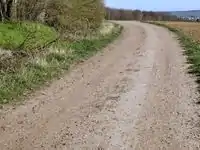
| tracktype | grade4 | Pehmeämpää tai epätasaisempaa pintaa rengasurissa ja/tai korkeampaa kasvillisuutta tai muita esteitä rengasurien välissä |  |
 | |
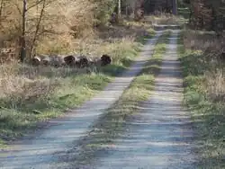
| tracktype | grade5 | Kasvillisuutta ajourissa, kuoppaista. |  |
 | |
| tracktype | <no value> | If no tracktype tag is present, the track is rendered with a dot-dash line style (as shown right). |  |
This table is a wiki template with a default description in English. Editable here.
Vesiväylät / waterway
Joet, kanavat, jne. Kulkusuunta piirretään yläjuoksulta alajuoksulle päin.
| Key | Value | Element | Comment | Carto rendering | Photo | |
|---|---|---|---|---|---|---|
Natural watercourses | ||||||
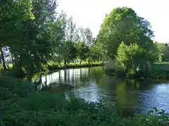
| waterway | river | Joki. Tien suunta yläjuoksulta merta kohti. Erittäin leveät joet (tarkka raja on määrittämättä mutta ainakin yli 50 metriä leveät) merkataan myös waterway=riverbank (alla). |  |
 | ||
| Leveät joet, joiden esittämiseen yksi vakiolevyinen jokiviiva ei ole riittävä. Piirrä tie rantaviivoja pitkin myötäpäivään alkuunsa palaavana lenkkinä, ts. ylitä joki kahdesti. Suositeltu maksimipituus on 500 solmua; pidemmät joet voi piirtää peräkkäisinä alueina. Lisäksi joen keskelle väylää merkkaamaan erillinen tie, jolla waterway=river. |  |
 | ||||
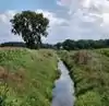
| waterway | stream | Oja, puro. Eräs ehdotettu raja (river vai stream) on ollut 5-7 metriä. Jos urheilullinen ihminen voi hypätä sen yli se on varmasti stream. Voi olla osan vuodesta kuivana. Pääasiassa luonnon muovaama. Voit myös lisätä width- tai est_width-tagilla (kohdassa Ominaisuudet) tiedon leveydestä. |  |
 | ||
| waterway | tidal_channel | A natural tidal waterway within the coastal marine environment with bi-directional flow of salty water which depends on the tides. | 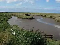 | |||
Man made waterways | ||||||
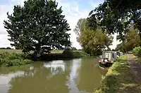
| waterway | canal | Kanava. | |
 | ||
| waterway | pressurised | A waterway where water is flowing in a fully enclosed conduit and subject to pressure; this includes gravity-driven penstocks and siphons and pump-driven pipelines, for example. | 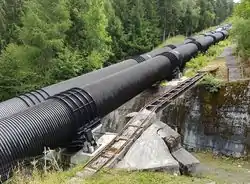 | |||
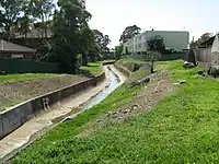
| waterway | drain | Rakennettu oja, avoviemäri. Yleensä betoni/kivipintainen. | |
 | ||
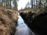
| waterway | ditch | Kaivettu oja. | |
 | ||
| waterway | fairway | A navigable route in a lake or sea marked by buoys. The navigable area marked by the buoys can be mapped with seamark:type=fairway. | ||||
| waterway | fish_pass | A |
 | |||
| waterway | canoe_pass | A canoe pass is a structure on or around artificial barriers (such as dams and locks) to enable whitewater praticants to go through those barriers | ||||
Facilities | ||||||
| waterway | dock | Märkätelakka, alue johon voidaan laskea vettä tai joka voidaan tyhjentää vedestä laivojen ja veneiden korjaamista varten. |  |
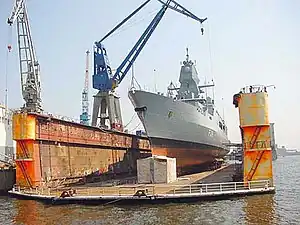 | ||
| waterway | boatyard | Kuivatelakka, alue jossa laivoja korjataan tai rakennetaan maan päällä. | 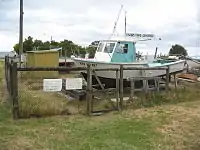 | |||
Barriers on waterways | ||||||
| waterway | dam | Pato. Vesi päästetään padosta joko sulun tai voimalaitoksen läpi tai vesi virtaa pois padotulta alueelta vain muualta. | 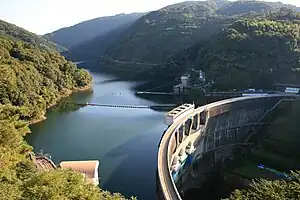 | |||
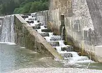
| waterway | weir | Pohjapato, "Puolipato", veden virtausta estävä ja ohjaava rakennelma joka vakituisesti päästää vettä (myös) ylitseen. | 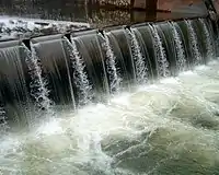 | |||
| waterway | waterfall | A waterfall, use in combination with natural=cliff | 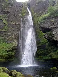 | |||
| waterway | rapids | A natural barrier, formed by a fast-flowing, often turbulent, section of the watercourse. | 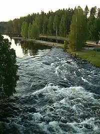 | |||
| waterway | lock_gate | Sulku, kanavissa hallittujen vedenpinnan tasojen välillä kulkemiseen. | 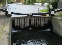 | |||
| waterway | sluice_gate | A sluice gate is a movable gate to control water flow. | 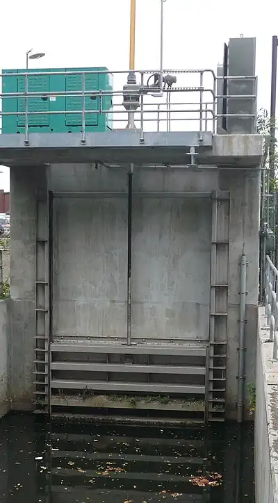 | |||
| waterway | security_lock | Flood barrier | 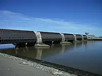 | |||
Other features on waterways | ||||||
| waterway | turning_point | Kääntöpaikka kanavan leveyttä pidemmille laivoille ja veneille. | ||||
| waterway | water_point | Vesipiste, josta veneilijät voivat ottaa yleensä maksutta puhdasta vettä | 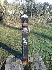 | |||
| waterway | fuel | A place to get fuel for boats. | 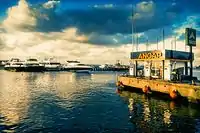 | |||
Some additional attributes for waterways | ||||||
| intermittent | yes | Indicates that the waterway is sometimes dry and sometimes contains water. | ||||
| seasonal | yes, spring, summer, autumn, winter, wet_season, dry_season | Indicates that a waterway has a seasonal (yearly cyclic) flow, usually flowing continuously for at least some part of the year. |  | |||
| destination | name | Name of the body of water the linear feature flows into. | ||||
| lock | yes | A lock is used for moving boats between waterways at two different levels. Can tag either the section of the way between the gates (detailed) or just a single node in the waterway (less detailed). | | |||
| mooring | yes, private, no | Satamalaituri, johon voi telakoida aluksia. | 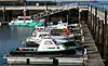 | |||
| usage | See the key for details | Possible uses of the waterway. Use semicolons to separate. | ||||
| tunnel | culvert | A short tunnel usually installed under roads, railways or building. Its size doesn't allow human to get inside and is as narrow as the structure is supposed to go under. For streams passing under a road in culverts use tunnel=culvert+layer=-1 on the section of stream passing under the road. Don't use either of these tags for streams passing under bridges. | 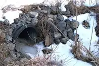 | |||
| tunnel | flooded | A long (> 100 m) tunnel where flowing water or other fluid prevent humans from safely walking inside despite its appropriate diameter or size. Water inside can be pressurised or not, used in combination with any waterway=* linear value. waterway=*. |  | |||
| bridge | aqueduct | Akvedukti [Wikipedia] | 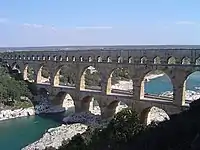 | |||
| waterway | user defined | All commonly used values according to Taginfo | ||||
=== Rautatiet / railway ===Lisää rautateihin liittyviä tageja löytyy sivulta Fi:OpenRailwayMap/Tagging.
| Key | Value | Element | Comment | Rendering carto | Photo | |
|---|---|---|---|---|---|---|
Tracks | ||||||
| railway | abandoned | Entinen rautatie, kiskot on yleensä poistettu eli näkyy ehkä vain penkereenä ja aukkona metsässä. | Not rendered by osm-carto | 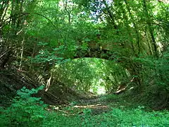 | ||
| railway | construction | Rakenteilla oleva rautatie. Katso construction=* ja construction=yes |  |
 | ||
| railway | disused | Käytöstä poistettu rautatie; kiskot ja muita laitteita ei ole poistettu mutta rataa ei käytetä |  |
 | ||
| railway | funicular | Cable driven inclined railways on a steep slope, with a pair of cars connected by one cable |  |
 | ||
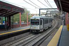
| railway | light_rail | A higher-standard tram system, normally in its own right-of-way. Often it connects towns and thus reaches a considerable length (tens of kilometres). | |
 | ||
| railway | miniature | Pienikokoiset puistorautatiet yms. huvipuistoissa ja muissa turistikohteissa. Raideleveys yleensä enintään 600 mm. |  |
 | ||
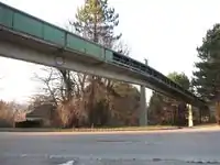
| railway | monorail | Yksikiskoinen juna, Suomessa käytössä vain Linnanmäen huvipuistossa. |  |
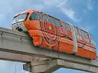 Monorail in Kuala Lumpur | ||
| railway | narrow_gauge | Erityisen kapean raideleveyden rautatie, usein tehdasalueen sisäinen tai muutoin hyvin rajatulla alueella. Suurin osa poistunut käytöstä. Katso Suomen kapearaiteiset rautatiet. | |
 | ||
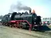
| Museorautatie. Katso Jokioisten museorautatie |  |
 | ||||
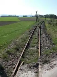
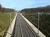
| railway | rail | Suomen rautatieverkon kiskot |  |
 | ||
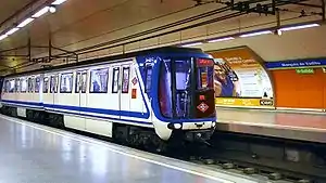
| railway | subway | Metroverkko |  |
 | ||
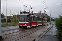
| railway | tram | Raitiovaunukiskot |  |
 | ||
Additional track features or attributes | ||||||
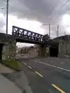
| bridge | yes | Rautatiesilta |  |
 | ||
| cutting | yes | Kallio- tai maaleikkaus | 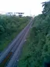 | |||
| electrified | contact_line rail yes no |
contact_line: ajolanka junan yläpuolella rail: erillinen virtakisko raiteen vieressä tai välissä (Suomessa ainoastaan Helsingin metrossa) yes: sähköistetty rata, ei tarkempia tietoja no: sähköistämätön rata |
 | |||
| embankment | yes | Osuus, jossa rata kulkee erillisellä penkereellä varsinaista maanpintaa korkeammalla. |  | |||
| embedded_rails | yes/<type of railway> | Specifies that a highway on which non-railway traffic is also allowed has railway tracks embedded in it but the rails are mapped as separate ways. | | |||
| frequency | number [Hz] | Sähköjärjestelmän taajuus. Käytetään vain sähköistetyillä radoilla. Katso myös voltage-tagi. |  | |||
| railway:track_ref | number | Track number | 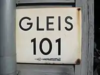 | |||
| service | crossover | Relatively short lengths of track which switch traffic from one parallel line to another | ||||
| service | siding | Sivuraide, pääraiteen suuntainen |  |
|||
| service | spur | Pistoraide, lyhyt yleensä yhden yrityksen käyttämä yhteys rataverkkoon | |
 | ||
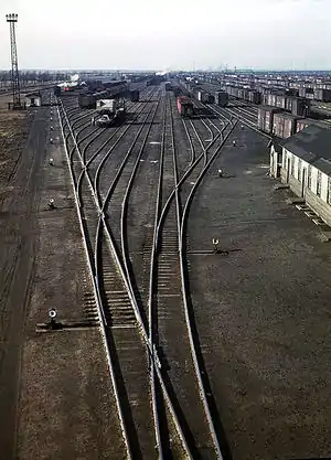
| service | yard | Ratapihan raiteet. Yksi tai useampi pääasiallisesti läpikulkuraiteena käytetty raide on kehoitettu jättämään ilman tätä. Nämä merkataan raiteet luokittelevan railway=* tagin lisäksi. | |
 | ||
| tunnel | yes | Rautatietunneli | 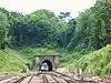 | |||
| tracks | number | Number of parallel tracks in close proximity when mapped as one single way representing all tracks. If not given means unknown and defaults to 1. In many parts of the world the tracks are being drawn out separately so that there is more detail, in which case this tag isn't used. | 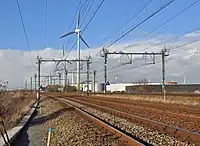 | |||
| usage | main branch industrial military tourism scientific test |
main line: heavy traffic branch line: connecting places with a mainline industrial: servicing large plants (iron, chemical etc.), surface mining, … military: servicing military area tourism: most mountain rails (rack-rails, funicular) and preserved railways scientific: rail transport at spaceports, large array telescopes, etc. test: track for testing new wheels, rails, tracks and rail technologies. |
||||
| voltage | number | Ajolangan tai virtakiskon jännite. Käytetään vain sähköistetyillä radoilla. |  | |||
Stations and stops | ||||||
| railway | halt | Pienempi asema tai seisake | 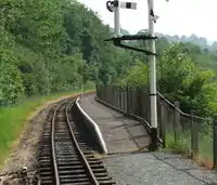 | |||
| public_transport | stop_position | The position on the railway track where the train (its centre) stops at a platform. This is useful for routing on long platforms where also short trains stop and on long platforms where multiple trains stop behind each other. See also public_transport=stop_area. | | |||
| public_transport | platform | Asemalaituri. Myös raitiovaunupysäkeillä. | .jpg.webp) | |||
| railway | platform | This is parallel to the rail line for showing where the actual platforms are. It is also to know where you can change platform and enter the station, so use footpaths to connect them. This is really useful for routing too. Use in addition to public_transport=platform. | | |||
| public_transport | station | Railway passenger-only station. | 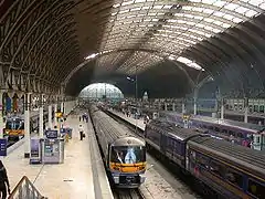 | |||
| railway | station | Rautatieasema | | |||
| railway | subway_entrance | Metroaseman sisäänkäynti | 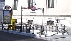 | |||
| railway | tram_stop | Raitiovaunupysäkki | 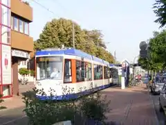 | |||
Other railways | ||||||
| railway | buffer_stop | Raiteen päässä oleva päätepuskin. Katso Buffer_stop | Not rendered by osm-carto | .jpg.webp) | ||
| railway | derail | A device used to prevent fouling of a rail track by unauthorized movements of trains or unattended rolling stock. See Derail (railroad). | Not rendered by osm-carto | 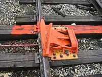 | ||
| railway | crossing | Radanylityspaikka jalankulkijoille | 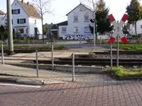 | |||
| railway | level_crossing | Tasoristeys | 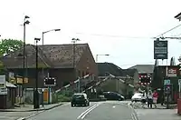 | |||
| railway | tram_level_crossing | A point where trams and roads cross. |  | |||
| railway | signal | Rautatieliikenteen opastin/merkki. Tarkemmat ohjeet merkitsemiseen löytyvät sivulta Fi:OpenRailwayMap/Tagging#Opastimet | Not rendered by osm-carto |  | ||
| railway | switch | Erisuuntaiset raiteet toisiinsa yhdistävä vaihde. Merkitään yksittäisenä pisteenä raiteiden yhtymäkohtaan. | Not rendered by osm-carto |  | ||
| railway | railway_crossing | Raideristeys eli kahden erisuuntaisen raiteen risteyskohta, jossa mahdollisutta raiteelta toiseelle siirtymiseen ole. | Not rendered by osm-carto |  | ||
| landuse | railway | Ground used around railways and railway-stations. |  Except no border, as landuse=industrial Except no border, as landuse=industrial |
 | ||
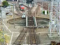
| railway | turntable | Junavaunujen ja vetureiden kääntöpöytä. |
|
 | ||
| railway | roundhouse | Veturitalli | Not rendered by osm-carto | 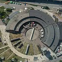 | ||
| railway | traverser | These are used for changing trains between railways. Also known as transfer table. | 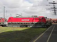 | |||
| railway | wash | A railroad carriage/car wash | Not rendered by osm-carto | 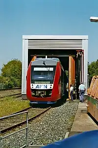 | ||
| railway | water_crane | A structure to deliver water to steam locomotives | Not rendered by osm-carto | 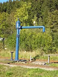 | ||
| railway | ventilation_shaft | A structure that allows ventilation in underground tunnels | Not rendered by osm-carto | .jpg.webp) | ||
| railway | user defined | All commonly used values according to Taginfo | – – – | – – – | ||

This table is a wiki template with a default description in English. Editable here.
Lentokentät
These are mainly related to aerodromes, airfields other ground facilities that support the operation of airplanes and helicopters. See the page Aeroways for an introduction on mapping these features.
| Key | Value | Element | Comment | Rendering | Photo |
|---|---|---|---|---|---|
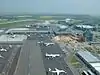
| aeroway | aerodrome | Lentokenttä. Huomaa tämä tagi on vain solmulle ja ei yleensä merkkaa minkään fyysisen rakennelman sijaintia lentokentän alueella vaan näennäistä keskipistettä. Katso myös military=airfield. | 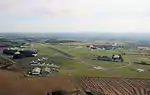 | ||
| aeroway | airstrip | A field or area where light aircraft can land and take off from. | 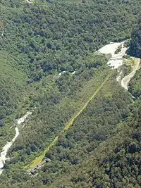 | ||
| aeroway | apron | Lentokoneiden pysäköintialue (asemataso). |  |
 | |
| aeroway | control_center | 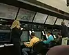 | |||
| aeroway | fuel | Fuelling station for aircraft. | .jpg.webp) | ||
| aeroway | gate | Käytetään lentoaseman lähtöporttien merkitsemiseen ja numerointiin. |  |
 | |
| aeroway | hangar | Lentokonehalli. | 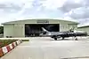 | ||
| aeroway | helipad | Helikopterien laskeutumispaikka. | 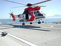 | ||
| aeroway | heliport |  | |||
| aeroway | holding_position | A point behind which aircraft are considered clear of a crossing way | 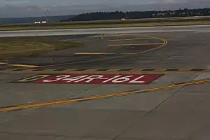 | ||
| aeroway | jet_bridge | Passenger boarding bridge | 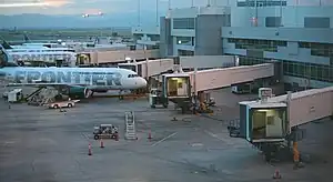 | ||
| aeroway | navigationaid | A facility that supports visual navigation for aircraft | 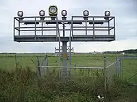 | ||
| airmark | beacon | 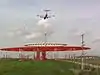 | |||
| aeroway | parking_position | A location where an aeroplane can park | 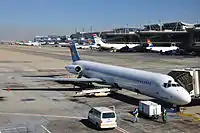 | ||
| aeroway | runway | Kiitotie. |  |
.jpg.webp) | |
| aeroway | taxilane | Taxilane is a path in an airport that is part of the aircraft parking area or apron (Proposed feature with low usage as of 2015-10; use with an eye towards the question correct usage). | |||
| aeroway | taxiway | Lentokoneiden käyttämät väylät terminaalien ja kiitoteiden välillä liikkumiseen. |  |
 | |
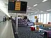
| aeroway | terminal | Lentokentän terminaalirakennus. |  |
 | |
| aeroway | tower | See also aeroway=control_tower or combination of man_made=tower + service=aircraft_control for similar schemes. |
 | ||
| aeroway | windsock | Tuulipussi. |  | ||
| aeroway | highway_strip | 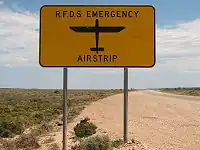 | |||
| aeroway | User defined | All commonly used values according to Taginfo |
This table is a wiki template with a default description in English. Editable here.
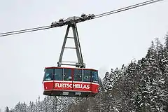
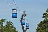
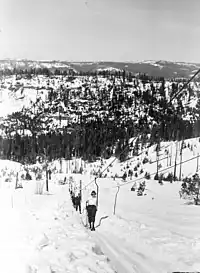
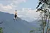
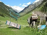
Köysiradat tms. roikkuvat väylät
This is used to tag different forms of transportation for people or goods by using aerial wires. For example these may include cable-cars, chair-lifts and drag-lifts. See the page Aerialway for more information on the usage of these tags.
| Key | Value | Element | Comment | Rendering carto | Photo | Taginfo |
|---|---|---|---|---|---|---|
| Types of aerialway | ||||||
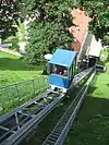
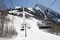
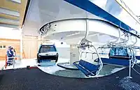
| aerialway | cable_car | Hytillinen hissi tai gondoli-rata |  |
 |
||
| aerialway | gondola | |
 |
|||
| aerialway | chair_lift | Tuolihissi |  |
 |
||
| aerialway | mixed_lift | |
 |
|||
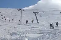
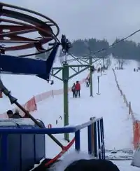
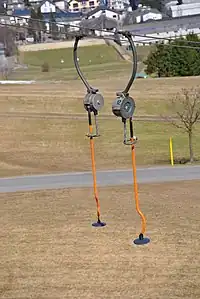
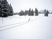
| aerialway | drag_lift | Ankkurihissi. Nykyään vaihtoehtona piste:lift=t-bar, lisätietoja laskettelurinteet-projektissa. | |
 |
||
| aerialway | t-bar | This automatically implies oneway=yes (drawn upward). |
|
 |
||
| aerialway | j-bar | This automatically implies oneway=yes (drawn upward). |
|
 |
||
| aerialway | platter | This automatically implies oneway=yes (drawn upward). |
|
 |
||
| aerialway | rope_tow | This automatically implies oneway=yes (draw upward). |
|
 |
||
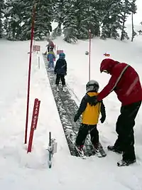
| aerialway | magic_carpet | This automatically implies oneway=yes (drawn upward). |
 |
|||
| aerialway | zip_line | This automatically implies oneway=yes (drawn downward). |
|
 |
||
| Equipments | ||||||
| aerialway | pylon |  |
||||
| aerialway | station | A station, where passengers can enter and/or leave the aerialway. |  |
 |
||
| Others | ||||||
| Obsolete, please use aerialway=zip_line instead. This automatically implies oneway=yes (drawn downward). |
 |
|||||
| aerialway | goods | Controversial, consider other aerialway=* values in combination with foot=no and/or a usage=* key instead of this. |  |
 |
||
| aerialway | user defined | All commonly used values according to Taginfo | ||||
This table is a wiki template with a default description in English. Editable here.
Sähkönjakelu
These are used to map electrical power generation and distributions systems. See the page titled Power for an introduction on its usage.
| Key | Value | Element | Comment | Rendering | Photo |
|---|---|---|---|---|---|
| power | cable | A way following the path of underground cables, such as the local 0.4 kV network between transformer stations, distribution boxes and cable connection points, or sea cables. Not to be confused with non-power supply cables such as cables for telecommunication. May be combined with voltage=*, circuits=* and location=*. | 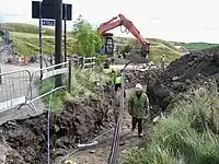 | ||
| power | catenary_mast | A catenary mast supports system of overhead wires used to supply electricity to electricaly powered vehicle equipped with a pantograph. | 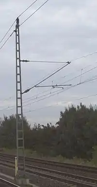 | ||
| power | compensator | Several kind of power devices used to insure of power quality and network resilience. |  | ||
| power | connection | A freestanding electrical connection between two or more overhead wires | 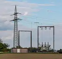 | ||
| power | converter | An HVDC converter converts electric power from high voltage alternating current (AC) to high-voltage direct current (HVDC), or vice-versa. | 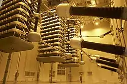 | ||
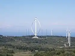
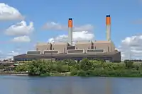
| power | generator | Voimalaitos |  |
 | |
| power | heliostat | A mirror of a heliostat device. | 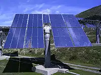 | ||
| power | insulator | A device to protect a power line from grounding on supports | 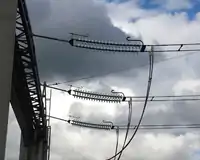 | ||
| power | line | Kaapeleiden reitti |  |
||
| line | busbar | Specifies that a power=line is a busbar in a substation. | |||
| line | bay | Specifies a power=line is a bay which connects an incoming circuit to a busbar assembly. | |||
| power | minor_line | A way following the path of (overground) minor power cables, supported by poles and not towers/pylons. (This isn't quite so simple, as sometimes larger towers are replaced by smaller poles made with a stronger material; a better distinction might be based on voltage). |  |
 | |
| power | plant | A place/industrial facility where power is generated (electricity, heat, cold water, biogas...). Individual generating units within the facility should be tagged as power=generator. | |
 | |
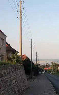
| power | pole | Poles supporting low to medium voltage lines (power=minor_line) and high voltage lines (power=line) up to 161,000 volts (161 kV). | 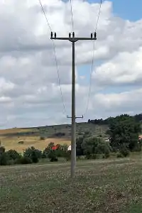 | ||
| power | portal | Power supporting structure composed of vertical legs with cables between them attached to a horizontal crossarm | 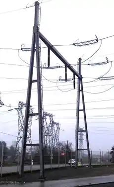 | ||
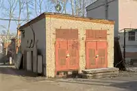
| power | [[ Too many Data Items entities accessed. | substation ]] | A tag for electricity substations. These provide voltage step-up/step-down, switching, conditioning, etc. Substations may be large facilities (up to several acres) for very high voltage transmission lines or just small buildings or kiosks near the street for low voltage distribution lines. Useful combinations: voltage=*, substation=* and location=*, see the feature page for details. | |
 | |
| power | switch | A tag for electricity switches which are devices which allow operators to power up & down lines and transformer in substations or outside. | 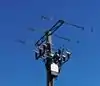 | ||
| power | switchgear | The switchgear comprises one or more busbar assemblies and a number of bays each connecting a circuit to the busbar assembly. | 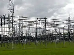 | ||
| power | terminal | Point of connection between overhead power lines to buildings or walls | 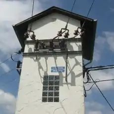 | ||
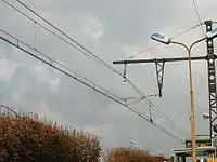
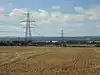
| power | tower | Korkeajännitelinjan torni. Älä käytä tätä yleisemmille ja lyhyemmille puisille sähkö- tai puhelintolpille. |  |
 | |
| power | transformer | A static device for transferring electric energy by inductive coupling between its windings. Large power transformers are typically located inside substations. | 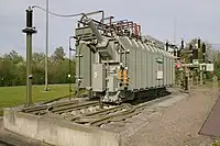 | ||
| power | User Defined | All commonly used values according to Taginfo |
This table is a wiki template with a default description in English. Editable here.
Rakennelma / man_made
Eräitä huomattavan erottuvia rakennelmia.
| Key | Value | Element | Comment | Rendering | Photo |
|---|---|---|---|---|---|
| man_made | adit | A type of entrance to an underground mine which is horizontal or nearly horizontal. |  | ||
| man_made | antenna | An antenna to transmit and/or receive wireless signals. | 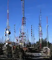 | ||
| man_made | beacon | Radiomajakka tai muu suunnistamisen avuksi rakennettu maamerkki, ei kuitenkaan majakka (josta katso alla man_made=lighthouse |  | ||
| man_made | beehive | Beehive | 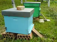 | ||
| man_made | breakwater | A man-made structure designed to protect a shore or harbour from the sea and waves. |  |
 | |
| man_made | bridge | The outline of a bridge, grouping together all features for that bridge.
Please also add bridge=* and layer=* to all ways running over the bridge. |
 |
 | |
| man_made | bunker_silo | An open-sided structure that can be used with vehicles to fill and empty them. | |||
| man_made | cairn | A mound of stones, usually conical or pyramidal, raised as a landmark or to designate a point of importance in surveying. |  | ||
| man_made | carpet_hanger | A construction to hang carpets for cleaning with the help of carpet beaters. |  | ||
| man_made | cellar_entrance | An entrance into artificially created vault. |  | ||
| man_made | chimney | A tall distinctive vertical conduit for venting hot gases or smoke, normally found near power stations or large factories. | 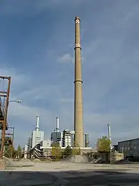 | ||
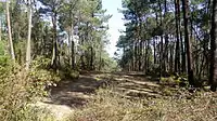
| man_made | clearcut | An area where all trees have been uniformly cut down. | |||
| man_made | column | A column used to support a structure or for decoration. |  | ||
| man_made | communications_tower | A huge tower for transmitting radio applications. |  | ||
| man_made | courtyard | An area that is usually enclosed by walls or buildings. |  | ||
| man_made | crane | Kiinteä tai kiskoilla liikkuva nosturi, esim. satamissa. |  | ||
| man_made | cross | Cross with little historical or religion value, e.g. summit cross. | 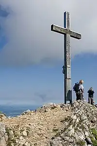 | ||
| man_made | cutline | A straight line cut in a forest. |  |
 | |
| man_made | dolphin | A marine structure for berthing and mooring of vessels. | 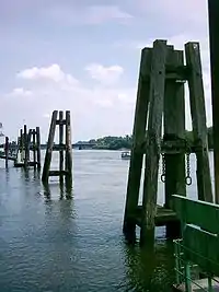 | ||
| man_made | dovecote | A place where doves are farmed or stored. | 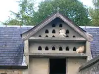 | ||
| man_made | dyke | A dyke is a an embankment built to restrict the flow of water or other liquids. |  | ||
| man_made | embankment | An artificial steep slope. | | ||
| man_made | flagpole | A long pole built to hold a flag. |  | ||
| man_made | flare | A tower constructed to burn off excess gas. | 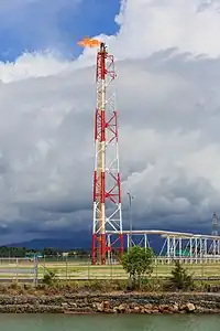 | ||
| man_made | footwear_decontamination | A facility to decontaminate footwear for hikers. | 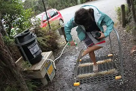 | ||
| man_made | gantry | An overhead structure across a major road usually for holding signs, often variable-message signs. | .jpg.webp) | ||
| man_made | gasometer | Kaasukello. Kaasukellosta englanniksi Wikipediassa | 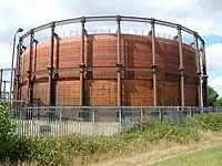 | ||
| man_made | goods_conveyor | A conveyor system for transporting materials |  |
 | |
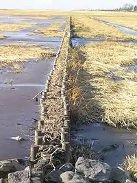
| man_made | groyne | A rigid structure built from a shoreline or riverbank that interrupts water flow and limits the movement of sediment. See also: man_made=breakwater. | |
 | |
| man_made | guard_stone | A guard stone: a stone built onto or into the corner of a building or wall to prevent carriages from damaging the structure, often found on either side of an entrance to a laneway, or alongside a wall to protect it. | 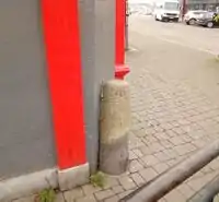 | ||
| man_made | heap | A large pile of material | 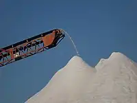 | ||
| man_made | insect_hotel | A structure intended to provide shelter for insects. | 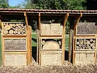 | ||
| man_made | kiln | A kiln: an oven used for industrial processes such as hardening, drying, or smelting |  | ||
| man_made | lighthouse | Majakka | 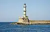 | ||
| man_made | manhole | Hole with a cover that allows access to an underground service location, just large enough for a human to climb through. | 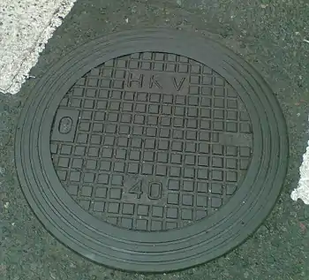 | ||
| man_made | mast | A mast is a vertical structure built to hold, for example, antennas. | 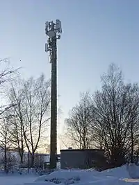 | ||
| man_made | mineshaft | A mineshaft: vertical tunnel into a mine where minerals are extracted. | 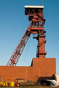 | ||
| man_made | monitoring_station | A station that monitors something. | 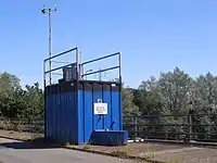 | ||
| man_made | nesting_site | A man made nesting aid that is mounted on a support device. |  | ||
| man_made | obelisk | Tall, narrow, four-sided, tapered monument which usually ends in a pyramid-like shape at the top. |  | ||
| man_made | observatory | Observatory: a location used for observing terrestrial or celestial events | 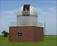 | ||
| man_made | offshore_platform | Offshore platform, oil platform or offshore drilling rig | 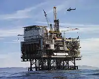 | ||
| man_made | petroleum_well | Oil well: a hole bored in the earth, designed to bring petroleum oil or gas to the surface | 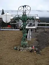 | ||
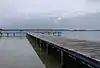
| man_made | pier | Laituri |  |
 | |
| man_made | pipeline | Putki esim. öljyn, maakaasun tms. siirtämiseen | 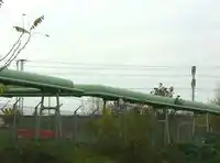 | ||
| man_made | planter | A structure for planting flowers or other ornamental plants. | 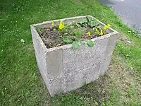 | ||
| A pumping rig for producing oil. Use of this tag is discouraged. See man_made=petroleum_well instead. |  | ||||
| man_made | pumping_station | Pumping station: a facility including pumps and equipment for pumping fluids from one place to another | 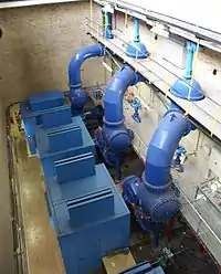 | ||
| man_made | reservoir_covered | A covered reservoir is a large man-made tank for holding fresh water | 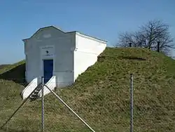 | ||
| man_made | satellite_dish | A dish-shaped parabolic antenna designed to receive or transmit radio waves to or from a satellite | 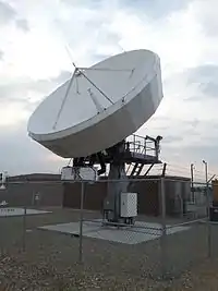 | ||
| man_made | silo | A storage container for bulk material, often grains such as corn or wheat |  | ||
| man_made | snow_fence | A solid fence-like structure built across steep slopes to reduce risk and severity of (snow) avalanches. |  | ||
| man_made | spoil_heap | Spoil heap, piles of waste rock removed during mining. |  | ||
| man_made | storage_tank | A container that holds liquids or compressed gases. | | ||
| man_made | street_cabinet | A cabinet located in the street and hosting technical equipment to operate facilities such as electricity or street lights. |  | ||
| man_made | stupa | A Buddhist dome-shaped structure with a spire on top |  | ||
| man_made | surveillance | Valvontakamerat ja kameroin valvotut alueet |  | ||
| man_made | survey_point | Kolmiomittauspiste tai muu maanmittaukseen käytetty rakennelma. |  | ||
| man_made | tailings_pond | Tailings pond: A body of liquid or slurry used to store byproducts of mining operations |  | ||
| man_made | telescope | Telescope: an instrument that aids in the observation of remote objects by collecting light or radio waves |  | ||
| man_made | torii | The gate structure found at the entrance of Shinto shrines and (rarely) Japanese Buddhist temples. | 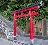 | ||
| man_made | tower | Torni, piippu, (antenni)masto, erittäin korkea talo. | 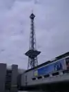 | ||
| man_made | utility_pole | A single pole supporting elevation of any of various and unspecified public utilities, such as power transmission, lighting or telephony. | 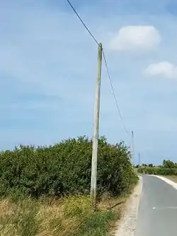 | ||
| man_made | ventilation_shaft | A vertical space in mines, tunnels, or buildings allowing stale air to leave the space underneath and/or fresh air to enter it. | 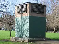 | ||
| man_made | video_wall | A digital screen, typically constructed out of smaller LED panels. |  | ||
| man_made | wastewater_plant | Vedenpuhdistamo |  |
 | |
| man_made | water_tap | Publicly usable water tap, providing access to water and usually equipped with a valve. |  | ||
| man_made | water_tower | Vesitorni | 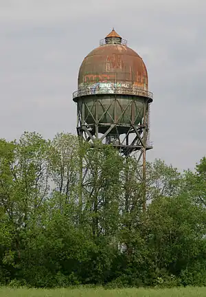 | ||
| man_made | water_well | A structural facility to access ground water, created by digging or drilling. |  | ||
| man_made | water_works | Vesilaitos | |
 | |
| man_made | watermill | Käyttövoimansa virtaavasta vedestä saava vesimylly. | 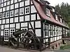 | ||
| man_made | wildlife_crossing | Structure that allow animals to cross human barriers safely. |  | ||
| man_made | windmill | Tuulimylly, yleensä historiallinen jäänne. Tuulivoimalat merkitään erikseen tageilla power=generator ja generator:source=wind. | 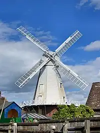 | ||
| man_made | windpump | A device that pumps natural gas or water using the wind, typically mass produced. | 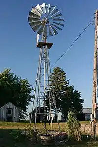 | ||
| man_made | works | Tehdas | 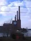 | ||
| man_made | yes | General tag for man-made (artificial) structures. | |||
| man_made | user defined | All commonly used values according to Taginfo |
This table is a wiki template with a default description in English. Editable here.
| Tag | Element | Comment | Rendering | Photo |
|---|---|---|---|---|
| building=entrance | Rakennuksen sisäänkäynti, pääovi, sivuovi, rappu |
Ajanviete / leisure
Useimpiin näistä sopii kaveriksi name=*. Jos mahdollista, niin lisää myös yhteystiedot: osoite (addr:street=*, addr:housenumber=*, addr:postcode=*,addr:city=*), puhelinnumero (phone=*) ja WWW-sivu: (website=*).
| Avain | Arvo | Elementti | Kommentti | Esitystapa | Valokuva |
|---|---|---|---|---|---|
| leisure | adult_gaming_centre | A venue with gambling machines and other pay-to-play games. With a set age limit, as opposed to leisure=amusement_arcade. | 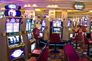 | ||
| leisure | amusement_arcade | A venue with pay-to-play games, such as video games, driving simulators, pinball machines, merchandisers, etc. Without a set age limit, as opposed to leisure=adult_gaming_centre. | 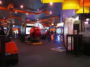 | ||
| leisure | bandstand | An open structure where musical bands can perform concerts. | 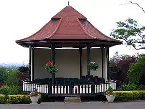 | ||
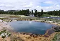
| leisure | bathing_place | Public place where you can freely bath in nature. | .jpg.webp) | ||
| leisure | beach_resort | To mark the boundary of a managed beach. | 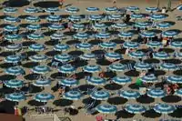 | ||
| leisure | bird_hide | A place to observe birds. | 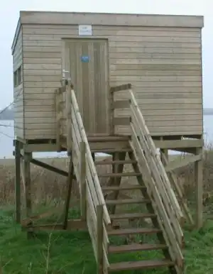 | ||
| leisure | bleachers | Raised, tiered rows of benches found at spectator events | 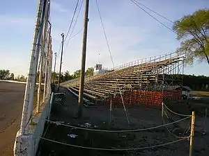 | ||
| leisure | bowling_alley | A facility that is equipped to play the game of bowling. | 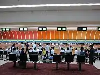 | ||
| leisure | common | Englannissa tarvittu vapaakulkuisten alueiden merkitsemiseen. Ei käytössä Suomessa. Pieniin vihreisiin kaupunkialueisiin jotka eivät ole puistojakaan sopii landuse=grass. | |||
| leisure | dance | Tanssipaikka (ei yökerho) |  | ||
| leisure | disc_golf_course | Disc golf course | 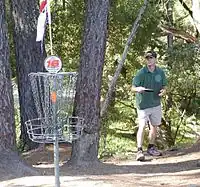 | ||
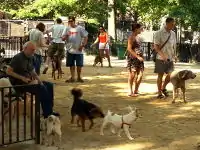
| leisure | dog_park | Koirapuisto |  |
 | |
| leisure | escape_game | A physical adventure game in which players solve a series of puzzles using clues, hints and strategy to complete the objectives at hand. |  | ||
| leisure | firepit | A permanent location or structure to host campfires, bonfires, etc. |  | ||
| leisure | fishing | Kalastusalue, ei tarpeen Suomessa. | 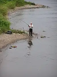 | ||
| leisure | fitness_centre | A place with exercise machines and/or fitness/dance classes. | 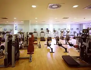 | ||
| leisure | fitness_station | A place with exercise machines, single or collection of, outdoor. | 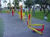 | ||
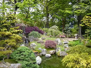
| leisure | garden | Puutarha |  |
 | |
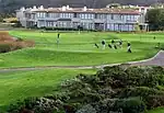
| leisure | golf_course | Golf-kentän alue tai solmulla esim. kentän sisäänkäyntiin liittyvän rakennuksen paikka. |  |
 | |
| leisure | hackerspace | A place where people with common interests, often in computers, technology, science, digital art or electronic art, can meet, socialize and/or collaborate. | 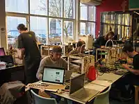 | ||
| leisure | horse_riding | A facility where people practise horse riding, usually in their spare time, e.g. a riding centre. For a riding arena use leisure=pitch + sport=equestrian. |  | ||
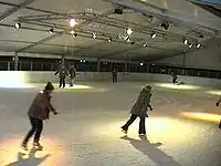
| leisure | ice_rink | Jäädytetty kaukalo esimerkiksi jääkiekkoa, jääpalloa tai luistelua varten. |  |
 | |
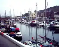
| leisure | marina | Huvivenesatama. Korjaus- ja huoltoalueet ovat erikseen. |  |
 | |
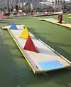
| leisure | miniature_golf | Minigolf |  |
 | |
| leisure | nature_reserve | Luonnonsuojelualue |  |
 | |
| leisure | outdoor_seating | Areas for outdoor gastronomy. | 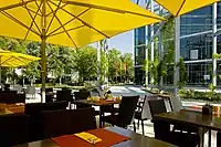 | ||
| leisure | park | Hoidettu puisto. Erittäin metsäisät puistoalueet tulisi merkata natural=wood, Keski-Euroopassa osa puistoistamme olisi muutenkin metsiä. |  |
 | |
| leisure | picnic_table | A picnic table | 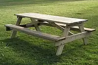 | ||
| leisure | pitch | Kenttä, urheiluun |  |
 | |
| leisure | playground | Leikkipuisto | 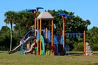 | ||
| leisure | resort | A place used for relaxation or recreation, attracting visitors for vacations, tourism and/or going swimming in a pool and/or a nearby body of water. | 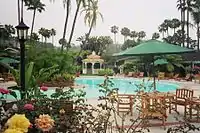 | ||
| leisure | sauna | A small room or house designed to experience dry or wet heat sessions, or an establishment with one or more of these and auxiliary facilities. | 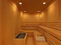 | ||
| leisure | slipway | Vesillelaskuramppi, paikka jossa auton perävaunu saadaan ajettua ramppia pitkin veteen ja vene perävaunulle tai siltä pois. |  | ||
| leisure | sports_centre | Liikuntakeskus |  |
 | |
| leisure | sports_hall | A sufficiently large single room that is suitable for practising sports indoors and does not have a "centre" character. |  | ||
| leisure | stadium | Kotimaista stadionin määritelmää hieman laajempi, urheilukenttä jolle on rakennettu riittävän monipaikkaiset istumakatsomot. | |
 | |
| leisure | summer_camp | Summer camp is a supervised program for children or teenagers conducted during the summer months in some countries. Children and adolescents who attend summer camp are known as campers. |  | ||
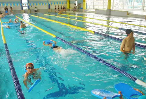
| leisure | swimming_area | A swimming area - place over river, lake or other water reservoir where swimming is allowed. |  | ||
| leisure | swimming_pool | A swimming pool (water area only). |  |
 | |
| leisure | tanning_salon | Place where customers can use UV lamps to tan their skin. | .jpg.webp) | ||
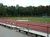
| leisure | track | Kilparata - juoksu, ravirata, koirakilpailu, pyöräily yms. | |
 | |
| leisure | trampoline_park | An leisure facility consisting of many interlinked trampolines | 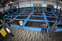 | ||
| leisure | water_park | Vesipuisto | 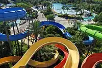 | ||
| leisure | wildlife_hide | A place to observe wildlife. See also leisure=bird_hide. | 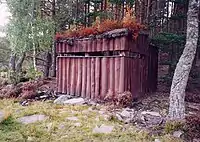 | ||
| leisure | user defined | All commonly used values according to Taginfo |
This table is a wiki template with a default description in English. Editable here.
"Hyödykkeet" / amenity
Useimpiin näistä sopii kaveriksi name=*. Jos mahdollista, niin lisää myös osoite (addr:street=*, addr:housenumber=*, addr:postcode=*,addr:city=*), puhelinnumero (phone=*) ja WWW-sivu: (website=*).
| Avain | Arvo | Elementti | Kommentti | Esitystapa | Valokuva | |
|---|---|---|---|---|---|---|
Sustenance | ||||||
| amenity | bar | Baari. Erot baarin ja pubin välillä katso: amenity=bar ja amenity=pub | 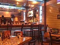 | |||
| amenity | biergarten | Puiston keskelle rakennettu ulkoilmaravintola (suom. olutpuutarha) | 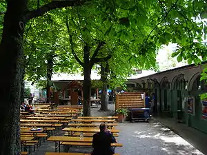 | |||
| amenity | cafe | Kahvila |  | |||
| amenity | fast_food | Pikaruokaravintola |  | |||
| amenity | food_court | Ruokailupaikka, missä ruokaa myy palvelutiskeiltään useampi eri ruokailuyritys, joiden kaikkien asiakkaiden käytössä on yksi isompi yhteinen ruokailutila. Tyypillinen sijaintipaikka esim. lentokentällä tai ostoskeskuksessa. |  | |||
| amenity | ice_cream | Ice cream shop or ice cream parlour. A place that sells ice cream and frozen yoghurt over the counter | .jpg.webp) | |||
| amenity | pub | Pubi. Voi myydä ruokaakin ja ulkomailla tarjota majoitusta. Erot pubin ja baarin välillä katso: amenity=pub ja amenity=bar |  | |||
| amenity | restaurant | Ravintola, ei pikaruokapaikka |  | |||
Education | ||||||
| amenity | college | Yliopistotasoisten ja peruskoulujen väliin jäävät koulutuslaitokset |  | |||
| amenity | driving_school | Driving School which offers motor vehicle driving lessons |  | |||
| amenity | kindergarten | Esikoulu. Huomaa, että päiväkoti merkitään tagilla amenity=childcare! |  | |||
| amenity | language_school | Language School: an educational institution where one studies a foreign language. |  | |||
| amenity | library | Kirjasto |  | |||
| amenity | toy_library | A place to borrow games and toys, or play with them on site. |  | |||
| amenity | research_institute | An establishment endowed for doing research. |  | |||
| amenity | training | Public place where you can get training. | | |||
| amenity | music_school | A music school, an educational institution specialized in the study, training, and research of music. | ._(9196267787).jpg.webp) | |||
| amenity | school | Koulujen alueet |  | |||
| amenity | traffic_park | Juvenile traffic schools |  | |||
| amenity | university | Yliopistotasoinen koulutus |  | |||
Transportation | ||||||
| amenity | bicycle_parking | Polkupyöräparkki. | 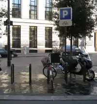 | |||
| amenity | bicycle_repair_station | General tools for self-service bicycle repairs, usually on the roadside; no service | 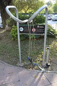 | |||
| amenity | bicycle_rental | Polkupyörävuokraamo, ei esiinny Suomessa samassa merkityksessä mutta voisi käyttää kaupunkien tarjoamien pantillisten polkupyörien lainauspisteille. | .jpg.webp) | |||
| amenity | boat_rental | Rent a Boat |  | |||
| amenity | boat_sharing | Share a Boat |  | |||
| amenity | bus_station | Useamman linjan bussiasema |  | |||
| amenity | car_rental | Autovuokraamo | ||||
| amenity | car_sharing | Autojen yhteiskäyttöpalvelu |  | |||
| amenity | car_wash | Autopesula, löytyy yleensä huoltoasemien yhteydessä. |  | |||
| amenity | compressed_air | A device to inflate tires/tyres (e.g. motorcar, bicycle) | 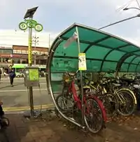 | |||
| amenity | vehicle_inspection | Government vehicle inspection |  | |||
| amenity | charging_station | Charging facility for electric vehicles | 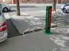 | |||
| amenity | driver_training | A place for driving training on a closed course |  | |||
| amenity | ferry_terminal | Laivaterminaali |  | |||
| amenity | fuel | Bensa-asema / huoltoasema. Yhteys yleisille teille merkataan usein tienä highway=service. Myös veneiden tankkausasemat. |  | |||
| amenity | grit_bin | Hiekoitusastia |  | |||
| amenity | motorcycle_parking | Parking for motorcycles | 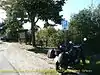 | |||
| amenity | parking | Pysäköintialue. Käytä vain joko yhteen solmuun tai alueeseen, alueisiinkin piirretään nykyään P-symboli automaattisesti. Pysäköintialueen sisäiset tiet ja yhteydet yleisille teille voi piirtää highway=service-tagilla. | 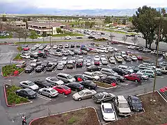 | |||
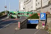
| amenity | parking_entrance | An entrance or exit to an underground or multi-storey parking facility. Group multiple parking entrances together with a relation using the tags type=site and site=parking. Do not mix with amenity=parking. | Underground |
 | ||
| amenity | parking_space | A single parking space. Group multiple parking spaces together with a relation using the tags type=site and site=parking. Do not mix with amenity=parking. |  |
.JPG.webp) | ||
| amenity | taxi | Taksiasema | 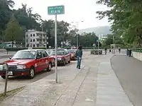 | |||
Financial | ||||||
| amenity | atm | Pankkiautomaatti | 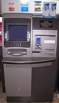 | |||
| amenity | bank | Pankki |  | |||
| amenity | bureau_de_change | Valuutanvaihtaja | 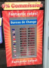 | |||
Healthcare | ||||||
| amenity | baby_hatch | Paikka, jonne vauvan voi hylätä anonyymisti adoptoitavaksi. Ei tarpeellinen Suomessa. |  | |||
| amenity | clinic | A medium-sized medical facility or health centre. |  | |||
| amenity | dentist | Hammaslääkäri |  | |||
| amenity | doctors | Yksityislääkärin vastaanotto tai yksityinen lääkärikeskus. Kunnalliset sairaalat merkitään amenity=hospital. |  | |||
| amenity | hospital | Terveyskeskus ja sairaala. Nimestä name=* selviää kumpi. |  | |||
| amenity | nursing_home | Discouraged tag for a home for disabled or elderly persons who need permanent care. Use amenity=social_facility + social_facility=nursing_home now. |  | |||
| amenity | pharmacy | Apteekki, lisää myös dispensing=yes |  | |||
| amenity | social_facility | A facility that provides social services: group & nursing homes, workshops for the disabled, homeless shelters, etc. |  | |||
| amenity | veterinary | Eläinlääkäri |  | |||
Entertainment, Arts & Culture | ||||||
| amenity | arts_centre | Taidekeskus. Taiteen tekemistä ja esittämistä edistävä keskus, joka esim. tarjoaa tiloja ja välineitä sekä järjestää kursseja. Ei taidemuseo, joka merkataan tourism=museum. |  | |||
| amenity | brothel | Bordelli | 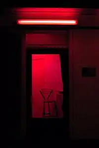 | |||
| amenity | casino | A gambling venue with at least one table game(e.g. roulette, blackjack) that takes bets on sporting and other events at agreed upon odds. | 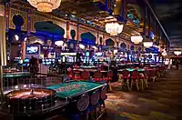 | |||
| amenity | cinema | Elokuvateatteri | 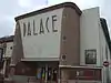 | |||
| amenity | community_centre | A place mostly used for local events, festivities and group activities; including special interest and special age groups. . |  | |||
| amenity | conference_centre | A large building that is used to hold a convention |  | |||
| amenity | events_venue | A building specifically used for organising events |  | |||
| amenity | exhibition_centre | An exhibition centre | ||||
| amenity | fountain | Suihkulähde | 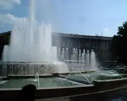 | |||
| amenity | gambling | A place for gambling, not being a shop=bookmaker, shop=lottery, amenity=casino, or leisure=adult_gaming_centre.
Games that are covered by this definition include bingo and pachinko. |
 | |||
| amenity | love_hotel | A love hotel is a type of short-stay hotel operated primarily for the purpose of allowing guests privacy for sexual activities. |  | |||
| amenity | music_venue | An indoor place to hear contemporary live music. |  | |||
| amenity | nightclub | Yökerho |  | |||
| amenity | planetarium | A planetarium. | 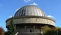 | |||
| amenity | public_bookcase | A street furniture containing books. Take one or leave one. | 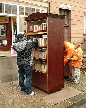 | |||
| amenity | social_centre | A place for free and not-for-profit activities. |  | |||
| amenity | stripclub | Paikka, jossa nähtävissä striptease-esityksiä (seksipalveluita tarjoavat paikat: amenity=brothel) |  | |||
| amenity | studio | Studio (TV, radio) |  | |||
| amenity | swingerclub | A club where people meet to have a party and group sex. |  | |||
| amenity | theatre | Teatteri tai ooppera |  | |||
Public Service | ||||||
| amenity | courthouse | Oikeustalo |  | |||
| amenity | fire_station | Pelastusasema |  | |||
| amenity | police | Poliisiasema |  | |||
| amenity | post_box | Postilaatikko | 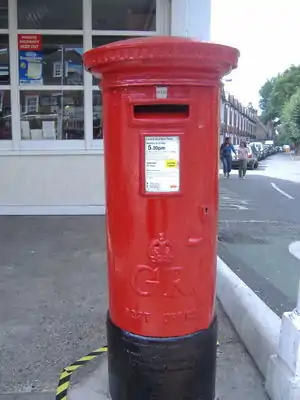 | |||
| amenity | post_depot | Post depot or delivery office, where letters and parcels are collected and sorted prior to delivery. | 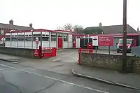 | |||
| amenity | post_office | Postikonttori | 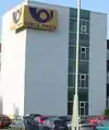 | |||
| amenity | prison | Vankila | 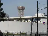 | |||
| amenity | ranger_station | National Park visitor headquarters: official park visitor facility with police, visitor information, permit services, etc | 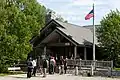 | |||
| amenity | townhall | Kunnantalo/kaupungintalo, nykyinen tai historiallinen |  | |||
Facilities | ||||||
| amenity | bbq | Julkinen grillauspaikka omaa ruoanlaittoa varten (esim. grillikatokset) | 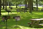 | |||
| amenity | bench | Penkki | 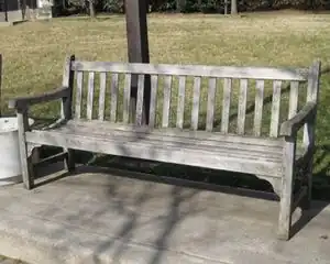 | |||
| amenity | dog_toilet | Area designated for dogs to urinate and excrete. |  | |||
| amenity | dressing_room | Area designated for changing clothes. | 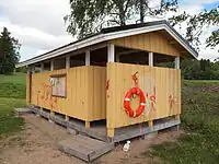 | |||
| amenity | drinking_water | Juomavesipiste | 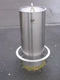 | |||
| amenity | give_box | A small facility where people drop off and pick up various types of items in the sense of free sharing and reuse. | 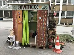 | |||
| amenity | mailroom | A mailroom for receiving packages or letters. |  | |||
| amenity | parcel_locker | Machine for picking up and sending parcels | 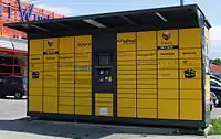 | |||
| amenity | shelter | Suojakatos | 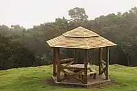 | |||
| amenity | shower | Public shower. | 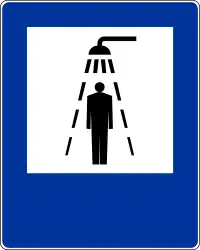 | |||
| amenity | telephone | Puhelinkoppi, jos vielä löydät jostain. | 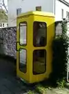 | |||
| amenity | toilets | Yleinen WC. Lisää fee=* jos tiedät maksullisuuden. | 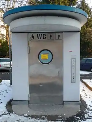 | |||
| amenity | water_point | Place where you can get large amounts of drinking water | 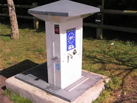 | |||
| amenity | watering_place | Place where water is contained and animals can drink | 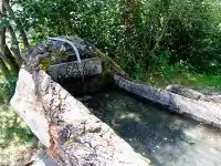 | |||
Waste Management | ||||||
| amenity | sanitary_dump_station | A place for depositing human waste from a toilet holding tank. | | |||
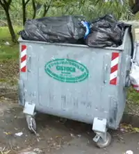
| amenity | recycling | Kierrätettävien jätteiden keräyspiste. | 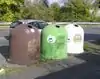 | |||
| amenity | waste_basket | Roskakori | 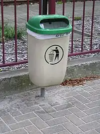 | |||
| amenity | waste_disposal | Jätteenkeräyspiste, myös veneilijöiden ja karavaanarien käyttöön tarkoitettu jätevesien imutyhjennysasema. Lisäksi tagilla waste=trash/excrement/chemical toilet kerrotaan mitä jätteitä piste ottaa vastaan: trash=roskapussit excrement=veneiden yms. vessat chemical toilet=kemiallisten käymälöiden tyhjennys |
 | |||
| amenity | waste_transfer_station | A waste transfer station is a location that accepts, consolidates and transfers waste in bulk. | ||||
Others | ||||||
| amenity | animal_boarding | A facility where you, paying a fee, can bring your animal for a limited period of time (e.g. for holidays) |  | |||
| amenity | animal_breeding | A facility where animals are bred, usually to sell them |  | |||
| amenity | animal_shelter | A shelter that recovers animals in trouble |  | |||
| amenity | animal_training | A facility used for non-competitive animal training | .jpg.webp) | |||
| amenity | baking_oven | An oven used for baking bread and similar, for example inside a building=bakehouse. |  | |||
| amenity | childcare | A place where children of different ages are looked after which is not an amenity=kindergarten or preschool. |  | |||
| amenity | clock | Yleisesti näkyvillä oleva kello | .jpg.webp) | |||
| amenity | crematorium | Krematorio |  | |||
| amenity | dive_centre | A dive center is the base location where sports divers usually start scuba diving or make dive guided trips at new locations. |  | |||
| amenity | funeral_hall | A place for holding a funeral ceremony, other than a place of worship. |  | |||
| amenity | grave_yard | Pieni hautausmaa kappelin tms. yhteydessä. Suuremmat kirkosta kauempana olevat merkataan landuse=cemetery. |  |
| ||
| amenity | hunting_stand | Metsästyslava | 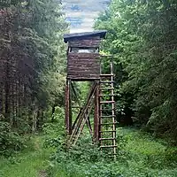 | |||
| amenity | internet_cafe | A place whose principal role is providing internet services to the public. |  | |||
| amenity | kitchen | A public kitchen in a facility to use by everyone or customers |  | |||
| amenity | kneipp_water_cure | Outdoor foot bath facility. Usually this is a pool with cold water and handrail. Popular in German speaking countries. | 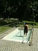 | |||
| amenity | lounger | An object for people to lie down. | .jpg.webp) | |||
| amenity | marketplace | Tori, jolla ajoittain myyntikojuja. | 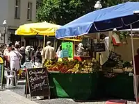 | |||
| amenity | monastery | Monastery is the location of a monastery or a building in which monks and nuns live. |  | |||
| amenity | photo_booth | A stand to create instant photos. | 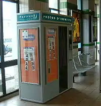 | |||
| amenity | place_of_mourning | A room or building where families and friends can come, before the funeral, and view the body of the person who has died. |  | |||
| amenity | place_of_worship | Kirkko, moskeija, kappeli; mikä tahansa hengellisen toiminnan paikka. Muista myös tagit religion=* ja denomination=* jolla kerrotaan minkä uskonnon tai uskontojen harjoittajien käytössä paikka on. Lisätietoja englanniksi | 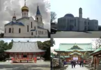 | |||
| amenity | [[ Too many Data Items entities accessed. | public_bath ]] | A location where the public may bathe in common, etc. japanese onsen, turkish bath, hot spring | .JPG.webp) | |||
| Yleisölle avoin tai kunnan rakennus | ||||||
| amenity | refugee_site | A human settlement sheltering refugees or internally displaced persons | 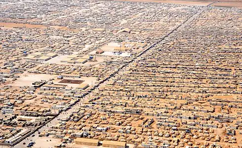 | |||
| amenity | vending_machine | Automaatti (syötävät, juotavat, liput yms). Huom: pankkiautomaatit merkitään tagilla atm=*. | 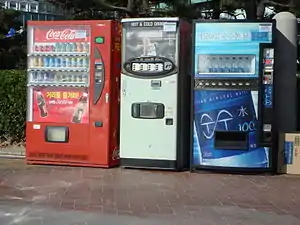 | |||
| amenity | user defined | All commonly used values according to Taginfo | ||||
This table is a wiki template with a default description in English. Editable here.
=== Kaupat / shop ===Lisää name=*. Jos mahdollista, niin lisää myös yhteystiedot: osoite (addr:street=*, addr:housenumber=*, addr:postcode=*,addr:city=*), puhelinnumero (phone=*) ja WWW-sivu: (website=*).
| Avain | Arvo | Kommentti | Esitystapa | Valokuva | ||
|---|---|---|---|---|---|---|
Food, beverages | ||||||
| shop | alcohol | Alko | 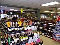 | |||
| shop | bakery | Leipomo | 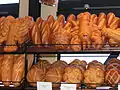 | |||
| shop | beverages | Pääasiassa juomien myyntiin keskittynyt liike | 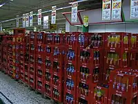 | |||
| shop | brewing_supplies | Shop focused on selling supplies for home brewing of beer, wine and spirits (where permitted). |  | |||
| shop | butcher | Lihakauppa |  | |||
| shop | cheese | Shop focused on selling cheese. |  | |||
| shop | chocolate | Shop focused on selling chocolate. |  | |||
| shop | coffee | Shop focused on selling coffee. | 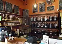 | |||
| shop | confectionery | Makeiskauppa (karkit, suklaat yms.) | 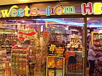 | |||
| shop | convenience | Lähikauppa - pieni ruokakauppa, jossa vain vähän muita tuotteita. (vertaa supermarket). Suomessa useimmat Alepat, Valintatalot, Siwat, K-Marketit jne. | 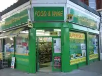 | |||
| shop | deli | Shop focused on selling delicatessen (fine foods, gourmet foods), possibly also fine wine. Not to be confused with the US delis. | 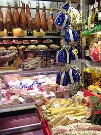 | |||
| shop | dairy | Shop focused on selling dairy products. |  | |||
| shop | farm | Maatilakauppa (maataloustuotteiden myynti maatilan yhteydessä) | 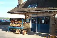 | |||
| shop | frozen_food | Shop focused on selling frozen food. | 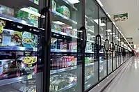 | |||
| shop | greengrocer | Shop focused on selling vegetables and fruits. | 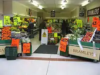 | |||
| shop | health_food | A health food shop; selling wholefoods, vitamins, nutrition supplements and meat and dairy alternatives. | 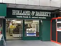 | |||
| shop | ice_cream | Shop selling ice cream. See also amenity=ice_cream. | 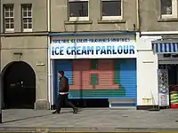 | |||
| shop | pasta | Shop focused on selling (fresh) pasta, ravioli, etc. |  | |||
| shop | pastry | Shop focused on selling baked sweets like cakes, biscuits, strudel and pies. |  | |||
| shop | seafood | Shop focused on selling fish/seafood. |  | |||
| shop | spices | Shop focused on selling spices. | .jpg.webp) | |||
| shop | tea | Shop focused on selling tea. | 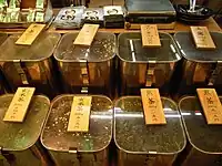 | |||
| shop | wine | Shop selling wine. | 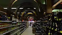 | |||
| shop | water | Shop focused on selling drinking water. | 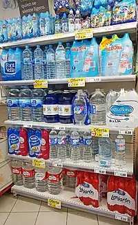 | |||
General store, department store, mall | ||||||
| shop | department_store | Tavaratalo | ||||
| shop | general | Sekatavarakauppa | 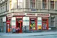 | |||
| shop | kiosk | Kioski. Pieni katutasossa oleva kauppa, joka myy esimerkiksi lehtiä, tupakkaa, makeisia ja postimerkkejä. | 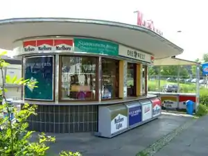 | |||
| shop | mall | Ostoskeskus | 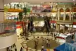 | |||
| shop | supermarket | Suurempi ruokakauppa, josta löytyy ainakin mainittavissa määrin muitakin tuotteita; Suomessa useimmat S-Marketit, K-Supermarketit jne. mutta myös Prismat, K-Citymarketit ja Euromarketit - hypermarket ei ole levinnyt käyttöön. | 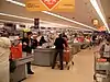 | |||
| shop | wholesale | Wholesale/warehouse club or cash and carry - a store that sells items in bulk to retailers. The branch of industry can be defined with wholesale=*. | 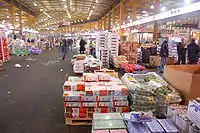 | |||
Clothing, shoes, accessories | ||||||
| shop | baby_goods | Shop focused on selling objects for babies (clothes, prams, cots, toys). |  | |||
| shop | bag | Shop focused on selling bags. | 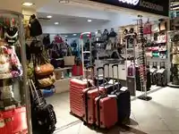 | |||
| shop | boutique | A small shopping outlet, especially one that specializes in elite and fashionable items | 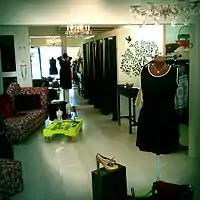 | |||
| shop | clothes | Vaatekauppa | 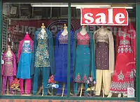 | |||
| shop | fabric | Shop focused on selling fabric and other materials for the purpose of making clothes and other products, eg dress making. |  | |||
| Shop focused on selling fashion. This is deprecated, please use shop=clothes. | 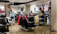 | |||||
| shop | fashion_accessories | Shop focused on selling fashion accessories. |  | |||
| shop | jewelry | Kultasepänliike, koruliike | 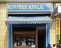 | |||
| shop | leather | Shop focused on selling products made out of leather. | ||||
| shop | sewing | A shop that sells sewing supplies (fabric, thread, yarn, knitting needles, sewing machines, etc.) |  | |||
| shop | shoes | Kenkäkauppa | 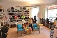 | |||
| shop | tailor | A place where clothing is made, repaired, or altered professionally, especially suits and men's clothing |  | |||
| shop | watches | Shop focused on selling watches. |  | |||
| shop | wool | Shop selling wool for making of clothes or other products. |  | |||
Discount store, charity | ||||||
| shop | charity | A charity shop is a shop operated by a charity, for the purposes of fundraising. |  | |||
| shop | second_hand | Kirpputori |  | |||
| shop | variety_store | A variety store retailer is a retail store that sells inexpensive items, sometimes with a single price point for all items in the store. | 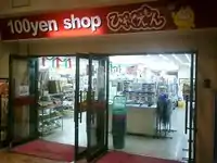 | |||
Health and beauty | ||||||
| shop | beauty | A non-hairdresser beauty shop, spa, nail salon, etc.. See also shop=hairdresser. |  | |||
| shop | chemist | Shop focused on selling articles of personal hygiene, cosmetics, and household cleaning products (for a shop that potentially dispenses prescription drugs, cf. pharmacy. U.S. drug store, see amenity=pharmacy) | 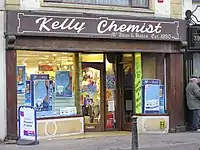 | |||
| shop | cosmetics | Shop focused on selling cosmetics | 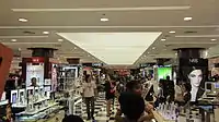 | |||
| shop | erotic | Shop focused on selling erotic toys, -clothes or other erotic stuff. | -01.jpg.webp) | |||
| shop | hairdresser | Kampaamot ja parturit | %252C_October_2009.JPG.webp) | |||
| shop | hairdresser_supply | A shop, where you can buy hairdressing supplies. |  | |||
| shop | hearing_aids | Kuulolaitteiden myyntiin erikoistunut liike |  | |||
| shop | herbalist | Shop focused on selling herbs, often for medical purposes. (See also: healthcare:speciality=herbalism and healthcare=alternative). |  | |||
| shop | massage | Hieroja |  | |||
| shop | medical_supply | Shop focused on selling medical supplies. |  | |||
| shop | nutrition_supplements | Shops that sells one or more nutritional supplements (of vitamins, minerals and/or herbs) |  | |||
| shop | optician | Optikko |  | |||
| shop | perfumery | Shop focused on selling perfumery |  | |||
| shop | tattoo | A tattoo parlour. |  | |||
Do-it-yourself, household, building materials, gardening | ||||||
| shop | agrarian | Shop focused on selling agrarian products, like seeds, agricultural machinery, animal feed, etc. |  | |||
| shop | appliance | Shop focused on selling large electrical items (aka white goods) washing machines, fridges, cookers, ovens, fans, etc. | 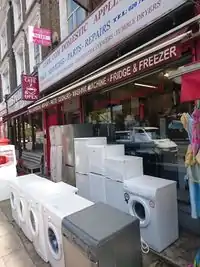 | |||
| shop | bathroom_furnishing | Shop focused on selling bathroom furniture and accessories |  | |||
| shop | doityourself | Kauppa, joka myy työkaluja ja tarvikkeita tee-se-itse nikkaroijille ja puutarhureille. |  | |||
| shop | electrical | Shop focused on selling electrical supplies and devices |  | |||
| shop | energy | Shop focused on selling energy | 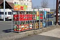 | |||
| shop | fireplace | Shop focused on selling electric fireplaces, stoves or masonry heaters and required fuels | 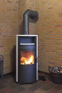 | |||
| shop | florist | Kukkakauppa: lähinnä ruukkukasveja ja leikkokukkia | 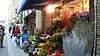 | |||
| shop | garden_centre | Puutarhakauppa: kaikkea mullasta taimiin. | 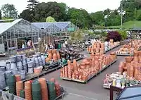 | |||
| shop | garden_furniture | Shop focused on selling garden furniture (sheds, outdoor tables, gates, fences, ...). See shop=garden_centre if also plants are sold. | ||||
| shop | gas | Shop focused on selling technical gas, such as argon, oxygen, acetylene, nitrogen, carbon dioxide, etc. in pressurized containers |  | |||
| shop | glaziery | Lasitusliike |  | |||
| shop | groundskeeping | Shop focused on selling outdoor groundskeeping equipment (lawnmowers, chainsaws, small tractors, ... |  | |||
| shop | hardware | Rautakauppa |  | |||
| shop | houseware | Shop focused on selling crockery, cutlery, kitchenware, small household appliances. |  | |||
| shop | locksmith | Shop focused on selling keys, see also craft=locksmith and craft=key_cutter | 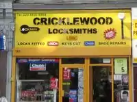 | |||
| shop | paint | Shop focused on selling paints. | 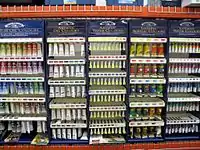 | |||
| shop | pottery | Shop focused on selling earthenware, stoneware and porcelain and other ceramic ware. | _74.jpg.webp) | |||
| shop | security | Shop focused on selling security items like burglar alarms, vaults, locking systems, video surveillance cameras, firefighting equipment, alarm systems, warning systems, etc. | ||||
| shop | trade | Shop focused on selling one or more building supplies such as timber/wood, cement etc. See also shop=doityourself | 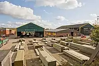 | |||
| This tag is deprecated. Please use craft=window_construction instead. | ||||||
Furniture and interior | ||||||
| shop | antiques | Shop focused on selling antiques. |  | |||
| shop | bed | Shop focused on selling beds, mattresses and other bedding products. | 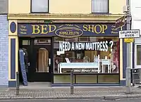 | |||
| shop | candles | Shop focused on selling candles and candle accessories (holders, etc) | .jpg.webp) | |||
| shop | carpet | Shop focused on selling carpets |  | |||
| shop | curtain | Shop focused on selling curtains or drapes (see also shop=fabric) |  | |||
| shop | doors | Shop focused on selling doors | ||||
| shop | flooring | Shop focused on selling floorings |  | |||
| shop | furniture | Sisustus- ja huonekaluliikkeet |  | |||
| shop | household_linen | Shop focused on selling household linen. | 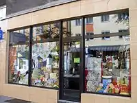 | |||
| shop | interior_decoration | Shop focused on selling interior decorations. |  | |||
| shop | kitchen | A shop where you can plan and buy your kitchen. (Sometimes called "kitchen studio" and the like, but plain kitchen is the most frequently used tag so far.) | 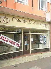 | |||
| shop | lighting | A shop selling lighting fixtures and lamps. |  | |||
| shop | tiles | Shop focused on selling tiles. |  | |||
| shop | window_blind | Shop focused on selling window blinds. |  | |||
Electronics | ||||||
| shop | computer | Tietokonekauppa |  | |||
| shop | electronics | Kodinkoneita: TV:t, radiot, tietokoneet, jääkaapit yms. |  | |||
| shop | hifi | Audio- ja videolaitteiden erikoisliike |  | |||
| shop | mobile_phone | Shop focused on selling mobile phones and accessories |  | |||
| shop | radiotechnics | Shop focused on selling electronic components, electrical products, radio measuring devices, supplies for radio and electronics. |  | |||
| shop | telecommunication | Shop selling internet, television or similar services, and related hardware. |  | |||
| shop | vacuum_cleaner | Shop focused on selling vacuum cleaners and associated products. |  | |||
Outdoors and sport, vehicles | ||||||
| shop | atv | Shop focused on selling |
 | |||
| shop | bicycle | Pyörien ja pyörätarvikkeiden myynnin lisäksi voi tarjota vuokraus- ja huoltopalveluja. | 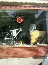 | |||
| shop | boat | Shop focused on selling boats, boat equipment and may rent or repair them | 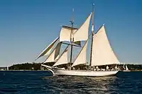 | |||
| shop | car | Autokauppa |  | |||
| shop | car_repair | Autokorjaamo | 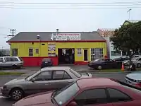 | |||
| shop | car_parts | Shop focused on selling auto parts, auto accessories, motor oil, car chemicals, etc. | 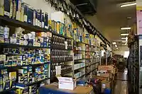 | |||
| shop | caravan | A shop for caravans, motorhomes & similar recreational vehicles. |  | |||
| shop | fuel | Shop selling fuels (motor fuel, wood, coal, gas) that can't be considered a amenity=fuel (fuel station). Use fuel:*=yes/no to indicate which fuels are available. |  | |||
| shop | fishing | Shop focused on selling fishing equipment. | .jpg.webp) | |||
| shop | golf | Shop focused on selling golf equipment. |  | |||
| shop | hunting | Shop focused on selling gun and hunting equipment. |  | |||
| shop | jetski | Shop focused on selling jetskis, jetski equipment and may rent or repair them |  | |||
| shop | military_surplus | Shop selling used military equipment |  | |||
| shop | motorcycle | Myy moottoripyöriä |  | |||
| shop | outdoor | Kauppa, joka myy telttailuun, vaeltamiseen, kiipeilyyn, kalastukseen ja muuhun luonnossa tapahtuvaan urheiluun tarvittavia varusteita (ja GPS-laitteita) |  | |||
| shop | scuba_diving | Shop focused on selling scuba diving equipment. |  | |||
| shop | ski | Shop focused on selling skis, ski equipment and may rent or repair them |  | |||
| shop | snowmobile | Shop focused on selling snowmobiles, snowmobile equipment and may rent or repair them |  | |||
| shop | sports | Urheiluvälineitä |  | |||
| shop | swimming_pool | A store that sells swimming pool equipment and supplies. |  | |||
| shop | trailer | Shop focused on selling trailers and parts and/or repairing / renting them |  | |||
| shop | tyres | Shop focused on selling tyres. | 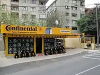 | |||
Art, music, hobbies | ||||||
| shop | art | Shop which sells works of art. May be paintings, sculpture, or other types of art |  | |||
| shop | camera | A shop mainly selling cameras and lenses |  | |||
| shop | collector | A shop for different collector's items like stamps, coins, action figures, etc. |  | |||
| shop | craft | An arts and crafts supply store. Commonly sold items are paper, canvas, paint, pencils, crafting wood, crafting tools, etc. - look at craft=* | .jpg.webp) | |||
| shop | frame | Shop focused on selling frames. |  | |||
| shop | games | Shop focused on selling board games, card games and/or role-playing games. |  | |||
| shop | model | Shop specialising in the sale of scale models. |  | |||
| shop | music | Shop focused on selling recorded music (vinyl/CDs/...) |  | |||
| shop | musical_instrument | Shop focused on selling musical instruments, lyrics, scores. If focused on a specific instrument, specify with musical_instrument=* | %252C_September_2009.JPG.webp) | |||
| shop | photo | Shop focused on selling products or services related with photography. |  | |||
| shop | trophy | Store selling trophies, awards, plaques etc. |  | |||
| shop | video | Video/dvd-kauppa/vuokraamo |  | |||
| shop | video_games | Shop focused on selling video games. |  GameStop on Powell Street in San Francisco, California. | |||
Stationery, gifts, books, newspapers | ||||||
| shop | anime | Shop focused on selling anime stuff. |  | |||
| shop | books | Kirjakauppa |  | |||
| shop | gift | Lahjatavarakauppa |  | |||
| shop | lottery | A shop of which the main or only purpose is the sale of lottery tickets. | %252C_Lotto.jpg.webp) | |||
| shop | newsagent | Englainninkielinen kuvaus: "Shop selling newspapers, cigarettes, other goods". Suomeen sopisi paremmin shop=kiosk |  | |||
| shop | stationery | Toimistotarvikkeita |  | |||
| shop | ticket | Shop focused on selling tickets for concerts, events, public transport, … |  | |||
Others | ||||||
| shop | bookmaker | A shop that takes bets on sporting and other events at agreed upon odds. | .jpg.webp) | |||
| shop | cannabis | a shop primarily and legally selling non-medical cannabis products |  | |||
| shop | copyshop | Shop focused on selling photocopying and printing services. |  | |||
| shop | dry_cleaning | Kuivapesula. Katso myös pesula: shop=laundry |  | |||
| shop | e-cigarette | Shop focused on selling electronic cigarettes. |  | |||
| shop | funeral_directors | Hautaustoimisto |  | |||
| shop | insurance | A shop selling insurance services from one or more insurance carriers. |  | |||
| shop | laundry | Pesula; palvelua tai itsepalvelua self_service=yes/no. |  | |||
| shop | money_lender | A money lender offers small personal loans at high rates of interest. |  | |||
| shop | outpost | Shop primarily used to pick-up items ordered online. |  | |||
| shop | party | A shop for party and festival supplies, like costumes, etc. |  | |||
| shop | pawnbroker | A pawnbroker (or pawnshop) is an individual or business that offers secured loans to people. See also shop=second_hand |  | |||
| shop | pest_control | Shop selling pest control goods to exterminate rats, insects etc. |  | |||
| shop | pet | A shop for pets, animals and toys or food for them. |  | |||
| shop | pet_grooming | A shop offering grooming services for pets (most frequently dogs) |  | |||
| shop | pyrotechnics | Store of pyrotechnics: fireworks, firecrackers, sparklers etc. | .JPG.webp) | |||
| shop | religion | Shop focused on selling religious articles, church shop. See also religion=* |  | |||
| shop | storage_rental | self storage |  | |||
| shop | tobacco | Shop focused on selling tobacco, cigarettes and their related accessories. |  | |||
| shop | toys | Lelukauppa |  | |||
| shop | travel_agency | Matkatoimisto |  | |||
| shop | weapons | Shop focused on selling weapons like knives, guns etc. |  | |||
| shop | vacant | An unused vacant shop. Can be used for an empty or abandoned retail space that seems to be available for lease or purchase where a retail store (or similar businesses) may be opened. No store is being operated in a vacant shop, and neither goods nor services are being offered. This tag can be used after a store was closed or for a newly built shop before any busisness was operated in the shop. |  | |||
| shop | A shop of unspecified type - it is always better to use another value that gives info about shop type, if possible. Used also as indicator that feature such as fuel station has shop. | |||||
| shop | user defined | All commonly used values according to Taginfo | ||||
This table is a wiki template with a default description in English. Editable here.
Matkailukohteet / tourism
Useimpiin näistä sopii kaveriksi name=*. Jos mahdollista, niin lisää myös yhteystiedot: osoite (addr:street=*, addr:housenumber=*, addr:postcode=*,addr:city=*), puhelinnumero (phone=*) ja WWW-sivu: (website=*).
| Key | Value | Element | Comment | carto-Rendering | Photo |
|---|---|---|---|---|---|
| tourism | alpine_hut |  | |||
| tourism | apartment | A holiday or vacation apartment is a furnished apartment or flat with cooking and bathroom facilities that can be rented for holiday vacations. This tag can be applied to a building accommodating one or more holiday flats. Between tourism=apartment and tourism=chalet is a clear distinction: "Chalet" is for a detached holiday cottage which you rent exclusively, "apartment" is for one or several flats in a shared building (or a single flat in one part of the building and other usages, like private apartments or a restaurant, in the other part). |  | ||
| tourism | aquarium | An aquarium, meant as |
 | ||
| tourism | artwork | Taideteos (patsas, veistos, seinämaalaus tms.) |  | ||
| tourism | attraction | Muu nähtävyys. |  | ||
| tourism | camp_pitch | camp pitch is the free space used to place a tent or or caravan within a tourism=camp_site or tourism=caravan_site area. | .jpg.webp) | ||
| tourism | camp_site | Leirintäalue |  | ||
| tourism | caravan_site | Asuntovaunualue. |  | ||
| tourism | chalet | Chalet is a type of accommodation used in the hospitality industry to describe one or more detached cottages with self-contained cooking facilities and/or bathroom and toilet facilities. This is not to be confused with the Swiss term for a type of wood house, use the tags building=cabin or building=yes instead. Between tourism=apartment and tourism=chalet is a clear distinction: "Chalet" is for a detached holiday cottage which you rent exclusively, "apartment" is for one or several flats in a shared building (or a single flat in one part of the building and other usages, like private apartments or a restaurant, in the other part). |  | ||
| tourism | gallery |  | |||
| tourism | guest_house |  | |||
| tourism | hostel |  | |||
| tourism | hotel | Hotelli |  | ||
| tourism | information | Opastustaulu tai infopiste |  | ||
| tourism | motel |  | |||
| tourism | museum | Museo. Useimmiten nimetty, käytä name=* |  | ||
| tourism | picnic_site | Levähdysalue; ulkotila jossa pöytiä ja penkkejä eväiden nauttimiseen, usein maantien varrella. |  | ||
| tourism | theme_park | Huvipuisto tai vastaava. |  |
 | |
| tourism | viewpoint | Näköalapaikka. |  | ||
| tourism | wilderness_hut |  | |||
| tourism | zoo | Eläintarha |  |
 | |
| tourism | yes | To add tourist interest to something described by other tags. | |||
| tourism | user defined | All commonly used values according to Taginfo |
This table is a wiki template with a default description in English. Editable here.
Museot ja historialliset kohteet
This is used to describe various historic places. For example: archeological sites, wrecks, ruins, castles and ancient buildings. See the page titled Historic for an introduction on its usage.
| Key | Value | Element | Comment | Rendering | Photo |
|---|---|---|---|---|---|
| historic | aircraft | A decommissioned aircraft which generally remains in one place |  | ||
| historic | aqueduct | A historic structure to convey water | 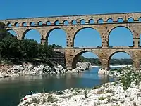 | ||
| historic | archaeological_site | Arkeologinen kaivanto. |  | ||
| historic | battlefield | Merkittävän historiallisen taistelun tapahtumapaikka, tuskin käytössä Suomessa. | .jpg.webp) | ||
| historic | bomb_crater | A bomb crater. |  | ||
| historic | building | If it's not clear what type a historic building has, it can be tagged as a generic building. |  | ||
| historic | cannon | A historic/retired cannon. Usually found at on forts or battlefields. | .jpg.webp) | ||
| historic | castle | Linna (säilynyt). |  | ||
| historic | castle_wall | A |
 |
 | |
| historic | charcoal_pile | Historic site of a charcoal pile. Often still in good condition in hilly forest areas. |  | ||
| historic | church | A building with historical value for Christian religious activities, particularly for worship services. |  | ||
| historic | city_gate | A |
 | ||
| historic | citywalls | A |
|
| |
| historic | farm | A historical farm, kept in its original state. |  | ||
| historic | fort | A military fort – distinct from a castle as it is generally more modern |  | ||
| historic | gallows | A structure designed for capital punishment by hanging. |  | ||
| historic | highwater_mark | A marker for indicating past flood. |  | ||
| historic | locomotive | A decommissioned locomotive which generally remains in one place. | 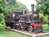 | ||
| historic | manor | Historic |
 | ||
| historic | memorial | Muistomerkki (pieni, ehkä vain laatta seinässä) |  | ||
| historic | mine | Abandoned underground mine workings for minerals such as coal or lead. | 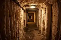 | ||
| historic | mine_shaft | Vertical shafts of a historic mine | 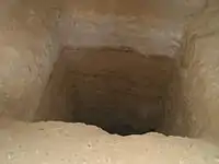 | ||
| historic | milestone | A historic marker that shows the distance to important destinations. | 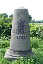 | ||
| historic | monastery | An historic monastery. See Also amenity=monastery. | 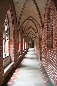 | ||
| historic | monument | Muistomerkki (suuri, patsas tai vastaava). |  | ||
| historic | optical_telegraph | Historic optical telegraph |  | ||
| historic | pillory | A construction designed to immobilitate and humiliate a person who was convicted in lower courts. |  | ||
| historic | railway_car | A decommissioned railway car which generally remains in one place. | 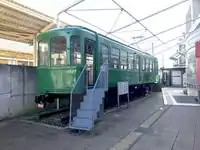 | ||
| historic | ruins | Rauniot (esim. linnan). |  | ||
| historic | rune_stone | A |
 | ||
| historic | ship | A decommissioned ship or submarine |  | ||
| historic | stone | A stone shaped or placed by man with historical value. |  | ||
| historic | tank | A decommissioned tank which generally remains in one place. | 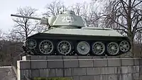 | ||
| historic | tomb | Historic tomb |  | ||
| historic | tower | Historic tower | |||
| historic |  | ||||
| historic | vehicle | A decommissioned land-based vehicle which generally remains in one place |  | ||
| historic | wayside_cross | A historical (usually christian) cross. Frequently found along the way in Southern Germany, Austria and probably elsewhere. |  | ||
| historic | wayside_shrine | A historical shrine often showing a religious depiction. Frequently found along the way in Southern Germany, Austria and probably elsewhere. |  | ||
| historic | wreck | Hylky, uponnut laiva. |  | ||
| historic | yes | Used to add the historic significance of the objects described by other tags. | |||
| historic | user defined | All commonly used values according to Taginfo |
This table is a wiki template with a default description in English. Editable here.
Maankäytön luokittelu / landuse
Erilaisia luokituksia alueille. Koska harvoilla paikkakunnilla on saatavilla tarpeeksi hyviä ilmakuvia talojen paikantamiseksi, voi alueita merkata pääasiallisen käyttötarkoituksen mukaan.
| Key | Value | Element | Description | Rendering | Photo | |
|---|---|---|---|---|---|---|
Common landuse key values - developed land | ||||||
| landuse | commercial | Alueella pääasiallisesti toimistoja |  |
 | ||
| landuse | construction | Rakennustyömaa |  |
 | ||
| landuse | education | An area predominately used for educational purposes/facilities. |  | |||
| landuse | fairground | A site where the fair takes place |  | |||
| landuse | industrial | Teollisuusalue | |
 | ||
| landuse | residential | Alueella pääasiallisesti asutusta |  |
 | ||
| landuse | retail | Alueella pääasiallisesti kauppoja |  |
 | ||
| landuse | institutional | Land used for institutional purposes, see
The meaning of this tag is ambiguous and unclear. Consider using another tag that better describes the object. For instance landuse=commercial. See talk page for discussion. |
 | |||
| Key | Value | Element | Description | Rendering | Photo | |
Common landuse key values - rural and agricultural land | ||||||
| landuse | aquaculture | currently not rendered by osm-carto | 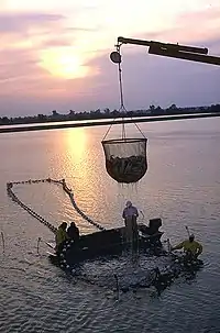 | |||
| landuse | allotments | Siirtolapuutarha |  |
 | ||
| landuse | farmland | An area of farmland used for tillage (cereals, vegetables, oil plants, flowers). |  |
 | ||
| landuse | [[ Too many Data Items entities accessed. | farmyard ]] | Maatilojen piha-alueet. |  |
 | ||
| landuse | flowerbed | An area designated for flowers |  | |||
| landuse | forest | Talousmetsä. Suomessakin moni metsä on hoidettua talousmetsää vaikkei olisi siistiä puurivistöä aluskasvillisuudesta paljaana ja kangasmetsän aluskasvillisuus on matalaa muutoinkin. Tuntomerkkejä:
Erityisesti (joissain) taajamissa on viime aikoina kuitenkin pyritty luonnontilaistamaan metsäalueita. |
 |
 | ||
| landuse | greenhouse_horticulture | Area used for growing plants in greenhouses | |
 | ||
| landuse | meadow | A meadow or pasture: land primarily vegetated by grass and non-woody plants, mainly used for hay or grazing |  |
 | ||
| landuse | orchard | intentional planting of trees or shrubs maintained for food production |  |
 | ||
| landuse | plant_nursery | intentional planting of plants maintaining for the production of new plants |  |
 | ||
| landuse | vineyard | Viinitarha |  |
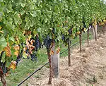 | ||
| Key | Value | Element | Description | Rendering | Photo | |
Common landuse key values - waterbodyWarning: currently, there is no convention on the exact meaning of this tag. Therefore, it makes sense to treat it like "boundary of aquaculture" (without implication of water body), which means, water body should be tagged by its own, using natural=water etc.}}} | ||||||
| landuse | basin | An area artificially graded to hold water.
Together with basin=* for stormwater/rainwater infiltration/detention/retention basins. |
|
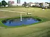 | ||
| Tekojärvi |  |
| ||||
| landuse | salt_pond | A place where salt (saline) water is evaporated to extract its salt. |  |
.jpg.webp) | ||
| Key | Value | Element | Description | Rendering | Photo | |
Other landuse key values | ||||||
| landuse | brownfield | Tulossa olevaa rakentamista, missä vanhat talot on jo purettu. | |
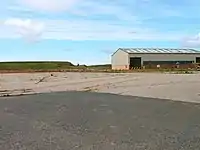 | ||
| landuse | cemetery | Hautausmaa. Voit lisätä religion=* -tagilla tiedon uskontokunnasta. | |
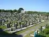 | ||
| Protected areas (deprecated) Alternate tagging of same thing: boundary=protected_area, protected_area=* | ||||||
| landuse | depot | An area used as a depot for e.g. vehicles (trains, buses or trams). Consider using rather standard landuse tags like landuse=railway, landuse=commercial, landuse=industrial, with subtag like industrial=depot. | currently not rendered by osm-carto | .JPG.webp) | ||
| landuse | garages | One level buildings with boxes commonly for cars, usually made of brick and metal. Usually this area belong to garage cooperative with own name, chairman, budget, rules, security, etc. |  |
 | ||
| landuse | grass | An area of mown and managed grass not otherwise covered by a more specific tag. Some view this as not a landuse, see the main page landuse=grass for discussion. |  |
 | ||
| landuse | greenfield | Tulossa olevaa rakentamista, missä ei ole aiemmin ollut rakennuksia. |  (not rendered) |
| ||
| landuse | landfill | Kaatopaikka |  |
 | ||
| landuse | military | Puolustusvoimien suljettu alue |  |
 | ||
| landuse | port | coastal industrial area where commercial traffic is handled. Consider using landuse=industrial + industrial=port for this type of industrial area. | currently not rendered by osm-carto |  | ||
| landuse | quarry | Avolouhos |  |
 | ||
| landuse | railway | Rautatiealue, ratapihat yms. mihin ulkopuolisilla ei ole asiaa. | |
 | ||
| landuse | recreation_ground | Ulkoilualue, sisältää yleensä jonkinlaisia kuntoilurakennelmia. |  |
| ||
| landuse | religious | An area used for religious purposes |  |
 | ||
| landuse | village_green | Englantilainen erikoisuus, tietynlainen "kylän puisto". Ei käytössä Suomessa. |  |
 | ||
| landuse | winter_sports | An area dedicated to winter sports (e.g. skiing) | .jpg.webp) | |||
| landuse | user defined | All commonly used values according to Taginfo | ||||
This table is a wiki template with a default description in English. Editable here.
Sotilasalueet
Vain puolustusvoimien/armeijan käytössä olevat tai käytöstä johtuvat kohteet. Muista myös landuse=military.
| Key | Value | Element | Comment | Rendering | Photo |
|---|---|---|---|---|---|
| military | airfield | Sotilaslentokenttä |  | ||
| military | ammunition | Military ammunition storage area. | |||
| military | barracks | Kasarmit |  | ||
| military | bunker | Bunkkeri |  | ||
| military | checkpoint | Place of a possible access to a restricted or secured area, where civilian visitors and vehicles will be controled by a military authority. |  Checkpoint Charlie | ||
| military | danger_area | Vaara-alue, kovapanosammuntojen kohdealue ja ympäröivä turvavyöhyke. |  |
 | |
| military | launchpad | Launchpads used for military purposes, see tag:aeroway=launchpad for civilian use |  | ||
| military | naval_base | Laivastotukikohta |  | ||
| military | nuclear_explosion_site | Nuclear weapons test site | |||
| military | obstacle_course | A military obstacle course. |  | ||
| military | office | Military offices, e.g. general staff office, military recruitment office etc |  | ||
| military | range | Ampumarata |  | ||
| military | training_area | An area where soldiers train and weapons or other military technology are experimented with or are tested. |  | ||
| military | trench | Trenches used for military purposes |  | ||
| military | user defined | All commonly used values according to Taginfo |
This table is a wiki template with a default description in English. Editable here.
Luonto
Luonnon kohteita ja ominaisuuksia kuvaavat merkinnät.
| Key | Value | Element | Comment | Tag Usage[1] | Carto rendering |
Photo |
|---|---|---|---|---|---|---|
Vegetation | ||||||
| natural | fell | Paljakka, puuton ja matalakasvustoinen alue korkeilla paikoilla. | No, see #545. |  | ||
| natural | grassland | Ruohoa. | |
 | ||
| natural | heath | Nummi, puuton varpukangas. Matalakasvuista pusikkoa, enintään satunnaisia puita. |  |
 | ||
| natural | moor | Don't use, see wikipage. Upland areas, characterised by low-growing vegetation on acidic soils. | currently not rendered by openstreetmap-carto |  | ||
| natural | scrub | Vapaasti rehottava metsätön alue, ei niitty; pääasiallisesti avoin, pusikkoa ja satunnaisia puita. |  |
 | ||
| natural | shrubbery | An area of shrubbery that is actively maintained or pruned by humans. A slightly wilder look is also possible | currently not rendered by openstreetmap-carto |  | ||
| natural | tree | Puu. |  | |||
| natural | tree_row | A line of trees. |  |
 | ||
| natural | tree_stump | A tree stump, the remains of a cut down or broken tree. |  | |||
| natural | tundra | Habitat above tree line in alpine and subpolar regions, principally covered with uncultivated grass, low growing shrubs and mosses and sometimes grazed. |  | |||
| natural | wood | Metsä. Yhdistä landuse=forest jos alue on selvästi hoidettua talousmetsää. |  |
 | ||
Water related | ||||||
| natural | bay | Lahti. |  |
 | ||
| natural | beach | Hiekkaranta, mutta myös sorapintaiset. |  |
 | ||
| natural | blowhole | An opening to a sea cave which has grown landwards resulting in blasts of water from the opening due to the wave action | 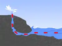 | |||
| natural | cape | A piece of elevated land sticking out into the sea or large lake. Includes capes, heads, headlands and (water) promontories. |  | |||
| natural | coastline | Rantaviiva, käytetty meren rantoihin ja suurimpiin järviimme. Tässäkin vesi kuuluu way:n kulkusuunnassa oikealle puolelle ja maa vasemmalle. |  |
 | ||
| natural | crevasse | A large crack in a glacier |  | |||
| natural | geyser | A spring characterized by intermittent discharge of water ejected turbulently and accompanied by steam. |  | |||
| natural | glacier | Ympärivuotinen jäätikkö |  |
 | ||
| natural | hot_spring | A spring of geothermally heated groundwater |  | |||
| natural | isthmus | A narrow strip of land, bordered by water on both sides and connecting two larger land masses. |  | |||
| natural | mud | Mutaa, savea. |  |
 | ||
| natural | peninsula | A piece of land projecting into water from a larger land mass, nearly surrounded by water | ||||
| natural | reef | A feature (rock, sandbar, coral, etc) lying beneath the surface of the water |  | |||
| natural | shingle | An accumulation of rounded rock fragments on a beach or riverbed |  |
 | ||
| natural | shoal | An area of the sea floor near the sea surface (literally, becomes shallow) and exposed at low tide. See natural=sand as well. | |
 | ||
| natural | spring | Lähde |  | |||
| natural | strait | A narrow area of water surrounded by land on two sides and by water on two other sides. |  |
.jpg.webp) | ||
| natural | water | Vesistö, muu kuin meri. Vesi kuuluu way:n kulkusuunnassa oikealle puolelle ja maa vasemmalle eli kierrä järvet myötäpäivään. Jos rantaviivan pituus ylittää n. 500 solmua, tehdään rantaviivan osista myös multipolygon-relaatio. Aikoinaan sellaisille käytettiin tagia natural=coastline. |  |
 | ||
| natural | wetland | Kosteikko. Käytä myös tagia wetland=* kertomaan kosteikon tyyppi tarkemmin. |  |
 | ||
Geology related | ||||||
| natural | arch | A rock arch naturally formed by erosion, with an opening underneath. | currently not rendered by openstreetmap-carto |  | ||
| natural | arete | An arête, a thin, almost knife-like, ridge of rock which is typically formed when two glaciers erode parallel U-shaped valleys. |  |
 | ||
| natural | bare_rock | An area with sparse/no soil or vegetation, so that the bedrock becomes visible. |  |
 | ||
| natural | cave_entrance | Luolan suuaukko. |  | |||
| natural | cliff | (Kallio)jyrkänne |  |
 | ||
| natural | dune | A hill of sand formed by wind, covered with no or very little vegetation. See also natural=sand and natural=beach | currently not rendered by openstreetmap-carto |  | ||
| natural | earth_bank | Large erosion gully or steep earth bank | _1.jpg.webp) | |||
| natural | fumarole | A fumarole is an opening in a planet's crust, which emits steam and gases | .jpg.webp) | |||
| natural | gully | Small scale cut in relief created by water erosion |  | |||
| natural | hill | A hill. | currently not rendered by openstreetmap-carto |  | ||
| natural | peak | Huippu (mäen tai tunturin). Jos tiedossa, kerro korkeus tagilla ele=*. |  | |||
| natural | ridge | A mountain or hill linear landform with a continuous elevated crest |  |
 | ||
| natural | rock | A notable rock or group of rocks attached to the underlying bedrock. | currently not rendered by openstreetmap-carto |  | ||
| natural | saddle | The lowest point along a ridge or between two mountain tops | 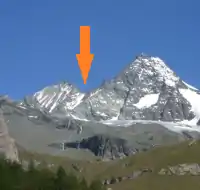 | |||
| natural | sand | Hiekkaa. Ei yhtään tai vain vähäpätöistä kasvillisuutta. |  |
 | ||
| natural | scree | Kivikko, rakka | |
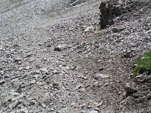 | ||
| natural | sinkhole | A natural depression or hole in the surface topography. | currently not rendered by openstreetmap-carto | 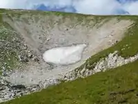 | ||
| natural | stone | Siirtolohkare tai muu suuri kivi. | currently not rendered by openstreetmap-carto |  | ||
| natural | valley | A natural depression flanked by ridges or ranges of mountains or hills | currently not rendered by openstreetmap-carto |  | ||
| natural | volcano | Tulivuori. Lisätageilla mahdollisesti merkattu sammuneeksi, lepääväksi tai aktiiviseksi. |  | |||
| natural | user defined | All commonly used values according to Taginfo | ||||
This table is a wiki template with a default description in English. Editable here.
Non Physical
=== Reitit ===Reittien merkkaamiseen suositellaan ja usein tarvitaan reittirelaatioita.
| Key | Value | Element | Comment | Rendering | Photo |
|---|---|---|---|---|---|
| route | bicycle | Cycle routes or bicycles route are named, numbered or otherwise signed. May go along roads, trails or dedicated cycle paths |  | ||
| route | bus | Bussilinja. Linjan numero kuuluu ref-tagiin. |  | ||
| route | canoe | Signed route for canoeing through a waterway. |  | ||
| route | detour | Route for fixed detour routes. Examples are Bedarfsumleitung in Germany and uitwijkroute in the Netherlands | %252C_StVO_1970.svg.png.webp) | ||
| route | ferry | Lautta/lossi |  |
 | |
| route | foot | Walking Route - is used for routes which are walkable without any limitations regarding fitness, equipment or weather conditions. |  | ||
| route | hiking | Hiking explains how to tag hiking routes. | 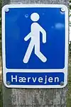 | ||
| route | horse | Riding routes | 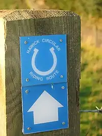 | ||
| route | inline_skates | Inline has more information on the subject. | |||
| route | light_rail | Route of a light rail line. | 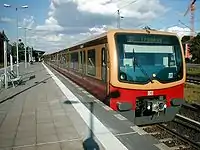 | ||
| route | mtb | Mountain biking explains how to tag mtb routes. |  | ||
| route | piste | Route of a piste (e.g., snowshoe or XC-Ski trails) in a winter sport area. |  | ||
| route | railway | A sequence of railway ways, often named (e.g., Channel Tunnel). See Railways. |  | ||
| route | road | Can be used to map various road routes/long roads. |  | ||
| route | running | For running (jogging) routes. |  | ||
| route | ski | For ski tracks (e.g., XC-Ski Trails User:Langläufer/Loipemap). |  | ||
| route | subway | Route of a metro service |  | ||
| route | train | Train services (e.g., London-Paris Eurostar) See Railways. | |||
| route | tracks | Railroad track as rail infrastructure. | | ||
| route | tram | See Trams for more information on tagging tram services. | 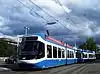 | ||
| route | trolleybus | The route of a trolleybus service. | 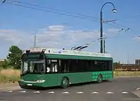 | ||
| route | User defined | All commonly used values according to Taginfo. |
This table is a wiki template with a default description in English. Editable here.
Rajat
Tarkempia ohjeita englanniksi
| Key | Value | Element | Comment | Rendering example | Photo | |
|---|---|---|---|---|---|---|
Boundary types | ||||||
| boundary | aboriginal_lands | A boundary representing official reservation boundaries of recognized aboriginal / indigenous / native peoples. |  |
 | ||
| boundary | administrative | Hallinnolliset rajat: aluehallintoviraston toimialueen (ent. läänit), kunnan, kaupunginosan tms. Käytä myös admin_level -tagia osoittamaan rajan tyyppi. |  |
 | ||
| boundary | border_zone | A border zone is an area near the border where special restrictions on movement apply. Usually a permit is required for visiting. | _-_crop.jpg.webp) | |||
| boundary | forest | A delimited forest is a land which is predominantly wooded and which is, for this reason, given defined boundaries. It may cover different tree stands, non-wooded areas, highways… but all the area within the boundaries are considered and managed as a single forest. |  | |||
| boundary | forest_compartment | A forest compartment is a numbered sub-division within a delimited forest, physically materialized with visible, typically cleared, boundaries. |  | |||
| boundary | hazard | A designated hazardous area, with a potential source of damage to health, life, property, or any other interest of value. |  | |||
| boundary | maritime | Maritime boundaries which are not administrative boundaries: the Baseline, Contiguous Zone and EEZ (Exclusive Economic Zone). |  | |||
| boundary | marker | A boundary marker, border marker, boundary stone, or border stone is a robust physical marker that identifies the start of a land boundary or the change in a boundary, especially a change in direction of a boundary. See also historic=boundary_stone |  | |||
| boundary | national_park | Kansallispuistojen tai luonnonpuistojen rajat. | |
 | ||
| boundary | place | boundary=place is commonly used to map the boundaries of a place=*, when these boundaries can be defined but these are not administrative boundaries. | ||||
| boundary | political | Äänestysalueen raja | ||||
| boundary | postal_code | Postal code boundaries | ||||
| boundary | protected_area | Protected areas, such as for national parks, marine protection areas, heritage sites, wilderness, cultural assets and similar. |  | |||
| boundary | special_economic_zone | A government-defined area in which business and trade laws are different. |  | |||
| boundary | disputed | An area of landed claimed by two or more parties (use with caution). See also Disputed territories. |  | |||
| boundary | user defined | All commonly used values according to Taginfo | ||||
Attributes | ||||||
| admin_level | (number) | Applies to boundary=administrative and is usually in the range 1 to 10, except for several countries (Bolivia, Germany, Mozambique, Netherlands, Philippines, Poland, Turkmenistan, Venezuela) where it is in the range 1 to 11 – see boundary. |  | |||
| border_type | * | To distinguish between types of boundary where admin_level isn't enough. Used in several different ways e.g in maritime contexts. | ||||
| start_date | (date) | Useful if the boundary is very recent (or if it will become effective in a near future). |  | |||
This table is a wiki template with a default description in English. Editable here.
Urheilu
This is used to provide information about which sports are placed on a facility such as a pitch or stadium. It is intended to be used in conjunction with tags landuse=* or leisure=*. See the page titled Sport for an introduction on its usage.
| Key | Value | Element | Comment | Example symbol | Photo |
|---|---|---|---|---|---|
| sport | 9pin | Useful combination: amenity=bar;pub;restaurant and leisure=bowling_alley See Also: sport=10pin;bowls;horseshoes |
 |
 | |
| sport | 10pin | Keilahalli |  |
 | |
| sport | american_football | Useful combination: leisure=pitch;stadium;sports_centre See Also: sport=rugby_league;rugby_union;soccer, or sport=australian_football;canadian_football The ambiguous sport=football tag is sometimes confused with this one. |
 |
 | |
| sport | aikido | Useful combination: amenity=dojo See Also: sport=judo;taekwondo |
 |
 | |
| sport | archery | Useful combination: leisure=pitch;stadium;sports_centre - Indicating that Archery is the sport the facility or area is intended for. See Also: sport=shooting;fencing |
 |
 | |
| sport | athletics | Yleisurheilu |  |
 | |
| sport | australian_football | Useful combination: leisure=pitch;stadium;sports_centre See Also: sport=soccer;american_football;canadian_football |
 | ||
| sport | badminton | Useful combination: leisure=pitch;sports_centre See Also: sport=tennis;paddle_tennis;table_tennis |
 |
 | |
| sport | bandy | Useful combination: leisure=pitch;stadium;sports_centre, surface=* See Also: sport=ice_hockey;soccer;field_hockey |
 |
 | |
| sport | base | Useful combination: building=*, man_made=*, bridge=*, natural=cliff See Also: sport=cliff_diving;free_flying |
 | ||
| sport | baseball | Useful combination: leisure=pitch;stadium;sports_centre, surface=* See Also: sport=cricket |
 |
 | |
| sport | basketball | Koripallo |  |
 | |
| sport | beachvolleyball | Useful combination: leisure=pitch;beach_resort;sports_centre, natural=sand;beach, surface=sand See Also: sport=volleyball;handball |
_pictogram.svg.png.webp) |
.jpg.webp) | |
| sport | billiards | Useful combination: leisure=bowling_alley, amenity=bar;pub;restaurant See Also: sport=darts;10pin;horseshoes |
 |
 | |
| sport | bmx | Useful combination: leisure=track;pitch;sports_centre, surface=earth, length=*, lanes=*, surface=* See Also: sport=cycling |
_pictogram.svg.png.webp) |
 | |
| sport | bobsleigh | Useful combination: leisure=track;sports_centre, surface=* See Also: sport=toboggan, Piste Maps, Winter sports |
  |
 | |
| sport | boules | DO NOT USE this old style combined with the tag type=* when describing the type of game. This is meant to specify the type of relations. Useful combination: leisure=pitch;sports_centre, surface=*, For game type use boules=petanque;lyonnaise;bocce See Also: sport=bowls;pelota;10pin, sport=9pin;horseshoes |
 |
 | |
| sport | bowls |  |
 | ||
| sport | boxing | Useful combination: leisure=stadium;sports_centre;pitch, surface=* See Also: sport=aikido;fencing;athletics |
 |
 | |
| sport | bullfighting | Useful combination: leisure=stadium;pitch |
 | ||
| sport | canadian_football | Useful combination: leisure=pitch;stadium;sports_centre and surface=* See Also: sport=american_football;australian_football;rugby_league, sport=soccer;rugby_union |
|
 | |
| sport | canoe | Melonta (Wikipedia) | _pictogram.svg.png.webp) |
 | |
| sport | chess | The intended use is for big chess-boards in the open air. Useful combination: leisure=pitch;picnic_table See Also: club=chess |
 |
 | |
| sport | cliff_diving | Useful combination: natural=cliff, height=*, depth=*, tidal=*, surface=*, note=* See Also: sport=climbing;swimming |
 |
 | |
| sport | climbing | Kiipeilyseinä tai -rinne |  |
 | |
| sport | climbing_adventure | Useful combination: landuse=recreation_ground, leisure=sports_centre See Also: sport=climbing |
 | ||
| sport | cockfighting | Useful combination: leisure=pitch for informal rings. |
 | ||
| sport | cricket | Kriketti on maila- ja pallopeli, jossa kaksi yhdentoista hengen joukkuetta ottelee keskenään. (Wikipedia) |  |
 | |
| This is not a sport! No not use this tag. Instead consider using leisure=pitch, sport=cricket, barrier=fence |
 | ||||
| sport | croquet | Kroketti (Wikipedia) |  |
 | |
| sport | curling | Useful combination: leisure=pitch;stadium;sports_centre See Also: sport=ice_stock;bowls;boules, surface=* |
 |
 | |
| sport | cycling | Useful combination: leisure=track;stadium;sports_centre, surface=* |
_pictogram.svg.png.webp) |
 | |
| sport | darts | Useful combination: amenity=bar;pub;restaurant, leisure=bowling_alley See Also: sport=billiards;10pin;horseshoes |
 |
 | |
| DO NOT USE THIS TAG, as it is ambiguous. See: sport=diving Instead use: sport=cliff_diving is the means for "jumping from a rock" or the Olympic discipline Diving. sport=scuba_diving is the means for "swimming under the water". |
|||||
| sport | dog_racing | Useful combination: leisure=track;stadium;sports_centre, surface=* See Also: sport=horse_racing |
 | ||
| sport | equestrian | Ratsastusta. |  |
 | |
| sport | fencing | Useful combination: leisure=pitch;stadium;sports_centre, surface=* See Also: sport=boxing;wrestling |
 |
 | |
| sport | field_hockey | Useful combination: leisure=pitch;sports_centre;stadium See Also: sport=ice_hockey;ice_skating |
 |
 | |
| Jalkapallokenttä. Toistaiseksi on epäselvyyttä eri jalkapallolajien merkkauksesta, vrt. sport=rugby ja sport=soccer | |||||
| sport | free_flying |   |
 | ||
| sport | gaelic_games | For tagging individual games under this category see the tag page. |
 | ||
| sport | golf |  |
 | ||
| sport | gymnastics | _pictogram.svg.png.webp) |
 | ||
| sport | handball |  |
 | ||
| sport | hapkido | Useful combination: amenity=dojo See Also: sport=aikido;judo;taekwondo |
 | ||
Disambiguous. See sport=hockey. Instead consider other tags. For example: For For For For |
|||||
| sport | horseshoes |  | |||
| sport | horse_racing | Ravi- tai laukkarata |  |
 | |
| sport | ice_hockey | Useful combination: leisure=ice_rink;stadium;sports_centre See Also: sport=field_hockey;ice_skating |
 |
 | |
| sport | ice_skating | Useful combination: leisure=ice_rink;sports_centre;pitch See Also: sport=ice_hockey;roller_skating The disambiguous sport=skating tag is sometimes confused with this one. |
  |
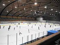 | |
| sport | ice_stock | Useful combination: leisure=pitch;stadium;sports_centre See Also: sport=curling |
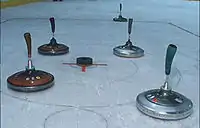 | ||
| sport | judo |  |
 | ||
| sport | karting | See also sport=motor;motocross |
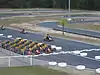 | ||
| sport | kitesurfing |  | |||
| sport | korfball |  |
 | ||
| sport | martial_arts |  | |||
| sport | model_aerodrome |  | |||
| sport | motocross | See also sport=motor;karting |
 | ||
| sport | motor | See also sport=karting;motocross |
 | ||
| sport | multi | Use this to indicate that that this pitch can be used to practise different kinds of sport. This is a shortcut to indicate that several unspecified sports are catered for, while you might instead use a semi-colon separated list of sports as a value (to be more precise) |
 | ||
| sport | netball |  |
 | ||
| sport | obstacle_course |  | |||
| sport | orienteering | Suunnistusseura tai -keskus |  |
 | |
| sport | paddle_tennis |  | |||
| sport | parachuting |  | |||
 |
 | ||||
| sport | pelota | Pelota (Wikipedia engl.) |   |
 | |
| sport | racquet |  |
 | ||
| sport | rc_car | .jpg.webp) | |||
| sport | roller_skating | See Also: sport=ice_skating;skateboard;field_hockey The disambiguous sport=skating tag is sometimes confused with this one. |
  |
 | |
| sport | rowing | Soutu (Wikipedia) |  |
 | |
| sport | rugby_league |  |
.jpg.webp) | ||
| sport | rugby_union |  |
 | ||
| sport | running | |
 | ||
.jpg.webp) | |||||
| sport | sailing |  |
 | ||
| sport | scuba_diving |  |
 | ||
| sport | shooting | Ampumaurheilupaikka sisä- tai ulkotiloissa |  |
 | |
| Luistelu | |||||
| sport | skateboard | Rullalautailu eli skeittaus |  |
 | |
| Kaikki hiihto; laskettelurinteiden kartoitus on ulkomailla aloitettu mutta merkintätavoista on vielä epäselvyyttä, kts. []. |  |
 | |||
| sport | soccer | Jalkapallo, kts. myös sport=football yllä. |  |
 | |
| sport | sumo |  | |||
| sport | surfing |  |
 | ||
| sport | swimming | Uinti, kts. myös leisure=water_park ja natural=beach |  |
 | |
| sport | table_tennis | Pöytätennis |  |
 | |
| sport | table_soccer | Useful combination: amenity=pub;bar;restaurant See Also: sport=soccer;table_tennis;billiards, leisure=amusement_arcade;adult_gaming_centre, club=table_soccer |
 |
 | |
| sport | taekwondo |  |
 | ||
| sport | tennis | Tennis |  |
 | |
| sport | toboggan |  | |||
| sport | trampoline | Trampoline sport is a sport that is carried on large trampolines indoor or outdoors | | ||
| sport | ultralight_aviation |  | |||
| sport | volleyball | _pictogram.svg.png.webp) |
 | ||
| sport | water_polo |  | |||
| sport | water_ski |  |
 | ||
| sport | weightlifting |  |
 | ||
| sport | wrestling |  |
 | ||
| sport | yoga |  | |||
| sport | user defined | All commonly used values according to Taginfo |
This table is a wiki template with a default description in English. Editable here.
Abutters
Vanhentunut mutta ei vielä kielletty tapa merkata katua ympäröivien aluiden maankäyttöä. Roikkuu mukana vain koska voi olla yhä jossain kartalla käytetty. Ei piirretä enää kartoille.
| Key | Value | Element | Comment | Rendering | Photo |
|---|---|---|---|---|---|
| abutters | commercial | predominantly office buildings, business parks, etc. | | ||
| abutters | industrial | predominantly workshops, factories, warehouses |  | ||
| abutters | mixed | where there is no clear predominance, for example mixed shops and residences in an inner city ring | |||
| abutters | residential | predominantly houses and apartments |  | ||
| abutters | retail | predominantly shops | |||
| abutters | user defined | All commonly used values according to Taginfo |
This table is a wiki template with a default description in English. Editable here.
Ominaisuudet
This is used to give additional information of a general nature about another element.
| Key | Value | Element | Comment | Rendering | Photo |
|---|---|---|---|---|---|
| area | yes | Merkkaa alkuunsa palaavan tien (lenkin) alueeksi, jos tien kuvaamaa ominaisuutta voisi pitää myös lenkin tekevänä tienä. Tarpeen esim. kävelykatuaukioille (highway=pedestrian), ettei sellaista piirrettäisi alueen reunoja kiertävänä kävelykatuna. Vastaesimerkkinä pysäköintialue, joka ymmärretään alueeksi ilmankin tagia area=yes. |  | ||
| brand | user defined | Brand of the feature. | |||
| bridge | yes / aqueduct / viaduct / cantilever / movable / covered / … | Silta, käytetään layer=*-tagin kanssa. | 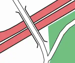 |
| |
| capacity | amount | Used for specifying capacity of a facility. | |||
| charge | amount | Used for specifying how much is charged for use/access to a facility. See toll=* or fee=*. | |||
| clothes | see key's page | Tagged on shops and other features to denote if they sell clothes or not and what type of clothes they sell. | | ||
| covered | yes | Used to denote that a node, way or area is covered by another entity (or in some cases the ground), when the use of layers is inappropriate, or additional clarification is needed. | Various, depending on the covered entity |  | |
| crossing | no / traffic_signals / uncontrolled / island / unmarked | Risteyksen ominaisuuksien kuvailu. | | ||
| crossing:island | yes / no | Specifies whether a pedestrian crossing has a refuge island | 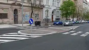 | ||
| cutting | yes / left / right | "Kallioleikkaus", tietä varten on kaivettu kanjoni mäen läpi | 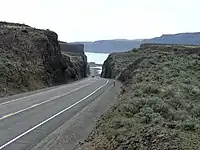 | ||
| disused | yes | Ei käytössä; esim. pysäköintialueeksi kuvailtava alue joka ei toimi pysäköintialueena. |  | ||
| drinking_water | yes / no | Describes whether a drinking water is available | |||
| drive_through | yes / no | Used to indicate if a pharmacy, bank, atm, or fast_food, or post_box offers drive_thru service. drive_through=* is different than drive_in=*} |  | ||
| drive_in | yes / no | Used to indicate if a cinema is a drive-in cinema or a restaurant offers drive-in service. drive_in=* is different than drive_through=* |  | ||
| electrified | contact_line / rail | Indicates infrastructure to supply vehicles with electricity on rail tracks | | ||
| ele | Number | Korkeus merenpinnasta metreinä |  | ||
| embankment | yes | Penger, maa-aineksella ympäristöään korkeammalle korotettu tie |  |
 | |
| [[ Too many Data Items entities accessed. | end_date ]] | Date | Kohteen poiston päiväys. | .jpg.webp) | ||
| est_width | Number | Arvioitu ajoradan leveys | | ||
| fee | yes / no | Used for specifying whether fee is charged for use/access to a facility. See also toll=*. | |||
| fire_object:type | poo / szo | Potentially dangerous and socially significant objects | |||
| fire_operator | Name | Fire station, which serves the object | |||
| fire_rank | 1bis / 2 to 5 | Rank fire, defined for a particular object | |||
| frequency | Number | Frequency in Hz | | ||
| hazard | see hazard | Indicates of the hazards. | |||
| hot_water | yes / no | Describes whether a hot water is available | |||
| inscription | User Defined | The full text of inscriptions, which can be found on buildings, memorials and other objects. | _(4749426050).jpg.webp) | ||
| internet_access | yes / wired / wlan / terminal / no | This tag is for indication that a map entity such as a building, a shop, restaurant, etc. offers internet access to the public, either as a paid service or even for free. |  | ||
| layer | -5 to 5 | Määrittää samassa paikassa sijaitsevien asioiden suhteelliset korkeudet, mikä on ylimpänä/alimpana. Arvo 0 on yleensä maan tasalla, +1 esim. silta, -1 heti maan pinnan tason alla. Eri layer:eille merkatuilta risteäviltä teiltä ei siis pääse risteyskohdassa vaihtamaan toiselle teistä. |  | ||
| leaf_cycle | evergreen / deciduous / semi_evergreen / semi_deciduous / mixed | Describes the phenology of leaves |  | ||
| leaf_type | broadleaved / needleleaved / mixed / leafless | Describes the type of leaves |  | ||
| location | underground / overground / underwater / roof / indoor | Location | | ||
| narrow | yes | Kulkuväylän hetkellinen kapeampi osuus maalla tai vesillä. |  | ||
| nudism | yes / obligatory / designated / no / customary / permissive | Indicates if the described object provides the possibility of nudism |  | ||
| opening_hours | 24/7 or mo md hh:mm-hh:mm. (read described syntax) | Aukioloajat erikseen määritellyssä muodossa ilmaistuna |  | ||
| opening_hours:drive_through | 24/7 or mo md hh:mm-hh:mm. (read described syntax) | opening_hours describes when something is open for drive-through services. | |||
| operator | User Defined | Kohteen toimintaa hoitava taho, julkinen tai yritys. | |||
| power_supply | yes / no | Describes whether a power supply is available | |||
| produce | User Defined | Describes a feature's agricultural output produced though a natural process of growing or breeding. |  | ||
| rental | see key's page | Tagged on shops and other features to denote if they rent something or not and what they rent. | |||
| sauna | yes / no | Describes whether a sauna is available | | ||
| service_times | see opening_hours | Times of service of a given feature e.g. church service | _Service_times_2012.jpg.webp) | ||
| shower | yes / no | Describes whether a shower is available | 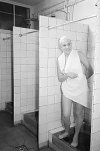 | ||
| start_date | Date | Kohteen luomisen päiväys, esimerkiksi milloin uusi tie on avattu tai avataan liikenteelle. |  | ||
| tactile_paving | yes /no | Indicate if a specific place can be detected or followed with a blindman's stick. | | ||
| tidal | yes | Area is flooded by the tide | 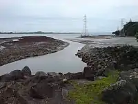 | ||
| toilets | yes / no | Describes whether a toilets is available | |||
| topless | yes / no | Indicates if the described object provides the possibility of female topless practice | 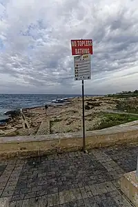 | ||
| tunnel | yes | Tunneli, käytetään layer=*-tagin kanssa. | 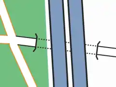 |
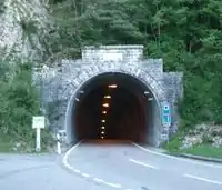 | |
| toilets:wheelchair | yes / no | States if a location has a wheelchair accessible toilet or not. |  | ||
| wheelchair | yes / no / limited | Kulkemisen esteettömyys pyörätuolilla. |  | ||
| width | Number | Ajoradan leveys | | ||
| Metsän vallitseva puusto: coniferous=havumetsä, deciduous=lehtimetsä, mixed=sekametsä |  |
Rajoitukset
Väylillä ja alueilla kulkemista koskevat rajoitukset. Monimutkaisimmat rajoitukset (esim. samalla väylällä eri aikoina vaihtelevat) eivät toistaiseksi välttämättä onnistu näillä suositelluilla tageilla, aiheesta on ehdotus
| Key | Value | Element | Comment | Rendering | Photo | |
|---|---|---|---|---|---|---|
| Vehicle types | ||||||
| access | agricultural / delivery / designated / destination / forestry / no / official / permissive / private / yes | Yleinen rajoitus väylän tai alueen käytölle: designated=Liikennemerkillä osoitettu tälle kulkumuodolle - voi maasta riippuen velvoittaa käyttämään kyseistä väylää permissive=Maanomistaja on sallinut mutta voi halutessaan kieltää (ei yleensä käytössä Suomessa, pihapiirit ovat kotirauhan piirissä mutta yleensä muualla kulku on vapaata); käytännössä kauppakeskusten aulat tms. suljettavat tilat, private=Sallittu vain maanomistajalle, destination=Vain jos ainoa reitti määränpäähän / läpiajo kielletty, unknown=Ei tiedossa kartoitushetkellä. agricultural="maatalousajo sallittu" (hyvin harvinainen suomessa - ei siis traktorit vaan tarkoituksen mukaan), forestry=ei käytössä suomessa (sallittu vain metsänhoidolle) no=Kielletty. |
||||
| agricultural | yes / no | Rajoitukset maatalousajoneuvoille. Arvot kuten yllä. (Harvinainen Suomessa) | ||||
| atv | For values see access above | Access restricted to wheeled vehicles 1.27m (50 inches) or less in width, for example |
||||
| bdouble | For values see access above | Access permission for |
||||
| bicycle | For values see access above + dismount | Rajoitukset pyöräilylle. Arvot kuten yllä. | ||||
| boat | For values see access above | Kaikkia veneitä koskeva rajoitus tai fyysinen mahdottomuus, esim. kapea tai matala joki | ||||
| electric_bicycle | For values see access above | Access permission for electric bicycles (mostly defined as having a maximum speed of 25 km/h) | ||||
| emergency | yes | Access permission for emergency motor vehicles; e.g., ambulance, fire truck, police car |  | |||
| foot | For values see access above | Rajoitukset jalankululle. Arvot kuten yllä. | ||||
| forestry | yes / no | Access permission for forestry vehicles, e.g. tractors. | ||||
| golf_cart | For values see access above | Access permission for golf carts and similar small, low-speed electric vehicles | ||||
| goods | For values see access above | Pakettiautolla ajon rajoitukset. Arvot kuten yllä. Pelkkä liikennemerkki nr. 313 Muiden liikennemerkkien alla voi olla käytössä nimenomaisesti pakettiautoa tarkoittava lisäkilpi |
||||
| hazmat | For values see access above | Vaarallisten aineiden kuljetuksia koskevat rajoitukset. Arvot kuten yllä. | ||||
| hgv | For values see access above | Raskasta liikennettä koskevat rajoitukset. Arvot kuten yllä. | ||||
| horse | For values see access above | Rajoitukset hevosliikenteelle. Arvot kuten yllä. | ||||
| inline_skates | yes / no | Access permission for |
||||
| lhv | For values see access above | Access permission for |
||||
| mofa | For values see access above | Access permission for |
||||
| moped | For values see access above | Access permission for |
||||
| motorboat | For values see access above | Moottoriveneitä koskeva rajoitus. Arvot kuten yllä. | ||||
| motorcar | For values see access above | Rajoitukset autolla ajolle. Arvot kuten yllä. Ei juurikaan sovellu käytettäväksi Suomessa, koska pelkkää autolla ajon kieltävää liikennemerkkiä ei ole olemassa. | ||||
| motorcycle | For values see access above | Rajoitukset moottoripyörille. Arvot kuten yllä. | ||||
| motor_vehicle | For values see access above | Rajoitukset moottoriajoneuvoille. Arvot kuten yllä. Esim. pyörätie jolla lisäkilpi "tontille ajo sallittu": highway=cycleway, motor_vehicle=destination |  | |||
| psv | For values see access above | Rajoitukset julkiselle liikenteelle (bussit, taksit). (Suomessa bussit ja taksit voivat olla erilaisten rajoitusten kohteena, mutta tagin merkitys on määritelmän mukaan julkinen liikenne). Myös tagia taxi=* on käytetty tarvittaessa. | ||||
| roadtrain | For values see access above | Access permission for |
 | |||
| ski | For values see access above | Access permission for |
||||
| speed_pedelec | For values see access above | Access permission for electric bicycles (mostly defined as having a maximum speed of 45 km/h) | ||||
| tank | For values see access above | Access permission for (military) tanks | ||||
| vehicle | For values see access above | Rajoitukset kaikille ajoneuvoille. Arvot kuten yllä. | ||||
| 4wd_only | yes | A road signed as only suitable for 4WD (offroad) vehicles | ||||
| Other | ||||||
| charge | Number | Maksullisen kohteen hinta. Ei vielä vakiintunutta muotoa vaihtelevien hinnoittelujen merkitsemiseksi. | ||||
| female | yes | Female-only or gender segregated (with male=yes) feature | ||||
| male | yes | Male-only or gender segregated (with female=yes) feature | ||||
| max_age | age | The legal maximum age | ||||
| maxaxleload | Weight | The legal maximum axleload – units other than tonnes should be explicit | ||||
| maxheight | Height | Suurin sallittu korkeus (metreinä) | ||||
| maxlength | Length | Suurin sallittu pituus (metreinä) | ||||
| maxspeed | Speed | Nopeusrajoitus. Tarpeen ainakin jos nopeus poikkeaa tieluokituksen yleisestä rajoituksesta (100/80/50). | ||||
| maxstay | Number | Rajoitettu (pysäköinti)aika, laita yksikkö mukaan ("30 min / 2 h") | ||||
| maxweight | Weight | Suurin sallittu paino (tonneissa) | ||||
| maxwidth | Width | Suurin sallittu leveys (metreinä) | ||||
| min_age | age | The legal minimum age | ||||
| minspeed | Speed | Pienin sallittu nopeus. Suomessa ei sellaisenaan käytössä, mutta moottoriteillä ja moottoriliikenneteillä ajoneuvon suurimman rakenteellisen nopeuden pitää olla vähintään 50 km/h joten tagia voi lisätä näihin. | ||||
| noexit | yes | Umpikuja. | ||||
| oneway | yes / no / -1 | Yksisuuntainen way, kulku sallittu vain wayn suuntaisesti. Arvo -1 tarkoittaa yksisuuntaisuutta way:n suuntaa vastaan. | ||||
| Relation:restriction | Used for a set of tags and members to represent a turn restriction. | |||||
| toll | yes | Tietullin alainen solmu/tie/alue. Toistaiseksi ei käytössä Suomessa. Maksupisteet merkattaisiin tagilla | ||||
| traffic_sign | city_limit | Taajama alkaa/päättyy -liikennemerkki. | ||||
| unisex | yes | Unisex feature | ||||
This table is a wiki template with a default description in English. Editable here.
| moped | yes / designated / official / private / permissive / destination / delivery / agricultural / forestry / unknown / no | Rajoitukset mopoille |
Nimeäminen
Nimet
Kohteiden nimi, mahdollisesti eri yhteyksissä käytettävät.
| Key | Value | Element | Comment |
|---|---|---|---|
| name | User defined | Kohteen nimi. | |
| name:<lg> | User defined | kohteen nimi tietyllä kielellä, esim. name:fi tai name:sv. Katso myös Bilingual_street_names | |
| name:left , name:right | User defined | Used when a way has different names for different sides (e.g., a street that's forming the boundary between two municipalities). | |
| int_name[:<lg>] | User defined | Mahdollinen kansainvälinen nimi. | |
| loc_name[:<lg>] | User defined | Paikallisesti käytetty nimi. | |
| nat_name[:<lg>] | User defined | ||
| official_name[:<lg>] | User defined | Official name. Useful where there is some elaborate official name, while a different one is a common name typically used. Example: official_name=Principat d'Andorra (where "name" is name=Andorra). | |
| old_name[:<lg>] | User defined | Mahdollinen aiemmin käytetty nimi. | |
| reg_name[:<lg>] | User defined | ||
| short_name[:<lg>] | User defined | Should be a recognizable commonly-used short version of the name, not a nickname (use alt_name for that), useful for searching (recognized by Nominatim). | |
| sorting_name[:<lg>] | User defined | Name, used for correct sorting of names — This is only needed when sorting names cannot be based only on their orthography (using the Unicode Collation Algorithm with collation tables tailored by language and script, or when sorted lists of names are including names written in multiple languages and/or scripts) but requires ignoring some parts such as:
all of them being ignored at the primary sort level and not easily inferable by a preprocessing algorithm. | |
| alt_name[:<lg>] | User defined | Vaihtoehtoinen nimi (ei vain paikallisesti käytetty) | |
| Do not use this tag, suffixed name tagging for multiple values is deprecated. |
This table is a wiki template with a default description in English. Editable here.
Tunnisteet
Kohteeseen viitattaessa käytettäviä tietoja, jotka eivät ole nimiä.
| Key | Value | Element | Comment | Rendering | Photo |
|---|---|---|---|---|---|
| iata | User Defined | Lentokentän IATA-tunniste | |||
| icao | User Defined | Lentokentän ICAO-tunniste | |||
| int_ref | User Defined | Kansainvälinen tunniste, esim. eurooppateillä E75. Katso myös WikiProject_Europe/E-road_network eurooppateiden keräämiseksi relaatioihin. | |||
| lcn_ref | User Defined | Paikallisen pyöräilyreitin tunnusnumero, ei käytössä Suomessa. | |||
| loc_ref | User Defined | Mahdollinen paikallinen tunniste. | |||
| nat_ref | User Defined | Kansallinen tunniste, teillä sama kuin ref=* | |||
| ncn_ref | User Defined | Pyöräilyreitin tunnusnumero. Nykyään suositeltu tapa on lisätä reittiä varten route-relaatio. | |||
| old_ref | User Defined | Mahdollinen entinen tai historiallinen tunniste. | |||
| rcn_ref | User Defined | Alueellisen pyöräilyreitin tunnusnumero, ei käytössä Suomessa. | |||
| ref | User Defined | Tunniste, esim. teiden numero. Useampi arvo erotellaan puolipisteellä. Teiden numerot merkataan ensimmäisestä numeron kertovasta liikennemerkistä alkaen, ei katkoviivallisten tienumeromerkkien ("johtaa tielle n") numeroita. | |||
| reg_ref | User Defined | Mahdollinen alueellinen tunniste. | |||
| source_ref | User Defined | To record the URI, source reference (eg Landsat) or other link to physical sources. |
This table is a wiki template with a default description in English. Editable here.
Template:Fi:Map Features:place
Template:Fi:Map Features:annotation
Template:Fi:Map Features:editor keys
Template:Fi
- ↑ Does not include uses in semi-colon value separated lists