< Dortmund < Luftbilder 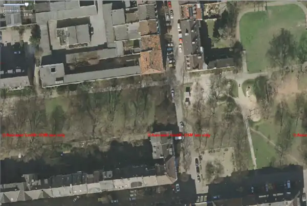
Dortmund/Luftbilder/Potw
Links
Text proposal
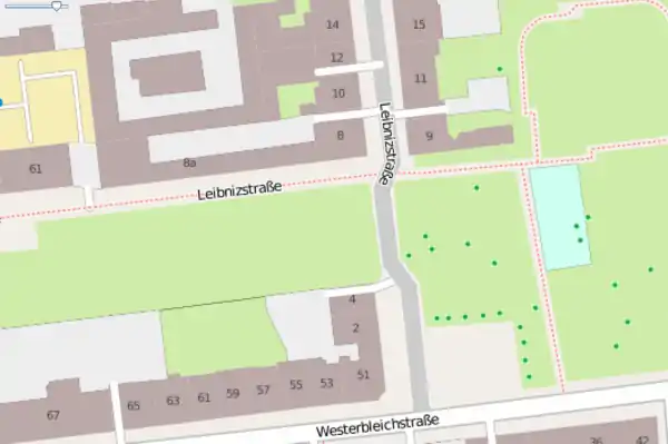
This week's project: "5-centimeters-per-pixel orthophoto"
Map with 5-centimeters-per-pixel orthophoto all the residential and other buildings around here (edit in potlatch here ) and local users will enter the house numbers. The company Aerowest supports OpenStreetMap as a free project. For the first time in Germany, a company available high-resolution aerial coverage for three months. The pilot project will be the entry point for further aerial releases. Aerowest has images of more than 350 cities ...more...
Example
Orthophoto
5-centimeters-per-pixel orthophoto
Openstreetmap
This article is issued from Openstreetmap. The text is licensed under Creative Commons - Attribution - Sharealike. Additional terms may apply for the media files.