Da:Map Features
Se WikiProject Denmark for information der relaterer sig til kortlægningsaktivitet der er specifik for Danmark. Tilbage til hovedsiden
|
OpenStreetMap har ikke nogen indholds restriktion på etiketter (tags) der kan tilknyttes. Du kan bruge enhver tag du ønsker. Men der er en fordel ved at have et fælles, anbefalet sæt af tags.
Noter om kortgenereringen (rendering):
Tabellerne er grupperet efter tema, med de mest brugte først.
Punkterne (noderne) er det basale element i OSM, de består af en længde- og breddegrad (et enkelt geografisk punkt). Punkterne er nødvendige for at definere en "vej" (liniestreng, se herunder), men kan også bruges alene til at repræsentere noget som f.eks en telefonbox, en pub, et sted-navn label, eller andre punkter af interesse (POI, 'Point Of Interest').
En liniestreng består af en ordnet liste af punkter, som definerer en "vej". Eksempler er veje (highway=*) og vandløb (waterway=*). En lukket liniestreng definerer ikke nødvendigvis et område (se herunder). Et eksempel er en rundkørsel, der blot er en vej, som danner en løkke.
En polygon består af en lukket liniestreng samt et tag, som definerer den som et område, f.eks. landuse=*. En lukket liniestreng med et tag, som normalt beskriver en lineær vej (f.eks. highway=*), kan omdannes til en polygon ved at tilføje tagget area=yes. En plads eller et torv kan mappes på denne måde ved hjælp af highway=pedestrian og area=yes.
Definerer en sammenhæng mellem to eller flere objekter. En relation består af tags, som definerer egenskaberne ved relationen og en ordnet liste af medlemmer, der hver især kan have en "rolle". Typiske eksempler på relationer:
|
Fysiske
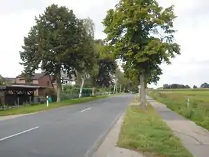
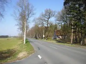
Veje (highway)
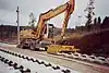
Veje (highway) taggen bruges primært til veje. Mange lande har deres egne definitioner på vejene (også Danmark). Ofte er det den eneste tag. Se Highway tag usage siderne for hjælp.
| Nøgle(key) | Værdi | Element | Kommentar | Rendering | Foto | |
|---|---|---|---|---|---|---|
Veje (Roads) | ||||||
|
Primære tags for vejnettet, fra mest betydende til mindst betydende veje | ||||||
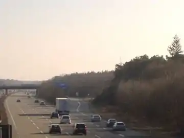
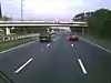
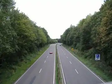
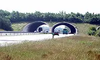
| highway | motorway | Motorvej
Skiltes med færdselstavle E42 |
 |
|||
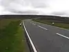
| highway | trunk | Motortrafikvej
Skiltes med færdselstavle E43 |
 |
| ||
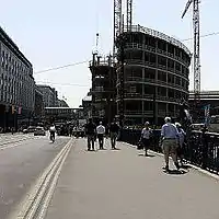
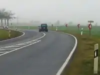
| highway | primary | Primærrute
Vej med et- eller to-cifret vejnummmer (i dag fra 6 til 99). Skiltes med ruteangivelse L42 (gul baggrund) |
 |
| ||
| highway | secondary | Sekundærrute
Vej med tre-cifret rutenummer (i dag fra 150 til 597). Skiltes med ruteangivelse L43 (hvid baggrund) |
 |
| ||
| highway | tertiary | Større vej
Større eller vigtig vej, som ikke er primær- eller sekundærvej. |
 |
| ||
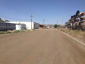
| highway | unclassified | Mindre vej
Vej som falder uden for de foregående kategorier (typisk mindre veje på landet eller i industriområder). Tagget anvendes også til offentlige grusveje, angiv da overfladetypen med surface=*. Husk at dette tag ikke bruges, hvis du ikke ved, hvilken type du skal bruge (dertil bruger man highway=road) |
 |
| ||
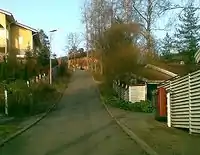
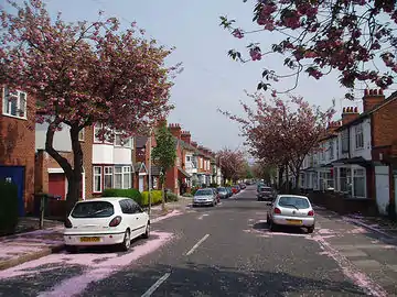
| highway | residential | Gade
Gade i boligområde, der hovedsagelig er beregnet til lokal trafik. Vigtige gennemgående gader tagges som highway=tertiary eller højere. Gader i industriområder og lignende tagges som highway=unclassified. |
 |
| ||
Ramper | ||||||
| highway | motorway_link | Til- eller frakørselsrampe til motorvej |  |
 A5 exit link to A672, Darmstadt, Germany | ||
| highway | trunk_link | Til- eller frakørselsrampe til motortrafikvej |  |
 A7 / OAL23 interchange, Nesselwang, Germany | ||
| highway | primary_link | Til- eller frakørselsrampe til primærrute |  |
_-_geo-en.hlipp.de_-_11914.jpg.webp) B20 exit and entrance to Brunn, Fridolfing, Germany | ||
| highway | secondary_link | Til- eller frakørselsrampe til sekundærrute |  |
 | ||
| highway | tertiary_link | Til- eller frakørselsrampe til anden større vej (tertiary) |  |
|||
Særlige vejtyper | ||||||
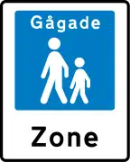
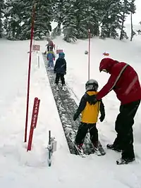
| highway | living_street | Opholds og legeområde
Lille gade, hvor børn må lege på kørebanen, maksimum fart er lav. |
 |
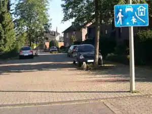 beginning of a living street with a paving stones surface and some trees and cars parking at the sides | ||
| highway | service | Adgangsvej
Adgangsvej til boligblokke, parkeringspladser, servicestationer, campingpladser, virksomheder, private ejendomme o.s.v. Tilføj service=driveway for privat indkørsel, service=parking_aisle for kørebane mellem båsene på parkeringsplads. |
 |
 | ||
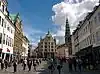
| highway | pedestrian | Gågade
Gade forbeholdt fodgængere, typisk i bycentre. Køretøjer er ikke tilladt medmindre andet er angivet med skiltning. Torve og pladser kan tagges ved at tilføje area=yes til en polygon, som afgrænser området. |
 |
 | ||
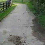
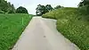
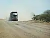
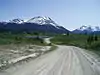
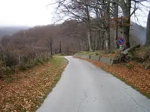
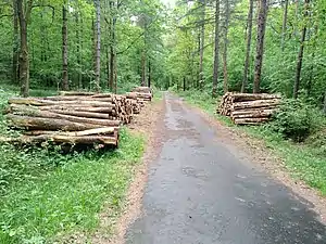
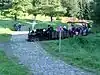
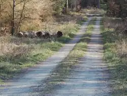
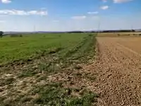
| highway | track | Markvej/skovvej
Hovedsageligt til landbrugsmæssig og skovbrugsmæssig arbejdskørsel, se også tracktype=*. |
 |
|||
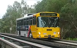
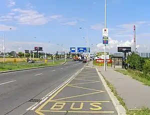
| highway | bus_guideway | Special busbane, hvor bussen styres med vandrette hjul mod en skinne. Dette er ikke en normal busbane og findes ikke i Danmark. |  |
 | ||
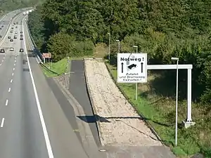
| highway | escape | Nødstopsspor
Anvendes til at standse løbske lastbiler med bremsesvigt. |
 | |||
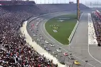
| highway | raceway | Racerbane (motorsportsbane)
Normalt ikke tilgængelig for almindelig trafik. |
 |
 | ||
| highway | road | Ukendt vejtype
Vej med ukendt klassifikation. Dette er et midlertidigt tag, som anvendes hvis vejens status ikke kendes. Når vejen er fuldt kortlagt, skal vejens klassifikation ændres til den korrekte værdi. |
 |
 | ||
| highway | busway | A dedicated roadway for bus rapid transit systems | 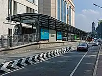 grade-seperated section of busway outside of station | |||
Stier | ||||||
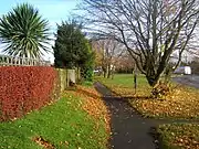
| highway | footway | Gangsti
Sti beregnet til fodgængere |
 |
 | ||
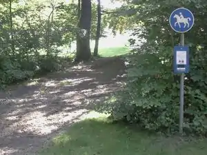
| highway | bridleway | Ridesti
Sti beregnet til ryttere, men anden trafik kan også være tilladt. |
 |
 | ||
| highway | steps | Trappe
Normalt kun egnet for fodgængere. Tilføj bicycle=dismount hvis cykler kan medføres her. |
 |
 | ||
| highway | corridor | For a hallway inside of a building. |  | |||
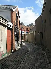
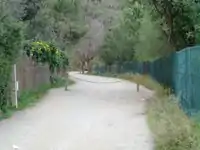
| highway | path | Sti
Ikke-specifik eller med delt anvendelse (f.eks. stier i skove). |
 |
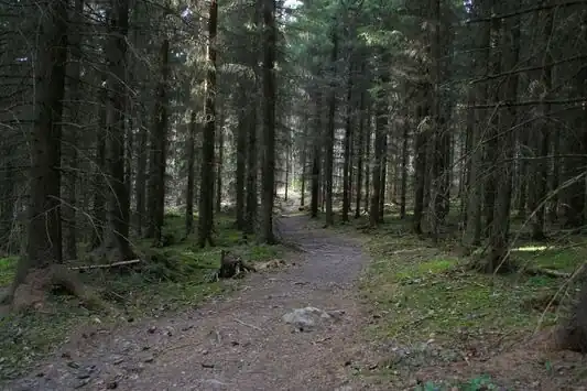 | ||
| highway | via_ferrata | A via ferrata is a route equipped with fixed cables, stemples, ladders, and bridges in order to increase ease and security for climbers. These via ferrata require equipment : climbing harness, shock absorber and two short lengths of rope, but do not require a long rope as for climbing. | not rendered in OSM-Carto | 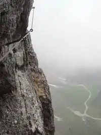 | ||
When sidewalk/crosswalk is tagged as a separate way | ||||||
| footway | sidewalk | Sidewalk that runs typically along residential road. Use in combination with highway=footway or highway=path | |
 | ||
| footway | crossing | Fodgængerovergang | |
 | ||
Fortov tagget som del af større vej (se Sidewalks) | ||||||
| sidewalk | both | left | right | no | Specifies that the highways has sidewalks on both sides, on one side or no sidewalk at all | 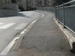 | |||
Cykelsti optegnet som egen vej | ||||||
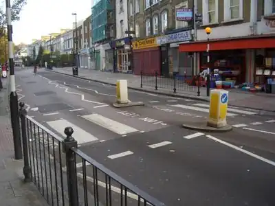
| highway | cycleway | Cykelsti
Separat sti beregnet for cykeltrafik. Fodgængere har i reglen også lov til at færdes på en cykelsti hvis der ikke er en gangsti langs cykelstien. Se også Vejledning i mapning af cykelstier. |
 |
 Separated cycleway with traffic sign | ||
Cykelvej tagget som del af større vej | ||||||
| cycleway | lane | Cykelbane
En afmærket cykelsti, som i Danmark er adskilt fra kørebanen med en ubrudt hvid kantstribe og markeret med påbudsskilte eller påmalede cykelsymboler. Biler må ikke køre på den afmærkede cykelbane. |
 | |||
| cycleway | opposite | Cykling er tilladt i begge retninger på ensrettet gade. Alternativt kan dette tagges som oneway:bicycle=no. |  | |||
| cycleway | opposite_lane | Cykelbane, der går mod trafikretningen på ensrettet gade. |  | |||
| cycleway | track | Cykelsti
Bygget som en del af vejen, men konstruktionsmæssigt adskilt fra kørebanen med kantsten eller lignende. Hvis adskillelsen gør det svært eller ulovligt at passere mellem vej og cykelsti (f.eks. hæk, hegn eller autoværn), tegnes cykelstien separat som highway=cycleway. Se også vejledningen om mapning af cykelstier |
 | |||
| cycleway | opposite_track | Cykelsti, der går mod trafikretningen på ensrettet gade. |  | |||
| cycleway | share_busway | Delt busbane, som må benyttes af cyklister. |  | |||
| cycleway | opposite_share_busway | Used on ways with oneway=yes that have a bus lane that cyclists are also permitted to use, and which go in the opposite direction to normal traffic flow (a "contraflow" bus lane). Used together with oneway:bicycle=no. | 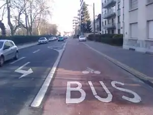 | |||
| cycleway | shared_lane | Delt cykelbane, der er adskilt fra kørebanen med stiplet kantstribe. Afstribningen er kun vejledende og motorkøretøjer må bruge cykelbanen hvis nødvendigt. "To minus en veje" er af denne type. | 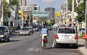 | |||
| busway | lane | Bus lane on both sides of the road. (See also: Parallel scheme for bus/psv lane tagging lanes:bus=* / lanes:psv=*) | | |||
Street parking tagged on the main roadway (see Street parking) | ||||||
| parking :left / :right / :both (hereafter: parking:side) |
lane | street_side | on_kerb | half_on_kerb | shoulder | no | separate | yes | Cykelbane
En afmærket cykelsti, som i Danmark er adskilt fra kørebanen med en ubrudt hvid kantstribe og markeret med påbudsskilte eller påmalede cykelsymboler. Biler må ikke køre på den afmærkede cykelbane. |
| |||
| parking:sideorientation=* | parallel | diagonal | perpendicular | Cykelbane
En afmærket cykelsti, som i Danmark er adskilt fra kørebanen med en ubrudt hvid kantstribe og markeret med påbudsskilte eller påmalede cykelsymboler. Biler må ikke køre på den afmærkede cykelbane. |
||||
Livscyklus (see also lifecycle prefixes) | ||||||
| highway | proposed | Planlagt vej (anlægsarbejde er ikke startet).
Kombineres med proposed=*. Tagget bør kun anvendes til vedtagne vejprojekter, hvor tracéet er endeligt fastlagt. |
||||
| highway | construction | Vej under anlæg.
Kombineres med construction=*. |
 |
 | ||
Egenskaber | ||||||
| abutters | commercial | industrial | mixed | residential | retail etc. | Linieformet arealanvendelse langs vej.
Anvendes kun, hvor der ikke er tilgængelige luftfoto. Ikke relevant for Danmark. |
 | |||
| bicycle_road | yes | A bicycle road is a road designated for bicycles. If residential streets get the status of bicycle roads, normally, by special signs, motor traffic is admitted with limited speed, often only for residents. | 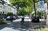 | |||
| bus_bay | both | left | right | A bus bay outside the main carriageway for boarding/alighting | 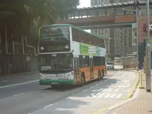 | |||
| change | yes | no | not_right | not_left | only_right | only_left | Specify the allowed/forbidden lane changes | .jpg.webp) | |||
| destination | <place name of destination> | Destination when following a linear feature | .svg.png.webp) | |||
| embankment | yes | dyke | A dyke or a raised bank to carry a road, railway, or canal across a low-lying or wet area. | 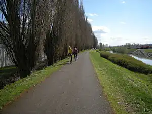 | |||
| embedded_rails | yes | <type of railway> | A highway on which non-railway traffic is also allowed has railway tracks embedded in it but the rails are mapped as separate ways. | _heading_NW.jpg.webp) | |||
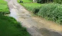
| ford | yes | Vadested
ved krydsning af vandløb, man må regne med at skulle køre gennem vand. |
 | |||
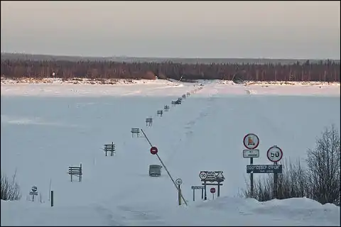
| ice_road | yes | Isvej
Markeret vej over tilfrossen vandoverflade. I sagens natur kun anvendelig om vinteren. |
 | |||
| incline | Number % | ° | up | down | Stigning i procent ("5%") eller grader ("20°")
Positive/negative værdier indikerer om vejen stiger eller daler i vejens retning. |
 | |||
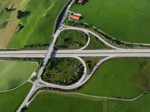
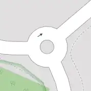
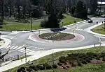
| junction | roundabout | Rundkørsel
Ensretning (oneway=yes) er underforstået og bliver defineret af nodernes sekvens i vejen (skal tegnes mod uret i Danmark). |
 |
 | ||
| lanes | <number> | Antal vognbaner
Alle fuldbredde vognbaner skal tælles med, også svingbaner, busbaner med videre. Nødspor og cykelbaner skal ikke medregnes. |
 | |||
| lit | yes | no | Gadebelysning
Angiver om vejen har gadebelysning. Se også highway=street_lamp for individuelle gadelamper. |
 | |||
| maxspeed | <number> | Specifies the maximum legal speed limit on a road, railway or waterway. | 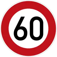 | |||
| motorroad | yes | no | Angiver, at kun hurtige motorkøretøjer må anvende vejen. Svarer i Danmark til motor(trafik)vej. Tagget anvendes i øjeblikket ikke på danske veje, da highway=trunk allerede svarer til motortrafikvej. | 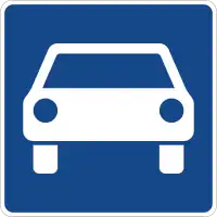 | |||
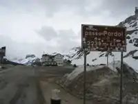
| mountain_pass | yes | Bjergpas
Angiver det højeste punkt på en vej over et bjergpas. |
 | |||
| mtb:scale | 0-6 | Klassifikationssystem for mountainbikespor. |  | |||
| mtb:scale :uphill | 0-5 | A classification scheme for mtb trails for going uphill if there is significant inclination. | | |||
| mtb:scale :imba | 0-4 | The IMBA Trail Difficulty Rating System shall be used for bikeparks. It is adapted to mtb trails with artificial obstacles. | ||||
| mtb:description | Text | Applies to highway=path and highway=track. A key to input variable infos related to mtbiking on a way with human words | ||||
| oneway | yes | no | reversible | Oneway streets are streets where you are only allowed to drive in one direction. | 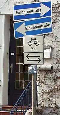 | |||
| oneway:bicycle | yes | no | | Used on ways with oneway=yes where it is legally permitted to cycle in both directions. | 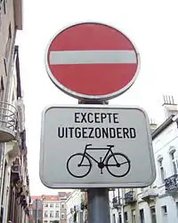 | |||
| overtaking | yes | no | caution | both | forward | backward | Overhaling
Angiver om overhaling er tilladt på strækningen. |
 | |||
| parallel | diagonal | perpendicular | marked | no_parking | no_stopping | fire_lane. | Vejsideparkering. Se parking:lane=* for detaljer. "side" kan være left, right eller both. | |||||
| free | ticket | disc | residents | customers | private | Parkeringsbetingelser for vejsideparkering. Se parking:condition=* for detaljer. "side" kan være left, right eller both. |  | ||||
| passing_places | yes | Vejen har hyppige vigepladser. Se også highway=passing_place. |  | |||
| priority | forward | backward | Traffic priority for narrow parts of roads, e.g. narrow bridges. |  | |||
| priority_road | designated | yes_unposted | end | Specifying roads signposted as priority roads. |  | |||
| sac_scale | hiking | mountain_hiking | demanding_mountain_hiking | alpine_hiking | demanding_alpine_hiking | difficult_alpine_hiking | Klassifikationssystem for vandrestier. | 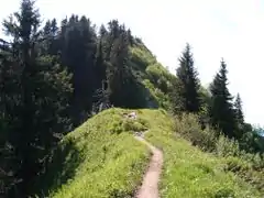 | |||
| service | alley | driveway | parking_aisle etc. | Type af adgangsvej: Anvend service=driveway for privat indkørsel, service=parking_aisle for kørebane mellem båsene på parkeringsplads. |  | |||
| smoothness | excellent | good | intermediate | bad | very_bad | horrible | very_horrible | impassable | See Key:smoothness for more details. | 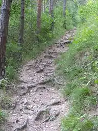 | |||
| surface | paved | unpaved | asphalt | concrete | paving_stones | sett | cobblestone | metal | wood | compacted | fine_gravel | gravel | pebblestone | plastic | grass_paver | grass | dirt | earth | mud | sand | ground | Overflade
Beskriver vejbanens overflade. Se surface=* for detaljer. |
||||
| tactile_paving | yes | no | A paving in the ground to be followed with a blindman's stick. | Not to be rendered on standard maps. | 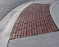 | ||
| tracktype | grade1 | grade2 | grade3 | grade4 | grade5 | To describe the quality of the surface. See Key:tracktype for more information. |  |
 | ||
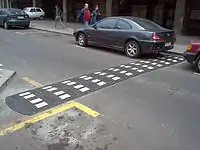
| traffic_calming | bump | hump | table | island | cushion | yes | etc. | Trafikdæmpning
Hastighedsdæmpende foranstaltning, f.eks. bump eller chikane. |
 | |||
| trail_visibility | excellent | good | intermediate | bad | horrible | no | Applies to highway=path, highway=footway, highway=cycleway and highway=bridleway. A classification for hiking trails visibility |  | |||
| trailblazed | yes | no | poles | cairns | symbols | Applies to highway=*. Describing trail blazing and marking. See Key:trailblazed for more information. | 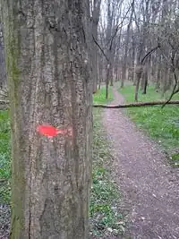 | |||
| trailblazed:visibility | excellent | good | intermediate | bad | horrible | no | Applies to trailblazed=*. A classification for visibility of trailblazing. See Key:trailblazed:visibility for more information. | ||||
| turn | left | slight_left | through | right | slight_right | merge_to_left | merge_to_right | reverse | The key turn can be used to specify the direction in which a way or a lane will lead. | 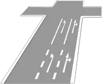 | |||
| width | <number> | The width of a feature. |  | |||
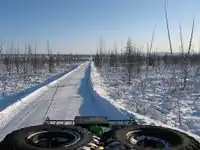
| winter_road | yes | Vintervej
Vejen kan kun anvendes, når undergrunden er frosset. Forekommer i arktiske områder. |
 | |||
Andre features | ||||||
| highway | bus_stop | Busstoppested
Større stationer bør tagges som amenity=bus_station i stedet. |
 | |||
| highway | crossing | A.k.a. crosswalk. Pedestrians can cross a street here; e.g., zebra crossing | | |||
| highway | elevator | An elevator or lift, used to travel vertically, providing passenger and freight access between pathways at different floor levels. | 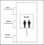 | |||
| highway | emergency_bay | An area beside a highway where you can safely stop your car in case of breakdown or emergency. | 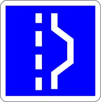 | |||
| highway | emergency_access_point | Sign number which can be used to define your current position in case of an emergency. Use with ref=NUMBER_ON_THE_SIGN. See also emergency=access_point | 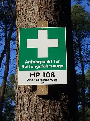 | |||
| highway | give_way | Vigepligtsskilt | 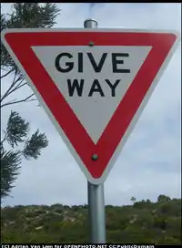 | |||
| emergency | phone | Nødtelefon
Findes ofte langs motorveje. |
 | |||
| highway | milestone | Highway location marker |  | |||
| highway | mini_roundabout | Mini-rundkørsel
Meget lille rundkørsel, ofte blot en malet eller brolagt cirkel i et kryds. For større rundkørsler anvendes junction=roundabout. |
 |
|||
| highway | motorway_junction | Frakørsel på motorvej. |  |
| ||
| highway | passing_place | Vigeplads
Tillader køretøjer at passere hinanden på smal vej. |
 | |||
| highway | platform | Perron
på station eller stoppested. Se public_transport=platform for nærmere detaljer Det anbefales indtil videre også at anvende det ældre tag highway=platform. |
 |
 | ||
| highway | rest_area | Rasteplads
ofte med toilet og picnicborde. Der kan normalt ikke tankes eller købes mad her. |
 |
 | ||
| highway | services | Serviceanlæg
med tankstation, cafeteria, kiosk m.v. Findes især langs motorveje. |
 |
 | ||
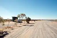
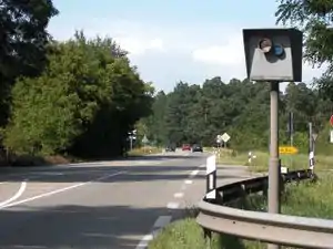
| highway | speed_camera | Fartkamera
Fast kamera til håndhævelse af fartbegrænsning. |
 | |||
| highway | stop | Stopskilt | 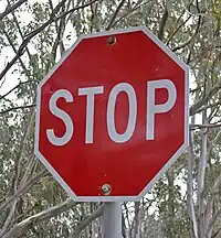 | |||
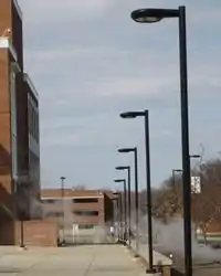
| highway | street_lamp | Gadelampe
Det er også muligt at angive, om gaden har gadebelysning med tagget lit=*. |
 | |||
| highway | toll_gantry | A toll gantry is a gantry suspended over a way, usually a motorway, as part of a system of electronic toll collection. For a toll booth with any kind of barrier or booth see: barrier=toll_booth | .jpg.webp) | |||
| highway | traffic_mirror | Mirror that reflects the traffic on one road when direct view is blocked. | 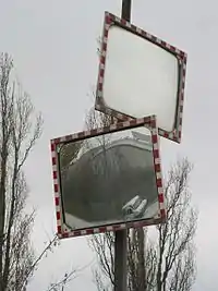 | |||
| highway | traffic_signals | Lysregulering | 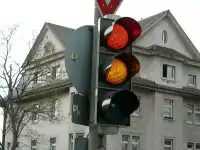 | |||
| highway | trailhead | Designated place to start on a trail or route | 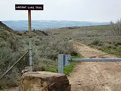 | |||
| highway | turning_circle | Vendeplads
typisk ved enden af blind vej i boligområde. |
 |
 | ||
| highway | turning_loop | A widened area of a highway with a non-traversable island for turning around, often circular and at the end of a road. |  | |||
| highway | brugerdefineret | Se også Taginfo for mere information. | ||||
.jpg.webp)
Jernbaner (railway)
- Hovedartikel: Railways
This tag includes all kinds of railways ranging from heavily used mainline railways to an abandoned rail line.
| Nøgle(key) | Værdi | Element | Kommentar | Rendering | Foto | |
|---|---|---|---|---|---|---|
Tracks | ||||||
| railway | abandoned | Nedlagt jernbanestrækning, hvor skinner og infrastruktur er fjernet. Betegnelsen skal ikke anvendes, hvis strækningen nu anvendes til andet formål, f.eks. cykelsti. | Not rendered by osm-carto | 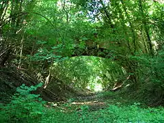 | ||
| railway | construction | Jernbane under anlæg, kan kombineres med construction=*. |  |
 | ||
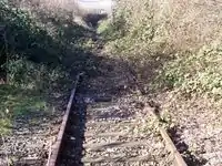
| railway | disused | Jernbanestrækning, der ikke længere er i drift, men hvor skinner og infrastruktur stadig er til stede. Se også disused=yes for alternativ tagging. |  |
 | ||
| railway | funicular | Kabeltrukket stejl jernbane, normalt med to vogne, der kører i modsat retning af hinanden. |  |
 | ||
| railway | light_rail | Letbane, sporveje i eget tracé adskilt fra biltrafik. Letbanetog er normalt længere og hurtigere end normale sporvogne. | |
 | ||
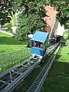
| railway | miniature | Miniaturejernbane, børn kan sidde på toget. Findes sommetider i større parker eller tivolier. |  |
 | ||
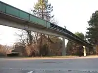
| railway | monorail | En jernbane med kun en skinne. |  |
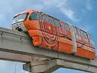 Monorail in Kuala Lumpur | ||
| railway | narrow_gauge | Smalsporsjernbane, for passager- eller godstog med smal sporvidde. | |
 | ||
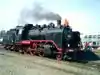
| Veteranjernbane, jernbane for historiske tog, normalt en turistattraktion |  |
 | ||||
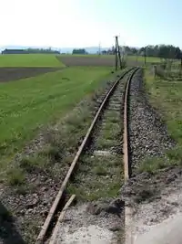
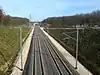
| railway | rail | Jernbane til fuld størrelse passager- eller godstog med standard sporvidde for det givne land eller stat. S-baner i København betragtes også som jernbaner. |  |
 | ||
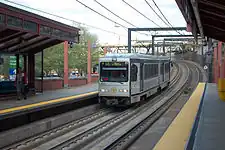
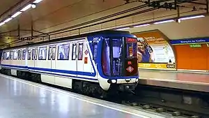
| railway | subway | Undergrundstog, metro, togservice, der mest kører i undergrunden i storbyområder. |  |
 | ||
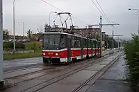
| railway | tram | Sporvej til sporvogne, ofte i gadetracé sammen med biltrafik. |  |
 | ||
Additional track features or attributes | ||||||
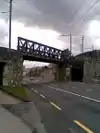
| bridge | yes | Bro, fører jernbanen over vand, vej eller anden jernbane. Husk layer=*. |  |
 | ||
| cutting | yes | Gennemskæring gennem bakke eller lignende. | 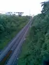 | |||
| electrified | contact_line rail yes no |
contact_line: Køreledning, rail: Tredje skinne, der er strømførende (f.eks. på metroen i Kbh), yes: angiver at banen er elektricificeret, men uden yderligere detaljer. |
 | |||
| embankment | yes | Dæmning over lavt område eller vand. Må ikke forveksles med dæmninger til opstemning af vand, se waterway=dam. |  | |||
| embedded_rails | yes/<type of railway> | Specifies that a highway on which non-railway traffic is also allowed has railway tracks embedded in it but the rails are mapped as separate ways. | | |||
| frequency | number [Hz] | Frekvens på køreledning eller -skinne. Anvend 0 for jævnstrøm. | 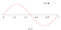 | |||
| railway:track_ref | number | Track number |  | |||
| service | crossover | Relatively short lengths of track which switch traffic from one parallel line to another | ||||
| service | siding | Sidespor, løber parallelt med hovedbanen. |  |
|||
| service | spur | Korte stykker spor, der forbinder fabrikker, havneområder og lignende med hovedbanen. | |
 | ||
| service | yard | Rangerspor | |
 | ||
| tunnel | yes | Tunnel. Skal altid anvendes ved underjordiske dele af metrobaner etc. Husk layer=*. | 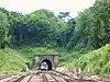 | |||
| tracks | number | Antal parallele spor på jernbane kortlagt som en enkelt vej. I mange dele af verden, også i Danmark, kortlægges de enkelte jernbanespor normalt separat og her skal dette tag derfor ikke anvendes. | 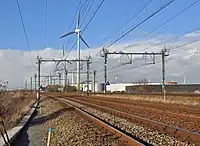 | |||
| usage | main branch industrial military tourism scientific test |
Angiver anvendelsen af banen. | ||||
| voltage | number | Spænding på køreledning eller -skinne. Angives i volt. |  | |||
Stations and stops | ||||||
| railway | halt | Trinbrædt, en lille station, oftes kun en perron og togene stopper måske kun ved signal. | 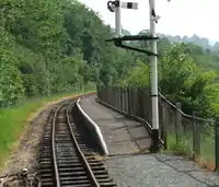 | |||
| public_transport | stop_position | The position on the railway track where the train (its centre) stops at a platform. This is useful for routing on long platforms where also short trains stop and on long platforms where multiple trains stop behind each other. See also public_transport=stop_area. | | |||
| public_transport | platform | Perron på station eller stoppested. Se public_transport=platform for nærmere detaljer. Det anbefales indtil videre også at anvende det ældre tag railway=platform. | .jpg.webp) | |||
| railway | platform | This is parallel to the rail line for showing where the actual platforms are. It is also to know where you can change platform and enter the station, so use footpaths to connect them. This is really useful for routing too. Use in addition to public_transport=platform. | | |||
| public_transport | station | Railway passenger-only station. | 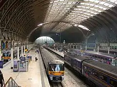 | |||
| railway | station | Jernbanestation | | |||
| railway | subway_entrance | Indgang til metro/undergrundsstation. | 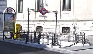 | |||
| railway | tram_stop | Sporvognsstoppested | 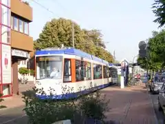 | |||
Other railways | ||||||
| railway | buffer_stop | Stops the train at the end of a track. See buffer stop. | Not rendered by osm-carto | .jpg.webp) | ||
| railway | derail | A device used to prevent fouling of a rail track by unauthorized movements of trains or unattended rolling stock. See Derail (railroad). | Not rendered by osm-carto | 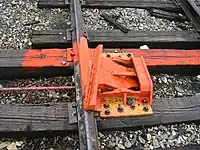 | ||
| railway | crossing | Fodgængerkrydsning, sted hvor fodgængere kan krydse banen. | 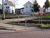 | |||
| railway | level_crossing | Jernbaneoverskæring, hvor vej og jernbane krydser hinanden. | 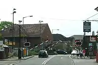 | |||
| railway | tram_level_crossing | A point where trams and roads cross. | 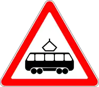 | |||
| railway | signal | Any kind of railway signal. | Not rendered by osm-carto | 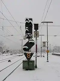 | ||
| railway | switch | Full connections between railways (aka 'points'). | Not rendered by osm-carto | 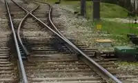 | ||
| railway | railway_crossing | Crossing rails with no interconnection. | Not rendered by osm-carto | 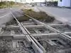 | ||
| landuse | railway | Ground used around railways and railway-stations. |  Except no border, as landuse=industrial Except no border, as landuse=industrial |
 | ||
| railway | turntable | These are used for changing the direction that part of a train is pointing in. |
|
 | ||
| railway | roundhouse | A semicircular building with many stalls for servicing engines. | Not rendered by osm-carto |  | ||
| railway | traverser | These are used for changing trains between railways. Also known as transfer table. |  | |||
| railway | wash | A railroad carriage/car wash | Not rendered by osm-carto | 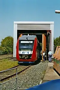 | ||
| railway | water_crane | A structure to deliver water to steam locomotives | Not rendered by osm-carto | 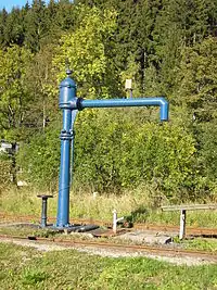 | ||
| railway | ventilation_shaft | A structure that allows ventilation in underground tunnels | Not rendered by osm-carto | .jpg.webp) | ||
| railway | brugerdefineret | Se også Taginfo for mere information. | – – – | – – – | ||

This table is a wiki template with a default description in English. Editable here.
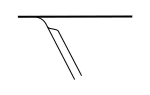
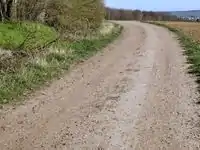
Vejtype (tracktype) for markveje og skovveje
Mapnik kræver dette tag for at tegne highway=track korrekt.
| Nøgle(key) | Værdi | Element | Kommentar | Rendering | Foto |
|---|---|---|---|---|---|
| tracktype | grade1 | Vej belagt med asfalt, fliser eller beton. | |
.jpg.webp) | |
| tracktype | grade2 | Ubelagt vej bestående af grus eller sand og med tæt pakket overflade. |  |
 | |
| tracktype | grade3 | Ubelagt vej eller hjulspor med jævn overflade bestående af både hårde og bløde materialer. |  |
 | |
| tracktype | grade4 | Ubelagt vej eller hjulspor med ujævn overflade bestående mest af bløde materialer såsom jord eller sand. |  |
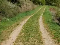 | |
| tracktype | grade5 | Ubelagt vej eller hjulspor bestående af bløde materialer såsom græs, sand eller jord og som kan være svær at skelne i landskabet. |  |
 | |
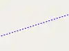
| tracktype | <no value> | If no tracktype tag is present, the track is rendered with a dot-dash line style (as shown right). | 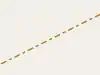 |
This table is a wiki template with a default description in English. Editable here.
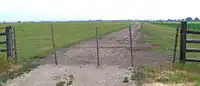
Forhindringer (barrier)
Forhindrings taggen bruges normalt knudepunkter langs veje, hvor rejsen er begrænset af en hindring. Den tilbydes som en bedre(renere) alternativ til at bruge Highway=gate osv. Den dækker også linier (f.eks hegn), der selv er hindringer.
| Nøgle (Key) | Værdi | Element | Kommentar | Rendering | Foto | |
|---|---|---|---|---|---|---|
Lineære forhindringer | ||||||
| barrier | cable_barrier | Also called guard cable. This is a road side or median barrier made of steel wire ropes mounted on weak posts. See also the more extensive wikipedia description. |  | |||
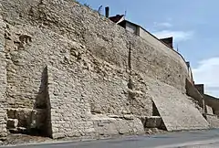
| barrier | city_wall | Bymur |  |
 | ||
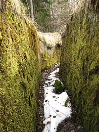
| barrier | ditch | Grøft, normalt med vand i bunden. Alternativt kan anvendes waterway=ditch. |  |
 | ||
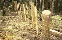
| barrier | fence | Hegn | |
 | ||
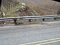
| barrier | guard_rail | Autoværn. | |
 | ||
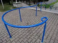
| barrier | handrail | Is designed to be grasped by the hand so as to provide stability or support. | |
 | ||
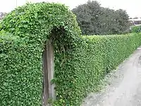
| barrier | hedge | Hæk eller levende hegn |  |
 | ||
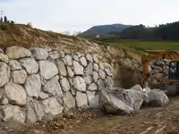
| barrier | retaining_wall | Støttemur, mur, sten eller beton som holder på en stejl skrænt. Tegnes så ned er til højre for stregens retning. | |
 | ||
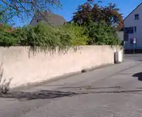
| barrier | wall | Mur | |
 | ||
Access control on highways (e.g. for blocking a path or road) | ||||||
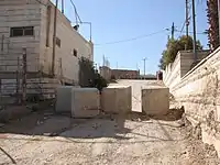
| barrier | block | A large, solid, immobile block that can be moved only with heavy machinery or great effort.
Typically big solid things made of concrete for stopping larger vehicles. Sometimes natural boulders are used for the same purpose. |
 | |||
| barrier | bollard | Pullert. For pullerter, der kan sænkes ned i vejen efter aktivering med elektronisk nøglekort eller lignende, kan tilføjes bollard=rising. | 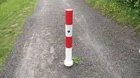 | |||
| barrier | border_control | Grænsekontrol. Her kontrolleres pas eller anden legimitation. | 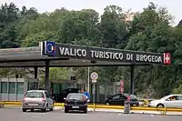 | |||
| barrier | bump_gate | For description see wikipedia:Bump gate, for another photo see flickr example: . | 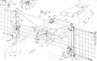 | |||
| barrier | bus_trap | See wikipedia:Bus trap. | 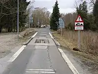 | |||
| barrier | cattle_grid | Kvægrist. Tillader køretøjer og fodgængere, men ikke dyr at passere. | 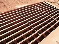 | |||
| barrier | coupure | A cut through a flood protection feature (e.g., (flood)wall, levee, or dyke) for a road or railway, that is readily made flood tight if required. | 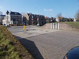 | |||
| barrier | cycle_barrier | Cykelchikane eller -barriere. | 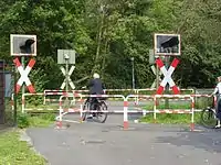 | |||
| barrier | debris | A road is blocked by debris with or without ground. This might be for short or long time. Often used as first step in blocking an abandoned road. | 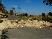 | |||
| barrier | entrance | Indgang. |  | |||
| barrier | full-height_turnstile | A full-height turnstile, also called HEET-turnstile (high entrance/exit turnstile), like the ones to access security areas. Note the mix of hyphen and underscore. | 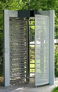 | |||
| barrier | gate | Port,låge. Tilføj access=* for at angive trafiktyper, der kan passere. | 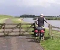 | |||
| barrier | hampshire_gate | A section of wire fence which can be removed temporarily.
Combine with access=* where appropriate. |
 | |||
| barrier | height_restrictor | Combine with maxheight=*. | 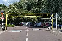 | |||
| barrier | horse_stile | A horse stile allows pedestrians and horses to cross a gap through a fence, but prevents or makes it very difficult for motorcycles and live stock to cross. | 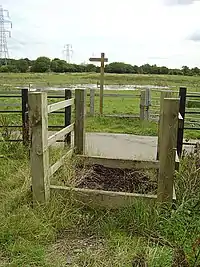 | |||
| barrier | kent_carriage_gap | A Kent carriage gap is used by local authorities in the UK to prevent motorised vehicles from accessing public rights of way whilst allowing most horse drawn carriages to pass.
These are now becoming common on byways in the UK |
||||
| barrier | kissing_gate | A gate which allows people to cross, but not livestock. | 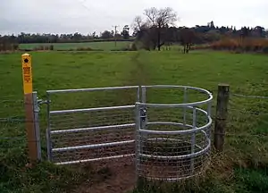 | |||
| barrier | lift_gate | Vippebom. | 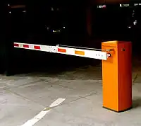 | |||
| barrier | motorcycle_barrier | Barriers along paths that prevent access by motorcycles. | 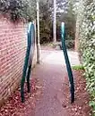 | |||
| barrier | planter | A plant box, or simply a planter, is a structure containing plants for decoration, which (in this context) has the primary purpose of preventing large vehicles from passing. | _01.jpg.webp) | |||
| barrier | sally_port | A sally port is used to pass through thick or city walls, and is a type of covered gate with two doors. |  | |||
| barrier | sliding_beam | Something between barrier=sliding_gate and barrier=lift_gate: it has a quite thin bar like in lift gate, but the bar slides aside to allow through. | 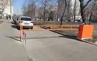 | |||
| barrier | sliding_gate | Gates open sideways. Usually automatic
Combine with access=* where appropriate. |
 | |||
| barrier | spikes | Spikes on the ground that prevent unauthorized access. Can also be removable; e.g., after payment in a garage. | .jpg.webp) | |||
| barrier | stile | Stente. Indretning, der tillader fodgængere at krydse et hegn eller en mur. | 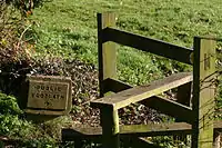 | |||
| barrier | sump_buster | A sump buster is a concrete slab or steel structure that prevents passing of two-tracked vehicles with less than a minimum track and ground clearance. (Typically stops normal cars.) | 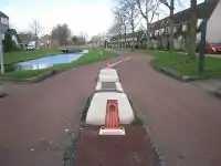 | |||
| barrier | swing_gate | Svingbom. Bevæges i vandret retning og anvendes f.eks. til at forhindre indkørsel til skovveje og lignende. Kan normalt passeres af fodgængere og cyklister. | 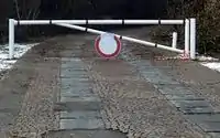 | |||
| barrier | toll_booth | Betalingssted for vejafgift, f.eks. ved Storebæltsbroen. | 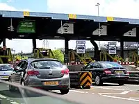 | |||
| barrier | turnstile | A turnstile (also called baffle gate) is used to allow one person at a time to pass. Use this for small turnstiles like the ones in supermarkets or some subways. | 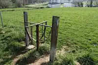 | |||
| barrier | wedge | A wedge-shaped barrier that rises out of the ground to block traffic. | 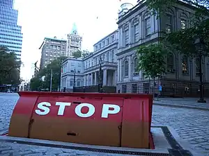 | |||
| barrier | wicket_gate | A wicket gate, or simply a wicket, is a pedestrian door or gate, particularly one built into a larger door or into a wall or fence. | 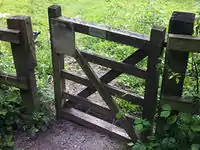 | |||
| barrier | yes | A barrier which nature cannot be determined; typically only used in mapping using aerial imagery. Should be replaced by a specific value. |  | |||
Linear barriers or access control on highways (e.g. along or for blocking a path or road) | ||||||
| Nøgle (Key) | Værdi | Element | Kommentar | Rendering | Rendering | Foto |
| barrier | bar | A fixed horizontal bar which blocks motor vehicles but can usually be bypassed on foot or bike. Often placed at trailheads. | 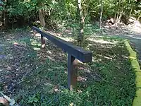 | |||
| barrier | barrier_board | A barrier board to restrict the passage of a way or to block off an area. | 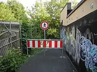 | |||
| barrier | bollard | Pullert. For pullerter, der kan sænkes ned i vejen efter aktivering med elektronisk nøglekort eller lignende, kan tilføjes bollard=rising. | 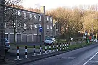 |
| ||
| barrier | chain | Kæde | |
 | ||
| barrier | jersey_barrier | A Jersey barrier consists of heavy prefabricated blocks to create a barrier. Use material=plastic or material=concrete to express the used material. |  |
 | ||
| barrier | kerb | Kantsten. Udgør en forhindring for køretøjer og kørestolsbrugere. Tilføj height=* for at angive højden. | 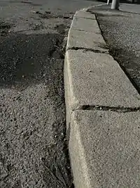 | |||
| barrier | log | Træstamme | 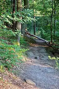 | |||
| barrier | rope | A flexible barrier made of fibres, twisted or braided together to improve strength. As a barrier it is often more symbolic than actually physically preventing pedestrians from accessing. |  | |||
| barrier | tank_trap | Static anti-tank obstacles that can take various forms, such as Czech hedgehog (barrier=tank_trap; tank_trap=czech_hedgehog). | 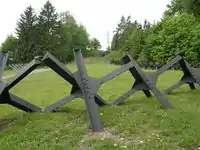 | |||
| barrier | tyres | A crash barrier made from tyres stacked on top of each other, commonly found at motor racing circuits. | 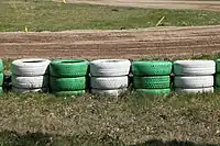 | |||
| barrier | user defined | All commonly used values according to Taginfo | ||||
This table is a wiki template with a default description in English. Editable here.
Lufthavn (aeroway)
These are mainly related to aerodromes, airfields other ground facilities that support the operation of airplanes and helicopters. See the page Aeroways for an introduction on mapping these features.
| Nøgle(key) | Værdi | Element | Kommentar | Rendering | Foto |
|---|---|---|---|---|---|
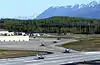
| aeroway | aerodrome | Lufthavn | 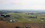 | ||
| aeroway | airstrip | A field or area where light aircraft can land and take off from. | 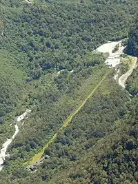 | ||
| aeroway | apron | Apron, flyparkeringsområde. |  |
 | |
| aeroway | control_center | 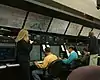 | |||
| aeroway | fuel | Fuelling station for aircraft. | .jpg.webp) | ||
| aeroway | gate | Gate. Anvendes til at angive gate nummer (kombiner med ref=*) |  |
 | |
| aeroway | hangar | Hangar |  | ||
| aeroway | helipad | Helipad. Helikoptere lander og starter her. |  | ||
| aeroway | heliport | 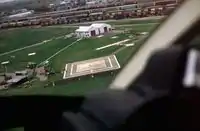 | |||
| aeroway | holding_position | A point behind which aircraft are considered clear of a crossing way | 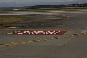 | ||
| aeroway | jet_bridge | Passenger boarding bridge | 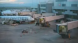 | ||
| aeroway | navigationaid | A facility that supports visual navigation for aircraft |  | ||
| airmark | beacon | 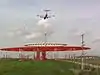 | |||
| aeroway | parking_position | A location where an aeroplane can park | 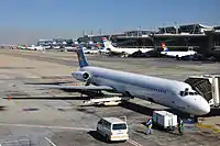 | ||
| aeroway | runway | Start- og landingsbane hvor fly letter og lander. |  |
.jpg.webp) | |
| aeroway | taxilane | Taxilane is a path in an airport that is part of the aircraft parking area or apron (Proposed feature with low usage as of 2015-10; use with an eye towards the question correct usage). | |||
| aeroway | taxiway | Taxibane, rullebane, som forbinder landingsbane og apron. |  |
 | |
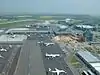
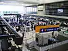
| aeroway | terminal | Terminal, passagerbygning. |  |
 | |
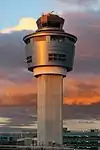
| aeroway | tower | See also aeroway=control_tower or combination of man_made=tower + service=aircraft_control for similar schemes. |
 | ||
| aeroway | windsock | Vindpose | 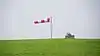 | ||
| aeroway | highway_strip | 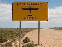 | |||
| aeroway | brugerdefineret | Se også Taginfo for mere information. |
This table is a wiki template with a default description in English. Editable here.
Vandveje (waterway)
Vandløb og kanaler skal mappes som veje tegnet i strømmens retning. Se Waterways for en introduktion til kortlægning af vandveje.
| Nøgle(key) | Værdi | Element | Kommentar | Rendering | Foto | |
|---|---|---|---|---|---|---|
Naturlige vandløb | ||||||
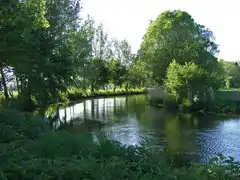
| waterway | river | Flod, større å. Tegnes som en linie midt i vandløbet i strømretningen. For bredere vandløb (> 12 m) kan bredderne indtegnes og tagges waterway=riverbank. |  |
 | ||
| Flodbred, åbrink. Anvendes ved bredere vandløb for at indtegne arealet mellem bredderne. Tegnes som en lukket polygon for et passende stykke af vandløbet. |  |
 | ||||
| waterway | stream | Bæk, lille å ikke bredere end ca 2 meter. |  |
 | ||
| waterway | tidal_channel | A natural tidal waterway within the coastal marine environment with bi-directional flow of salty water which depends on the tides. | 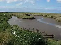 | |||
Kunstige vandveje | ||||||
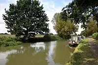
| waterway | canal | Kanal, større kunstig vandvej til transport, vandkraft eller kunstvanding. For bredere kanaler (> 12 m) kan bredderne indtegnes og tagges waterway=riverbank. | |
 | ||
| waterway | pressurised | A waterway where water is flowing in a fully enclosed conduit and subject to pressure; this includes gravity-driven penstocks and siphons and pump-driven pipelines, for example. | 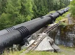 | |||
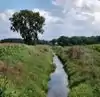
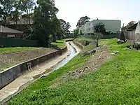
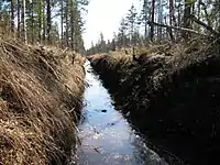
| waterway | drain | Lille kanal, mindre kunstig vandvej til bortledning af regnvand eller lignende. Større end en grøft. | |
 | ||
| waterway | ditch | Grøft. Kunstig rende til bortledning af vand, findes ofte langs veje. Typisk mindre end 2 meter bred. | |
 | ||
| waterway | fairway | A navigable route in a lake or sea marked by buoys. The navigable area marked by the buoys can be mapped with seamark:type=fairway. | ||||
| waterway | fish_pass | A |
 | |||
| waterway | canoe_pass | A canoe pass is a structure on or around artificial barriers (such as dams and locks) to enable whitewater praticants to go through those barriers | ||||
Faciliteter | ||||||
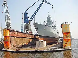
| waterway | dock | Dok, aflukket vandområde beregnet til skibsbygning eller reparation |  |
 | ||
| waterway | [[ Too many Data Items entities accessed. | boatyard ]] | (Både)værft | 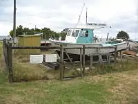 | |||
Forhindringer | ||||||
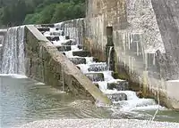
| waterway | dam | Dæmning. Vand strømmer normalt ikke over en dæmning. | 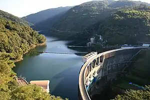 | |||
| waterway | weir | Stemmeværk i vandløb. Vandet kan normalt flyde over toppen af stemmeværket. | 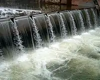 | |||
| waterway | waterfall | A waterfall, use in combination with natural=cliff | 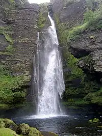 | |||
| waterway | rapids | A natural barrier, formed by a fast-flowing, often turbulent, section of the watercourse. | 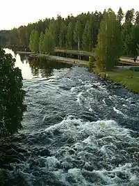 | |||
| waterway | lock_gate | Sluseport. Normalt anvendes lock=yes for sluse, men for større sluser kan det være mere hensigtsmæssigt at tagge slusedørene direkte. | 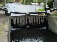 | |||
| waterway | sluice_gate | A sluice gate is a movable gate to control water flow. | 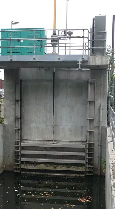 | |||
| waterway | security_lock | Flood barrier | 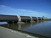 | |||
Andre vandvejsfunktioner | ||||||
| waterway | turning_point | Vendeplads for lange fartøjer i vandveje af begrænset bredde. Angiv maksimal længde med maxlength=*. | ||||
| waterway | water_point | Sted i marina eller havn hvor man kan tanke større mængder 'drikkevand'. | 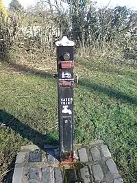 | |||
| waterway | fuel | A place to get fuel for boats. |  | |||
Egenskaber | ||||||
| intermittent | yes | Angiver, at vandløbet ikke har permanent vandføring. | ||||
| seasonal | yes, spring, summer, autumn, winter, wet_season, dry_season | Indicates that a waterway has a seasonal (yearly cyclic) flow, usually flowing continuously for at least some part of the year. |  | |||
| destination | name | Name of the body of water the linear feature flows into. | ||||
| lock | yes | Sluse. Tagget tilføjes på vandvejen mellem sluseportene. | | |||
| mooring | yes, private, no | Angiver en bred eller kaj beregnet til fortøjning af fartøjer. Anvend maxstay=*, hvis der er restriktioner på opholdstiden. |  | |||
| usage | See the key for details | Possible uses of the waterway. Use semicolons to separate. | ||||
| tunnel | culvert | Anvendes til at markere en underføring af et vandløb i et rør eller lignende under en vej. |  | |||
| tunnel | flooded | A long (> 100 m) tunnel where flowing water or other fluid prevent humans from safely walking inside despite its appropriate diameter or size. Water inside can be pressurised or not, used in combination with any waterway=* linear value. waterway=*. |  | |||
| bridge | aqueduct | A bridge which conveys an artificial waterway over a road, valley, or another waterway. | 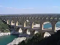 | |||
| waterway | user defined | Se også Taginfo for mere information. | ||||
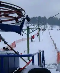
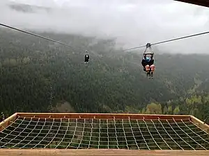
Svævebane (aerialway)
This is used to tag different forms of transportation for people or goods by using aerial wires. For example these may include cable-cars, chair-lifts and drag-lifts. See the page Aerialway for more information on the usage of these tags.
| Nøgle(key) | Værdi | Element | Kommentar | Rendering | Foto | Taginfo |
|---|---|---|---|---|---|---|
| Types of aerialway | ||||||
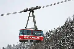
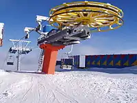
| aerialway | cable_car | Kabelbane, normalt to store kabiner, der kører modsat hinanden |  |
 |
||
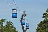
| aerialway | gondola | Gondollift, svævebane med et større antal små kabiner, der kører i ring. Hver kabine (gondol) har typisk plads til 6-8 personer. Skiene placeres i en udendørs holder. | |
 |
||
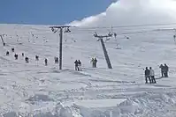
| aerialway | chair_lift | Stolelift, åben lift med en bænk med plads til mellem 2 og 4 personer. |  |
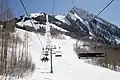 |
||
| aerialway | mixed_lift | |
 |
|||
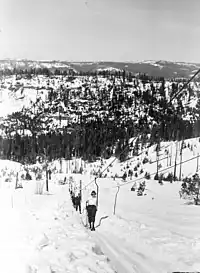
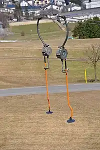
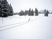
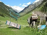
| aerialway | drag_lift | Træklift, egentlig ikke nogen svævebane, da skiløberen trækkes op med skiene på sneen. | |
 |
||
| aerialway | t-bar | This automatically implies oneway=yes (drawn upward). |
|
 |
||
| aerialway | j-bar | This automatically implies oneway=yes (drawn upward). |
|
 |
||
| aerialway | platter | This automatically implies oneway=yes (drawn upward). |
|
 |
||
| aerialway | rope_tow | This automatically implies oneway=yes (draw upward). |
|
 |
||
| aerialway | magic_carpet | This automatically implies oneway=yes (drawn upward). |
 |
|||
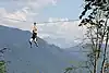
| aerialway | zip_line | This automatically implies oneway=yes (drawn downward). |
|
 |
||
| Equipments | ||||||
| aerialway | pylon | Mast, som bærer svævebanen. | 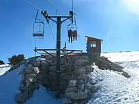 |
|||
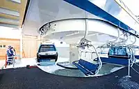
| aerialway | station | Liftstation, her stiger man på eller af liften. |  |
 |
||
| Others | ||||||
| Obsolete, please use aerialway=zip_line instead. This automatically implies oneway=yes (drawn downward). |
 |
|||||
| aerialway | goods | Controversial, consider other aerialway=* values in combination with foot=no and/or a usage=* key instead of this. |  |
 |
||
| aerialway | brugerdefineret | Se også Taginfo for mere information. | ||||
This table is a wiki template with a default description in English. Editable here.
Offentlig transport (public transport)
This is used for features related to public transport. For example: railway stations, bus stops and services. See the page titled Public transport for an introduction on its usage.
| Nøgle(key) | Værdi | Element | Kommentar | Rendering | Foto |
|---|---|---|---|---|---|
| public_transport | stop_position | The position on the street or rails where a bus, tram or train stops. | | ||
| public_transport | platform | The place where passengers are waiting for the transportation vehicle. |  |
| |
| public_transport | station | A station where several buses or trains end their service. Used in combination with building=yes or area=yes. |  | ||
| public_transport | stop_area | The stop area is a relation that contains all elements of a train/subway/monorail/tram/bus/trolleybus/aerialway/ferry stop. |  | ||
| public_transport | brugerdefineret | Se også Taginfo for mere information. |
This table is a wiki template with a default description in English. Editable here.
Elektricitet (power)
Nøglen power=* anvendes til diverse faciliteter vedrørende elforsyning såsom kraftværker, transformerstationer og højspændingsledninger. Se Power for mere information. På siden Denmark/Da:Power_networks findes information om kortlægning af det danske elnet.
| Nøgle(key) | Værdi | Element | Kommentar | Rendering | Foto |
|---|---|---|---|---|---|
| power | cable | Elkabel
Elforsyningskabel, som normalt er nedgravet i jorden eller havbunden. Placeringen kan angives med location=underground/underwater. Anvend ikke tagget til kabler til telekommunikation eller lignende. |
 | ||
| power | catenary_mast | A catenary mast supports system of overhead wires used to supply electricity to electricaly powered vehicle equipped with a pantograph. | 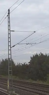 | ||
| power | compensator | Several kind of power devices used to insure of power quality and network resilience. |  | ||
| power | connection | A freestanding electrical connection between two or more overhead wires | 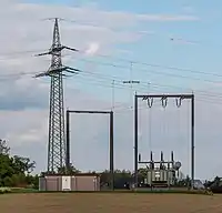 | ||
| power | converter | HVDC omformer
En installation til omformning mellem vekselstrøm og jævnstrøm. |
 | ||
| power | generator | Generator
Anlæg, der producerer elektricitet. Kombineres med generator:source=*, generator:method=* og generator:output=* |
 |
 | |
| power | heliostat | A mirror of a heliostat device. |  | ||
| power | insulator | A device to protect a power line from grounding on supports | 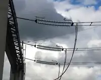 | ||
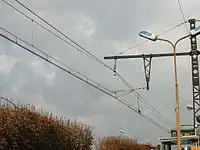
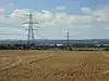
| power | line | Højspændingsledning
Luftledning med en spænding på 50 kilovolt eller mere. |
 |
||
| line | busbar | Specifies that a power=line is a busbar in a substation. | |||
| line | bay | Specifies a power=line is a bay which connects an incoming circuit to a busbar assembly. | |||
| power | minor_line | Mellem- eller lavspændingsledning
Luftledning med en spænding på mindre end 50 kilovolt. |
 |
 | |
| power | plant | Kraftværk
Facilitet med en eller flere generatorer, der producerer elektricitet. De enkelte generatorer mappes separat som power=generator. |
|
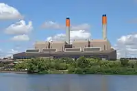 | |
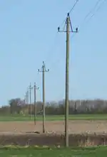
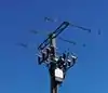
| power | pole | Mellem- eller lavspændingsmast
En mast, som bærer en lav- eller mellemspændingsledning (power=minor_line). I Danmark oftest i form af en træpæl. |
|
| |
| power | portal | Power supporting structure composed of vertical legs with cables between them attached to a horizontal crossarm | 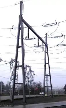 | ||
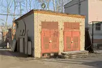
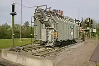
| power | substation | Transformerstation
Transformer- eller transformatorstation. Tagget anvendes også til koblingsstationer, kabelovergangsstationer og lignende uden spændingstransformering. |
|
 | |
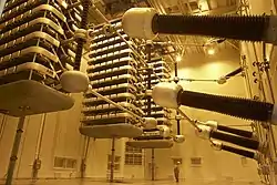
| power | switch | Bryder
En bryder kan ind- og udkoble en højspændingsledning f.eks. ved kortslutning. |
 | ||
| power | switchgear | The switchgear comprises one or more busbar assemblies and a number of bays each connecting a circuit to the busbar assembly. | 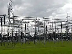 | ||
| power | terminal | Point of connection between overhead power lines to buildings or walls | 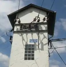 | ||
| power | tower | Højspændingsmast. |  |
 | |
| power | transformer | Transformator
En transformator omformer vekselstrøm fra en spænding til en anden spænding. |
 | ||
| power | selvdefineret | Se også Taginfo for mere information. |
This table is a wiki template with a default description in English. Editable here.
Menneskeskabt (man_made)
A tag for identifying man made (artificial) structures that are added to the landscape. See the page Man-made for an introduction on its usage.
| Nøgle(key) | Værdi | Element | Kommentar | Rendering | Foto |
|---|---|---|---|---|---|
| man_made | adit | Mineindgang, der er (næsten) vandret (modsat mineskakt). | 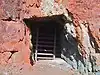 | ||
| man_made | antenna | An antenna to transmit and/or receive wireless signals. | 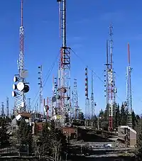 | ||
| man_made | beacon | A structure for signalling on land and sea. | 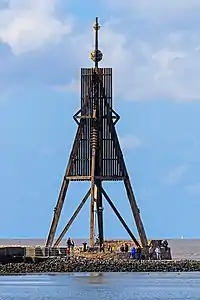 | ||
| man_made | beehive | Beehive | 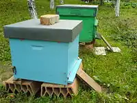 | ||
| man_made | breakwater | Bølgebryder, Mole Beskytter en havn eller kyst mod bølger og strøm. For høfder, se man_made=groyne. |
 |
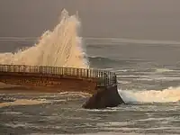 | |
| man_made | bridge | Bro Markerer omridset af en bro og samler alle veje, som fører over broen. Husk at tilføje layer=*. Veje, som fører over broen skal som sædvanlig tagges med bridge=* og layer=*. |
 |
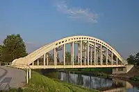 | |
| man_made | bunker_silo | Køresilo. | |||
| man_made | cairn | A mound of stones, usually conical or pyramidal, raised as a landmark or to designate a point of importance in surveying. | 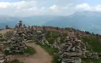 | ||
| man_made | carpet_hanger | A construction to hang carpets for cleaning with the help of carpet beaters. | 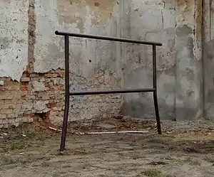 | ||
| man_made | cellar_entrance | An entrance into artificially created vault. | 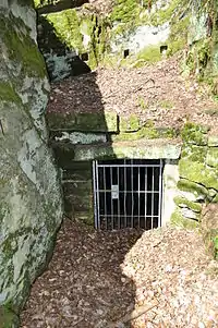 | ||
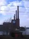
| man_made | chimney | Skorsten (stor, f.eks. ved fabrik eller kraftværk). | 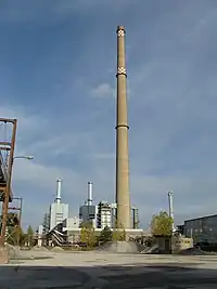 | ||
| man_made | clearcut | Rydning Område i skov, hvor alle træer er blevet fældet og eventuel nye små træer er blevet plantet. |
|||
| man_made | column | A column used to support a structure or for decoration. | 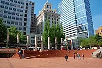 | ||
| man_made | communications_tower | Meget stort sendetårn Almindelige gittermaster og lignende tagges som man_made=mast. |
 | ||
| man_made | courtyard | An area that is usually enclosed by walls or buildings. |  | ||
| man_made | crane | Stationær kran, f.eks. på værft. |  | ||
| man_made | cross | Cross with little historical or religion value, e.g. summit cross. |  | ||
| man_made | cutline | Fældningslinier i skov f.eks. brandbælter. |  |
 | |
| man_made | dolphin | A marine structure for berthing and mooring of vessels. | 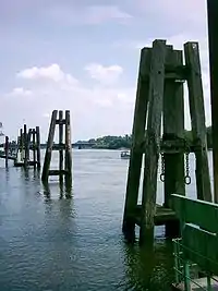 | ||
| man_made | dovecote | A place where doves are farmed or stored. | 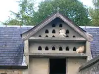 | ||
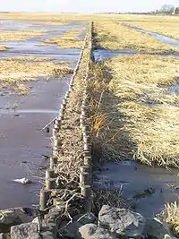
| man_made | dyke | Dige Beskytter mod oversvømmelse ved højvande. |
 | ||
| man_made | embankment | Dæmning Holder en vej, jernbane eller kanal hævet over landskabet. Må ikke forveksles med dæmning til opstemning af vand, se waterway=dam. Se også man_made=dyke. |
| ||
| man_made | flagpole | Flagstang |  | ||
| man_made | flare | A tower constructed to burn off excess gas. | 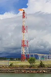 | ||
| man_made | footwear_decontamination | A facility to decontaminate footwear for hikers. | 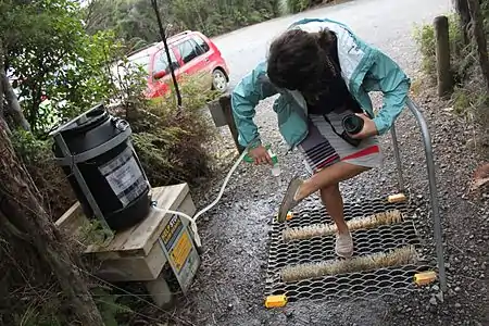 | ||
| man_made | gantry | An overhead structure across a major road usually for holding signs, often variable-message signs. | .jpg.webp) | ||
| man_made | gasometer | A large container in which natural gas or town gas is stored near atmospheric pressure at ambient temperatures. | 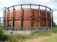 | ||
| man_made | goods_conveyor | A conveyor system for transporting materials |  |
 | |
| man_made | groyne | Høfde Struktur vinkelret på kysten, der modvirker kysterosion og fremmer aflejring af materialer. |
|
 | |
| man_made | guard_stone | A guard stone: a stone built onto or into the corner of a building or wall to prevent carriages from damaging the structure, often found on either side of an entrance to a laneway, or alongside a wall to protect it. | 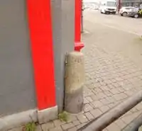 | ||
| man_made | heap | A large pile of material | 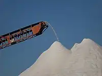 | ||
| man_made | insect_hotel | A structure intended to provide shelter for insects. | 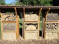 | ||
| man_made | kiln | A kiln: an oven used for industrial processes such as hardening, drying, or smelting |  | ||
| man_made | lighthouse | Fyrtårn Sender en lysstråle ud for at guide skibsfarten |
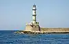 | ||
| man_made | manhole | Hole with a cover that allows access to an underground service location, just large enough for a human to climb through. | 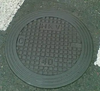 | ||
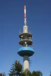
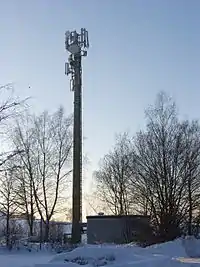
| man_made | mast | Mast Lodret struktur til at montere antenner og lignende på. Mindre end et tårn og som oftest lavet som gittermast. |
 | ||
| man_made | mineshaft | Mineskakt | 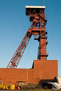 | ||
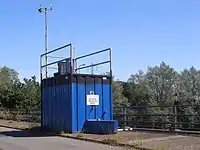
| man_made | monitoring_station | Målestation F.eks. vejrstation. |
 | ||
| man_made | nesting_site | A man made nesting aid that is mounted on a support device. |  | ||
| man_made | obelisk | Tall, narrow, four-sided, tapered monument which usually ends in a pyramid-like shape at the top. |  | ||
| man_made | observatory | Observatorium | 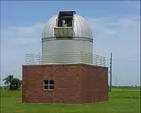 | ||
| man_made | offshore_platform | Offshore platform f.eks. til olieudvinding. | 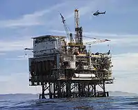 | ||
| man_made | petroleum_well | Oliebrønd | 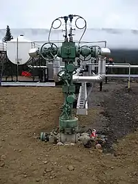 | ||
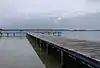
| man_made | pier | Bådebro eller større struktur ud i vandet. Kan have butikker og restauranter (kendes fra England). |  |
 | |
| man_made | pipeline | Rørledning til transport af væsker eller gasser, f.eks. råolie, naturgas, spildevand. | 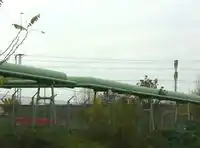 | ||
| man_made | planter | A structure for planting flowers or other ornamental plants. | 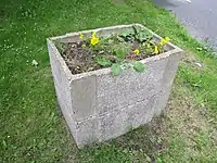 | ||
| A pumping rig for producing oil. Use of this tag is discouraged. See man_made=petroleum_well instead. | 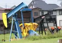 | ||||
| man_made | pumping_station | Pumpestation | 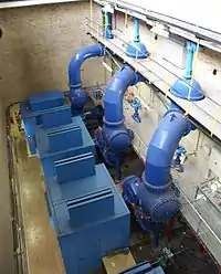 | ||
| man_made | reservoir_covered | Overdækket vandreservoir. | 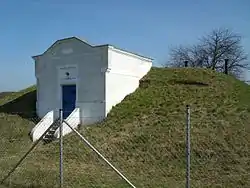 | ||
| man_made | satellite_dish | A dish-shaped parabolic antenna designed to receive or transmit radio waves to or from a satellite | 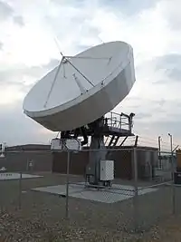 | ||
| man_made | silo | Silo Til opbevaring af løsvare produkter på fast form såsom korn. |
 | ||
| man_made | snow_fence | A solid fence-like structure built across steep slopes to reduce risk and severity of (snow) avalanches. |  | ||
| man_made | spoil_heap | Spoil heap, piles of waste rock removed during mining. | 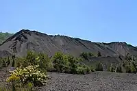 | ||
| man_made | storage_tank | Tank Til opbevaring af flydende eller gasformige stoffer, såsom olie eller gas. |
| ||
| man_made | street_cabinet | Kabelskab eller lignende F.eks. fordelingsskab til el eller telefon, styreskab til lysregulering m.v. |
 | ||
| man_made | stupa | A Buddhist dome-shaped structure with a spire on top |  | ||
| man_made | surveillance | Overvågningskamera |  | ||
| man_made | survey_point | Trigonometrisk punkt, geodætisk postament En sten eller betonblok med en metalskive med præcist opmålt position til brug for landmålere. |
 | ||
| man_made | tailings_pond | Tailings pond: A body of liquid or slurry used to store byproducts of mining operations |  | ||
| man_made | telescope | Telescope: an instrument that aids in the observation of remote objects by collecting light or radio waves | 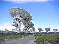 | ||
| man_made | torii | The gate structure found at the entrance of Shinto shrines and (rarely) Japanese Buddhist temples. | 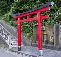 | ||
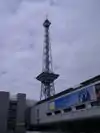
| man_made | tower | Tårn f.eks. til radio og tv sendere, men også turistattraktioner. |
 | ||
| man_made | utility_pole | A single pole supporting elevation of any of various and unspecified public utilities, such as power transmission, lighting or telephony. | 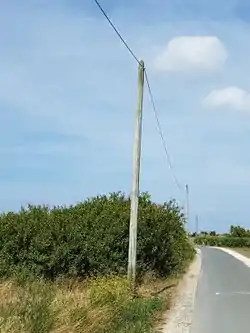 | ||
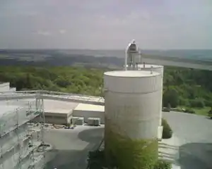
| man_made | ventilation_shaft | A vertical space in mines, tunnels, or buildings allowing stale air to leave the space underneath and/or fresh air to enter it. | 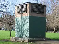 | ||
| man_made | video_wall | A digital screen, typically constructed out of smaller LED panels. |  | ||
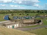
| man_made | wastewater_plant | Rensningsanlæg til spildevand. |  |
 | |
| man_made | water_tap | Vandhane til offentlig benyttelse f.eks. på kirkegård. Brug drinking_water=yes/no for at angive, om vandet er drikkeligt. |
 | ||
| man_made | water_tower | Vandtårn | 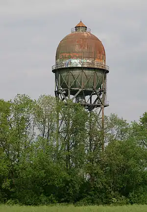 | ||
| man_made | water_well | Brønd til udvinding af grundvand. | 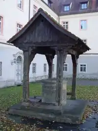 | ||
| man_made | water_works | Vandværk | |
 | |
| man_made | watermill | Vandmølle (gammeldags), historisk og for det meste ikke længere funktionsdygtig. | 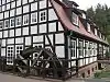 | ||
| man_made | wildlife_crossing | Faunapassage En bro eller tunnel, som tillader dyreliv at krydse en større vej eller jernbane. |
 | ||
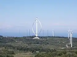
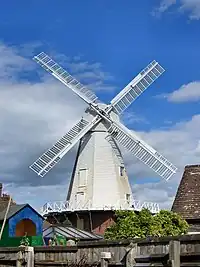
| man_made | windmill | Vindmølle (gammeldags), for det meste bygget til maling af korn eller vandpumpning. Moderne vindturbiner skal tagges som power=generator og generator:source=wind. |
 | ||
| man_made | windpump | A device that pumps natural gas or water using the wind, typically mass produced. | 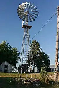 | ||
| man_made | works | Værk, fabrik Industriel bygning til produktion af et eller andet. |
 | ||
| man_made | yes | General tag for man-made (artificial) structures. | |||
| man_made | brugerdefineret | Se også Taginfo for mere information. |
This table is a wiki template with a default description in English. Editable here.
Tags omkring bygninger kan ses her: Bygninger
Faciliteter (amenity)
Anvendes til at mappe faciliteter såsom toiletter, banker, skoler etc
| Nøgle(key) | Værdi | Element | Kommentar | Rendering | Foto | |
|---|---|---|---|---|---|---|
Mad og drikke (Sustenance) | ||||||
| amenity | bar | Bar, sted hvor der udskænkes alkoholiske drikke. Til forskel fra en pub kan der normalt ikke købes mad her. |  | |||
| amenity | biergarten | Biergarten (ølhave). Forekommer især i Tyskland. |  | |||
| amenity | cafe | Cafe |  | |||
| amenity | fast_food | Fastfood, f.eks grillbar eller burgerrestaurant. Der er ingen bordbetjening. |  | |||
| amenity | food_court | An area with several different restaurant food counters and a shared eating area. Commonly found in malls, airports, etc. | 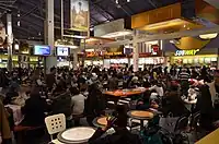 | |||
| amenity | ice_cream | iskiosk, se også shop=confectionery. | .jpg.webp) | |||
| amenity | pub | Værtshus/pub, kro, et sted hvor der udskænkes øl og alkoholiske drikke; der serveres også normalt (lette) måltider her, sommetider mulighed for overnatning (kro). Se også amenity=bar. | 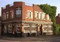 | |||
| amenity | restaurant | Restaurant (ikke fastfood). | 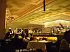 | |||
Uddannelse (Education) | ||||||
| amenity | college | Gymnasium, handelsskole, anden skole for mellem- og erhvervsuddannelser | 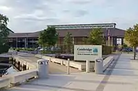 | |||
| amenity | driving_school | Driving School which offers motor vehicle driving lessons |  | |||
| amenity | kindergarten | Børnehave |  | |||
| amenity | language_school | Language School: an educational institution where one studies a foreign language. |  | |||
| amenity | library | Offentligt bibliotek |  | |||
| amenity | toy_library | A place to borrow games and toys, or play with them on site. |  | |||
| amenity | research_institute | An establishment endowed for doing research. |  | |||
| amenity | training | Public place where you can get training. | | |||
| amenity | music_school | A music school, an educational institution specialized in the study, training, and research of music. | ._(9196267787).jpg.webp) | |||
| amenity | school | Skole, område eller bygning |  | |||
| amenity | traffic_park | Juvenile traffic schools |  | |||
| amenity | university | Universitet, campus eller bygning |  | |||
Transport (transportation) | ||||||
| amenity | bicycle_parking | Cykelparkering | 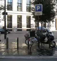 | |||
| amenity | bicycle_repair_station | General tools for self-service bicycle repairs, usually on the roadside; no service | 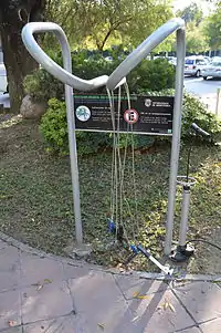 | |||
| amenity | bicycle_rental | Cykeludlejning | .jpg.webp) | |||
| amenity | boat_rental | Rent a Boat |  | |||
| amenity | boat_sharing | Share a Boat |  | |||
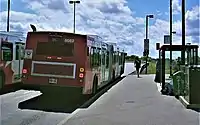
| amenity | bus_station | Busstation (det er en stor station, et busstoppested er: highway=bus_stop) | | |||
| amenity | car_rental | Biludlejning | ||||
| amenity | car_sharing | Share a car | 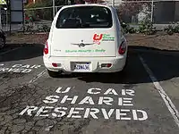 | |||
| amenity | car_wash | Bilvask | 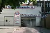 | |||
| amenity | compressed_air | A device to inflate tires/tyres (e.g. motorcar, bicycle) | 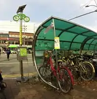 | |||
| amenity | vehicle_inspection | Government vehicle inspection | 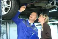 | |||
| amenity | charging_station | Ladestander eller anden ladestation for elbiler. | 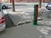 | |||
| amenity | driver_training | A place for driving training on a closed course | 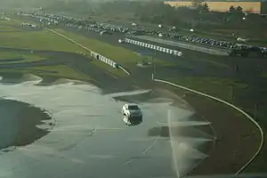 | |||
| amenity | ferry_terminal | Færgeterminal, færgeleje | 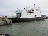 | |||
| amenity | fuel | Tankstation. Adgangsveje til tankstationer bliver tagget highway=service. | 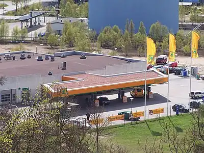 | |||
| amenity | grit_bin | Vejkasser til vejsalt/strøsand. |  | |||
| amenity | motorcycle_parking | Parking for motorcycles |  | |||
| amenity | parking | Parkeringsplads. Adgangsveje til og veje på parkeringspladser tagges som highway=service. For veje mellem parkeringsrækkerne tilføjes service=parking_aisle. | 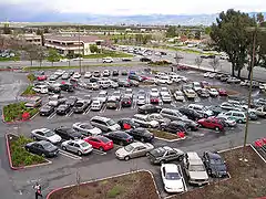 | |||
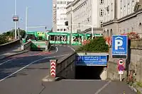
| amenity | parking_entrance | Indkørsel til parkeringshus eller -kælder. | Underground |
 | ||
| amenity | parking_space | Parkeringsbås til enkelt køretøj. Må ikke forveksles med amenity=parking |  |
.JPG.webp) | ||
| amenity | taxi | Taxiholdeplads | 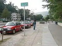 | |||
Penge (financial) | ||||||
| amenity | atm | Pengeautomat, anvend operator=* til at indikere banknavnet | 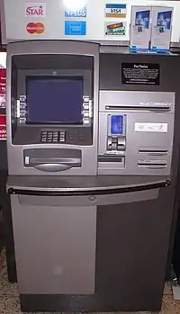 | |||
| amenity | bank | Bank. Hvis banken har en (udendørs) pengeautomat, der også kan anvendes af andre end bankens kunder, bør denne tagges separat. |  | |||
| amenity | bureau_de_change | Vekselkontor til veksling af fremmed valuta. | 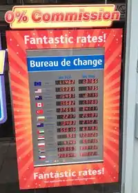 | |||
Sundhed (healthcare) | ||||||
| amenity | baby_hatch | A place where a baby can be, out of necessity, anonymously left to be safely cared for and perhaps adopted. |  | |||
| amenity | clinic | A medium-sized medical facility or health centre. |  | |||
| amenity | dentist | Tandlægeklinik |  | |||
| amenity | doctors | Lægeklinik |  | |||
| amenity | hospital | Hospital eller sygehus | 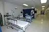 | |||
| amenity | nursing_home | Plejehjem | 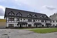 | |||
| amenity | pharmacy | Apotek | 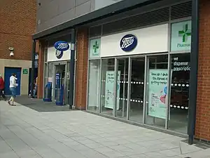 | |||
| amenity | social_facility | A facility that provides social services: group & nursing homes, workshops for the disabled, homeless shelters, etc. | 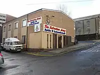 | |||
| amenity | veterinary | Dyrlægeklinik |  | |||
Underholding, kunst og kultur (Entertainment, arts & culture) | ||||||
| amenity | arts_centre | Kulturhus e.l., et sted hvor diverse kunstformer fremvises eller udføres. |  | |||
| amenity | brothel | Bordel |  | |||
| amenity | casino | A gambling venue with at least one table game(e.g. roulette, blackjack) that takes bets on sporting and other events at agreed upon odds. | 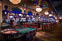 | |||
| amenity | cinema | Biograf |  | |||
| amenity | community_centre | Forsamlingshus eller lignende. |  | |||
| amenity | conference_centre | A large building that is used to hold a convention |  | |||
| amenity | events_venue | A building specifically used for organising events |  | |||
| amenity | exhibition_centre | An exhibition centre | ||||
| amenity | fountain | Springvand | 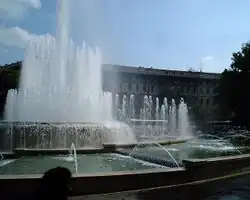 | |||
| amenity | gambling | A place for gambling, not being a shop=bookmaker, shop=lottery, amenity=casino, or leisure=adult_gaming_centre.
Games that are covered by this definition include bingo and pachinko. |
 | |||
| amenity | love_hotel | A love hotel is a type of short-stay hotel operated primarily for the purpose of allowing guests privacy for sexual activities. |  | |||
| amenity | music_venue | An indoor place to hear contemporary live music. |  | |||
| amenity | nightclub | Natklub |  | |||
| amenity | planetarium | A planetarium. |  | |||
| amenity | public_bookcase | A street furniture containing books. Take one or leave one. | 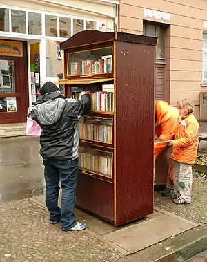 | |||
| amenity | social_centre | A place for free and not-for-profit activities. |  | |||
| amenity | stripclub | A place that offers striptease or lapdancing (for sexual services use amenity=brothel). |  | |||
| amenity | studio | TV radio or recording studio |  | |||
| amenity | swingerclub | A club where people meet to have a party and group sex. |  | |||
| amenity | theatre | Teater, operahus |  | |||
Public Service | ||||||
| amenity | courthouse | Ret eller Domhus |  | |||
| amenity | fire_station | Brandstation |  | |||
| amenity | police | Politistation |  | |||
| amenity | post_box | Postkasse | 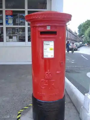 | |||
| amenity | post_depot | Post depot or delivery office, where letters and parcels are collected and sorted prior to delivery. | 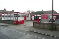 | |||
| amenity | post_office | Postkontor | 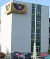 | |||
| amenity | prison | Fængsel | 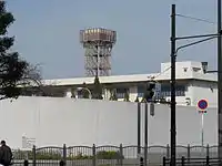 | |||
| amenity | ranger_station | National Park visitor headquarters: official park visitor facility with police, visitor information, permit services, etc | 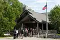 | |||
| amenity | townhall | Rådhus |  | |||
Facilities | ||||||
| amenity | bbq | BBQ or Barbecue is a permanently built grill for cooking food, which is most typically used outdoors by the public. For example these may be found in city parks or at beaches. Use the tag fuel=* to specify the source of heating, such as fuel=wood;electric;charcoal. For mapping nearby table and chairs, see also the tag tourism=picnic_site. For mapping campfires and firepits, instead use the tag leisure=firepit. | 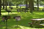 | |||
| amenity | bench | Bænk | 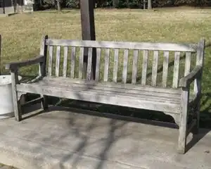 | |||
| amenity | dog_toilet | Area designated for dogs to urinate and excrete. | 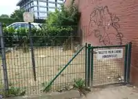 | |||
| amenity | dressing_room | Area designated for changing clothes. | 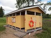 | |||
| amenity | drinking_water | Drikkevand, vandhane eller lignende langs vandreruter etc. | 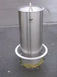 | |||
| amenity | give_box | A small facility where people drop off and pick up various types of items in the sense of free sharing and reuse. | 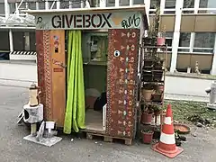 | |||
| amenity | mailroom | A mailroom for receiving packages or letters. |  | |||
| amenity | parcel_locker | Machine for picking up and sending parcels | 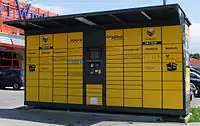 | |||
| amenity | shelter | Shelter, primitiv overdækket overnatningsplads. | 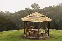 | |||
| amenity | shower | Public shower. | 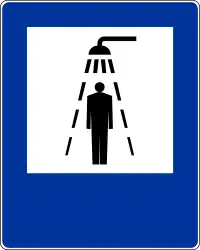 | |||
| amenity | telephone | Telefonboks, offentlig telefon. | 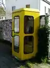 | |||
| amenity | toilets | Offentligt toilet, tilføj fee=yes hvis der kræves betaling. | 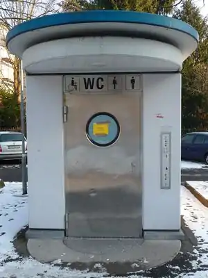 | |||
| amenity | water_point | Place where you can get large amounts of drinking water | 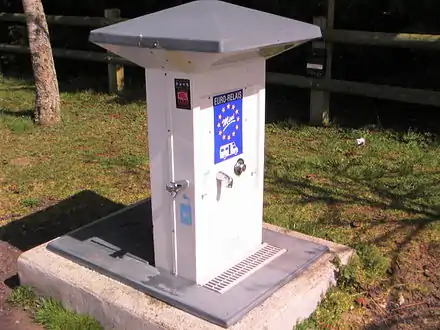 | |||
| amenity | watering_place | Place where water is contained and animals can drink | 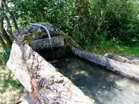 | |||
Waste Management | ||||||
| amenity | sanitary_dump_station | A place for depositing human waste from a toilet holding tank. | | |||
| amenity | recycling | Genbrugsplads. Kombiner med recycling=container for genbrugscontainere eller recycling=centre for genbrugsstation. | 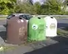 | |||
| amenity | waste_basket | Skraldespand | 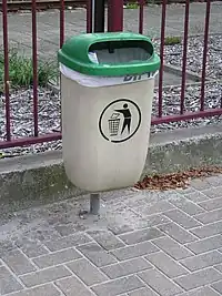 | |||
| amenity | waste_disposal | Affaldsplads, hvor f.eks sejlere eller campister kan deponere deres affald. | 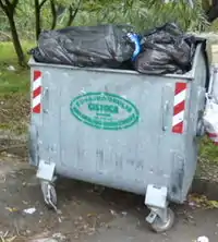 | |||
| amenity | waste_transfer_station | A waste transfer station is a location that accepts, consolidates and transfers waste in bulk. | ||||
Andet (Others) | ||||||
| amenity | animal_boarding | Hundepension, kattepension etc. hvor man kan få sit kæledyr passet mod betaling (f.eks. i ferier) |  | |||
| amenity | animal_breeding | A facility where animals are bred, usually to sell them | 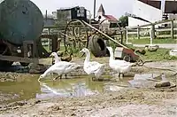 | |||
| amenity | animal_shelter | A shelter that recovers animals in trouble |  | |||
| amenity | animal_training | A facility used for non-competitive animal training | .jpg.webp) | |||
| amenity | baking_oven | An oven used for baking bread and similar, for example inside a building=bakehouse. | 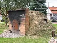 | |||
| amenity | childcare | A place where children of different ages are looked after which is not an amenity=kindergarten or preschool. |  | |||
| amenity | [[ Too many Data Items entities accessed. | clock ]] | Offentligt ur, f.eks. på rådhusbygning eller station. | .jpg.webp) | |||
| amenity | crematorium | Krematorium |  | |||
| amenity | dive_centre | A dive center is the base location where sports divers usually start scuba diving or make dive guided trips at new locations. | 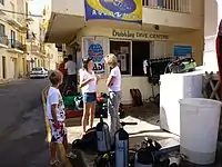 | |||
| amenity | funeral_hall | A place for holding a funeral ceremony, other than a place of worship. |  | |||
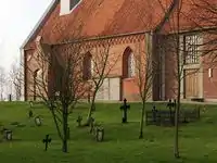
| amenity | grave_yard | Begravelsesplads, en mindre begravelsesplads (kirkegård). Større kirkegårde / begravelsespladser bør tagges som landuse=cemetery istedet for. |  |
| ||
| amenity | hunting_stand | A hunting stand: an open or enclosed platform used by hunters to place themselves at an elevated height above the terrain | 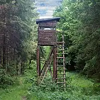 | |||
| amenity | internet_cafe | A place whose principal role is providing internet services to the public. |  | |||
| amenity | kitchen | A public kitchen in a facility to use by everyone or customers |  | |||
| amenity | kneipp_water_cure | Outdoor foot bath facility. Usually this is a pool with cold water and handrail. Popular in German speaking countries. |  | |||
| amenity | lounger | An object for people to lie down. | .jpg.webp) | |||
| amenity | marketplace | Markedsplads, hvor der foregår reguleret handel, ofte kun på bestemte dage. |  | |||
| amenity | monastery | Monastery is the location of a monastery or a building in which monks and nuns live. |  | |||
| amenity | photo_booth | A stand to create instant photos. | 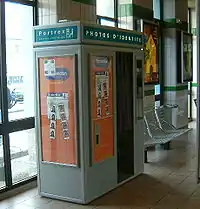 | |||
| amenity | place_of_mourning | A room or building where families and friends can come, before the funeral, and view the body of the person who has died. | 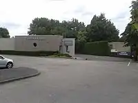 | |||
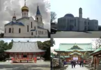
| amenity | place_of_worship | Kirke, moske, tempel o.s.v. Bemærk at du også behøver: religion=*, som regel også: denomination=* samt stedets foretrukne navn: name=*. Folkekirker tagges denomination=*=evangelical_lutheran Se artikel for detaljer. |
 | |||
| amenity | public_bath | A location where the public may bathe in common, etc. japanese onsen, turkish bath, hot spring | .JPG.webp) | |||
| Offentlig bygning, der ikke falder ind under en mere specifik katagori (såsom skole, bibliotek, hospital, rådhus). Eksempler kan være ministerier, administrationsbygninger, socialkontorer. Skal kombineres med building=yes. | ||||||
| amenity | refugee_site | A human settlement sheltering refugees or internally displaced persons | 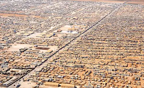 | |||
| amenity | vending_machine | A machine selling goods – food, tickets, newspapers, etc. Add type of goods using vending=* | 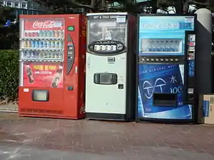 | |||
| amenity | brugerdefineret | Se Taginfo siden for andre ofte anvendte værdier | ||||
This table is a wiki template with a default description in English. Editable here.
Kontor
Her udføres administrativt eller professionelt arbejde
| Nøgle(key) | Værdi | Element | Kommentar | Rendering | Foto |
|---|---|---|---|---|---|
| office | accountant | An office of an accountant. | |||
| office | advertising_agency | An advertising agency or ad agency or advert agency is a service based business dedicated to creating, planning, and handling advertising (and sometimes other forms of promotion) for its clients. | |||
| office | architect | An office of a person who designs buildings and also sometimes supervises their construction.. | |||
| office | association | An office of a non-profit organization, society, such as a student, sport, consumer, automobile, bike association, etc. | |||
| office | charity | An office of a charitable organization. | |||
| office | company | An office of a private company. | |||
| office | consulting | An office for a consulting firm, providing expert professional advice to other companies or organisations. | |||
| office | coworking | Coworking is a style of work that involves a shared working environment, often an office, and independent activity. | |||
| office | diplomatic | An embassy, diplomatic mission, consulate or liaison office of a foreign government or parastatal entity in a host country. | |||
| office | educational_institution | An office of an educational institution. | |||
| office | employment_agency | An office of an employment agency. | |||
| office | engineer | An office of an engineer. | |||
| office | energy_supplier | An office of a energy supplier. | |||
| office | estate_agent | An office of a estate agent or realtor. | |||
| office | financial | An office of a company in the financial sector. | |||
| office | forestry | An office of a place that manages the planting, managing, and caring of forests. | |||
| office | foundation | An office of a foundation. | |||
| office | geodesist | An office of a person who does land surveys. | |||
| office | government | An office of a (supra)national, regional or local government agency or department. | |||
| office | graphic_design | An office for a graphic designer. | |||
| office | guide | An office for tour guides, mountain guides, dive guides, etc. | |||
| See healthcare=* for healthcare facilities, office=insurance or office=company for a healthcare company. | |||||
| office | insurance | An office of a insurance company or agent such as State Farm, Progressive, Allstate or Geico. | |||
| office | it | An office of a person who specializes in technology. | |||
| office | lawyer | An office of a person who practices law. | |||
| office | logistics | An office of a forwarder or hauler. | |||
| office | moving_company | An office of a moving service or relocation company. | |||
| office | newspaper | An office of a newspaper company, such as the New York Times. | |||
| office | ngo | An office of a non-governmental organisation. | |||
| office | notary | See office=lawyer above. | |||
| See office=religion below. | |||||
| office | political_party | An office of a political party. | |||
| office | private_investigator | An office of a person who can undertake in investigatory law services. | |||
| office | property_management | Office of a company which manages a real estate property. | |||
| office | publisher | An office of a company which publishes books or music. | |||
| office | quango | An office of a =quasi-autonomous non-governmental organization. | |||
real_estate_agent |
Use office=estate_agent instead. | ||||
| office | religion | An office of an religion instance, such as a parish office. Additionally, you may use religion=* and denomination=*. | |||
| office | research | An office for a place that specializes in investigating systematically. | |||
| office | security | An office for private security guards. | |||
| office | surveyor | An office of a person who does surveys. The surveys can be for land, for risk and damage evaluations of properties and equipment, or opinion surveys or statistics. | |||
| office | tax_advisor | Specialist preparing tax declarations for companies and individuals. | |||
| office | telecommunication | Telecommunication company office. | |||
| office | translator | An office of a translator | |||
| office | travel_agent | An office of a travel agent. See also shop=travel_agency. | |||
| office | union | An office of a trade union, an association of workers forming a bargaining unit. | |||
| office | visa | An office of an organisation offering visa assistance | |||
| office | water_utility | An office of a water utility company or water board. | |||
| office | yes | Generic tag for unspecified office type. | |||
| office | brugerdefineret | Se også Taginfo for mere information. |
This table is a wiki template with a default description in English. Editable here.
Butikker - Indkøb (shop)
The shop tag is used as a place of business that has stocked goods for sale or sells services. See the page titled Shop for an introduction on its usage.
| Nøgle(key) | Værdi | Kommentar | Rendering | Foto | ||
|---|---|---|---|---|---|---|
Food, beverages | ||||||
| shop | alcohol | Butik med bevilling til at sælge vin og spiritus. | 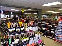 | |||
| shop | bakery | Bager | 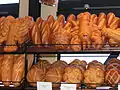 | |||
| shop | beverages | Shop focused on selling alcoholic and non-alcoholic beverages. See also shop=alcohol. |  | |||
| shop | brewing_supplies | Shop focused on selling supplies for home brewing of beer, wine and spirits (where permitted). | 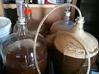 | |||
| shop | butcher | Slagter | 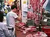 | |||
| shop | cheese | Shop focused on selling cheese. | 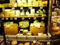 | |||
| shop | chocolate | Shop focused on selling chocolate. | 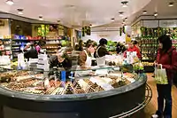 | |||
| shop | coffee | Shop focused on selling coffee. | 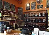 | |||
| shop | confectionery | Slikbutik | 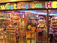 | |||
| shop | convenience | Nærbutik, f.eks. døgnkiosk, lille købmand. | 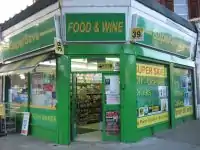 | |||
| shop | deli | Delikatesser | 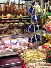 | |||
| shop | dairy | Shop focused on selling dairy products. |  | |||
| shop | farm | Gårdbutik, sælger egne landbrugsprodukter. | 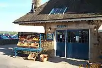 | |||
| shop | frozen_food | Shop focused on selling frozen food. | 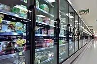 | |||
| shop | greengrocer | Grønthandler | 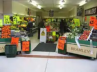 | |||
| shop | health_food | A health food shop; selling wholefoods, vitamins, nutrition supplements and meat and dairy alternatives. | 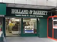 | |||
| shop | ice_cream | Shop selling ice cream. See also amenity=ice_cream. | 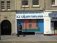 | |||
| shop | pasta | Shop focused on selling (fresh) pasta, ravioli, etc. |  | |||
| shop | pastry | Shop focused on selling baked sweets like cakes, biscuits, strudel and pies. |  | |||
| shop | seafood | Fiskehandler |  | |||
| shop | spices | Shop focused on selling spices. | .jpg.webp) | |||
| shop | tea | Shop focused on selling tea. | 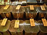 | |||
| shop | wine | Shop selling wine. |  | |||
| shop | water | Shop focused on selling drinking water. |  | |||
General store, department store, mall | ||||||
| shop | department_store | Varehus, stor butik, ofte i flere etager, som sælger et stort udvalg af varer. Se også shop=mall. | ||||
| shop | general | A store that carries a general line of merchandise. (see also shop=convenience if it sells food). | 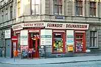 | |||
| shop | kiosk | Lille kiosk på gaden. | 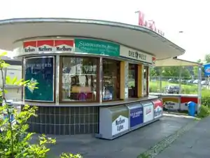 | |||
| shop | mall | Butikscenter, mange butikker under samme tag. |  | |||
| shop | supermarket | Supermarked |  | |||
| shop | wholesale | Wholesale/warehouse club or cash and carry - a store that sells items in bulk to retailers. The branch of industry can be defined with wholesale=*. |  | |||
Clothing, shoes, accessories | ||||||
| shop | baby_goods | Shop focused on selling objects for babies (clothes, prams, cots, toys). |  | |||
| shop | bag | Shop focused on selling bags. |  | |||
| shop | boutique | A small shopping outlet, especially one that specializes in elite and fashionable items |  | |||
| shop | clothes | Tøjbutik |  | |||
| shop | fabric | Shop focused on selling fabric and other materials for the purpose of making clothes and other products, eg dress making. |  | |||
| Shop focused on selling fashion. This is deprecated, please use shop=clothes. |  | |||||
| shop | fashion_accessories | Mode tilbehør butik |  | |||
| shop | jewelry | Juveler, guldsmed |  | |||
| shop | leather | Shop focused on selling products made out of leather. | ||||
| shop | sewing | A shop that sells sewing supplies (fabric, thread, yarn, knitting needles, sewing machines, etc.) |  | |||
| shop | shoes | Skobutik, skomager |  | |||
| shop | tailor | A place where clothing is made, repaired, or altered professionally, especially suits and men's clothing |  | |||
| shop | watches | Shop focused on selling watches. |  | |||
| shop | wool | Shop selling wool for making of clothes or other products. | 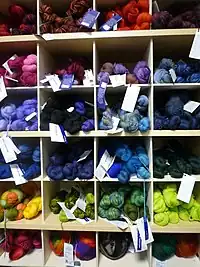 | |||
Discount store, charity | ||||||
| shop | charity | A charity shop is a shop operated by a charity, for the purposes of fundraising. |  | |||
| shop | second_hand | Genbrugsbutik |  | |||
| shop | variety_store | A variety store retailer is a retail store that sells inexpensive items, sometimes with a single price point for all items in the store. |  | |||
Health and beauty | ||||||
| shop | beauty | A non-hairdresser beauty shop, spa, nail salon, etc.. See also shop=hairdresser. |  | |||
| shop | chemist | Materialist, sælger produkter til personlig hygiejne, kosmetik, rengøringsprodukter, håndkøbsmedicin m.v. | 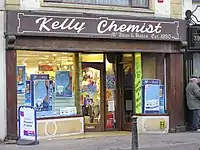 | |||
| shop | cosmetics | Shop focused on selling cosmetics |  | |||
| shop | erotic | Shop focused on selling erotic toys, -clothes or other erotic stuff. | -01.jpg.webp) | |||
| shop | hairdresser | Frisør | %252C_October_2009.JPG.webp) | |||
| shop | hairdresser_supply | A shop, where you can buy hairdressing supplies. | 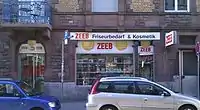 | |||
| shop | hearing_aids | Shop focused on selling hearing aids devices |  | |||
| shop | herbalist | Shop focused on selling herbs, often for medical purposes. (See also: healthcare:speciality=herbalism and healthcare=alternative). |  | |||
| shop | massage | A massage shop |  | |||
| shop | medical_supply | Shop focused on selling medical supplies. |  | |||
| shop | nutrition_supplements | Shops that sells one or more nutritional supplements (of vitamins, minerals and/or herbs) |  | |||
| shop | optician | Optiker |  | |||
| shop | perfumery | Shop focused on selling perfumery |  | |||
| shop | tattoo | Tatovørsalon |  | |||
Do-it-yourself, household, building materials, gardening | ||||||
| shop | agrarian | Shop focused on selling agrarian products, like seeds, agricultural machinery, animal feed, etc. |  | |||
| shop | appliance | Shop focused on selling large electrical items (aka white goods) washing machines, fridges, cookers, ovens, fans, etc. |  | |||
| shop | bathroom_furnishing | Shop focused on selling bathroom furniture and accessories |  | |||
| shop | doityourself | Byggemarked, gør-det-selv butik. |  | |||
| shop | electrical | Shop focused on selling electrical supplies and devices | 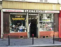 | |||
| shop | energy | Shop focused on selling energy |  | |||
| shop | fireplace | Shop focused on selling electric fireplaces, stoves or masonry heaters and required fuels |  | |||
| shop | florist | Blomsterhandel |  | |||
| shop | garden_centre | Havecenter | 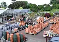 | |||
| shop | garden_furniture | Shop focused on selling garden furniture (sheds, outdoor tables, gates, fences, ...). See shop=garden_centre if also plants are sold. | ||||
| shop | gas | Shop focused on selling technical gas, such as argon, oxygen, acetylene, nitrogen, carbon dioxide, etc. in pressurized containers | 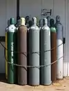 | |||
| shop | glaziery | Glarmester |  | |||
| shop | groundskeeping | Shop focused on selling outdoor groundskeeping equipment (lawnmowers, chainsaws, small tractors, ... |  | |||
| shop | hardware | Isenkræmmer, som sælger skruer, søm og andre byggematerialer, se også shop=doityourself. | 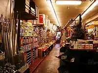 | |||
| shop | houseware | Shop focused on selling crockery, cutlery, kitchenware, small household appliances. |  | |||
| shop | locksmith | Shop focused on selling keys, see also craft=locksmith and craft=key_cutter |  | |||
| shop | paint | Malerforretning |  | |||
| shop | pottery | Shop focused on selling earthenware, stoneware and porcelain and other ceramic ware. | _74.jpg.webp) | |||
| shop | security | Shop focused on selling security items like burglar alarms, vaults, locking systems, video surveillance cameras, firefighting equipment, alarm systems, warning systems, etc. | ||||
| shop | trade | Shop focused on selling one or more building supplies such as timber/wood, cement etc. See also shop=doityourself |  | |||
| This tag is deprecated. Please use craft=window_construction instead. | ||||||
Furniture and interior | ||||||
| shop | antiques | Antikivitetshandler |  | |||
| shop | bed | Shop focused on selling beds, mattresses and other bedding products. |  | |||
| shop | candles | Shop focused on selling candles and candle accessories (holders, etc) | .jpg.webp) | |||
| shop | carpet | Tæppehandler |  | |||
| shop | curtain | Gardinhandler, se også shop=fabric. |  | |||
| shop | doors | Shop focused on selling doors | ||||
| shop | flooring | Shop focused on selling floorings |  | |||
| shop | furniture | Møbelbutik, møbelhus | 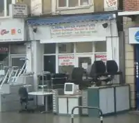 | |||
| shop | household_linen | Shop focused on selling household linen. | 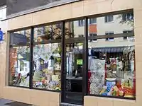 | |||
| shop | interior_decoration | Shop focused on selling interior decorations. |  | |||
| shop | kitchen | Køkkenbutik, butik som sælger køkkenindretning (kaldes sommetider Køkkenstudio etc., men kitchen er det mest brugte tag indtil videre). |  | |||
| shop | lighting | A shop selling lighting fixtures and lamps. |  | |||
| shop | tiles | Shop focused on selling tiles. |  | |||
| shop | window_blind | Persienner (specialbutik som næsten kun sælger persienner). |  | |||
Electronics | ||||||
| shop | computer | Computerudstyr |  | |||
| shop | electronics | Forbrugerelektronik, f.eks. radio/tv, computerer, hårde hvidevarer. |  | |||
| shop | hifi | Shop focused on selling High Fidelity or High End environment to listen music or watch films at home | 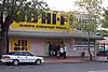 | |||
| shop | mobile_phone | Shop focused on selling mobile phones and accessories | 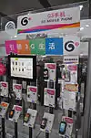 | |||
| shop | radiotechnics | Elektronikudstyr, sælger komponenter, måleinstrumenter, tilbehør til radioamatører og elektronikselvbyggere. |  | |||
| shop | telecommunication | Shop selling internet, television or similar services, and related hardware. | 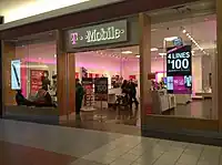 | |||
| shop | vacuum_cleaner | Shop focused on selling vacuum cleaners and associated products. |  | |||
Outdoors and sport, vehicles | ||||||
| shop | atv | Shop focused on selling |
 | |||
| shop | bicycle | Cykelhandler, cykelsmed |  | |||
| shop | boat | Shop focused on selling boats, boat equipment and may rent or repair them |  | |||
| shop | car | Bilhandler, autohandel, tilføj bilmærke(r) med brand=* |  | |||
| shop | car_repair | Autoværksted, ikke del af en autohandel, oftest ikke tilknyttet bestemt bilmærke. | 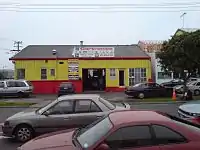 | |||
| shop | car_parts | Shop focused on selling auto parts, auto accessories, motor oil, car chemicals, etc. |  | |||
| shop | caravan | A shop for caravans, motorhomes & similar recreational vehicles. |  | |||
| shop | fuel | Shop selling fuels (motor fuel, wood, coal, gas) that can't be considered a amenity=fuel (fuel station). Use fuel:*=yes/no to indicate which fuels are available. | 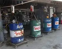 | |||
| shop | fishing | Shop focused on selling fishing equipment. | .jpg.webp) | |||
| shop | golf | Shop focused on selling golf equipment. |  | |||
| shop | hunting | Shop focused on selling gun and hunting equipment. | 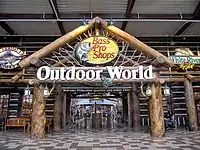 | |||
| shop | jetski | Shop focused on selling jetskis, jetski equipment and may rent or repair them |  | |||
| shop | military_surplus | Shop selling used military equipment |  | |||
| shop | motorcycle | Shop focused on selling motorcycles and/or related accessories, clothes, parts, and rental services. |  | |||
| shop | outdoor | Fritidsudstyr, sælger udstyr til udendørs sport såsom campinggrej, vandrerudstyr, fiskegrej. | 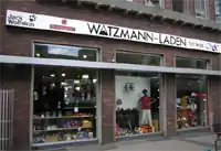 | |||
| shop | scuba_diving | Shop focused on selling scuba diving equipment. | 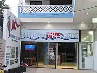 | |||
| shop | ski | Shop focused on selling skis, ski equipment and may rent or repair them | 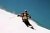 | |||
| shop | snowmobile | Shop focused on selling snowmobiles, snowmobile equipment and may rent or repair them |  | |||
| shop | sports | Sportsbutik | 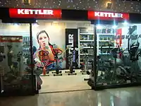 | |||
| shop | swimming_pool | A store that sells swimming pool equipment and supplies. |  | |||
| shop | trailer | Shop focused on selling trailers and parts and/or repairing / renting them |  | |||
| shop | tyres | Shop focused on selling tyres. | 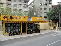 | |||
Art, music, hobbies | ||||||
| shop | art | Shop which sells works of art. May be paintings, sculpture, or other types of art |  | |||
| shop | camera | A shop mainly selling cameras and lenses |  | |||
| shop | collector | A shop for different collector's items like stamps, coins, action figures, etc. |  | |||
| shop | craft | An arts and crafts supply store. Commonly sold items are paper, canvas, paint, pencils, crafting wood, crafting tools, etc. - look at craft=* | .jpg.webp) | |||
| shop | frame | Shop focused on selling frames. |  | |||
| shop | games | Shop focused on selling board games, card games and/or role-playing games. |  | |||
| shop | model | Shop specialising in the sale of scale models. |  | |||
| shop | music | Shop focused on selling recorded music (vinyl/CDs/...) |  | |||
| shop | musical_instrument | Shop focused on selling musical instruments, lyrics, scores. If focused on a specific instrument, specify with musical_instrument=* | %252C_September_2009.JPG.webp) | |||
| shop | photo | Shop focused on selling products or services related with photography. |  | |||
| shop | trophy | Store selling trophies, awards, plaques etc. |  | |||
| shop | video | Shop focused on selling or renting out videos/DVDs. |  | |||
| shop | video_games | Shop focused on selling video games. |  GameStop on Powell Street in San Francisco, California. | |||
Stationery, gifts, books, newspapers | ||||||
| shop | anime | Shop focused on selling anime stuff. |  | |||
| shop | books | Boghandel |  | |||
| shop | gift | Shop focused on selling gifts, greeting cards, or tourist gifts (souvenirs) |  | |||
| shop | lottery | A shop of which the main or only purpose is the sale of lottery tickets. | %252C_Lotto.jpg.webp) | |||
| shop | newsagent | Kiosk, bladkiosk, sælger aviser, tidsskrifter, tobaksvarer. | 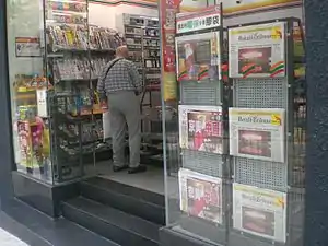 | |||
| shop | stationery | Kontorudstyr |  | |||
| shop | ticket | Shop focused on selling tickets for concerts, events, public transport, … | 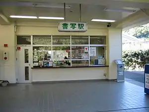 | |||
Others | ||||||
| shop | bookmaker | A shop that takes bets on sporting and other events at agreed upon odds. | .jpg.webp) | |||
| shop | cannabis | a shop primarily and legally selling non-medical cannabis products | 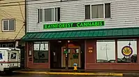 | |||
| shop | copyshop | Shop focused on selling photocopying and printing services. |  | |||
| shop | dry_cleaning | Shop or kiosk offering a clothes dry cleaning service. The actual cleaning may be done elsewhere. | 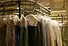 | |||
| shop | e-cigarette | Shop focused on selling electronic cigarettes. |  | |||
| shop | funeral_directors | Bedemand |  | |||
| shop | insurance | A shop selling insurance services from one or more insurance carriers. |  | |||
| shop | laundry | Vaskeri, møntvask, betjent eller selvbetjening. | 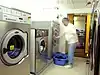 | |||
| shop | money_lender | A money lender offers small personal loans at high rates of interest. | 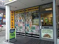 | |||
| shop | outpost | Shop primarily used to pick-up items ordered online. | 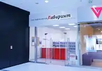 | |||
| shop | party | A shop for party and festival supplies, like costumes, etc. | 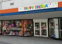 | |||
| shop | pawnbroker | A pawnbroker (or pawnshop) is an individual or business that offers secured loans to people. See also shop=second_hand |  | |||
| shop | pest_control | Shop selling pest control goods to exterminate rats, insects etc. | 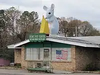 | |||
| shop | pet | A shop for pets, animals and toys or food for them. |  | |||
| shop | pet_grooming | A shop offering grooming services for pets (most frequently dogs) | 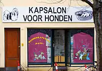 | |||
| shop | pyrotechnics | Store of pyrotechnics: fireworks, firecrackers, sparklers etc. | .JPG.webp) | |||
| shop | religion | Shop focused on selling religious articles, church shop. See also religion=* |  | |||
| shop | storage_rental | self storage | 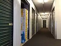 | |||
| shop | tobacco | Tobakshandler, se også shop=newsagent. |  | |||
| shop | toys | Legetøjsbutik |  | |||
| shop | travel_agency | Shop focused on selling tickets for travelling. Also known as a tour operator. |  | |||
| shop | weapons | Shop focused on selling weapons like knives, guns etc. | 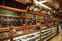 | |||
| shop | vacant | Ledigt butikslokale (butikken er lukket). Tilføj evt. en note=* om den tidligere butik. | 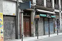 | |||
| shop | A shop of unspecified type - it is always better to use another value that gives info about shop type, if possible. Used also as indicator that feature such as fuel station has shop. | |||||
| shop | brugerdefineret | Se Taginfo for mere information. | ||||
This table is a wiki template with a default description in English. Editable here.
Håndværk (craft)
| Nøgle(key) | Værdi | Kommentar | Rendering | Foto |
|---|---|---|---|---|
| craft | agricultural_engines | Planning and constructing engines and tools for agricultural use. | 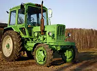 | |
| craft | bakery | A workplace for fresh bakery goods. No shop. | .JPG.webp) | |
| craft | basket_maker | Producing baskets, often made from Willow. |  | |
| craft | beekeeper | Biavler |  | |
| craft | blacksmith | Smed | _055.jpg.webp) | |
| craft | boatbuilder | Bådbygger |  | |
| craft | bookbinder | Bogbinder |  | |
| craft | brewery | A brewery is a dedicated building for the making of beer |  | |
| craft | builder | Constructs buildings, streets and other objects. |  | |
| craft | [[ Too many Data Items entities accessed. | carpenter ]] | Tømrer, snedker |  | |
| craft | carpet_layer | Workplace or office of carpet layers that bring carpet on your floor. |  | |
| craft | caterer | Workplace or office of one who prepares customized meals for takeout, or provides prepared meals or supplies to a group at social gatherings. |  | |
| craft | chimney_sweeper | Workplace or office of a person who cleans chimneys for a living. |  | |
| craft | clockmaker | Workplace or office of a clockmaker that is building or repairing clocks but not watches. See also craft=watchmaker |  | |
| craft | confectionery | A place where the set of food items that are rich in sugar, any one or type of which is called a confection is produced. |  | |
| craft | distillery | Distillery |  | |
| craft | dressmaker | A place where clothes are created, repaired or altered to fit personal needs. |  | |
| craft | electrician | Elektriker | 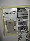 | |
| craft | floorer | Workplace or office of a floorer which is a tradesman specialized in laying floors. See also craft=parquet_layer craft=carpet_layer craft=tiler |
 | |
| craft | gardener | Workplace or office of a garden designer or a landscape gardener. |  | |
| craft | glaziery | Glarmester |  | |
| craft | handicraft | A place where useful and decorative devices are made completely by hand or using only simple tools |  | |
| craft | hvac | Workplace or office of an HVAC system designer (Heating, Ventilating, and Air Conditioning) | 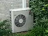 | |
| craft | insulation | Workplace or office of a person who does thermal insulation in buildings. |  | |
| craft | jeweller | Juveler |  | |
| craft | key_cutter | A place where keys can be duplicated from originals. | .jpg.webp) | |
| craft | locksmith | Låsesmed |  | |
| craft | metal_construction | A place where handrails, gates, ramps and similar things from metal are made. |  | |
| craft | optician | Optiker | | |
| craft | painter | Maler |  | |
| craft | parquet_layer | Workplace or office of a parquet layer. | | |
| craft | photographer | Fotograf |  | |
| craft | photographic_laboratory | A place where photos taken on a film or digital images are transformed into a more permanent form, often on paper or plastic foil. |  | |
| craft | piano_tuner | A piano tuner or technician. A professional that tunes, regulates and makes the maintenance of pianos. Most of them repair simple problems and some restore a whole piano. |  | |
| craft | plasterer | Stukkatør |  | |
| craft | plumber | VVS |  | |
| craft | pottery | Pottemager |  | |
| craft | rigger | Workplace or office of a person who makes masts, yards, sails, and cordage for sailboats and sailing ships. | ||
| craft | roofer | Workplace or office of a tradesman who is specialized in roof construction. |  | |
| craft | saddler | A place where saddles or accessories for cars and boats are produced or repaired. |  | |
| craft | sailmaker | Sejlmager |  | |
| craft | sawmill | Savværk |  | |
| craft | scaffolder | Workplace or office of a tradesman who builds temporary structure used to support people and material in the construction or repair of buildings and other large structures. |  | |
| craft | sculptor | A place where sculptures are made. |  | |
| craft | shoemaker | Skomager |  | |
| craft | stand_builder | Workplace of a company that builds stands/booths for fairs. |  | |
| craft | stonemason | Stenhugger |  | |
| craft | stove_fitter | A workplace/office of a person/company who designs and builds stoves/tiled stoves. |  | |
| craft | sun_protection | A place where sun protection is made, repaired, or delivered for assembly, especially awnings and shutters. |  | |
| craft | tailor | Skrædder |  | |
| craft | tiler | Workplace or office of a person who lays tiles on floors, swimming pools and such. |  | |
| craft | tinsmith | A tinsmith, or tinner or tinker or tinplate worker. Workplace or office of a person who makes and repairs things made of light-coloured metal, particularly tinware. | .jpg.webp) | |
| craft | turner | A turner or wood turner. |  | |
| craft | upholsterer | Møbelpolster |  | |
| craft | watchmaker | Urmager |  | |
| craft | window_construction | Construct windows |  | |
| craft | winery | Produces wine | 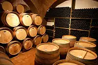 | |
| craft | brugerdefineret | Se også Taginfo for mere information. |
This table is a wiki template with a default description in English. Editable here.
Nødhjælp (emergency)
This is used to describe the location of emergency facilities and equipment. See the page Emergency for an introduction on its usage.
| Nøgle(key) | Værdi | Element | Kommentar | Rendering | Foto | |
|---|---|---|---|---|---|---|
Emergency services | ||||||
| emergency | ambulance_station | A ambulance station is a structure or other area set aside for storage of ambulance vehicles, medical equipment, personal protective equipment, and other medical supplies. | 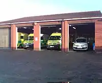 | |||
| emergency | defibrillator | Defibrillator, an external and portable electronic device that diagnoses and can correct arrhythmia of the heart automatically (aka Automated External Defibrillator, AED). Previously tagged as emergency=aed or medical=aed. |  | |||
Brandweer | ||||||
| emergency | fire_extinguisher | A fire extinguisher is an active fire protection device used to extinguish or control small fires, often in emergency situations. |  | |||
| emergency | fire_flapper | A wildland firefighting tool also called a swatter or a beater. It is designed for extinguishing minor fires in rural areas such as heaths. | 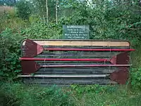 | |||
| emergency | fire_hose | A high-pressure hose used to carry water or other fire retardant (such as foam) to a fire to extinguish it. | 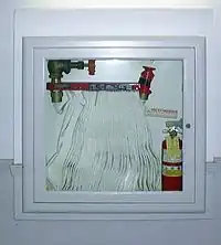 | |||
| emergency | fire_hydrant | An active fire protection measure, and a source of water provided in most urban, suburban, and rural areas with municipal water service to enable fire fighters to tap into the municipal water supply to assist in extinguishing a fire. |  | |||
| emergency | water_tank | A large water basin or tank for a fire department to take water. |  | |||
| emergency | fire_water_pond | A man made or natural pond with water for a fire department. |  | |||
| emergency | suction_point | A preferred point to pump water off a river or other waters for a fire department. | ||||
Reddingsbrigade en strandwacht | ||||||
| emergency | lifeguard_base | The central place for vehicles and facilities of the lifeguard. Can also serve for central communication point. |  | |||
| emergency | lifeguard_tower | A guard tower that lifeguards use to watch and monitor swimmers, in order to prevent drowning or other dangers from occurring. |  | |||
| emergency | lifeguard_platform | A platform used by lifeguards. | .jpg.webp) | |||
| emergency | lifeguard_place | The central hub for lifeguards. | .JPG.webp) | |||
| emergency | life_ring | An inflatable floating device. |  | |||
Others | ||||||
| emergency | assembly_point | Assembly point or area in case of emergency | 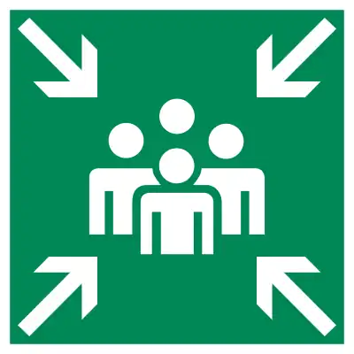 | |||
| emergency | access_point | Sign with an ID which can be used to define your current position in case of an emergency, or as an assembly point for emergency services. (replaces highway=emergency_access_point) | | |||
| emergency | phone | An emergency telephone to call the emergency services. |  | |||
| emergency | ses_station | State Emergency Service is an Australian non-profit organization that provides assistance during and after explicitly declared natural or man-made disasters. |  | |||
| emergency | siren | Instrument capable of producing loud sounds to alert people in case of emergencies. The most modern use case is for civil defense as "air raid" sirens or tornado sirens. |  | |||
| emergency | brugerdefineret | Se også Taginfo for mere information. | ||||
Turisme (tourism)
This is used to map places and things of specific interest to tourists. For example these may be places to see, places to stay and things and places providing support.
| Nøgle(key) | Værdi | Element | Kommentar | Rendering | Foto |
|---|---|---|---|---|---|
| tourism | alpine_hut |  | |||
| tourism | apartment | A holiday or vacation apartment is a furnished apartment or flat with cooking and bathroom facilities that can be rented for holiday vacations. This tag can be applied to a building accommodating one or more holiday flats. Between tourism=apartment and tourism=chalet is a clear distinction: "Chalet" is for a detached holiday cottage which you rent exclusively, "apartment" is for one or several flats in a shared building (or a single flat in one part of the building and other usages, like private apartments or a restaurant, in the other part). |  | ||
| tourism | aquarium | An aquarium, meant as |
 | ||
| tourism | artwork | Kunstværk, især udendørs, f.eks. skulptur på plads eller i park. |  | ||
| tourism | attraction | Turist attraktion generelt, dette tag anvendes ofte som supplement til andre tags (som historic =*). |  | ||
| tourism | camp_pitch | camp pitch is the free space used to place a tent or or caravan within a tourism=camp_site or tourism=caravan_site area. | .jpg.webp) | ||
| tourism | camp_site | Lejrplads, teltcamping, et sted hvor man kan slå et telt op. |  | ||
| tourism | caravan_site | Campingplads |  | ||
| tourism | chalet | Udlejningshytte, feriebolig |  | ||
| tourism | gallery |  | |||
| tourism | guest_house | Pensionat, bed & breakfast |  | ||
| tourism | hostel | Vandrehjem |  | ||
| tourism | hotel | Hotel |  | ||
| tourism | information | Turistinformation, f.eks. turistkontor eller informationstavle. Kan suppleres med information=*. |  | ||
| tourism | motel | Motel |  | ||
| tourism | museum | Museum |  | ||
| tourism | picnic_site | Picnic-plads, ofte med borde og bænke. |  | ||
| tourism | theme_park | Forlystelsespark |  |
 | |
| tourism | viewpoint | Udsigtspunkt, et sted, ofte højt beliggende, med en god udsigt over det omkringliggende landskab, bemærkelsesværdige bygninger eller naturskønne område. |  | ||
| tourism | wilderness_hut |  | |||
| tourism | zoo | Zoologisk have eller dyrepark. |  |
 | |
| tourism | yes | Kan tilføjes et objekt tagget som noget andet for at angive, det har en turistmæssig interesse. | |||
| tourism | brugerdefineret | Se Taginfo for andre ofte anvendte værdier |
This table is a wiki template with a default description in English. Editable here.
===Historisk (historic)===Anvendes til at beskrive historiske steder. Se Historic for flere detaljer om anvendelsen af dette tag.
This table is a wiki template with a default description in English. Editable here.
Brug af landområder (landuse)
Anvendes til at beskrive anvendelse af landområder. Se Landuse for flere detaljer om anvendelsen af dette tag.
| Nøgle(key) | Værdi | Element | Kommentar | Rendering | Foto | |
|---|---|---|---|---|---|---|
Common landuse key values - developed land | ||||||
| landuse | commercial | Kontorområde, område, der hovedsageligt anvendes til kontorer. |  |
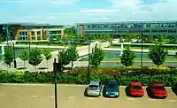 | ||
| landuse | construction | Byggeplads, bliver til noget andet, når byggearbejdet er afsluttet. |  |
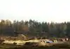 | ||
| landuse | education | An area predominately used for educational purposes/facilities. | 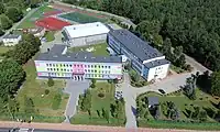 | |||
| landuse | fairground | A site where the fair takes place | 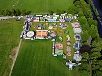 | |||
| landuse | industrial | Industriområde, område hovedsageligt anvendt til industriformål (fabrikker, værksteder, håndværk, lager) | |
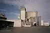 | ||
| landuse | residential | Boligområde, område hovedsageligt anvendt til beboelse, f.eks. parcelhuse, boligblokke. |  |
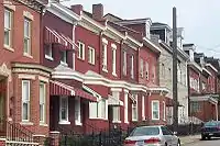 | ||
| landuse | retail | Butiksområde, område hovedsageligt med butikker, selvom anden anvendelse (f.eks. beboelse, kontorer) også kan forekomme. |  |
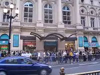 | ||
| landuse | institutional | Land used for institutional purposes, see
The meaning of this tag is ambiguous and unclear. Consider using another tag that better describes the object. For instance landuse=commercial. See talk page for discussion. |
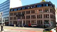 | |||
| Nøgle(key) | Værdi | Element | Kommentar | Rendering | Foto | |
Common landuse key values - rural and agricultural land | ||||||
| landuse | aquaculture | currently not rendered by osm-carto | 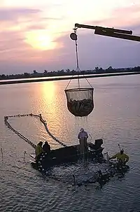 | |||
| landuse | allotments | Kolonihaver |  |
 | ||
| landuse | farmland | Landbrugsområde, synonym for farm og anvendes i JOSM, fordi farm betragtes som tvetydigt (menes der kun selve gården eller gården med marker?) |  |
 | ||
| landuse | farmyard | Gård (landbrug), område med landbrugsbygninger såsom beboelse med have, stalde, lader og direkte udenomsarealer, der ikke dyrkes. |  |
 | ||
| landuse | flowerbed | An area designated for flowers | 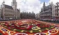 | |||
| landuse | forest | Skov, dyrket skov eller plantage |  |
 | ||
| landuse | greenhouse_horticulture | Drivhusområde, område med drivhuse og tilhørende udenomsarealer. | |
 | ||
| landuse | meadow | Eng, areal med vedvarende græs til afgræsning eller høslet, ofte i fugtigt, lavtliggende område. |  |
 | ||
| landuse | orchard | Frugtplantage, plantage af træer eller buske til frugt-, bær- eller nøddeproduktion. |  |
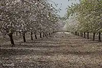 | ||
| landuse | plant_nursery | Planteskole, område til fremavl af nye planter til senere udplantning andetsteds. Anvendes ikke til drivhuse, se landuse=greenhouse_horticulture. |  |
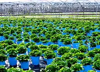 | ||
| landuse | vineyard | Vingård, område til produktion af vindruer. |  |
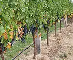 | ||
| Nøgle(key) | Værdi | Element | Kommentar | Rendering | Foto | |
Common landuse key values - waterbodyWarning: currently, there is no convention on the exact meaning of this tag. Therefore, it makes sense to treat it like "boundary of aquaculture" (without implication of water body), which means, water body should be tagged by its own, using natural=water etc.}}} | ||||||
| landuse | basin | Regnvandsbassin til opsamling af regnvand, som derefter langsomt bortledes til vandløb eller grundvand. Typen kan angives med basin=*. | |
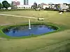 | ||
| Vandreservoir, stemmesø eller lignende |  |
| ||||
| landuse | salt_pond | Saltindvinding ved inddampning af havvand i lave damme. |  |
.jpg.webp) | ||
| Nøgle(key) | Værdi | Element | Kommentar | Rendering | Foto | |
Other landuse key values | ||||||
| landuse | brownfield | Tidligere bebygget område reserveret til nybyggeri. De gamle bygninger er fjernet, men byggearbejde er endnu ikke påbegyndt. | |
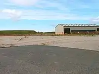 | ||
| landuse | cemetery | Større Begravelsesplads, kirkegård. religion=* kan tilføjes. | |
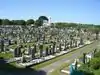 | ||
| Protected areas (deprecated) Alternate tagging of same thing: boundary=protected_area, protected_area=* | ||||||
| landuse | depot | An area used as a depot for e.g. vehicles (trains, buses or trams). Consider using rather standard landuse tags like landuse=railway, landuse=commercial, landuse=industrial, with subtag like industrial=depot. | currently not rendered by osm-carto | .JPG.webp) | ||
| landuse | garages | Garageanlæg, område med lave garage-bygninger til køretøjer, ofte fællesejet. Anvendes ikke til enkeltstående garager hørende til en bolig. |  |
 | ||
| landuse | grass | Græsareal, f.eks. større græsplæne, offentlige græsarealer. Anvendes ikke til enge eller græsmarker. |  |
 | ||
| landuse | greenfield | Område reserveret til nybyggeri og som ikke tidligere har været bebygget. Den oprindelige anvendelse (f.eks. landbrugsdrift) er ophørt, men byggearbejde er endnu ikke påbegyndt. |  (not rendered) |
| ||
| landuse | landfill | Losseplads |  |
 | ||
| landuse | military | Militært område |  |
 | ||
| landuse | port | coastal industrial area where commercial traffic is handled. Consider using landuse=industrial + industrial=port for this type of industrial area. | currently not rendered by osm-carto |  | ||
| landuse | quarry | Grusgrav, stenbrud, åben mine, område med overfladeudvinding af mineraler. |  |
 | ||
| landuse | railway | Sporareal, område til jernbanedrift, normalt utilgængeligt for offentligheden. F.eks. rangerterræn, remiser | |
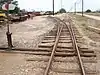 | ||
| landuse | recreation_ground | Parklignende område for recreative aktiviteter med boldbaner og lignende. Se også leisure=park. |  |
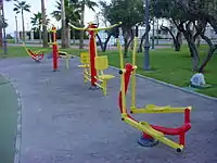 | ||
| landuse | religious | An area used for religious purposes |  |
 | ||
| landuse | village_green | Dyrskueplads eller lignende, et grønt område, som anvendes til større begivenheder, såsom markeder, dyrskuer, festivaler. |  |
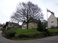 | ||
| landuse | winter_sports | An area dedicated to winter sports (e.g. skiing) | .jpg.webp) | |||
| landuse | brugerdefineret | Se Taginfo for andre ofte anvendte værdier | ||||
This table is a wiki template with a default description in English. Editable here.
Militær (military)
This is used for facilities and on land used by the military. These may include the Navy, Army, Air Force and Marines. See the page titled Military for an introduction on its usage.
| Nøgle(key) | Værdi | Element | Kommentar | Rendering | Foto |
|---|---|---|---|---|---|
| military | airfield | Flyvestation, luftbase, base for luftvåben med landingsbaner, hangarer m.v. | 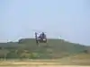 | ||
| military | ammunition | Military ammunition storage area. | |||
| military | barracks | Kaserne, område med bygninger til indkvartering af soldater. | 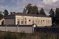 | ||
| military | bunker | Bunker, armeret bygning, der kan modstå svær beskydning. For historiske bunkere fra 2. verdenskrig se WW2 pillboxes. | 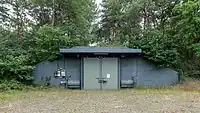 | ||
| military | checkpoint | Place of a possible access to a restricted or secured area, where civilian visitors and vehicles will be controled by a military authority. |  Checkpoint Charlie | ||
| military | danger_area | Fareområde, f.eks. omkring skydeområde |  |
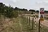 | |
| military | launchpad | Launchpads used for military purposes, see tag:aeroway=launchpad for civilian use |  | ||
| military | naval_base | Flådestation, base for skibe til maritimt forsvar. |  | ||
| military | nuclear_explosion_site | Nuclear weapons test site | |||
| military | obstacle_course | A military obstacle course. |  | ||
| military | office | Military offices, e.g. general staff office, military recruitment office etc |  | ||
| military | range | Skydeområde, hvor der trænes i anvendelse af skydevåben, artilleri eller bombning. |  | ||
| military | training_area | An area where soldiers train and weapons or other military technology are experimented with or are tested. |  | ||
| military | trench | Trenches used for military purposes |  | ||
| military | brugerdefineret | Se Taginfo for andre ofte anvendte værdier |
This table is a wiki template with a default description in English. Editable here.
Natur (natural)
Anvendes til at beskrive fysiske landskabsfeatures inklusivt de, som er ændret af menneskelig aktivitet. Se Natural for en introduktion.
| Nøgle(key) | Værdi | Element | Kommentar | Tag Usage[1] | Rendering | Foto |
|---|---|---|---|---|---|---|
Vegetation | ||||||
| natural | fell | Habitat above the tree line covered with grass, dwarf shrubs and mosses. | No, see #545. | 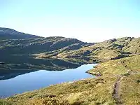 | ||
| natural | grassland | Græsland, naturligt græsdækket område. | |
 | ||
| natural | heath | Hede, område bevokset med lyng eller andre lave buske. |  |
 | ||
| natural | moor | Don't use, see wikipage. Upland areas, characterised by low-growing vegetation on acidic soils. | currently not rendered by openstreetmap-carto | 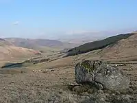 | ||
| natural | scrub | Krat, område bevokset med buske eller lave træer. |  |
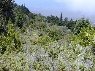 | ||
| natural | shrubbery | An area of shrubbery that is actively maintained or pruned by humans. A slightly wilder look is also possible | currently not rendered by openstreetmap-carto | 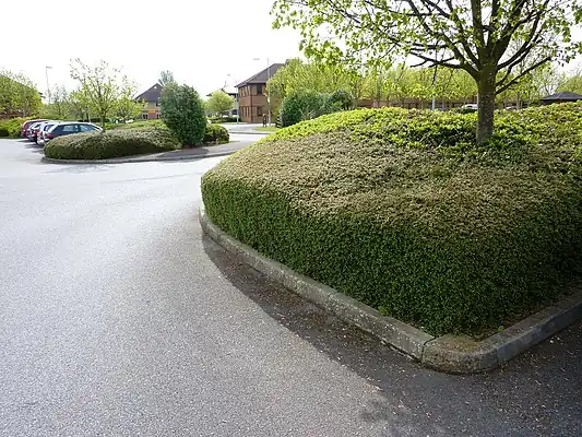 | ||
| natural | tree | Træ, især markant eller fritstående træ. |  | |||
| natural | tree_row | A line of trees. |  |
 | ||
| natural | tree_stump | A tree stump, the remains of a cut down or broken tree. |  | |||
| natural | tundra | Habitat above tree line in alpine and subpolar regions, principally covered with uncultivated grass, low growing shrubs and mosses and sometimes grazed. |  | |||
| natural | wood | Naturlig skov, urskov, skov, der ikke plejes af mennesker. For plejet skov, se landuse=forest. |  |
 | ||
Water related | ||||||
| natural | bay | Bugt. |  |
 | ||
| natural | beach | Strand, sand-, grus- eller stendækket område ved kysten. |  |
 | ||
| natural | blowhole | An opening to a sea cave which has grown landwards resulting in blasts of water from the opening due to the wave action | 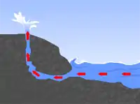 | |||
| natural | cape | A piece of elevated land sticking out into the sea or large lake. Includes capes, heads, headlands and (water) promontories. |  | |||
| natural | coastline | Kystlinie. Skal tegnes med uret omkring vand og mod uret omkring land, dvs land til venstre og vand til højre. Som eneste undtagelse behøver kystlinier ikke at danne en lukket polygon, de skal bare at være forbundet med hinanden, enden af en linie til starten af den næste, således at linierne tilsammen danner en lukket polygon. | 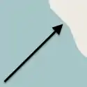 |
 | ||
| natural | crevasse | A large crack in a glacier |  | |||
| natural | geyser | A spring characterized by intermittent discharge of water ejected turbulently and accompanied by steam. |  | |||
| natural | glacier | Gletcher, Bræ, Indlandsis, permanent isdækket land. |  |
 | ||
| natural | hot_spring | A spring of geothermally heated groundwater |  | |||
| natural | isthmus | A narrow strip of land, bordered by water on both sides and connecting two larger land masses. |  | |||
| natural | mud | Mudder. |  |
 | ||
| natural | peninsula | A piece of land projecting into water from a larger land mass, nearly surrounded by water | ||||
| natural | reef | A feature (rock, sandbar, coral, etc) lying beneath the surface of the water |  | |||
| natural | shingle | An accumulation of rounded rock fragments on a beach or riverbed |  |
 | ||
| natural | shoal | An area of the sea floor near the sea surface (literally, becomes shallow) and exposed at low tide. See natural=sand as well. | |
 | ||
| natural | spring | Kilde, et sted hvor grundvandet naturligt kommer til overfladen | 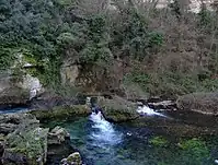 | |||
| natural | strait | A narrow area of water surrounded by land on two sides and by water on two other sides. |  |
.jpg.webp) | ||
| natural | water | Sø eller anden vandflade. For brede vandløb se waterway=riverbank. |  |
 | ||
| natural | wetland | Vådområde, typen kan angives med wetland=*. |  |
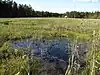 | ||
Geology related | ||||||
| natural | arch | A rock arch naturally formed by erosion, with an opening underneath. | currently not rendered by openstreetmap-carto |  | ||
| natural | arete | An arête, a thin, almost knife-like, ridge of rock which is typically formed when two glaciers erode parallel U-shaped valleys. |  |
 | ||
| natural | bare_rock | An area with sparse/no soil or vegetation, so that the bedrock becomes visible. |  |
 | ||
| natural | cave_entrance | Huleindgang. |  | |||
| natural | cliff | Klippevæg, klint, hvis klinten tegnes som en linie, skal toppen af klinten være til venstre og bunden til højre set i liniens retning. |  |
 | ||
| natural | dune | A hill of sand formed by wind, covered with no or very little vegetation. See also natural=sand and natural=beach | currently not rendered by openstreetmap-carto | 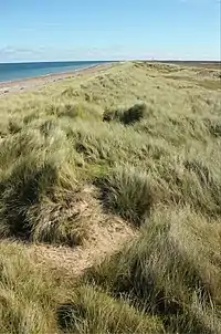 | ||
| natural | earth_bank | Large erosion gully or steep earth bank | _1.jpg.webp) | |||
| natural | fumarole | A fumarole is an opening in a planet's crust, which emits steam and gases | .jpg.webp) | |||
| natural | gully | Small scale cut in relief created by water erosion | 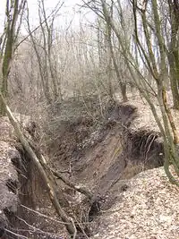 | |||
| natural | hill | A hill. | currently not rendered by openstreetmap-carto |  | ||
| natural | peak | Bjergtop, bakketop. |  | |||
| natural | ridge | A mountain or hill linear landform with a continuous elevated crest |  |
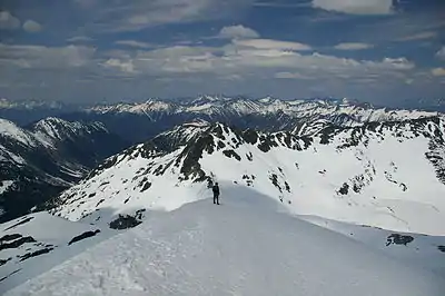 | ||
| natural | rock | A notable rock or group of rocks attached to the underlying bedrock. | currently not rendered by openstreetmap-carto | 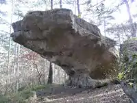 | ||
| natural | saddle | The lowest point along a ridge or between two mountain tops |  | |||
| natural | sand | Sand, sanddækket område uden eller kun med ubetydelig bevoksning. Se også natural=beach. |  |
 | ||
| natural | scree | Urer, område med løs klippe, ofte nedenfor stejle bjergsider. | |
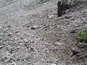 | ||
| natural | sinkhole | A natural depression or hole in the surface topography. | currently not rendered by openstreetmap-carto |  | ||
| natural | stone | Fritstående sten, f.eks. kampesten efterladt efter istiden. | currently not rendered by openstreetmap-carto | 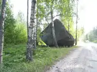 | ||
| natural | valley | A natural depression flanked by ridges or ranges of mountains or hills | currently not rendered by openstreetmap-carto |  | ||
| natural | volcano | Vulkan, enten slumrende, udslugt eller aktiv. |  | |||
| natural | user defined | Se Taginfo siden for andre ofte anvendte værdier | ||||
This table is a wiki template with a default description in English. Editable here.
Geologi (geological)
This is used to describe the geological makeup of an area. See the page Geological for an introduction on its usage.
| Nøgle(key) | Værdi | Element | Kommentar | Rendering | Foto |
|---|---|---|---|---|---|
| geological | moraine | A moraine is any ice formed accumulation of unconsolidated glacial debris (soil and rock) which can occur in currently glaciated and formerly glaciated regions, such as those areas acted upon by glacial ice. | 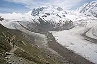 | ||
| geological | outcrop | An outcrop site is a place where the bedrock or superficial deposits have become locally exposed and are directly accessible to analysis. |  | ||
| geological | palaeontological_site | A palaeontological site is a place (or group of physical sites) in which remains of ancient living forms is preserved. Area under the study of the forms of life existing in prehistoric times, as represented by the fossils of plants, animals, and other organisms investigated using the discipline of palaeontology. |  | ||
| geological | brugerdefineret | Se også Taginfo for mere information. |
This table is a wiki template with a default description in English. Editable here.
Ikke fysisk
Ruter
- Hovedartikel: relation:route
This is used to describe routes of all different kinds.
| Key | Value | Element | Comment | Rendering | Photo |
|---|---|---|---|---|---|
| route | bicycle | Cycle routes or bicycles route are named, numbered or otherwise signed. May go along roads, trails or dedicated cycle paths |  | ||
| route | bus | The route a public bus service takes. See Buses. |  | ||
| route | canoe | Signed route for canoeing through a waterway. | 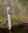 | ||
| route | detour | Route for fixed detour routes. Examples are Bedarfsumleitung in Germany and uitwijkroute in the Netherlands | %252C_StVO_1970.svg.png.webp) | ||
| route | ferry | The route a ferry takes from terminal to terminal Please make sure to add at least one node per tile (zoom level 12), better at least one every few km, so offline editors catch it with bbox requests. |  |
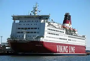 | |
| route | foot | Walking Route - is used for routes which are walkable without any limitations regarding fitness, equipment or weather conditions. |  | ||
| route | hiking | Hiking explains how to tag hiking routes. | 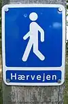 | ||
| route | horse | Riding routes | 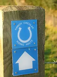 | ||
| route | inline_skates | Inline has more information on the subject. | |||
| route | light_rail | Route of a light rail line. | 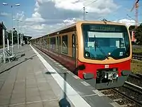 | ||
| route | mtb | Mountain biking explains how to tag mtb routes. | 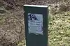 | ||
| route | piste | Route of a piste (e.g., snowshoe or XC-Ski trails) in a winter sport area. |  | ||
| route | railway | A sequence of railway ways, often named (e.g., Channel Tunnel). See Railways. | 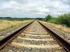 | ||
| route | road | Can be used to map various road routes/long roads. |  | ||
| route | running | For running (jogging) routes. |  | ||
| route | ski | For ski tracks (e.g., XC-Ski Trails User:Langläufer/Loipemap). |  | ||
| route | subway | Route of a metro service |  | ||
| route | train | Train services (e.g., London-Paris Eurostar) See Railways. | |||
| route | tracks | Railroad track as rail infrastructure. | | ||
| route | tram | See Trams for more information on tagging tram services. | 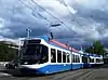 | ||
| route | trolleybus | The route of a trolleybus service. | 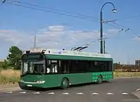 | ||
| route | brugerdefineret | Se Taginfo for andre ofte anvendte værdier |
This table is a wiki template with a default description in English. Editable here.
Grænse (boundary)
Anvendes til at beskrive administrative og andre grænser. Se Boundaries for flere detaljer om anvendelsen af tagget. Se Relation:boundary for grænserelationer.
| Nøgle(key) | Værdi | Element | Kommentar | Rendering | Foto | |
|---|---|---|---|---|---|---|
Boundary types | ||||||
| boundary | aboriginal_lands | A boundary representing official reservation boundaries of recognized aboriginal / indigenous / native peoples. |  |
 | ||
| boundary | administrative | Administrativ grænse, f.eks. statsgrænse, regionsgrænse eller kommunegrænse. Anvend admin_level=* for at angive typen. |  |
 | ||
| boundary | border_zone | A border zone is an area near the border where special restrictions on movement apply. Usually a permit is required for visiting. | _-_crop.jpg.webp) | |||
| boundary | forest | A delimited forest is a land which is predominantly wooded and which is, for this reason, given defined boundaries. It may cover different tree stands, non-wooded areas, highways… but all the area within the boundaries are considered and managed as a single forest. | 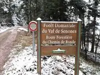 | |||
| boundary | forest_compartment | A forest compartment is a numbered sub-division within a delimited forest, physically materialized with visible, typically cleared, boundaries. | 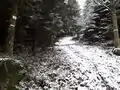 | |||
| boundary | hazard | A designated hazardous area, with a potential source of damage to health, life, property, or any other interest of value. |  | |||
| boundary | maritime | Maritim grænse, for eksempel 200 sømil økonomisk zone. Den territoriale grænse i havet (normalt 12 sømil grænsen) angives med boundary=administrative. |  | |||
| boundary | marker | A boundary marker, border marker, boundary stone, or border stone is a robust physical marker that identifies the start of a land boundary or the change in a boundary, especially a change in direction of a boundary. See also historic=boundary_stone |  | |||
| boundary | national_park | Nationalparkgrænse |  |
 | ||
| boundary | place | boundary=place is commonly used to map the boundaries of a place=*, when these boundaries can be defined but these are not administrative boundaries. | ||||
| boundary | political | Valgkredsgrænse | ||||
| boundary | postal_code | Postal code boundaries | ||||
| boundary | protected_area | For eksempel grænse for fredet område eller vandbeskyttelsesområde. |  | |||
| boundary | special_economic_zone | A government-defined area in which business and trade laws are different. |  | |||
| boundary | disputed | An area of landed claimed by two or more parties (use with caution). See also Disputed territories. |  | |||
| boundary | brugerdefineret | Se Taginfo for andre ofte anvendte værdier | ||||
Attributes | ||||||
| admin_level | (number) | Anvendes sammen med boundary=administrative. I Danmark anvendes 2 for statsgrænse, 4 for regionsgrænse og 7 for kommunegrænse. |  | |||
| border_type | * | To distinguish between types of boundary where admin_level isn't enough. Used in several different ways e.g in maritime contexts. | ||||
| start_date | (date) | Useful if the boundary is very recent (or if it will become effective in a near future). |  | |||
This table is a wiki template with a default description in English. Editable here.
Sport
Angiver sportsgren, som udøves på et idrætsanlæg eller anden facilitet. Anvendes sammen med landuse=* eller leisure=*.
| Key | Værdi | Element | Kommentar | Rendering | Foto |
|---|---|---|---|---|---|
| sport | 9pin | Keglespil. Se wikipedia. |  |
 | |
| sport | 10pin | Bowling (med 10 kegler). Se wikipedia |  |
 | |
| sport | american_football | Amerikansk fodbold |  |
 | |
| sport | aikido | Useful combination: amenity=dojo See Also: sport=judo;taekwondo |
 |
 | |
| sport | archery | Bueskydning |  |
 | |
| sport | athletics | Atletik. En fællesbetegnelse for løbe-, spring- og kastediscipliner, som typisk udøves på et atletikstadion. |  |
 | |
| sport | australian_football | Useful combination: leisure=pitch;stadium;sports_centre See Also: sport=soccer;american_football;canadian_football |
 | ||
| sport | badminton | Badminton |  |
 | |
| sport | bandy | Useful combination: leisure=pitch;stadium;sports_centre, surface=* See Also: sport=ice_hockey;soccer;field_hockey |
 |
 | |
| sport | [[ Too many Data Items entities accessed. | base ]] | Useful combination: building=*, man_made=*, bridge=*, natural=cliff See Also: sport=cliff_diving;free_flying |
 | ||
| sport | baseball | Baseball |  |
 | |
| sport | basketball | Useful combination: leisure=pitch;stadium;sports_centre, surface=* See Also: sport=volleyball;handball |
 |
 | |
| sport | beachvolleyball | Useful combination: leisure=pitch;beach_resort;sports_centre, natural=sand;beach, surface=sand See Also: sport=volleyball;handball |
_pictogram.svg.png.webp) |
.jpg.webp) | |
| sport | billiards | Useful combination: leisure=bowling_alley, amenity=bar;pub;restaurant See Also: sport=darts;10pin;horseshoes |
 |
 | |
| sport | bmx | Useful combination: leisure=track;pitch;sports_centre, surface=earth, length=*, lanes=*, surface=* See Also: sport=cycling |
_pictogram.svg.png.webp) |
 | |
| sport | bobsleigh | Useful combination: leisure=track;sports_centre, surface=* See Also: sport=toboggan, Piste Maps, Winter sports |
  |
 | |
| sport | boules | Boules. En fællesbetegnelse for spil med stålkugler. Variationer af spillet kendes som petanque og lyonnais. |  |
 | |
| sport | bowls | Useful combination: leisure=pitch;stadium;sports_centre, surface=* See Also: sport=boules;pelota;10pin, sport=9pin;horseshoes |
 |
 | |
| sport | boxing | Boksning |  |
 | |
| sport | bullfighting | Useful combination: leisure=stadium;pitch |
 | ||
| sport | canadian_football | Useful combination: leisure=pitch;stadium;sports_centre and surface=* See Also: sport=american_football;australian_football;rugby_league, sport=soccer;rugby_union |
|
 | |
| sport | canoe | Useful combination: landuse=recreation_ground, leisure=sports_centre, amenity=canoe_hire;boat_rental, club=*, shop=* See Also: sport=water_ski;swimming;surfing |
_pictogram.svg.png.webp) |
 | |
| sport | chess | The intended use is for big chess-boards in the open air. Useful combination: leisure=pitch;picnic_table See Also: club=chess |
 |
 | |
| sport | cliff_diving | Useful combination: natural=cliff, height=*, depth=*, tidal=*, surface=*, note=* See Also: sport=climbing;swimming |
 |
 | |
| sport | climbing | Klatring på naturlige klippevægge eller kunstige klatremure. |  |
 | |
| sport | climbing_adventure | Useful combination: landuse=recreation_ground, leisure=sports_centre See Also: sport=climbing |
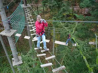 | ||
| sport | cockfighting | Useful combination: leisure=pitch for informal rings. |
 | ||
| sport | cricket | Useful combination: leisure=pitch;stadium;sports_centre, landuse=recreation_ground, surface=* See Also: sport=baseball |
 |
 | |
| This is not a sport! No not use this tag. Instead consider using leisure=pitch, sport=cricket, barrier=fence |
 | ||||
| sport | croquet | Useful combination: leisure=pitch;stadium;sports_centre, landuse=recreation_ground, surface=* See Also: sport=field_hockey |
 |
 | |
| sport | curling | Useful combination: leisure=pitch;stadium;sports_centre See Also: sport=ice_stock;bowls;boules, surface=* |
 |
 | |
| sport | cycling | Useful combination: leisure=track;stadium;sports_centre, surface=* |
_pictogram.svg.png.webp) |
 | |
| sport | darts | Useful combination: amenity=bar;pub;restaurant, leisure=bowling_alley See Also: sport=billiards;10pin;horseshoes |
 |
 | |
| DO NOT USE THIS TAG, as it is ambiguous. See: sport=diving Instead use: sport=cliff_diving is the means for "jumping from a rock" or the Olympic discipline Diving. sport=scuba_diving is the means for "swimming under the water". |
|||||
| sport | dog_racing | Useful combination: leisure=track;stadium;sports_centre, surface=* See Also: sport=horse_racing |
 | ||
| sport | equestrian | Ridning. Betegnelsen dækker bl.a. over disciplinerne springning, dressur og military. Se også sport=horse_racing.. |  |
 | |
| sport | fencing | Useful combination: leisure=pitch;stadium;sports_centre, surface=* See Also: sport=boxing;wrestling |
 |
 | |
| sport | field_hockey | Useful combination: leisure=pitch;sports_centre;stadium See Also: sport=ice_hockey;ice_skating |
 |
 | |
| Anvend ikke dette tag, da 'football' betyder forskellige ting rundt om i verden. Brug i stedet for sport=soccer for fodbold og sport=american_football for amerikansk fodbold. | |||||
| sport | free_flying |   |
 | ||
| sport | gaelic_games | For tagging individual games under this category see the tag page. |
 | ||
| sport | golf |  |
 | ||
| sport | gymnastics | _pictogram.svg.png.webp) |
 | ||
| sport | handball |  |
 | ||
| sport | hapkido | Useful combination: amenity=dojo See Also: sport=aikido;judo;taekwondo |
 | ||
| Hockey eller Ishockey. | |||||
| sport | horseshoes |  | |||
| sport | horse_racing | Hestevæddeløb på trav- eller galopbane. |  |
 | |
| sport | ice_hockey | Useful combination: leisure=ice_rink;stadium;sports_centre See Also: sport=field_hockey;ice_skating |
 |
 | |
| sport | ice_skating | Useful combination: leisure=ice_rink;sports_centre;pitch See Also: sport=ice_hockey;roller_skating The disambiguous sport=skating tag is sometimes confused with this one. |
  |
 | |
| sport | ice_stock | Useful combination: leisure=pitch;stadium;sports_centre See Also: sport=curling |
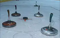 | ||
| sport | judo |  |
 | ||
| sport | karting | See also sport=motor;motocross |
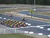 | ||
| sport | kitesurfing |  | |||
| sport | korfball |  |
 | ||
| sport | martial_arts |  | |||
| sport | model_aerodrome |  | |||
| sport | motocross | See also sport=motor;karting |
 | ||
| sport | motor | See also sport=karting;motocross |
 | ||
| sport | multi | Multisport. Benyttes f.eks. om sportshal, hvor der dyrkes flere forskellige sportsgrene. |  | ||
| sport | netball |  |
 | ||
| sport | obstacle_course |  | |||
| sport | orienteering |  |
 | ||
| sport | paddle_tennis | 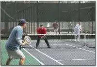 | |||
| sport | parachuting |  | |||
 |
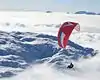 | ||||
| sport | pelota |   |
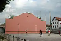 | ||
| sport | racquet | Fællesbetegnelse for ketchersportsgrene (tennis, squash, badminton med videre). |  |
 | |
| sport | rc_car | .jpg.webp) | |||
| sport | roller_skating | See Also: sport=ice_skating;skateboard;field_hockey The disambiguous sport=skating tag is sometimes confused with this one. |
  |
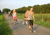 | |
| sport | rowing |  |
 | ||
| sport | rugby_league |  |
.jpg.webp) | ||
| sport | rugby_union |  |
 | ||
| sport | running | |
 | ||
.jpg.webp) | |||||
| sport | sailing |  |
 | ||
| sport | scuba_diving |  |
 | ||
| sport | shooting | See also sport=archery |
 |
 | |
| Skøjtning på indendørs- eller udendørsbane. | |||||
| sport | skateboard |  |
 | ||
 |
 | ||||
| sport | soccer | Fodbold. |  |
 | |
| sport | sumo |  | |||
| sport | surfing |  |
 | ||
| sport | swimming | Svømning. |  |
 | |
| sport | table_tennis | Bordtennis. |  |
 | |
| sport | table_soccer | Useful combination: amenity=pub;bar;restaurant See Also: sport=soccer;table_tennis;billiards, leisure=amusement_arcade;adult_gaming_centre, club=table_soccer |
 |
 | |
| sport | taekwondo |  |
 | ||
| sport | tennis | Tennis. |  |
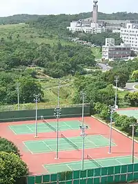 | |
| sport | toboggan |  | |||
| sport | trampoline | Trampoline sport is a sport that is carried on large trampolines indoor or outdoors |  | ||
| sport | ultralight_aviation |  | |||
| sport | volleyball | _pictogram.svg.png.webp) |
 | ||
| sport | water_polo |  | |||
| sport | water_ski |  |
 | ||
| sport | weightlifting |  |
 | ||
| sport | wrestling |  |
 | ||
| sport | yoga |  | |||
| sport | brugerdefineret | Se Taginfo for andre ofte anvendte værdier |
This table is a wiki template with a default description in English. Editable here.
Abutters
This key applies to ways only when, for instance, aerial views are not available. See landuse=* for areas.
| Key | Value | Element | Comment | Rendering | Photo |
|---|---|---|---|---|---|
| abutters | commercial | predominantly office buildings, business parks, etc. | | ||
| abutters | industrial | predominantly workshops, factories, warehouses |  | ||
| abutters | mixed | where there is no clear predominance, for example mixed shops and residences in an inner city ring | |||
| abutters | residential | predominantly houses and apartments |  | ||
| abutters | retail | predominantly shops | |||
| abutters | brugerdefineret | Se Taginfo for andre ofte anvendte værdier |
This table is a wiki template with a default description in English. Editable here.
Egenskaber (properties)
This is used to give additional information of a general nature about another element.
| Key | Value | Element | Comment | Rendering | Photo |
|---|---|---|---|---|---|
| area | yes | Angiver, at tagget gælder et areal, hvor tagget normalt anvendes for en linear vej. F.eks. sammen med highway=pedestrian for en plads eller torv. |  | ||
| brand | user defined | Brand of the feature. | |||
| bridge | yes / aqueduct / viaduct / cantilever / movable / covered / … | Bro. Husk layer=*. | 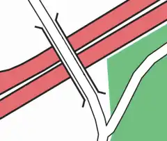 |
| |
| capacity | amount | Used for specifying capacity of a facility. | |||
| charge | amount | Used for specifying how much is charged for use/access to a facility. See toll=* or fee=*. | |||
| clothes | see key's page | Tagged on shops and other features to denote if they sell clothes or not and what type of clothes they sell. | | ||
| covered | yes | Overdækket. Objektet befinder sig under et andet objekt, f.eks. vej under bygning. | Various, depending on the covered entity | 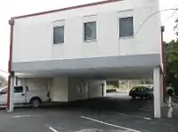 | |
| crossing | no / traffic_signals / uncontrolled / island / unmarked | Beskriver f.eks. om en fodgængerovergang er lysreguleret eller ej. | | ||
| crossing:island | yes / no | Specifies whether a pedestrian crossing has a refuge island | 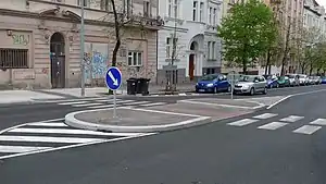 | ||
| cutting | yes / left / right | Gennemskæring gennem bakke. | 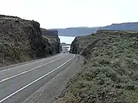 | ||
| disused | yes | Nedlagt. Objektet er ikke længere i brug, men eksisterer stadig (f.eks. nedlagt jernbane) |  | ||
| drinking_water | yes / no | Describes whether a drinking water is available | |||
| drive_through | yes / no | Used to indicate if a pharmacy, bank, atm, or fast_food, or post_box offers drive_thru service. drive_through=* is different than drive_in=*} |  | ||
| drive_in | yes / no | Used to indicate if a cinema is a drive-in cinema or a restaurant offers drive-in service. drive_in=* is different than drive_through=* |  | ||
| electrified | contact_line / rail | Indicates infrastructure to supply vehicles with electricity on rail tracks | | ||
| ele | Number | Højde over havniveau i meter, f.eks. for bakketop. Se også height=* |  | ||
| embankment | yes | Dæmning som fører vej eller jernbane over vand eller lavtliggende område. Anvend man_made=dyke for dige til beskyttelse mod oversvømmelse. Anvend waterway=dam for dæmning til opstemning af vand. |  |
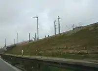 | |
| end_date | Date | Slutdato, tidspunkt hvor objektet ophørte med at eksistere, f.eks. nedrivningsår for en tidligere bygning. | .jpg.webp) | ||
| est_width | Number | A rough guess of the width of way in metres | | ||
| fee | yes / no | Used for specifying whether fee is charged for use/access to a facility. See also toll=*. | |||
| fire_object:type | poo / szo | Potentially dangerous and socially significant objects | |||
| fire_operator | Name | Fire station, which serves the object | |||
| fire_rank | 1bis / 2 to 5 | Rank fire, defined for a particular object | |||
| frequency | Number | Frequency in Hz | | ||
| hazard | see hazard | Indicates of the hazards. | |||
| hot_water | yes / no | Describes whether a hot water is available | |||
| inscription | User Defined | The full text of inscriptions, which can be found on buildings, memorials and other objects. | _(4749426050).jpg.webp) | ||
| internet_access | yes / wired / wlan / terminal / no | Internetadgang, f.eks. i hotel eller cafe. |  | ||
| layer | -5 to 5 | Lag, angiver den relative lagorden af veje, jernbaner eller vandveje, som krydser hinanden ude af niveau. 0 (standard) angiver grundniveau, 1 til 5 angiver niveau over grundniveau (typisk for bro), -1 til -5 angiver niveau under grundniveau (typisk for tunnel). |  | ||
| leaf_cycle | evergreen / deciduous / semi_evergreen / semi_deciduous / mixed | Describes the phenology of leaves | 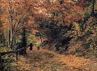 | ||
| leaf_type | broadleaved / needleleaved / mixed / leafless | Describes the type of leaves |  | ||
| location | underground / overground / underwater / roof / indoor | Location | | ||
| narrow | yes | Relative indication that a way (waterway, highway, cycleway) gets narrower. | 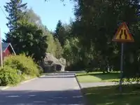 | ||
| nudism | yes / obligatory / designated / no / customary / permissive | Indicates if the described object provides the possibility of nudism | 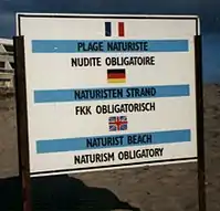 | ||
| opening_hours | 24/7 or mo md hh:mm-hh:mm. (read described syntax) | Åbningstider for butikker og lignende. |  | ||
| opening_hours:drive_through | 24/7 or mo md hh:mm-hh:mm. (read described syntax) | opening_hours describes when something is open for drive-through services. | |||
| operator | User Defined | Operatør, angiver firma, organisation eller lignende, som bestyrer objektet. Dette er ikke nødvendigvis objektets ejer. Se også brand=*. | |||
| power_supply | yes / no | Describes whether a power supply is available | |||
| produce | User Defined | Describes a feature's agricultural output produced though a natural process of growing or breeding. |  | ||
| rental | see key's page | Tagged on shops and other features to denote if they rent something or not and what they rent. | |||
| sauna | yes / no | Describes whether a sauna is available |  | ||
| service_times | see opening_hours | Times of service of a given feature e.g. church service | _Service_times_2012.jpg.webp) | ||
| shower | yes / no | Describes whether a shower is available | 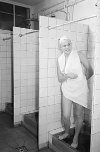 | ||
| start_date | Date | Startdato, tidspunkt hvor objektet begyndte at eksistere, f.eks. konstruktionsår for en bygning. |  | ||
| tactile_paving | yes /no | Indicate if a specific place can be detected or followed with a blindman's stick. | | ||
| tidal | yes | Area is flooded by the tide | 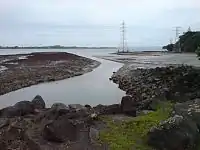 | ||
| toilets | yes / no | Describes whether a toilets is available | |||
| topless | yes / no | Indicates if the described object provides the possibility of female topless practice |  | ||
| tunnel | yes | Tunnel. Husk layer=*. | 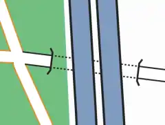 |
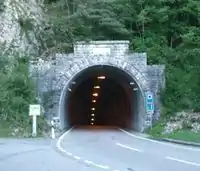 | |
| toilets:wheelchair | yes / no | States if a location has a wheelchair accessible toilet or not. |  | ||
| wheelchair | yes / no / limited | Angiver om stedet er tilgængeligt for kørestolsbrugere. |  | ||
| width | Number | Bredde i meter, f.eks. af vej eller vandløb. | | ||
| Skovtype. Nåleskov=coniferous, løvskov=deciduous, blandskov=mixed. |  |
Restriktioner
This is used to define restrictions that apply to the associated element. See the page titled Restrictions for an introduction on its usage.
| Key | Value | Element | Comment | Rendering | Photo | |
|---|---|---|---|---|---|---|
| Vehicle types | ||||||
| access | agricultural / delivery / designated / destination / forestry / no / official / permissive / private / yes | General access permission.
|
||||
| agricultural | yes / no | Access permission for agricultural vehicles, e.g. tractors. | ||||
| atv | For values see access above | Access restricted to wheeled vehicles 1.27m (50 inches) or less in width, for example |
||||
| bdouble | For values see access above | Access permission for |
||||
| bicycle | For values see access above + dismount | Access permission for bicycles. Usage of bicycle=dismount and bicycle=no will vary in different countries. If according to local traffic rules a bicycle is no longer seen as a bicycle when there's no one driving it, then there's no need for using bicycle=dismount. If the local legislation still sees an undriven bicycle as a bicycle then you may need to use both bicycle=dismount and bicycle=no. | ||||
| boat | For values see access above | Access permission for small boats and pleasure crafts, including yachts | ||||
| electric_bicycle | For values see access above | Access permission for electric bicycles (mostly defined as having a maximum speed of 25 km/h) | ||||
| emergency | yes | Access permission for emergency motor vehicles; e.g., ambulance, fire truck, police car |  | |||
| foot | For values see access above | Access permission for pedestrians. | ||||
| forestry | yes / no | Access permission for forestry vehicles, e.g. tractors. | ||||
| golf_cart | For values see access above | Access permission for golf carts and similar small, low-speed electric vehicles | ||||
| goods | For values see access above | Access permission for |
||||
| hazmat | For values see access above | Access permission for vehicles carrying hazardous materials. |  | |||
| hgv | For values see access above | Access permission for |
||||
| horse | For values see access above | Access permission for horse riders. | ||||
| inline_skates | yes / no | Access permission for |
||||
| lhv | For values see access above | Access permission for |
||||
| mofa | For values see access above | Access permission for |
||||
| moped | For values see access above | Access permission for |
||||
| motorboat | For values see access above | Access permission boats and yachts using motor | ||||
| motorcar | For values see access above | Access permission for (motor) cars | ||||
| motorcycle | For values see access above | Access permission for motorcycles | ||||
| motor_vehicle | For values see access above | Access permission for any motorized vehicle |  | |||
| psv | For values see access above | Access permission for Public Service Vehicles (UK), e.g. buses and coaches | ||||
| roadtrain | For values see access above | Access permission for |
 | |||
| ski | For values see access above | Access permission for |
||||
| speed_pedelec | For values see access above | Access permission for electric bicycles (mostly defined as having a maximum speed of 45 km/h) | ||||
| tank | For values see access above | Access permission for (military) tanks | ||||
| vehicle | For values see access above | Access permission for all vehicles | ||||
| 4wd_only | yes | A road signed as only suitable for 4WD (offroad) vehicles | ||||
| Other | ||||||
| charge | Number | Amount of toll or fee. See toll=* as well | ||||
| female | yes | Female-only or gender segregated (with male=yes) feature | ||||
| male | yes | Male-only or gender segregated (with female=yes) feature | ||||
| max_age | age | The legal maximum age | ||||
| maxaxleload | Weight | The legal maximum axleload – units other than tonnes should be explicit | ||||
| maxheight | Height | Height limit – units other than metres should be explicit | ||||
| maxlength | Length | Length limit – units other than metres should be explicit | ||||
| maxspeed | Speed | Maximum speed – units other than km/h should be explicit | ||||
| maxstay | Number | Maximum stay, in units given (hour/hours/day/days) | ||||
| maxweight | Weight | Weight limit – units other than tonnes should be explicit | ||||
| maxwidth | Width | Width limit – units other than metres should be explicit | ||||
| min_age | age | The legal minimum age | ||||
| minspeed | Speed | Minimum speed – units other than km/h should be explicit | ||||
| noexit | yes | Vejen ender blindt her (også for fodgængere og cyklister). Tagget bruges især til at markere, at enden af vejen ikke er forbundet til en anden nærliggende vej. | ||||
| oneway | yes / no / -1 | oneway=yes for traffic direction same as the sequence of nodes of the way. oneway=no for bidirectional traffic. oneway=-1 for traffic direction opposite to the sequence of nodes of the way (if the way cannot be reversed). Some road types are assumed to be one-way (e.g. highway=motorway), others are assumed to be two-way (most others). |
||||
| Relation:restriction | Used for a set of tags and members to represent a turn restriction. | |||||
| toll | yes | Toll or fee must be paid to access way. See also barrier=toll_booth | ||||
| traffic_sign | city_limit | Bygrænse. Byzone starter/ender her. | ||||
| unisex | yes | Unisex feature | ||||
This table is a wiki template with a default description in English. Editable here.
Navngivning
Navn
The name=* tag is the primary tag used for mapping the name of an element. See the page titled Names for an introduction on its usage.
| Key | Value | Element | Comment |
|---|---|---|---|
| name | User defined | Navn, det fælles brugte, standard navn. For navne i tosprogede områder se Bilingual street names | |
| name:<lg> | User defined | Navnet på et andet sprog, for eksempel name:en=Copenhagen. Se Multilingual names. | |
| name:left , name:right | User defined | Used when a way has different names for different sides (e.g., a street that's forming the boundary between two municipalities). | |
| int_name[:<lg>] | User defined | Internationalt navn | |
| loc_name[:<lg>] | User defined | Lokalt navn | |
| nat_name[:<lg>] | User defined | Nationalt navn | |
| official_name[:<lg>] | User defined | Officielt navn. Anvendes hvor landets eller byens officielle navn afviger fra det normalt anvendte navn. For eksempel official_name=Freie und Hansestadt Hamburg for byen name=Hamburg. | |
| old_name[:<lg>] | User defined | Historisk navn | |
| reg_name[:<lg>] | User defined | Regionalt navn | |
| short_name[:<lg>] | User defined | Forkortet navn, nyttig for søgninger (understøttes af Nominatim). For eksempel short_name=Ndr Ringvej for name=Nordre Ringvej. | |
| sorting_name[:<lg>] | User defined | Form af navnet som hjælper til korrekt sortering i navnelister. Det kan bruges til at udelade artikler (Den/Det/The etc) eller andre dele af navnet, der ikke skal sorteres efter, for eksempel det typiske Rue i franske vejnavne. | |
| alt_name[:<lg>] | User defined | Alternativt navn, som også anvendes for dette objekt. | |
| Do not use this tag, suffixed name tagging for multiple values is deprecated. |
This table is a wiki template with a default description in English. Editable here.
Referencer
Referencer anvendes primært til vejnumre og rutenumre, men kan også tilføjes andre objekter med et nummer såsom højspændingsmaster.
| Key | Value | Element | Comment | Rendering | Photo |
|---|---|---|---|---|---|
| iata | User Defined | IATA International airport codes | |||
| icao | User Defined | ICAO International airport codes | |||
| int_ref | User Defined | International reference (eg E 30) | |||
| lcn_ref | User Defined | The number of the local cycle network | 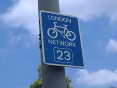 | ||
| loc_ref | User Defined | Local reference | |||
| nat_ref | User Defined | National reference | |||
| ncn_ref | User Defined | The number reference (eg 54) of a National Cycle Network route. In the UK, national routes have single-or double-digit numbers with a red background on the signs. |  | ||
| old_ref | User Defined | Historical reference | |||
| rcn_ref | User Defined | The number of the regional cycle network. In the UK the regional routes have double-digit numbers with a blue background on the signs. |  (Sign showing both national and regional spur). | ||
| ref | User Defined | The common default reference (eg M25, in Germany always with space eg A 5) | |||
| reg_ref | User Defined | Regional reference | |||
| source_ref | User Defined | To record the URI, source reference (eg Landsat) or other link to physical sources. |
This table is a wiki template with a default description in English. Editable here.
Template:Da:Map Features:place Template:Da:Map Features:addr
Andet
Template:Da:Map Features:annotation
- ↑ Does not include uses in semi-colon value separated lists