Cameroon Import
| Description | Osm Import of geographic data in Cameroon |
|---|---|
| Author | EUROSHA PROJECT |
| Source | Institut National de Cartographie de Yaoundé |
| Date | 13 Mars 2013 |
| Permission | ODbL 1.0 / DbCL 1.0 / CC-BY-SA 2.0 |
This wiki page documents what data related to the Cameroon has been or is being imported into OpenStreetMap. This is part of WikiProject Cameroon.
Guidelines for Cameroon data import
- The new talk-cm list is now active! Subscribe!! http://lists.openstreetmap.org/listinfo/talk-cf
- Planned imports will be announced to the talk-cm list.
- Local community-consensus should be made before imports.
Goals
Enrich and extend the disposable OSM data in Cameroun under the rules of the Open-Source
Proposal for import:
- Only data from contributors who gave explicit consent will be imported.
- Data review and assessment. Check for data integrity (copyright issues, etc.).
- Data received
Import Project n°1
The National Institute of Cartography of Yaounde signed a permission to integrate its data to Openstreetmap. The data collected consist of a vector file of the boundaries of the departments of the North and Far North of Cameroon and raster files of the two regions.
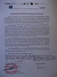
Authorization of the use and sharing of data
Process
- Rectify the maps in QGIS or georeference them in JOSM
Data Quality
The data collected is of excellent quality overall but it is not ready-to-use.
Background
- Main page: WikiProject Cameroon
- Data license: ODbL 1.0 / DbCL 1.0
- Type of license : CC-BY-SA 2.0 - no longer suitable for OSM, but:
- Link to permission : see Potential Datasources#Cameroon and Import/Catalogue
- OSM attribution : Contributors#INC
Importers
Eurosha Project Cameroon:
- Main Page: WikiProject Cameroon
Willy Franck SOB:
This article is issued from Openstreetmap. The text is licensed under Creative Commons - Attribution - Sharealike. Additional terms may apply for the media files.