Buckinghamshire
| V・T・E |
| latitude: 51.87889582285027, longitude: -0.8301775190663071 |
| Browse map of Buckinghamshire 51°52′44.02″ N, 0°49′48.64″ W |
| Edit map |
|
External links:
|
| Use this template for your city |
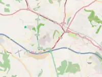
Buckinghamshire is a county in South East England at latitude 51°52′44.02″ North, longitude 0°49′48.64″ West.
The ceremonial county of Buckinghamshire 87460![]() 87460, in the South East region of England is made up of the non-metropolitan county of Buckinghamshire together with the unitary authority of Milton Keynes. The ceremonial county of Buckinghamshire borders with Greater London, Berkshire, Oxfordshire, Northamptonshire, Bedfordshire and Hertfordshire.
87460, in the South East region of England is made up of the non-metropolitan county of Buckinghamshire together with the unitary authority of Milton Keynes. The ceremonial county of Buckinghamshire borders with Greater London, Berkshire, Oxfordshire, Northamptonshire, Bedfordshire and Hertfordshire.
Community Boards
The unitary authority of Buckinghamshire 10947197![]() 10947197 is divided into 16 Community boards:
10947197 is divided into 16 Community boards:
- Amersham & Villages Community Board 15648076
 15648076
 - Aylesbury Community Board
- Beaconsfield & Chepping Wye Community Board 15648079 15648079
- Beeches Community Board 15648080 15648080
- Buckingham & Villages Community Board
- Chesham & Villages Community Board 15648077 15648077
- Denham, Gerrards Cross & The Chalfonts Community Board 15648078 15648078
- Haddenham & Waddesdon Community Board
- High Wycombe Community Board 15648083 15648083
- Missendens Community Board 15648082 15648082
- North West Chilterns Community Board
- South West Chilterns Community Board
- Wendover and Villages Community Board
- Wexham & The Ivers Community Board 15648081 15648081
- Wing & Ivinghoe Community Board
- Winslow & Villages Community Board
Towns in Buckinghamshire
This is a list of the twelve largest settlements, in alphabetical order, within the ceremonial county of Buckinghamshire.
Taken from the Wikipedia article: Buckinghamshire - Settlements.
Roads in Buckinghamshire
| %age roads complete | |||||
|---|---|---|---|---|---|
| Postal Area | Town Name | Tracks | Mapped | Labelled | Notes |
| Roads between towns and villages | 0% | 0% | 0% | ||
| Amersham | 0% | 0% | 0% | ||
| Aylesbury | 0% | 0% | 0% | ||
| Beaconsfield | 0% | 0% | 0% | ||
| Bletchley | 0% | 0% | 0% | ||
| Buckingham | 0% | 0% | 0% | ||
| Chesham | 0% | 0% | 0% | ||
| Great Missenden | 0% | 0% | 0% | ||
 | High Wycombe | 30% | 30% | 30% |
Booker, Cressex and Castlefield areas done. |
| Marlow | 0% | 0% | 0% | ||
| Milton Keynes | 0% | 0% | 0% | ||
| Newport Pagnell | 0% | 0% | 0% | ||
| Olney | 0% | 0% | 0% | ||
| Princes Risborough | 0% | 0% | 0% | ||
| Wendover | 0% | 0% | 0% | ||
| Winslow | 0% | 0% | 0% | ||