Ar:Map Features
تمثل خريطة الشارع الحرة المعالم المادية على الأرض (مثل الطرق أو المباني) باستخدام الوسوم المرفقة بتراكيب بياناتها الأساسية (العُقَد و الطُرُق والعَلاقات). تصف كل واصفة سمة جغرافية للمَعْلَم المعروض بواسطة تلك العقدة أو الطريق أو العلاقة المحددة.
يسمح وضع نظام الواصفات الحرة في خريطة الشارع الحرة للخريطة أن تشمل عددا غير محدود من الصفات التي تصف كل مَعْلَم. ويوافق المجتمع على مجموعات أساسية وقيمة معينة للواصفات الأكثر استخداما، التي تعمل كمعايير غير رسمية. ومع ذلك، يمكن للمستخدمين إنشاء واصفات جديدة لتحسين نمط الخريطة أو لدعم التحليلات التي تعتمد على خصائص غير محددة سابقا للمعالم. يمكن العثور على وصف مختصر للواصفات التي تتعلق بمواضيع أو تفاصيل معينة باستخدام .
يمكن وصف معظم الميزات باستخدام عدد قليل فقط من الواصفات، مثل مسار يحتوي على واصفة تصنيف مثل طريق = طريق مشاة ، وربما أيضا اسما باستخدام اسم = *. ولكن، لأن هذا لجميع أنحاء العالم، خريطة شاملة، يمكن أن يكون هناك الكثير من أنواع المعالم المختلفة في خريطة الشارع الحرة، وتقريبا كل منها موصوفة بالواصفات.
للحصول على تفاصيل أخرى حول المزيد من الواصفات والتعديلات المقترحة على الواصفات الحالية، يمكنك الاطلاع على المعالم المُقْتَرَحَة و المعالم المتروكة والمعالم المرفوضة. إذا كنت لا تجد علامة مناسبة في هذه القائمة لا تتردد في إضافتها في ومعالم للنظر فيها وإعطائها قيمة مناسبة. مع مرور الوقت، قد تجد أن اسم العلامة تم تعديله ليتناسب مع الإجماع عليه من المستخدمين . وقد تم استخدام العديد من العلامات الجيدة بعد توثيقها لاحقا.
معالم أساسية
خط مُعَلَّق
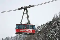
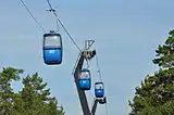
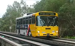
aerialway
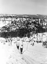
يستخدم هذا في تمييز أشكال النقل المختلفة للأشخاص أو البضائع باستخدام الأسلاك الهوائية. على سبيل المثال ، قد تشمل هذه التلفريك ، والمصاعد المعلقة والكراسي المعلقة. انظر الصفحة خَط_مُعَلَّق للحصول على مزيد من المعلومات حول استخدام هذه الواصفات.
| المفتاح | القيمة | العنصر | معلومات توضيحية | رسمه خرائطيا | صورة توضيحية |
|---|---|---|---|---|---|
| أنواع الخط المعلق | |||||
| aerialway خط مُعَلَّق |
cable_car |  |
 | ||
| aerialway | gondola | |
 | ||
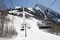
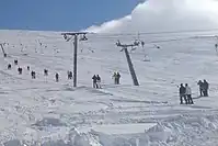
| aerialway | chair_lift |  |
 | ||
| aerialway | mixed_lift | 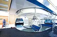 | |||
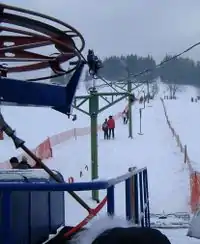
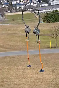
| aerialway | drag_lift | هذا يعني تلقائيًا oneway=yes (drawn upward). |
|
 | |
| aerialway | t-bar | This automatically implies oneway=yes (drawn upward). |
|
 | |
| aerialway | j-bar | This automatically implies oneway=yes (drawn upward). |
|
 | |
| aerialway | platter | This automatically implies oneway=yes (drawn upward). |
|
 | |
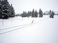
| aerialway | rope_tow | This automatically implies oneway=yes (drawn upward). |
|
 | |
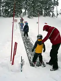
| aerialway | magic_carpet | This automatically implies oneway=yes (drawn upward). |
 | ||
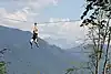
| aerialway | zip_line | This automatically implies oneway=yes (drawn downward). |
|
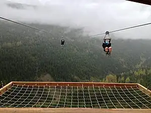 | |
| Equipments | |||||
| aerialway | pylon | 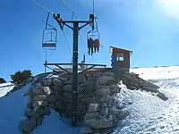 | |||
| aerialway | station | A station, where passengers can enter and/or leave the aerialway. | <map lat='47.02085' lon='8.7032' z='17' w='100' h='100' format='jpeg' layer='mapnik' /> | 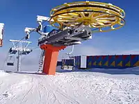 | |
| Others | |||||
| aerialway | canopy | Obsolete, please use aerialway=zip_line instead. This automatically implies oneway=yes (drawn downward). |
 | ||
| aerialway | goods | Controversial, consider other aerialway=* values in combination with foot=no and/or a usage=* key instead of this. |  |
 | |
| aerialway | user defined | All commonly used values according to Taginfo | |||
This table is a wiki template with a default description in English. Editable here.
Aeroway
| المفتاح | القيمة | العنصر | وصف | رسم / تصوير إيضاحي | صورة |
|---|---|---|---|---|---|
| aeroway | aerodrome | مطار مدني. |  | ||
| aeroway | airstrip | A field or area where light aircraft can land and take off from. |  | ||
| aeroway | apron | موقف أو مأوى للطائرات. |  |
 | |
| aeroway | control_center |  | |||
| aeroway | fuel | Fuelling station for aircraft. | .jpg.webp) | ||
| aeroway | gate |  |
 | ||
| aeroway | hangar | 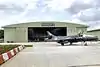 | |||
| aeroway | helipad | منصة مروحيات. | 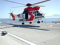 | ||
| aeroway | heliport |  | |||
| aeroway | holding_position | A point behind which aircraft are considered clear of a crossing way | 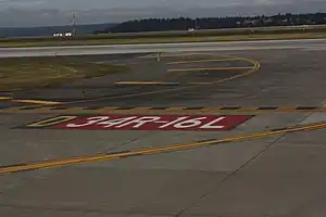 | ||
| aeroway | jet_bridge | Passenger boarding bridge | 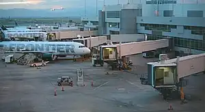 | ||
| aeroway | navigationaid | A facility that supports visual navigation for aircraft | 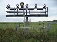 | ||
| airmark | beacon | 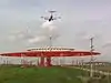 | |||
| aeroway | parking_position | A location where an aeroplane can park | 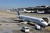 | ||
| aeroway | runway | مهبط طائرات. |  |
.jpg.webp) | |
| aeroway | taxilane | Taxilane is a path in an airport that is part of the aircraft parking area or apron (Proposed feature with low usage as of 2015-10; use with an eye towards the question correct usage). | |||
| aeroway | taxiway | مدرج لمناورات الطائرات. |  |
 | |
| aeroway | terminal | محطة ركاب في مطار مدني. |  |
 | |
| aeroway | tower | See also aeroway=control_tower or combination of man_made=tower + service=aircraft_control for similar schemes. |
 | ||
| aeroway | windsock |  | |||
| aeroway | highway_strip | 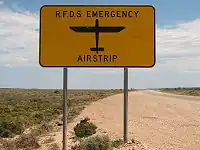 | |||
| aeroway | User defined | أنظر Taginfo لترى المزيد من القيمات المستعملة. |
This table is a wiki template with a default description in English. Editable here.
Amenity
| المفتاح | القيمة | العنصر | وصف | رسم / تصوير إيضاحي | صورة | |
|---|---|---|---|---|---|---|
Sustenance | ||||||
| amenity | bar | Bar is a purpose-built commercial establishment that sells alcoholic drinks to be consumed on the premises. They are characterised by a noisy and vibrant atmosphere, similar to a party and usually don't sell food. See also the description of the tags amenity=pub;bar;restaurant for a distinction between these. | 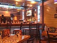 | |||
| amenity | biergarten | حديقة لشرب الجعة نجدها عادة في ألمانيا. | 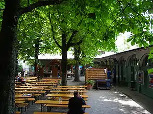 | |||
| amenity | cafe | مقهى. | 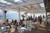 | |||
| amenity | fast_food | مطعم أكلة سريعة. | 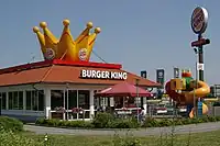 | |||
| amenity | food_court | An area with several different restaurant food counters and a shared eating area. Commonly found in malls, airports, etc. | 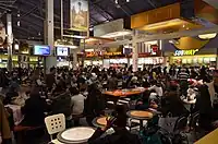 | |||
| amenity | ice_cream | Ice cream shop or ice cream parlour. A place that sells ice cream and frozen yoghurt over the counter | .jpg.webp) | |||
| amenity | pub | حانة. | 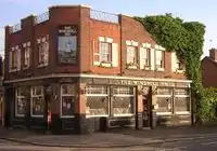 | |||
| amenity | restaurant | مطعم لغير الأكلة السريعة. |  | |||
Education | ||||||
| amenity | college | كلية. |  | |||
| amenity | driving_school | Driving School which offers motor vehicle driving lessons | 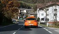 | |||
| amenity | kindergarten | For children too young for a regular school (also known as preschool, playschool or nursery school), in some countries including afternoon supervision of primary school children. |  | |||
| amenity | language_school | Language School: an educational institution where one studies a foreign language. |  | |||
| amenity | library | مكتبة عمومية. |  | |||
| amenity | toy_library | A place to borrow games and toys, or play with them on site. |  | |||
| amenity | research_institute | An establishment endowed for doing research. |  | |||
| amenity | training | Public place where you can get training. | | |||
| amenity | music_school | A music school, an educational institution specialized in the study, training, and research of music. | ._(9196267787).jpg.webp) | |||
| amenity | school | مدرسة. |  | |||
| amenity | traffic_park | Juvenile traffic schools |  | |||
| amenity | university | جامعة. |  | |||
Transportation | ||||||
| amenity | bicycle_parking | ساحة وقوف للدراجات. |  | |||
| amenity | bicycle_repair_station | General tools for self-service bicycle repairs, usually on the roadside; no service |  | |||
| amenity | bicycle_rental | تأجير دراجات | .jpg.webp) | |||
| amenity | boat_rental | Rent a Boat |  | |||
| amenity | boat_sharing | Share a Boat |  | |||
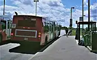
| amenity | bus_station | محطة كبيرة للحافلات. |  | |||
| amenity | car_rental | تأجير السيارات | ||||
| amenity | car_sharing | Share a car | 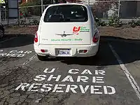 | |||
| amenity | car_wash | غسيل سيارات |  | |||
| amenity | compressed_air | A device to inflate tires/tyres (e.g. motorcar, bicycle) | 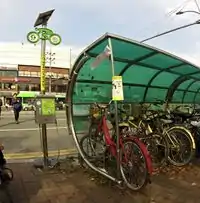 | |||
| amenity | vehicle_inspection | Government vehicle inspection |  | |||
| amenity | charging_station | Charging facility for electric vehicles |  | |||
| amenity | driver_training | A place for driving training on a closed course |  | |||
| amenity | ferry_terminal | Ferry terminal/stop. A place where people/cars/etc. can board and leave a ferry. |  | |||
| amenity | fuel | محطة تزويد بالوقود. |  | |||
| amenity | grit_bin | A container that holds grit or a mixture of salt and grit. |  | |||
| amenity | motorcycle_parking | Parking for motorcycles |  | |||
| amenity | parking | ساحة وقوف للسيارات. |  | |||
| amenity | parking_entrance | An entrance or exit to an underground or multi-storey parking facility. Group multiple parking entrances together with a relation using the tags type=site and site=parking. Do not mix with amenity=parking. | Underground |
 | ||
| amenity | parking_space | A single parking space. Group multiple parking spaces together with a relation using the tags type=site and site=parking. Do not mix with amenity=parking. |  |
.JPG.webp) | ||
| amenity | taxi | A place where taxis wait for passengers. | 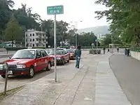 | |||
Financial | ||||||
| amenity | atm | صراف آلي. | 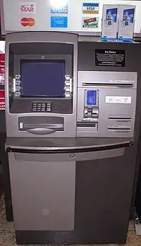 | |||
| amenity | bank | بنك أو مصرف. |  | |||
| amenity | bureau_de_change | Bureau de change, money changer, currency exchange, Wechsel, cambio – a place to change foreign bank notes and travellers cheques. |  | |||
Healthcare | ||||||
| amenity | baby_hatch | A place where a baby can be, out of necessity, anonymously left to be safely cared for and perhaps adopted. | 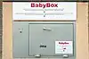 | |||
| amenity | clinic | A medium-sized medical facility or health centre. |  | |||
| amenity | dentist | عيادة طبيب أسنان |  | |||
| amenity | doctors | عيادة طبيب |  | |||
| amenity | hospital | مستشفى. |  | |||
| amenity | nursing_home | Discouraged tag for a home for disabled or elderly persons who need permanent care. Use amenity=social_facility + social_facility=nursing_home now. |  | |||
| amenity | pharmacy | صيدلية. |  | |||
| amenity | social_facility | A facility that provides social services: group & nursing homes, workshops for the disabled, homeless shelters, etc. |  | |||
| amenity | veterinary | عيادة بيطرية |  | |||
Entertainment, Arts & Culture | ||||||
| amenity | arts_centre | مركز للفنون. |  | |||
| amenity | brothel | بيت دعارة |  | |||
| amenity | casino | A gambling venue with at least one table game(e.g. roulette, blackjack) that takes bets on sporting and other events at agreed upon odds. |  | |||
| amenity | cinema | سينما. |  | |||
| amenity | community_centre | A place mostly used for local events, festivities and group activities; including special interest and special age groups. . |  | |||
| amenity | conference_centre | A large building that is used to hold a convention |  | |||
| amenity | events_venue | A building specifically used for organising events |  | |||
| amenity | exhibition_centre | An exhibition centre | ||||
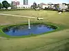
| amenity | fountain | نافورة | 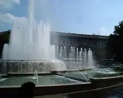 | |||
| amenity | gambling | A place for gambling, not being a shop=bookmaker, shop=lottery, amenity=casino, or leisure=adult_gaming_centre.
Games that are covered by this definition include bingo and pachinko. |
 | |||
| amenity | love_hotel | A love hotel is a type of short-stay hotel operated primarily for the purpose of allowing guests privacy for sexual activities. |  | |||
| amenity | music_venue | An indoor place to hear contemporary live music. |  | |||
| amenity | nightclub | ملهى ليلي |  | |||
| amenity | planetarium | A planetarium. |  | |||
| amenity | public_bookcase | A street furniture containing books. Take one or leave one. | 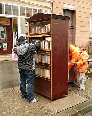 | |||
| amenity | social_centre | A place for free and not-for-profit activities. |  | |||
| amenity | stripclub | A place that offers striptease or lapdancing (for sexual services use amenity=brothel). |  | |||
| amenity | studio | TV radio or recording studio |  | |||
| amenity | swingerclub | A club where people meet to have a party and group sex. |  | |||
| amenity | theatre | مسرح. |  | |||
Public Service | ||||||
| amenity | courthouse | محكمة أو قصر عدالة. |  | |||
| amenity | fire_station | A station of a fire brigade |  | |||
| amenity | police | A police station where police officers patrol from and that is a first point of contact for civilians |  | |||
| amenity | post_box | صندوق بريد عمومي. | 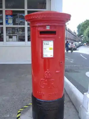 | |||
| amenity | post_depot | Post depot or delivery office, where letters and parcels are collected and sorted prior to delivery. |  | |||
| amenity | post_office | مكتب بريد. |  | |||
| amenity | prison | سجن. |  | |||
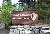
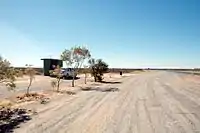
| amenity | ranger_station | National Park visitor headquarters: official park visitor facility with police, visitor information, permit services, etc |  | |||
| amenity | townhall | مركز إداري لمدينة. |  | |||
Facilities | ||||||
| amenity | bbq | BBQ or Barbecue is a permanently built grill for cooking food, which is most typically used outdoors by the public. For example these may be found in city parks or at beaches. Use the tag fuel=* to specify the source of heating, such as fuel=wood;electric;charcoal. For mapping nearby table and chairs, see also the tag tourism=picnic_site. For mapping campfires and firepits, instead use the tag leisure=firepit. | 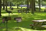 | |||
| amenity | bench | A bench to sit down and relax a bit | 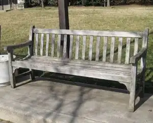 | |||
| amenity | dog_toilet | Area designated for dogs to urinate and excrete. |  | |||
| amenity | dressing_room | Area designated for changing clothes. |  | |||
| amenity | drinking_water | Drinking water is a place where humans can obtain potable water for consumption. Typically, the water is used for only drinking. Also known as a drinking fountain or bubbler. | 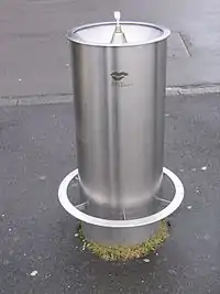 | |||
| amenity | give_box | A small facility where people drop off and pick up various types of items in the sense of free sharing and reuse. | 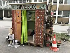 | |||
| amenity | mailroom | A mailroom for receiving packages or letters. |  | |||
| amenity | parcel_locker | Machine for picking up and sending parcels | 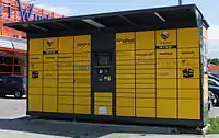 | |||
| amenity | shelter | A small shelter against bad weather conditions. To additionally describe the kind of shelter use shelter_type=*. |  | |||
| amenity | shower | Public shower. |  | |||
| amenity | telephone | هاتف عمومي. |  | |||
| amenity | toilets | غرفة إستراحة عمومية مجانية أو غير مجانية. |  | |||
| amenity | water_point | Place where you can get large amounts of drinking water |  | |||
| amenity | watering_place | Place where water is contained and animals can drink |  | |||
Waste Management | ||||||
| amenity | sanitary_dump_station | A place for depositing human waste from a toilet holding tank. | | |||
| amenity | recycling | مرافق إعادة التصنيع. |  | |||
| amenity | waste_basket | A single small container for depositing garbage that is easily accessible for pedestrians. |  | |||
| amenity | waste_disposal | A medium or large disposal bin, typically for bagged up household or industrial waste. | 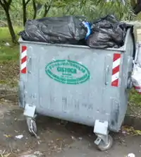 | |||
| amenity | waste_transfer_station | A waste transfer station is a location that accepts, consolidates and transfers waste in bulk. | ||||
Others | ||||||
| amenity | animal_boarding | A facility where you, paying a fee, can bring your animal for a limited period of time (e.g. for holidays) |  | |||
| amenity | animal_breeding | A facility where animals are bred, usually to sell them | 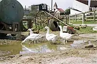 | |||
| amenity | animal_shelter | A shelter that recovers animals in trouble |  | |||
| amenity | animal_training | A facility used for non-competitive animal training | .jpg.webp) | |||
| amenity | baking_oven | An oven used for baking bread and similar, for example inside a building=bakehouse. | 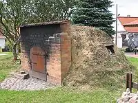 | |||
| amenity | childcare | A place where children of different ages are looked after which is not an amenity=kindergarten or preschool. |  | |||
| amenity | clock | A public visible clock | .jpg.webp) | |||
| amenity | crematorium | A place where dead human bodies are burnt |  | |||
| amenity | dive_centre | A dive center is the base location where sports divers usually start scuba diving or make dive guided trips at new locations. | 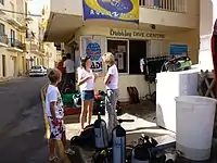 | |||
| amenity | funeral_hall | A place for holding a funeral ceremony, other than a place of worship. |  | |||
| amenity | grave_yard | مقبرة صغيرة، و إن كانت كبيرة إذا يفضل إستعمال landuse=cemetery. |  |

| ||
| amenity | hunting_stand | A hunting stand: an open or enclosed platform used by hunters to place themselves at an elevated height above the terrain | 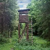 | |||
| amenity | internet_cafe | A place whose principal role is providing internet services to the public. |  | |||
| amenity | kitchen | A public kitchen in a facility to use by everyone or customers | 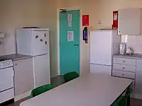 | |||
| amenity | kneipp_water_cure | Outdoor foot bath facility. Usually this is a pool with cold water and handrail. Popular in German speaking countries. | 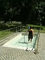 | |||
| amenity | lounger | An object for people to lie down. | .jpg.webp) | |||
| amenity | marketplace | A marketplace where goods and services are traded daily or weekly. | 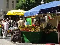 | |||
| amenity | monastery | Monastery is the location of a monastery or a building in which monks and nuns live. |  | |||
| amenity | photo_booth | A stand to create instant photos. |  | |||
| amenity | place_of_mourning | A room or building where families and friends can come, before the funeral, and view the body of the person who has died. |  | |||
| amenity | place_of_worship | مكان عبادة : جامع، كنيسة أو معبد و من الأفضل إضافة religion=something. |  | |||
| amenity | public_bath | A location where the public may bathe in common, etc. japanese onsen, turkish bath, hot spring | .JPG.webp) | |||
| A generic public building. Don't use! See office=government. | ||||||
| amenity | refugee_site | A human settlement sheltering refugees or internally displaced persons |  | |||
| amenity | vending_machine | A machine selling goods – food, tickets, newspapers, etc. Add type of goods using vending=* |  | |||
| amenity | user defined | أنظر Taginfo لترى المزيد من القيمات المستعملة. | ||||
This table is a wiki template with a default description in English. Editable here.
حواجز
| المفتاح | القيمة | العنصر | وصف | رسم / تصوير إيضاحي | صورة | |
|---|---|---|---|---|---|---|
Linear barriers (e.g. along a path or road) | ||||||
| barrier | cable_barrier | Also called guard cable. This is a road side or median barrier made of steel wire ropes mounted on weak posts. See also the more extensive wikipedia description. |  | |||
| barrier | city_wall | A fortification used to defend a city or settlement from potential aggressors.
From ancient to modern times, they are used to enclose settlements.
See also historic=city_gate, historic=citywalls and defensive_works=*. |
 |
 | ||
| barrier | ditch | خندق, usually with a stream at the bottom, that is not easily crossed, especially if not on foot. Can be used in combination with waterway=stream or waterway=drain |  |
 | ||
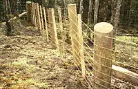
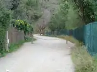
| barrier | fence | سياج | |
 | ||
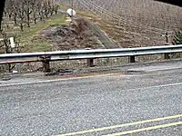
| barrier | guard_rail | A guard_rail, also called a crash barrier. Right side is inner, left side is outer. | |
 | ||
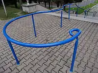
| barrier | handrail | Is designed to be grasped by the hand so as to provide stability or support. | |
 | ||
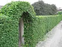
| barrier | hedge | سياج من نباتات |  |
 | ||
| barrier | retaining_wall | Retaining walls serve to retain the lateral pressure of soil. Right side is bottom, left side is top. | |
 | ||
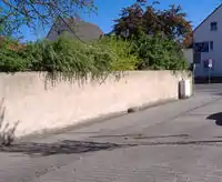
| barrier | wall | سور | |
 | ||
Access control on highways (e.g. for blocking a path or road) | ||||||
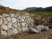
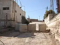
| barrier | block | A large, solid, immobile block that can be moved only with heavy machinery or great effort.
Typically big solid things made of concrete for stopping larger vehicles. Sometimes natural boulders are used for the same purpose. |
 | |||
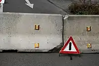
| barrier | bollard | One or more solid (usually concrete or metal) pillar(s) used to control traffic. | 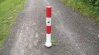 | |||
| barrier | border_control | This is a control point at an international border between two countries. Passports or other forms of ID will be checked. |  | |||
| barrier | bump_gate | For description see wikipedia:Bump gate, for another photo see flickr example: . |  | |||
| barrier | bus_trap | See wikipedia:Bus trap. |  | |||
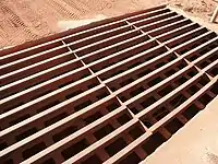
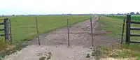
| barrier | cattle_grid | Bars in the road surface that allow wheeled vehicles but not animals to cross.
Sometimes known as a Texas Gate, even outside of Texas. |
 | |||
| barrier | coupure | A cut through a flood protection feature (e.g., (flood)wall, levee, or dyke) for a road or railway, that is readily made flood tight if required. |  | |||
| barrier | cycle_barrier | Barriers to bicycle traffic, most typically a pair of staggered steel bars perpendicular to the way itself whose gaps allow pedestrians to pass. Cyclists may pass, but only at very reduced speed. May be installed ahead of a hazard, such as a road or rail crossing. |  | |||
| barrier | debris | A road is blocked by debris with or without ground. This might be for short or long time. Often used as first step in blocking an abandoned road. |  | |||
| barrier | entrance | A gap in a linear barrier with nothing that limits passing through.
access=yes is implied. The limitations are the same of the way that crosses it, if there is such. |
 | |||
| barrier | full-height_turnstile | A full-height turnstile, also called HEET-turnstile (high entrance/exit turnstile), like the ones to access security areas. Note the mix of hyphen and underscore. | 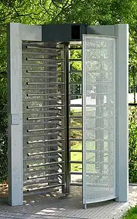 | |||
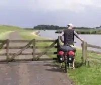
| barrier | gate | An entrance that can be opened or closed to get through the barrier. For a permanent opening in the barrier, see barrier=entrance.
Combine with access=* where appropriate. |
 | |||
| barrier | hampshire_gate | A section of wire fence which can be removed temporarily.
Combine with access=* where appropriate. |
 | |||
| barrier | height_restrictor | Combine with maxheight=*. | 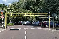 | |||
| barrier | horse_stile | A horse stile allows pedestrians and horses to cross a gap through a fence, but prevents or makes it very difficult for motorcycles and live stock to cross. | 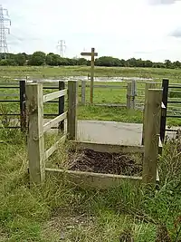 | |||
| barrier | kent_carriage_gap | A Kent carriage gap is used by local authorities in the UK to prevent motorised vehicles from accessing public rights of way whilst allowing most horse drawn carriages to pass.
These are now becoming common on byways in the UK |
||||
| barrier | kissing_gate | A gate which allows people to cross, but not livestock. | 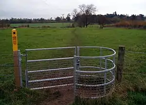 | |||
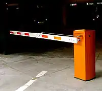
| barrier | lift_gate | A lift gate (boom barrier) is a bar, or pole pivoted in such a way as to allow the boom to block vehicular access through a controlled point.
Combine with access=* where appropriate. |
 | |||
| barrier | motorcycle_barrier | Barriers along paths that prevent access by motorcycles. | 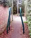 | |||
| barrier | planter | A plant box, or simply a planter, is a structure containing plants for decoration, which (in this context) has the primary purpose of preventing large vehicles from passing. | _01.jpg.webp) | |||
| barrier | sally_port | A sally port is used to pass through thick or city walls, and is a type of covered gate with two doors. | 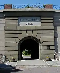 | |||
| barrier | sliding_beam | Something between barrier=sliding_gate and barrier=lift_gate: it has a quite thin bar like in lift gate, but the bar slides aside to allow through. | 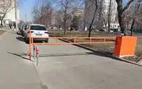 | |||
| barrier | sliding_gate | Gates open sideways. Usually automatic
Combine with access=* where appropriate. |
 | |||
| barrier | spikes | Spikes on the ground that prevent unauthorized access. Can also be removable; e.g., after payment in a garage. | .jpg.webp) | |||
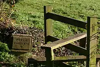
| barrier | stile | A stile allows pedestrians to cross a wall or fence, but never actually "opens" the barrier
(Unlike a gate, a stile has few or no moving parts). |
 | |||
| barrier | sump_buster | A sump buster is a concrete slab or steel structure that prevents passing of two-tracked vehicles with less than a minimum track and ground clearance. (Typically stops normal cars.) | 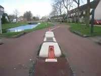 | |||
| barrier | swing_gate | Similar to a lift gate but rotates sidewards to open. It is usually made out of metal bars (wood or other material possible) and is intended to prevent cars from access but can usually be crossed by pedestrians and cyclists. | 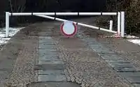 | |||
| barrier | toll_booth | A road usage toll or fee is collected here. Used with toll=* and charge=*. | 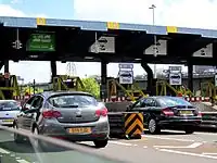 | |||
| barrier | turnstile | A turnstile (also called baffle gate) is used to allow one person at a time to pass. Use this for small turnstiles like the ones in supermarkets or some subways. | 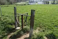 | |||
| barrier | wedge | A wedge-shaped barrier that rises out of the ground to block traffic. | 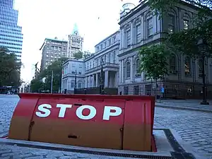 | |||
| barrier | wicket_gate | A wicket gate, or simply a wicket, is a pedestrian door or gate, particularly one built into a larger door or into a wall or fence. | 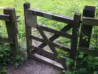 | |||
| barrier | yes | A barrier which nature cannot be determined; typically only used in mapping using aerial imagery. Should be replaced by a specific value. |  | |||
Linear barriers or access control on highways (e.g. along or for blocking a path or road) | ||||||
| المفتاح | القيمة | العنصر | وصف | رسم / تصوير إيضاحي | رسم / تصوير إيضاحي | صورة |
| barrier | bar | A fixed horizontal bar which blocks motor vehicles but can usually be bypassed on foot or bike. Often placed at trailheads. | 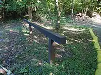 | |||
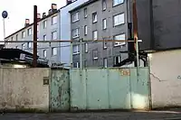
| barrier | barrier_board | A barrier board to restrict the passage of a way or to block off an area. | 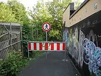 | |||
| barrier | bollard | Solid (usually concrete or metal) pillar or pillars in the middle of the road to prevent passage by some traffic. See key bollard=* | 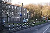 |
| ||
| barrier | chain | A chain used to prevent motorised vehicles. | |
 | ||
| barrier | jersey_barrier | A Jersey barrier consists of heavy prefabricated blocks to create a barrier. Use material=plastic or material=concrete to express the used material. | 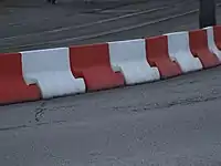 |
 | ||
| barrier | kerb | A kerb (or curb) is a short solid barrier, usually found at the edge of a road, path or sidewalk, which prevents entrance by vehicles and wheelchair users. The height of the kerb is tagged additionally as height=*, if available. Right side is bottom, left side is top. | 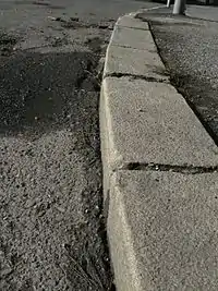 | |||
| barrier | log | Use this when the passage is closed by lumber (trunk of a tree). This kind of barrier is often useful to sit on. This barrier partially blocks cyclists but can be crossed by lifting the bike over. |  | |||
| barrier | rope | A flexible barrier made of fibres, twisted or braided together to improve strength. As a barrier it is often more symbolic than actually physically preventing pedestrians from accessing. | 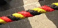 | |||
| barrier | tank_trap | Static anti-tank obstacles that can take various forms, such as Czech hedgehog (barrier=tank_trap; tank_trap=czech_hedgehog). |  | |||
| barrier | tyres | A crash barrier made from tyres stacked on top of each other, commonly found at motor racing circuits. |  | |||
| barrier | user defined | All commonly used values according to Taginfo | ||||
This table is a wiki template with a default description in English. Editable here.
Boundary
| المفتاح | القيمة | العنصر | وصف | رسم / تصوير إيضاحي | صورة | |
|---|---|---|---|---|---|---|
Boundary types | ||||||
| boundary | aboriginal_lands | A boundary representing official reservation boundaries of recognized aboriginal / indigenous / native peoples. |  |
 | ||
| boundary | administrative | حدود إدارية. |  |
 | ||
| boundary | border_zone | A border zone is an area near the border where special restrictions on movement apply. Usually a permit is required for visiting. | _-_crop.jpg.webp) | |||
| boundary | forest | A delimited forest is a land which is predominantly wooded and which is, for this reason, given defined boundaries. It may cover different tree stands, non-wooded areas, highways… but all the area within the boundaries are considered and managed as a single forest. |  | |||
| boundary | forest_compartment | A forest compartment is a numbered sub-division within a delimited forest, physically materialized with visible, typically cleared, boundaries. |  | |||
| boundary | hazard | A designated hazardous area, with a potential source of damage to health, life, property, or any other interest of value. | 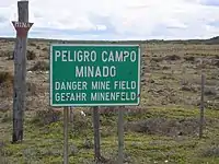 | |||
| boundary | maritime | Maritime boundaries which are not administrative boundaries: the Baseline, Contiguous Zone and EEZ (Exclusive Economic Zone). | 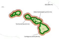 | |||
| boundary | marker | A boundary marker, border marker, boundary stone, or border stone is a robust physical marker that identifies the start of a land boundary or the change in a boundary, especially a change in direction of a boundary. See also historic=boundary_stone | 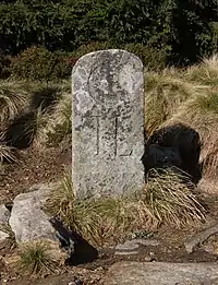 | |||
| boundary | national_park | محمية طبيعية. | 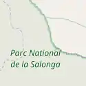 |
 | ||
| boundary | place | boundary=place is commonly used to map the boundaries of a place=*, when these boundaries can be defined but these are not administrative boundaries. | ||||
| boundary | political | حدود سياسية. | ||||
| boundary | postal_code | Postal code boundaries | ||||
| boundary | protected_area | Protected areas, such as for national parks, marine protection areas, heritage sites, wilderness, cultural assets and similar. |  | |||
| boundary | special_economic_zone | A government-defined area in which business and trade laws are different. |  | |||
| boundary | disputed | An area of landed claimed by two or more parties (use with caution). See also Disputed territories. |  | |||
| boundary | user defined | أنظر Taginfo لترى المزيد من القيمات المستعملة. | ||||
Attributes | ||||||
| admin_level | (number) | Applies to boundary=administrative and is usually in the range 1 to 10, except for several countries (Bolivia, Germany, Mozambique, Netherlands, Philippines, Poland, Turkmenistan, Venezuela) where it is in the range 1 to 11 – see boundary. |  | |||
| border_type | * | To distinguish between types of boundary where admin_level isn't enough. Used in several different ways e.g in maritime contexts. | ||||
| start_date | (date) | Useful if the boundary is very recent (or if it will become effective in a near future). |  | |||
This table is a wiki template with a default description in English. Editable here.
الطرق
لقراءة المزيد عن الطرق انظر ويكيبيديا
| المفتاح | القيمة | يستخدم كـ | وصف | شكلة على الخريطة | صورة مثال | |
|---|---|---|---|---|---|---|
طرقات | ||||||
|
These are the principal tags for the road network. They range from the most to least important. | ||||||
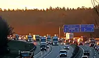
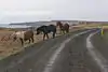
| highway | motorway | طريق "سريع" رئيسي مقسم الاتجاهات (مزدوج) يكون عادة مقيد بمخارج ومداخل ، ويكون بمسارين أو أكثر بالإضافة إلى وجود كتف صلب للطوارئ. ويسمى أيضاً بالطريق السريع المزدوج وبالدائري وبالطريق الدولي في بعض الدول وبــ Freeway ، Autobahn، إلخ .. |  |
|||
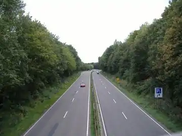
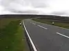
| highway | trunk | طريق "رئيسي" وهو من أهم الطرق في الدول التي لا يوجد بها طرقًا سريعة. (لا يلزم بالضرورة أن يكون طريقًا سريعًا مقسم الاتجاه أي بالامكان أن يكون طريق مفرد إلا أنه بالغالب يكون مقسوم بخط أو رصيف لتأمين حركة المرور .) |  |
| ||
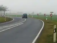
| highway | primary | طريق "أولي" حسب التقسيم الإداري وهو يأتي بالمرحلة التالية من الأهمية بعد الطريق الرئيسي وكثير من الدول تضعه للربط بين المدن الكبيرة ويستخدم أيضاً لتصنيف الطريق المهم داخل المجمعات السكنية ويكون مفرد بالغالب (أي لا يقسم بين الاتجاهات فاصل) |  |
| ||
| highway | secondary | طريق "ثانوي" حسب التقسيم الإداري أو طريق مهم داخل المجمعات السكنية : وهو أقل أهمية من الطريق الأولي ويستخدم غالبا لربط المدن |  |
| ||
| highway | tertiary | طريق "ثالثي" أقل أهمية من الطريق الثانوي وهو غالباً ما يستخدم للربط بين القرى والهجر وغير ذلك |  |
| ||
| highway | unclassified | طرق غير مصنف وهو من أقل الطرق أهمية في شبكات الطرق - أي الطرق الفرعية ذات التصنيف الأقل من الطريق الثالثي ، ولكنها لم توضع بغرض الوصول إلى الممتلكات. (وهي غالباً ما تربط القرى والهجر.) |  |
| ||
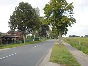
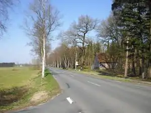
| highway | residential | طريق يسلك منطقة عمرانية أو سكنية |  |
| ||
Link roads | ||||||
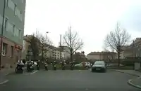
| highway | motorway_link | مخرج أو مدخل خاص يسمح بمغادرة أو باقتناء الطريق السيارة دون أن يكون هناك تداخل للسير و تسمح أيضا بالانتقال من طريق سريع إلى آخر دون أن يكون هناك خطر من التعارض |  |
 A5 exit link to A672, Darmstadt, Germany | ||
| highway | trunk_link | مخرج أو مدخل خاص يسمح بمغادرة أو باقتناء الطريق الرئيسي |  |
 A7 / OAL23 interchange, Nesselwang, Germany | ||
| highway | primary_link | طريق يربط طريقا أوليا |  |
_-_geo-en.hlipp.de_-_11914.jpg.webp) B20 exit and entrance to Brunn, Fridolfing, Germany | ||
| highway | secondary_link | طريق يربط طريقا ثانويا |  |
 | ||
| highway | tertiary_link | طريق يربط طريقا فرعيا ثالثيا وهو أقل أهمية من الطريق الثانوي |  |
|||
Special road types | ||||||
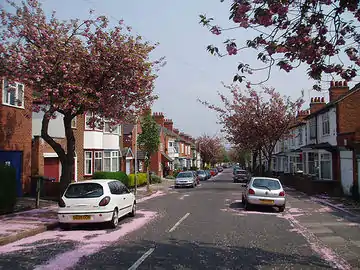
| highway | living_street | طريق الحواري السكني ، وهي شوارع سكنية حيث يكون للمشاة أولوية قانونية على السيارات ، وتمشي فيه السيارات بسرعات منخفضة جدًا ويُسمح للأطفال باللعب في الشارع. |  |
 beginning of a living street with a paving stones surface and some trees and cars parking at the sides | ||
| highway | service | طريق خدمي لمبنى أو طريق تسلك للوصول لمجمع خدمات ويمكن وصف الخدمة بالمفتاح أو لموقف السيارات أو محطة للوقود ويكن وصف الخدمات بالمفتاح service=* و يمكن تخصيص من يملك صلاحية الدخول من خلال المفتاح access=* |  |
 | ||
| highway | pedestrian | طريق مخصص للمشاة |  |
 | ||
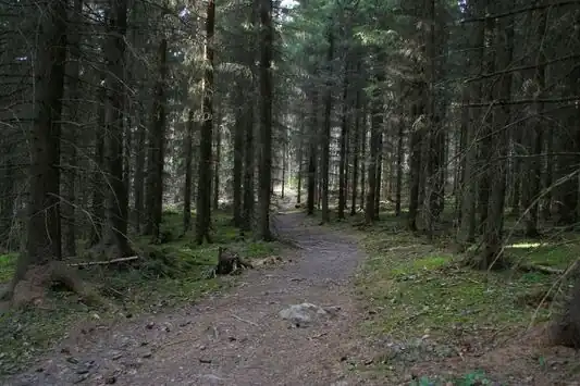
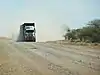
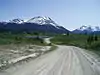
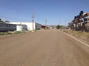
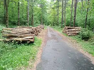
| highway | track | طريق غير معبد: وهو مسار يستخدمه من يريد الذهاب داخل الصحراء ويستخدمه أيضاً المزارعين ويكون أحيانا طريقا داخل غابة ولوصف جودة المسار استخدم المفتاح tracktype=* |  |
|||
| highway | bus_guideway | A busway where the vehicle guided by the way (though not a railway) and is not suitable for other traffic. Please note: this is not a normal bus lane, use access=no, psv=yes instead! |  |
 | ||
| highway | escape | For runaway truck ramps, runaway truck lanes, emergency escape ramps, or truck arrester beds. It enables vehicles with braking failure to safely stop. |  | |||
| highway | raceway | طريق سباق وهو طريق مخصص للسباقات. |  |
 | ||
| highway | road | طريق بتقسيم إداري مجهول يعين بهاته القيمة إلى أن تتضح المعلومات حوله و يتم حين إذ إستعمال قيمة أخرى. |  |
 | ||
| highway | busway | A dedicated roadway for bus rapid transit systems |  grade-seperated section of busway outside of station | |||
مسارات. | ||||||
| highway | footway | مسار للمشاة |  |
 | ||
| highway | bridleway | مسار للخيول |  |
 | ||
| highway | steps | درج |  |
 | ||
| highway | corridor | For a hallway inside of a building. |  | |||
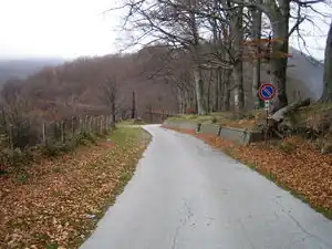
| highway | path | مسار لاستعمال غير محدد أو غير مقيد. |  |
 | ||
| highway | via_ferrata | A via ferrata is a route equipped with fixed cables, stemples, ladders, and bridges in order to increase ease and security for climbers. These via ferrata require equipment : climbing harness, shock absorber and two short lengths of rope, but do not require a long rope as for climbing. | not rendered in OSM-Carto | 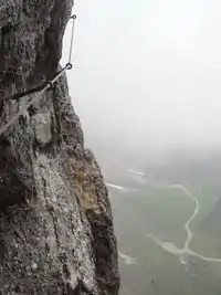 | ||
When sidewalk/crosswalk is tagged as a separate way | ||||||
| footway | sidewalk | Sidewalk that runs typically along residential road. Use in combination with highway=footway or highway=path | |
 | ||
| footway | [[ Too many Data Items entities accessed. | crossing ]] | معبر المترجلين، معبر المشاة | |
 | ||
When sidewalk (or pavement) is tagged on the main roadway (see Sidewalks) | ||||||
| sidewalk | both | left | right | no | Specifies that the highways has sidewalks on both sides, on one side or no sidewalk at all |  | |||
When cycleway is drawn as its own way (see Bicycle) | ||||||
| highway | cycleway | مسار للدراجات |  |
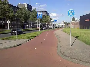 Separated cycleway with traffic sign | ||
Cycleway tagged on the main roadway or lane (see Bicycle) | ||||||
| cycleway | lane | A lane is a route that lies within the roadway | 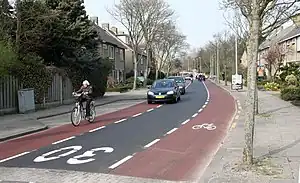 | |||
| cycleway | opposite | Used on ways with oneway=yes where it is legally permitted to cycle in both directions. Used together with oneway:bicycle=no. |  | |||
| cycleway | opposite_lane | Used on ways with oneway=yes that have a cycling lane going the opposite direction of normal traffic flow (a "contraflow" lane). Used together with oneway:bicycle=no. | 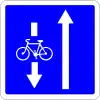 | |||
| cycleway | track | A track provides a route that is separated from traffic. In the United States, this term is often used to refer to bike lanes that are separated from lanes for cars by pavement buffers, bollards, parking lanes, and curbs. Note that a cycle track may alternatively be drawn as a separate way next to the road which is tagged as highway=cycleway. | 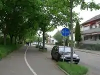 | |||
| cycleway | opposite_track | Used on ways with oneway=yes that have a cycling track going the opposite direction of normal traffic flow. Used together with oneway:bicycle=no. | 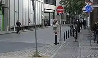 | |||
| cycleway | share_busway | There is a bus lane that cyclists are permitted to use. | 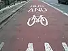 | |||
| cycleway | opposite_share_busway | Used on ways with oneway=yes that have a bus lane that cyclists are also permitted to use, and which go in the opposite direction to normal traffic flow (a "contraflow" bus lane). Used together with oneway:bicycle=no. | 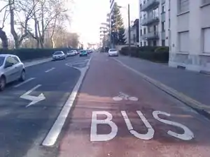 | |||
| cycleway | shared_lane | Cyclists share a lane with motor vehicles, but there are markings indicating that they should share the lane with motorists. In some places these markings are known as "sharrows" ('sharing arrows') and this is the tag to use for those. | 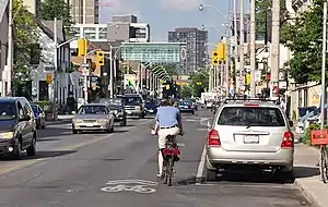 | |||
| busway | lane | Bus lane on both sides of the road. (See also: Parallel scheme for bus/psv lane tagging lanes:bus=* / lanes:psv=*) | | |||
Street parking tagged on the main roadway (see Street parking) | ||||||
| parking :left / :right / :both (hereafter: parking:side) |
lane | street_side | on_kerb | half_on_kerb | shoulder | no | separate | yes | Primary key to record parking along the street. Desribes the parking position of parked vehicles in the street. | 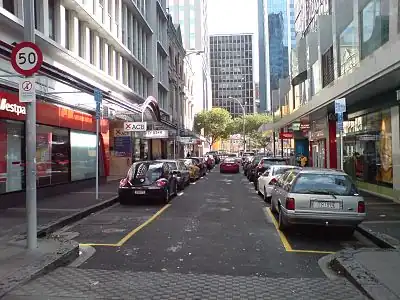 | |||
| parking:sideorientation=* | parallel | diagonal | perpendicular | To specify the orientation of parked vehicles if there is street parking. | ||||
Lifecycle (see also lifecycle prefixes) | ||||||
| highway | proposed | للطرقات المخطط تصميمها ولم يبدأ إنشائها. تستعمل مع proposed=* قيمة الطريق المقترحة | ||||
| highway | construction | للطرقات اللتي هي في طور الإنجاز و البناء. تستعمل مع construction=*. |  |
 | ||
Attributes | ||||||
| abutters | commercial | industrial | mixed | residential | retail etc. | See Key:abutters for more details. |  | |||
| bicycle_road | yes | A bicycle road is a road designated for bicycles. If residential streets get the status of bicycle roads, normally, by special signs, motor traffic is admitted with limited speed, often only for residents. |  | |||
| bus_bay | both | left | right | A bus bay outside the main carriageway for boarding/alighting |  | |||
| change | yes | no | not_right | not_left | only_right | only_left | Specify the allowed/forbidden lane changes | .jpg.webp) | |||
| destination | <place name of destination> | Destination when following a linear feature | .svg.png.webp) | |||
| embankment | yes | dyke | A dyke or a raised bank to carry a road, railway, or canal across a low-lying or wet area. |  | |||
| embedded_rails | yes | <type of railway> | A highway on which non-railway traffic is also allowed has railway tracks embedded in it but the rails are mapped as separate ways. | _heading_NW.jpg.webp) | |||
| ford | yes | الطريق يجتاز مجرى مائي و يحتم على المركبات الدخول للماء |  | |||
| ice_road | yes | A highway is laid upon frozen water basin, definitely doesn't exist in summer. |  | |||
| incline | Number % | ° | up | down | منحدر و يمكن تواجد شاحنات بطيئة |  | |||
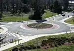
| junction | roundabout | طريق دائري يدل على إتجاه واحد oneway=yes و لا يعفي من إستعمال highway=* | 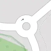 |
 | ||
| lanes | <number> | عدد المسارات المخصصة في الطريق للأغراض العامة لحركة المرور، للحافلات ... | 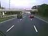 | |||
| lit | yes | no | Street lighting |  | |||
| maxspeed | <number> | Specifies the maximum legal speed limit on a road, railway or waterway. |  | |||
| motorroad | yes | no | The motorroad tag is used to describe highways that have motorway-like access restrictions but that are not a motorway. | 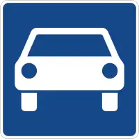 | |||
| mountain_pass | yes | The highest point of a mountain pass. |  | |||
| mtb:scale | 0-6 | Applies to highway=path and highway=track. A classification scheme for mtb trails (few inclination and downhill). |  | |||
| mtb:scale :uphill | 0-5 | A classification scheme for mtb trails for going uphill if there is significant inclination. | | |||
| mtb:scale :imba | 0-4 | The IMBA Trail Difficulty Rating System shall be used for bikeparks. It is adapted to mtb trails with artificial obstacles. | ||||
| mtb:description | Text | Applies to highway=path and highway=track. A key to input variable infos related to mtbiking on a way with human words | ||||
| oneway | yes | no | reversible | Oneway streets are streets where you are only allowed to drive in one direction. |  | |||
| oneway:bicycle | yes | no | | Used on ways with oneway=yes where it is legally permitted to cycle in both directions. | | |||
| overtaking | yes | no | caution | both | forward | backward | Specifying sections of roads where overtaking is legally forbidden. Use overtaking:forward=yes/no/caution and overtaking:backward=yes/no/caution when it depends on driving direction. |  | |||
| parallel | diagonal | perpendicular | marked | no_parking | no_stopping | fire_lane. | Deprecated variant to map parking along streets. See section on street parking above or the street parking page for more details. | |||||
| free | ticket | disc | residents | customers | private | Deprecated variant to map parking conditions along streets. See section on street parking above or the street parking page for more details. |  | ||||
| passing_places | yes | طريق يحتوي على عدة مناطق مجاوزة. |  | |||
| priority | forward | backward | Traffic priority for narrow parts of roads, e.g. narrow bridges. |  | |||
| priority_road | designated | yes_unposted | end | Specifying roads signposted as priority roads. |  | |||
| sac_scale | hiking | mountain_hiking | demanding_mountain_hiking | alpine_hiking | demanding_alpine_hiking | difficult_alpine_hiking | Applies to highway=path and highway=footway. A classification scheme for hiking trails. |  | |||
| service | alley | driveway | parking_aisle etc. | See Key:service for more details. |  | |||
| smoothness | excellent | good | intermediate | bad | very_bad | horrible | very_horrible | impassable | See Key:smoothness for more details. |  | |||
| surface | paved | unpaved | asphalt | concrete | paving_stones | sett | cobblestone | metal | wood | compacted | fine_gravel | gravel | pebblestone | plastic | grass_paver | grass | dirt | earth | mud | sand | ground | See Key:surface for more details. | ||||
| tactile_paving | yes | no | A paving in the ground to be followed with a blindman's stick. | Not to be rendered on standard maps. |  | ||
| tracktype | grade1 | grade2 | grade3 | grade4 | grade5 | To describe the quality of the surface. See Key:tracktype for more information. |  |
 | ||
| traffic_calming | bump | hump | table | island | cushion | yes | etc. | تشير للمرافق المخصصة لتهدة حركة المرور. |  | |||
| trail_visibility | excellent | good | intermediate | bad | horrible | no | Applies to highway=path, highway=footway, highway=cycleway and highway=bridleway. A classification for hiking trails visibility |  | |||
| trailblazed | yes | no | poles | cairns | symbols | Applies to highway=*. Describing trail blazing and marking. See Key:trailblazed for more information. |  | |||
| trailblazed:visibility | excellent | good | intermediate | bad | horrible | no | Applies to trailblazed=*. A classification for visibility of trailblazing. See Key:trailblazed:visibility for more information. | ||||
| turn | left | slight_left | through | right | slight_right | merge_to_left | merge_to_right | reverse | The key turn can be used to specify the direction in which a way or a lane will lead. | 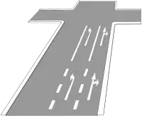 | |||
| width | <number> | The width of a feature. |  | |||
| winter_road | yes | A highway functions during winter, probably can't be driven in summer. | 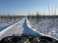 | |||
علامات أخرة | ||||||
| highway | bus_stop | محطة صغيرة للحافلات. المحطات الكبيرة يرمز إليها بـ amenity=bus_station | 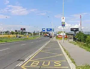 | |||
| highway | crossing | A.k.a. crosswalk. Pedestrians can cross a street here; e.g., zebra crossing | | |||
| highway | elevator | An elevator or lift, used to travel vertically, providing passenger and freight access between pathways at different floor levels. | 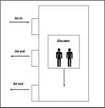 | |||
| highway | emergency_bay | An area beside a highway where you can safely stop your car in case of breakdown or emergency. | 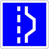 | |||
| highway | emergency_access_point | علامة رقمية تدل على موقعك في حالة طوارئ و يقع إستعمالها مع ref=الرقم_في_العلامة. | 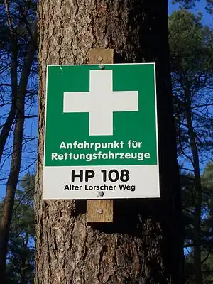 | |||
| highway | give_way | علامة ليست لك الاولوية | 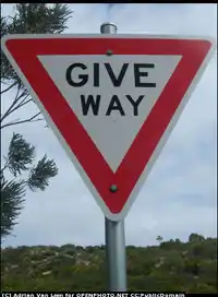 | |||
| emergency | phone | A calling device can be used to tell on your current position in case of an emergency. Use with ref=NUMBER_ON_THE_SIGN |  | |||
| highway | milestone | Highway location marker |  | |||
| highway | mini_roundabout | طريق دائري صغير |  |
|||
| highway | motorway_junction | Indicates a junction (UK) or exit (US). ref=* should be set to the exit number or junction identifier. (Some roads – e.g., the A14 – also carry junction numbers, so the tag may be encountered elsewhere despite its name) |  |
| ||
| highway | passing_place | منطقة مجاوزة للطرقات الضيقة. | 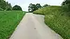 | |||
| highway | platform | A platform at a bus stop or station. |  |
 | ||
| highway | rest_area | Place where drivers can leave the road to rest, but not refuel. |  |
 | ||
| highway | services | محطة وقود و خدمة سيارات (أطعمة، مشروبات أو مرطبات، وقود ...) توجد عادة في الطرقات السيارة. |  |
 | ||
| highway | speed_camera | رادار أو كاميرا تصوير لمخالفات السرعة. | 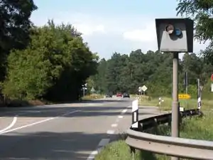 | |||
| highway | stop | علامة قف | 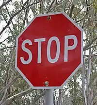 | |||
| highway | street_lamp | A street light, lamppost, street lamp, light standard, or lamp standard is a raised source of light on the edge of a road, which is turned on or lit at a certain time every night |  | |||
| highway | toll_gantry | A toll gantry is a gantry suspended over a way, usually a motorway, as part of a system of electronic toll collection. For a toll booth with any kind of barrier or booth see: barrier=toll_booth | .jpg.webp) | |||
| highway | traffic_mirror | Mirror that reflects the traffic on one road when direct view is blocked. |  | |||
| highway | traffic_signals | إشارات المرور، أضواء السير |  | |||
| highway | trailhead | Designated place to start on a trail or route |  | |||
| highway | turning_circle | هي مساحة دائرية و مضخمة في نهاية الطريق، المراد منها تسهيل عملية الإنعطاف للسيارات. |  |
 | ||
| highway | turning_loop | A widened area of a highway with a non-traversable island for turning around, often circular and at the end of a road. | 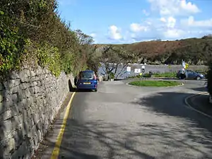 | |||
| highway | User Defined | أنظر Taginfo لترى المزيد من القيم المستعملة. | ||||
.jpg.webp)
Historic
This is used to describe various historic places. For example: archeological sites, wrecks, ruins, castles and ancient buildings. See the page titled Historic for an introduction on its usage.
| المفتاح | القيمة | العنصر | وصف | رسم / تصوير إيضاحي | صورة |
|---|---|---|---|---|---|
| historic | aircraft | A decommissioned aircraft which generally remains in one place | 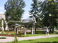 | ||
| historic | aqueduct | A historic structure to convey water | 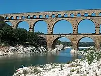 | ||
| historic | archaeological_site | موقع أثري. | 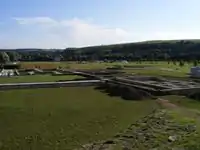 | ||
| historic | battlefield | The site of a battle or military skirmish in the past. This could be on land or at sea. | .jpg.webp) | ||
| historic | bomb_crater | A bomb crater. | 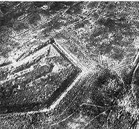 | ||
| historic | building | If it's not clear what type a historic building has, it can be tagged as a generic building. | 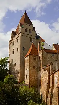 | ||
| historic | cannon | A historic/retired cannon. Usually found at on forts or battlefields. | .jpg.webp) | ||
| historic | castle | حصن، قصر، قلعة. | 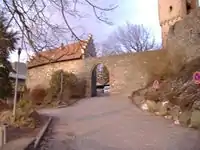 | ||
| historic | castle_wall | A |
|
 | |
| historic | charcoal_pile | Historic site of a charcoal pile. Often still in good condition in hilly forest areas. | 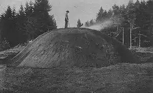 | ||
| historic | church | A building with historical value for Christian religious activities, particularly for worship services. |  | ||
| historic | city_gate | A |
 | ||
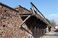
| historic | citywalls | A |
|
| |
| historic | farm | A historical farm, kept in its original state. |  | ||
| historic | fort | A military fort – distinct from a castle as it is generally more modern |  | ||
| historic | gallows | A structure designed for capital punishment by hanging. |  | ||
| historic | highwater_mark | A marker for indicating past flood. |  | ||
| historic | locomotive | A decommissioned locomotive which generally remains in one place. |  | ||
| historic | manor | Historic |
 | ||
| historic | memorial | مقبرة تذكارية. |  | ||
| historic | mine | Abandoned underground mine workings for minerals such as coal or lead. | 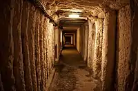 | ||
| historic | mine_shaft | Vertical shafts of a historic mine |  | ||
| historic | milestone | A historic marker that shows the distance to important destinations. | 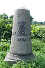 | ||
| historic | monastery | An historic monastery. See Also amenity=monastery. | 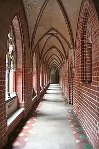 | ||
| historic | monument | نصب تذكاري. | 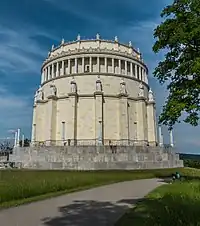 | ||
| historic | optical_telegraph | Historic optical telegraph | 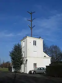 | ||
| historic | pillory | A construction designed to immobilitate and humiliate a person who was convicted in lower courts. | 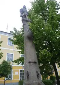 | ||
| historic | railway_car | A decommissioned railway car which generally remains in one place. |  | ||
| historic | ruins | أطلال. | 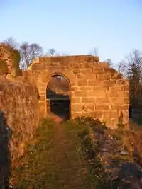 | ||
| historic | rune_stone | A |
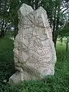 | ||
| historic | ship | A decommissioned ship or submarine | 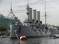 | ||
| historic | stone | A stone shaped or placed by man with historical value. | 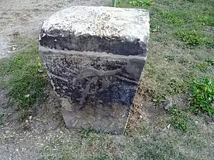 | ||
| historic | tank | A decommissioned tank which generally remains in one place. | 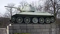 | ||
| historic | tomb | Historic tomb | 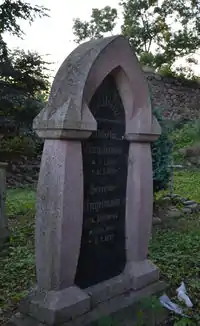 | ||
| historic | tower | Historic tower | |||
| historic |  | ||||
| historic | vehicle | A decommissioned land-based vehicle which generally remains in one place | 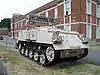 | ||
| historic | wayside_cross | A historical (usually christian) cross. Frequently found along the way in Southern Germany, Austria and probably elsewhere. | 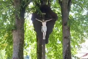 | ||
| historic | wayside_shrine | A historical shrine often showing a religious depiction. Frequently found along the way in Southern Germany, Austria and probably elsewhere. |  | ||
| historic | wreck | Nautical craft that has unintentionally been sunk or destroyed. |  | ||
| historic | yes | Used to add the historic significance of the objects described by other tags. | |||
| historic | user defined | أنظر Taginfo لترى المزيد من القيمات المستعملة. |
This table is a wiki template with a default description in English. Editable here.
Landuse
| المفتاح | القيمة | العنصر | وصف | رسم / تصوير إيضاحي | صورة | |
|---|---|---|---|---|---|---|
Common landuse key values - developed land | ||||||
| landuse | commercial | منطقة مهنية. |  |
 | ||
| landuse | construction | A site which is under active development and construction of a building or structure, including any purposeful alteration to the land or vegetation upon it. Abandoned construction projects and sites should not use this tag. |  |
 | ||
| landuse | education | An area predominately used for educational purposes/facilities. |  | |||
| landuse | fairground | A site where the fair takes place |  | |||
| landuse | industrial | منطقة صناعية. |  |
 | ||
| landuse | residential | منطقة سكنية. |  |
 | ||
| landuse | retail | منطقة تجارية. |  |
 | ||
| landuse | institutional | Land used for institutional purposes, see
The meaning of this tag is ambiguous and unclear. Consider using another tag that better describes the object. For instance landuse=commercial. See talk page for discussion. |
 | |||
| المفتاح | القيمة | العنصر | وصف | رسم / تصوير إيضاحي | صورة | |
Common landuse key values - rural and agricultural land | ||||||
| landuse | aquaculture | currently not rendered by osm-carto |  | |||
| landuse | allotments | قطعة أرض صغيرة تأجرها البلدية للخواص. |  |
 | ||
| landuse | farmland | An area of farmland used for tillage (cereals, vegetables, oil plants, flowers). |  |
 | ||
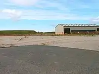
| landuse | farmyard | An area of land with farm buildings like farmhouse, dwellings, farmsteads, sheds, stables, barns, equipment sheds, feed bunkers, etc. plus the open space in between them and the shrubbery/trees around them. |  |
 | ||
| landuse | flowerbed | An area designated for flowers |  | |||
| landuse | forest | أرض مشجرة. |  |
 | ||
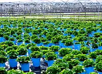
| landuse | greenhouse_horticulture | Area used for growing plants in greenhouses | |
 | ||
| landuse | meadow | A meadow or pasture: land primarily vegetated by grass and non-woody plants, mainly used for hay or grazing |  |
 | ||
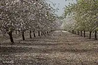
| landuse | orchard | intentional planting of trees or shrubs maintained for food production |  |
 | ||
| landuse | plant_nursery | intentional planting of plants maintaining for the production of new plants |  |
 | ||
| landuse | vineyard | A piece of land where grapes are grown. |  |
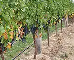 | ||
| المفتاح | القيمة | العنصر | وصف | رسم / تصوير إيضاحي | صورة | |
Common landuse key values - waterbodyWarning: currently, there is no convention on the exact meaning of this tag. Therefore, it makes sense to treat it like "boundary of aquaculture" (without implication of water body), which means, water body should be tagged by its own, using natural=water etc.}}} | ||||||
| landuse | basin | حوض مياه. |  |
 | ||
| منطقة لخزن المياه. |  |
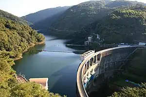 | ||||
| landuse | salt_pond | A place where salt (saline) water is evaporated to extract its salt. |  |
.jpg.webp) | ||
| المفتاح | القيمة | العنصر | وصف | رسم / تصوير إيضاحي | صورة | |
Other landuse key values | ||||||
| landuse | brownfield | منطقة مخصصة لإعادة تهيأتها بعد أن هدمت بها المباني القديمة. | |
 | ||
| landuse | cemetery | مقبرة كبيرة و إذا كانت صغيرة إذا يفضل إستعمال amenity=grave_yard. | |
 | ||
| Protected areas (deprecated) Alternate tagging of same thing: boundary=protected_area, protected_area=* | ||||||
| landuse | depot | An area used as a depot for e.g. vehicles (trains, buses or trams). Consider using rather standard landuse tags like landuse=railway, landuse=commercial, landuse=industrial, with subtag like industrial=depot. | currently not rendered by osm-carto | .JPG.webp) | ||
| landuse | garages | One level buildings with boxes commonly for cars, usually made of brick and metal. Usually this area belong to garage cooperative with own name, chairman, budget, rules, security, etc. |  |
 | ||
| landuse | grass | An area of mown and managed grass not otherwise covered by a more specific tag. Some view this as not a landuse, see the main page landuse=grass for discussion. |  |
 | ||
| landuse | greenfield | منطقة مخصصة لإعادة تهيأتها و لم يبنى فوقها شيء سابقا. |  (not rendered) |
| ||
| landuse | landfill | موقع دفن للنفايات. |  |
 | ||
| landuse | military | For land areas owned/used by the military for whatever purpose |  |
 | ||
| landuse | port | coastal industrial area where commercial traffic is handled. Consider using landuse=industrial + industrial=port for this type of industrial area. | currently not rendered by osm-carto |  | ||
| landuse | quarry | منجم معادن. |  |
 | ||
| landuse | railway | Area for railway use, generally off-limits to the general public | |
 | ||
| landuse | recreation_ground | منطقة خضراء مفتوحة للإستجمام، عمومية أو خصوصية. |  |
 | ||
| landuse | religious | An area used for religious purposes |  |
 | ||
| landuse | village_green | منطقة خضراء تتوسط قرية. |  |
 | ||
| landuse | winter_sports | An area dedicated to winter sports (e.g. skiing) | .jpg.webp) | |||
| landuse | user defined | أنظر Taginfo لترى المزيد من القيمات المستعملة. | ||||
This table is a wiki template with a default description in English. Editable here.
Leisure
| المفتاح | القيمة | العنصر | وصف | رسم / تصوير إيضاحي | صورة |
|---|---|---|---|---|---|
| leisure | adult_gaming_centre | A venue with gambling machines and other pay-to-play games. With a set age limit, as opposed to leisure=amusement_arcade. |  | ||
| leisure | amusement_arcade | A venue with pay-to-play games, such as video games, driving simulators, pinball machines, merchandisers, etc. Without a set age limit, as opposed to leisure=adult_gaming_centre. |  | ||
| leisure | bandstand | An open structure where musical bands can perform concerts. |  | ||
| leisure | bathing_place | Public place where you can freely bath in nature. | .jpg.webp) | ||
| leisure | beach_resort | To mark the boundary of a managed beach. |  | ||
| leisure | bird_hide | A place to observe birds. |  | ||
| leisure | bleachers | Raised, tiered rows of benches found at spectator events |  | ||
| leisure | bowling_alley | A facility that is equipped to play the game of bowling. |  | ||
| leisure | common | مساحة مفتوحة للعموم قصد التفسح. | |||
| leisure | dance | A place to go dancing. |  | ||
| leisure | disc_golf_course | Disc golf course |  | ||
| leisure | dog_park | Designated area, with or without a fenced boundary, where dog-owners are permitted to exercise their pets unrestrained. |  |
 | |
| leisure | escape_game | A physical adventure game in which players solve a series of puzzles using clues, hints and strategy to complete the objectives at hand. |  | ||
| leisure | firepit | A permanent location or structure to host campfires, bonfires, etc. |  | ||
| leisure | fishing | A place for fishing. |  | ||
| leisure | fitness_centre | A place with exercise machines and/or fitness/dance classes. |  | ||
| leisure | fitness_station | A place with exercise machines, single or collection of, outdoor. | | ||
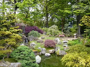
| leisure | garden | حديقة. |  |
 | |
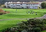
| leisure | golf_course | A golf course. |  |
 | |
| leisure | hackerspace | A place where people with common interests, often in computers, technology, science, digital art or electronic art, can meet, socialize and/or collaborate. | 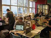 | ||
| leisure | horse_riding | A facility where people practise horse riding, usually in their spare time, e.g. a riding centre. For a riding arena use leisure=pitch + sport=equestrian. | 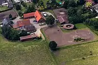 | ||
| leisure | ice_rink | A place where you can skate or play ice hockey. |  |
 | |
| leisure | marina | مرسى لليخوت و الزوارق ذات محرك. |  |
 | |
| leisure | miniature_golf | A place or area that you can play miniature golf. |  |
 | |
| leisure | nature_reserve | Protected area of importance for wildlife, flora, fauna or features of geological or other special interest. | |
 | |
| leisure | outdoor_seating | Areas for outdoor gastronomy. | 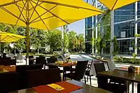 | ||
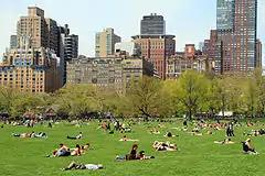
| leisure | park | منتزه. |  |
 | |
| leisure | picnic_table | A picnic table | 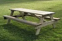 | ||
| leisure | pitch | ميدان رياضي. |  |
 | |
| leisure | playground | ملعب. |  | ||
| leisure | resort | A place used for relaxation or recreation, attracting visitors for vacations, tourism and/or going swimming in a pool and/or a nearby body of water. |  | ||
| leisure | sauna | A small room or house designed to experience dry or wet heat sessions, or an establishment with one or more of these and auxiliary facilities. |  | ||
| leisure | slipway | منشأ سفن. | 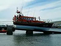 | ||
| leisure | sports_centre | A distinct facility where a range of sports take place within an enclosed area. To describe what kind of sport(s) use sport=*. |  |
 | |
| leisure | sports_hall | A sufficiently large single room that is suitable for practising sports indoors and does not have a "centre" character. | 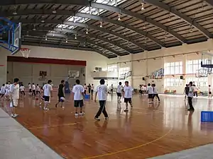 | ||
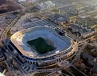
| leisure | stadium | ملعب مدرج. | |
 | |
| leisure | summer_camp | Summer camp is a supervised program for children or teenagers conducted during the summer months in some countries. Children and adolescents who attend summer camp are known as campers. |  | ||
| leisure | swimming_area | A swimming area - place over river, lake or other water reservoir where swimming is allowed. |  | ||
| leisure | swimming_pool | A swimming pool (water area only). |  |
 | |
| leisure | tanning_salon | Place where customers can use UV lamps to tan their skin. | .jpg.webp) | ||
| leisure | track | حلبة سباق. | |
 | |
| leisure | trampoline_park | An leisure facility consisting of many interlinked trampolines |  | ||
| leisure | water_park | An amusement park with features like water slides, recreational pools (e.g. wave pools) or lazy rivers. |  | ||
| leisure | wildlife_hide | A place to observe wildlife. See also leisure=bird_hide. |  | ||
| leisure | user defined | أنظر [[[Ar:Taginfo|Taginfo]] لترى المزيد من القيمات المستعملة. |
This table is a wiki template with a default description in English. Editable here.
Man made
| المفتاح | القيمة | العنصر | وصف | رسم / تصوير إيضاحي | صورة |
|---|---|---|---|---|---|
| man_made | adit | A type of entrance to an underground mine which is horizontal or nearly horizontal. | 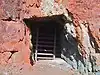 | ||
| man_made | antenna | An antenna to transmit and/or receive wireless signals. | 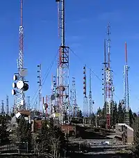 | ||
| man_made | beacon | A structure for signalling on land and sea. | 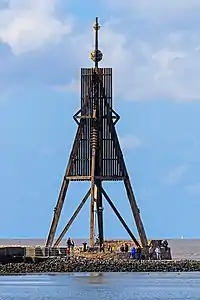 | ||
| man_made | beehive | Beehive | 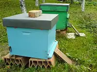 | ||
| man_made | breakwater | A man-made structure designed to protect a shore or harbour from the sea and waves. |  |
 | |
| man_made | bridge | The outline of a bridge, grouping together all features for that bridge.
Please also add bridge=* and layer=* to all ways running over the bridge. |
 |
 | |
| man_made | bunker_silo | An open-sided structure that can be used with vehicles to fill and empty them. | |||
| man_made | cairn | A mound of stones, usually conical or pyramidal, raised as a landmark or to designate a point of importance in surveying. |  | ||
| man_made | carpet_hanger | A construction to hang carpets for cleaning with the help of carpet beaters. |  | ||
| man_made | cellar_entrance | An entrance into artificially created vault. | 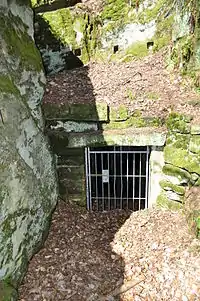 | ||
| man_made | chimney | A tall distinctive vertical conduit for venting hot gases or smoke, normally found near power stations or large factories. | 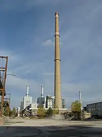 | ||
| man_made | clearcut | An area where all trees have been uniformly cut down. | |||
| man_made | column | A column used to support a structure or for decoration. |  | ||
| man_made | communications_tower | A huge tower for transmitting radio applications. | 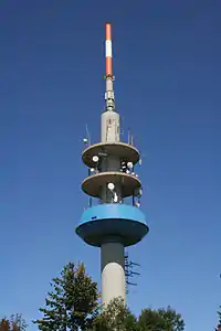 | ||
| man_made | courtyard | An area that is usually enclosed by walls or buildings. |  | ||
| man_made | crane | A stationary, permanent crane. |  | ||
| man_made | cross | Cross with little historical or religion value, e.g. summit cross. |  | ||
| man_made | cutline | A straight line cut in a forest. |  |
 | |
| man_made | dolphin | A marine structure for berthing and mooring of vessels. |  | ||
| man_made | dovecote | A place where doves are farmed or stored. |  | ||
| man_made | dyke | A dyke is a an embankment built to restrict the flow of water or other liquids. |  | ||
| man_made | embankment | An artificial steep slope. |  | ||
| man_made | flagpole | A long pole built to hold a flag. | 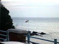 | ||
| man_made | flare | A tower constructed to burn off excess gas. | 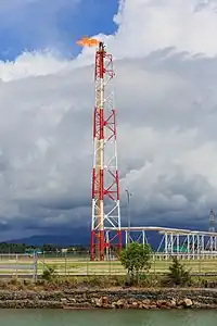 | ||
| man_made | footwear_decontamination | A facility to decontaminate footwear for hikers. | 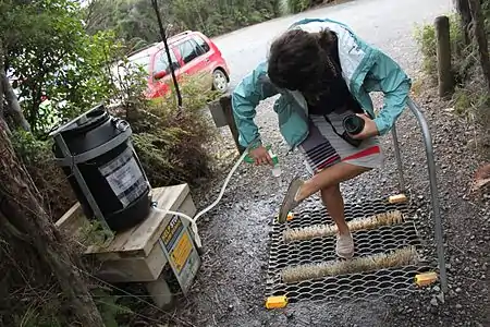 | ||
| man_made | gantry | An overhead structure across a major road usually for holding signs, often variable-message signs. | .jpg.webp) | ||
| man_made | gasometer | A large container in which natural gas or town gas is stored near atmospheric pressure at ambient temperatures. | 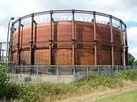 | ||
| man_made | goods_conveyor | A conveyor system for transporting materials |  |
 | |
| man_made | groyne | A rigid structure built from a shoreline or riverbank that interrupts water flow and limits the movement of sediment. See also: man_made=breakwater. | |
 | |
| man_made | guard_stone | A guard stone: a stone built onto or into the corner of a building or wall to prevent carriages from damaging the structure, often found on either side of an entrance to a laneway, or alongside a wall to protect it. | 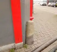 | ||
| man_made | heap | A large pile of material | 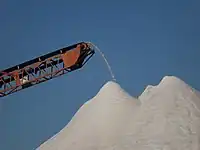 | ||
| man_made | insect_hotel | A structure intended to provide shelter for insects. | 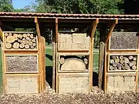 | ||
| man_made | kiln | A kiln: an oven used for industrial processes such as hardening, drying, or smelting |  | ||
| man_made | lighthouse | يبعث الضوء لتوجيه السفن | 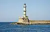 | ||
| man_made | manhole | Hole with a cover that allows access to an underground service location, just large enough for a human to climb through. |  | ||
| man_made | mast | A mast is a vertical structure built to hold, for example, antennas. |  | ||
| man_made | mineshaft | A mineshaft: vertical tunnel into a mine where minerals are extracted. |  | ||
| man_made | monitoring_station | A station that monitors something. |  | ||
| man_made | nesting_site | A man made nesting aid that is mounted on a support device. | 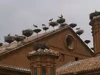 | ||
| man_made | obelisk | Tall, narrow, four-sided, tapered monument which usually ends in a pyramid-like shape at the top. |  | ||
| man_made | [[ Too many Data Items entities accessed. | observatory ]] | Observatory: a location used for observing terrestrial or celestial events | 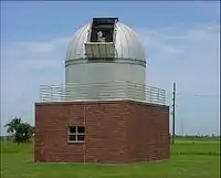 | ||
| man_made | offshore_platform | Offshore platform, oil platform or offshore drilling rig | 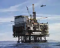 | ||
| man_made | petroleum_well | Oil well: a hole bored in the earth, designed to bring petroleum oil or gas to the surface | 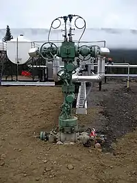 | ||
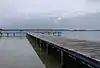
| man_made | pier | A pier is a raised walkway over water, supported by widely spread piles or pillars. |  |
 | |
| man_made | pipeline | A major pipeline carrying gas, water, oil, etc. | 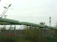 | ||
| man_made | planter | A structure for planting flowers or other ornamental plants. | 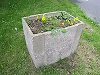 | ||
| A pumping rig for producing oil. Use of this tag is discouraged. See man_made=petroleum_well instead. | 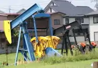 | ||||
| man_made | pumping_station | Pumping station: a facility including pumps and equipment for pumping fluids from one place to another |  | ||
| man_made | reservoir_covered | A covered reservoir is a large man-made tank for holding fresh water |  | ||
| man_made | satellite_dish | A dish-shaped parabolic antenna designed to receive or transmit radio waves to or from a satellite |  | ||
| man_made | silo | A storage container for bulk material, often grains such as corn or wheat |  | ||
| man_made | snow_fence | A solid fence-like structure built across steep slopes to reduce risk and severity of (snow) avalanches. | 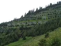 | ||
| man_made | spoil_heap | Spoil heap, piles of waste rock removed during mining. | 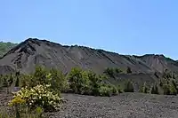 | ||
| man_made | storage_tank | A container that holds liquids or compressed gases. | | ||
| man_made | street_cabinet | A cabinet located in the street and hosting technical equipment to operate facilities such as electricity or street lights. | 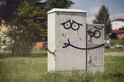 | ||
| man_made | stupa | A Buddhist dome-shaped structure with a spire on top | 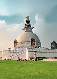 | ||
| man_made | surveillance | A surveillance camera or other type of surveillance equipment. | 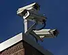 | ||
| man_made | survey_point | عمود لحساب و تحديد الإتجاه و أي معدات مثبتة يستعملها أخصائيو قيس الأراضي |  | ||
| man_made | tailings_pond | Tailings pond: A body of liquid or slurry used to store byproducts of mining operations | 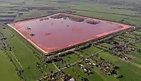 | ||
| man_made | telescope | Telescope: an instrument that aids in the observation of remote objects by collecting light or radio waves | 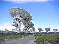 | ||
| man_made | torii | The gate structure found at the entrance of Shinto shrines and (rarely) Japanese Buddhist temples. | 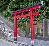 | ||
| man_made | tower | برج. | 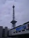 | ||
| man_made | utility_pole | A single pole supporting elevation of any of various and unspecified public utilities, such as power transmission, lighting or telephony. | 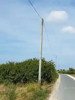 | ||
| man_made | ventilation_shaft | A vertical space in mines, tunnels, or buildings allowing stale air to leave the space underneath and/or fresh air to enter it. | 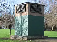 | ||
| man_made | video_wall | A digital screen, typically constructed out of smaller LED panels. |  | ||
| man_made | wastewater_plant | A wastewater plant is a facility used to treat wastewater or sewage. | |
 | |
| man_made | water_tap | Publicly usable water tap, providing access to water and usually equipped with a valve. |  | ||
| man_made | water_tower | برج لخزن المياه عادة ما يتواجد في المرتفعات قريبا للمدن. | 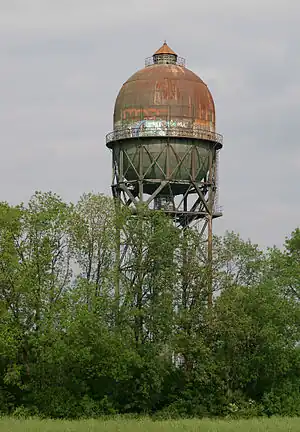 | ||
| man_made | water_well | A structural facility to access ground water, created by digging or drilling. | 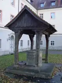 | ||
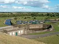
| man_made | water_works | A place where drinking water is found and applied to the local waterpipes network. | |
 | |
| man_made | watermill | A mill driven by water power. | 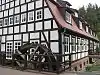 | ||
| man_made | wildlife_crossing | Structure that allow animals to cross human barriers safely. | 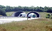 | ||
| man_made | windmill | طاحونة هوائية. |  | ||
| man_made | windpump | A device that pumps natural gas or water using the wind, typically mass produced. |  | ||
| man_made | works | مبنى صناعي. |  | ||
| man_made | yes | General tag for man-made (artificial) structures. | |||
| man_made | user defined | أنظر Taginfo لترى المزيد من القيمات المستعملة. |
This table is a wiki template with a default description in English. Editable here.
Military
| المفتاح | القيمة | العنصر | وصف | رسم / تصوير إيضاحي | صورة |
|---|---|---|---|---|---|
| military | airfield | مطار عسكري. |  | ||
| military | ammunition | Military ammunition storage area. | |||
| military | barracks | ثكنة عسكرية. |  | ||
| military | bunker | ملجأ تحت الأرض. |  | ||
| military | checkpoint | Place of a possible access to a restricted or secured area, where civilian visitors and vehicles will be controled by a military authority. |  Checkpoint Charlie | ||
| military | danger_area | منطقة كبيرة مشار إليها تحيط بمكان التدرب على إطلاق النار. |  |
 | |
| military | launchpad | Launchpads used for military purposes, see tag:aeroway=launchpad for civilian use |  | ||
| military | naval_base | A naval base |  | ||
| military | nuclear_explosion_site | Nuclear weapons test site | |||
| military | obstacle_course | A military obstacle course. | 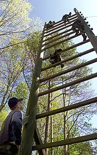 | ||
| military | office | Military offices, e.g. general staff office, military recruitment office etc |  | ||
| military | range | منطقة عسكرية للتدرب على إطلاق النار. | 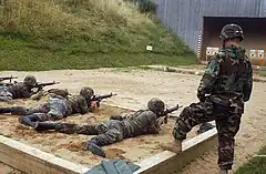 | ||
| military | training_area | An area where soldiers train and weapons or other military technology are experimented with or are tested. | 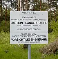 | ||
| military | trench | Trenches used for military purposes | 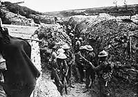 | ||
| military | user defined | أنظر Taginfo لترى المزيد من القيمات المستعملة. |
This table is a wiki template with a default description in English. Editable here.
Natural طبيعي
يستخدم هذا المفتاح لوصف سمات الأرض الطبيعية والمادية. وتشمل هذه أيضًا السمات التي تم تغييرها بواسطة البشر.
| المفتاح | القيمة | العناصر التي يصح أن يوضع عليها الوسم | وصف (أسباب استخدام الوسم) | Tag Usage[1] | كيفية تمثليها على الخريطة بنمط كارتو | صورة |
|---|---|---|---|---|---|---|
كل ما يتعلق بالغطاء النباتي أو سطح الأرض الطبيعي | ||||||
| natural | fell | موطن النباتات التي تقع فوق خط الأشجار ويكون هذا المكان مغطى بالعشب والشجيرات القزمة والطحالب. | حالياً لا يتم عرض هذه الأماكن على الخريطة الرسمية لـOSM openstreetmap-carto للمزيد انظر هنا #545 |  | ||
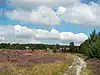
| natural | grassland | مواطن الأراضي العُشبيّة وهي عبارة عن موائل طبيعية مُنبسطة تُهيمن عليها الأعشاب (النجيليات) وأنواعٌ أُخرى من العُطريّات (النباتات اللامتخشبة)، وبعض أنواع السعادى والأسليات، بالنسبة لمواطن الأعشاب المدارة (التي تحصد ويعتنى بها) قم باستخدام الوسم landuse=grass بدلاً من natural=grassland، وكذا بالنسبة للمروج (الأراضي الواسعة التي ينبت بها العشب الكثير وترعى فيها الدواب) استخدم الوسم landuse=meadow. | |
 | ||
| natural | heath | موطن شجيرات قزمة توجد بشكل أساسي في تربة حمضية وعقيمة خالية من التصريف،كما أن تلك النباتات خشبية متفتحة ومنخفضة النمو و طول هذه الشجيرات يتراوح ما بين 20 سم إلى مترين. |  |
 | ||
| natural | moor | مناطق النباتات قليلة النمو في التربة الحمضية، والتي تكون في أماكن مرتفعة وذات مناخ أكثر برودة ورطوبة. لا تستخدم هذا الوسم، انظر صفحة الوسم للمزيد من التفاصيل natural=moor. |
حالياً لا يتم عرض هذه الأماكن على الخريطة الرسمية لـOSM openstreetmap-carto | 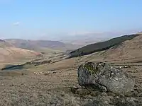 | ||
| natural | scrub | أرض لم تزرع من قبل البشر ومغطاة بالشجيرات أو الأشجار المتقزمة والتي تسمى بـالأشجار القمئية كما تسمى بأراضي الجُنيبات أو أراضي الشجيرات ، أو أراضي الأشجار المُنخفضة، أو أراضي الآجام ، وفي علم النبات وعلم البيئة ، تُعرَّف الشجيرة على أنها نبات خشبي شديد التشعب وبطول لا يتعدى الـ8 أمتار وعادة ما تكون بسيقان عديدة، ومنها الشجيرات الطويلة بطول من 2 إلى 8 أمتار، والشجيرات الصغيرة من 1 إلى 2 متر والشجيرات الصغيرة جدا التي يقل ارتفاعها عن متر واحدالمصدر ويمكن أن يكون هذا الوسم هو المناسب للرياض (الروضة) والفياض. |  |
 | ||
| natural | shrubbery | An area of shrubbery that is actively maintained or pruned by humans. A slightly wilder look is also possible | currently not rendered by openstreetmap-carto | 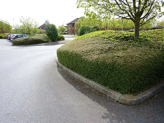 | ||
| natural | tree | لتمثيل شجرة واحدة، واستخدم الوسم species=* لوضع الاسم العلمي لجنس للشجرة والوسم genus=* لوضع الاسم العلمي لفصيلة الشجرة، فمثلا لو رغبنا بإضافة شجرة غضا نضع عقدة (نقطة) ثم نسمها بـgenus=Haloxylon لدلالة على جنسها ولو رغبنا بكتابة الجنس بالعربي نضعها هكذا genus:ar=رمث وكذلك نحدد الفصيلة بـ species=Haloxylon persicum وبالعربية species:ar=غضا. | 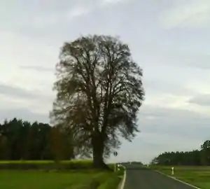 | |||
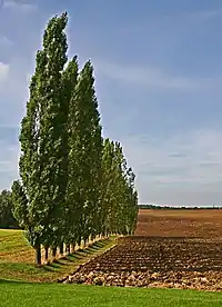
| natural | tree_row | خط من الأشجار. |  |
 | ||
| natural | tree_stump | A tree stump, the remains of a cut down or broken tree. | 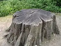 | |||
| natural | tundra | Habitat above tree line in alpine and subpolar regions, principally covered with uncultivated grass, low growing shrubs and mosses and sometimes grazed. |  | |||
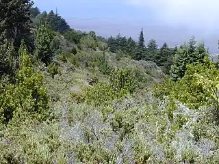
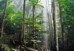
| natural | wood | الغابة: وهي المنطقة مغطاة بالأشجار ("أشجار غابات" أو "أشجار خشبية"). راجع أيضًا الوسم landuse=forest للغابات المستحدثة أو المدارة، أيضاً لإضافة المزيد من التفاصيل ، يمكن استخدام leaf_type=* لوصف أنواع أوراق الأشجار وleaf_cycle=* لوصف دورة حياة الأوراق. |  |
 | ||
ذات العلاقة بالمياه | ||||||
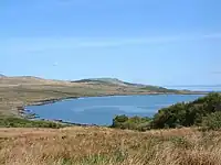
| natural | bay | الخليج: وهو مسطح مائي محاط باليابسة من ثلاث جهات. |  |
 | ||
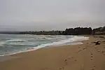
| natural | beach | الشاطئ: وهو اليابس على طول حافّة محيط أو بحر أو بحيرة أو نهر ويكون بالعادة من الرمل أو الألواح الخشبية أو غيرها من المواد السائبة. |  |
 | ||
| natural | blowhole | An opening to a sea cave which has grown landwards resulting in blasts of water from the opening due to the wave action | 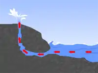 | |||
| natural | cape | الرأس البحري: وهو الجزء من اليابسة الذي يبرز داخل مياه البحر أو البحيرات الكبيرة. | 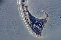 | |||
| natural | coastline | الساحل: ويتم تمثيله كخط (طريق) فاصل بين البحر والأرض، ويحدد الخط الساحلي من متوسط ارتفاع المد الربيعي (وقت اكتمال ضوء القمر) راجع المقالات التالية للمزيد: mean high water springs و Tide | 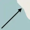 |
 | ||
| natural | crevasse | A large crack in a glacier |  | |||
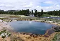
| natural | geyser | فوارة حارة: وهي عبارةٌ عن نبْعِ ماءٍ حارٍّ يدفعُ الماءَ الساخنَ و البخارَ في الهواءِ من فتحاتٍ وشقوقَ في السطحِ الخارجيِّ للقشرةِ الأرضيةِ بشكلٍ متكرّر ويرافقه بخار. | 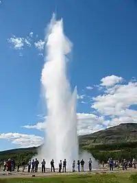 | |||
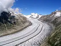
| natural | glacier | نهر جليدي: وهو جسم دائم من الجليد يتكون بشكل طبيعي من الثلج الذي يتحرك تحت ثقله. |  |
 | ||
| natural | hot_spring | ينبوع ساخن أو عين حمئة: وهي عين ماء حارّة يتداوى بها المرضى. | 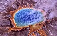 | |||
| natural | isthmus | البرزخ: وهو عبارة عن شريط ضيق من اليابسة محاط من الجهتين بالماء وغالبا ما يصل كتلتين يابستين ذواتا حجم كبير نسبيا ببعضهما. | 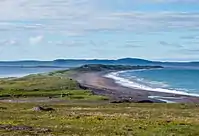 | |||
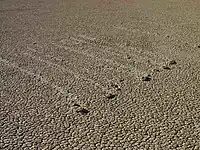
| natural | mud | المنطقة المغطاة بالطين (موحله): تربة ناعمة الحبيبات مشبعة بالماء بدون نمو كبير للنبات. انظر أيضا وصف الوسمين natural=wetland + wetland=* للمزيد من المعلومات. |  |
 | ||
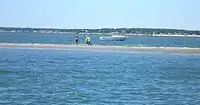
| natural | peninsula | شبه الجزيرة: وهي أي امتداد لليابسة محاط بالماء من ثلاث جهات. | ||||
| natural | reef | شعاب: هي عبارة عن صخور أو حاجز رملي، أو أي شكل آخر يوجد تحت سطح الماء (صخور رسوبية، مرجان ، إلخ). |  | |||
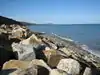
| natural | shingle | حصى المياه: وهو عباره عن حصى متراكم بشكل شظايا صخرية مستديرة يكون على أطراف الشاطئ أو مجرى النهر والفرق بينه وبين النوع السابق هو سبب وجود هذا الحصى حيث أن الحصى اتقل وتراكم بواسطة المياه. |  |
 | ||
| natural | shoal | An area of the sea floor near the sea surface (literally, becomes shallow) and exposed at low tide. See natural=sand as well. | |
 | ||
| natural | spring | ينبوع أو عين: هو مكان تدفّق المياه الجوفيّة بشكل طبيعي لخارج الأرض. | 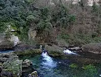 | |||
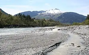
| natural | strait | المضيق: وهو قناة مائية تصل مسطحين مائيين كبيرين ببعضهما وبالتالي فإنها تقع بين مساحتين كبيرتين من اليابسة. |  |
.jpg.webp) | ||
| natural | water | لرسم مساحة أي مسطح مائي طبيعي مثل بحيرة أو بركة ويشمل ذلك المسطحات المنشأة بواسطة البشر مثل الخندق أو القناة. انظر أيضًا الوسم waterway=riverbank لرسم مساحات مسطحات الأنهار. |  |
 | ||
| natural | wetland | المناطق الرطبة (المستنقعات/السباخ): و هي كل مساحة ومكان تغمره المياه كليا أو جزئيا أو تكون أرضه مشبعة بالمياه، أو به نسبة من المياه أو رطوبة ويكون ذلك خلال كامل السنة أو لفترة مؤقتة، ويشمل ذلك الأراضي المعرضة للفيضان، ولتحديد أدق للأراضي الرطبة استخدم الوسم wetland=*. |  |
 | ||
ذات الصلة بالشكل الأرضي | ||||||
| natural | arch | A rock arch naturally formed by erosion, with an opening underneath. | currently not rendered by openstreetmap-carto |  | ||
| natural | arete | النتؤ الصخري: وهو نتوء صخري رفيع يشبه السكين يتشكل عادة عندما يتسبب نهران جليديان في تآكل وديان متوازية على شكل حرف U |  |
 | ||
| natural | bare_rock | منطقة بها نباتات قليلة أو خالية من النباتات ، بحيث يصبح صخر الأساس مرئيًا. |  |
 | ||
| natural | cave_entrance | مدخل الكهف (الغار) والكهف هو تجويف طبيعي تحت سطح الأرض أو في الصخور يسمح بدخول الإنسان فيه. |  | |||
| natural | cliff | الجرف: وهي الحافة التي تكون بشكل عمودي تام أو شديد الانحدار وتنتج بسبب تآكل وتعرض الصخور لعمليات التعرية البيئية. |  |
 | ||
| natural | dune | تلة من الرمل تكونت بفعل الرياح ، مغطاة بنباتات قليلة أو ينعدم فيها النبات. انظر أيضًا للوسم natural=sand و natural=beach. | حالياً لا يتم عرض هذه الأماكن على الخريطة الرسمية لـOSM openstreetmap-carto |  | ||
| natural | earth_bank | Large erosion gully or steep earth bank | _1.jpg.webp) | |||
| natural | fumarole | A fumarole is an opening in a planet's crust, which emits steam and gases | .jpg.webp) | |||
| natural | gully | Small scale cut in relief created by water erosion |  | |||
| natural | hill | التل وهو أرض مرتفعة عن سطح الارض و لكنها اقل ارتفاعا من الجبال و هي ارض هرمية او قبابية. | حالياً لا يتم عرض هذه الأماكن على الخريطة الرسمية لـOSM openstreetmap-carto |  | ||
| natural | peak | قمة تل أو جبل ما وهي هي أعلى نقطة ارتفاعا من أي نقطة أخرى متاخمة لها مباشرة، ويسمى بـ(ذروة، أوج، رأس، قمة،)، ولتحديد الارتفاع استخدم الوسم ele=*. |  | |||
| natural | ridge | تضاريس سلاسل القمم الجبلية المتصلة التي على شكل خط مستدق |  |
 | ||
| natural | rock | صخرة: وهي لوصف صخرة ما تكون بارزة من أصلها الأرضي ومرتبطة بالتضاريس الأساسية للمكان. | حالياً لا يتم عرض هذه الأماكن على الخريطة الرسمية لـOSM openstreetmap-carto |  | ||
| natural | saddle | السرج الجبلي: وهو أدنى مكان بين قمتي جبل أو تل ما، كما يسمى بالممر الجبلي ويكون هذا المكان أسهل للعبور وعادة يتشكل بسبب مجرى مياه. | 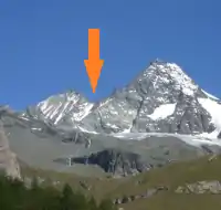 | |||
| natural | sand | المنطقة المغطاة بالرمال والتي ليس بها نباتات أو بها القليل من النباتات. لا تستخدم هذا الوسم للرمال التي على الشواطيء واستخدم الوسم natural=beach وحدد نوع السطح رملي surface=sand كما يمكن استخدام الوسم natural=dune للكثبان الرملية (لكنها لا تعرض حاليا على الخريطة الرسمية). |  |
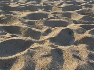 | ||
| natural | scree | حصى: وهي مجموعة من الشظايا الصخرية الزاوية الني تراكمت وسقطت أسفل صخرة أو حائط صخري أو المنحدرات الجبلية والبراكين، وتنتج بنسبة كبيرة بسبب التجوية أو بعد سقوط الصخور. | |
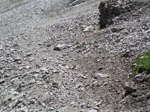 | ||
| natural | sinkhole | بالوعة (جيولوجيا) أو هبوط أرضي : وهي فتحة مستديرة في سطح التكوينات الجيرية في مناطق الكارست، يترسب فيها الماء. | حالياً لا يتم عرض هذه الأماكن على الخريطة الرسمية لـOSM openstreetmap-carto | 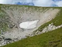 | ||
| natural | stone | صخرة أو حصاة مستقلة: وهي صخرة كبيرة (مهما كان معنى ذلك) وتكون صخرة طبيعية أو جزء صخري غير متصل بالتضاريس الأساسية. | حالياً لا يتم عرض هذه الأماكن على الخريطة الرسمية لـOSM openstreetmap-carto | 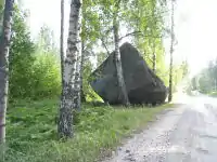 | ||
| natural | valley | الوادي:وهو مكان حوض أو منخفض طبيعي على سطح الأرض، وتمتد الأودية بين السهول والهضاب والجبال. وتسيل الأنهار والسيول عبره. | حالياً لا يتم عرض هذه الأماكن على الخريطة الرسمية لـOSM openstreetmap-carto |  | ||
| natural | volcano | البركان: و هو الفتحة المكشوفة على سطح الأرض والتي تنبعث منها مادة بركانية. |  | |||
| natural | user defined | ويشمل ذلك جميع القيم شائعة الاستخدام من قبل المحررين انقر هنا لمعرفتها ويمكن الإطلاع على احصائية للقيم المستخدمة مع المفتاح natural وعدد مرات استخدامها عبر موقع Taginfo. | ||||
This table is a wiki template with a default description in English. Editable here.
Place
| المفتاح | القيمة | العنصر | وصف | صورة | Count | |
|---|---|---|---|---|---|---|
Administratively declared places | ||||||
| place | country | بلاد. | .png.webp) |
|||
| place | state | ولاية أو دولة. |  |
|||
| place | region | منطقة أو إقليم. |  |
|||
| place | province | See boundary=administrative, admin_level=* varies; may not be used in all countries. | ||||
| place | district | See boundary=administrative, admin_level=* varies; may not be used in all countries. | ||||
| place | county | إقليم أو مقاطعة. |  |
|||
| place | municipality | See boundary=administrative, admin_level=* varies; depending on the country a collection of arbitrary hamlets, villages and towns may form an administrative unit; sometimes members of a unit reform or join with another municipality as a result of political process. Within a municipality individual settlements are a lot less connected than those within a city, where they have grown connected over time. |  |
|||
Populated settlements, urban | ||||||
| place | city | مدينة كبرى (أكثر من 100.000 ساكن). |  |
|||
| place | borough | See boundary=administrative, depending on the country suburbs in larger cities are often grouped into administrative units called boroughs or city districts; using the value borough avoids name confusion in countries that declare districts within their states or counties. |  |
|||
| place | suburb | ضاحية من المدينة. |  |
|||
| place | quarter | A named part of a bigger settlement where this part is smaller than a suburb and bigger than a neighbourhood. This does not have to be an administrative entity. The term quarter is sometimes used synonymously for neighbourhood. |
 |
|||
| place | neighbourhood | A named part of a place=village, a place=town or a place=city. Smaller than place=suburb and place=quarter. The term quarter is sometimes used synonymously for neighbourhood, but may also stand for borough or suburb and hence is often avoided in OSM. See |
 |
|||
| place | city_block | A named city block that is part of a place=city. See |
 |
|||
| place | plot | A named plot is a tract or parcel of land owned or meant to be owned by some owner. | 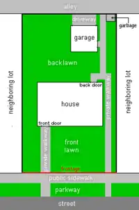 |
|||
Populated settlements, urban and rural | ||||||
| place | town | مدينة تضم بين 10.000 و 100.000 ساكن. |  |
|||
| place | village | قرية (أقل ن 10.000 ساكن). | ||||
| place | hamlet | مجمع بيوت أصغر حجما من القرية. |  |
|||
| place | isolated_dwelling | Smallest kind of human settlement. No more than 2 households. |  |
|||
| place | farm | A farm that has its own name. If the farm is not a part of bigger settlement use place=isolated_dwelling. See also landuse=farmyard | 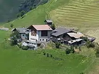 |
|||
| place | allotments | Dacha or cottage settlement, which is located outside other inhabited locality. This value is used mainly in Russia and other countries of the former Soviet Union, where a lot of such unofficial settlements exist | 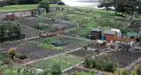 |
|||
Other places | ||||||
| place | continent | إحدى القارات. |  |
|||
| place | archipelago | Identifies the relation of an archipelago, which contains several islands and islets. | ||||
| place | island | جزيرة. | 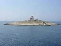 |
|||
| place | islet | Identifies an islet (< 1 km2). |  |
|||
| place | square | For a |
 |
|||
| place | locality | منطقة أو محلة من غير ان تكون مسكونة | ||||
| place | sea | A part of an ocean. | 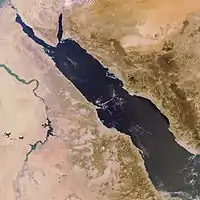 |
|||
| place | ocean | The world's five main major oceanic divisions. |  |
|||
| place | User Defined | أنظر Taginfo لترى المزيد من القيمات المستعملة. | ||||
Additional attributes | ||||||
| population | Number | Number of inhabitants of the place. Among other things, it might be used in selecting which name to render at a given zoom level at what font size. | ||||
| is_in | Text | Optional. Rudimentary way to describe boundary hierarchies, e.g. place=suburb, name=Eccleshall, is_in=Sheffield,South Yorkshire,England,UK. When boundary polygons exist, this is seldom needed. Unless categorization is wrongly done by e.g. Nominatim. | ||||
This section is a wiki template with a default description in English. Editable here.
Power
| المفتاح | القيمة | العنصر | وصف | رسم / تصوير إيضاحي | صورة |
|---|---|---|---|---|---|
| power | cable | A way following the path of underground cables, such as the local 0.4 kV network between transformer stations, distribution boxes and cable connection points, or sea cables. Not to be confused with non-power supply cables such as cables for telecommunication. May be combined with voltage=*, circuits=* and location=*. | 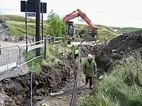 | ||
| power | catenary_mast | A catenary mast supports system of overhead wires used to supply electricity to electricaly powered vehicle equipped with a pantograph. |  | ||
| power | compensator | Several kind of power devices used to insure of power quality and network resilience. |  | ||
| power | connection | A freestanding electrical connection between two or more overhead wires |  | ||
| power | converter | An HVDC converter converts electric power from high voltage alternating current (AC) to high-voltage direct current (HVDC), or vice-versa. |  | ||
| power | generator | مولد كهربائي. |  |
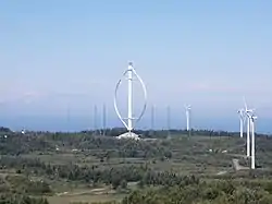 | |
| power | heliostat | A mirror of a heliostat device. | 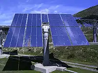 | ||
| power | insulator | A device to protect a power line from grounding on supports | 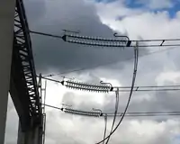 | ||
| power | line | خط سلك كهربائي. |  |
||
| line | busbar | Specifies that a power=line is a busbar in a substation. | |||
| line | bay | Specifies a power=line is a bay which connects an incoming circuit to a busbar assembly. | |||
| power | minor_line | A way following the path of (overground) minor power cables, supported by poles and not towers/pylons. (This isn't quite so simple, as sometimes larger towers are replaced by smaller poles made with a stronger material; a better distinction might be based on voltage). |  |
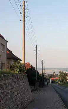 | |
| power | plant | A place/industrial facility where power is generated (electricity, heat, cold water, biogas...). Individual generating units within the facility should be tagged as power=generator. | |
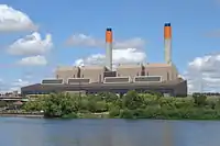 | |
| power | pole | Poles supporting low to medium voltage lines (power=minor_line) and high voltage lines (power=line) up to 161,000 volts (161 kV). | 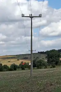 | ||
| power | portal | Power supporting structure composed of vertical legs with cables between them attached to a horizontal crossarm | 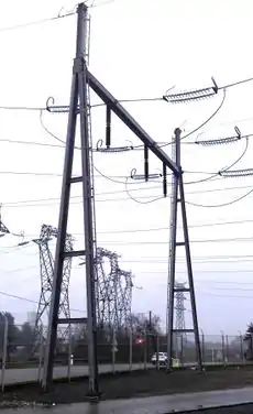 | ||
| power | substation | A tag for electricity substations. These provide voltage step-up/step-down, switching, conditioning, etc. Substations may be large facilities (up to several acres) for very high voltage transmission lines or just small buildings or kiosks near the street for low voltage distribution lines. Useful combinations: voltage=*, substation=* and location=*, see the feature page for details. | |
 | |
| power | switch | A tag for electricity switches which are devices which allow operators to power up & down lines and transformer in substations or outside. | 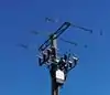 | ||
| power | switchgear | The switchgear comprises one or more busbar assemblies and a number of bays each connecting a circuit to the busbar assembly. |  | ||
| power | terminal | Point of connection between overhead power lines to buildings or walls |  | ||
| power | tower | برج معدني لدعم أسلاك كهربائية ذات قوة عالية. لا يجب إستعمالها هع الأعمدة الكهربائية اللوحية. |  |
 | |
| power | transformer | A static device for transferring electric energy by inductive coupling between its windings. Large power transformers are typically located inside substations. |  | ||
| power | User Defined | أنظر Taginfo لترى المزيد من القيمات المستعملة. |
This table is a wiki template with a default description in English. Editable here.
سكة حديدية
| المفتاح | القيمة | العنصر | وصف | رسم / تصوير إيضاحي | صورة | |
|---|---|---|---|---|---|---|
Tracks | ||||||
| railway | abandoned | آثار خط أو سكة قطار تمت إزالتها و لم تعد موجودة. | Not rendered by osm-carto |  | ||
| railway | construction | Railway under construction. |  |
 | ||
| railway | disused | خط أو سكة قطار مهملة و لم تعد مستعملة لكنها موجودة. |  |
 | ||
| railway | funicular | Cable driven inclined railways on a steep slope, with a pair of cars connected by one cable |  |
 | ||
| railway | light_rail | خط أو سكة قطار خفيف. | |
 | ||
| railway | miniature | Miniature railways are narrower than narrow gauge and carry passengers, frequently at an exact scale of "standard-sized" rail (for example "1/4 scale"). They can often be found in parks. |  |
 | ||
| railway | monorail | خط أو سكة قطارات بقضيب واحد. |  |
 Monorail in Kuala Lumpur | ||
| railway | narrow_gauge | خط أو سكة قطارات ضيقة. | |
 | ||
| خط أو سكة قطار تاريخي عادة ما يكون معلما سياحيا. |  |
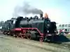 | ||||
| railway | rail | خط أو سكة قطار. |  |
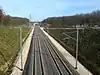 | ||
| railway | subway | A city passenger rail service running mostly grade separated (see Wikipedia:rapid transit). Often a significant portion of the line or its system/network is underground. |  |
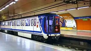 | ||
| railway | tram | خط أو سكة ترام. |  |
 | ||
Additional track features or attributes | ||||||
| bridge | yes | If the railway goes over a street, waterway or other railway on an elevated structure. |  |
 | ||
| cutting | yes | A section where the railway is significantly lower than ground level, but not underground. |  | |||
| electrified | contact_line rail yes no |
contact_line: a power line over the train head rail: a third rail near the track supplying the train with power yes: electrified track, but no details available no: track with no power supply. |
 | |||
| embankment | yes | A section where the railway is raised significantly higher than ground level. | | |||
| embedded_rails | yes/<type of railway> | Specifies that a highway on which non-railway traffic is also allowed has railway tracks embedded in it but the rails are mapped as separate ways. | | |||
| frequency | number [Hz] | The frequency with which a line is electrified. Use 0 for DC. Also see the voltage tag. |  | |||
| railway:track_ref | number | Track number |  | |||
| service | crossover | Relatively short lengths of track which switch traffic from one parallel line to another | ||||
| service | siding | Relatively short lengths of track, running parallel to (and connected to) a main route |  |
|||
| service | spur | Relatively short lengths of track, built to give one company or entity access to a main or branch line. | |
 | ||
| service | yard | Tracks within railway company operated marshalling or maintenance yards. | |
 | ||
| tunnel | yes | If the railway goes below ground. Most subways have this tag. | 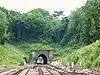 | |||
| tracks | number | Number of parallel tracks in close proximity when mapped as one single way representing all tracks. If not given means unknown and defaults to 1. In many parts of the world the tracks are being drawn out separately so that there is more detail, in which case this tag isn't used. |  | |||
| usage | main branch industrial military tourism scientific test |
main line: heavy traffic branch line: connecting places with a mainline industrial: servicing large plants (iron, chemical etc.), surface mining, … military: servicing military area tourism: most mountain rails (rack-rails, funicular) and preserved railways scientific: rail transport at spaceports, large array telescopes, etc. test: track for testing new wheels, rails, tracks and rail technologies. |
||||
| voltage | number | The voltage with which a line is electrified. Also see the frequency tag. |  | |||
Stations and stops | ||||||
| railway | halt | محطة قطار صغيرة يمكن أن تكون دون رصيف. | 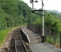 | |||
| public_transport | stop_position | The position on the railway track where the train (its centre) stops at a platform. This is useful for routing on long platforms where also short trains stop and on long platforms where multiple trains stop behind each other. See also public_transport=stop_area. | | |||
| public_transport | platform | This is parallel to the rail line for showing where the actual platforms are. It is also to know where you can change platform and enter the station, so use footpaths to connect them. This is really useful for routing too. Use only if the platform is served by public transport. | .jpg.webp) | |||
| railway | platform | This is parallel to the rail line for showing where the actual platforms are. It is also to know where you can change platform and enter the station, so use footpaths to connect them. This is really useful for routing too. Use in addition to public_transport=platform. | | |||
| public_transport | station | Railway passenger-only station. |  | |||
| railway | station | محطة قطار. | | |||
| railway | subway_entrance | The entrance to a subway station, usually going from surface to underground. |  | |||
| railway | tram_stop | A tram stop is a place where a passenger can embark / disembark a tram. |  | |||
Other railways | ||||||
| railway | buffer_stop | Stops the train at the end of a track. See buffer stop. | Not rendered by osm-carto | .jpg.webp) | ||
| railway | derail | A device used to prevent fouling of a rail track by unauthorized movements of trains or unattended rolling stock. See Derail (railroad). | Not rendered by osm-carto | 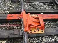 | ||
| railway | crossing | نقطة عبور للمترجلين على مستوى سكة القطار. |  | |||
| railway | level_crossing | نقطة تقاطع بين سكة قطار و طريق للسيارات. |  | |||
| railway | tram_level_crossing | A point where trams and roads cross. |  | |||
| railway | signal | Any kind of railway signal. | Not rendered by osm-carto |  | ||
| railway | switch | Full connections between railways (aka 'points'). | Not rendered by osm-carto |  | ||
| railway | railway_crossing | Crossing rails with no interconnection. | Not rendered by osm-carto |  | ||
| landuse | railway | Ground used around railways and railway-stations. |  Except no border, as landuse=industrial Except no border, as landuse=industrial |
 | ||
| railway | turntable | These are used for changing the direction that part of a train is pointing in. |
|
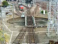 | ||
| railway | roundhouse | A semicircular building with many stalls for servicing engines. | Not rendered by osm-carto | 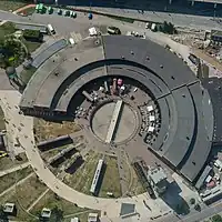 | ||
| railway | traverser | These are used for changing trains between railways. Also known as transfer table. |  | |||
| railway | wash | A railroad carriage/car wash | Not rendered by osm-carto |  | ||
| railway | water_crane | A structure to deliver water to steam locomotives | Not rendered by osm-carto |  | ||
| railway | ventilation_shaft | A structure that allows ventilation in underground tunnels | Not rendered by osm-carto | .jpg.webp) | ||
| railway | user defined | أنظر Taginfo لترى المزيد من القيمات المستعملة. | – – – | – – – | ||

This table is a wiki template with a default description in English. Editable here.
Route
| المفتاح | القيمة | العنصر | وصف | رسم / تصوير إيضاحي | صورة |
|---|---|---|---|---|---|
| route | bicycle | Cycle routes or bicycles route are named, numbered or otherwise signed. May go along roads, trails or dedicated cycle paths |  | ||
| route | bus | The route a public bus service takes. See Buses. |  | ||
| route | canoe | Signed route for canoeing through a waterway. |  | ||
| route | detour | Route for fixed detour routes. Examples are Bedarfsumleitung in Germany and uitwijkroute in the Netherlands | %252C_StVO_1970.svg.png.webp) | ||
| route | ferry | The route a ferry takes from terminal to terminal Please make sure to add at least one node per tile (zoom level 12), better at least one every few km, so offline editors catch it with bbox requests. |  |
 | |
| route | foot | Walking Route - is used for routes which are walkable without any limitations regarding fitness, equipment or weather conditions. |  | ||
| route | hiking | Hiking explains how to tag hiking routes. |  | ||
| route | horse | Riding routes |  | ||
| route | inline_skates | Inline has more information on the subject. | |||
| route | light_rail | Route of a light rail line. |  | ||
| route | mtb | Mountain biking explains how to tag mtb routes. |  | ||
| route | piste | Route of a piste (e.g., snowshoe or XC-Ski trails) in a winter sport area. |  | ||
| route | railway | A sequence of railway ways, often named (e.g., Channel Tunnel). See Railways. |  | ||
| route | road | Can be used to map various road routes/long roads. |  | ||
| route | running | For running (jogging) routes. |  | ||
| route | ski | For ski tracks (e.g., XC-Ski Trails User:Langläufer/Loipemap). |  | ||
| route | subway | Route of a metro service |  | ||
| route | train | Train services (e.g., London-Paris Eurostar) See Railways. | |||
| route | tracks | Railroad track as rail infrastructure. | | ||
| route | tram | See Trams for more information on tagging tram services. |  | ||
| route | trolleybus | The route of a trolleybus service. |  | ||
| route | User defined | أنظر Taginfo |
This table is a wiki template with a default description in English. Editable here.
دكان
| المفتاح | القيمة | وصف | رسم / تصوير إيضاحي | صورة | ||
|---|---|---|---|---|---|---|
Food, beverages | ||||||
| shop | alcohol | Shop selling alcohol to take away |  | |||
| shop | bakery | مخبز. |  | |||
| shop | beverages | Shop focused on selling alcoholic and non-alcoholic beverages. See also shop=alcohol. |  | |||
| shop | brewing_supplies | Shop focused on selling supplies for home brewing of beer, wine and spirits (where permitted). |  | |||
| shop | butcher | جزار. |  | |||
| shop | cheese | Shop focused on selling cheese. |  | |||
| shop | chocolate | Shop focused on selling chocolate. |  | |||
| shop | coffee | Shop focused on selling coffee. |  | |||
| shop | confectionery | Shop focused on selling sweets or candy |  | |||
| shop | convenience | A small local shop carrying a small subset of the items you would find in a supermarket |  | |||
| shop | deli | Shop focused on selling delicatessen (fine foods, gourmet foods), possibly also fine wine. Not to be confused with the US delis. |  | |||
| shop | dairy | Shop focused on selling dairy products. |  | |||
| shop | farm | Shop or roadside stand focused on selling freshly harvested farm produce |  | |||
| shop | frozen_food | Shop focused on selling frozen food. | 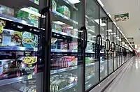 | |||
| shop | greengrocer | Shop focused on selling vegetables and fruits. | 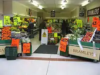 | |||
| shop | health_food | A health food shop; selling wholefoods, vitamins, nutrition supplements and meat and dairy alternatives. |  | |||
| shop | ice_cream | Shop selling ice cream. See also amenity=ice_cream. | 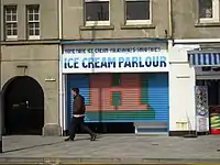 | |||
| shop | pasta | Shop focused on selling (fresh) pasta, ravioli, etc. |  | |||
| shop | pastry | Shop focused on selling baked sweets like cakes, biscuits, strudel and pies. |  | |||
| shop | [[ Too many Data Items entities accessed. | seafood ]] | Shop focused on selling fish/seafood. |  | |||
| shop | spices | Shop focused on selling spices. | .jpg.webp) | |||
| shop | tea | Shop focused on selling tea. |  | |||
| shop | wine | Shop selling wine. |  | |||
| shop | water | Shop focused on selling drinking water. |  | |||
General store, department store, mall | ||||||
| shop | department_store | A single large store – often multiple storeys high – selling a large variety of goods (see also shop=mall) | ||||
| shop | general | A store that carries a general line of merchandise. (see also shop=convenience if it sells food). |  | |||
| shop | kiosk | A small shop on the pavement that sells magazines, tobacco, newspapers, sweets and stamps. |  | |||
| shop | mall | A shopping mall – multiple stores under one roof (also known as a shopping centre) |  | |||
| shop | supermarket | Supermarket – a large store with groceries and other items |  | |||
| shop | wholesale | Wholesale/warehouse club or cash and carry - a store that sells items in bulk to retailers. The branch of industry can be defined with wholesale=*. |  | |||
Clothing, shoes, accessories | ||||||
| shop | baby_goods | Shop focused on selling objects for babies (clothes, prams, cots, toys). |  | |||
| shop | bag | Shop focused on selling bags. |  | |||
| shop | boutique | A small shopping outlet, especially one that specializes in elite and fashionable items |  | |||
| shop | clothes | Shop focused on selling clothes and/or underwear (other related value in use is fashion) |  | |||
| shop | fabric | Shop focused on selling fabric and other materials for the purpose of making clothes and other products, eg dress making. |  | |||
| Shop focused on selling fashion. This is deprecated, please use shop=clothes. |  | |||||
| shop | fashion_accessories | Shop focused on selling fashion accessories. |  | |||
| shop | jewelry | Jewellers shops. |  | |||
| shop | leather | Shop focused on selling products made out of leather. | ||||
| shop | sewing | A shop that sells sewing supplies (fabric, thread, yarn, knitting needles, sewing machines, etc.) |  | |||
| shop | shoes | Shop focused on selling shoes. |  | |||
| shop | tailor | A place where clothing is made, repaired, or altered professionally, especially suits and men's clothing |  | |||
| shop | watches | Shop focused on selling watches. |  | |||
| shop | wool | Shop selling wool for making of clothes or other products. |  | |||
Discount store, charity | ||||||
| shop | charity | A charity shop is a shop operated by a charity, for the purposes of fundraising. |  | |||
| shop | second_hand | A shop buying and selling used clothes and other things. See also shop=pawnbroker |  | |||
| shop | variety_store | A variety store retailer is a retail store that sells inexpensive items, sometimes with a single price point for all items in the store. |  | |||
Health and beauty | ||||||
| shop | beauty | A non-hairdresser beauty shop, spa, nail salon, etc.. See also shop=hairdresser. |  | |||
| shop | chemist | Shop focused on selling articles of personal hygiene, cosmetics, and household cleaning products (for a shop that potentially dispenses prescription drugs, cf. pharmacy. U.S. drug store, see amenity=pharmacy) |  | |||
| shop | cosmetics | Shop focused on selling cosmetics |  | |||
| shop | erotic | Shop focused on selling erotic toys, -clothes or other erotic stuff. | -01.jpg.webp) | |||
| shop | hairdresser | Here you can get your hair cut, coloured, … See also shop=beauty | %252C_October_2009.JPG.webp) | |||
| shop | hairdresser_supply | A shop, where you can buy hairdressing supplies. |  | |||
| shop | hearing_aids | Shop focused on selling hearing aids devices |  | |||
| shop | herbalist | Shop focused on selling herbs, often for medical purposes. (See also: healthcare:speciality=herbalism and healthcare=alternative). |  | |||
| shop | massage | A massage shop |  | |||
| shop | medical_supply | Shop focused on selling medical supplies. |  | |||
| shop | nutrition_supplements | Shops that sells one or more nutritional supplements (of vitamins, minerals and/or herbs) |  | |||
| shop | optician | Shop focused on selling eyeglasses, contact lenses (may also check your eyes). |  | |||
| shop | perfumery | Shop focused on selling perfumery |  | |||
| shop | tattoo | A tattoo parlour. |  | |||
Do-it-yourself, household, building materials, gardening | ||||||
| shop | agrarian | Shop focused on selling agrarian products, like seeds, agricultural machinery, animal feed, etc. |  | |||
| shop | appliance | Shop focused on selling large electrical items (aka white goods) washing machines, fridges, cookers, ovens, fans, etc. |  | |||
| shop | bathroom_furnishing | Shop focused on selling bathroom furniture and accessories |  | |||
| shop | doityourself | Shop focused on selling tools and supplies to do-it-yourself householders, gardening, … |  | |||
| shop | electrical | Shop focused on selling electrical supplies and devices |  | |||
| shop | energy | Shop focused on selling energy |  | |||
| shop | fireplace | Shop focused on selling electric fireplaces, stoves or masonry heaters and required fuels |  | |||
| shop | florist | Shop focused on selling bouquets of flowers (see shop=garden_centre for potted flowers). |  | |||
| shop | garden_centre | Shop focused on selling potted flowers, maybe even trees (see also shop=florist for flower bouquets). |  | |||
| shop | garden_furniture | Shop focused on selling garden furniture (sheds, outdoor tables, gates, fences, ...). See shop=garden_centre if also plants are sold. | ||||
| shop | gas | Shop focused on selling technical gas, such as argon, oxygen, acetylene, nitrogen, carbon dioxide, etc. in pressurized containers |  | |||
| shop | glaziery | Shop focused on selling and installing glazing for windows and doors. |  | |||
| shop | groundskeeping | Shop focused on selling outdoor groundskeeping equipment (lawnmowers, chainsaws, small tractors, ... |  | |||
| shop | hardware | Shop focused on selling building supplies including screws, bolts & paints, … See also shop=doityourself |  | |||
| shop | houseware | Shop focused on selling crockery, cutlery, kitchenware, small household appliances. |  | |||
| shop | locksmith | Shop focused on selling keys, see also craft=locksmith and craft=key_cutter |  | |||
| shop | paint | Shop focused on selling paints. |  | |||
| shop | pottery | Shop focused on selling earthenware, stoneware and porcelain and other ceramic ware. | _74.jpg.webp) | |||
| shop | security | Shop focused on selling security items like burglar alarms, vaults, locking systems, video surveillance cameras, firefighting equipment, alarm systems, warning systems, etc. | ||||
| shop | trade | Shop focused on selling one or more building supplies such as timber/wood, cement etc. See also shop=doityourself |  | |||
| This tag is deprecated. Please use craft=window_construction instead. | ||||||
Furniture and interior | ||||||
| shop | antiques | Shop focused on selling antiques. |  | |||
| shop | bed | Shop focused on selling beds, mattresses and other bedding products. |  | |||
| shop | candles | Shop focused on selling candles and candle accessories (holders, etc) | .jpg.webp) | |||
| shop | carpet | Shop focused on selling carpets |  | |||
| shop | curtain | Shop focused on selling curtains or drapes (see also shop=fabric) |  | |||
| shop | doors | Shop focused on selling doors | ||||
| shop | flooring | Shop focused on selling floorings |  | |||
| shop | furniture | Shop focused on selling furniture, might range from small decorational items to a whole flat interior |  | |||
| shop | household_linen | Shop focused on selling household linen. |  | |||
| shop | interior_decoration | Shop focused on selling interior decorations. |  | |||
| shop | kitchen | A shop where you can plan and buy your kitchen. (Sometimes called "kitchen studio" and the like, but plain kitchen is the most frequently used tag so far.) |  | |||
| shop | lighting | A shop selling lighting fixtures and lamps. |  | |||
| shop | tiles | Shop focused on selling tiles. |  | |||
| shop | window_blind | Shop focused on selling window blinds. |  | |||
Electronics | ||||||
| shop | computer | Shop focused on selling computers, peripherals, software, … |  | |||
| shop | electronics | Shop focused on selling consumer electronics (TV, radio, …). Larger ones may also sell computers, fridges, … |  | |||
| shop | hifi | Shop focused on selling High Fidelity or High End environment to listen music or watch films at home |  | |||
| shop | mobile_phone | Shop focused on selling mobile phones and accessories |  | |||
| shop | radiotechnics | Shop focused on selling electronic components, electrical products, radio measuring devices, supplies for radio and electronics. |  | |||
| shop | telecommunication | Shop selling internet, television or similar services, and related hardware. |  | |||
| shop | vacuum_cleaner | Shop focused on selling vacuum cleaners and associated products. |  | |||
Outdoors and sport, vehicles | ||||||
| shop | atv | Shop focused on selling |
 | |||
| shop | bicycle | Shop focused on selling bicycles, bicycle equipment and may rent or repair them |  | |||
| shop | boat | Shop focused on selling boats, boat equipment and may rent or repair them |  | |||
| shop | car | Car store – a place to buy cars or to get your car repaired |  | |||
| shop | car_repair | Shop focused on car repair (usually independent of a specific car brand). |  | |||
| shop | car_parts | Shop focused on selling auto parts, auto accessories, motor oil, car chemicals, etc. |  | |||
| shop | caravan | A shop for caravans, motorhomes & similar recreational vehicles. |  | |||
| shop | fuel | Shop selling fuels (motor fuel, wood, coal, gas) that can't be considered a amenity=fuel (fuel station). Use fuel:*=yes/no to indicate which fuels are available. |  | |||
| shop | fishing | Shop focused on selling fishing equipment. | .jpg.webp) | |||
| shop | golf | Shop focused on selling golf equipment. |  | |||
| shop | hunting | Shop focused on selling gun and hunting equipment. |  | |||
| shop | jetski | Shop focused on selling jetskis, jetski equipment and may rent or repair them |  | |||
| shop | military_surplus | Shop selling used military equipment |  | |||
| shop | motorcycle | Shop focused on selling motorcycles and/or related accessories, clothes, parts, and rental services. |  | |||
| shop | outdoor | Shop focused on selling camping, walking, climbing, and other outdoor sports equipment (GPSes, etc.) |  | |||
| shop | scuba_diving | Shop focused on selling scuba diving equipment. |  | |||
| shop | ski | Shop focused on selling skis, ski equipment and may rent or repair them |  | |||
| shop | snowmobile | Shop focused on selling snowmobiles, snowmobile equipment and may rent or repair them |  | |||
| shop | sports | Shop focused on selling sporting goods. |  | |||
| shop | swimming_pool | A store that sells swimming pool equipment and supplies. |  | |||
| shop | trailer | Shop focused on selling trailers and parts and/or repairing / renting them |  | |||
| shop | tyres | Shop focused on selling tyres. |  | |||
Art, music, hobbies | ||||||
| shop | art | Shop which sells works of art. May be paintings, sculpture, or other types of art |  | |||
| shop | camera | A shop mainly selling cameras and lenses |  | |||
| shop | collector | A shop for different collector's items like stamps, coins, action figures, etc. |  | |||
| shop | craft | An arts and crafts supply store. Commonly sold items are paper, canvas, paint, pencils, crafting wood, crafting tools, etc. - look at craft=* | .jpg.webp) | |||
| shop | frame | Shop focused on selling frames. |  | |||
| shop | games | Shop focused on selling board games, card games and/or role-playing games. |  | |||
| shop | model | Shop specialising in the sale of scale models. |  | |||
| shop | music | Shop focused on selling recorded music (vinyl/CDs/...) |  | |||
| shop | musical_instrument | Shop focused on selling musical instruments, lyrics, scores. If focused on a specific instrument, specify with musical_instrument=* | %252C_September_2009.JPG.webp) | |||
| shop | photo | Shop focused on selling products or services related with photography. |  | |||
| shop | trophy | Store selling trophies, awards, plaques etc. |  | |||
| shop | video | Shop focused on selling or renting out videos/DVDs. |  | |||
| shop | video_games | Shop focused on selling video games. |  GameStop on Powell Street in San Francisco, California. | |||
Stationery, gifts, books, newspapers | ||||||
| shop | anime | Shop focused on selling anime stuff. |  | |||
| shop | books | Shop focused on selling books (for a library that lends books, see amenity=library) |  | |||
| shop | gift | Shop focused on selling gifts, greeting cards, or tourist gifts (souvenirs) |  | |||
| shop | lottery | A shop of which the main or only purpose is the sale of lottery tickets. | %252C_Lotto.jpg.webp) | |||
| shop | newsagent | Shop focused on selling newspapers, cigarettes, other goods |  | |||
| shop | stationery | Shop focused on selling office supplies |  | |||
| shop | ticket | Shop focused on selling tickets for concerts, events, public transport, … |  | |||
Others | ||||||
| shop | bookmaker | A shop that takes bets on sporting and other events at agreed upon odds. | .jpg.webp) | |||
| shop | cannabis | a shop primarily and legally selling non-medical cannabis products |  | |||
| shop | copyshop | Shop focused on selling photocopying and printing services. |  | |||
| shop | dry_cleaning | Shop or kiosk offering a clothes dry cleaning service. The actual cleaning may be done elsewhere. |  | |||
| shop | e-cigarette | Shop focused on selling electronic cigarettes. |  | |||
| shop | funeral_directors | Providing services related to funeral arrangements, may also be known as a "funeral parlour" or "undertakers". |  | |||
| shop | insurance | A shop selling insurance services from one or more insurance carriers. |  | |||
| shop | laundry | A shop to get your normal clothes washed. Might be self service coin operated, with service staff for drop off, … |  | |||
| shop | money_lender | A money lender offers small personal loans at high rates of interest. |  | |||
| shop | outpost | Shop primarily used to pick-up items ordered online. |  | |||
| shop | party | A shop for party and festival supplies, like costumes, etc. |  | |||
| shop | pawnbroker | A pawnbroker (or pawnshop) is an individual or business that offers secured loans to people. See also shop=second_hand |  | |||
| shop | pest_control | Shop selling pest control goods to exterminate rats, insects etc. |  | |||
| shop | pet | A shop for pets, animals and toys or food for them. |  | |||
| shop | pet_grooming | A shop offering grooming services for pets (most frequently dogs) |  | |||
| shop | pyrotechnics | Store of pyrotechnics: fireworks, firecrackers, sparklers etc. | .JPG.webp) | |||
| shop | religion | Shop focused on selling religious articles, church shop. See also religion=* |  | |||
| shop | storage_rental | self storage |  | |||
| shop | tobacco | Shop focused on selling tobacco, cigarettes and their related accessories. |  | |||
| shop | toys | Shop focused on selling toys. |  | |||
| shop | travel_agency | Shop focused on selling tickets for travelling. Also known as a tour operator. |  | |||
| shop | weapons | Shop focused on selling weapons like knives, guns etc. |  | |||
| shop | vacant | An unused vacant shop. Can be used for an empty or abandoned retail space that seems to be available for lease or purchase where a retail store (or similar businesses) may be opened. No store is being operated in a vacant shop, and neither goods nor services are being offered. This tag can be used after a store was closed or for a newly built shop before any busisness was operated in the shop. |  | |||
| shop | A shop of unspecified type - it is always better to use another value that gives info about shop type, if possible. Used also as indicator that feature such as fuel station has shop. | |||||
| shop | user defined | أنظر Taginfo لترى المزيد من القيمات المستعملة. | ||||
This table is a wiki template with a default description in English. Editable here.
Template:Ar:Map Features:sport
Tourism
| المفتاح | القيمة | العنصر | وصف | رسم / تصوير إيضاحي | صورة |
|---|---|---|---|---|---|
| tourism | alpine_hut |  | |||
| tourism | [[ Too many Data Items entities accessed. | apartment ]] | A holiday or vacation apartment is a furnished apartment or flat with cooking and bathroom facilities that can be rented for holiday vacations. This tag can be applied to a building accommodating one or more holiday flats. Between tourism=apartment and tourism=chalet is a clear distinction: "Chalet" is for a detached holiday cottage which you rent exclusively, "apartment" is for one or several flats in a shared building (or a single flat in one part of the building and other usages, like private apartments or a restaurant, in the other part). |  | ||
| tourism | aquarium | An aquarium, meant as |
 | ||
| tourism | artwork |  | |||
| tourism | attraction |  | |||
| tourism | camp_pitch | camp pitch is the free space used to place a tent or or caravan within a tourism=camp_site or tourism=caravan_site area. | .jpg.webp) | ||
| tourism | camp_site |  | |||
| tourism | caravan_site |  | |||
| tourism | chalet | Chalet is a type of accommodation used in the hospitality industry to describe one or more detached cottages with self-contained cooking facilities and/or bathroom and toilet facilities. This is not to be confused with the Swiss term for a type of wood house, use the tags building=cabin or building=yes instead. Between tourism=apartment and tourism=chalet is a clear distinction: "Chalet" is for a detached holiday cottage which you rent exclusively, "apartment" is for one or several flats in a shared building (or a single flat in one part of the building and other usages, like private apartments or a restaurant, in the other part). |  | ||
| tourism | gallery |  | |||
| tourism | guest_house | بيت ضيافة. |  | ||
| tourism | hostel | مسكن للشباب. |  | ||
| tourism | hotel | فندق. |  | ||
| tourism | information |  | |||
| tourism | motel | نزل. |  | ||
| tourism | museum | متحف |  | ||
| tourism | picnic_site |  | |||
| tourism | theme_park |  |
 | ||
| tourism | viewpoint |  | |||
| tourism | wilderness_hut |  | |||
| tourism | zoo | حديقة حيوانات |  |
 | |
| tourism | yes | To add tourist interest to something described by other tags. | |||
| tourism | user defined | أنظر Taginfo لترى المزيد من القيمات المستعملة. |
This table is a wiki template with a default description in English. Editable here.
Template:Ar:Map Features:waterway
معالم إضافية
Template:Ar:Map Features:addr
Template:Ar:Map Features:annotation
Template:Ar:Map Features:name
Template:Ar:Map Features:properties
Template:Ar:Map Features:references
Template:Ar:Map Features:restrictions
- ↑ Does not include uses in semi-colon value separated lists